Coleridge Way
The Coleridge Way, named after the romantic poet Samuel Taylor Coleridge (1772 - 1834), is a fine 84-kilometre trail across the Quantock Hills Area of Outstanding Beauty and Exmoor National Park.
The trail begins on the western edge of the Somerset Levels, in the ancient village of Nether Stowey, at the cottage where Coleridge lived from the last day of 1796 until late in 1799. The poet composed some of his best-known works during his three years living in Nether Stowey, including The Rime of the Ancient Mariner, Frost at Midnight, and Kubla Khan.
Coleridge was a fanatical walker and went on many long walks in the area with his friends and fellow brother-and-sister poets William and Dorothy Wordsworth, who lived nearby. Many of their adventures in the countryside took place in the dead of night and raised suspicions among some of the locals, resulting in a government official being sent to investigate whether they were French spies. He soon reported back that they were "mere poets".
The Coleridge Way showcases scenery that the trio would have been very familiar with and from which they drew much of their poetic inspiration.
Nether Stowey is most easily reached by bus from Bridgwater, which has a station on the Great Western Railway mainline between London and Penzance. I arrived early in the afternoon of the day before I started the Coleridge Way, allowing me time to explore the village and warm up with a 4.5 kilometre circular walk to the village of Over Stowey and back. Afterwards, I had dinner and a few pints in the Ancient Mariner pub before settling in for the night at the very comfortable Old House B&B.
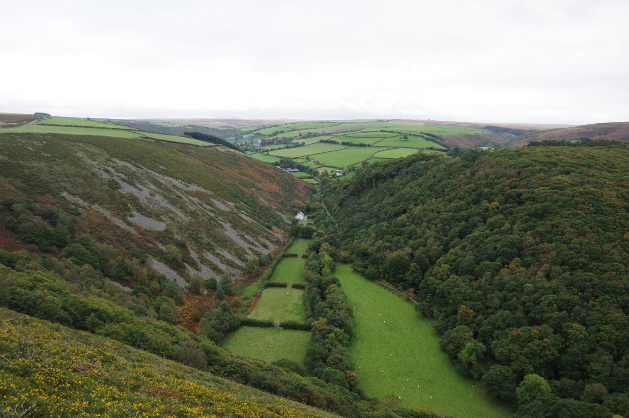
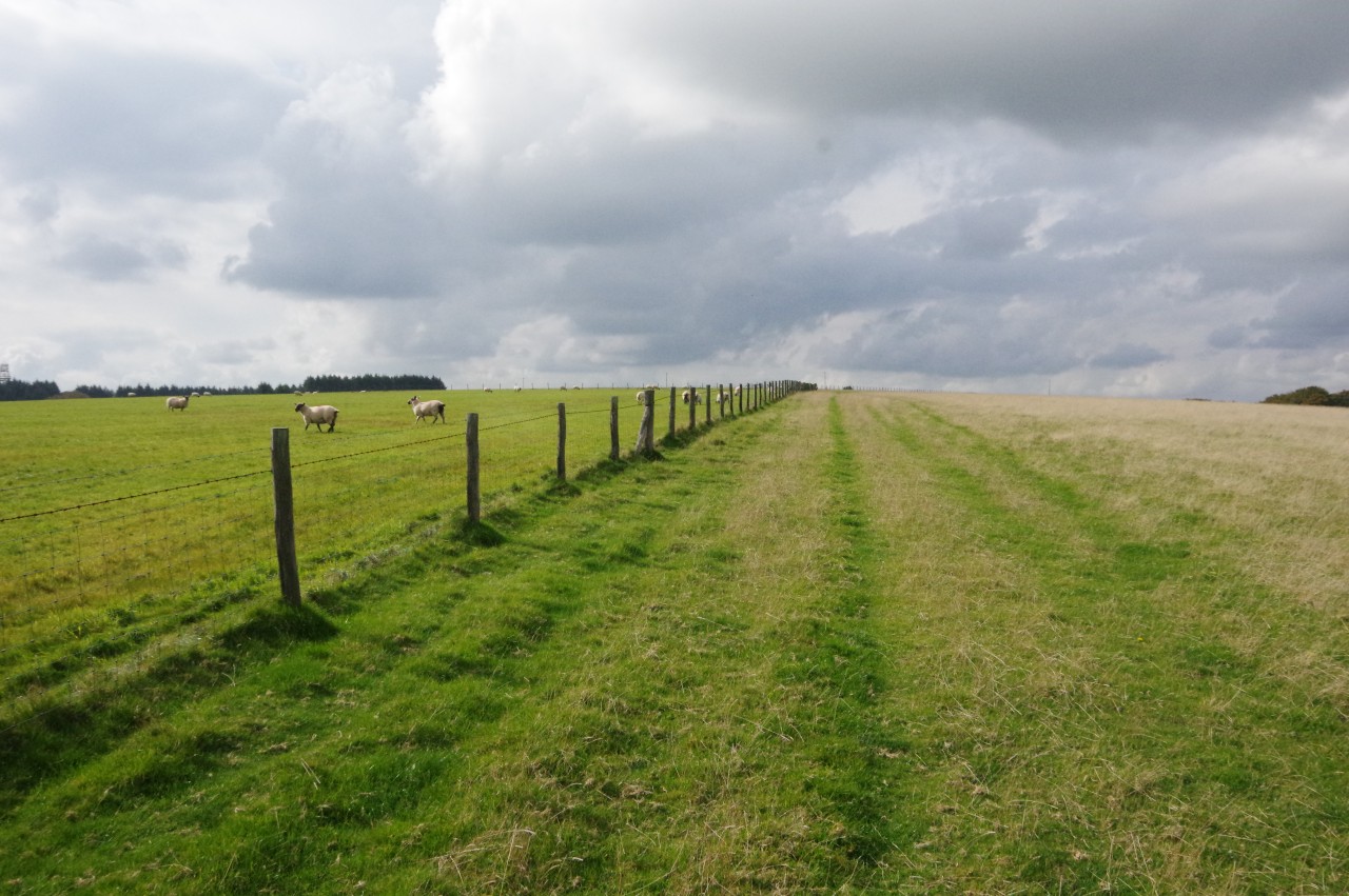
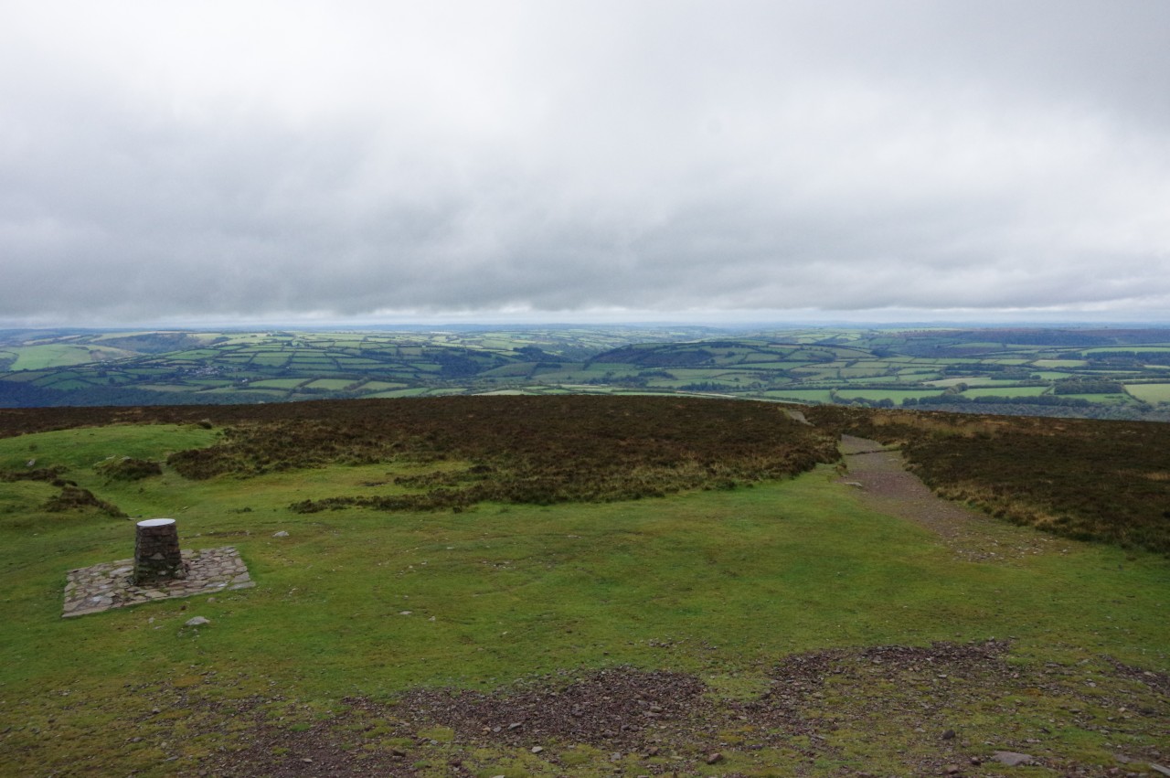
From Nether Stowey, which was once in the shadow of a medieval castle, the route heads west over the Quantock Hills, passing through quiet woods before leaving the Quantocks behind to cross a stretch of fertile farmland on the way to the Brendon Hills, a former mining area on the edge of Exmoor. Climbing onto Exmoor proper, the Way skirts around the windswept Dunkery Beacon, the highest peak on the moor and also the highest in Somerset. A long descent through ancient woodland leads to the village of Porlock, where the Coleridge Way originally ended when it was opened in 2005.
In 2014, the Way was extended further westward, climbing back onto the moor, from which there are many magnificant coastal views. The final stretch of the Way crosses from Somerset into Devon and follows the long Brendon Valley, a lush, well-wooded gorge cut through the moorland by a stream that gradually grows to become the East Lyn River as it flows toward the Bristol Channel at Lynmouth.
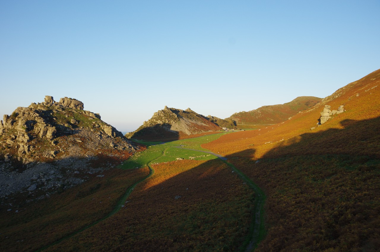
The Coleridge Way officially ends on Lynmouth's Esplanade, where it meets several other long-distance paths including the South West Coast Path and the Two Moors Way. However, there is one more optional extension west of Lynmouth to the stunning Valley of Rocks, where the Poets' Shelter offers a fine spot to watch the sunset.
On the walk, I carried two books with me: a selection of Coleridge's poetry and the Coleridge Way Companion Guide, written by Ian Pearson, a resident of Nether Stowey. The latter, rather than being only a simple turn-by-turn guide, gives lots of attention to the places and people to be found along the route and is a very enjoyable and informative read.
As well as the trail's association with Coleridge and the Wordsworths, there are several other literary connections. Fellow poet Percy Bysshe Shelley visited Exmoor a few years after Coleridge, and parts of R.D. Blackmore's famous 19th-century novel Lorna Doone were set around the section of the trail near the Devon-Somerset border.
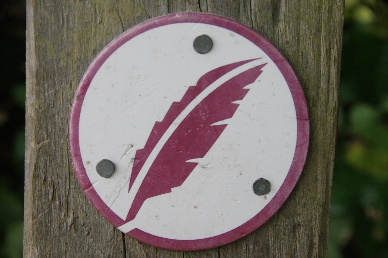
The Coleridge Way is shown on Ordnance Survey maps and is very well-waymarked and easy to follow, with a distinctive quill logo showing the way. There are quite a few hills along the way, but none of them are too taxing, and any reasonably fit walker should be comfortably able to complete the route in as little as four days.
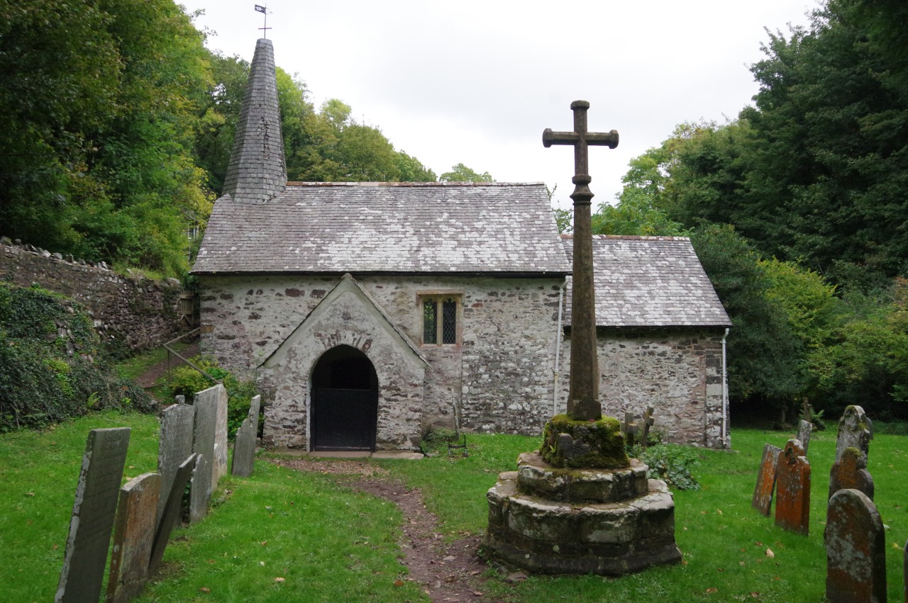
Coleridge himself is reputed to have walked from Nether Stowey to Porlock in a single day, but to rush through the Way like that would be a shame. Nether Stowey, Porlock and Lynmouth are all well worth exploring, as are the towns of Williton and Watchet, which are near the path and both have stops on the West Somerset Railway's heritage line. Several smaller villages on the route have excellent, friendly country pubs that can make for good overnight stops. There are also plenty of interesting excursions that can be made from the Way, including the climb up to the summit of Dunkery Beacon, a visit to the ancient harbour at Porlock Weir, a circuit of the National Trust villages behind Porlock Bay, or a side-trip into "Doone Country".
Day 1
Nether Stowey to Sampford Brett
02 Oct 2018
19.4km
Day 2
Sampford Brett to Roadwater
04 Oct 2018
12.6km
Day 3
Roadwater to Cutcombe
05 Oct 2018
14.3km
Day 4
Wheddon Cross to Porlock
06 Oct 2018
13.6km
Day 5
Porlock to Brendon
08 Oct 2018
16.4km
Day 6
Brendon to Valley of Rocks
09 Oct 2018
9.5km