SOUTH WEST COAST PATH NATIONAL TRAIL
Stage 48: Hartland Quay to Clovelly
Friday, July 03, 2015
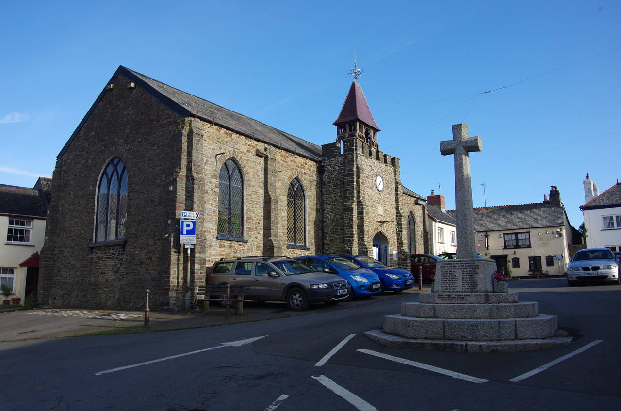
(1) Hartland Village
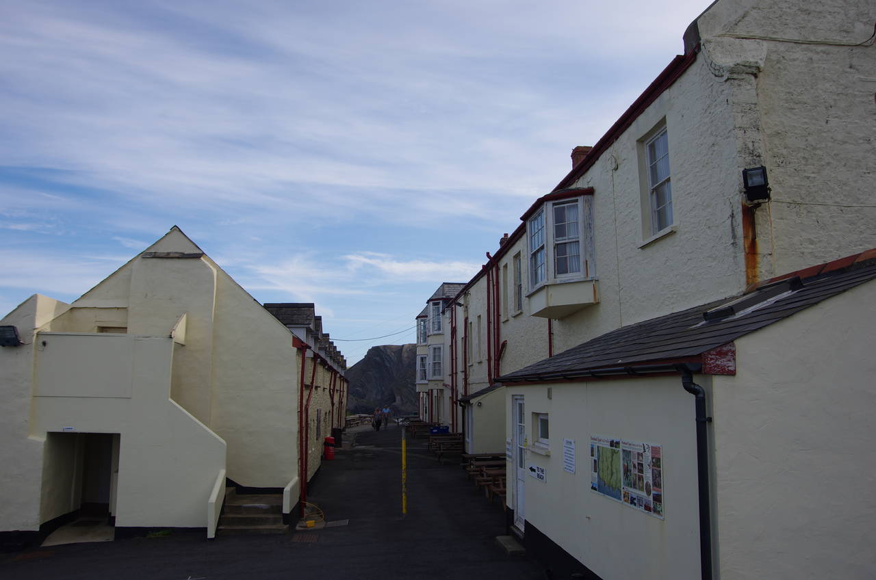
(2) Hartland Quay
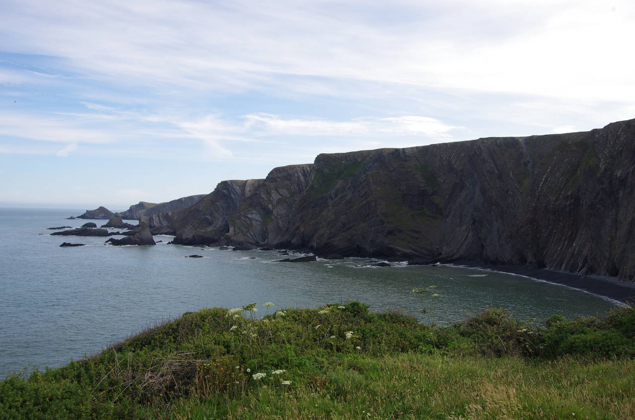
(3) Warren Cliff
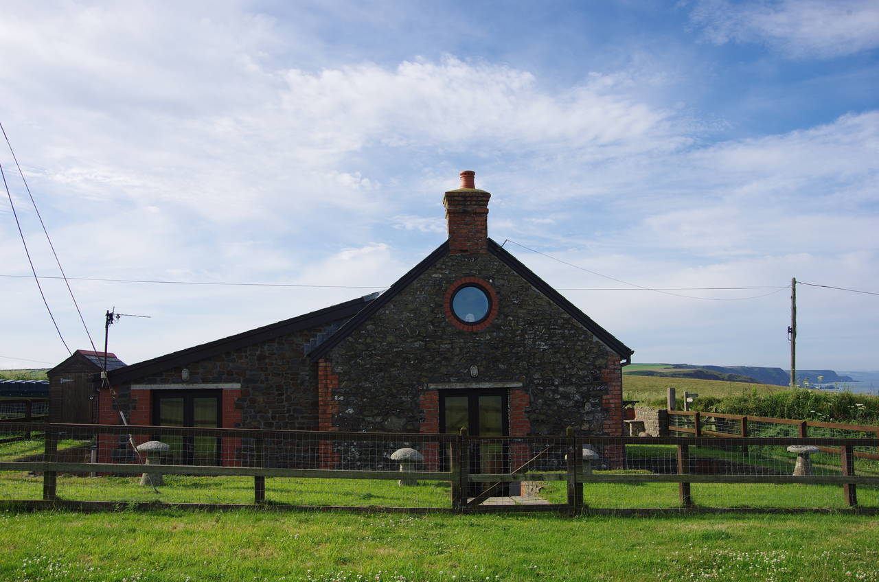
(4) The Rocket House
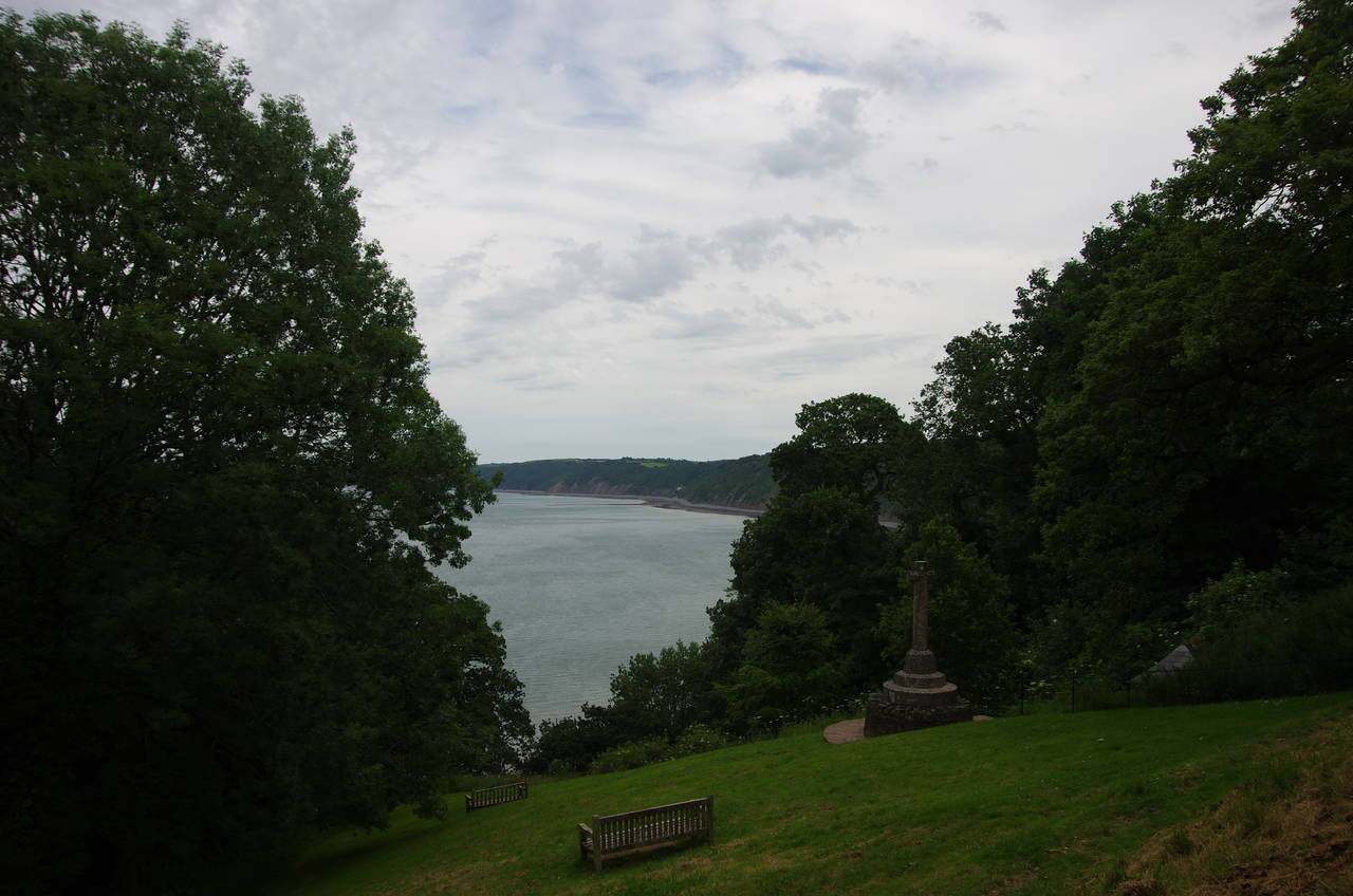
After a couple of days exploring Launceston and Bodmin Moor, I returned to Hartland early on a Friday morning. With plenty of time for the day's walk, I made a short diversion into the middle of the village, which is centered around a small square where the war memorial cross stands in front of the former St John's Chapel of Ease, now the village's arts centre (picture 1).
After wandering along to the end of Fore Street I retraced my steps to the junction of North Street and West Street, following the latter out of the village for the 45 minute walk back to the coast at Hartland Quay via the village of Stoke Barton.
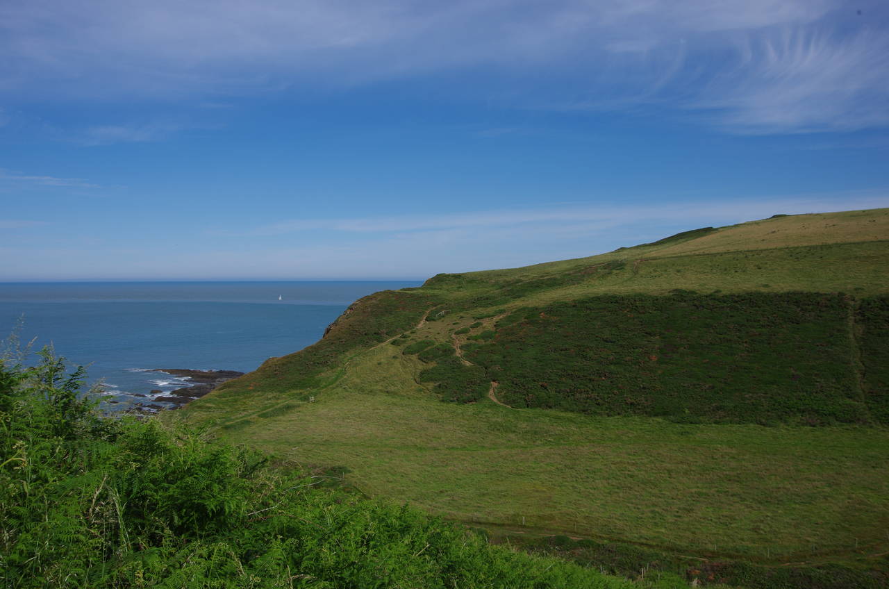
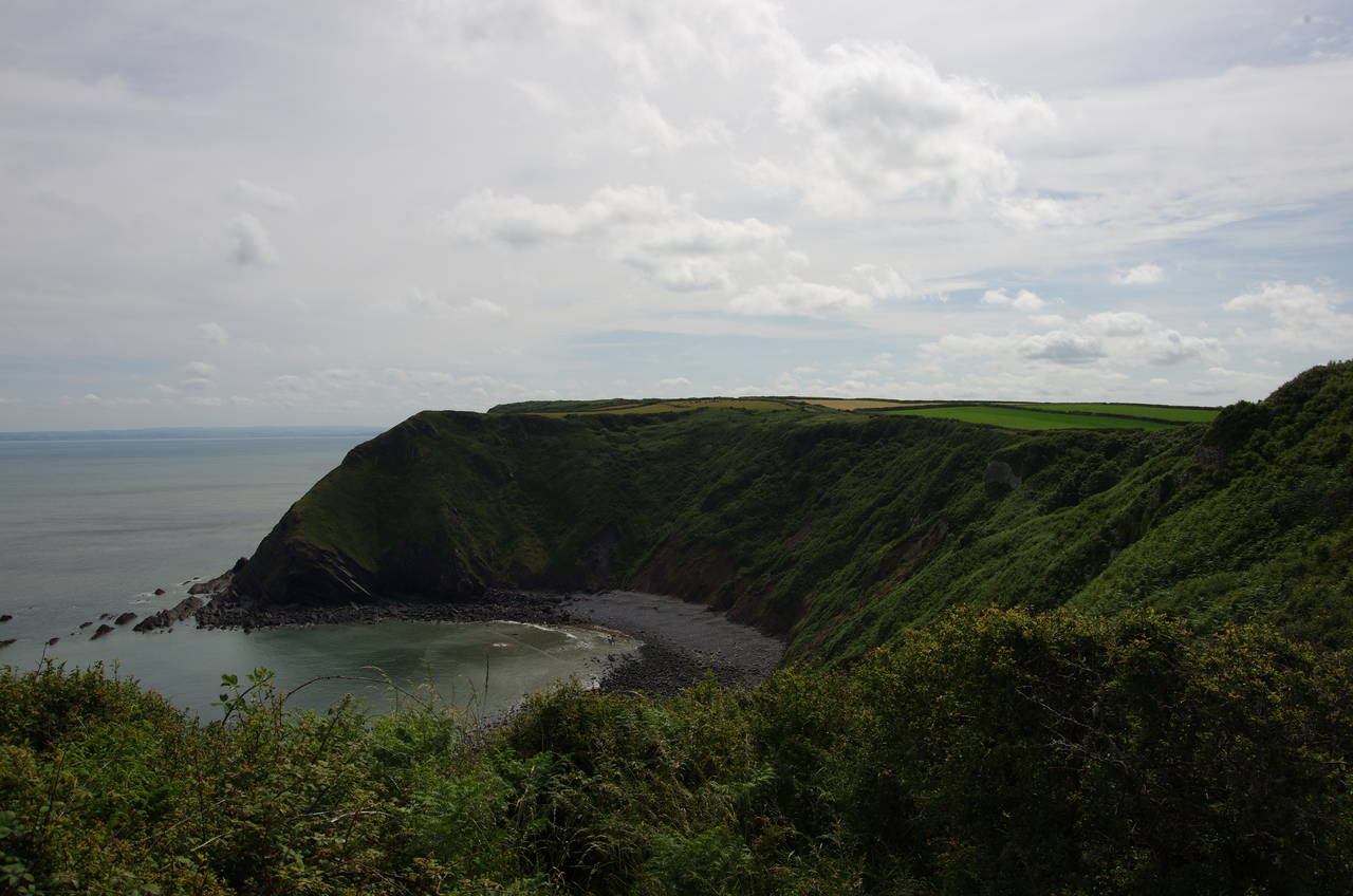
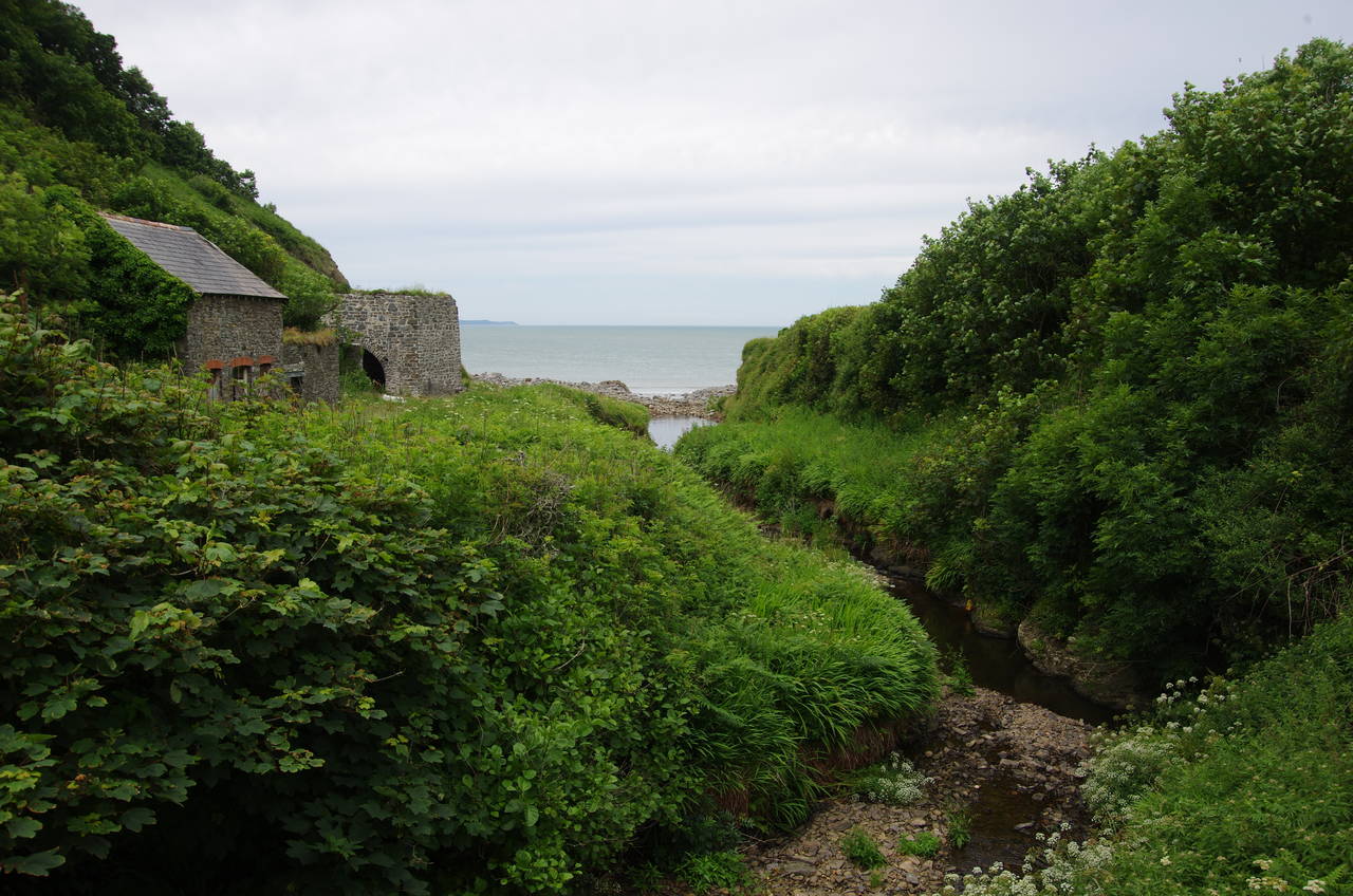
Rejoining the Coast Path at the end of the old quay buildings (picture 2), I followed the road back uphill for about 200 metres onto the lower slope of Warren Cliff (picture 3). Here the Coast Path leaves the road to climb an overgrown path up to a cottage known as the Rocket House (picture 4), where the path turns left to run along the flat, grassy top of the cliff.
(5) Folly on Warren Cliff
(6) Blackpool Mill
(7) Ducksberry
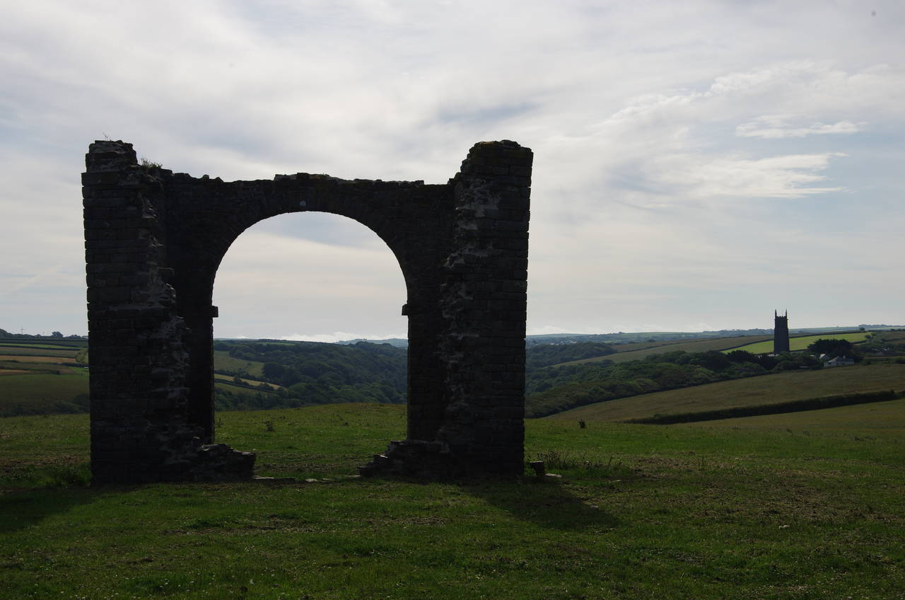
(8) Dame Hole
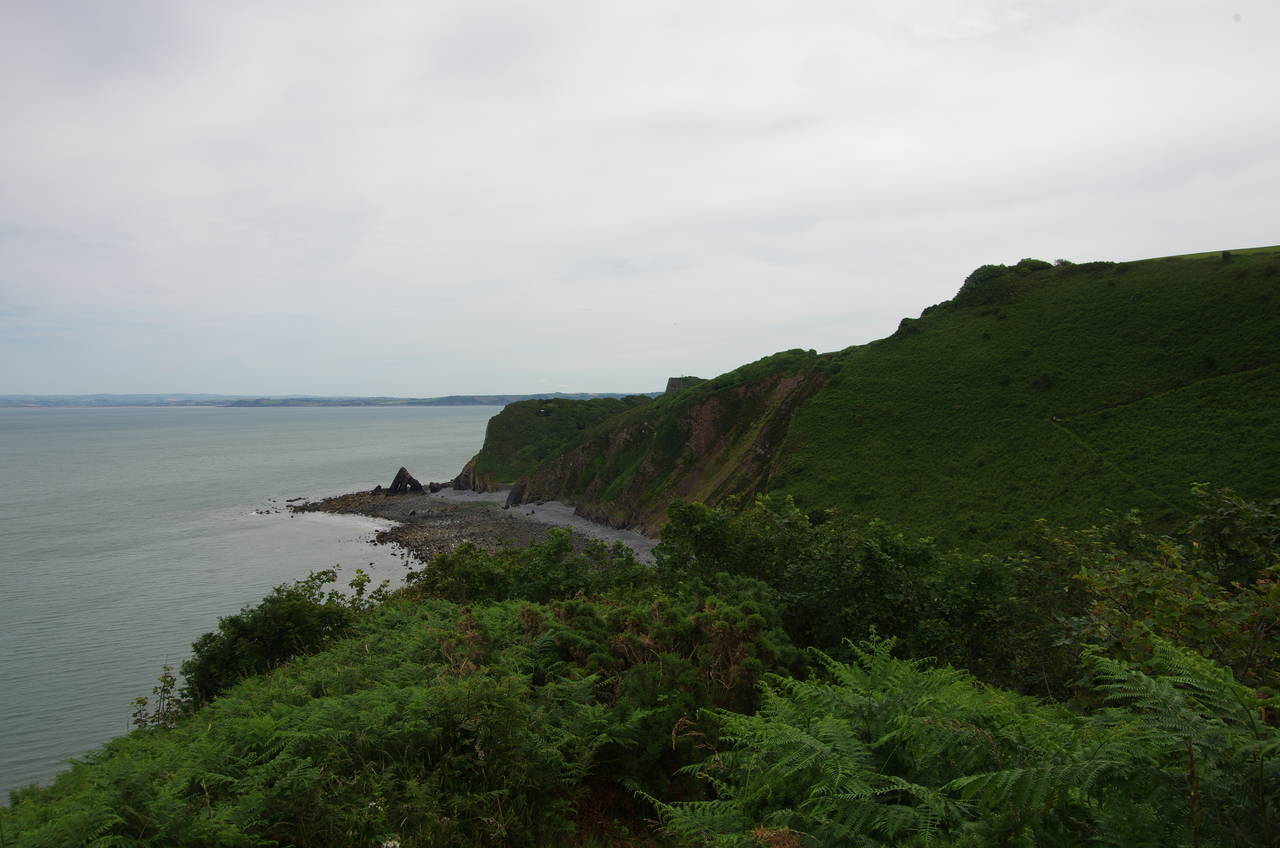
About halfway along Warren Cliff, the path passes by the ruin of an old folly with the tower of Stoke Barton Church prominent in the background (picture 5). At the end of the cliff the path cuts across the minor promontory of Dyer's Lookout and descends into the valley of Blackpool Mill (picture 6), where the tiny River Abbey, which in truth is just a shallow stream, flows down from just north of Hartland village.
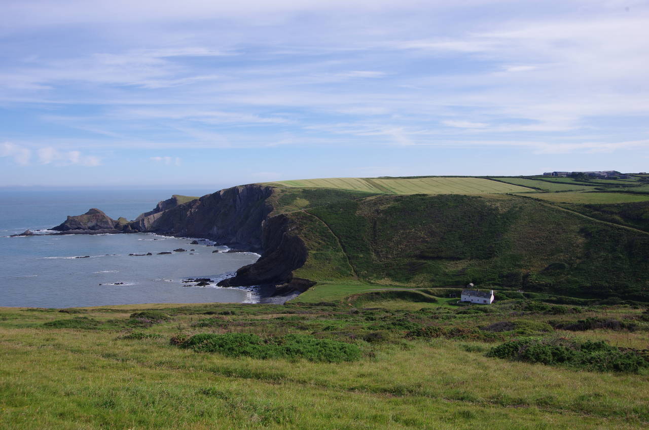
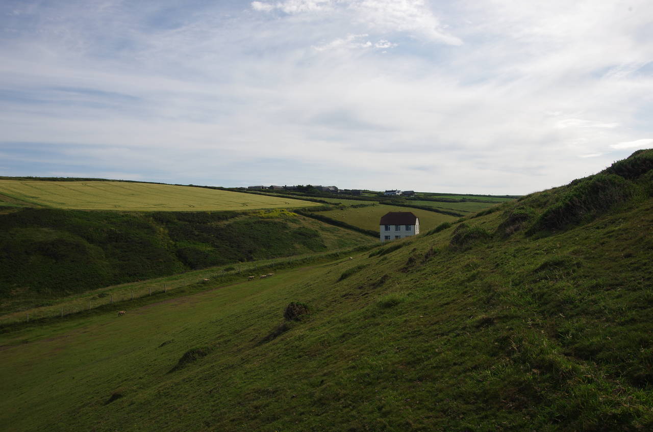
After crossing the stream, the path passes close to the little white Blackpool Mill Cottage and starts a short but steep climb up to Berry Cliff. Almost immediately the path descends again into the shallower valley of Ducksberry (picture 7). Over the next cliff, the path descends to the landward end of Damehole Point (picture 8) before turning sharp right along a valley behind the steep ridge of Smoothlands.
(9) Titchberry Water
(10) Glenart Castle Memorial
(11) Hartland Point and Lundy Island
(12) North Cliff
Beyond Smoothlands the path regains its view of the sea and climbs up to the lip of the valley of Titchberry Water (picture 9). The path crosses a wooden footbridge a little way up the valley and then climbs onto the low Upright Cliff and onwards along field edges on the higher Blagdon Cliff.
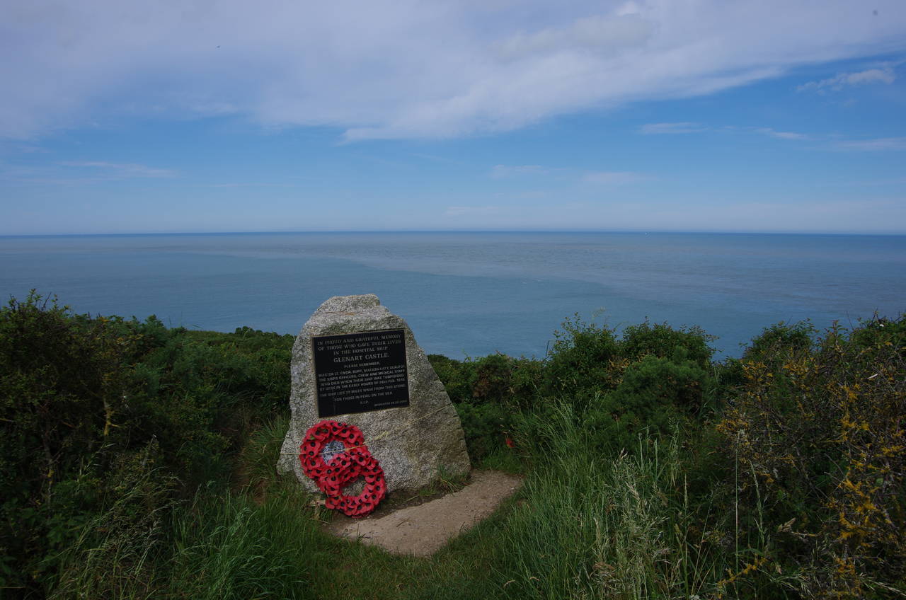
In the corner of a field towards the end of the cliff is a memorial to the crew of the hospital ship Glenart Castle (picture 10), which was sunk in the Bristol Channel by a German U-boat on the 26th of February 1918, with only 33 survivors from the 186 people aboard.
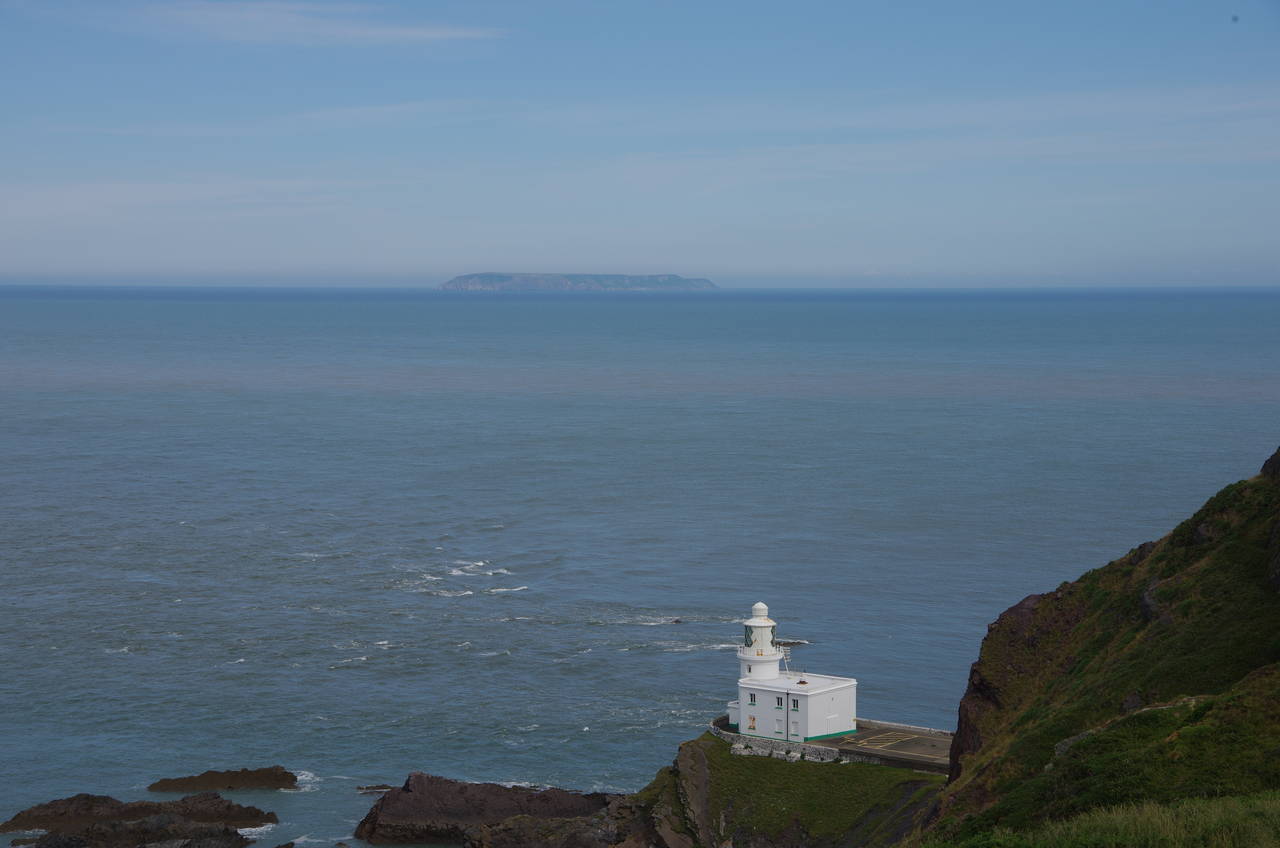
In the next field, the path climbs up towards a fenced-off Coastguard lookout on the top of Hartland Point, high above the Hartland Point Lighthouse, which dates from 1874. This is the closest point on the mainland to Lundy Island (picture 11), twenty kilometres away, and also marks the boundary between the Atlantic Ocean and the Bristol Channel.
After heading northwards for the last few stages, at Hartland Point the Coast Path turns eastwards and before long there is a very noticeable change in the surroundings.
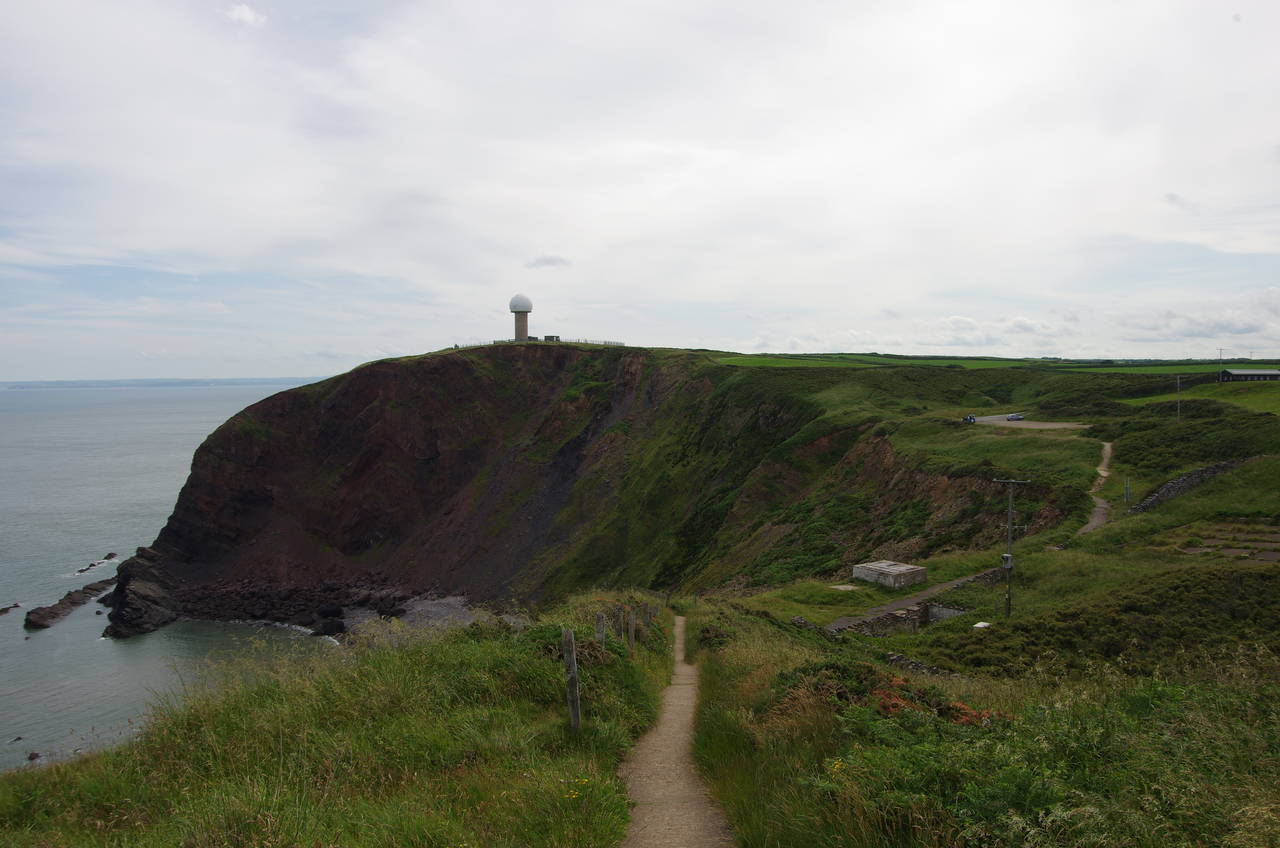
The path runs along the fence of the Coastguard lookout then down to the lighthouse access road on the eastern side of Hartland Point. Beyond a small carpark the path leaves the road to follow a clifftop path around Barley Bay towards the air-traffic control radar station on North Cliff, which I had been able to see since early in the previous stage of the walk (picture 12).
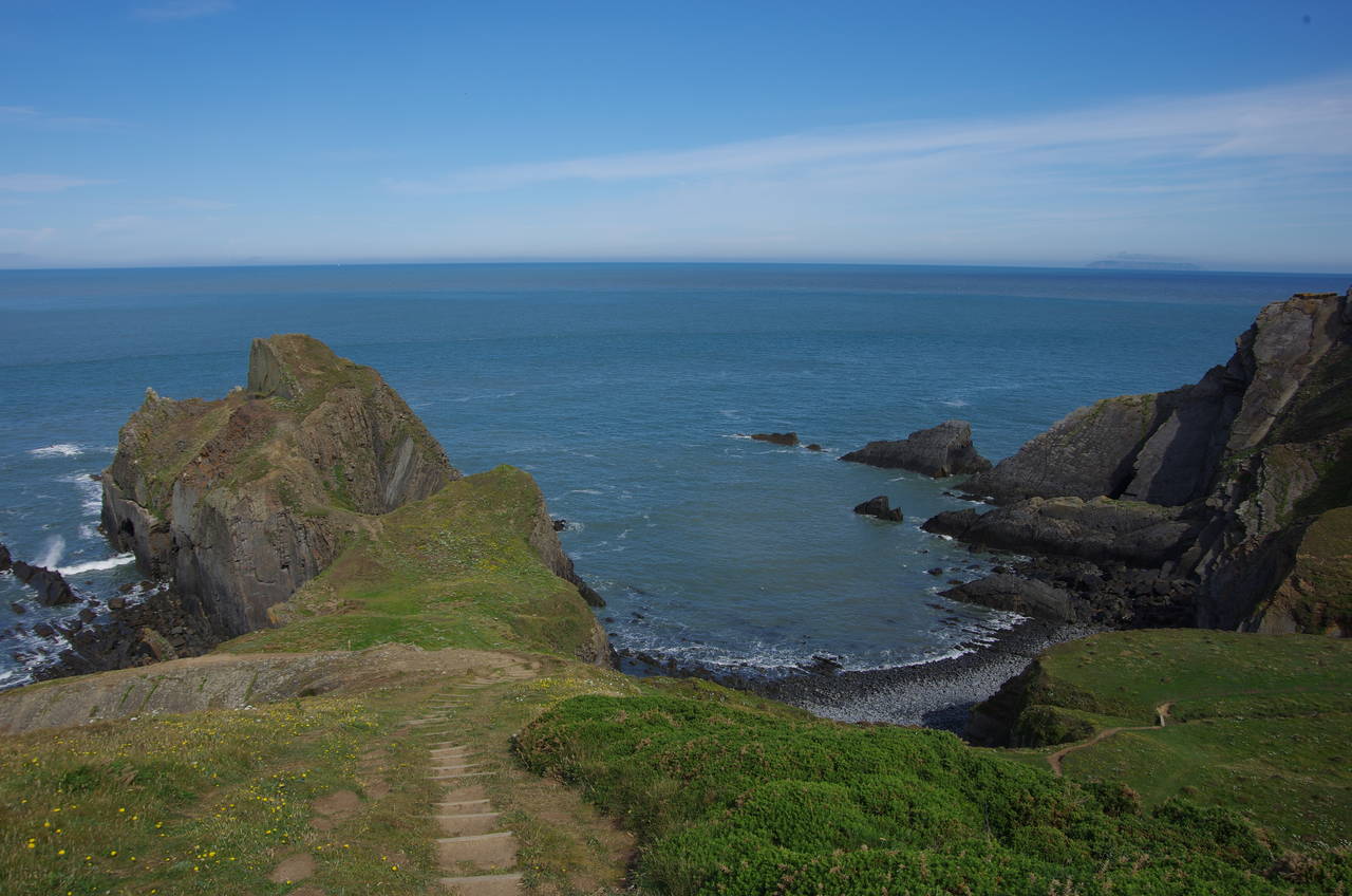
(13) Shipload Bay
(14) East Titchberry Farm
(15) NT East Titchberry
(16) Gawlish Cliff
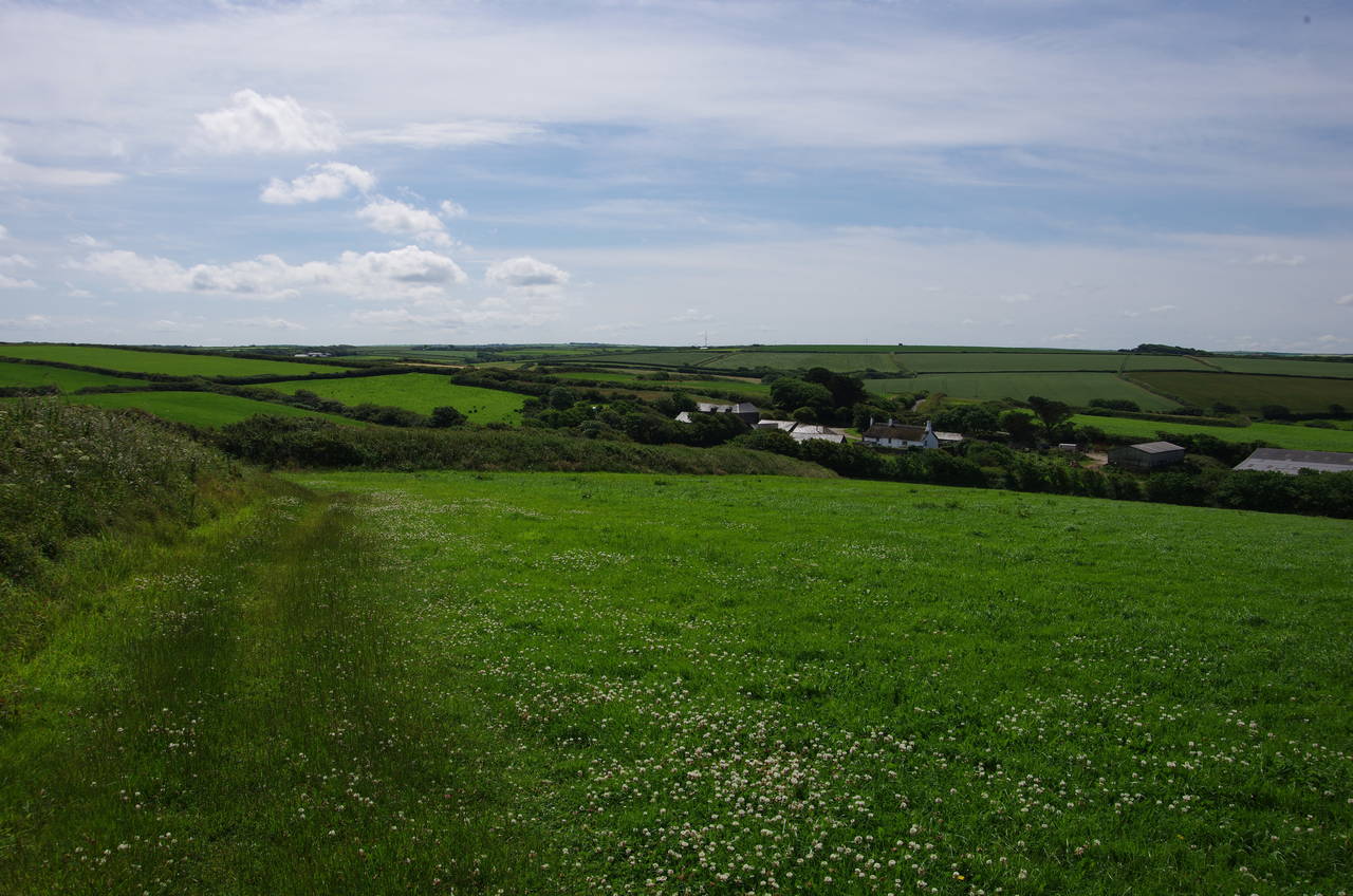
The Coast Path circles around the seaward side of the radar station, soon joining an enclosed and very overgrown path above Shipload Bay, with only one or two gaps in the dense foliage giving views across the bay to Eldern Point (picture 13). After battling with the vegetation for about 500 metres, halfway around the bay, a brief stretch along the edges of two small fields gives views inland over East Titchberry Farm (picture 14) before the path crosses a stile into the National Trust's East Titchberry estate.
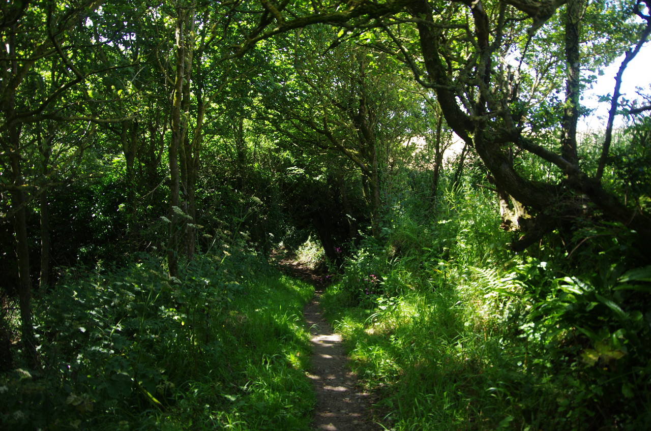
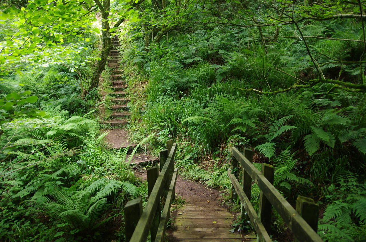
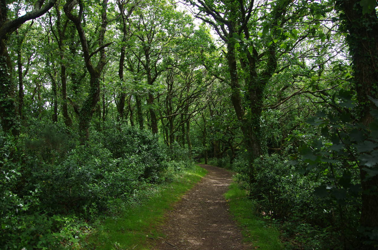
The remainder of the path around to Eldern Point is much easier going, though still mostly enclosed. There's even a short stretch through a grove of trees (picture 15), the first shady spot on the path for a few days.
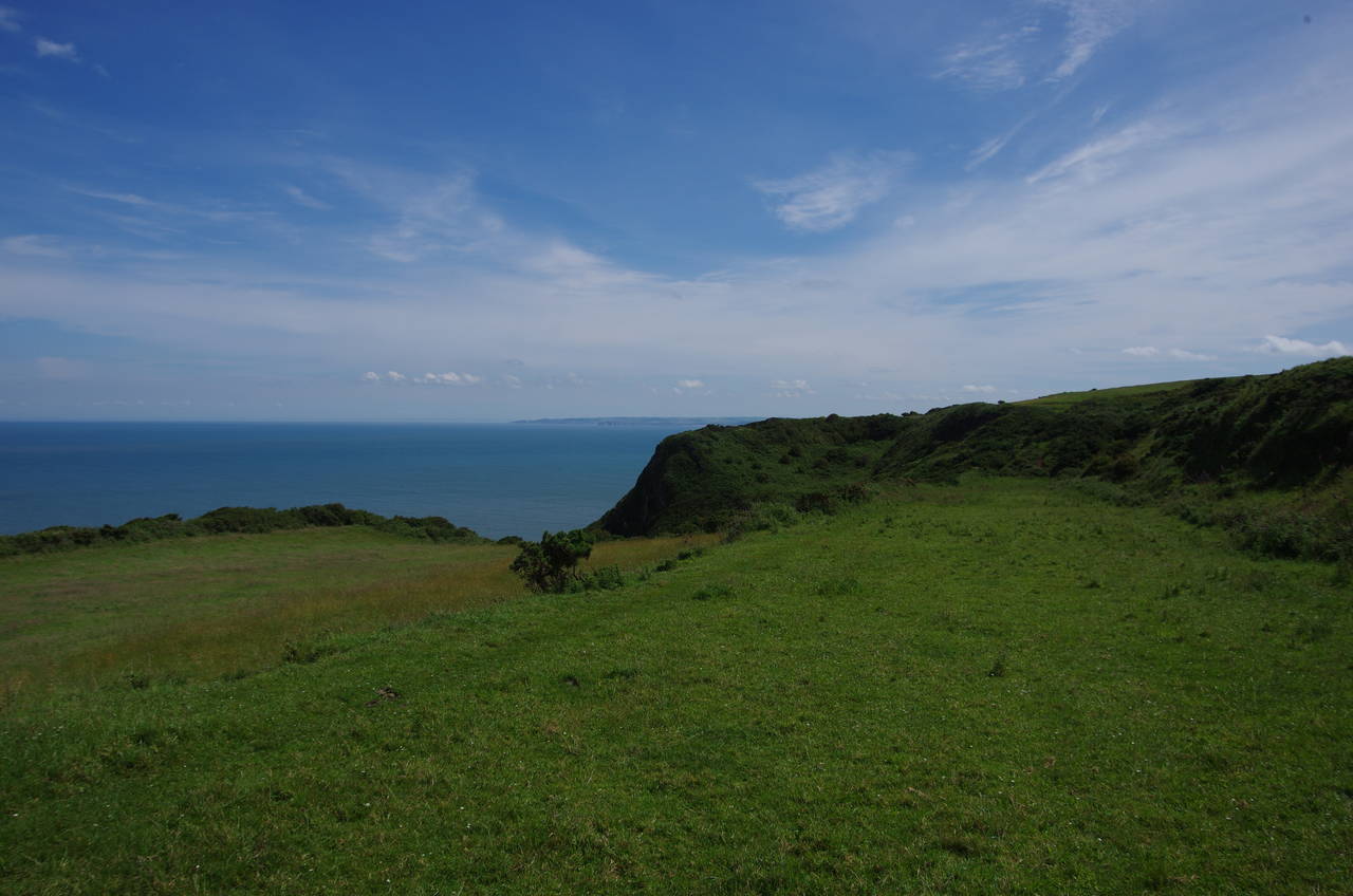
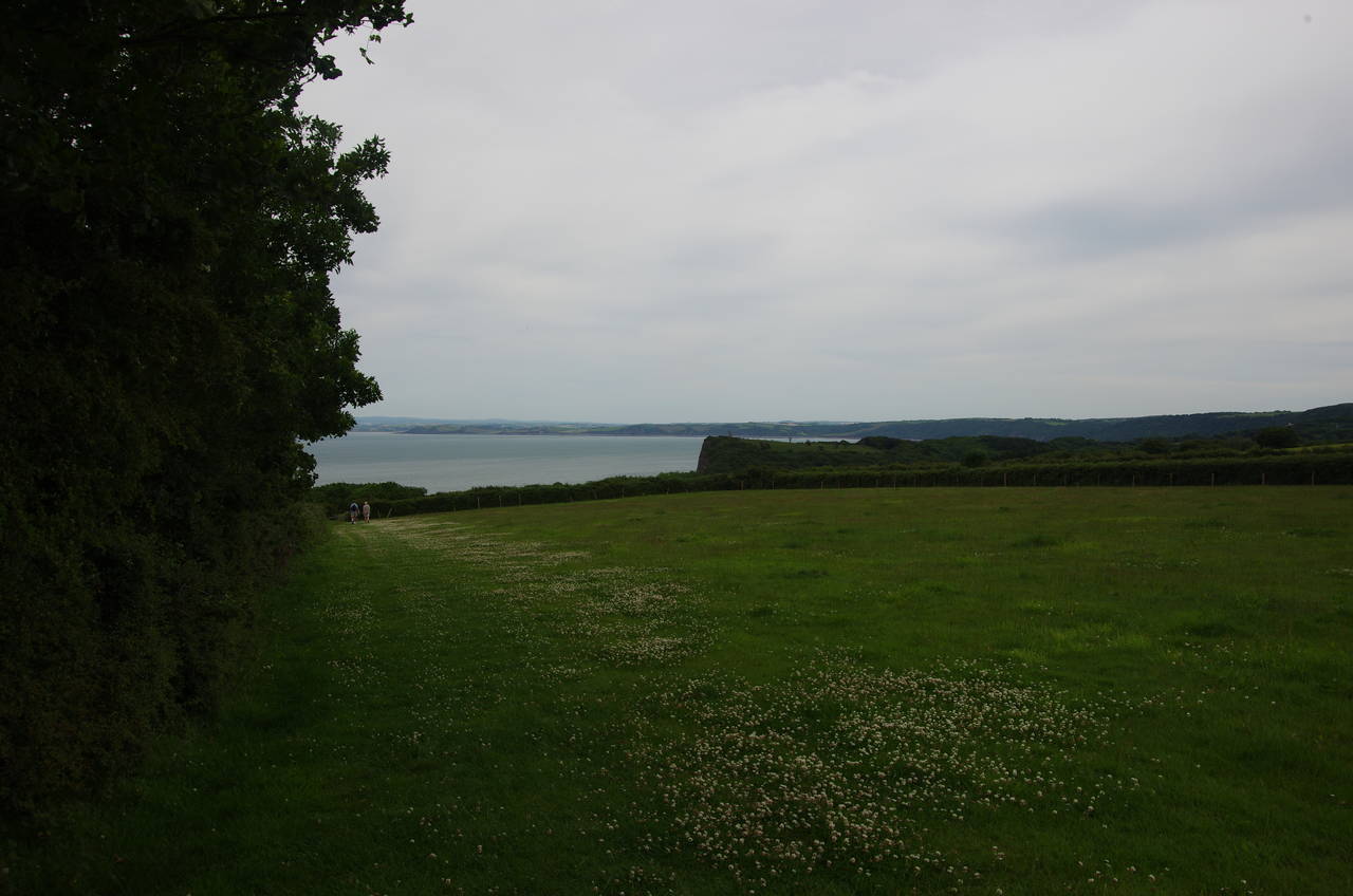
Beyond Eldern Point the path runs along the edges of a long series of open fields on Gawlish Cliff (picture 16), Fatacott Cliff and Exmansworthy Cliff. Three kilometres of almost unbroken, 150-metre high clifftop gives plenty of opportunities to admire the views north-eastwards across Bideford Bay towards Woolacombe, a little over 25 kilometres away as the crow flies, but around 90 kilometres away on the Coast Path.
(17) Beckland Farm East
(18) Memorial on Windbury Head
(19) Brownsham
(20) Brownsham Cliff
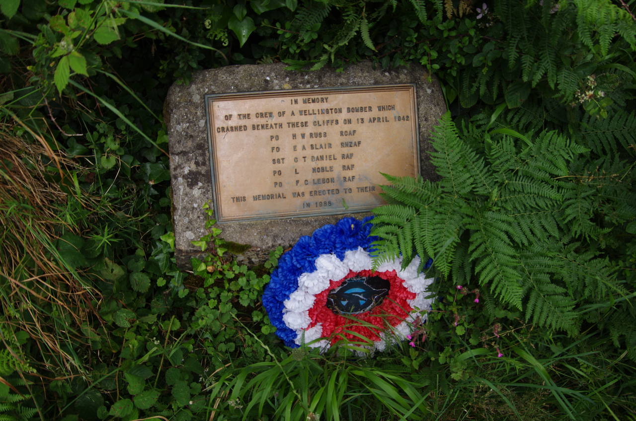
At the end of Beckland Cliff, the path descends briefly to cross a lush combe at Beckland Farm East (picture 17) before climbing back up along the edges of several fields onto Windbury Head, site of a prehistoric settlement and earthwork. Just beyond a stile about halfway up to the tip of the point, a small memorial beside the path remembers the five crew of an allied Wellington Bomber that crashed at the foot of the cliff on 13th April 1942, a Canadian, a New Zealander and three Britons (picture 18).
From Windbury Head, the Coast Path plunges down into a deep, sheltered valley that is part of the National Trust's Brownsham estate (picture 19), zig-zagging up the other side to a meadow that was carpeted in tiny flowers. The route follows the left-hand edge of the meadow across Brownsham Cliff (picture 20) for about 500 metres before descending through Mouthmill Wood into the next valley.
(21) Mouth Mill
(22) Gallantry Bower
(23) The Cabin
(24) Approaching Clovelly
Emerging on the floor of the narrow valley, the path crosses a footbridge over a vigorous little stream near an old mill and limekiln (picture 21). A track leads the short distance down to the rocky Mouthmill Beach then turns sharply back on itself to climb steadily up into the large wood of Gallantry Bower (picture 22).
After crossing a large clifftop paddock where the trees have been cleared to graze horses, the path heads back into the woods. There are several interconnected trails through the woods and the Coast Path turns several times to stick fairly close to the clifftops. There are signposts at every junction so the route is very easy to follow.
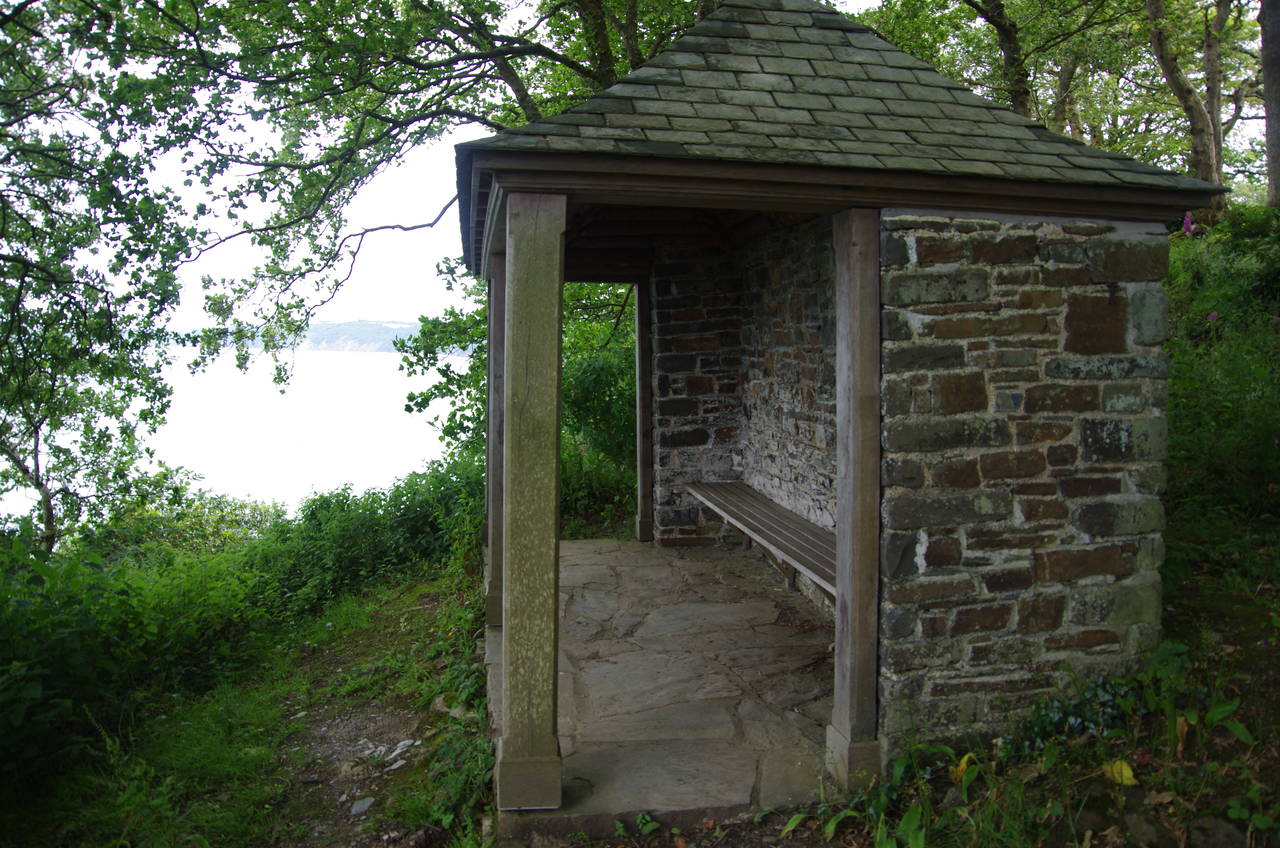
About two kilometres after climbing out of Mouthmill the path briefly cuts across the corner of a field before re-entering the woods. A shelter marked on maps as "The Cabin" (picture 23) provides a place to rest and look out across the bay before embarking on the last kilometre to Clovelly, an easy stroll among tall trees on the edge of a large pasture (picture 24).
(25) Mount Pleasant
(26) High Street, Clovelly
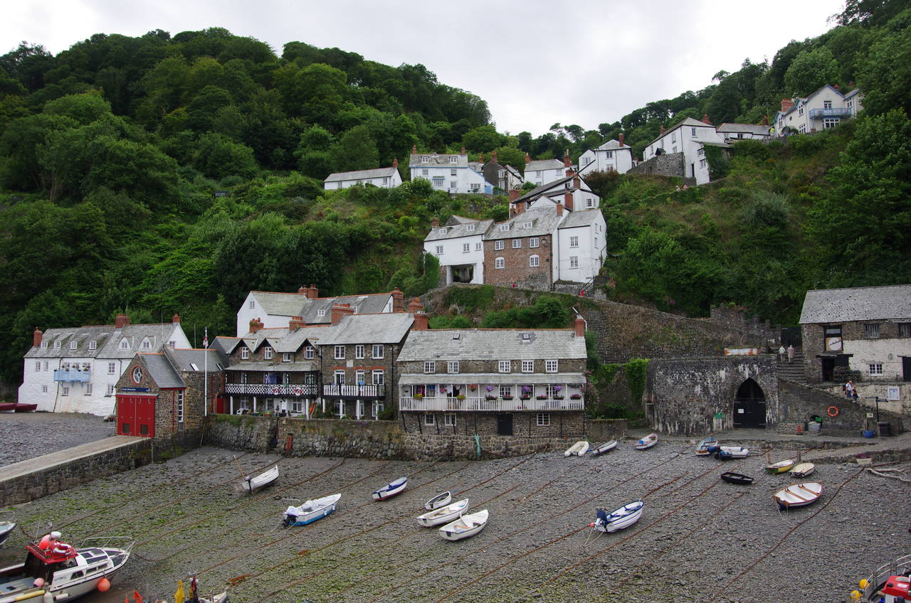
(27) Clovelly Harbour
(28) Clovelly
At the far end of the pasture the path goes through a gate onto a quiet road called the Hobby Drive, following the tarmac for about 200 metres past a small carpark and the viewpoint of Mount Pleasant (picture 25) to the top of Clovelly's High Street, and the end of this stage of the Coast Path -- a mere 15.9 kilometre ramble.
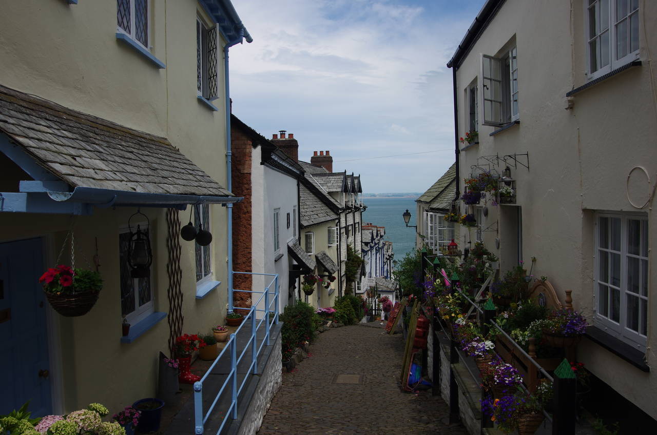
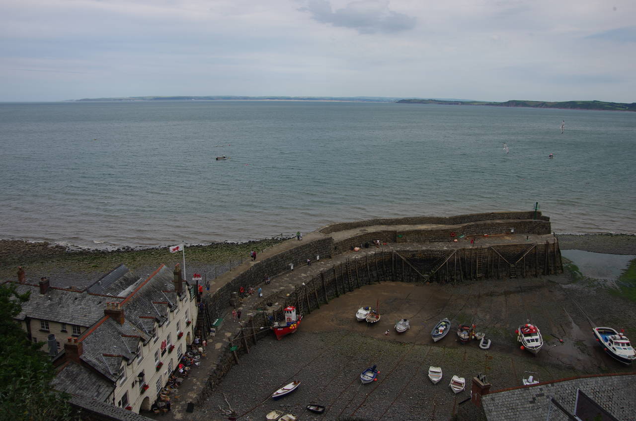
Clovelly's is not the usual kind of High Street. Narrow and cobbled, it leads steeply down between the tightly-packed houses (picture 26) to a small medieval harbour (picture 27). From the harbour wall one can see just how steep the High Street really is (picture 28). The village is car-free and all goods that arrive by sea or road are dragged up and down the hill in wooden sleds.
Clovelly's chief industry is tourism, and the village seemed to be full of school groups and retirees when I arrived. However, by late afternoon most of the visitors disappeared and the village took on a far more serene atmosphere.
After a few hours exploring the village and a stop in the pub beside the harbour, it was time to make the steep climb back up the High Street to the visitor centre above the village. Outside I caught the last bus of the day back to Bude, where I was staying one more night before moving further along the path to the town of Barnstaple.