SOUTH WEST COAST PATH NATIONAL TRAIL
Stage 47: Morwenstow to Hartland Quay
Tuesday, June 30, 2015
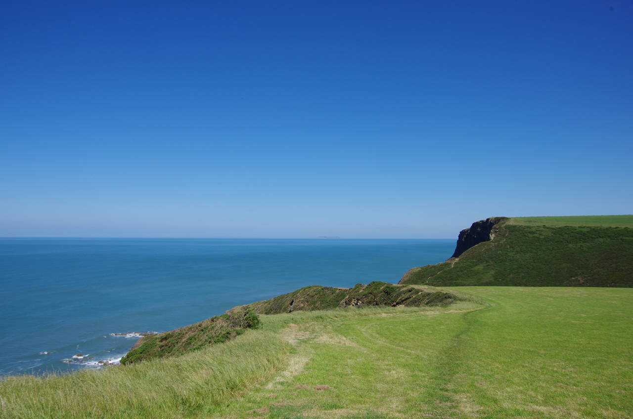
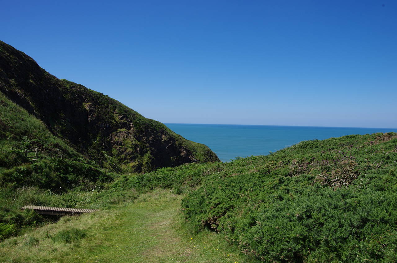
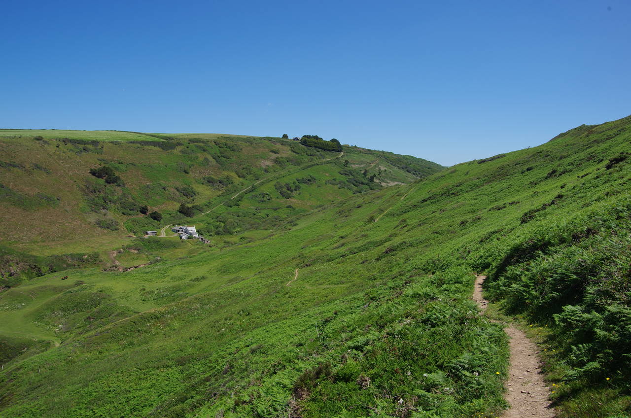
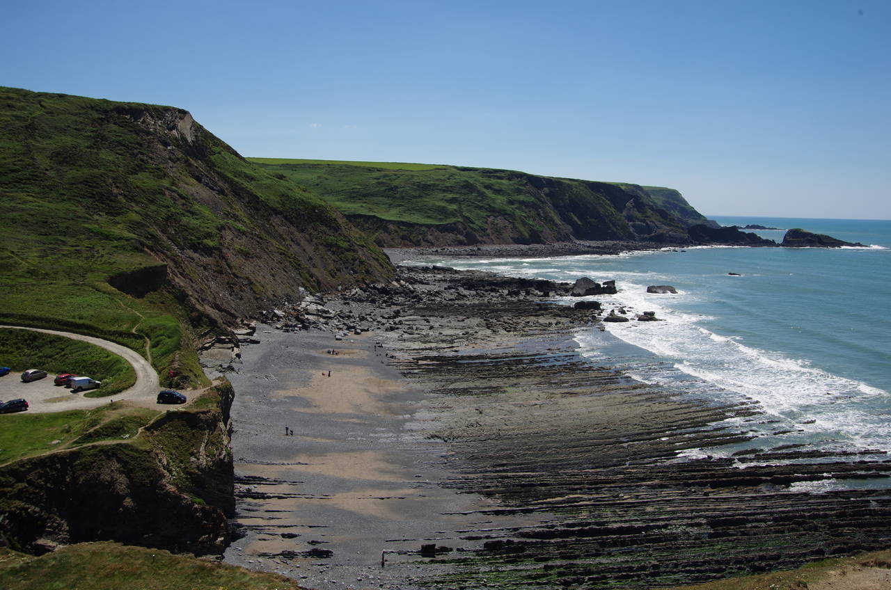
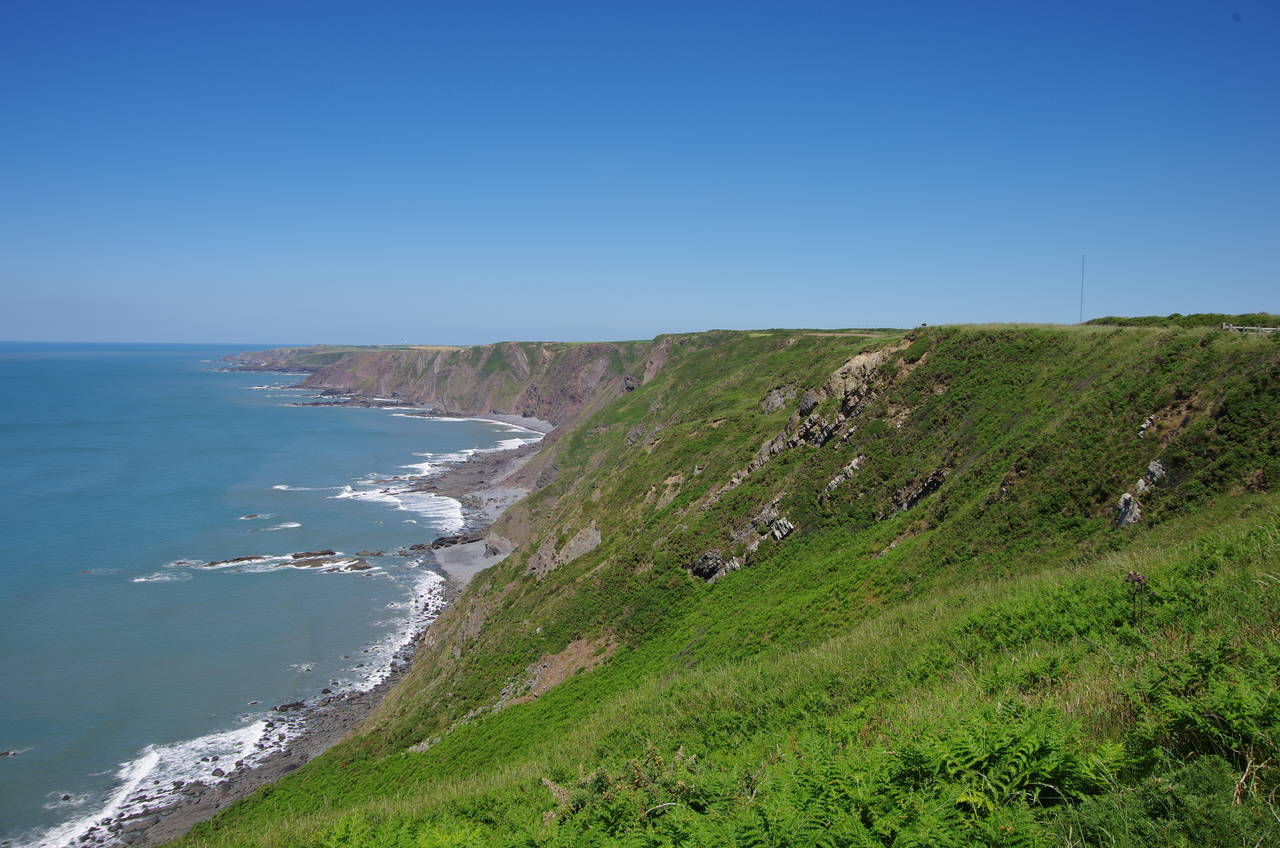
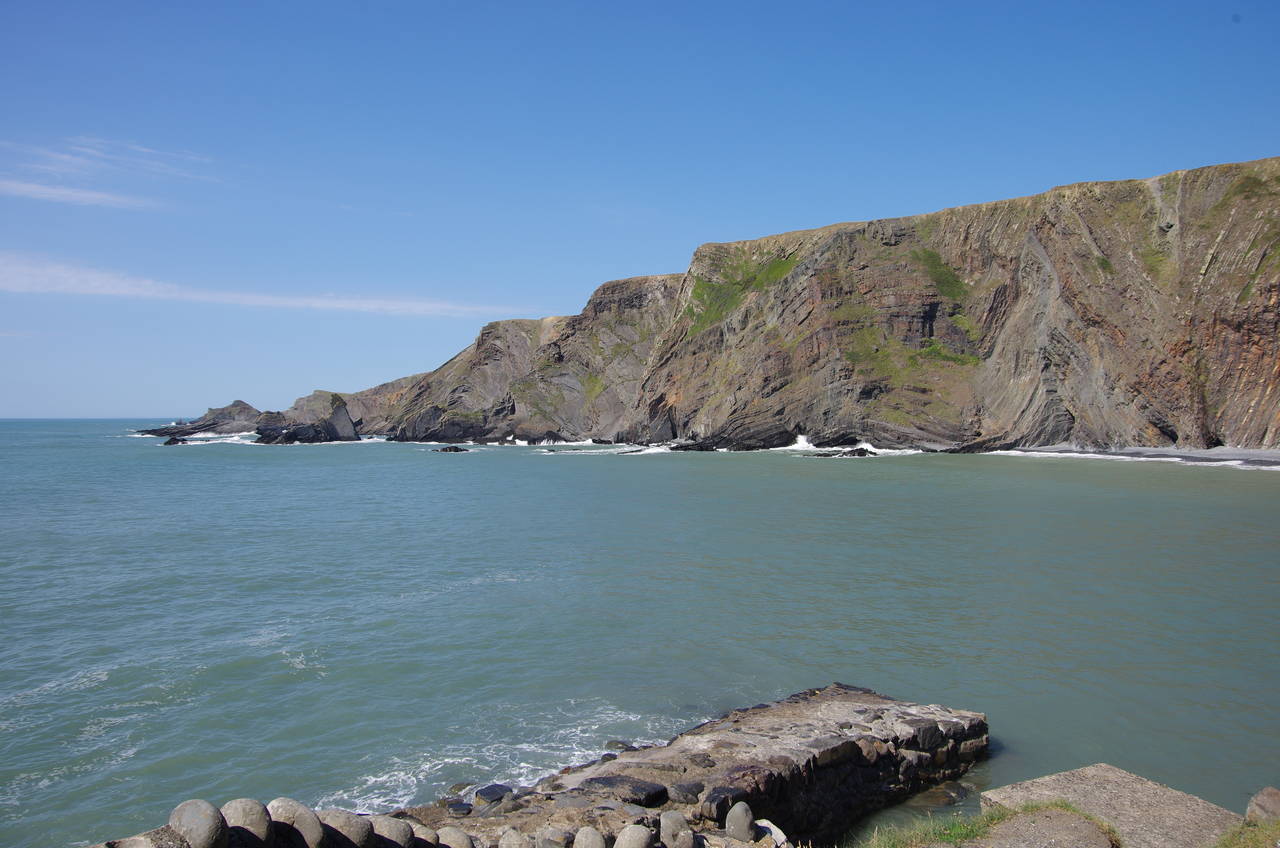
(1) Vicarage Cliff
(2) St Morwenna's Well
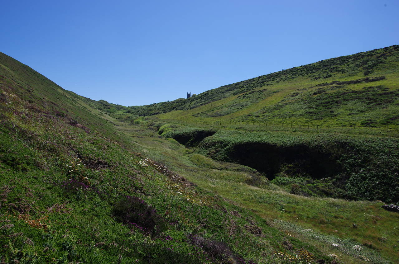
(3) St Morwenna's Well
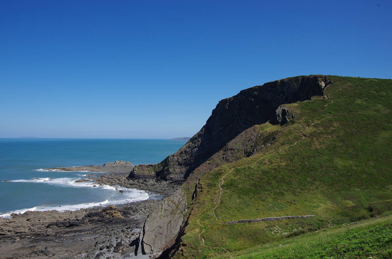
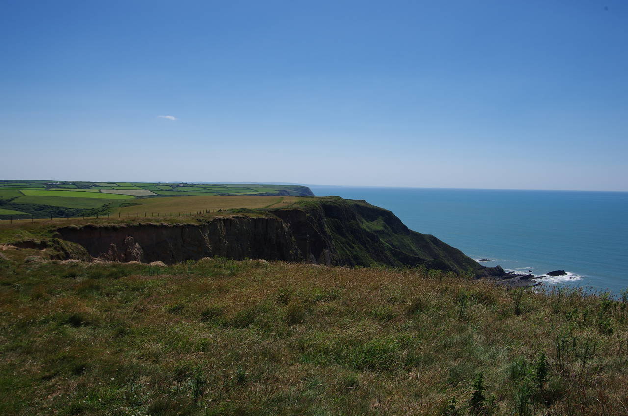
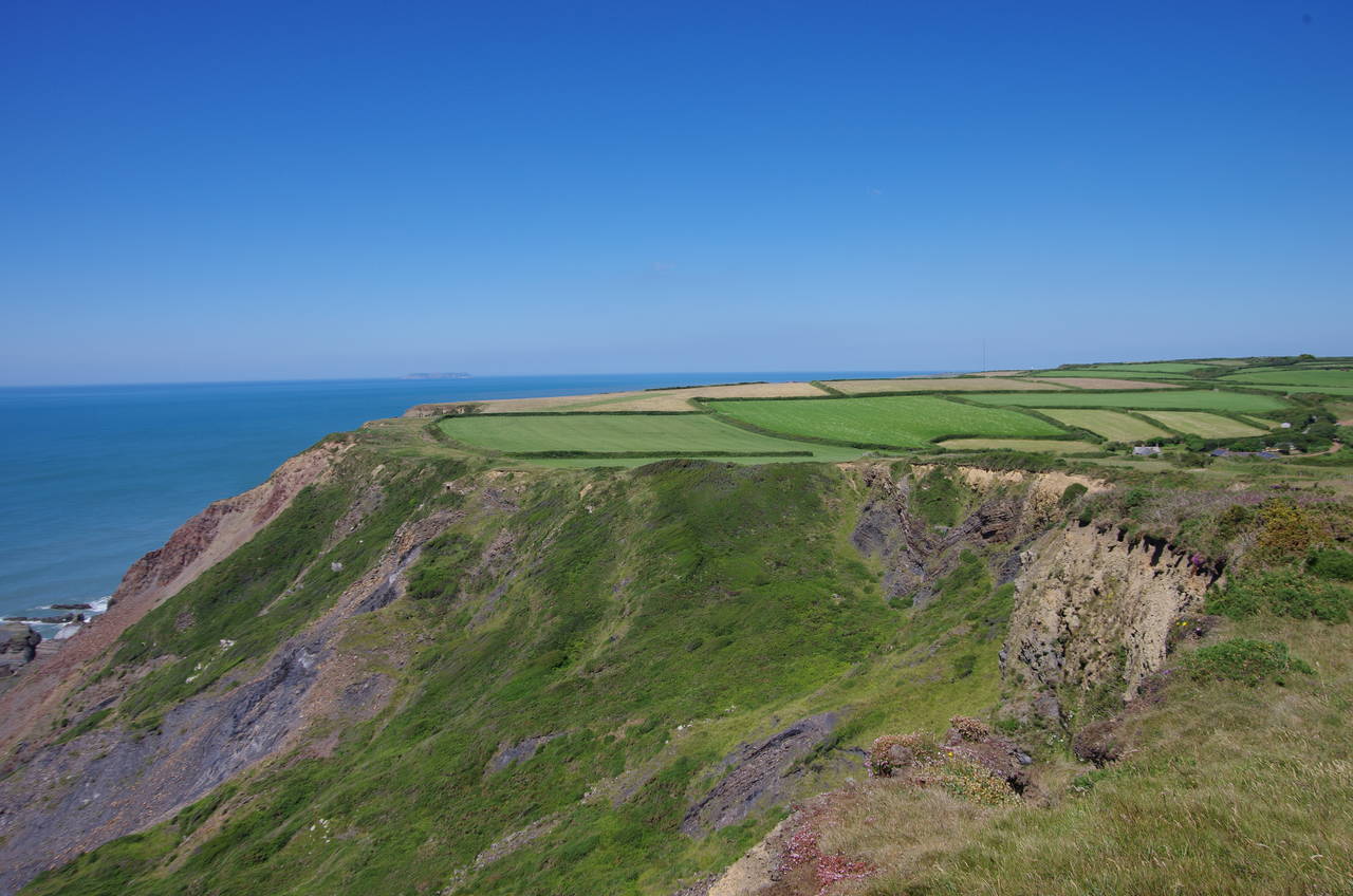
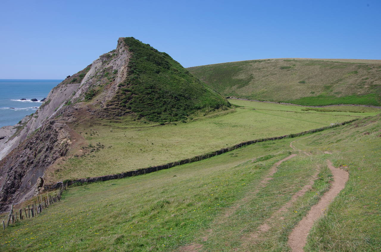
(4) View ahead from Henna Cliff
A very hot day was forecast and by the time I boarded the only bus of the morning from Bude to Morwenstow it was already getting close to 30 degrees. The bus ride was a lot longer than the previous evening's journey, skipping Morwenstow and going to Hartland Village, where I was planning to finish the day's walk, before coming back to Morwenstow. The 80-minute ride passed quickly however as I was chatting to the other two passengers, who were also heading out to walk the Coast Path. One was a middle-aged Scotsman who I had met on a bus to Tintagel a few days earlier and the other was a younger English lady who said she was walking the Coast Path as part of her training for a mountain-climbing expedition to Russia.
The young lady got off the bus at Hartland heading towards Bude, while myself and the Scot continued on to Morwenstow, alighting by the Bush Inn and walking across the fields to Hawker's Hut where we parted company. He was walking south towards Bude, while I headed off northwards along the edges of grassy fields atop Vicarage Cliff (picture 1).
At the far side of the second field, the path descends along the cliff edge into the hanging valley of St. Morwenna's Well (picture 2) to cross a short footbridge over a tiny stream that flows over the cliff a few metres away to the left. Looking inland from this pleasant spot one can see the tower of Morwenstow Church peeking over the lip of the valley (picture 3).
From the bridge, a steep and strenuous climb out of the valley to the peak of Henna Cliff is a taste of things to come. Ahead from Henna Cliff (picture 4) one can see the next few valleys that must be crossed, a radio transmitter that resembles a golf ball on a tee far ahead on Hartland Point, and the mysterious granite plateau of Lundy Island on the horizon where the Atlantic Ocean becomes the Bristol Channel.
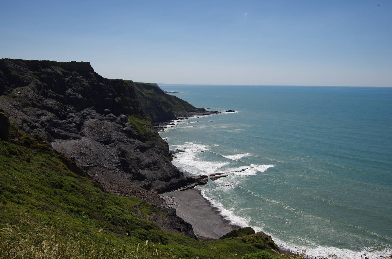
(5) Yeol Mouth
(6) Yeolmouth Cliff
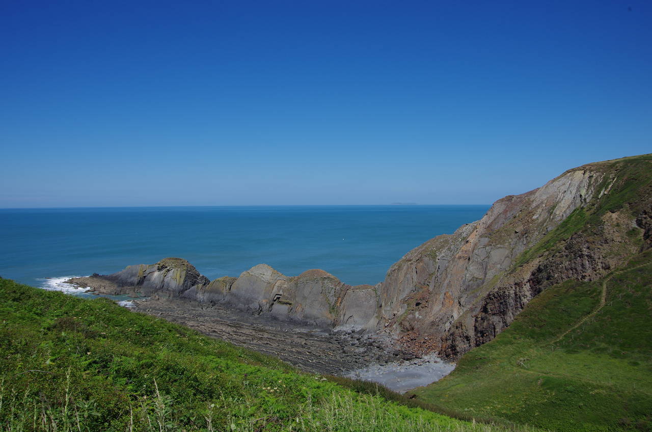
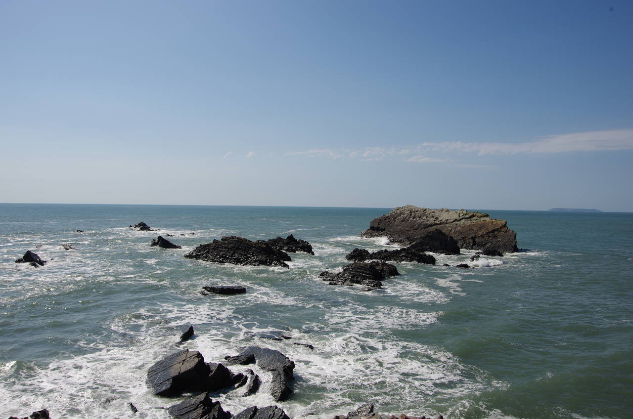
(7) Litter Mouth and Gull Rock
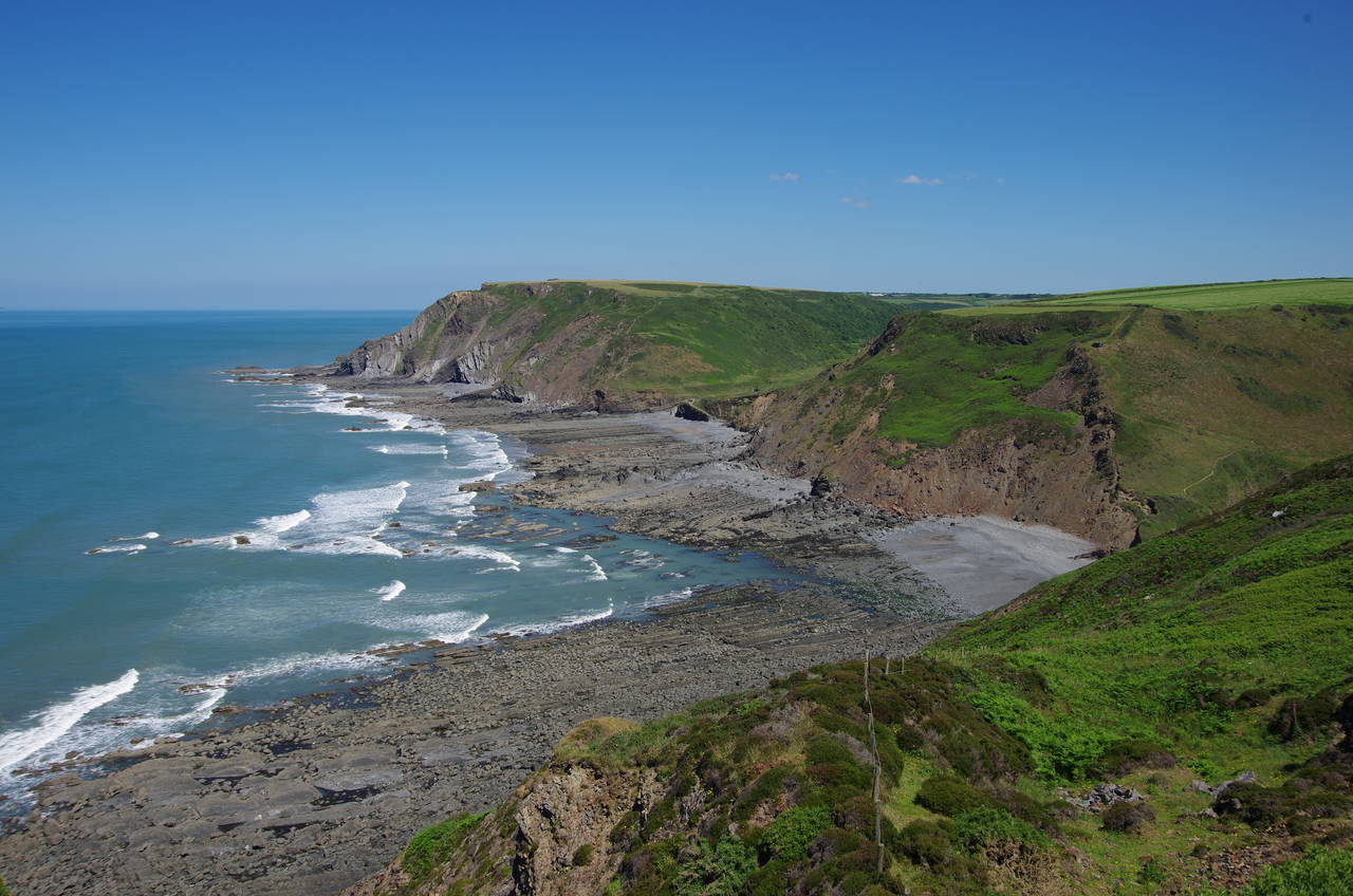
(8) Marsland Mouth and Welcombe Mouth
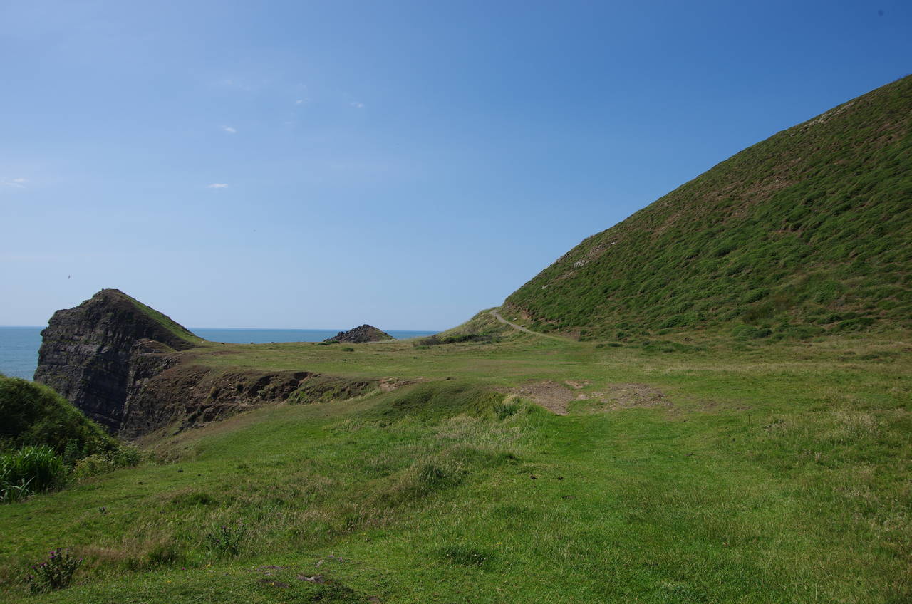
From Henna Cliff, an obvious path skirts around the top of an area of scrub called Westcott Wattle before dropping steeply into Yeol Mouth (picture 5). After an equally steep climb up the other side to a wooden gate, a grassy path squeezes between the clifftop and a large fenced pasture on the flat top of Yeolmouth Cliff (picture 6). Beyond another gate the path runs just inside another large pasture on Cornakey Cliff until a steep zig-zag path heads down into Litter Mouth, where the long finger of Gull Rock stretches out into the Atlantic on the far side of an inaccessible little beach (picture 7).
Another steep climb, this time on an almost endless flight of rough steps, takes the path up onto Marsland Cliff, where the next two valleys of Marsland Mouth and Welcombe Mouth can be surveyed, not far ahead (picture 8).
(9) Marsland Valley
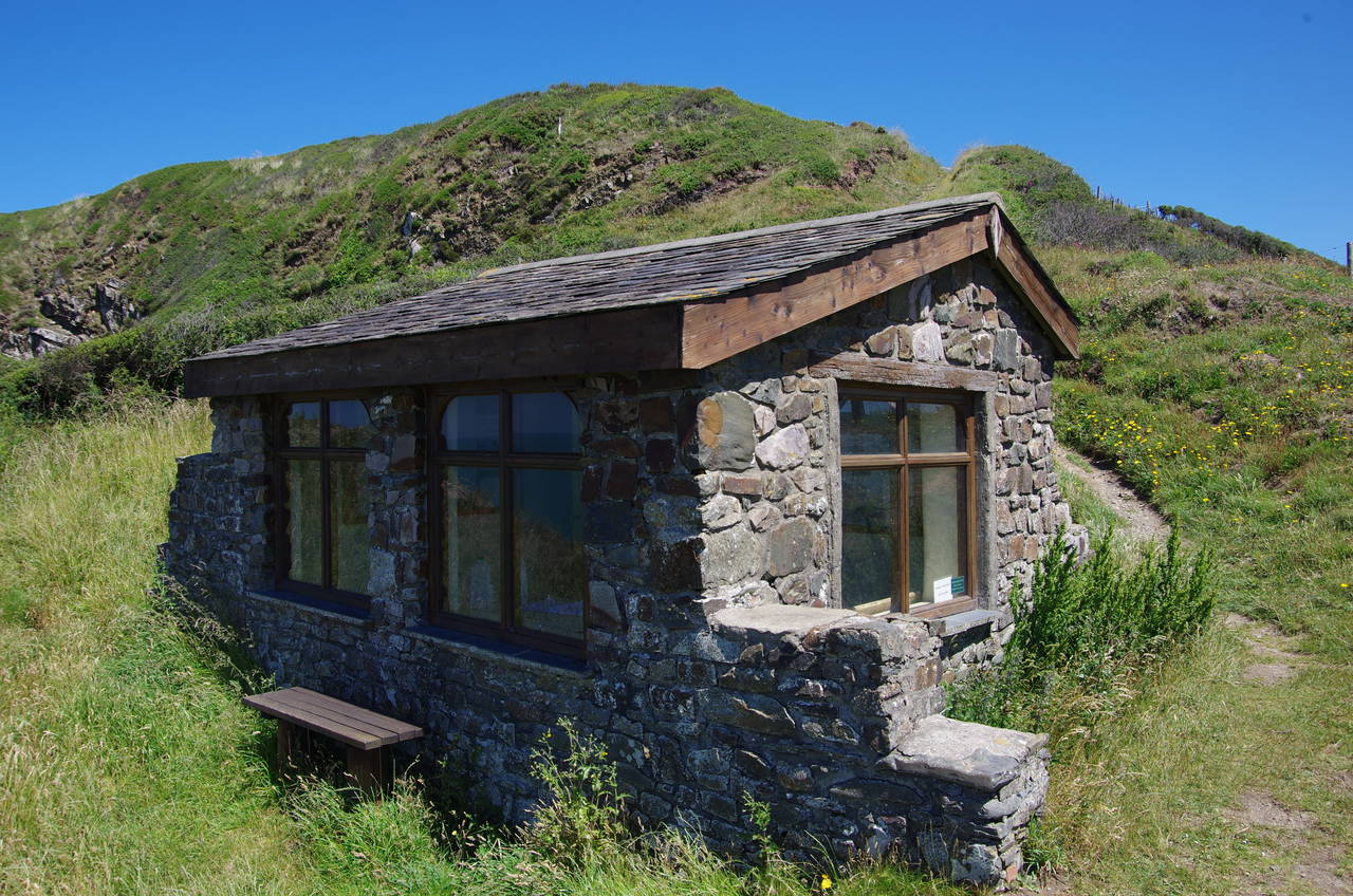
(10) Ronald Duncan's Hut
(11) Welcombe Mouth
(12) Welcombe Mouth
The path winds its way along the gorse-covered hillside of Marsland Cliff, eventually zig-zagging down into the valley above Marsland Mouth (picture 9). On crossing the footbridge over the shallow stream, the Coast Path leaves Cornwall after around 480 kilometres and re-enters Devon.
A very steep path climbs up out of Marsland Valley, gaining around 100 metres to reach Ronald Duncan's Hut, a room with a view just below the top of the hill (picture 10). The hut, built by the 20th-century poet and playwright after whom it is named, was open and had a visitor's book and three large containers of water provided for walkers to replenish their supplies. Whoever carries the water up to the hut each day must be very fit indeed.
While I was signing the visitor's book the young lady I met on the bus arrived, having walked at least twice as far as I had managed so far and looking rather red due to the hot weather. She was at least able to reassure me that the hardest part of the walk was behind me before we set off again in opposite directions.
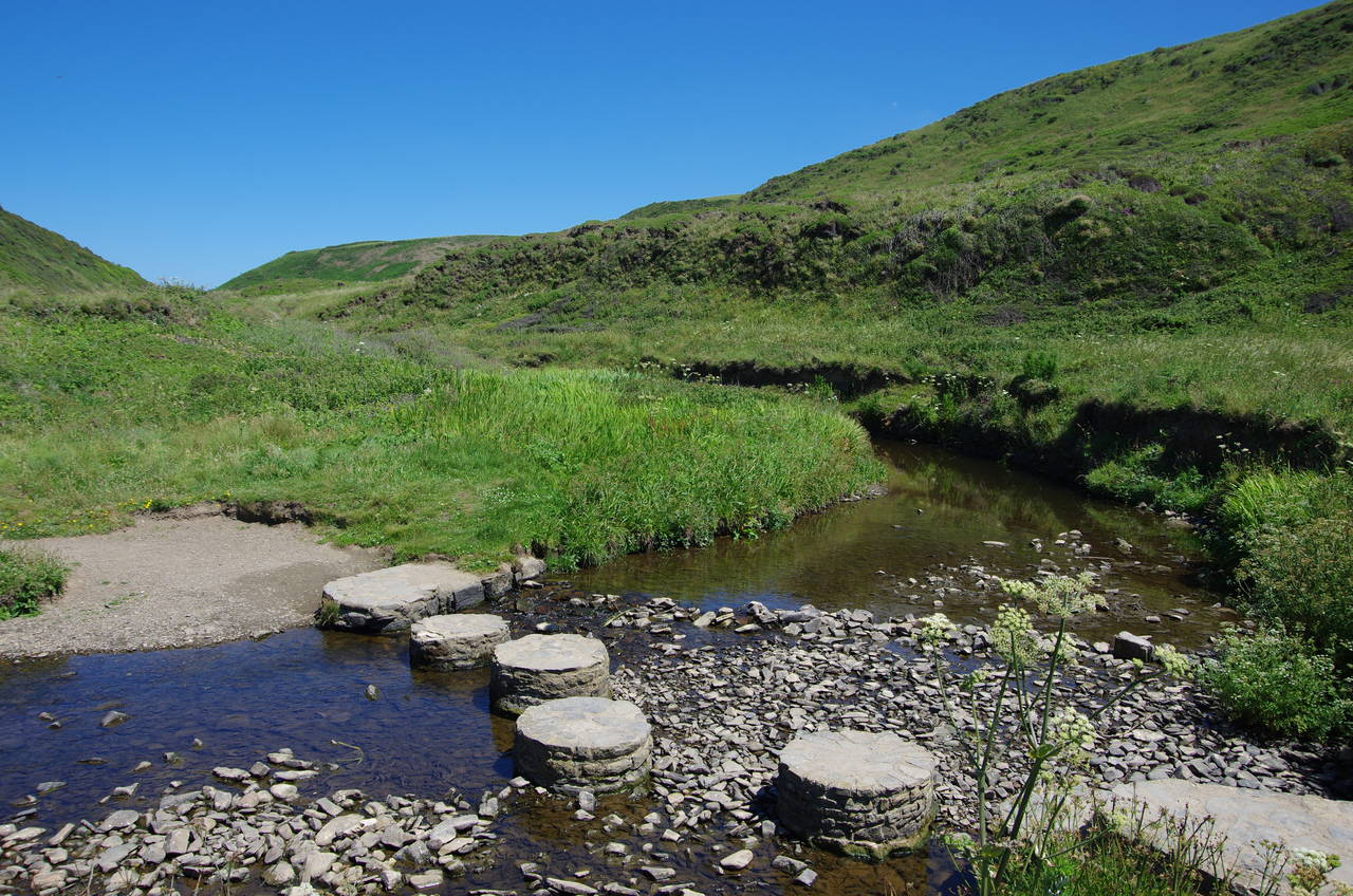
Behind the hut the path climbs a little higher, crossing the short end of a field before a long descent into the deep valley of Welcombe Mouth (picture 11), which is owned in it's entirety by the National Trust. Just above the beach, where there is another good example of the eroded edges of tilted rock strata, the path crosses a small carpark to reach a line of stepping stones across a pond where the waters of a small stream pool before spilling over the edge of the cliff and onto the beach below (picture 12).
(13) Welcombe Mouth
(14) View back from Embury Beacon
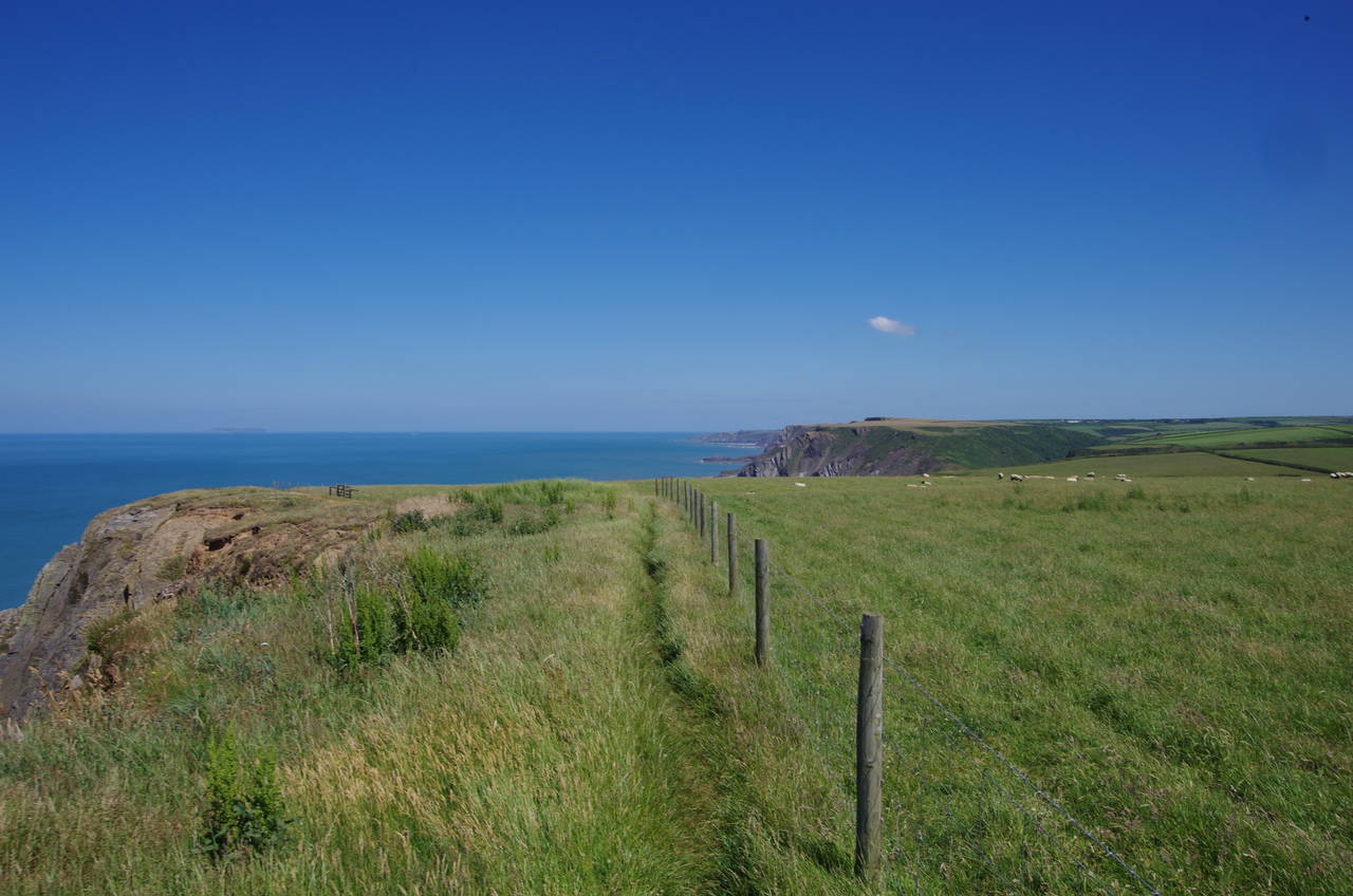
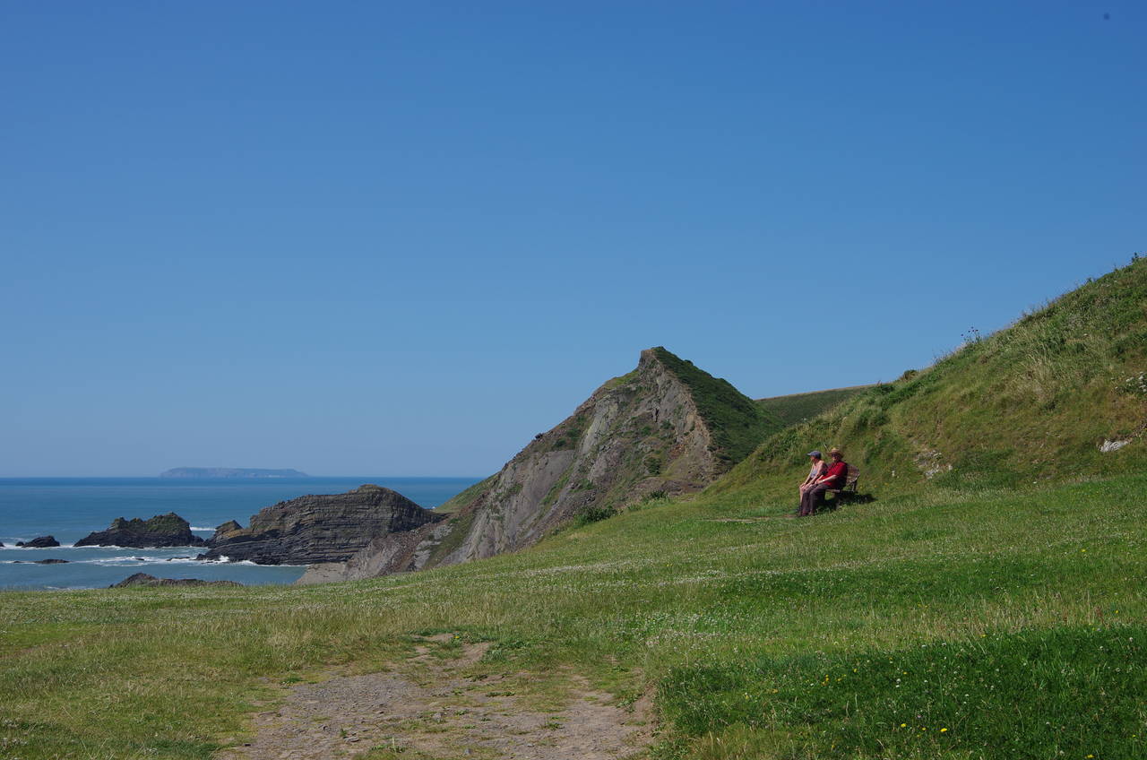
(15) Nabor Point
(16) Broadbench Cove
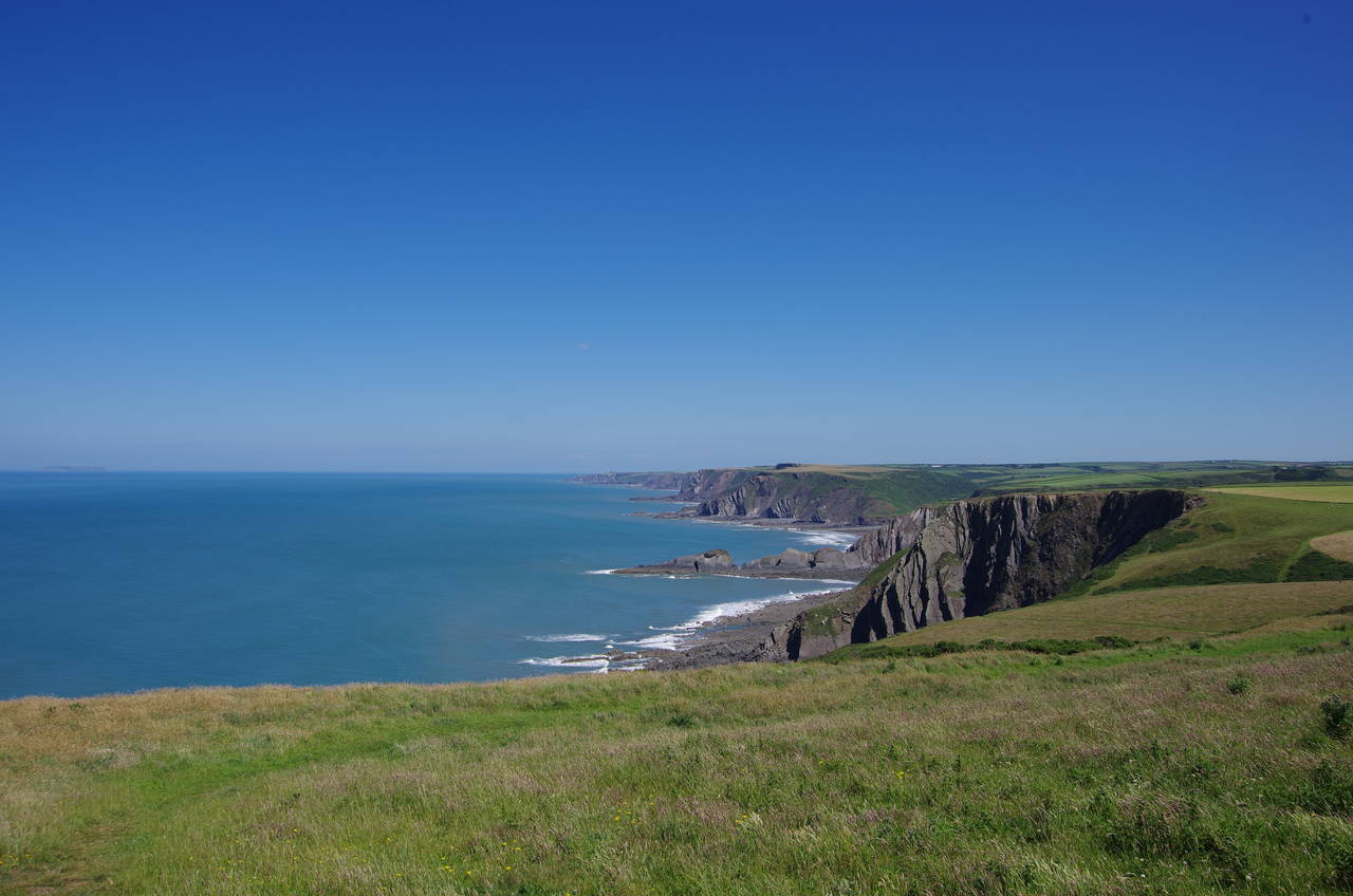
The fifth steep climb in as many kilometres gives a good view across Welcombe Mouth and Marsland Cliff (picture 13) before the path levels out at around 140 metres. Mercifully, there are no more valley crossings for a while and instead the path follows the more gently undulating clifftop route around Knap Head and on for another kilometre to the scant remains of an Iron-age hill fort at Embury Beacon (picture 14). The path passes through a low earthen rampart, but there is little other evidence of the fort's existence, with most of it having been lost to the stormy Atlantic. Ahead is Nabor Point (picture 15), which is reached by circling around the top of Broadbench Cove (picture 16).
(17) Sandhole Cliff
(18) Field above Dixon's Well
(19) Mansley Cliff

(20) Approaching Speke's Mill Mouth
The Coast Path runs along the top of Sandhole Cliff (picture 17) for about 500 metres before being forced to join a quiet lane for another 500 metres to Sandhole Cross. There a signpost points through a hedge and out along the edge of a field above a bowl-shaped depression called Dixon's Well (picture 18).
Beyond a large cleft in the cliff, the path runs along the crumbling but relatively flat Mansley Cliff (picture 19) for about one and half kilometres to Swansford Hill. The path then divides, with the main path descending into a shallow valley behind the hill while an alternative path runs higher up the side of the ridge. Choosing the main path, I followed it along the gorse-covered valley floor, which curves left around the foot of the hill to head back towards the ocean at Speke's Mill Mouth with Lundy Island framed nicely by the peaks at the end of the valley (picture 20).
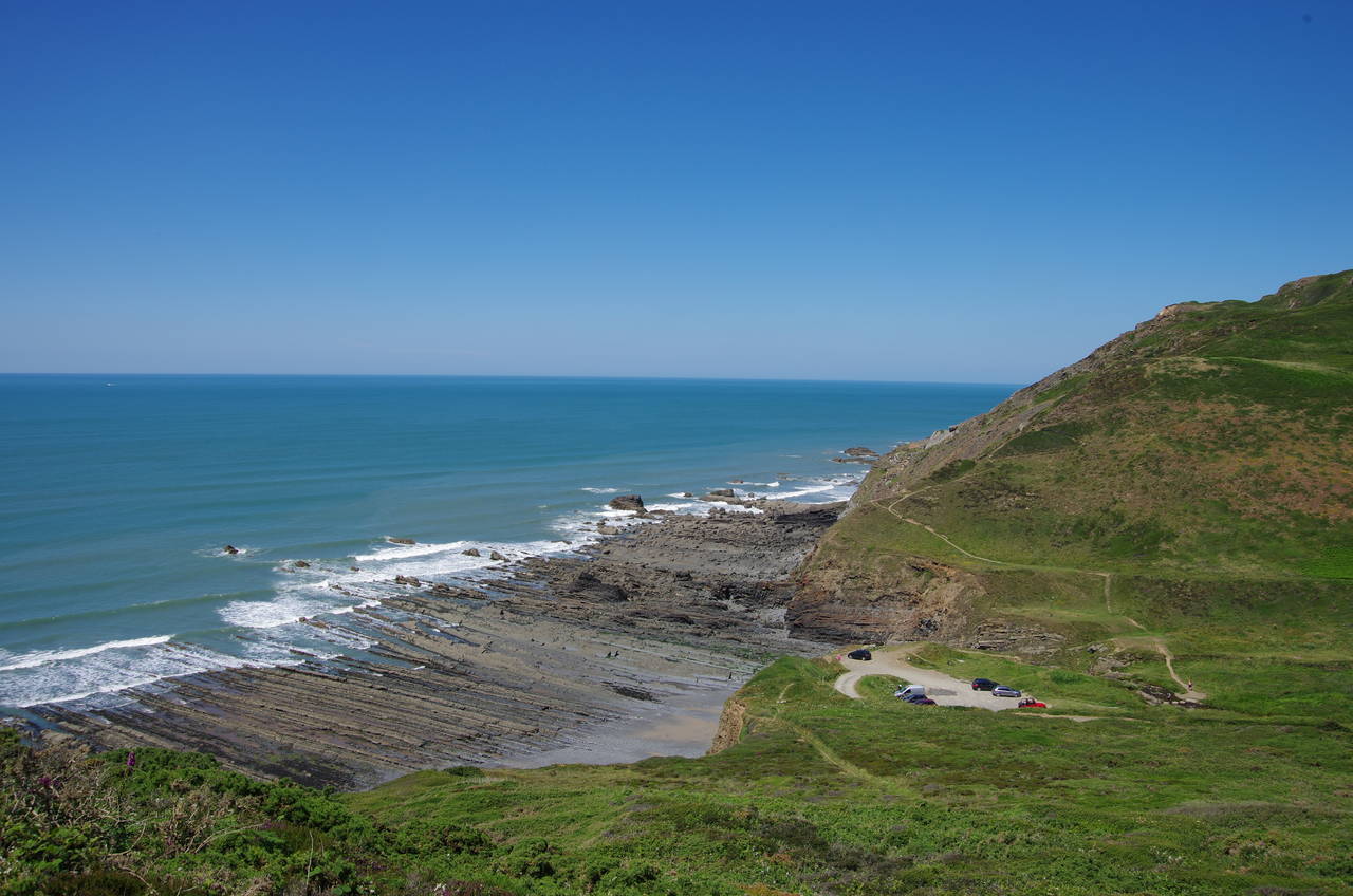
(21) Speke's Mill Mouth
(22) St Catherine's Tor
(23) Path above Childspit Beach
(24) Screda Point
Halfway back to the water, the path crosses a footbridge over a winding stream to join a vehicle track for the rest of the way to a grassy picnic area overlooking the ocean (picture 21). A rough path makes a short climb through scrub to a field where the Coast Path hugs the clifftop for a while before bearing inland to converge with a stone wall behind St Catherine's Tor (picture 22), a half-eroded hill being slowly consumed by the waves.
The Coast Path makes an unsignposted turn through a gate in the wall, heading along the valley floor on the far side of St Catherine's Tor to the cliff above the tiny Childspit Beach, which mostly remains out of sight below (picture 23). An obvious track leads up over the neck of the slate promontory of Screda Point, where a few cattle were grazing on the grassy top (picture 24).
(25) Hartland Quay
(26) Warren Cliff
(27) Rocks off Hartland Quay
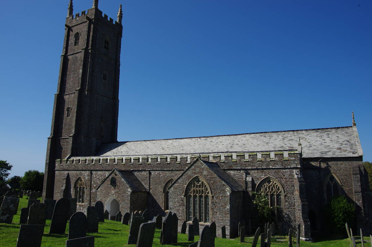
(28) Parish Church of St Nectan, Stoke Barton
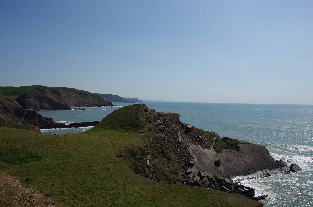
As the path rounds Screda Point, Hartland Quay comes into view ahead, a large flat tongue of land projecting out into the Atlantic from the foot of the cliffs (picture 25). The path descends steeply down to the quay's lower carpark and the end of this stage of the Coast Path, a rather strenuous 13.3 kilometres that deserves its reputation as one of the hardest stages of the entire National Trail.
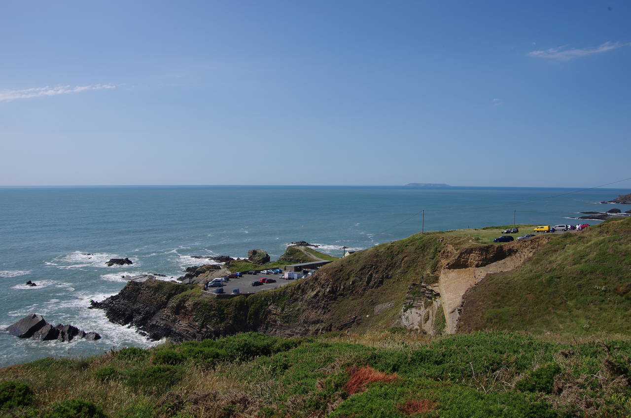
Hartland Quay was built in the late 1500's for the export of local grain and the import of Welsh coal and lime, with a sturdy stone pier on the north side of the quay sheltering the boats as they loaded and unloaded. A terminal decline in commercial trade began when the railway came to nearby Bideford in 1855 and maintenance of the pier soon ceased. In 1887 the pier was all but destroyed by a fierce Atlantic storm and little trace of it remains today. Where the old pier once stood there is now a small slipway leading down to a small beach, overlooked by the imposing Warren Cliff, where the layers of rock have been turned almost vertical by geological movements (picture 26). The approach to the old pier must have been quite treacherous, as the sea off the quay is full of dangerous-looking rocks (picture 27).
The large main building, originally the custom house, is now a pub, where I stopped off for some refreshment. The day's walking wasn't quite over yet however, as the nearest public transport is a four kilometre walk inland at the village of Hartland. From the quay one must climb the winding access road for almost a kilometre until it levels out near a small cottage known as the Rocket House. The narrow strip of tarmac continues inland between hedge-lined fields to the village of Stoke Barton, where the road skirts around the churchyard of the 14th-century Church of St Nectan (picture 28), said to have the tallest church tower in Devon. Beyond the village the road passes the grounds of the 12-century Hartland Abbey then continues onward through more hedge-lined farmland to Hartland.
I still had about an hour until my bus was due, which gave me time to explore the large village and find the bus stop. A little unusually, the buses don't go near the village centre, but instead leave from Northgate Green about five minutes walk from the centre in the north-west corner of the village.
The ride back to Bude was much swifter than the morning's journey had been, taking 35 minutes. As I crossed the carpark behind Summerleaze Beach on the way up to my accommodation, I was greeted for the third time in the day by the young lady from the bus, who had beaten me back to Bude, despite having walked almost twice as far as I had done. I must be getting old.