SOUTH WEST COAST PATH NATIONAL TRAIL
Stage 49: Clovelly to Appledore
Monday, July 06, 2015
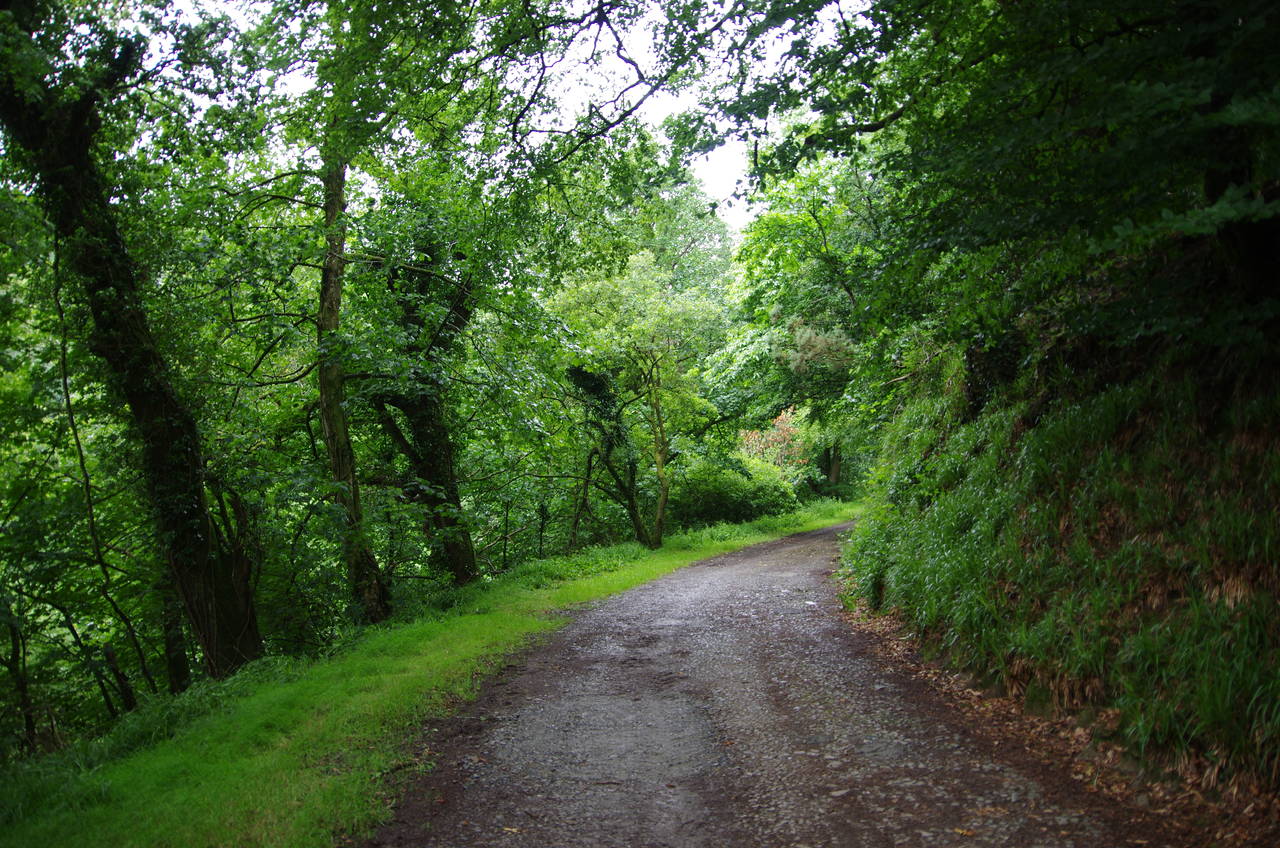
(1) Hobby Drive
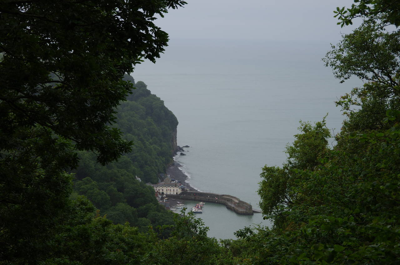
(2) Clovelly Harbour
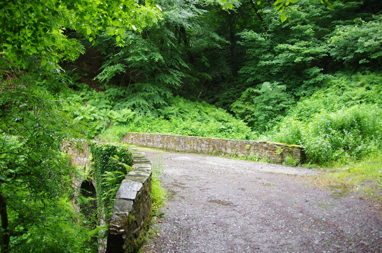
(3) Last bridge on The Hobby Drive
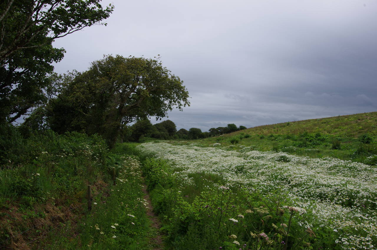
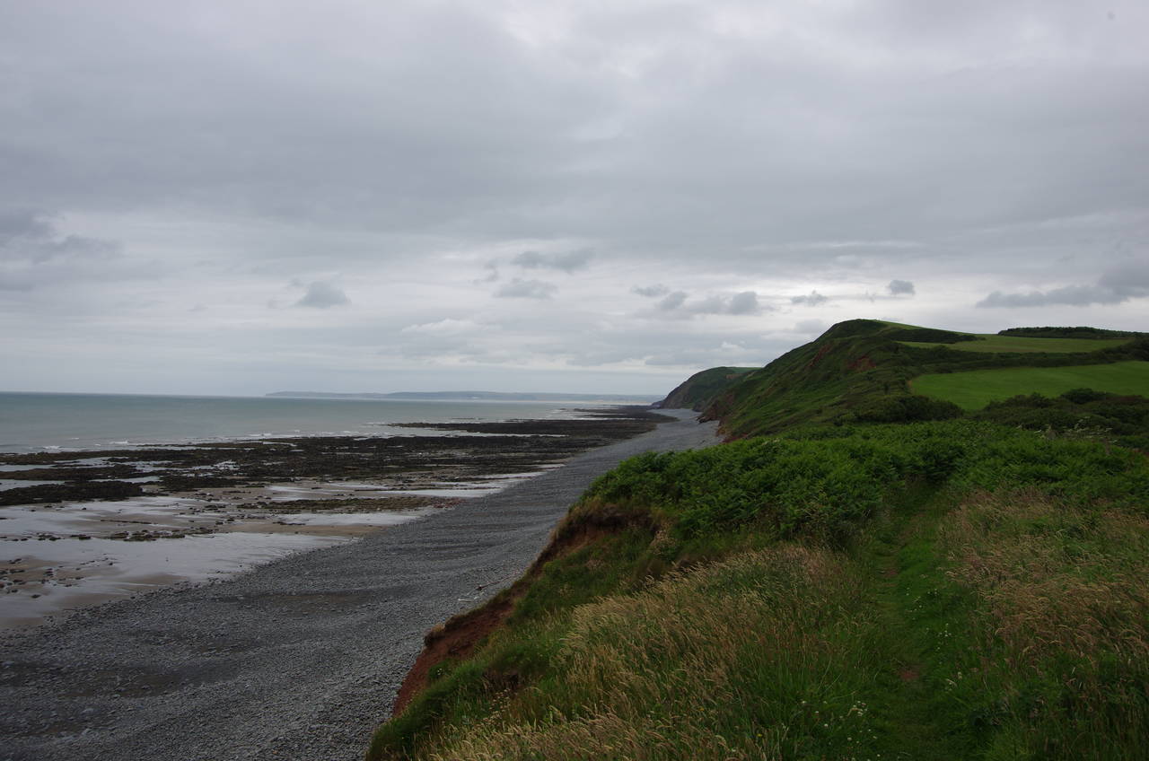
(4) Buck's Down
After a couple of days off I returned to the village of Clovelly at around 10:30 on a rather drizzly morning. The forecast had suggested that the weather would soon clear up, but there was no sign of that yet so I pulled on my waterproofs and set off from the top of Clovelly's cobbled High Street.
The Coast Path heads southwards into woods on The Hobby Drive (picture 1), an unsealed road built in the early 1800's. The Hobby Drive provides a winding but fairly flat route along the contours of the steep and thickly-wooded hillside high above Bideford Bay for the first three kilometres of the day's walk. About a third of the way along, the track turns inland to cross stone bridges over two valleys that join further down the hillside to form a steep combe known as the Devil's Kitchen. As the path heads back towards the sea after the second bridge, a viewpoint gives the only good view down to Clovelly Harbour from the path (picture 2).
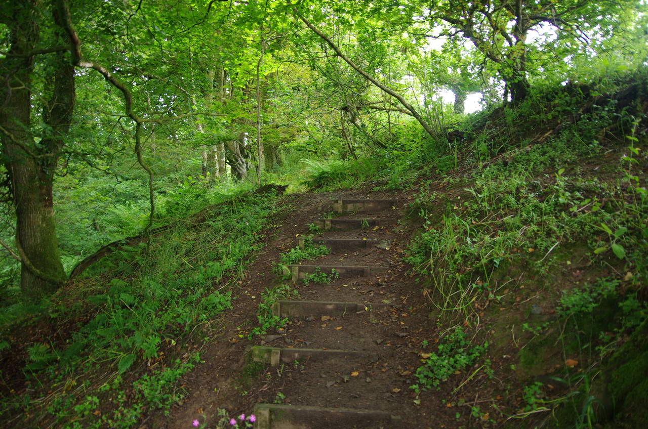
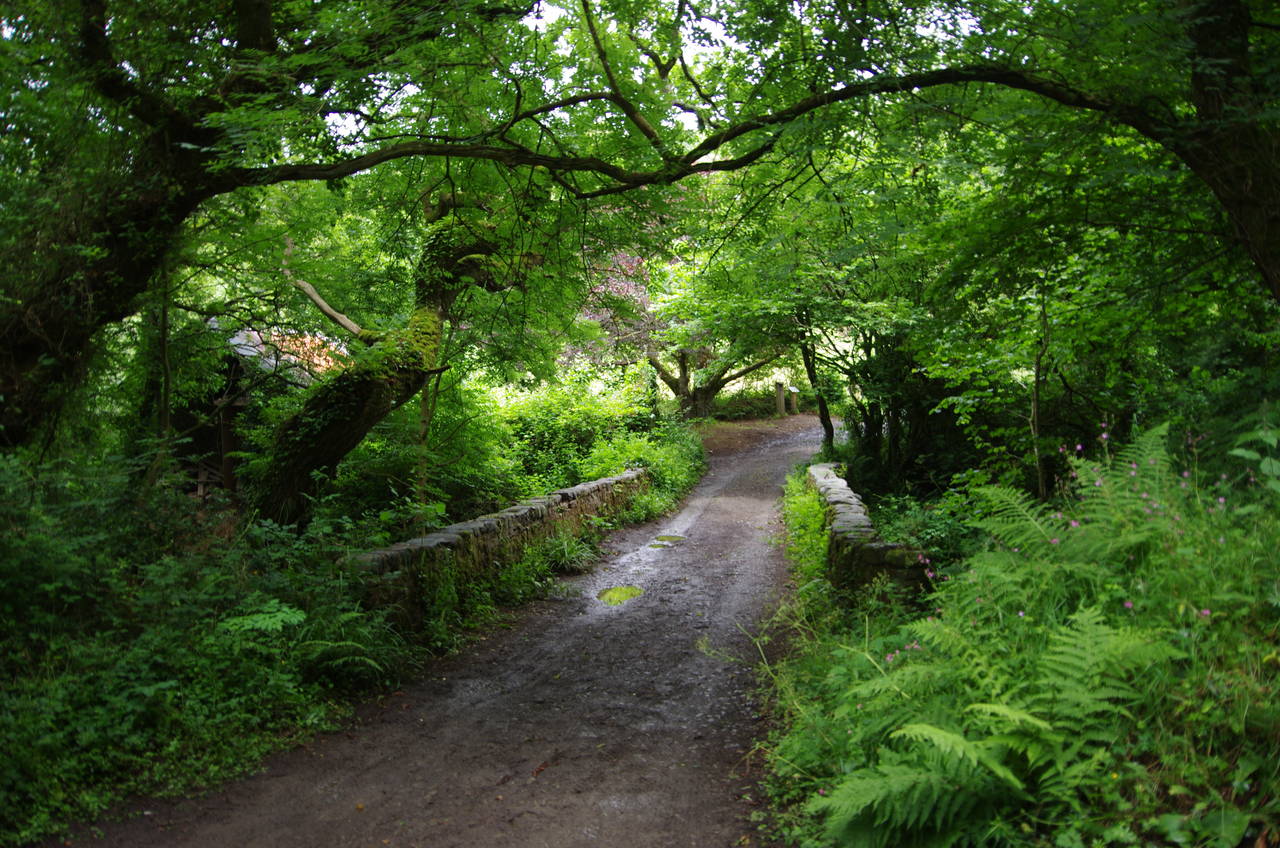
About twenty minutes walking later the path once again bends inland to cross one more stone bridge over a valley and stream (picture 3). A few minutes more and the track reaches a signpost where the Coast Path finally leaves The Hobby Drive, turning left down some rough steps into a steep-sided gorge.
A rather rickety wooden footbridge crosses over the bottom of the gorge before the path climbs back up to a gate into a large meadow on Buck's Down (picture 4). By now the drizzle had stopped for the moment so I paused to pack away my waterproofs before continuing along the left-hand edge of the meadow to another gate leading through a band of trees and into the next field.
(5) Buck's Valley Woods
(6) Buck's Cross
(7) Buck's Mills
(8) Buck's Mills
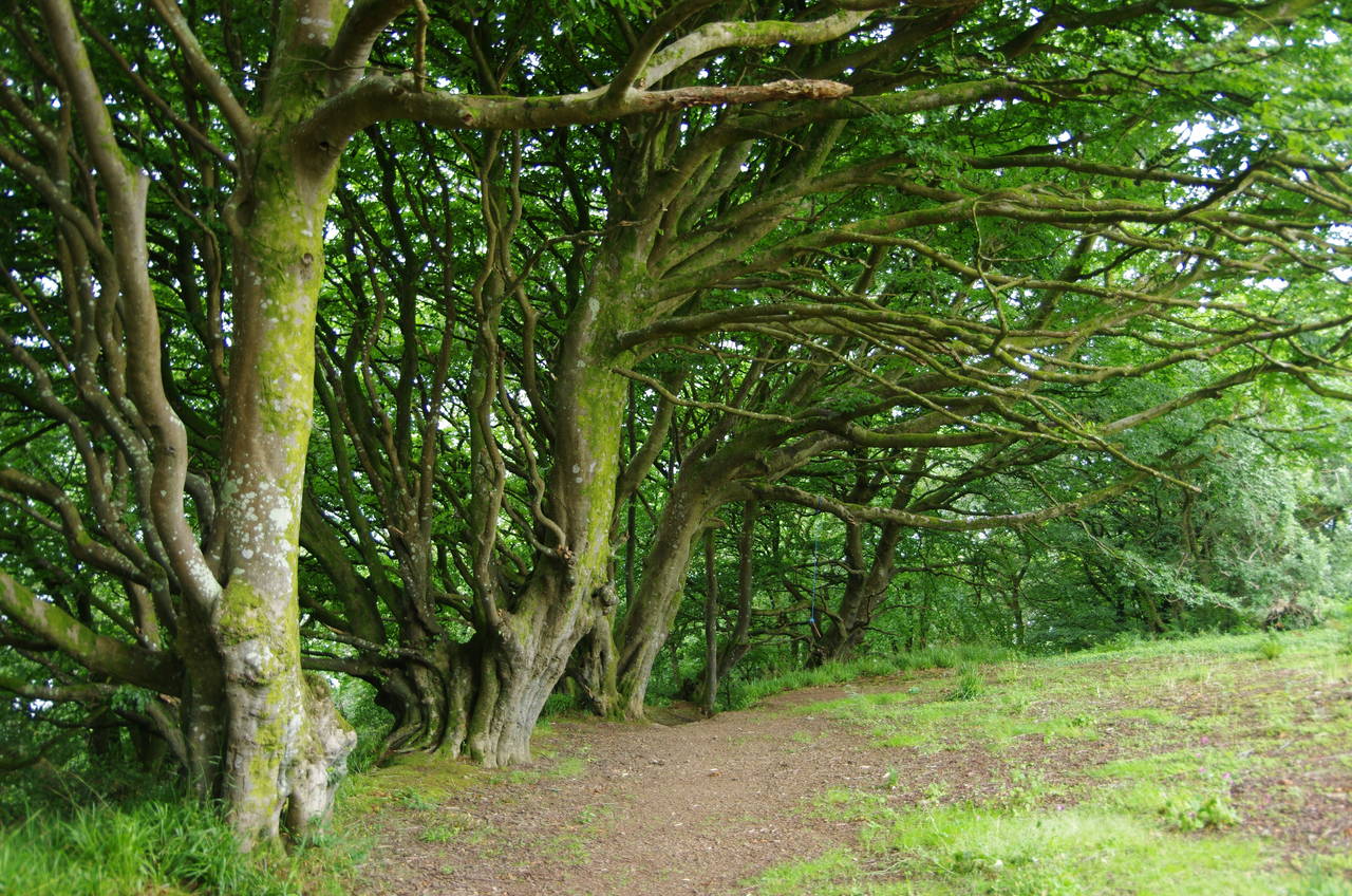
Again sticking to the left edge of the field, the path reaches yet another gate on the edge of the Woodland Trust's Bucks Valley Woods. The path climbs gently up through the woods (picture 5) onto another field-edge path across the top of Bucks Valley before re-entering the woods at Bucks Cross (picture 6).
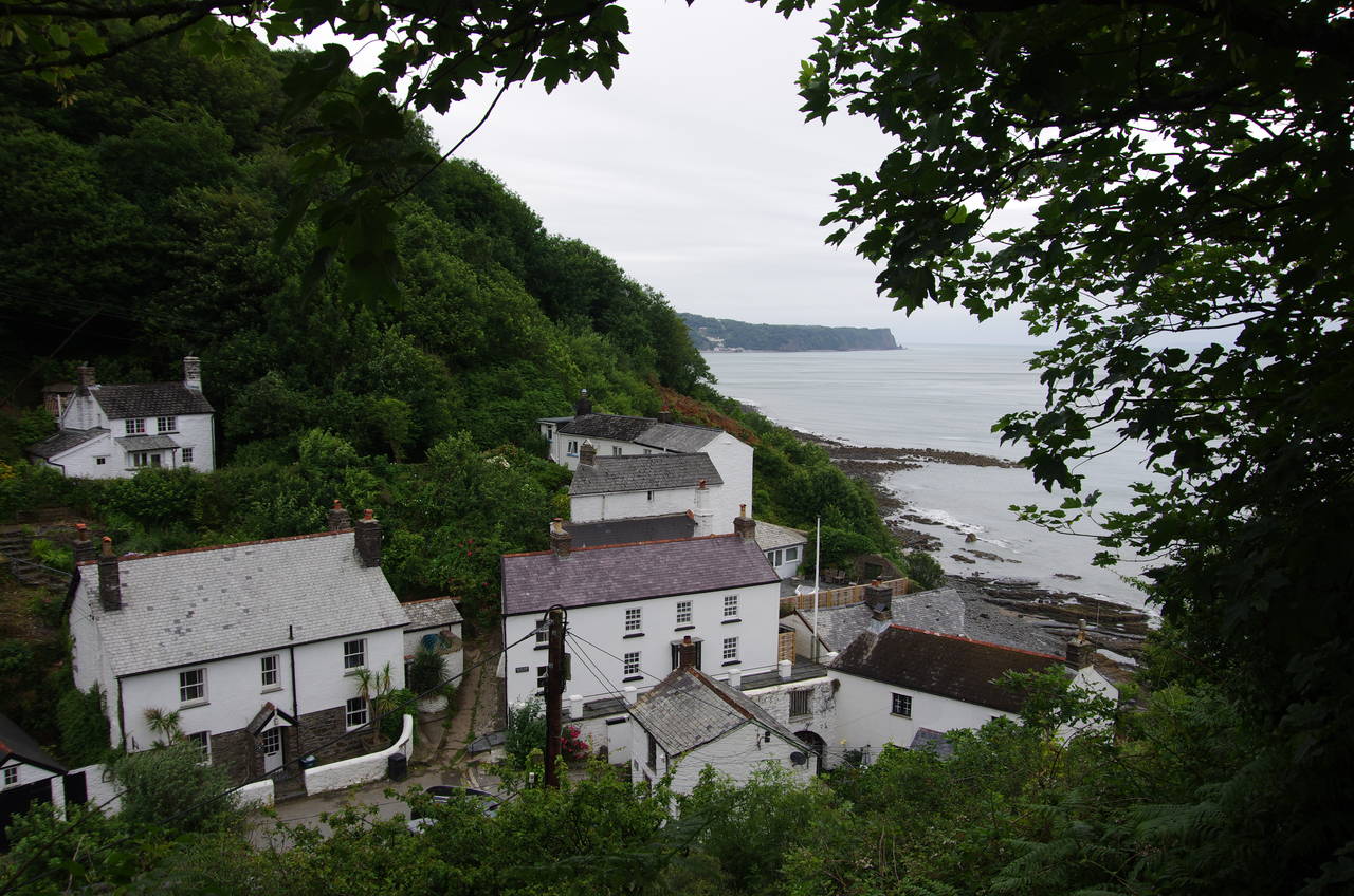
The path now winds its way through the woods for a bit more than a kilometre with a few minor ups and downs before descending into the middle of Buck's Mills, an attractive hillside village of about two dozen mostly whitewashed stone houses. The Coast Path emerges between houses onto the village street before climbing up past a red telephone booth and between houses to leave just as abruptly as it arrived.
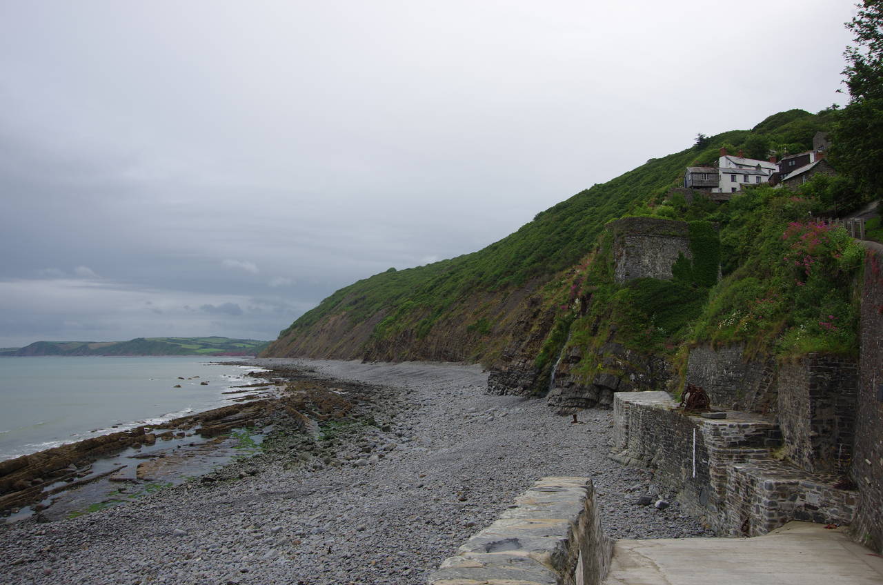
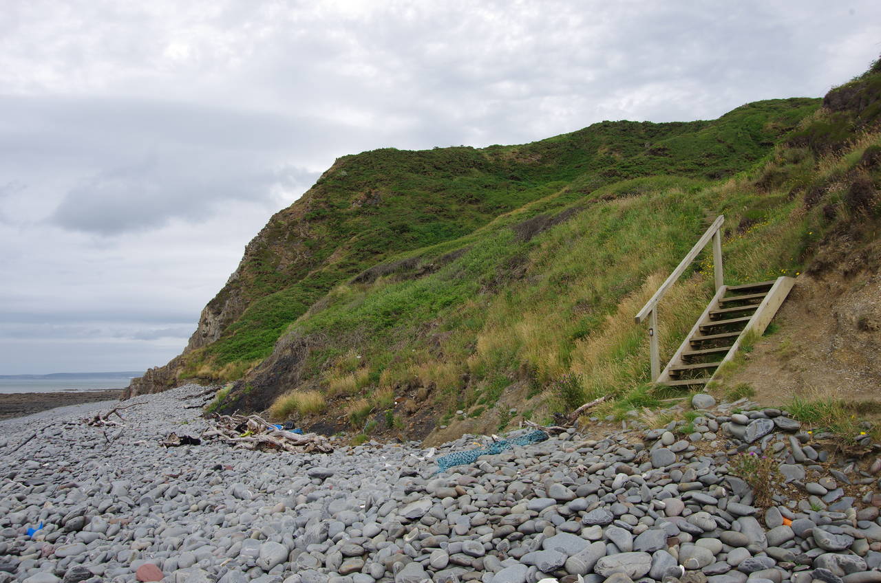
Before departing I first made a diversion down the steep path to the stony beach for a better view of the next stretch of coast I would be walking above (picture 7). The best view of the village itself is to be had from the path that climbs up out of the village into the National Trust's Worthygate Woods (picture 8).
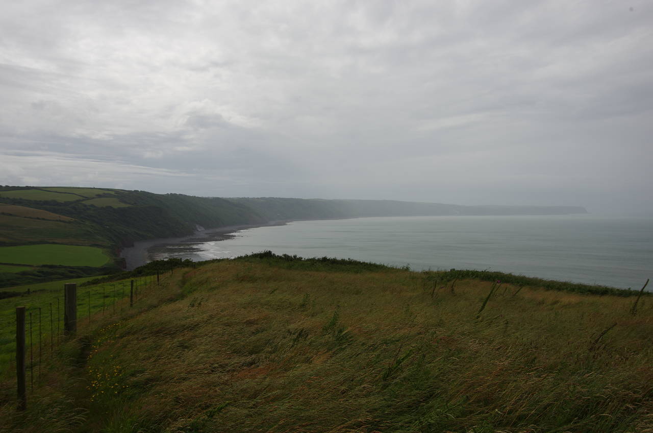
(9) View back from Worthy Gate
(10) View ahead from Sloo Woods
(11) Peppercombe
(12) Peppercombe
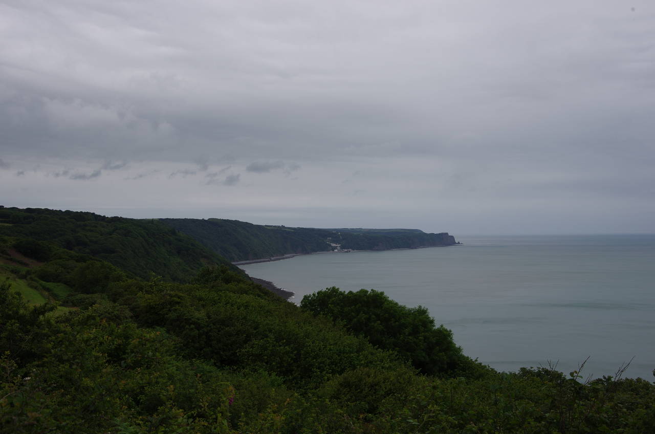
The path climbs up through the woods and then continues to climb just outside the edge of a field to reach the top of a ridge, where the path re-enters Worthygate Woods at about 145 metres above the sea. Looking back from the ridge, Bucks Mills is hidden from view in its combe but Clovelly is visible back across the bay (picture 9).
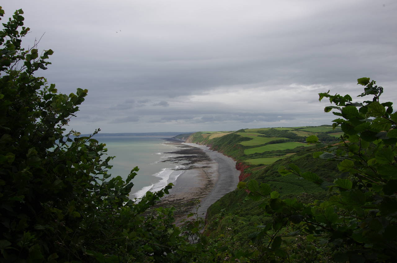
The next stretch of the path runs through the dense oak woodland on the upper slopes of Worthygate Woods and onward through Sloo Woods for almost three kilometres with no views of the sea until very near the end, where a gap in the dense foliage gives a view ahead along Peppercombe Beach, revealing that the high cliffs and dense woods were about to end and be replaced by lower cliffs and green fields (picture 10).
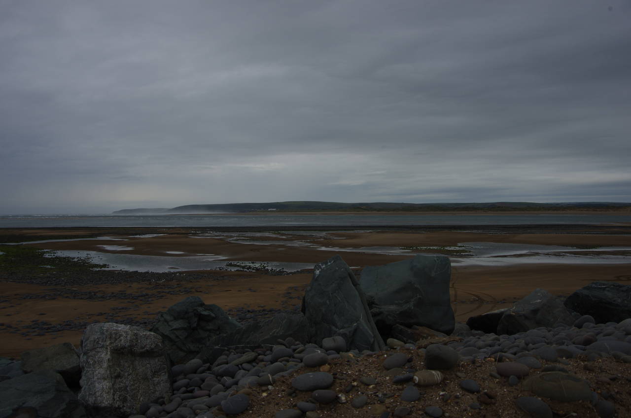
The path soon begins to descend into the valley of Peppercombe, crossing a stone bridge (picture 11) before turning left through a wooden gate and following a well-worn path along the valley floor through a carpet of knee-high ferns to reach the low clifftop at the foot of the combe (picture 12).
(13) Babbacombe Cliff
(14) Heavy shower over Bideford Bay
(15) Beach below Green Cliff
(16) View ahead from Green Cliff
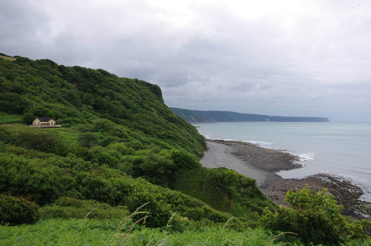
A grassy path runs along the clifftops (picture 13) for a little while before the path begins to climb steadily up a very overgrown path just outside the boundary fence of the Portledge Estate. As I climbed I noticed a heavy shower sweeping across the bay from behind me (picture 14) and was able to get back into my waterproofs in time to avoid getting wet as I continued up to the peak of Babbacombe Cliff.
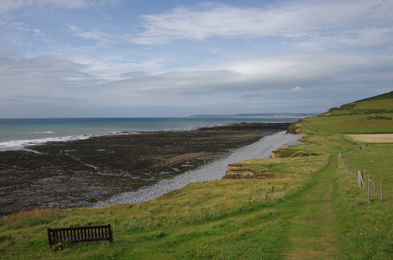
The route then continues along the undulating Westacott Cliff outside a series of fields until suddenly the path descends steeply to the stony beach at the foot of a narrow combe, the last part of the descent being assisted by wooden steps. A few metres along the beach is another flight of steps (picture 15) by which the path begins an equally steep climb up to the top of Green Cliff (picture 16) at just over 100 metres above sea level.
(17) Cornborough Cliff
(18) Old Limekiln
(19) Kipling Tors
(20) Westward Ho!
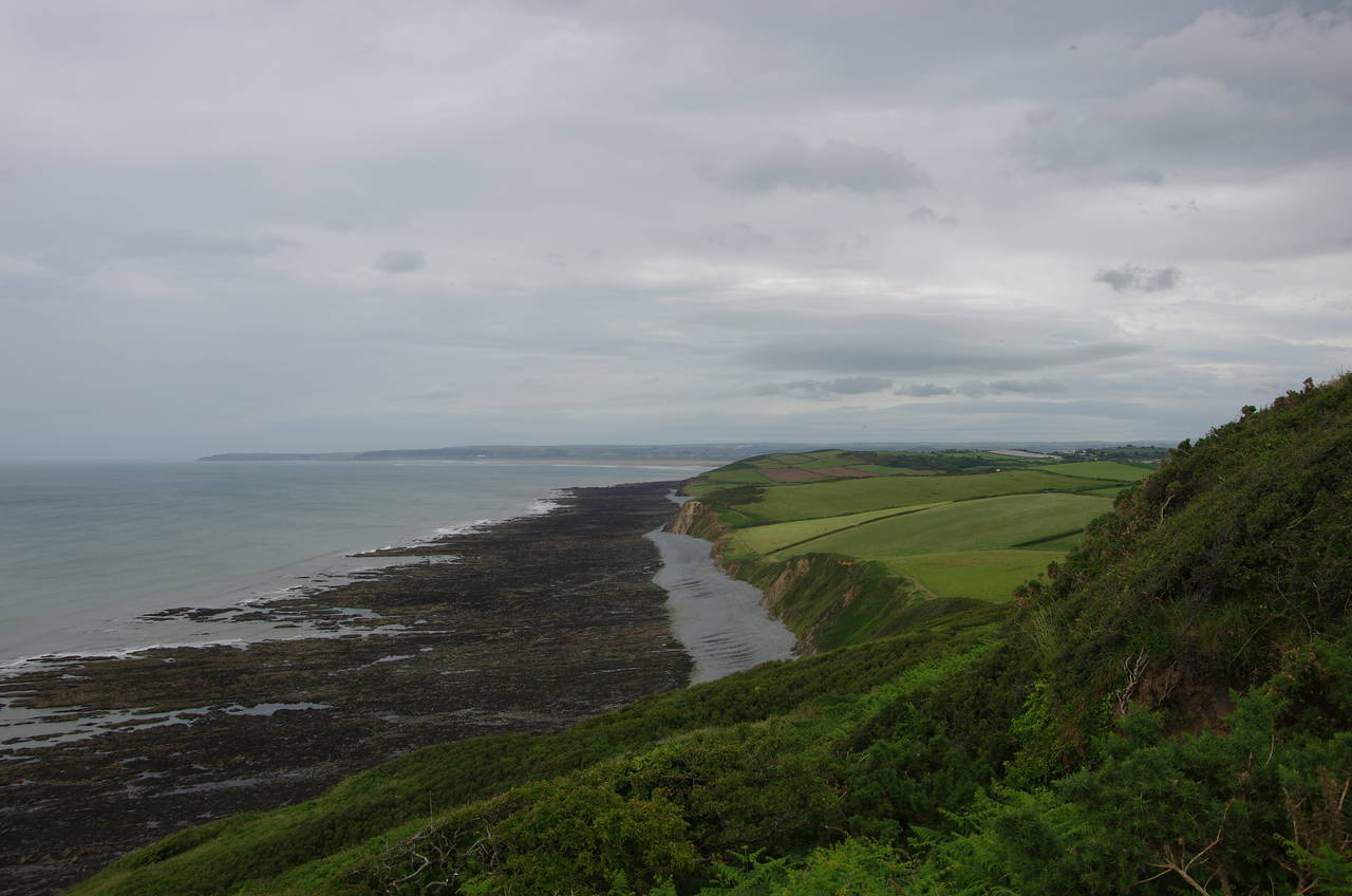
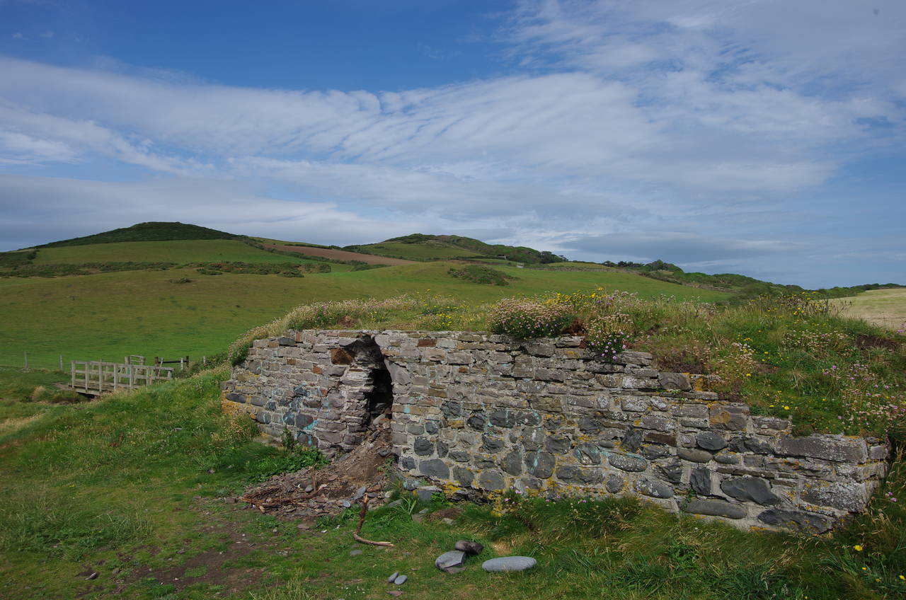
From the high point of Green Cliff, a long and gentle downhill stretch beside fields leads down to a footbridge over a tiny stream that separates Green Cliff from the low hump of the National Trust's Abbotsham Cliff, which the path climbs over outside several more fields. A little beyond the NT sign, on Cornborough Cliff (picture 17), the path gets broader and I passed a scenically-sited bench, the first indications that I was getting closer to the next town and soon I passed the first people I had seen on the Coast Path since setting off from Clovelly. Just before a footbridge at the low point of the cliff I passed by an old limekiln (picture 18), which had a small geocache hidden inside.
A short distance further along the cliffs the path becomes surfaced in gravel and begins to skirt around the gently curving lower edge of Kipling Tors (picture 19), the surface turning to rough tarmac about halfway along. Around the corner the path reaches the large Seafield Holiday Park at the western end of the resort town of Westward Ho!. A footpath skirts around the seaward side of a row of colourful beach huts to join the end of the town's promenade, below which the receding tide had revealed a wide ledge of volcanic rock covered in little pools.
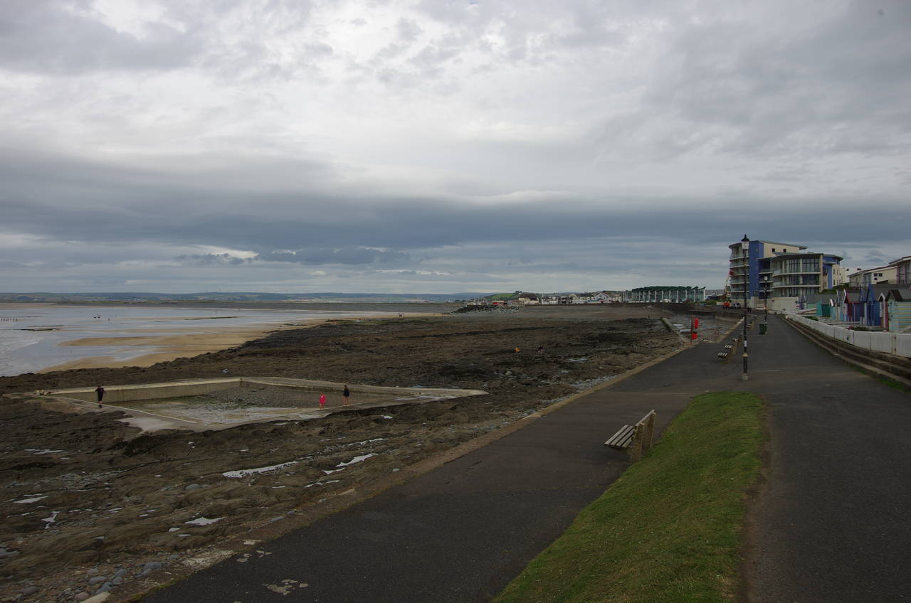
The promenade runs behind a large, modern looking building and in front of the closely-spaced chalets of two more holiday parks, below which a tidal swimming pool that had been built into the ledge had been partly filled with shingle by the action of the sea (picture 20).
Westward Ho! has the distinction of being the only town in England to have an exclamation mark in its name and is also the only place I know of in England that is named after a book (rather than the book being named after the place). The town was founded in the 1860's and according to what I've read is well and truly past its heyday, though there does seem to have been some new development in recent years.
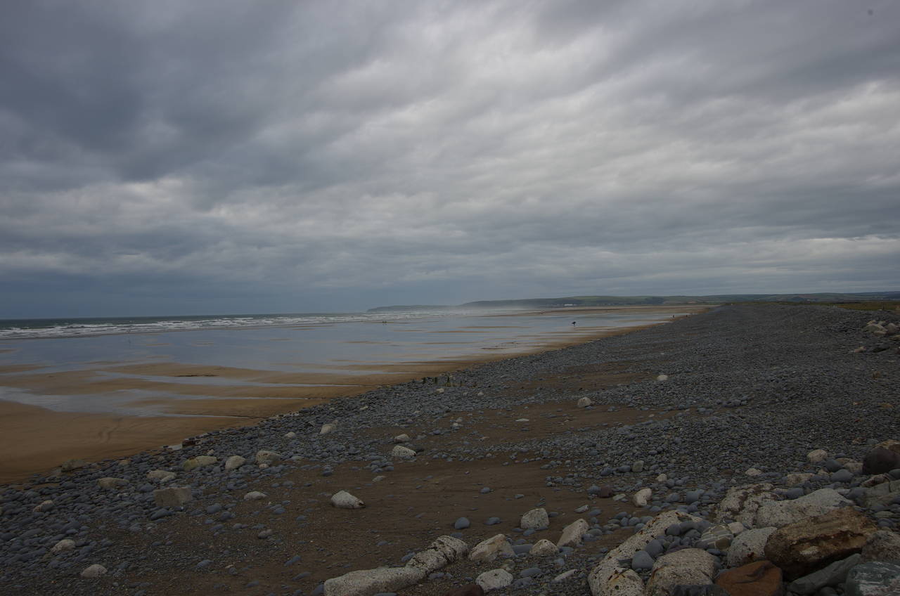
(21) Pebble Ridge
(22) Sandymere
(23) Royal North Devon Golf Club
(24) Northam Burrows Country Park
At the end of the promenade the Coast Path briefly runs along the top of a pebble ridge (picture 21) -- though some of these pebbles are the size of footballs -- to pass a small go-kart track before dropping down off the back of the ridge and into a grassy field. This is part of the Northam Burrows Country Park, a large area of low dunes and flat marshes that occupies the peninsula north of Westward Ho! up to the mouth of the River Torridge.
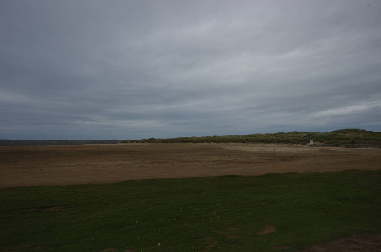
The route soon joins a narrow road that runs behind and parallel to the pebble ridge for about a kilometre to reach a carpark below a lifeguard hut that is perched on top of the ridge. The road then bears right to get around a large flat expanse of sand behind the ridge called Sandymere.
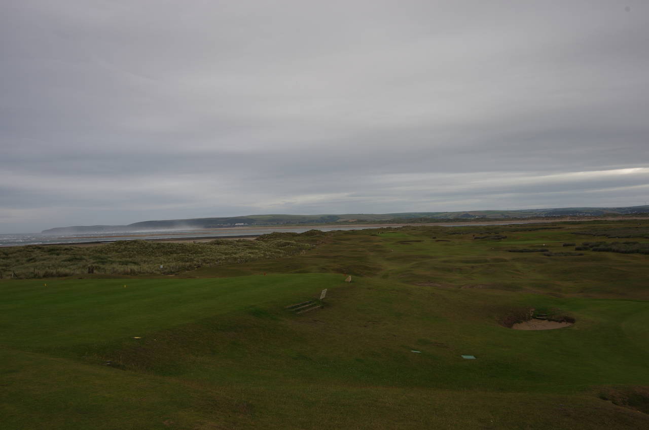
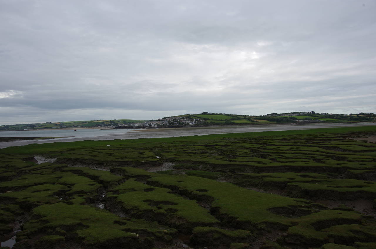
At the back of Sandymere the route leaves the road and heads up just to the left of a brick building belonging to the Royal North Devon Golf Club. A well worn path runs along the left edge of the golf course (picture 23), fenced off from more dunes for some time until the path finally returns to the edge of the dunes just as the coast starts to curve around the end of the golf course away from the sea and into the Torridge Estuary (picture 24). About a kilometre across the mouth of the river is a large expanse of dunes at Braunton Burrows, still about a day and a half's walk further along the Coast Path.
(25) View towards Appledore
(26) Irsha Street, Appledore
(27) Appledore Church
(28) Appledore waterfront
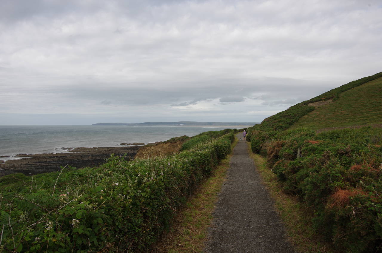
Leaving the golf course behind, the path continues around the edge of the dunes for a while to a signpost where the route shortcuts across a finger of land to a carpark where the path joins another road along the edge of a marshy inlet, heading back in the direction of Westward Ho! for a while with views across the inlet to the town of Appledore (picture 25).
The road is followed all the way to the back of the inlet where it turns left across a stone bridge over a stream called The Pill and up to a little wooden hut at the entrance of the country park. Here the path splits into two alternatives: a low-tide route along the shore and a longer high-tide route along the road. It was still close to low-tide so I headed off past an old WWII bunker and onto the partly stony, partly sandy shore. After about 300 metres, just beyond an old slipway, the route climbs wooden steps back onto the low crumbling cliffs atop which a narrow path runs for another 300 metres to the edge of Appledore.
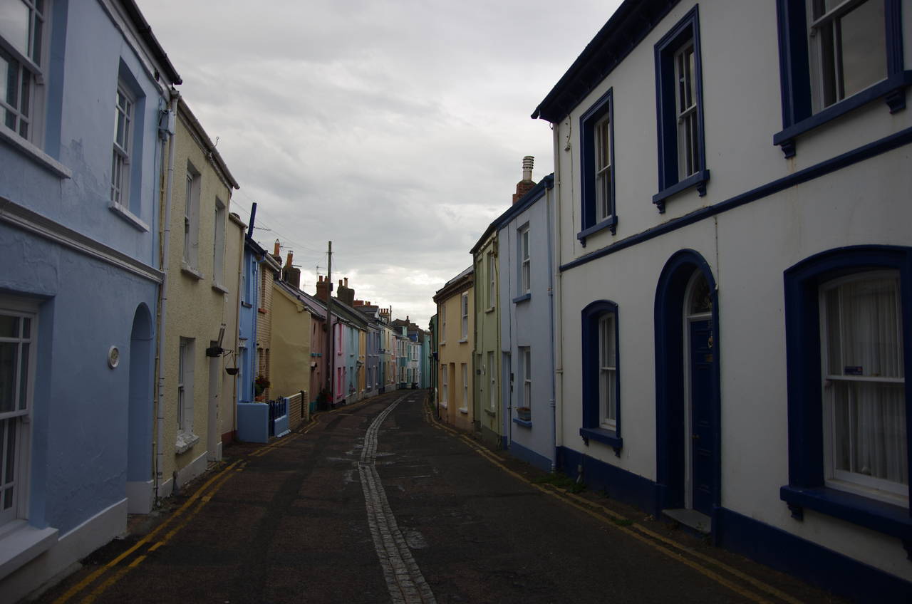
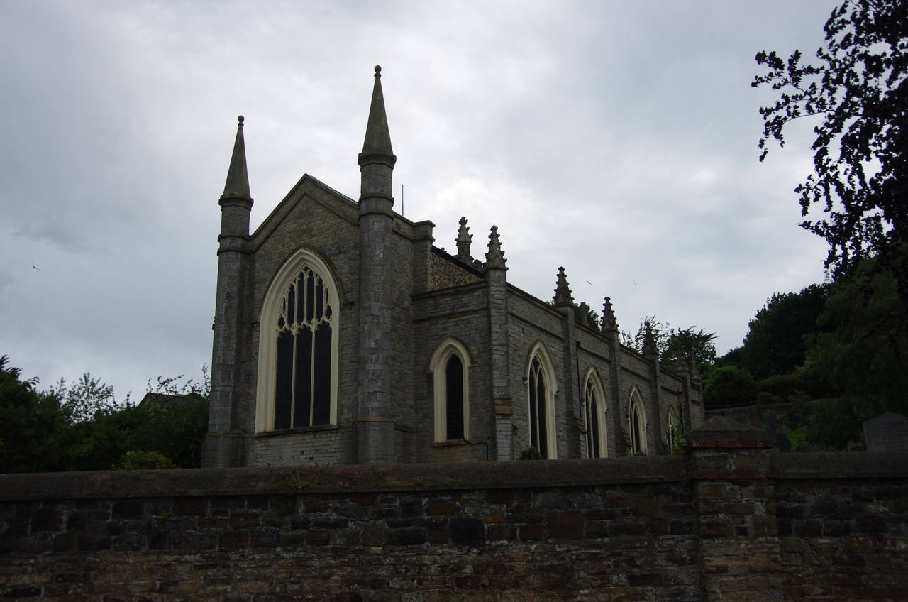
Down some steps the route passes the Appledore Lifeboat Station and joins Irsha Street, passing a small park where a large stone is carved with images of Viking longships and St George and the dragon. The narrow street runs between colourful houses (picture 26), briefly regaining a view of the estuary before passing behind the Beaver Inn pub and along another narrow stretch between houses to emerge below the church of St Mary (picture 27).
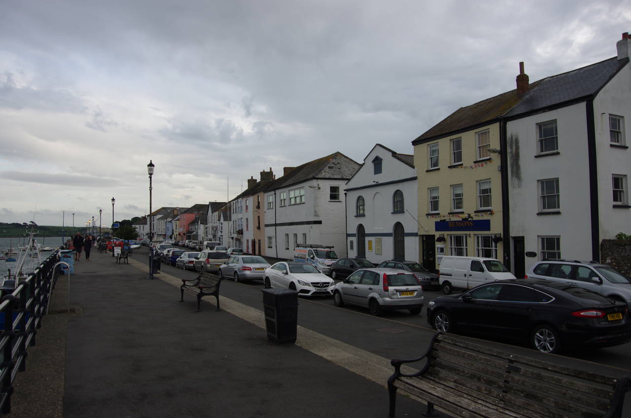
Just past the carpark the Coast Path joins Appledore's waterfront promenade (picture 28), where I finished the day's walk at a convenient bus stop, with my GPS showing 25.3 kilometres walked from Clovelly. With about 40 minutes to wait for the next bus to Barnstaple, where I was staying for the next week, I headed off to find some dinner. Having spent the previous afternoon exploring the town, I knew exactly where to find a meal of fish and chips and soon returned to the promenade to enjoy my dinner while looking across the river to the town of Instow, which I would walk through on the Coast Path tomorrow.