SOUTH WEST COAST PATH NATIONAL TRAIL
Stage 46: Bude to Morwenstow
Monday, June 29, 2015
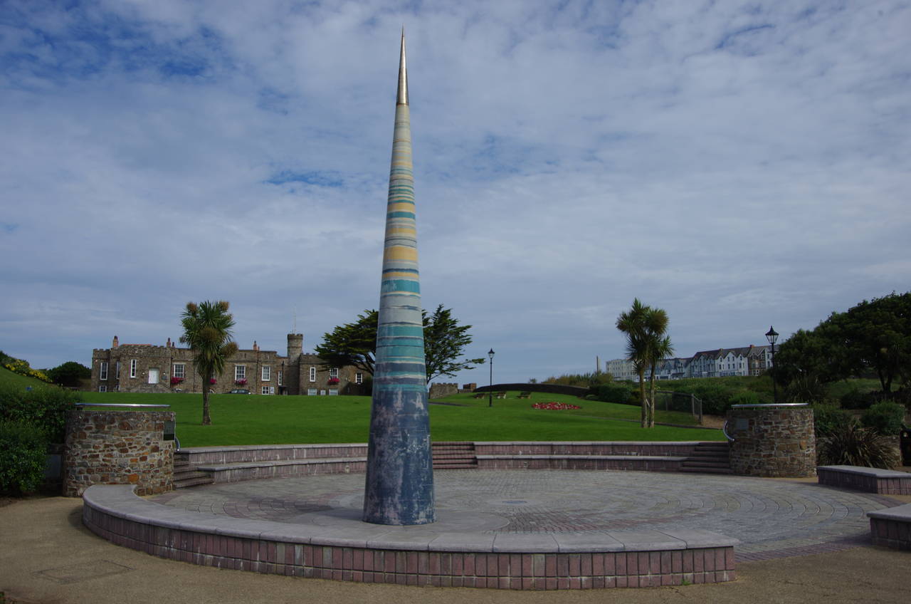
(1) Bude Light
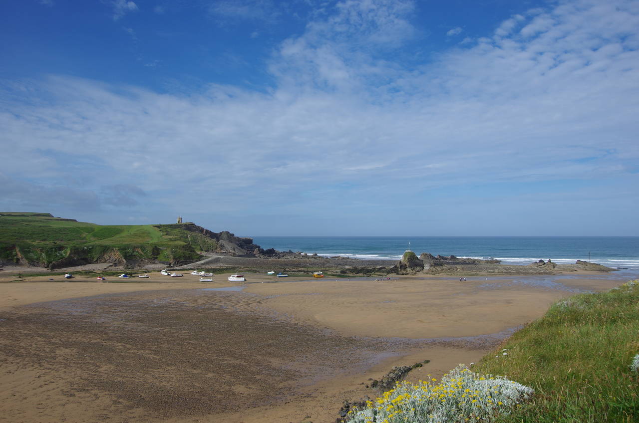
(2) Summerleaze Beach
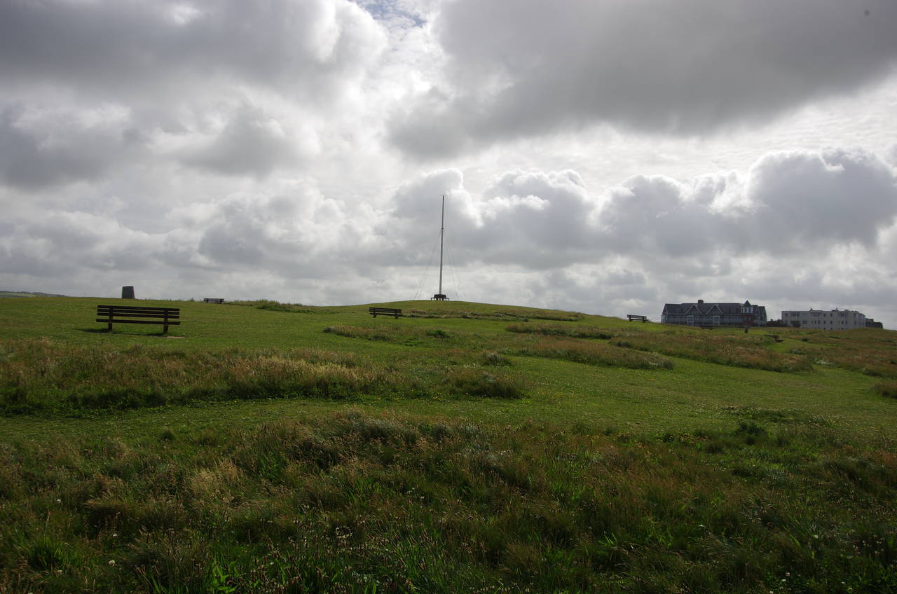
(3) Summerleaze Down
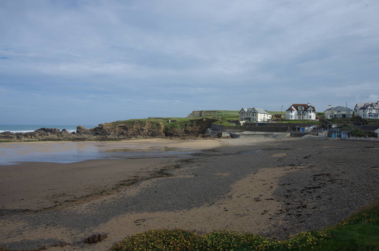
(4) Crooklets Beach
When planning my walk along the South West Coast Path, this stage had given me more headaches than any other. All of the guidebooks I had read describe the 24.5 kilometre walk from Bude in northern Cornwall to Hartland Quay in north-west Devon as one of the toughest stages on the entire path, though the northern half is considerably harder than the southern half, with the the cliffs getting higher and the valleys getting deeper.
When using public transport, as I was, the walk is made even harder by a stiff uphill climb after leaving the official path and an extra four-kilometre walk inland to the nearest bus stop in the village of Hartland, where the last bus back to Bude leaves just after six in the evening. While I usually enjoy a challenge, I was fairly confident that the time limit imposed by the bus timetable would put this challenge beyond my capabilities, so I had to find a way to split the stage in two.
The hamlet of Morwenstow, almost literally a stone's throw south of the Cornwall-Devon border, is the only other place near this stretch of the Coast Path that has access to public transport. Just two buses call there each day -- the first was going to be too early to be useful, so I had only one realistic option, at just after four in the afternoon, which was going to make for a fairly long day out for only around four hours walking.
On my travels throughout southern Englnad I have found more often than not that public transport is rather sparse near county borders and across them, even in some places where the lack of a direct bus service seems totally inexplicable. A very long and circuitous route between the cities of Salisbury and Winchester a few years ago still springs readily to mind, but I digress....
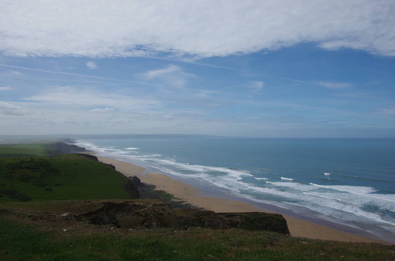
From the Bude Light (picture 1), the Coast Path heads along the adjacent road, past tennis courts and a Methodist chapel to cross a footbridge over the River Neet. A short distance to the right lies Bude's town centre, but the Coast Path turns left, heading to the far right corner of the large carpark behind Summerleaze Beach to find a lane that climbs up to a café overlooking the sands (picture 2). A narrower tarmac footpath continues to climb behind the café onto the edge of the large grassy expanse of Summerleaze Down (picture 3).
The footpath runs along to a lifeguard hut that stands on the low cliff above a tidal pool at the corner of the Down, turning right to follow the cliffs past a cricket oval and down to a short promenade in front of a row of beach huts at Crooklets Beach (picture 4).
(5) Maer Cliff
(6) Northcott Mouth
(7) Sarshall's Pit
(8) Sandymouth
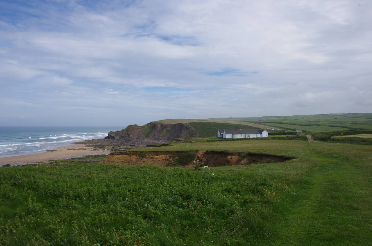
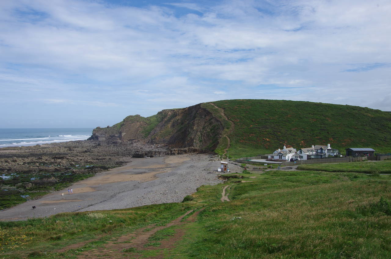
Just beyond a beachside café, a footbridge crosses a stream that flows out across the beach then the route heads for a small carpark and then turns left to follow a short lane up to a gate marking the beginning of the National Trust's Maer Cliff (picture 5).
An obvious, well-worn path leads along the ragged, storm-battered cliffs for the better part of a kilometre before the path briefly joins a quiet road to get around the clifftop Northcott Bungalow. Soon back on the grass, the Coast Path descends to the back of the small shingle beach at Northcott Mouth (picture 6).
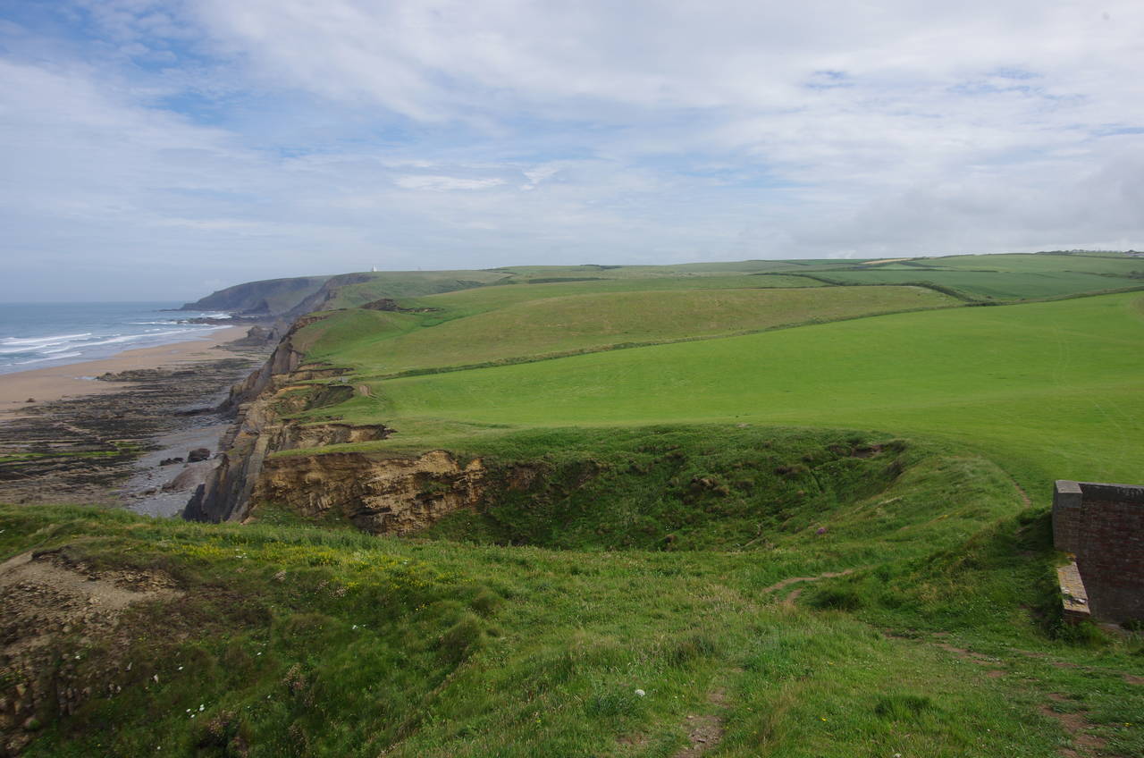
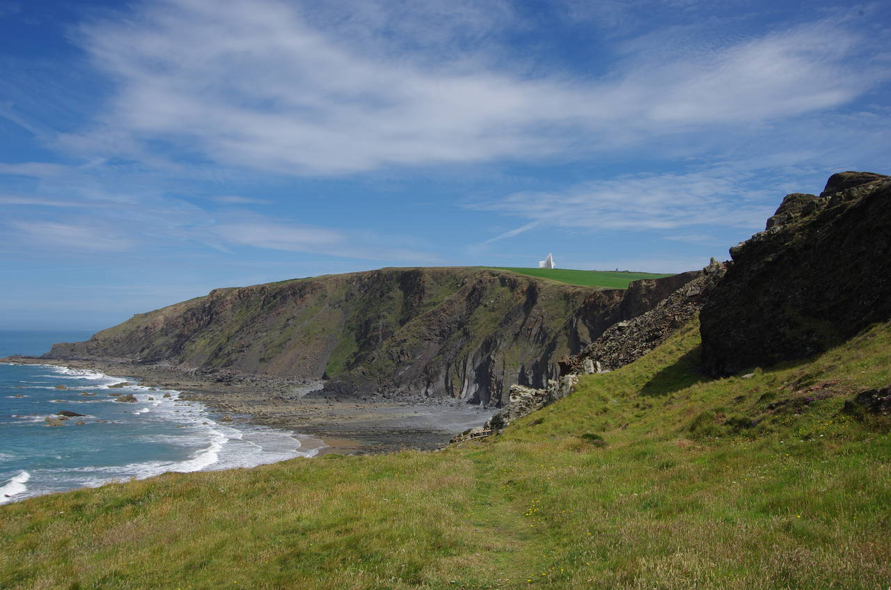
A long and rather steep flight of steps takes the path back up onto the next stretch of clifftop, which runs along the edge of a large meadow with a Bronze-Age round barrow just off the path. At the far edge of the field the path squeezes past the ruins of an old brick building just above a small landslip known as Sarshall's Pit (picture 7). The path then continues to skirt two more large fields to reach the next combe, the National Trust's Sandymouth (picture 8).
(9) Stowe Cliffs
(10) Warren Gutter
(11) Duckpool
(12) Duckpool
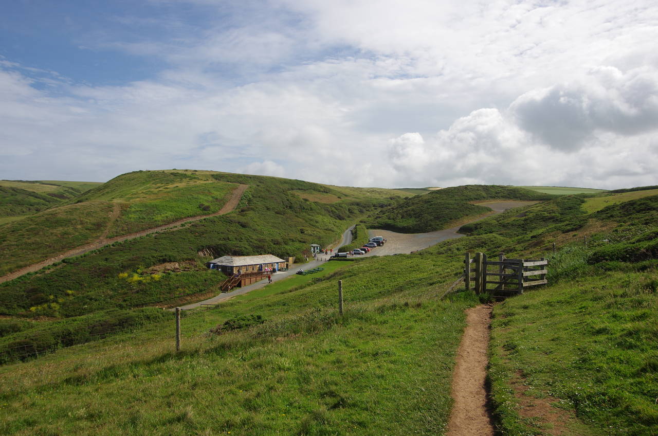
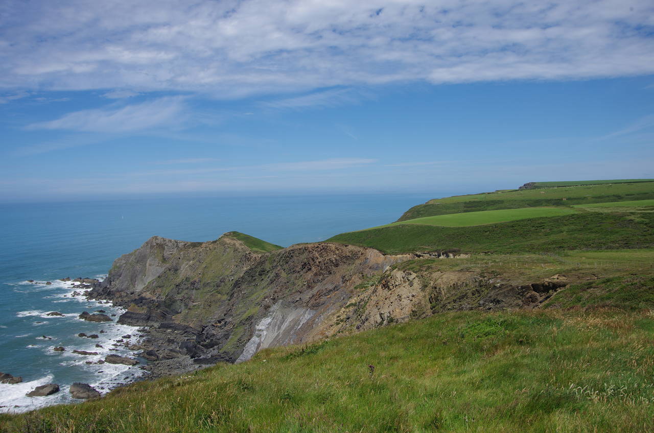
The Coast Path crosses Sandymouth below the National Trust café and carpark, climbing up into a meadow behind the crumbling Stowe Cliffs and following the right bank of a narrow stream for a little while before crossing over a wooden bridge and climbing over a small hill. There would usually be a good view from the top of the hill back over the path covered so far, but on this day it was rather hazy (picture 9).
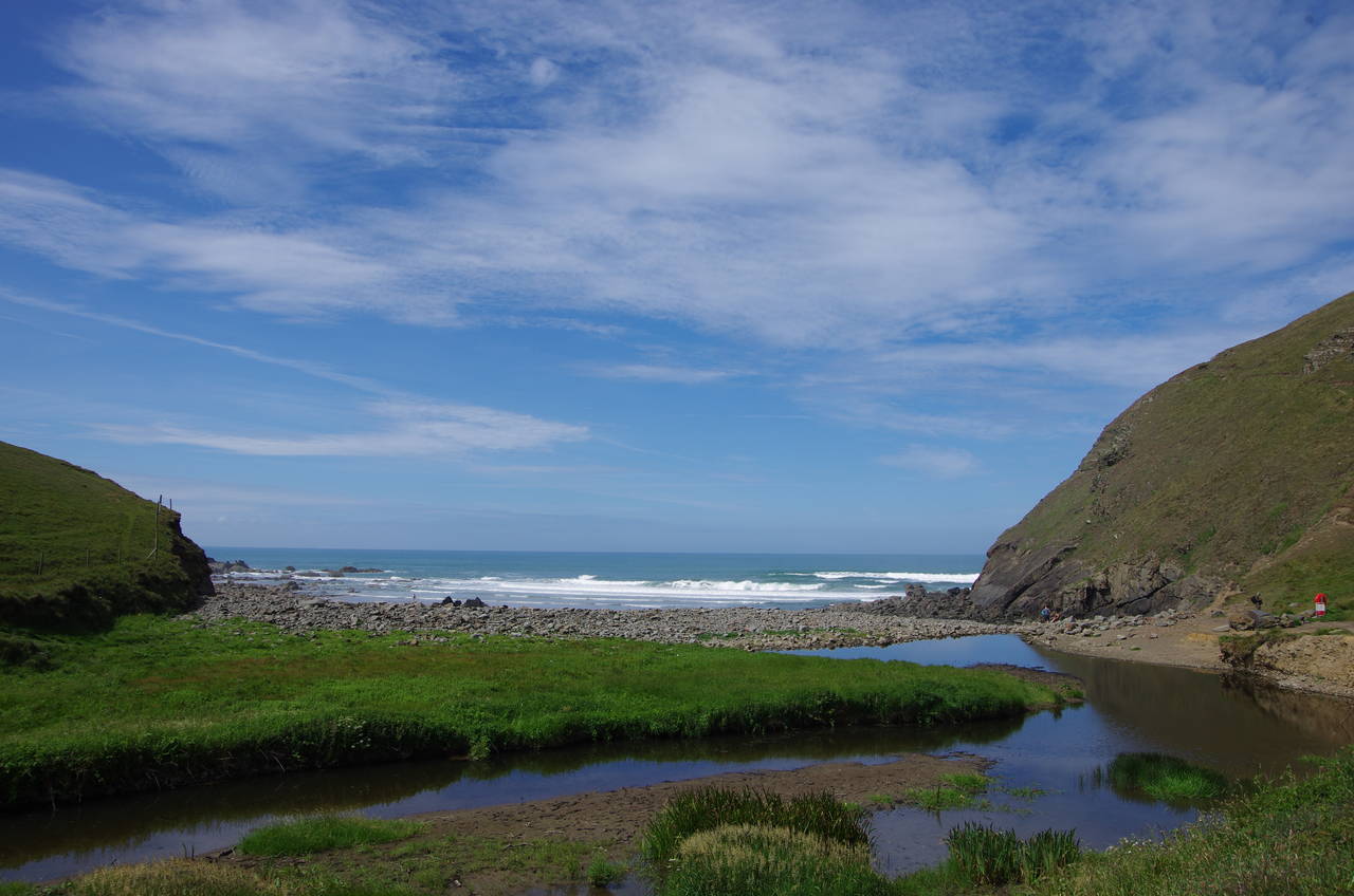
About a kilometre along the cliffs, the path dips down to cross the wide combe at Warren Gutter (picture 10) then crosses the low rise of Warren Point to reach the flat-bottomed valley of Duckpool. The path bears inland a little on its way down into the valley to find a footbridge over the small river that winds its way down the valley to a little beach (picture 11).
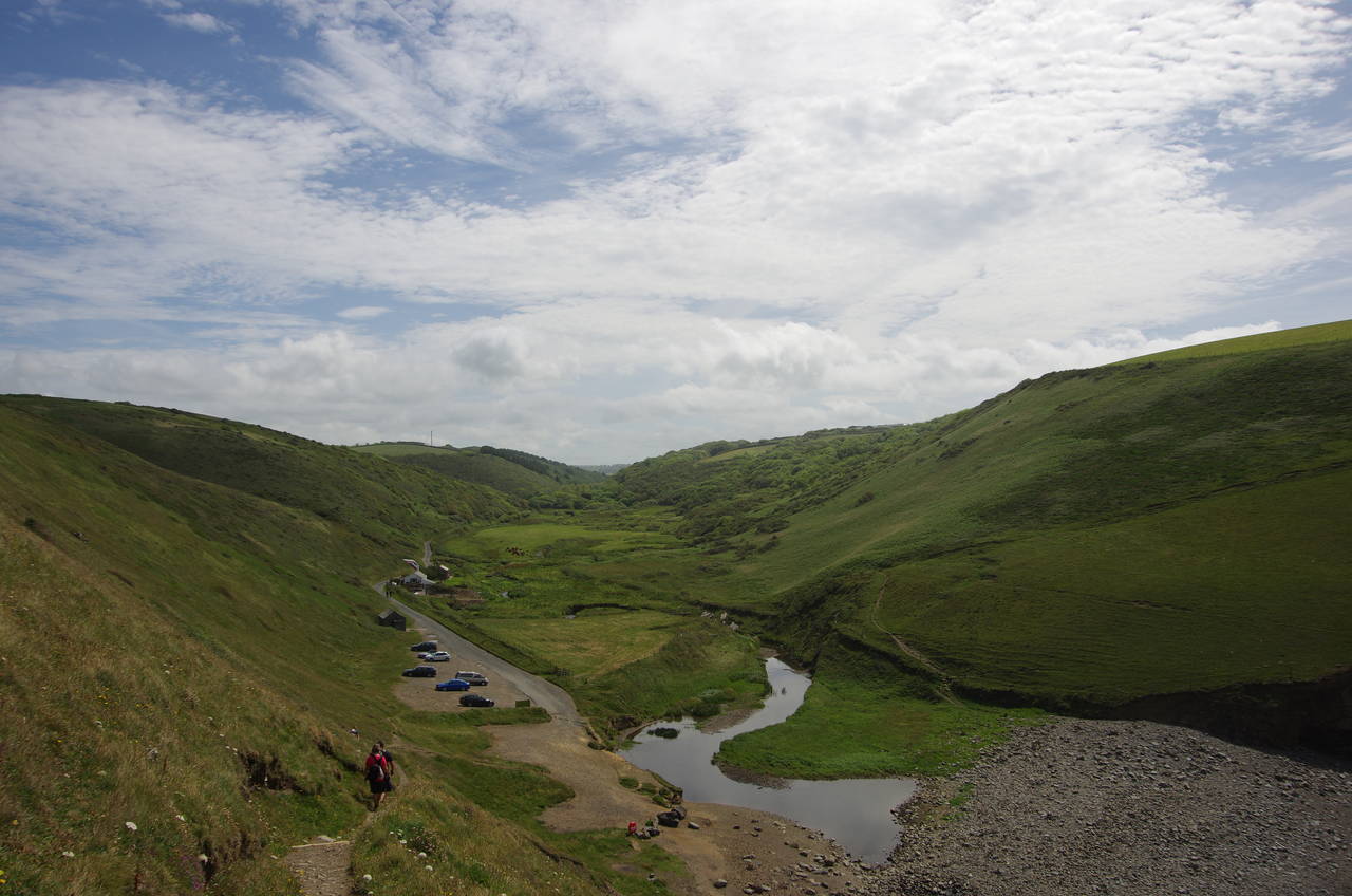
From Duckpool onwards, the path starts to get a little tougher. The first little challenge is a steep climb from the carpark behind the beach up to Steeple Point, where the reward is a nice view back up the valley (picture 12).
(13) Harscott High Cliff
(14) Cleave Camp Radio Station
(15) Stanbury Mouth
(16) Higher Sharpnose Point
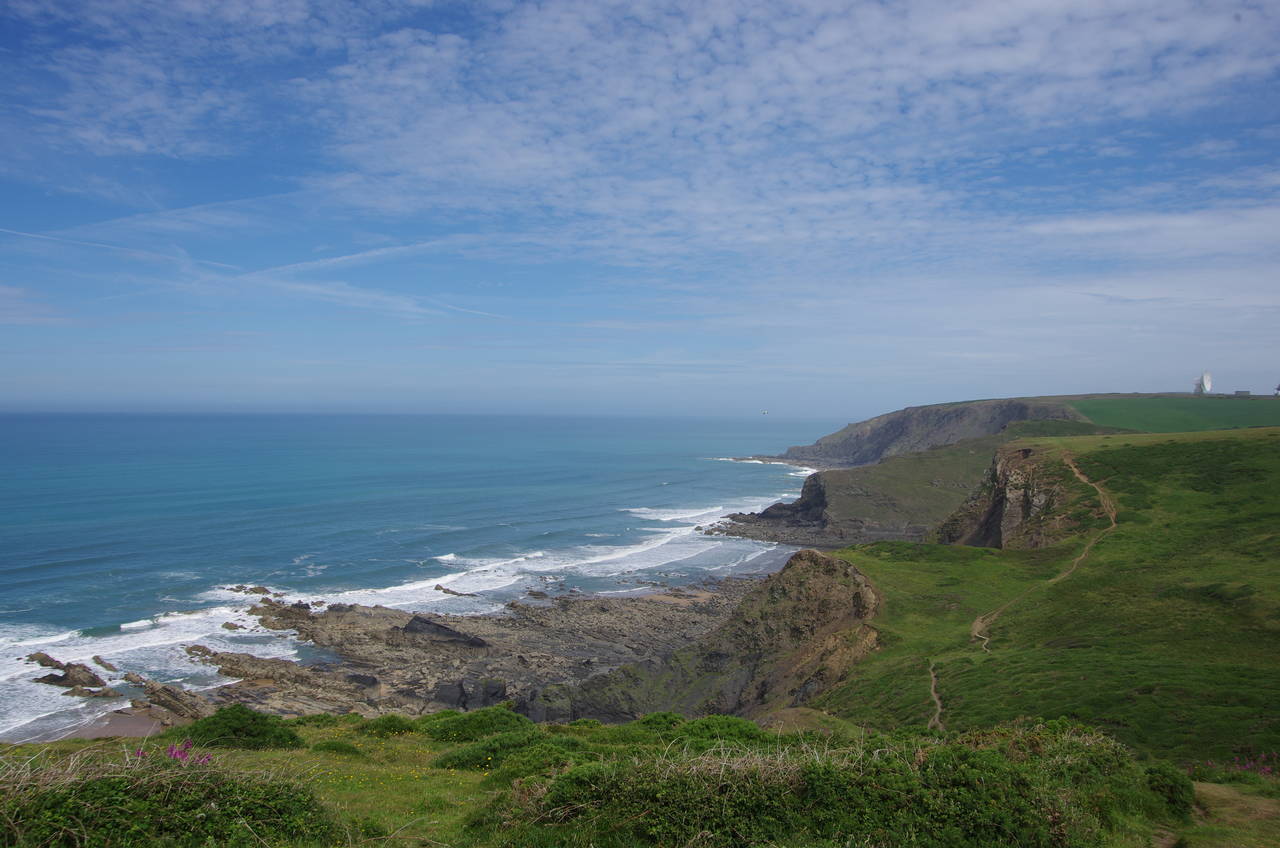
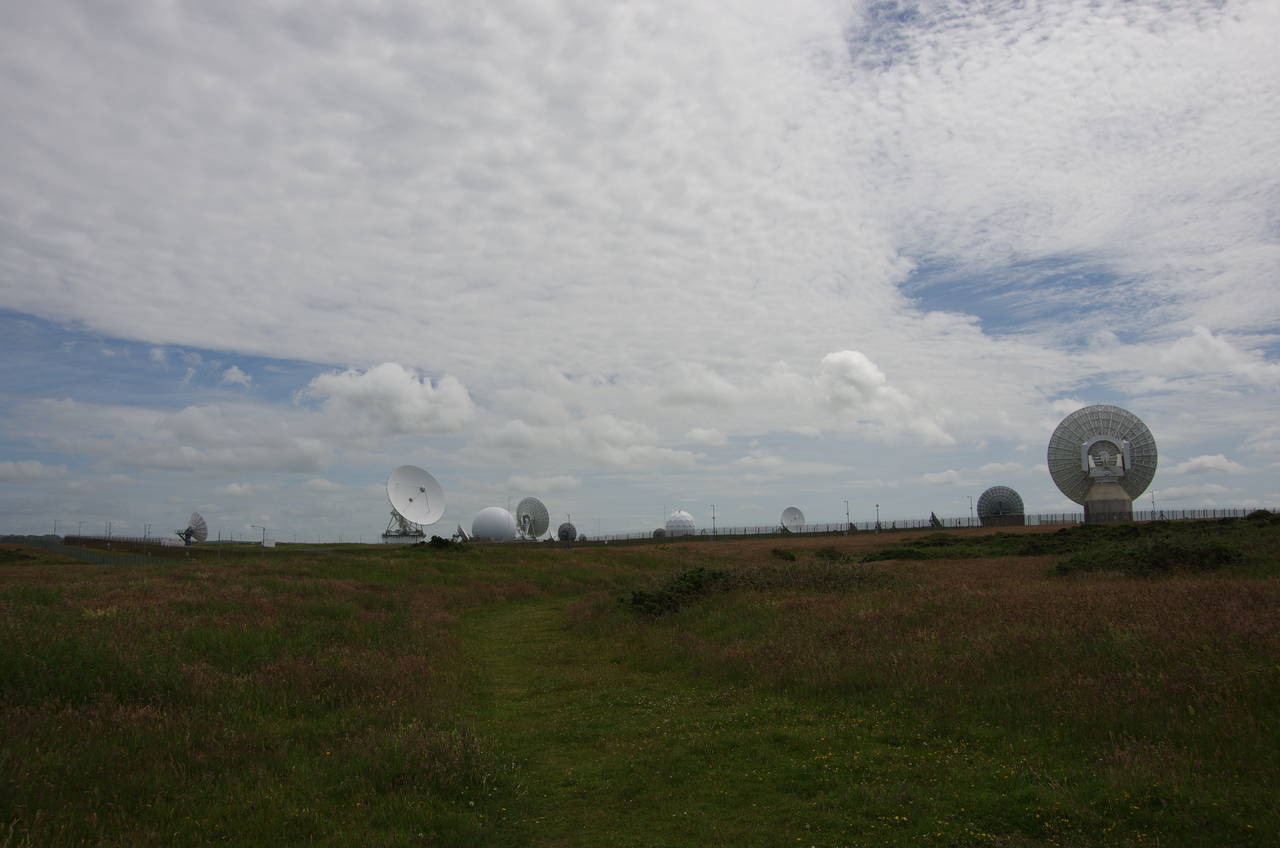
At the tip of Steeple Point, the path turns sharp right to skirt around the top of Harscott High Cliff (picture 13) to the tip of Lower Sharpnose Point. From there the path turns inland for about 200 metres towards the high wire fence of the Cleave Camp Radio Station (picture 14). This site has more than a dozen radio and satellite dishes of varying sizes, which had been visible since about halfway through the previous stage of the walk.
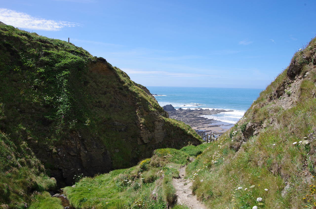
Just before the fence, the path turns left to head past the corner of the complex and through a large patch of gorse to return to the clifftop, where the path soon comes up to a steep-sided gorge above a little crescent of beach at Stanbury Mouth. A steep flight of steps descends to a footbridge over a tiny stream, after which the path heads about fifty metres upstream on a rather precarious, crumbling path that in a couple of places was beginning to crumble into the stream (picture 15).
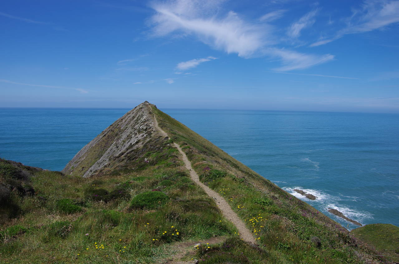
After climbing out of the gorge up the gorse-covered hillside, the path runs along the clifftops outside a series of fields, making for the distinctive promontory of Higher Sharpnose Point (picture 16).
(17) Higher Sharpnose Point
(18) Vicarage Cliff
(19) Tidna Shute
(20) Tidna Shute
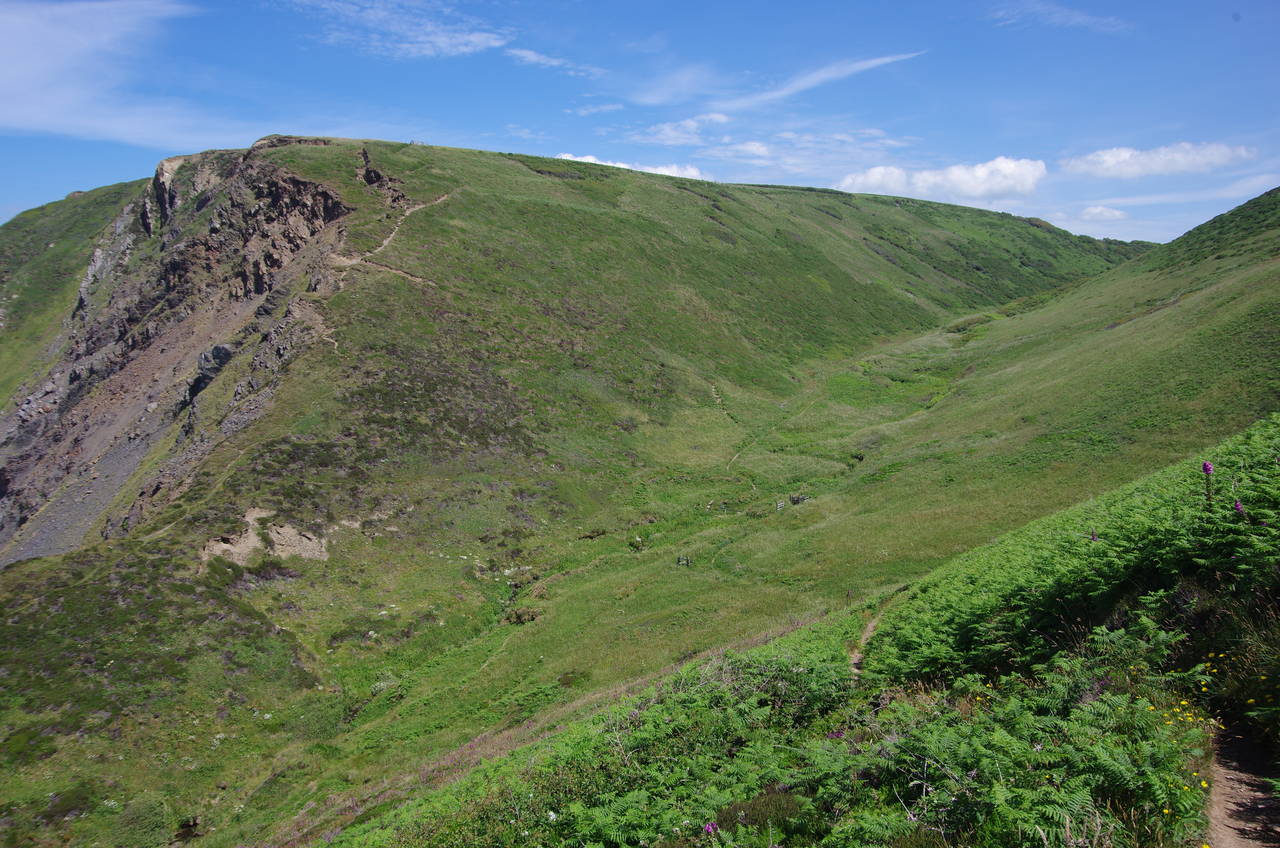
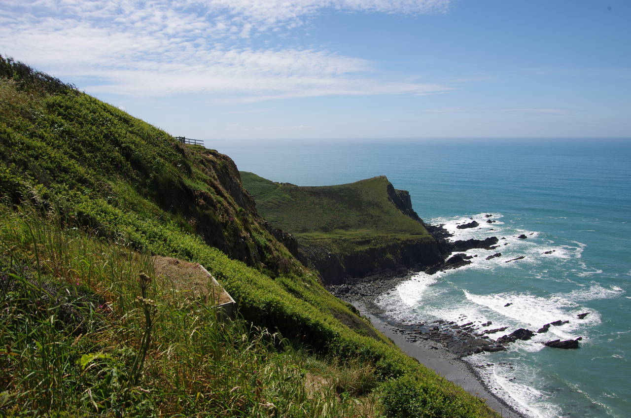
By an abandoned coastguard hut on Higher Sharpnose Point the path turns sharp right, but first there is an optional and rather vertiginous path that heads out along the 100 metre long ridge (picture 17). From the rocky outcrop at the tip there are great views of the rugged cliffs in both directions, including Vicarage Cliff just to the north (picture 18).
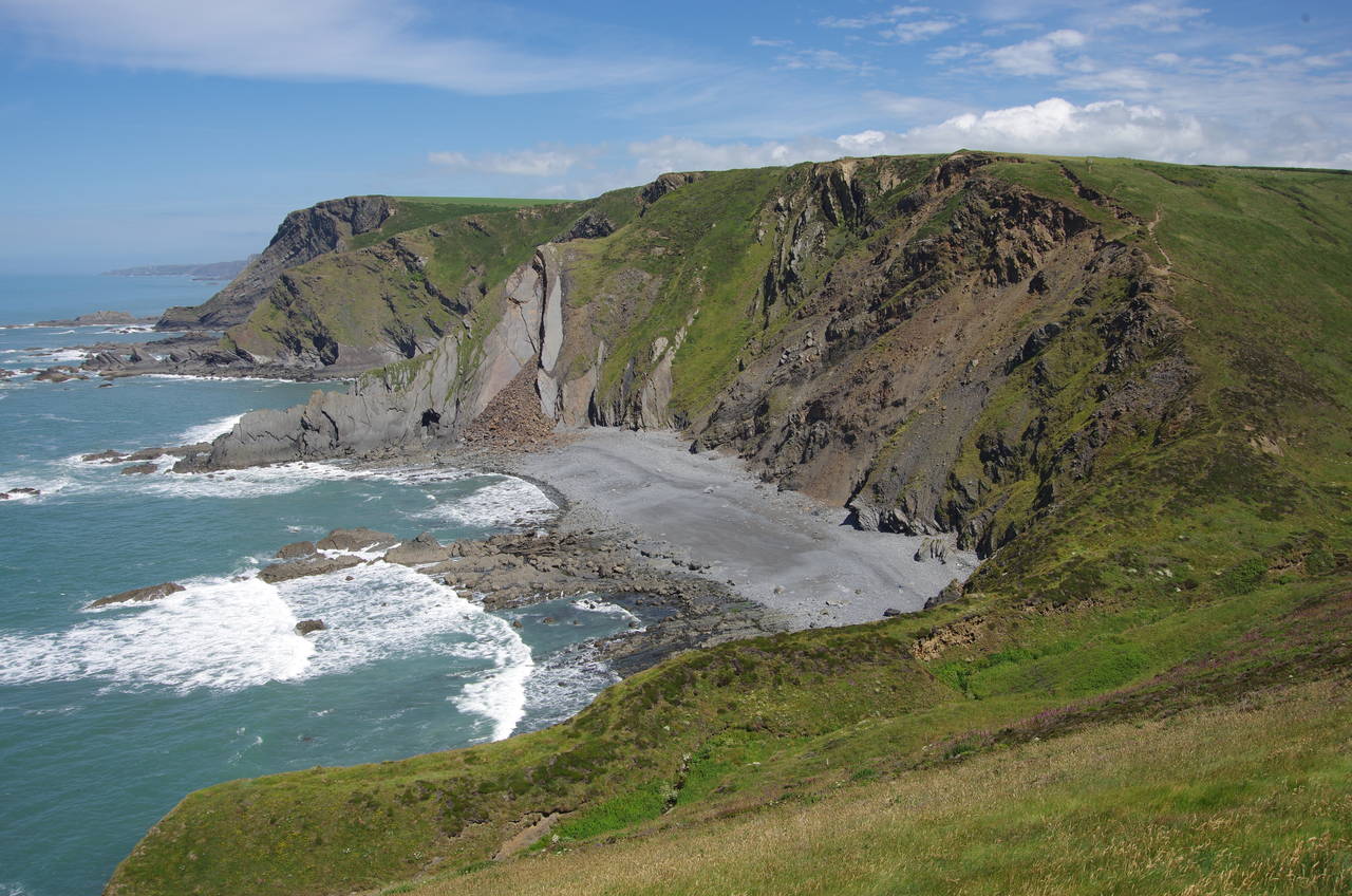
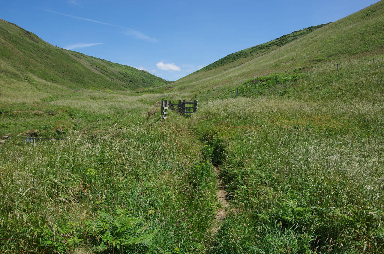
Back on the official route, I followed the path down into the deep, green valley of Tidna Shute (picture 19), which separates Higher Sharpnose Point from Vicarage Cliff. From the quiet valley floor (picture 20), a stony path zigzags steeply up to the flat top of Vicarage Cliff, running along the short edge of a field and through a gate into another.
(21) Hawker's Hut
(22) Vicarage Cliff
(23) Morwenstow Church
(24) The Bush Inn, Crosstown
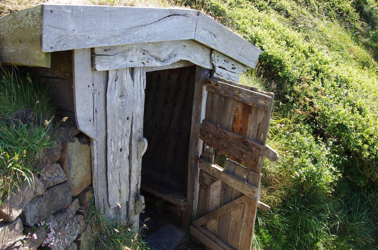
About fifty metres along the edge of the field is a National Trust sign and the end of this stage of the walk, 12 kilometres from Bude. The sign points out a short path leading about ten metres down the cliff to a small wooden hut, Hawker's Hut (picture 21), named after the eccentric Reverend Robert Stephen Hawker, who was the local vicar from 1834 until 1875.
The tiny structure, not even tall enough to stand up straight in, is the smallest building in the National Trust's care. It was built by Hawker from driftwood as a study and as a lookout for shipwrecks, which were common on this treacherous stretch of coastline. Inside the hut, every inch of the timbers are covered in the carved names and initials of people who have visited the hut.
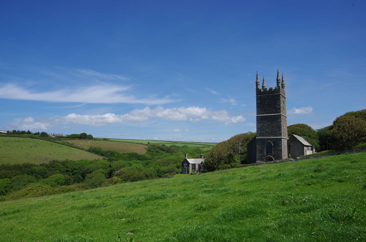
Sitting in the little hut, one can enjoy the same view Hawker would have seen more than 140 years ago, across Vicarage Cliff to Higher Sharpnose Point (picture 22). After a few minutes doing exactly that, I made way for the next visitor and continued a little further along the clifftops to turn inland along the near edge of the next field, following a tall hedge towards the Norman tower of Morwenstow's Parish Church of St Morwenna and St John the Baptist (picture 23), which stands 600 metres behind the cliffs.
Nearby the church is a large old farmhouse that now serves as the Rectory Farm Tearoom. I still had well over two hours until the bus, so I called in at the tearoom for a late lunch before wandering around the shady churchyard. Parson Hawker and his parishoners broke with tradition by burying more than forty victims of local shipwrecks in the churchyard. A ship's figurehead in the churchyard marks the resting place of the captain and crew of the Scottish ship Caledonia, which was wrecked on Higher Sharpnose Point in September 1842.
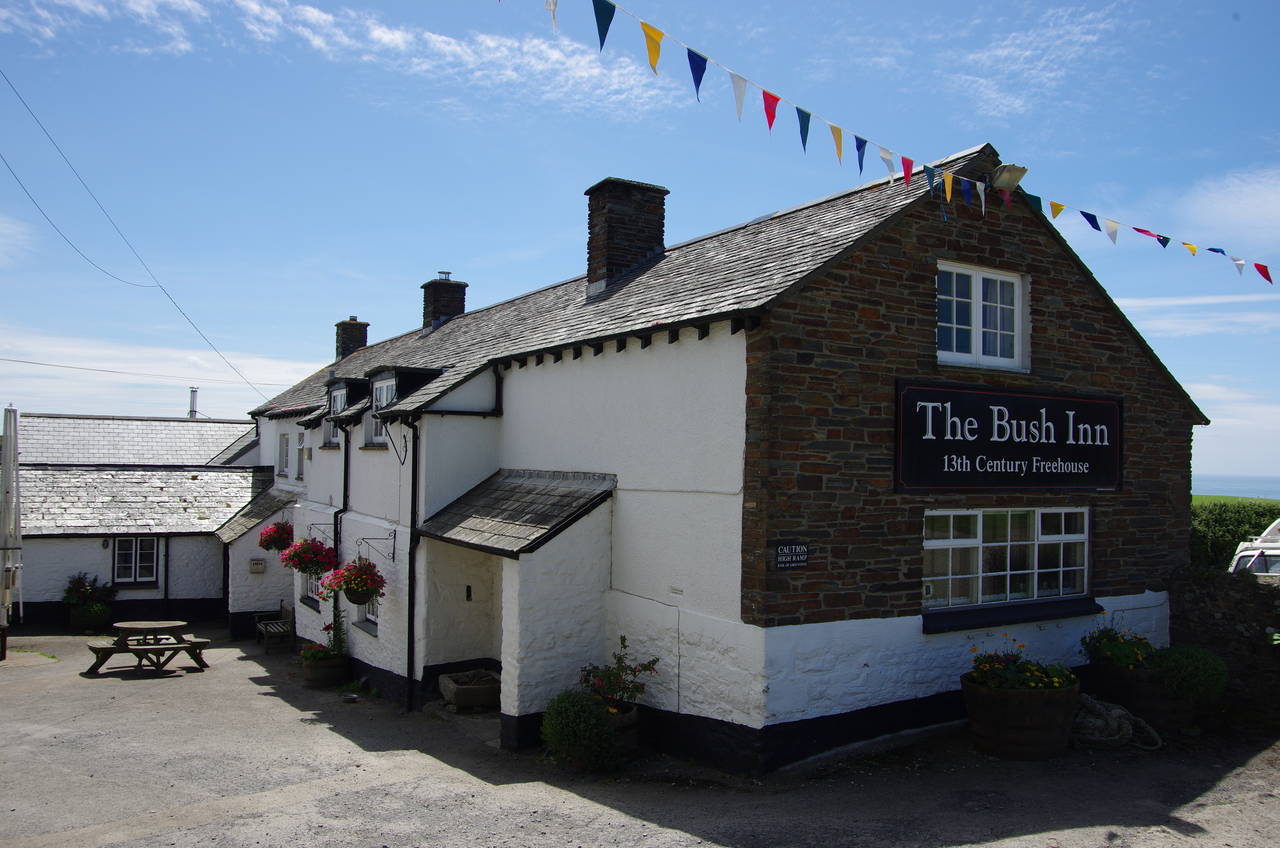
From the church, a narrow lane leads a few hundred metres further inland to the hamlet of Crosstown, where a few houses and a whitewashed pub sit around three sides of a small green. The 13th-century Bush Inn was a perfectly fine place to wait out the remaining hour until the bus arrived. (The unmarked bus stop is at the corner of the green closest to the lane from the church.)
The bus took only 20 minutes to take me back to Bude, arriving well before five o'clock and leaving me a good few hours to explore more of the town and to watch the sun set over the beach.