THE SAXON SHORE WAY
Stage 8: Herne Bay to Sandwich
Saturday, February 12th 2011
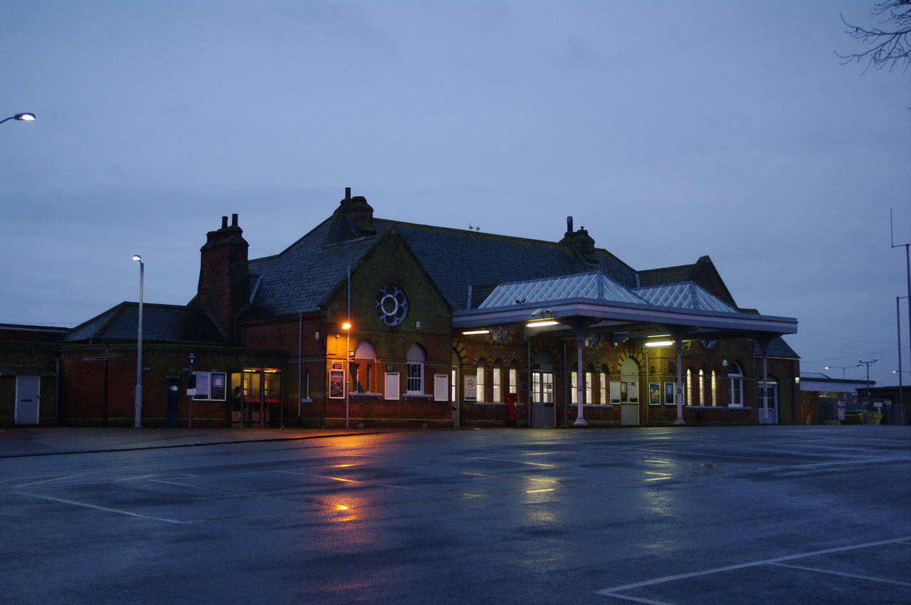
(1) Herne Bay Station

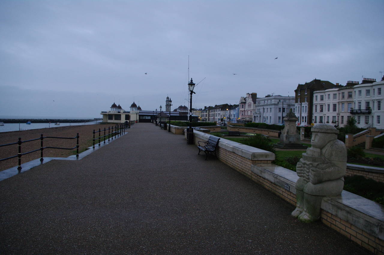
(2) Herne Bay Pier
(3) Approaching Bandstand
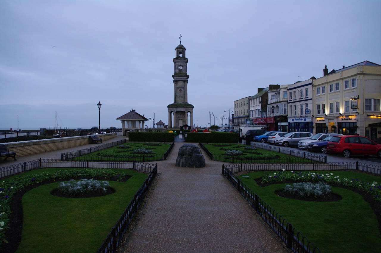
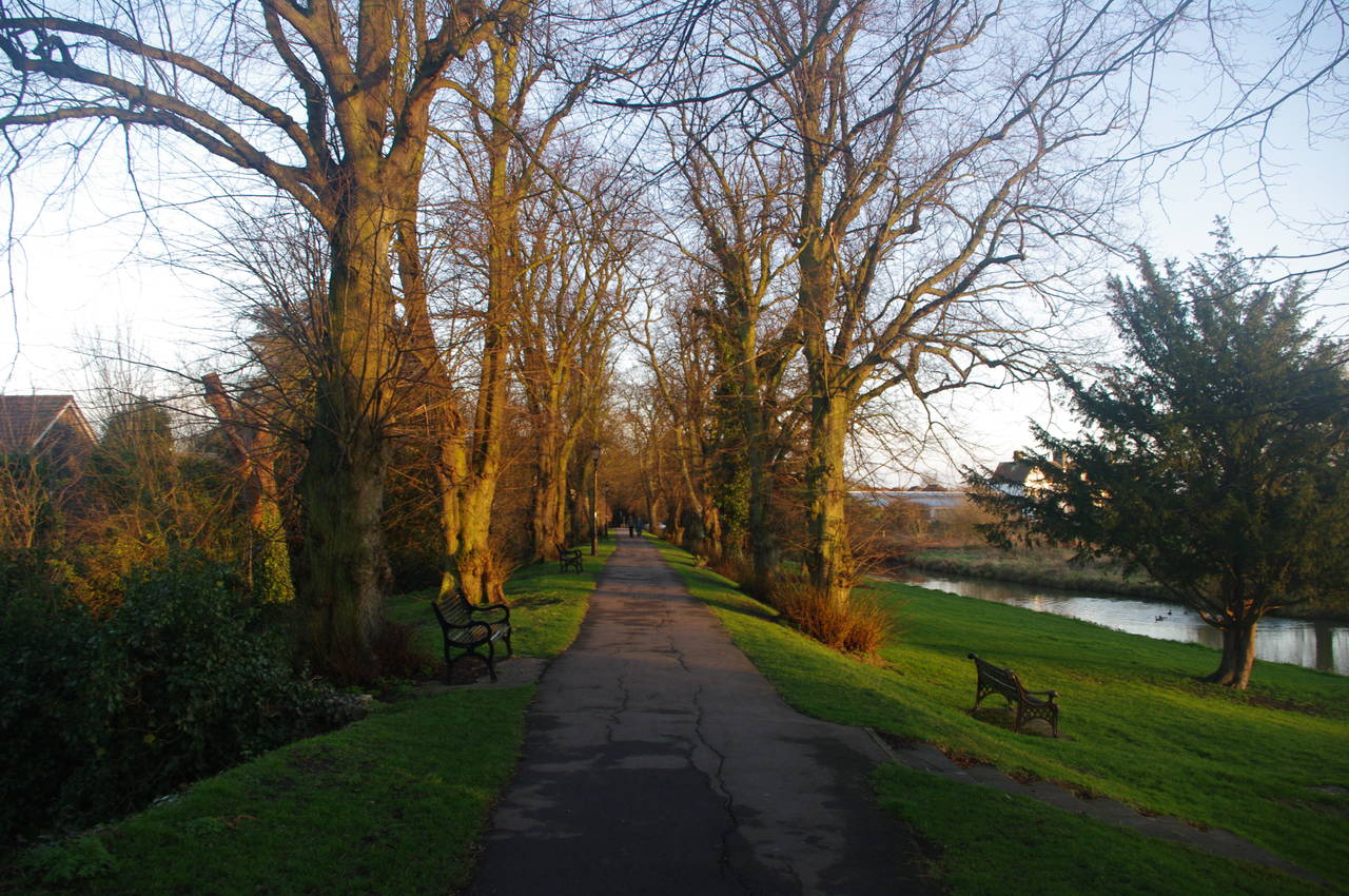
(4) Gardens, Herne Bay
In contrast to when I had last walked on the Saxon Shore Way, 13 days earlier, the temperature was about 10 degrees warmer. On the minus side, however, it had been raining for the previous few days, so I was expecting to encounter lots of muddy paths.
It was still raining lightly during the 100 minute train journey from London Victoria down to Herne Bay and continued to do so as I walked from Herne Bay Station (picture 1), along Station Road, to rejoin the Saxon Shore Way at the Herne Bay Pier (picture 2) just after dawn.
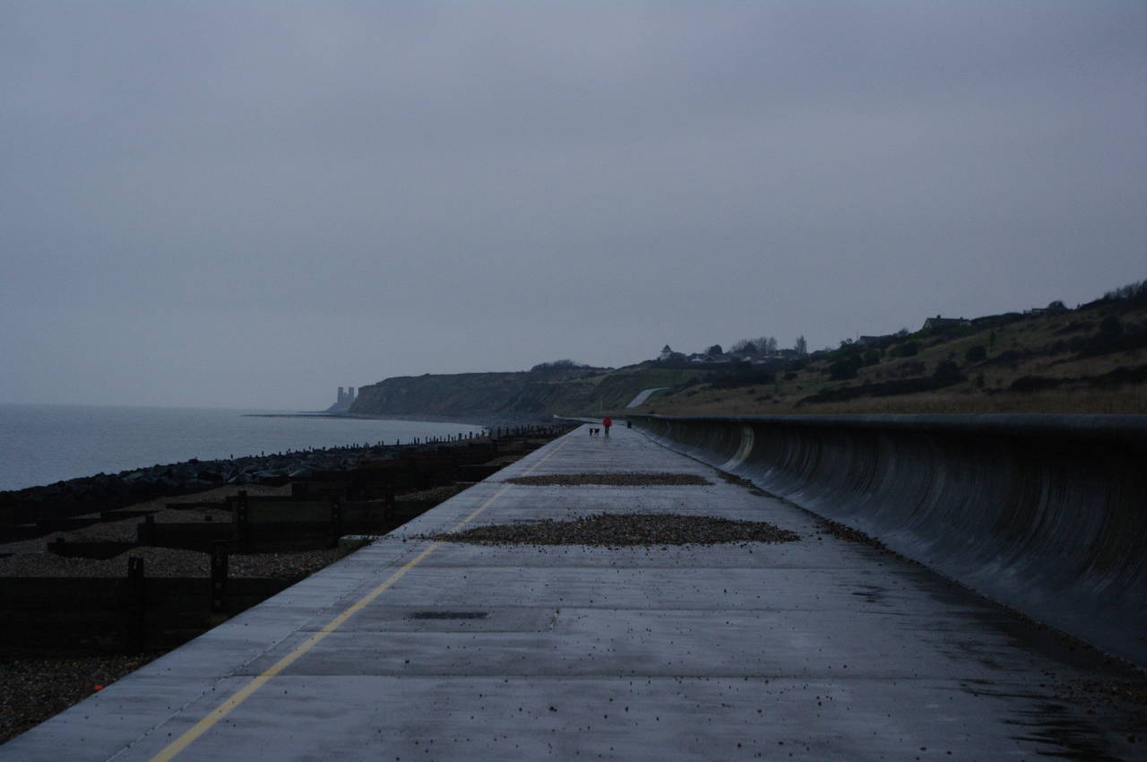
The first section of the day's walk, along the coast from Herne Bay to Reculver, was already familiar to me, as I had walked this stretch of the path almost six months previously to reach the beginning of the Thanet Coast Path. The walk was quite different this time, however, with the change of season and very different weather. Another difference was that on this day there were many birds flying around the pier, though none would stay still long enough for me to get a good close-up picture.
From the pier, the Saxon Shore Way heads east along the wide promenade, which soon passes through the middle of a large Victorian era bandstand (picture 3), though this early in the morning the bandstand was closed and I had to detour around it.
On both sides of the bandstand, there are well-kept gardens next to the promenade, On the eastern side, the gardens contain a children's playground and a 23 metre high clock tower (picture 4).
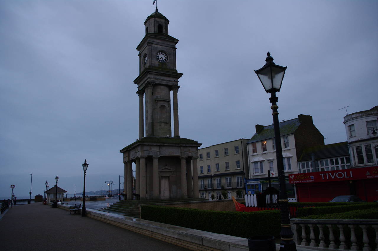
(5) Clock Tower, Herne Bay
(6) View across Herne Bay
(7) Fancy houses, Herne Bay
(8) King's Hall, Herne Bay
Built in 1837, the clock tower (picture 5) was the world's first free-standing clock tower.
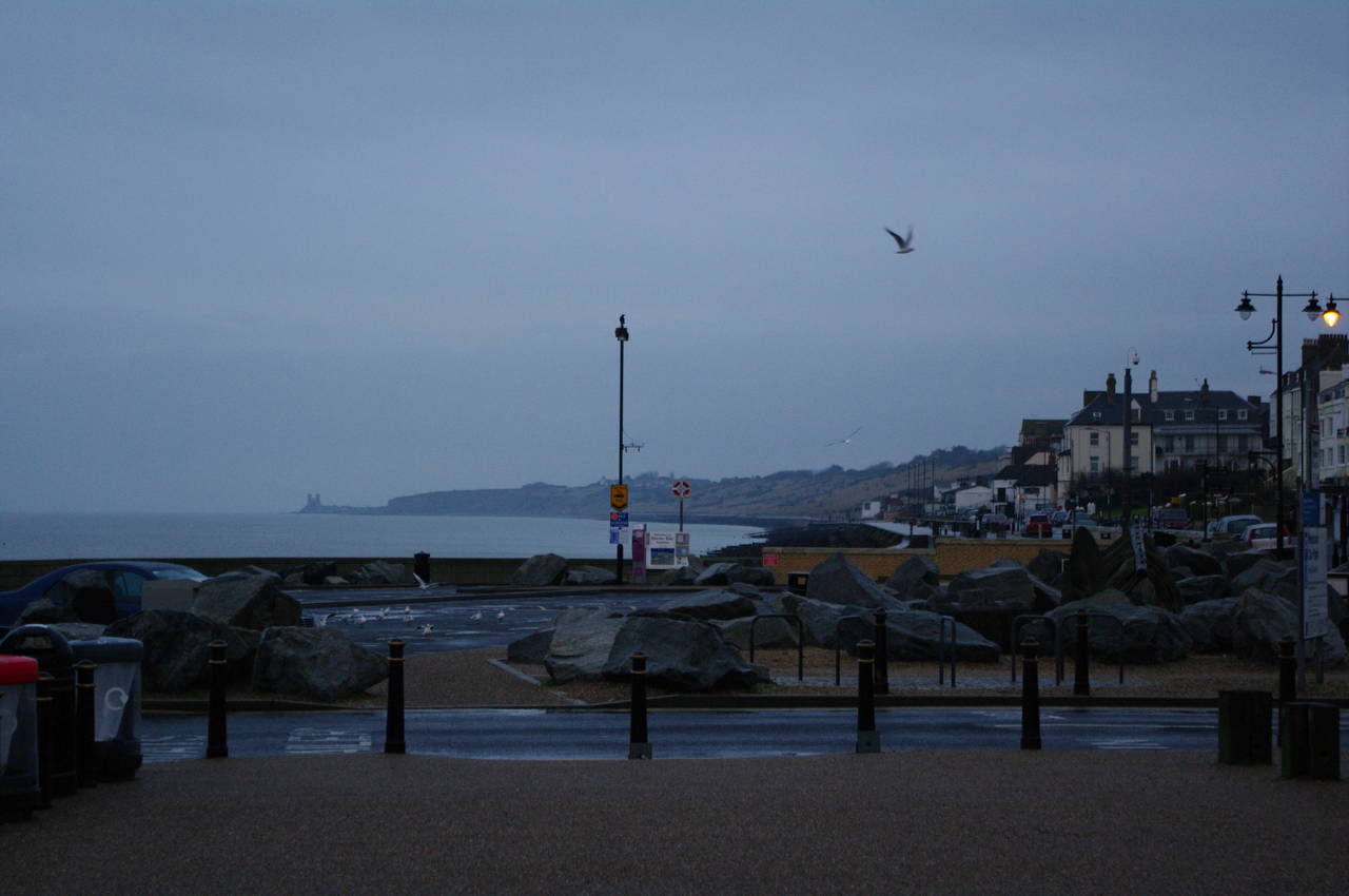
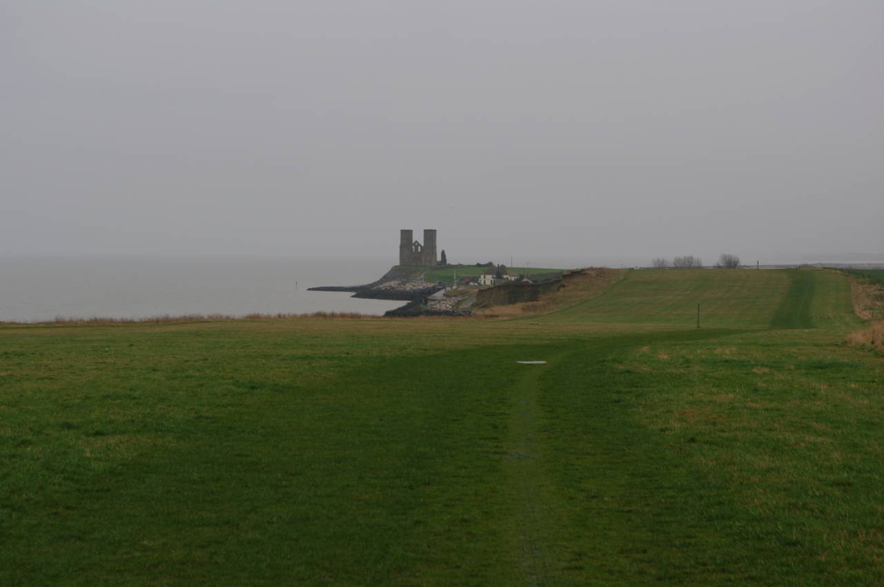
A short distance further, at the end of the promenade, the path passes through an area of large rocks and strange sculptures from which the twin towers of St Mary's Church at Reculver were clearly visible around five kilometres away on the other side of the bay (picture 6).
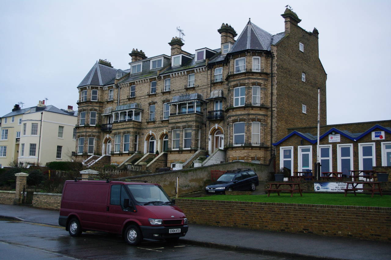
Continuing eastwards along the coast, the route soon joins another broad path between the shingle beach and the road, with a number of interesting buildings from Herne Bay's late-Victorian heyday lining the other side of the road (picture 7).
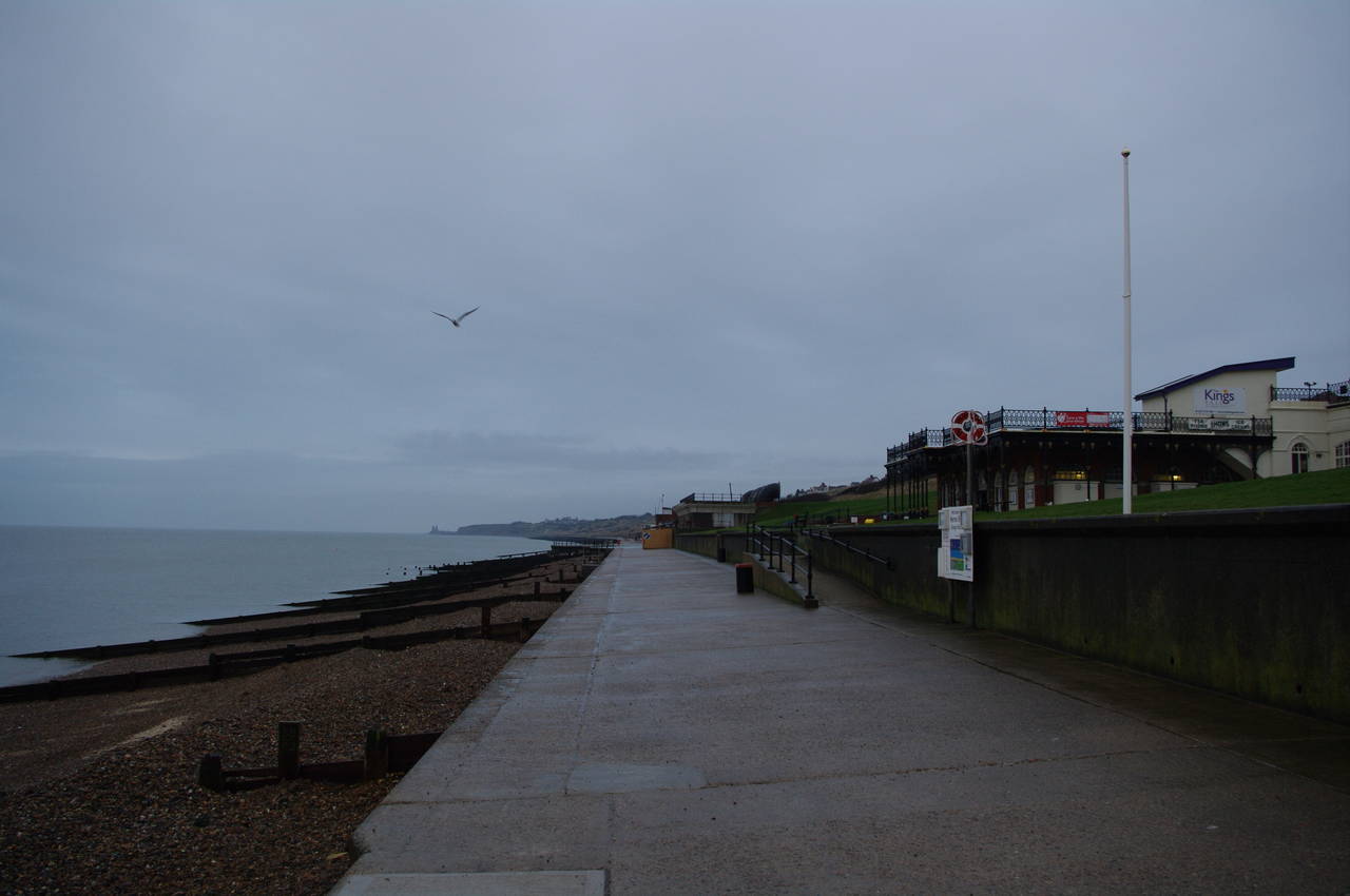
The path soon passes a building known as King's Hall (picture 8). On my previous visit, there had been many people here sitting on the sea-wall and the grass around the building, enjoying the summer sun, but today there were just a couple of hardy souls to be seen along this stretch of beach, walking their dogs.
(9) Herne Bay
(10) View towards Bishopstone
(11) Path climbs towards Bishopstone
(12) Reculver Country Park
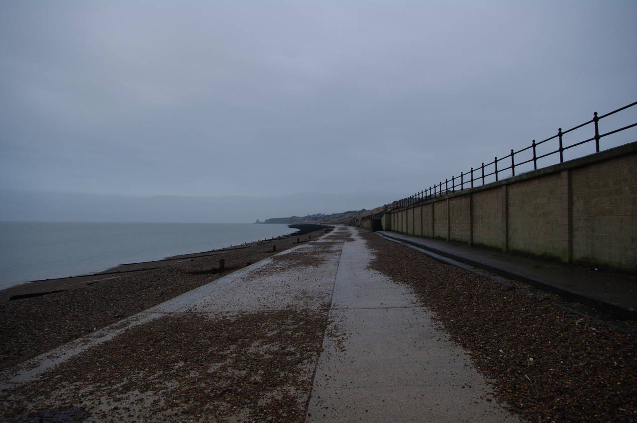
From here, the path continues along the low seaside path, gradually leaving the town behind. Since my previous visit, a significant amount of shingle from the beach had been deposited on the path (picture 9), presumably by some wild winter weather.
The path continues along the beach with the shingle divided into small sections by regular groynes. To the right of the path, the hills gradually rise higher, and the hamlet of Bishopstone came into view on top of the hill ahead (picture 10) while the Reculver towers temporarily disappeared from view behind the cliffs.
Below Bishopstone, a marker post points uphill along a concrete path (picture 11), which soon turns back on itself before reaching the top of the hill. After reaching a black and yellow gate across the path at the edge of Bishopstone, the route turns left and after a few metres turns left again onto a narrower footpath that soon leads over a footbridge and into an area of scrub. This footpath passes through the scrub and between the cliffs and some houses before reaching some concrete steps that lead uphill to a large open grassy area beside the carpark of the Reculver Country Park.
Last time I had been here, a parasailer had been trying to take off from this area, but there had not been enough wind for him to get airborne for more than a few seconds at a time. Today, there was plenty of wind, but the only people using the park were dog owners.
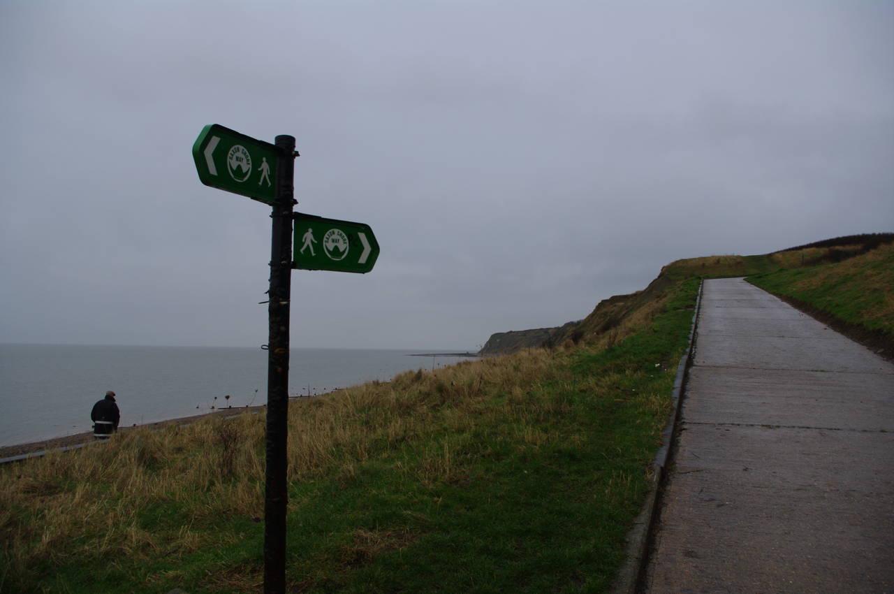
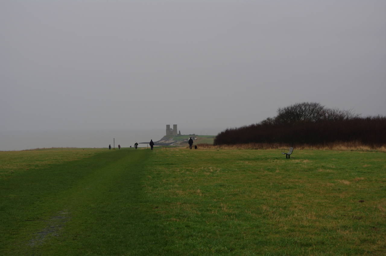
On the other side of the grassy square, two mown paths lead off around either side of some brushland. There is no waymarker here, but it doesn't really matter which of the two paths you take as they join up again on the other side, where the towers at Reculver come back into view (picture 12), still a couple of kilometres ahead. In the summer, the grass beside the neatly mown path had been much longer.
(13) Wire mesh on the path
(14) View towards Reculver
(15) Reculver Cross
(16) St Mary's Church, Reculver
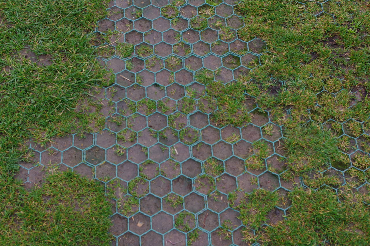
The path through Reculver Country Park has been given an interesting defence against the wear that would normally be caused by the thousands of walkers and cyclists who visit the park each year. A layer of wire mesh has been laid down along the path and the grass happily grows through the mesh. In the summer, I hadn't really noticed the mesh at all.
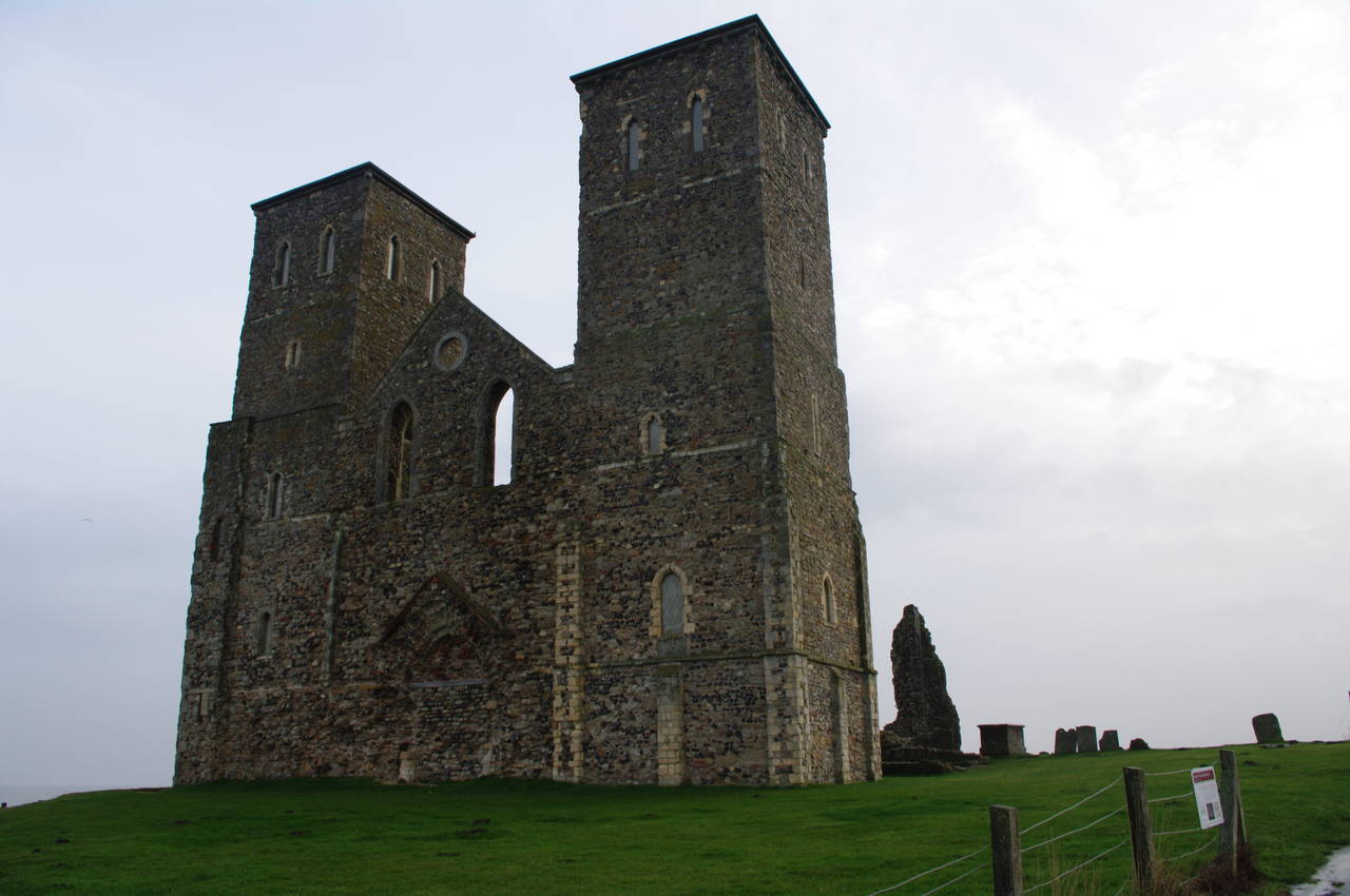
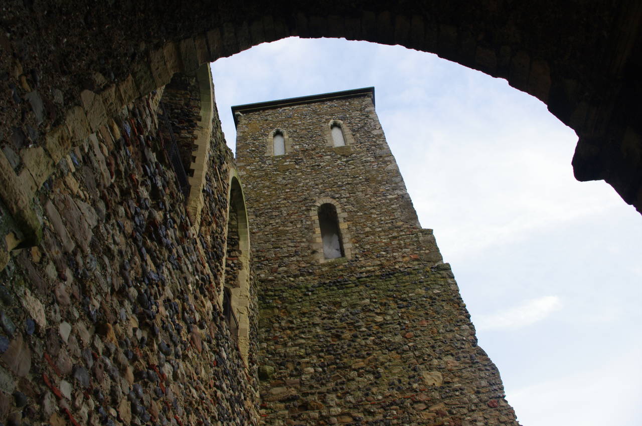
As the path crosses the crest of the hill, it becomes clear that St Mary's Church sits atop an exposed point (picture 14). When the church was first built, it was more than 500 metres from the sea, but over the centuries erosion saw most of the surrounding village of Reculver fall into the sea. By the early 19th century the village was largely abandoned and the church fell into ruins. The bulk of the current village consists of three large caravan parks, which gradually come into view as the path gets closer to the village.
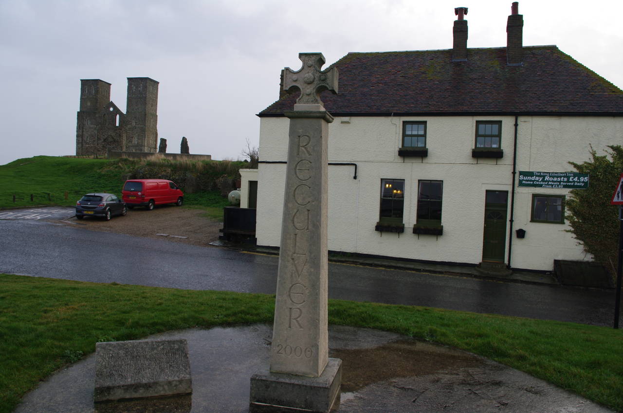
The path passes alongside one of these before arriving at the King Ethelbert Inn (picture 15). The cross that stands in front of the pub was modelled on fragments of a cross that stood in the old village in Roman times. The stone plaque next to the cross reads "AD 2000, This cross was comissioned by the Canterbury City Council with the support of the Dean and Chapter of Canterbury Cathedral, to commemorate the millenium and two thousand years of christianity."
At the cross, the Saxon Shore Way turns right and starts to head inland. Before continuing along the Way, I headed up the path to the left to take a closer look at the church. The impressive 12th-century towers at the front of the church appear fairly intact (picture 16), though the spires that once topped them are now long gone.
(17) St Mary's Church, Reculver
(18) St Mary's Church, Reculver
(19) Path leaving Reculver
(20) Southeastern Train
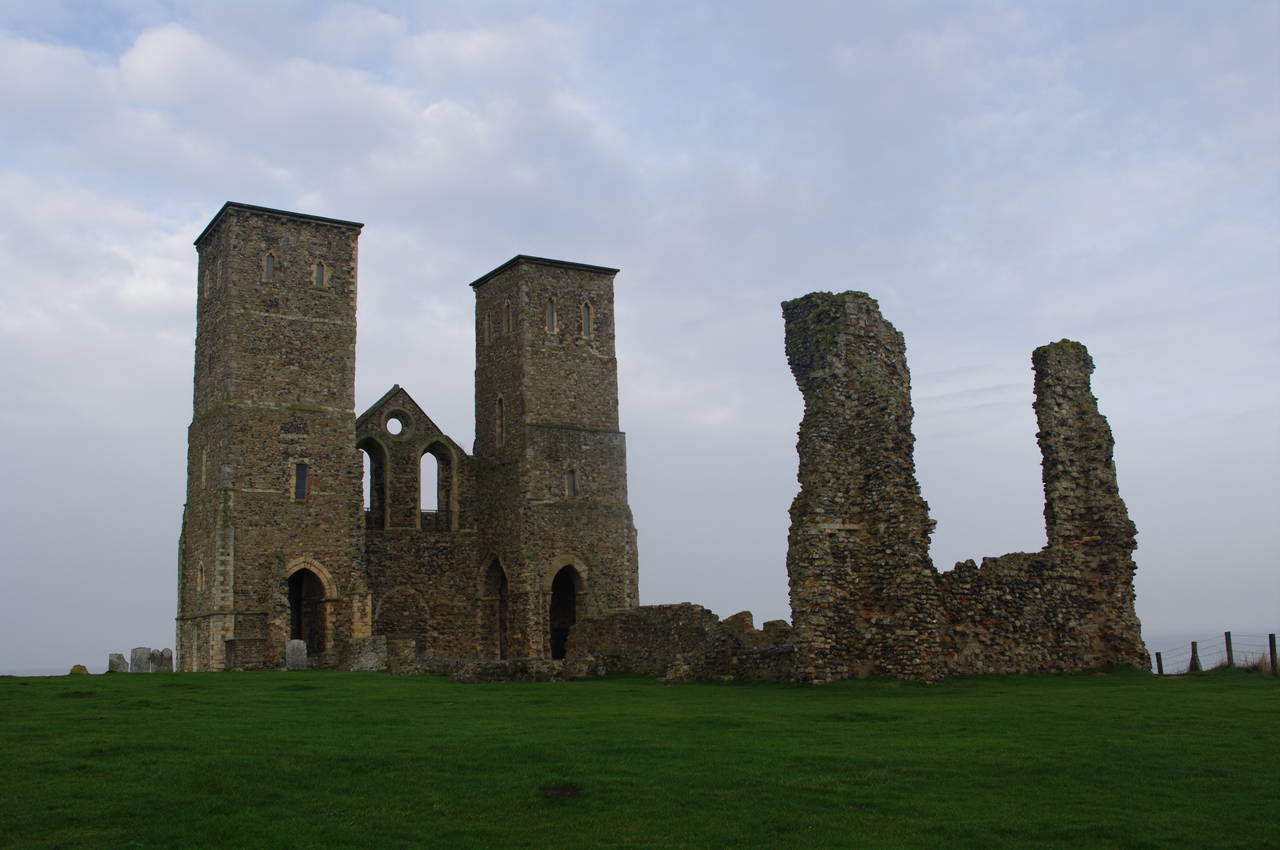
Most of the remainder of the church was demolished after the encroaching sea forced the locals to abandon it in 1805, and only a fraction of the masonry remains in place (picture 17). The towers were left standing to aid sea navigation, and it is possible to stand under them (picture 18), but not to climb them. On the back of the front wall, a worn stone plaque reveals more of the building's history after it was abandoned:
These towers, the remains of the once venerable church of Reculvers were purchased of the parish by the Corporation of Trinity House of Deptford Strond in the year 1810. And groins laid down at their expence, to protect the cliff on which the church had stood. When the ancient spires were afterwards blown down, the present substitutes were erected, to render the towers still sufficiently conspicuous to be useful to navigation. Capt Joseph Cotton, Deputy Master in the year 1819.
The substitute spires the inscription refers to have since been removed, but the towers still seem rather conspicuous to me.
While I was looking around the ruins, the light rain that had accompanied me so far on the walk stopped and the sun made a few feeble attempts to break through the cloud cover.
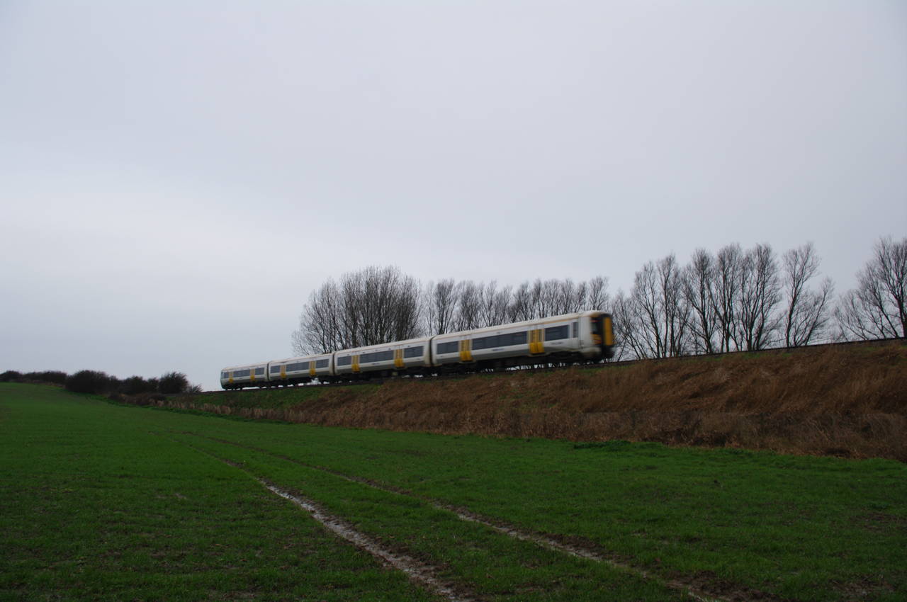
On returning to the Saxon Shore Way next to the King Ethelbert Inn, I followed the route downhill for a short distance before it turns left in front of an ice cream kiosk. The route then follows a rough road past the Reculver Caravan Park and when it reaches a metal gate across the road, the route turns right and follows a narrow waterway southwards across a series of muddy fields (picture 19) to reach the rail line that runs between Herne Bay and Margate. The path then heads to the right for about twenty metres before turning left onto a driveway that passes under the railway line. Just after I walked under the railway line, a train zoomed past towards Herne Bay (picture 20).
(21) View towards the Isle of Thanet
(22) Reynolds Farm
(23) Marshside Farm

(24) Path away from Boydens Gate
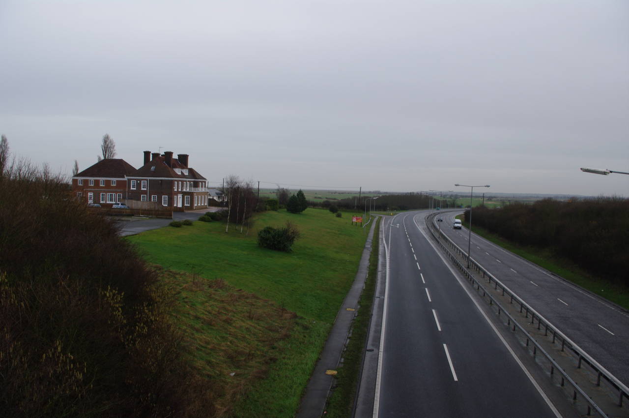
The route follows the driveway uphill to turn briefly left along a minor road before turning right and crossing a bridge over the A299 Thanet Way road. From the bridge there was a good view towards the Isle of Thanet (picture 21).
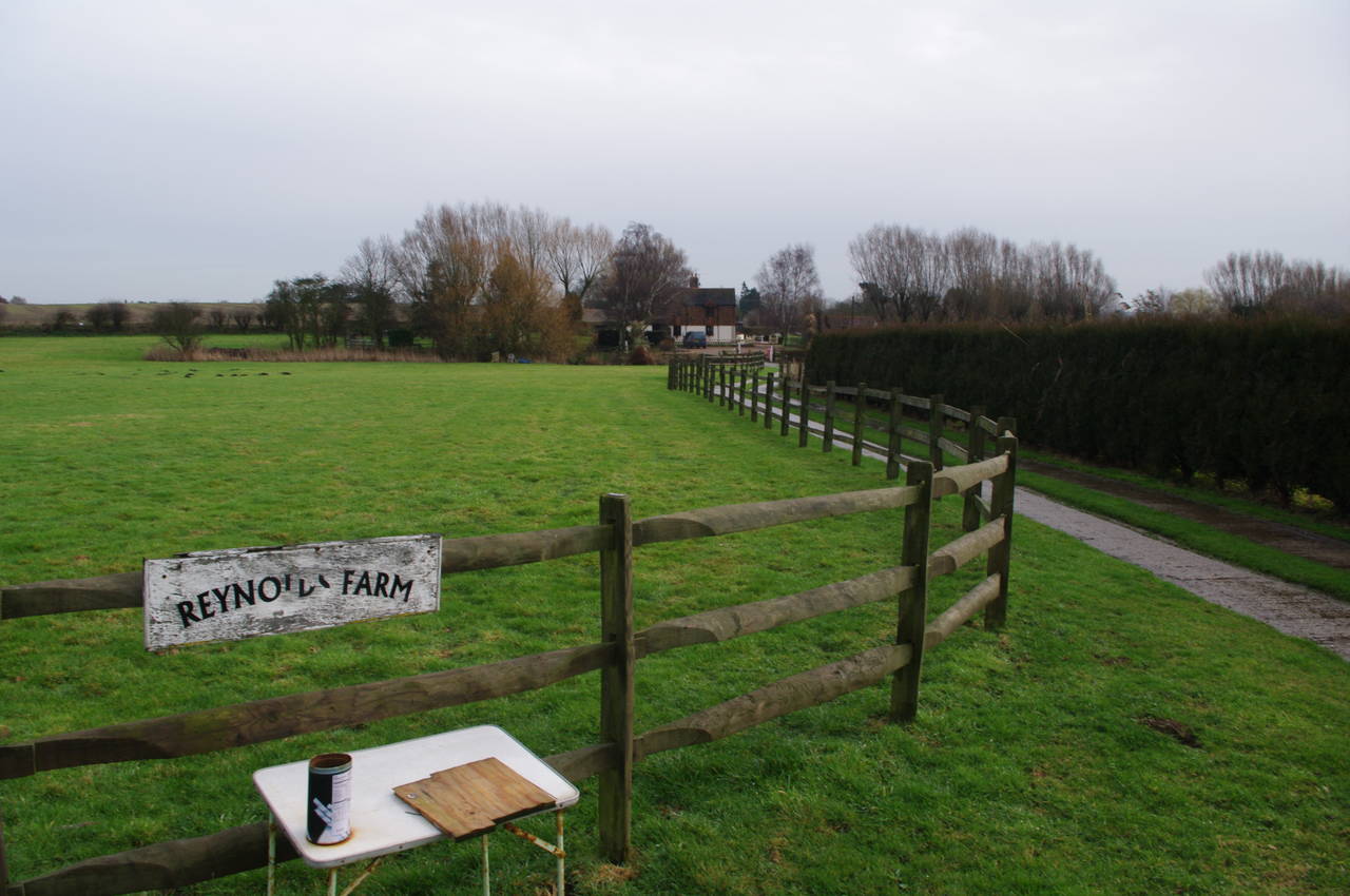
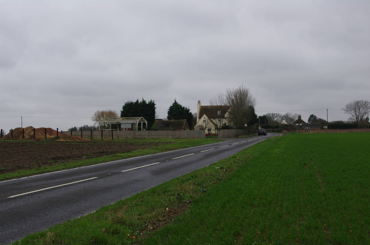
Once over the A299, the path turns right onto a road called North Stream, which parallels the A299 for about two hundred metres. Just before North Stream merges into the A299, the Saxon Shore Way turns left and follows Reynolds Farm Road south for nearly a kilometre, with open fields and the occasional farmhouse on either side of the road, including Reynolds Farm itself (picture 22). While walking along the road I could just make out the cooling towers of Richborough Power Station (which I would pass towards the end of the day's walk) on the horizon.
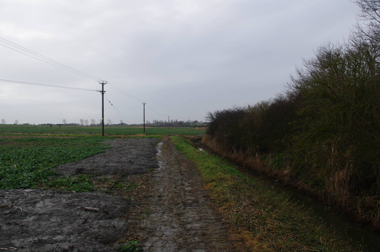
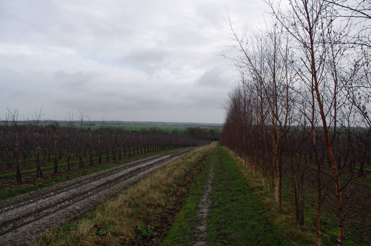
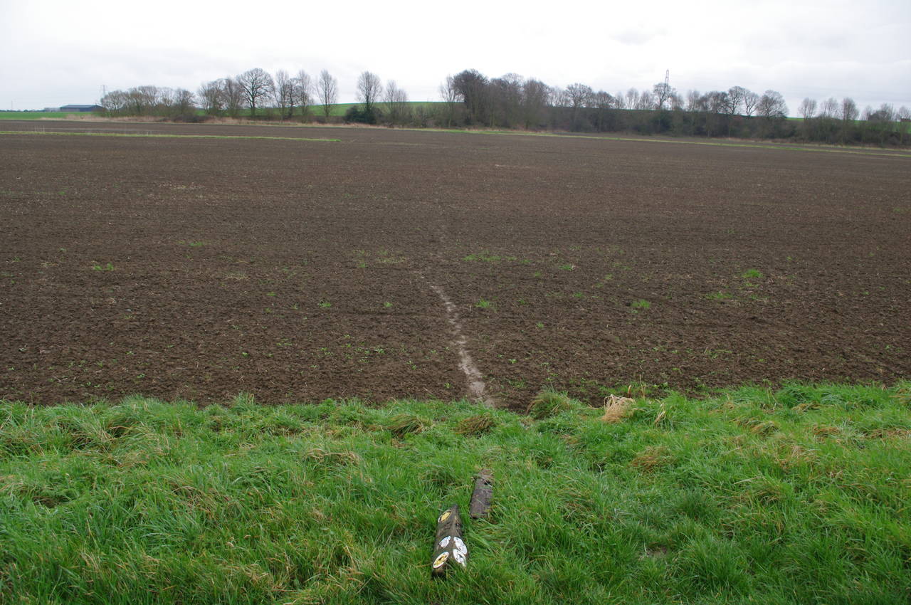
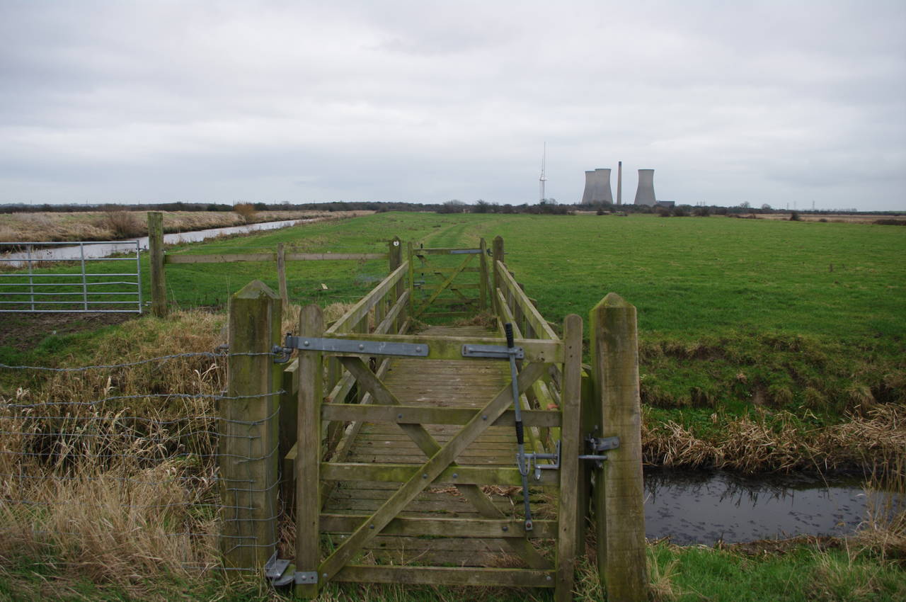
After almost a kilometre, the road bears off to the left, but the route of the Saxon Shore Way continues straight ahead on a very muddy farm track through apple orchards, where I passed a couple of ladies who were on horseback. After about 700 metres, the track reaches a farmhouse, where the route turns left and heads downhill on an even muddier track (picture 23) towards Marshside Farm. Just before reaching the farm buildings, the route turns right and heads along the edge of the orchard to a stile; the first of four that the route crosses as it heads into the village of Boydens Gate.
Beyond the last stile, the path follows a narrow alley, crosses a road, and then follows a concrete path between two high hedges to another road, which it crosses to follow another alleyway that starts a few metres to the right. The alleyway leads to a small plank bridge across a stream on the edge of Boydens Gate (picture 24).
(25) Chitty Lane
(26) Sarre Penn
(27) Path towards Walmers Hill
(28) Island Road, Upstreet
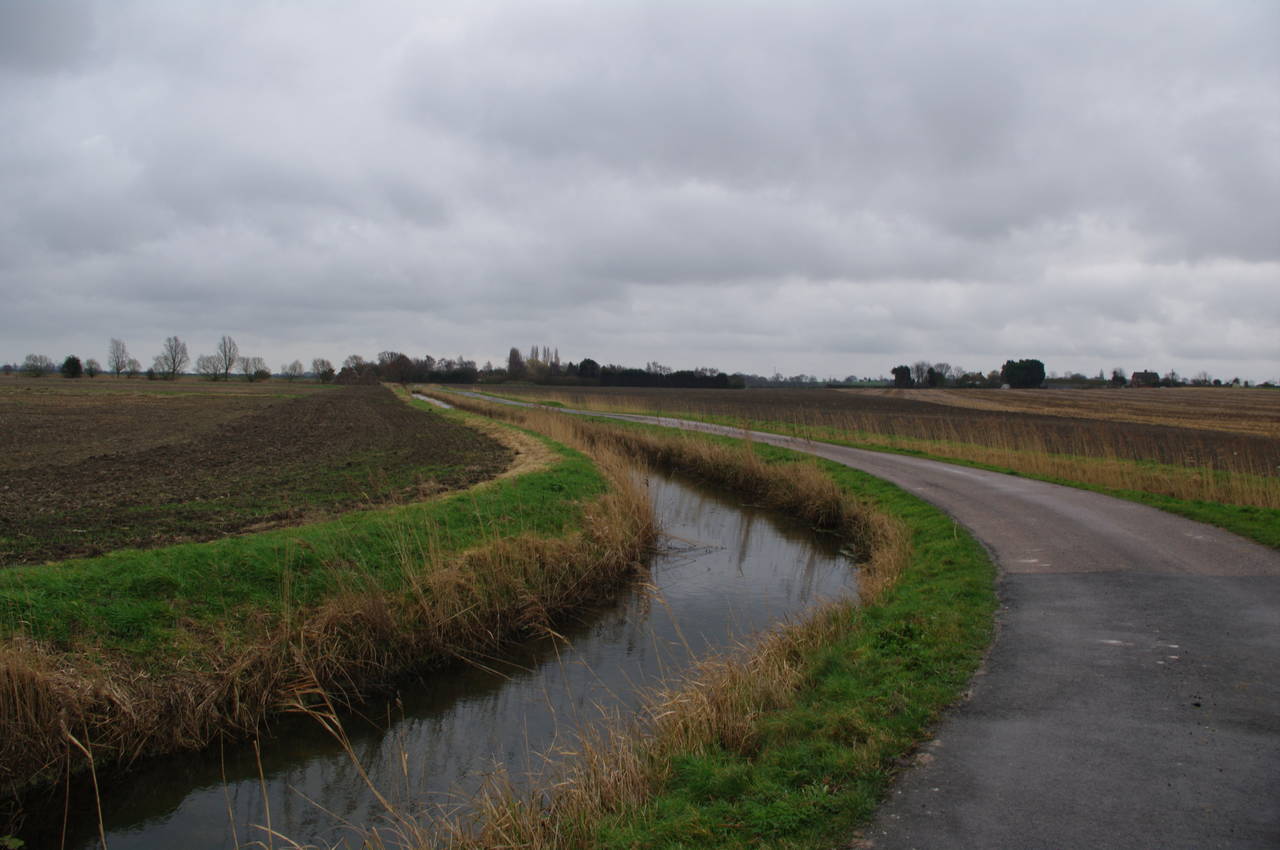
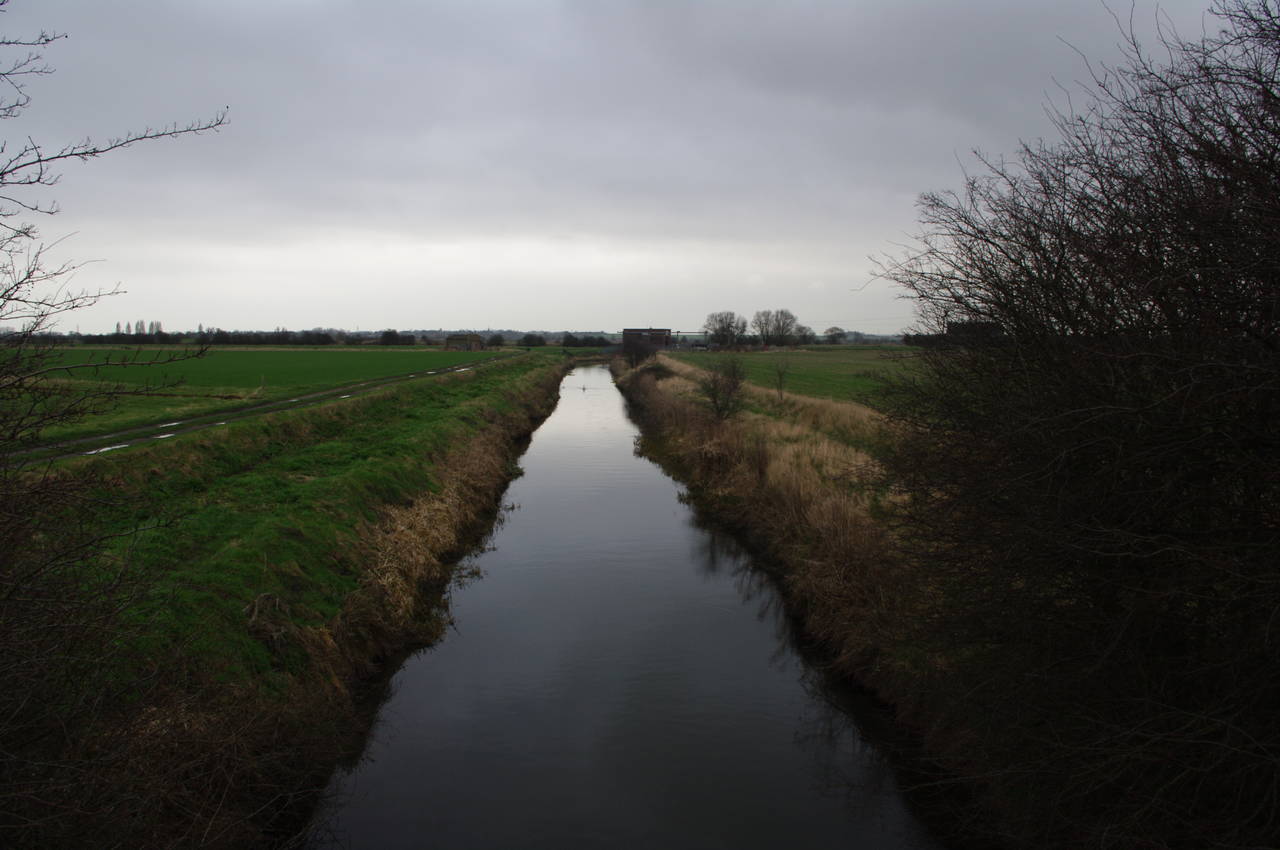
The route then heads out across open fields before reaching another road, Chitty Lane, which continues between more fields (picture 25) before it curves around to the right towards the hamlet of Chitty. A signpost then points to the left along a farm track that passes Lower Chitty Farm and continues past a field where cattle were grazing, eventually reaching a concrete bridge over a small waterway known as Sarre Penn (picture 26).
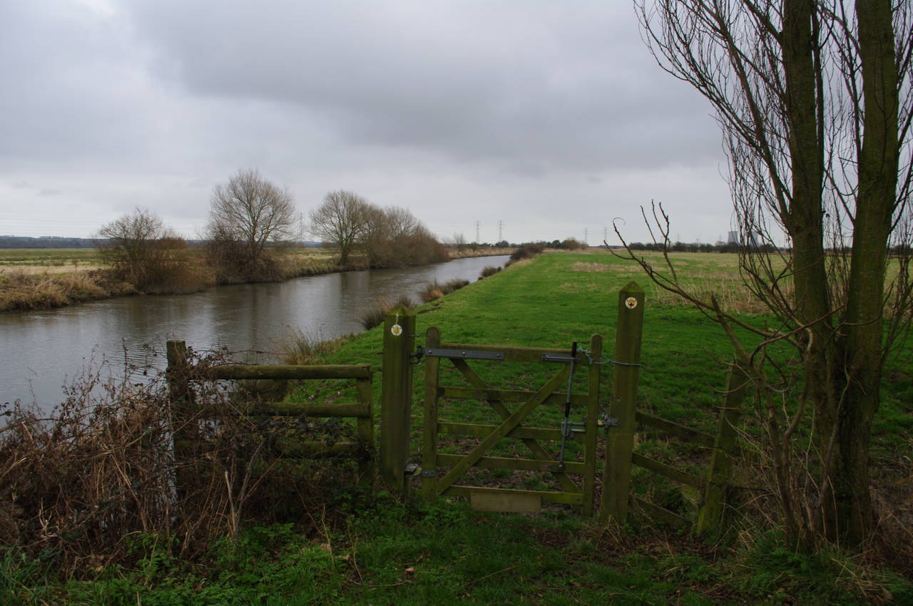
The route then follows the grassy bank of Sarre Penn for a few minutes until a fallen waymarker post indicates where the path turns left across a very muddy field (picture 27). On the other side of the field, the path crosses a drainage ditch near another fallen marker post and climbs some rough steps up the side of Walmers Hill. At the top of the steps, the path heads to the right to another marker post and then to the left across an open field to reach Island Road with the village of Upstreet visible off to the right (picture 28).
(29) Great Stour, Grove Ferry
(30) Grove Ferry Inn
(31) Great Stour, Grove Ferry
(32) Little Stour near West Stourmouth
The route crosses Island Road and continues ahead over another field, where the trail had been ploughed away. The exact route wasn't clear until I had reached the top of the ridge that runs from side to side across the field and could see the next marker post on the far side of the field. There a flight of paved steps leads down to Grove Ferry Road, which immediately heads over a level railway crossing and a bridge over the Great Stour River in quick succession (picture 29).
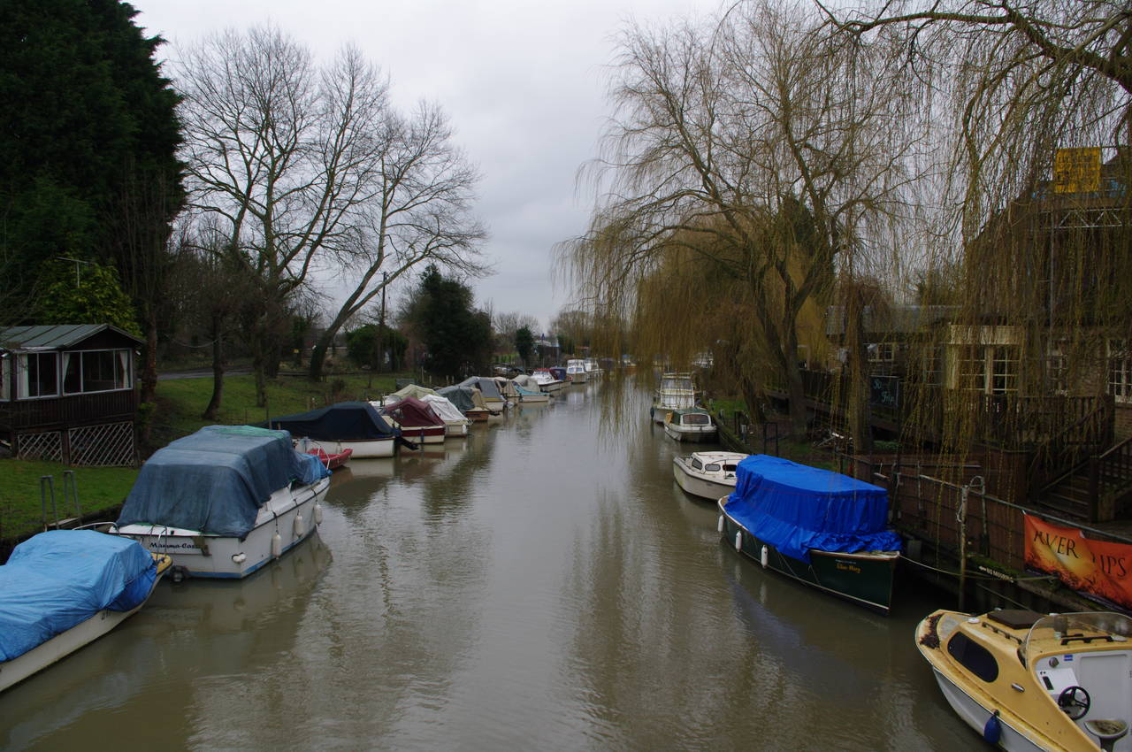
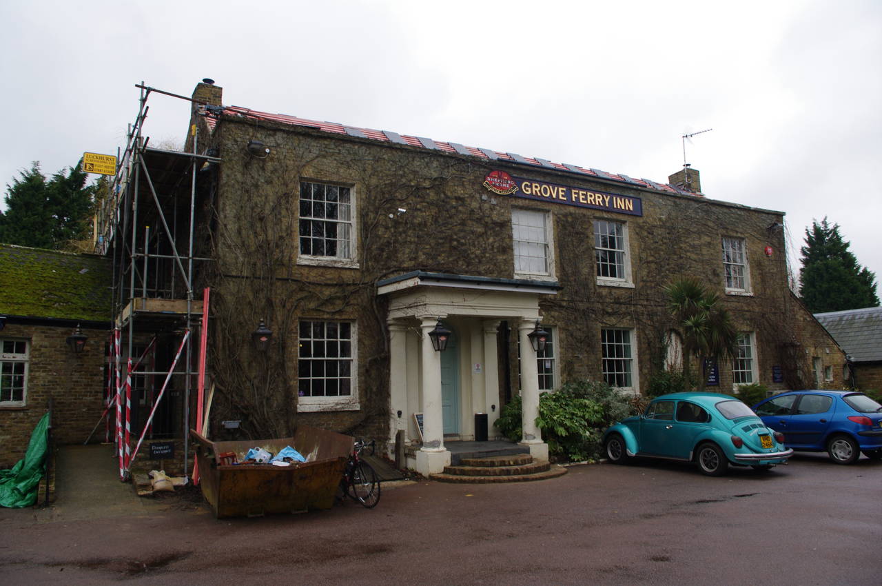
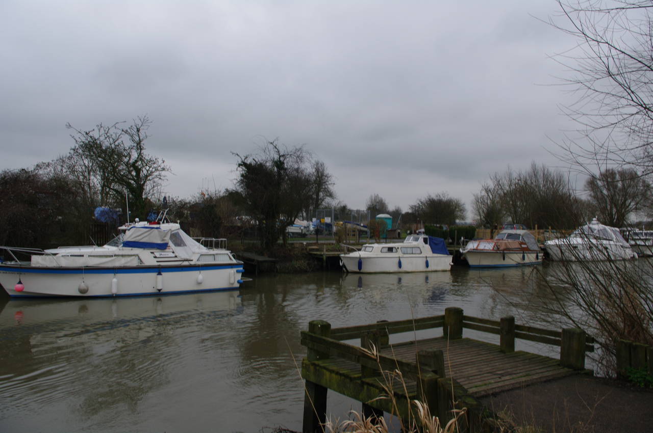
The route follows Grove Ferry Road as it curves to the left past the Grove Ferry Inn (picture 30). Reaching the entrance of the car park, the route almost turns back on itself, following the driveway for a few metres before turning right into the Grove Ferry Picnic Site, where I stopped to eat my lunch on the grassy river bank opposite a number of boats (picture 31).
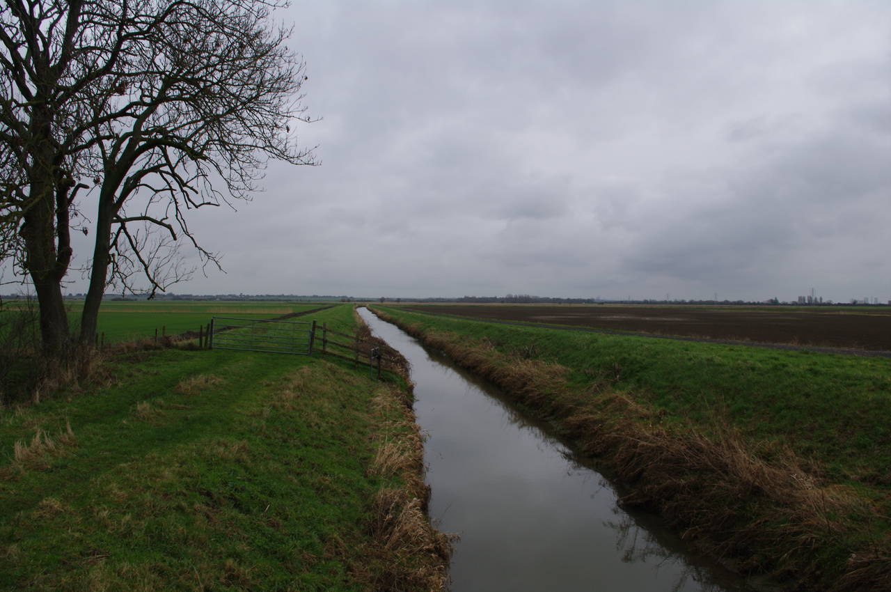
The route then follows the river bank for a few hundred metres before heading behind some buildings and rejoining Grove Ferry Road at a wooden gate. Almost immediately the route turns left off the road, passing through a squeeze stile and heading out across open fields towards the Little Stour River. This section of the Way is shared with the Stour Valley Walk.
On reaching the river the route turns left for a short distance alongside the Little Stour, then crosses a footbridge over the river. At the end of the bridge, the Stour Valley Walk continues straight ahead towards the nearly village of West Stourmouth, while the Saxon Shore Way turns left and follows the course of the Little Stour (picture 32).
(33) Swan on the Little Stour

(34) Pluck's Gutter
(35) Path along the River Stour
(36) View towards Richborough Power Station
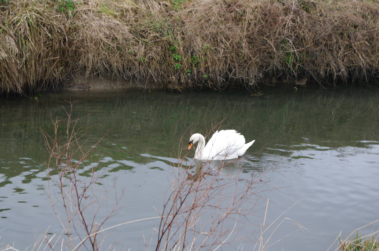
The path along the river bank was quite overgrown and uneven in places and I had to slow my pace along this part of the path. The fields on either side of the river are fertile farming land, crossed by many drainage ditches, which harbour many kinds of birds, including swans (picture 33).
All this land was once submerged under the Wantsum Channel which separated the Isle of Thanet from the mainland in Saxon times, but had completely silted up by the middle ages creating a very flat landscape.
After around two and a half kilometres, the Little Stour flows into the Great Stour at Pluck's Gutter, where a few dozen boats were moored near the Stour Bridge (picture 34).
From Pluck's Gutter, the Saxon Shore Way follows the River Stour all the way to the outskirts of Sandwich, a distance of more than eleven kilometres. For the first half of this stretch, the path is mostly grassy and the walking is easy, though the surface is quite uneven in places. This part of the path passes through many wooden gates (picture 35) and crosses numerous little footbridges over drainage ditches (picture 36). For much of the way, the massive cooling towers of the abandoned Richborough Power Station, which the route eventually passes, are visible in the distance.
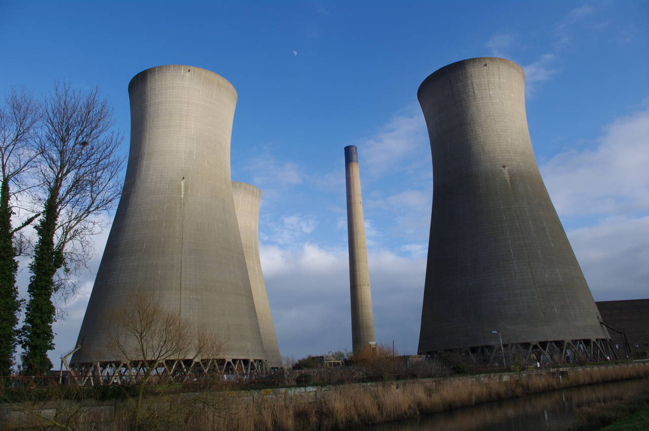
(37) Richborough Power Station
(38) Richborough Road, Sandwich
(39) The Butts, Sandwich
(40) The Rope Walk, Sandwich
About 700 metres before the path passes the power station, it passes under a railway bridge, which carries trains between Sandwich and Minster, where the line joins the line between Ramsgate and Canterbury. Under the bridge, the path became very muddy and would stay that way for most of the way to Sandwich, cutting my pace by about half.
Beyond the bridge, the muddy path continues along the river bank passing opposite the Richborough Power Station complex (picture 37). As I approached, the late-afternoon sun began to break through the clouds, casting some interesting shadows on the chimney and cooling towers.
The power station opened in 1962, burning coal from the nearby Kent Coalfields. In 1971 it was converted to burn oil, and then in 1989 to burn an alternative fuel called Orimulsion. In 1996, electricity generation ceased after court cases about the enivronmental effects of the fuel. The site is not completely abandoned however, as it also contains a sub-station that is connected to the Thanet Offshore Windfarm, which started generating power in September 2010. The wind farm itself is located about 12km northeast of the tip of the Isle of Thanet.
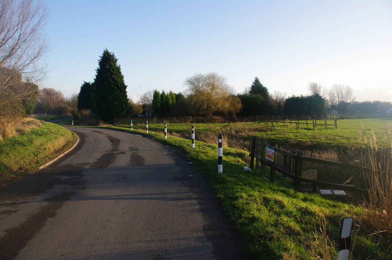
With the sun now shining, I continued along the riverbank towards Sandwich. After about two kilometres, a bend in the river takes the path back towards the railway line and the route joins a very muddy vehicle track, which it follows for about a kilometre before passing under the A256 and joining Richborough Road on the outskirts of Sandwich (picture 38).
At the end of Richborough Road, the route takes the footpath to the left along Ash Road, which it soon crosses and takes another footpath off to the right along The Butts (picture 39), part of the old town wall. At the end of The Butts, the path crosses a road and continues along the line of the old town wall on a similar stretch of footpath called The Rope Walk (picture 40).
Where the path crosses New Street to the next section of path along Mill Wall, I left the Saxon Shore Way for the day, with my GPS indicating 31.3km covered since Herne Bay Pier. Although this had been the longest stage of the walk so far, I had felt quite good for most of the way. It was only on the very muddy stretch from Richborough to Sandwich that I had begun to tire due to the more difficult conditions.
From Mill Wall, it was less than 300 metres walk to Sandwich station, which I reached just as the sun was setting. Unfortunately, it seemed that I had just missed a train, but at least the 50 minute wait gave me an opportunity to try to clean my boots, which were very muddy indeed.