SOUTH WEST COAST PATH NATIONAL TRAIL
Stage 14: Torquay to St Mary's Bay
Monday, May 20, 2013
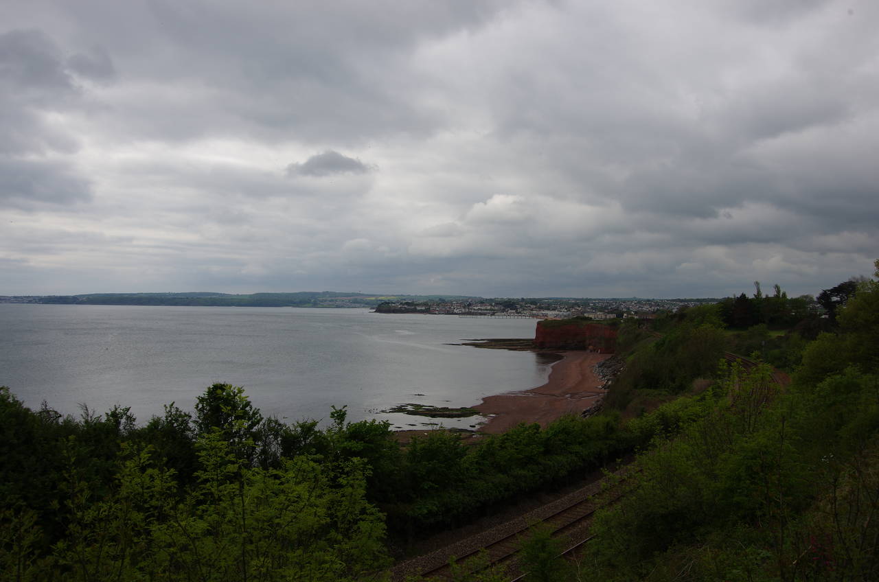
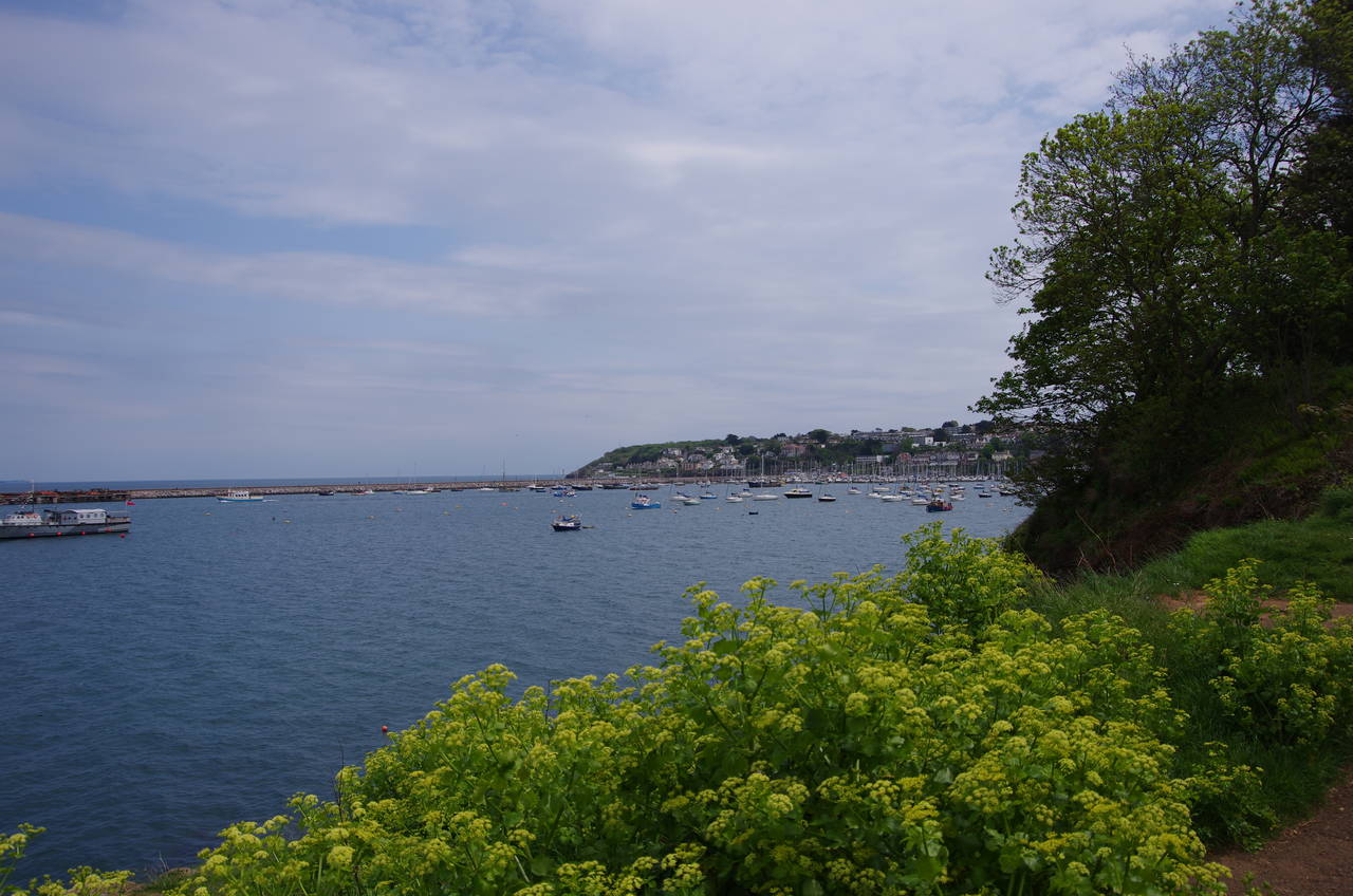
(1) Preston Sands
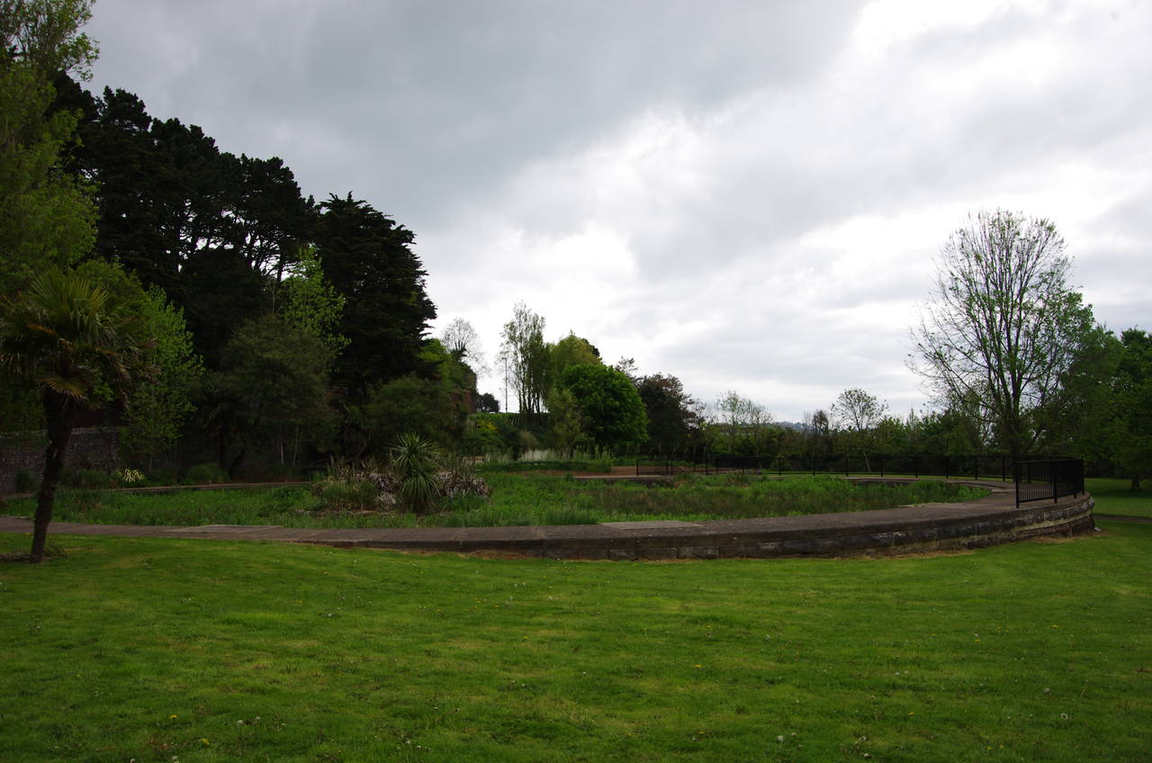
(2) Hollicombe Park
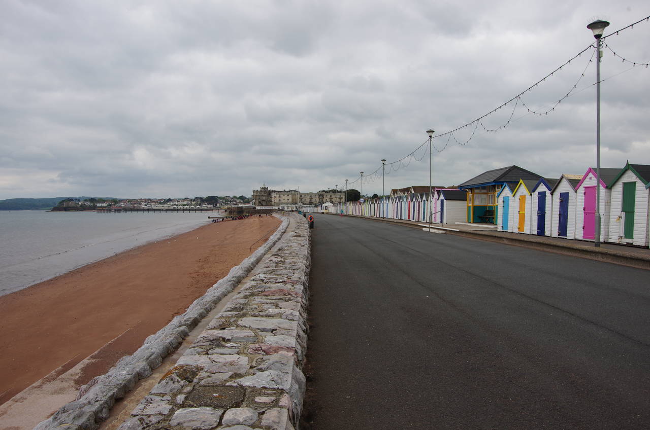
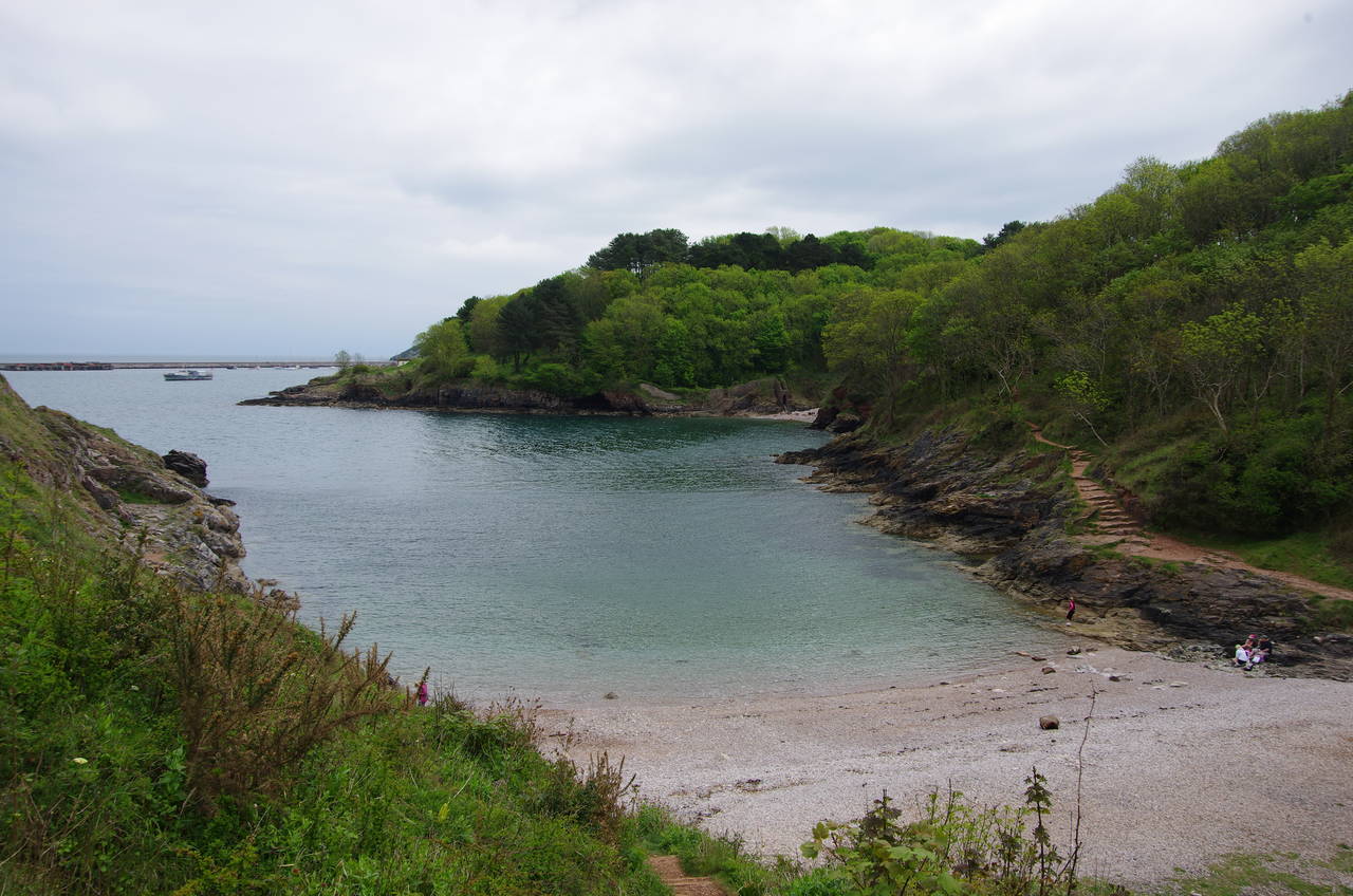
(3) Preston Sands
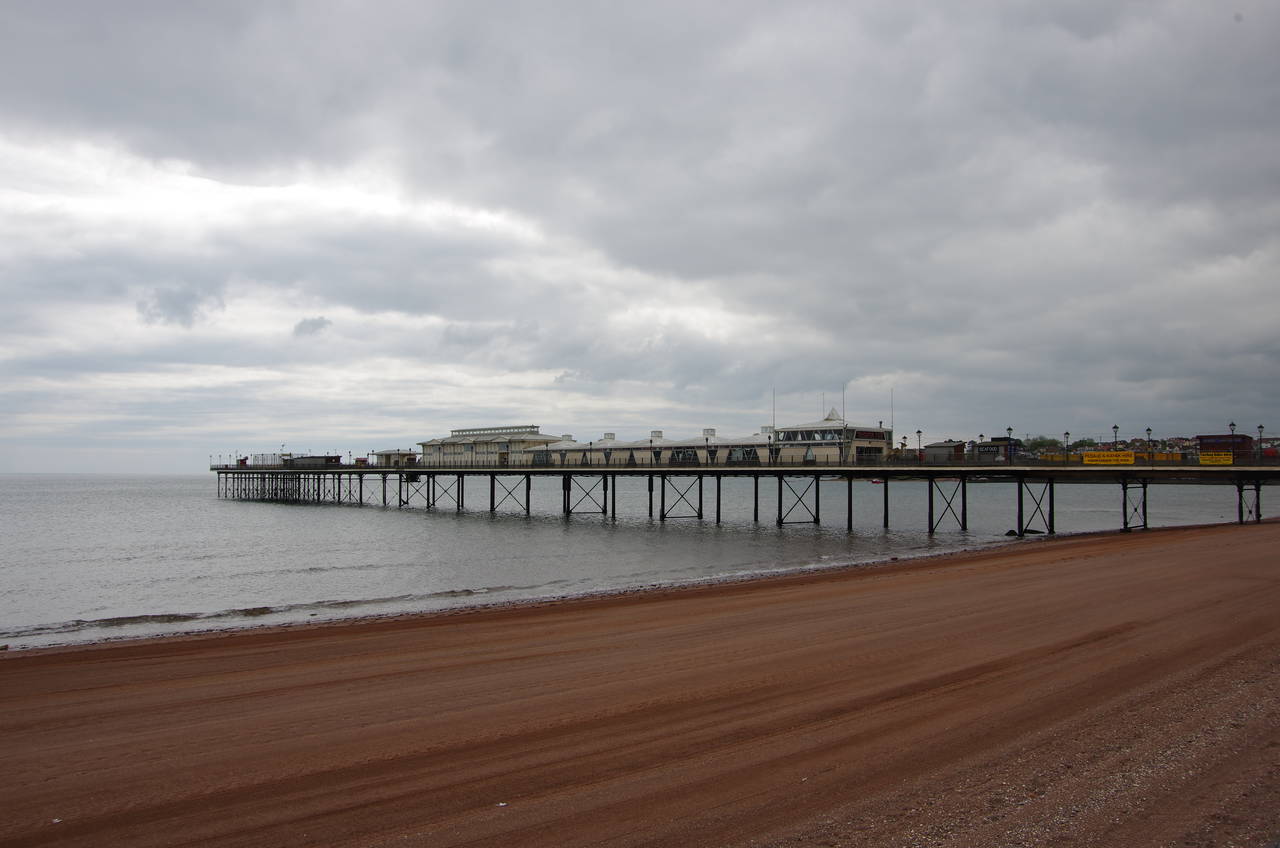
(4) Paignton Pier
After taking a day off to explore the historic city of Exeter, I returned to the Coast Path on a rather cold and dull Monday morning. Setting out from the little park on Corbyn's Head, I followed the A3022 Torbay Road southwards past the small Livermead Beach, which virtually disappears at high tide.
Before long, the road converges with the railway line that runs south from Torquay to Paignton, paralleling the line as it cuts across the back of Livermead Head then jinking right to cross over the line. The road runs alongside the line for another 200 metres, with views south over Preston Sands (picture 1), then bears away as the road and the railway are separated by the small Hollicombe Park (picture 2). The Coast Path soon leaves the road, crossing the park on a tarmac footpath to find a stone bridge back over to the seaward side of the tracks.
The tarmac path squeezes between the railway and the clifftop for a short distance before descending to Preston Sands at the end of a long line of beach huts (picture 3). The path follows the promenade above the beach for about 500 metres to the other end of the beach huts, which are backed by the grassy strip of Preston Green for most of the way. Reaching a beachside café called The Boathouse, the path is forced to take a detour inland, following Marine Drive around a large hotel before returning to the beach at Paignton Sands, which is backed by the larger Paignton Green. A couple of minutes walk down the promenade, the path passes under the landward end of the 240-metre Paignton Pier (picture 4), which opened in June 1879.
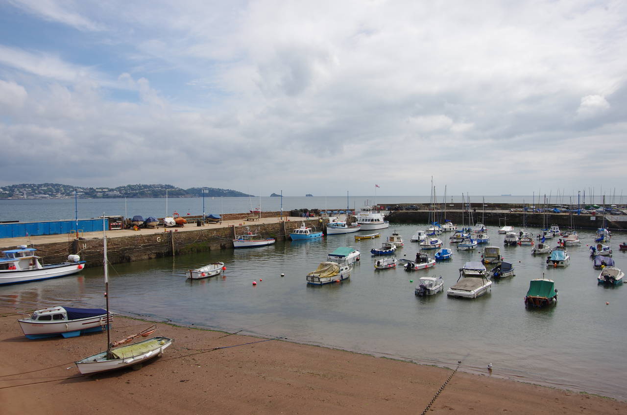
(5) Paignton Harbour

(6) Roundham Head
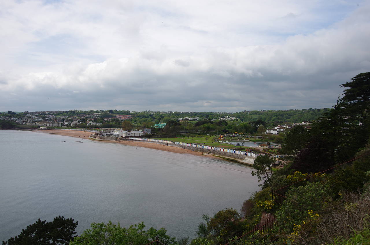
(7) Goodrington Sands
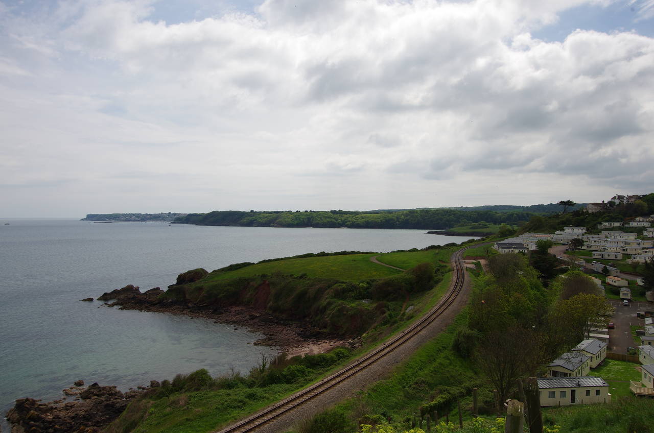
(8) Waterside Holiday Park
At the far end of Paignton Beach, the promenade bends left, passing under an arch of the Harbour Light Restaurant to reach the edge of Paignton Harbour (picture 5). The Coast Path follows Roundham Road along the right wall of the harbour, eventually turning left into Cliff Road and following it past houses up to Roundham Gardens, which occupies the end of Roundham Head.
A tarmac path follows the clifftop around the edge of the headland, circling a short distance from a large house (picture 6). On the far side of the headland, the Coast Path has good views over the beach at Goodrington Sands before descending through more public gardens to join the beachside promenade in front of another long line of beach huts. The promenade is followed all the way to the far end of the 800 metre beach, taking a path under the railway.
The railway here is now reduced to a single track as the National Rail branch line from Newton Abbot ends at Paignton and the line south of Paignton Station belongs to the Paignton & Dartmouth Steam Railway. The heritage railway runs south along the coast from Paignton's restored Queen's Park Station before cutting inland to the Dart Valley where the track follows the banks of the River Dart down to the line's terminus at Kingswear.
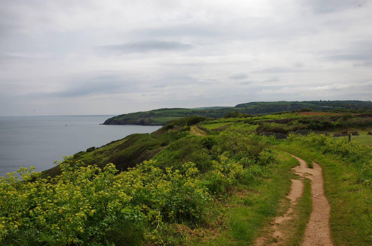
Once under the railway, the Coast Path immediately turns left to join a narrow footpath that runs parallel to the tracks for the next one and a half kilometres, beside the back fences of Goodrington for the first half, before climbing across more open ground to the top of a small hill above the large Waterside Holiday Park. From the hilltop there are views ahead over much of the day’s walk (picture 8).
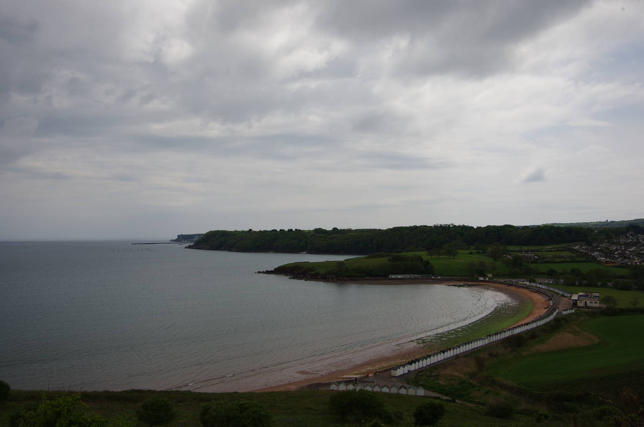
(9) Broad Sands
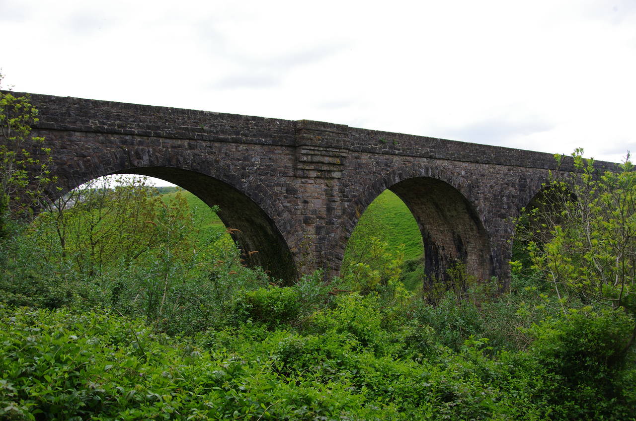
(10) Railway viaduct behind Broad Sands
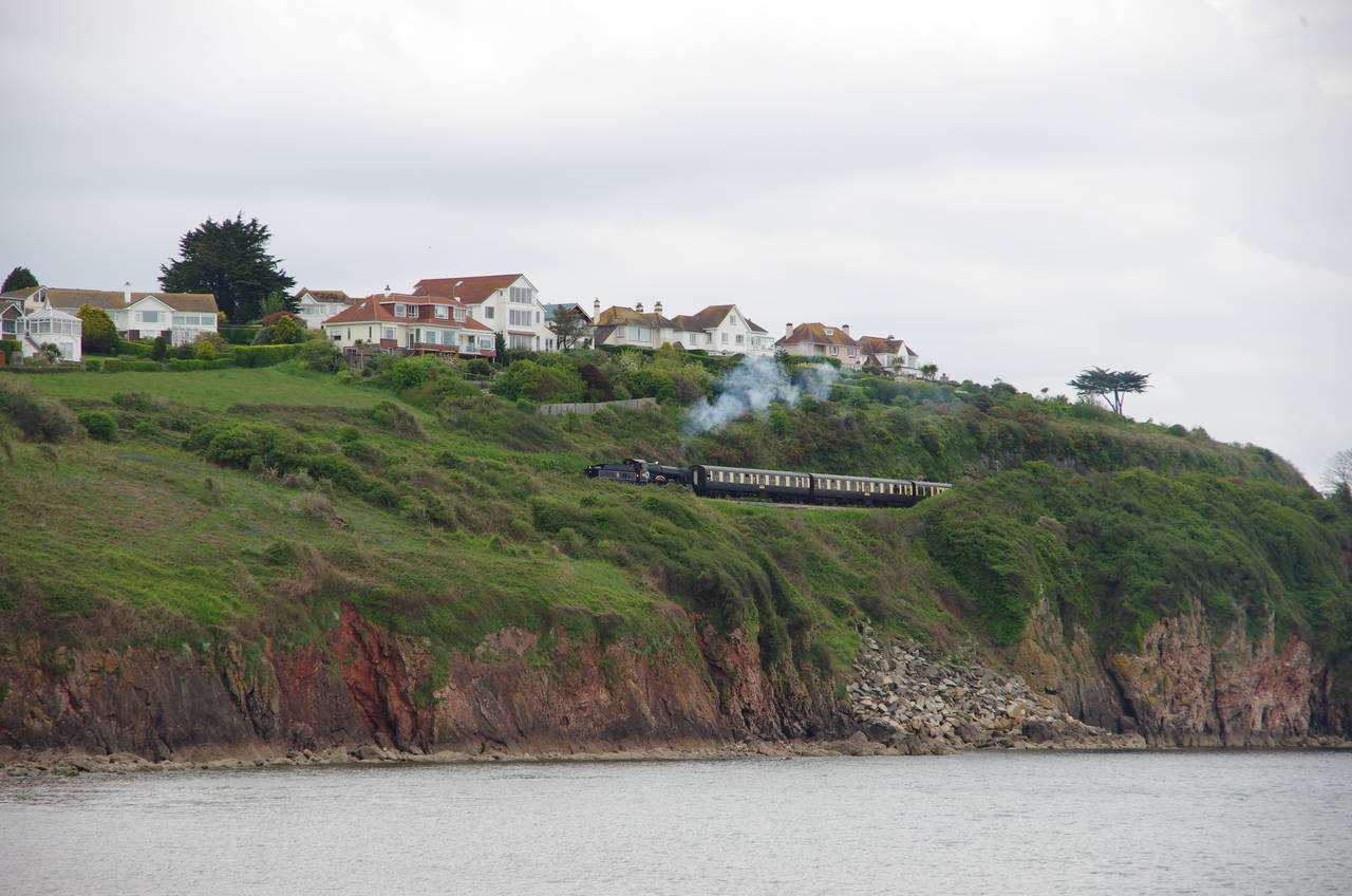
(11) Paignton & Dartmouth Steam Railway
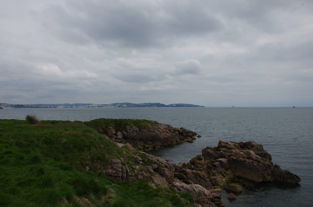
(12) Churston Point
A narrow footpath descends along the edge of the holiday park, dipping down to the level of the railway line before climbing again as the line bears away from the coast behind the cove of Broad Sands (picture 9). Descending some concrete steps, the path meets a track that passes under an impressive stone railway viaduct (picture 10) and soon reaches the promenade at Broad Sands.
Looking back towards Goodrington, I caught sight of one of the Paignton & Dartmouth Steam Railway's locomotives hauling half a dozen carriages in the direction of Kingswear (picture 11). As the heritage railway does not have a turntable, the locomotives actually run backwards for the southbound leg of their journey.
The Coast Path follows the curving promenade around the sweep of Broad Sands and then continues up onto a grassy path around the low headland of Churston Point, where one has good views back across Torbay (picture 12).
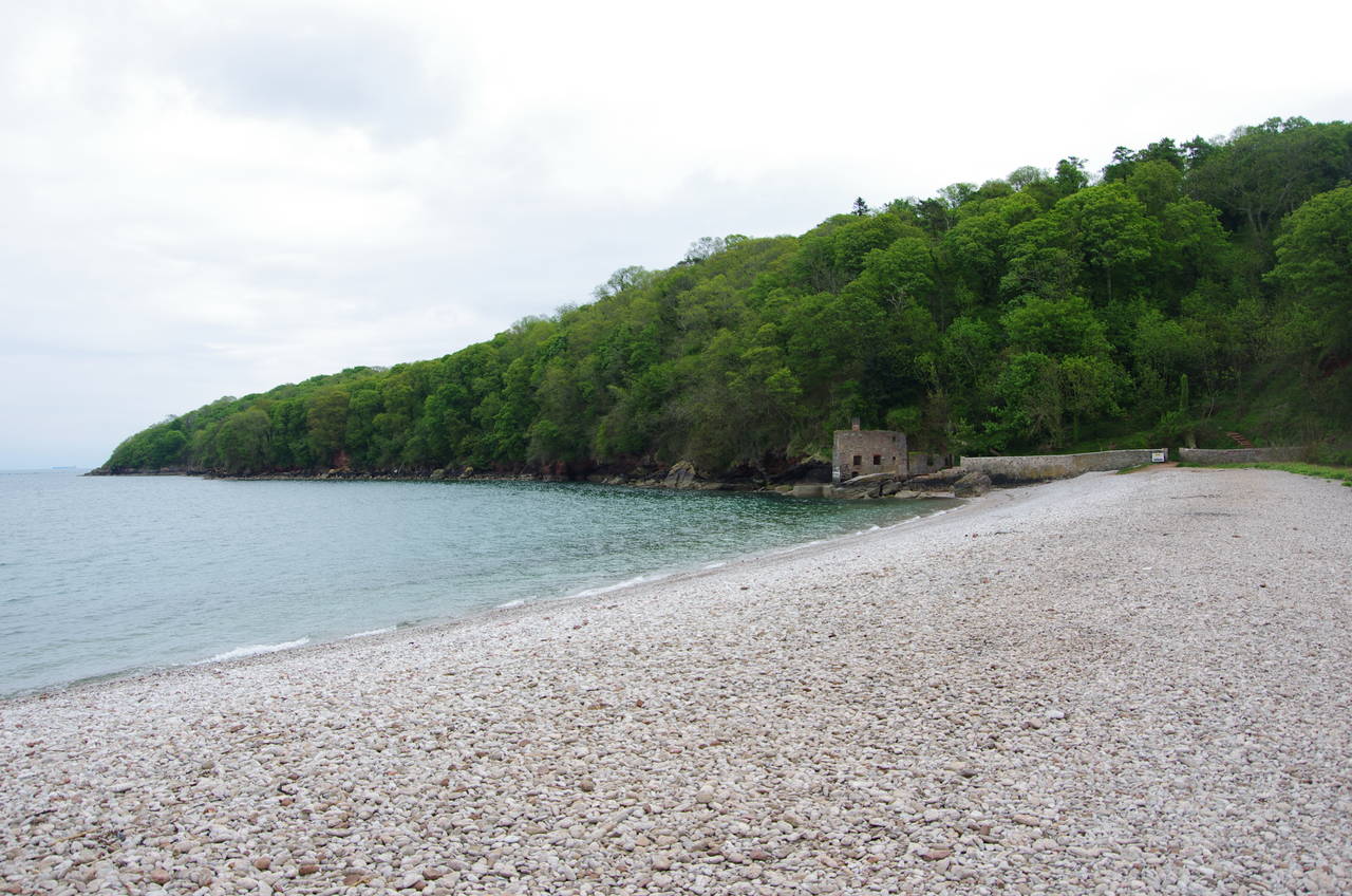
(13) Elberry Cove
(14) Churston Cove
(15) Battery Garden, Brixham
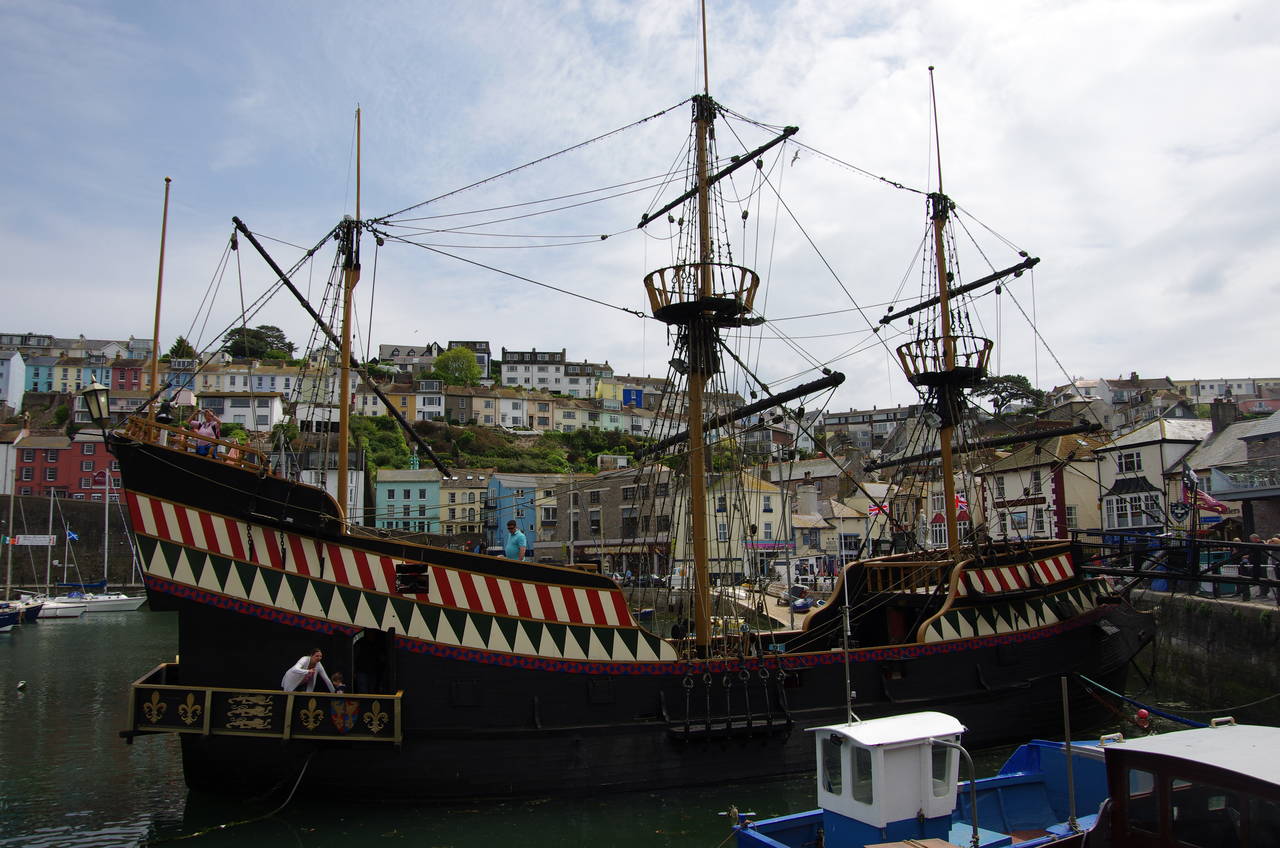
(16) The Golden Hind, Brixham Harbour
After rounding the point the path descends to Elberry Cove, crossing the shingle beach (picture 13) to pass through a gap in the stone wall to the right of a ruined stone building labelled on some maps as Lord Churston's Bathhouse. The path then climbs into Marridge Wood; a long narrow stretch of woodland that separates the Churston Golf Course from the sea. After almost two kilometres in the woods, the path descends steps to Churston Cove (picture 14) crossing the small beach to find a rocky path that climbs through a small wood to Brixham Holiday Park.
The route descends for a short distance on a sunken footpath, turning left past a barrier to descend to Fishcombe Cove, where a path leads through trees and into Battery Gardens (picture 15), where a gun battery stood from 1586 until after the Second World War.
The Coast Path now runs along the low cliffs bordering Brixham's outer harbour, which is protected by a 900 metre long breakwater. Leaving Battery Gardens, the path continues along the seafront all the way to Brixham's inner harbour, where a replica of The Golden Hind is moored by the Quay (picture 16). The original ship was sailed around the world by Francis Drake between 1577 and 1580, making him the first Englishman to circumnavigate the globe.
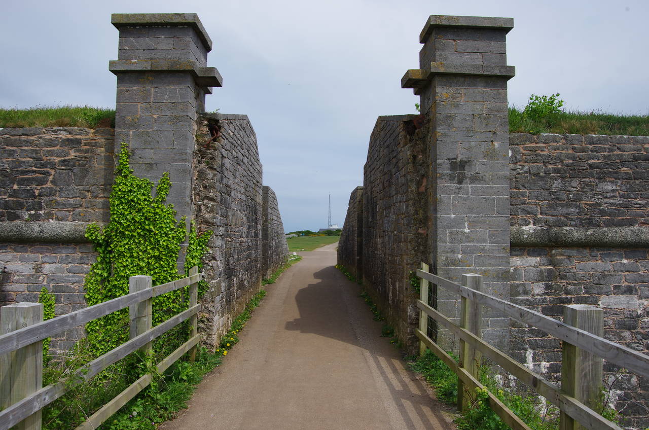
(17) Berry Head
(18) Berry Head Lighthouse
(19) Durl Head
(20) St Mary's Bay
The Coast Path runs along the quayside all the way around the harbour to the landward end of the breakwater, where a ramp leads steeply up to Berry Head Road. A couple of minutes walk along the road a tarmac path on the left leads between houses and along the edge of a clifftop picnic area. Below the cliff is the large Shoalstone Outdoor Pool, which had been drained for cleaning and repainting. With the work about half finished, the shallow end of the pool was spotlessly clean, while the deep end looked rather grimy and uninviting.
At the end of the picnic area, the route crosses a carpark and rejoins Berry Head Road, which soon swings right to pass by the entrance of the Berry Head Hotel. A few metres further, the path leaves the road at a large sign proclaiming "Berry Head, 100 million years in the making...". The path passes through quiet woods to reach the access road of a large limestone quarry situated on the north side of the headland of Berry Head. Around a quarter of the mass of the headland was removed before operations ceased in 1969.
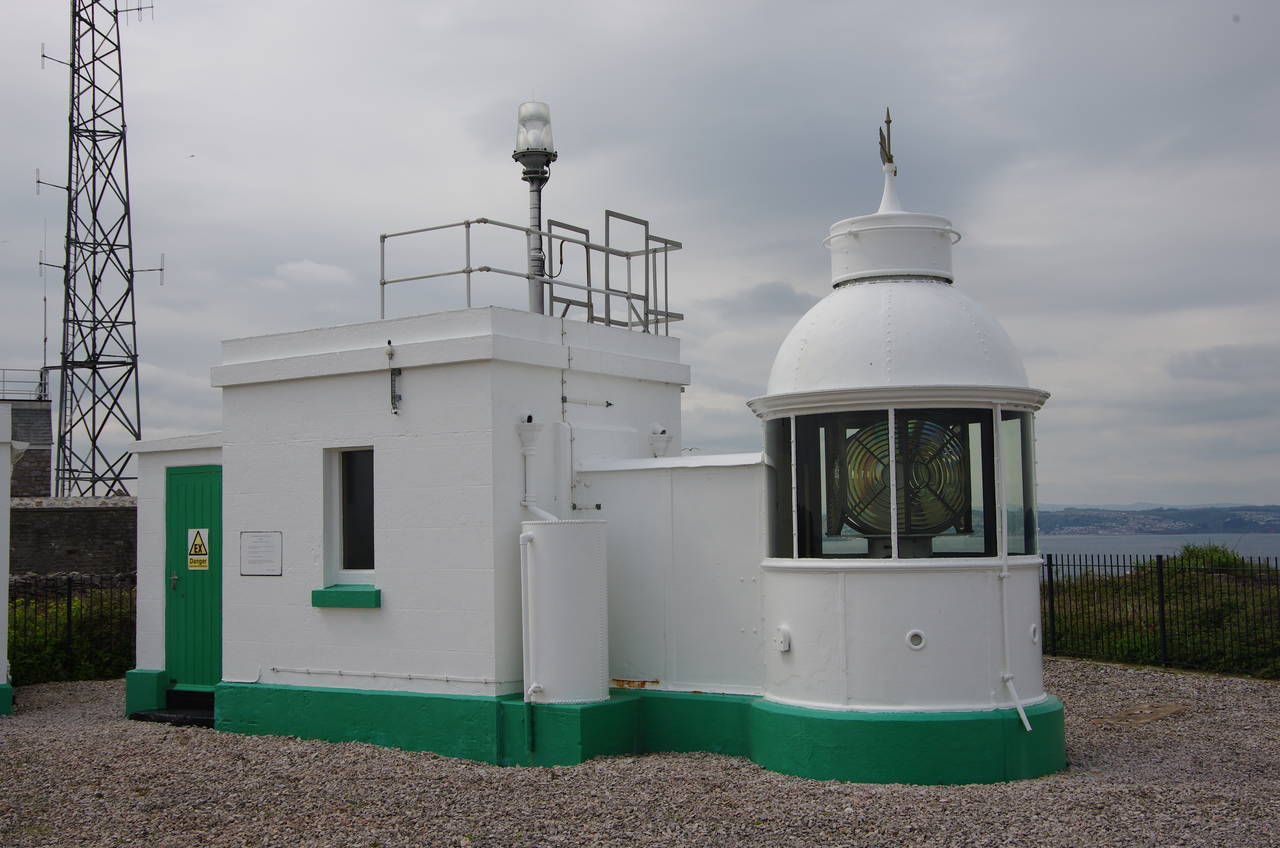
The Coast Path follows the road away from the quarry, soon reaching a junction where another access road heads into the fortress that was built on Berry Head in 1793 (obliterating the remains of an Iron Age fort in the process) to defend Torbay during the Napoleonic Wars. Here I left the Coast Path to follow the road through the impressively thick walls of the fortress (picture 17) and down to the tip of the headland, passing an old sentry building and a coastguard lookout station before wandering up to the diminutive lighthouse on the tip of the headland (picture 18). Built in 1906, this is the smallest lighthouse in the British Isles, the 58-metre high headland giving it sufficient elevation to shine its beam 22 kilometres out into the English Channel.
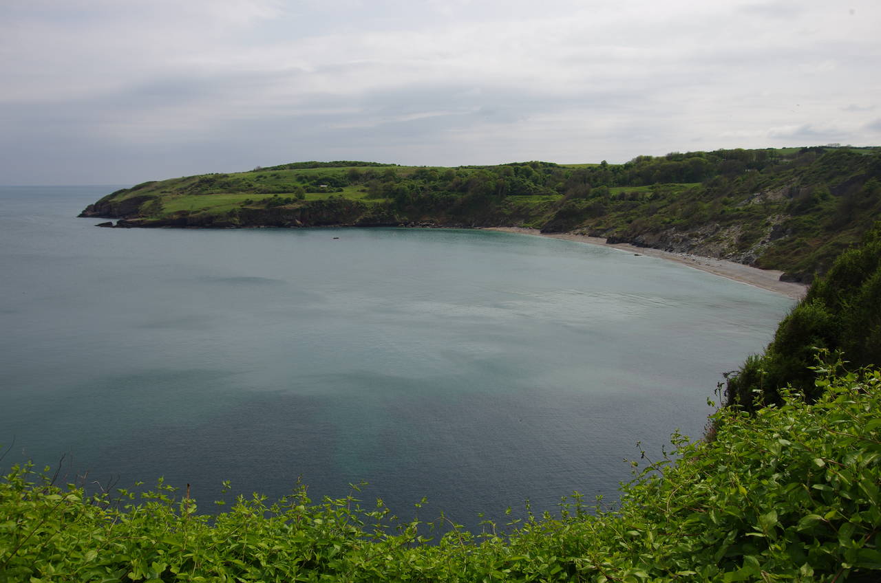
Returning to the Coast Path after the 1000-metre round trip to the lighthouse, I continued along the quarry access road, which runs southwest away from Berry Head, crossing the carpark of Berry Head National Nature Reserve. Just after the carpark, some steps on the left take the path away from the road, through a patch of scrub and back to the clifftops, now on Durl Head (picture 19). Sticking close to the clifftop the path circles gradually around St Mary's Bay (picture 20), crossing a number of stone stiles along the way. After about a kilometre, the path becomes more enclosed as it skirts around the perimeter of the Riviera Bay Holiday Park on the southern fringes of Brixham.
On the far side of the holiday park, the path turns left over another stone stile. This is where I left the Coast Path for the day, with another 16.3 kilometres of the official route covered, not counting the diversion to the tip of Berry Head. From here, it was about 20 minutes walk through the back streets of Brixham to return to the harbour, where I did a bit more exploring before catching a bus back to Torquay in time to look around the town centre and Torre Abbey Gardens before sunset.