SOUTH WEST COAST PATH NATIONAL TRAIL
Stage 12: Exmouth to Teignmouth
Friday, May 17, 2013
(1) River Exe
(2) Starcross
(3) Atmospheric Railway Pumping Station
(4) Cockwood Harbour
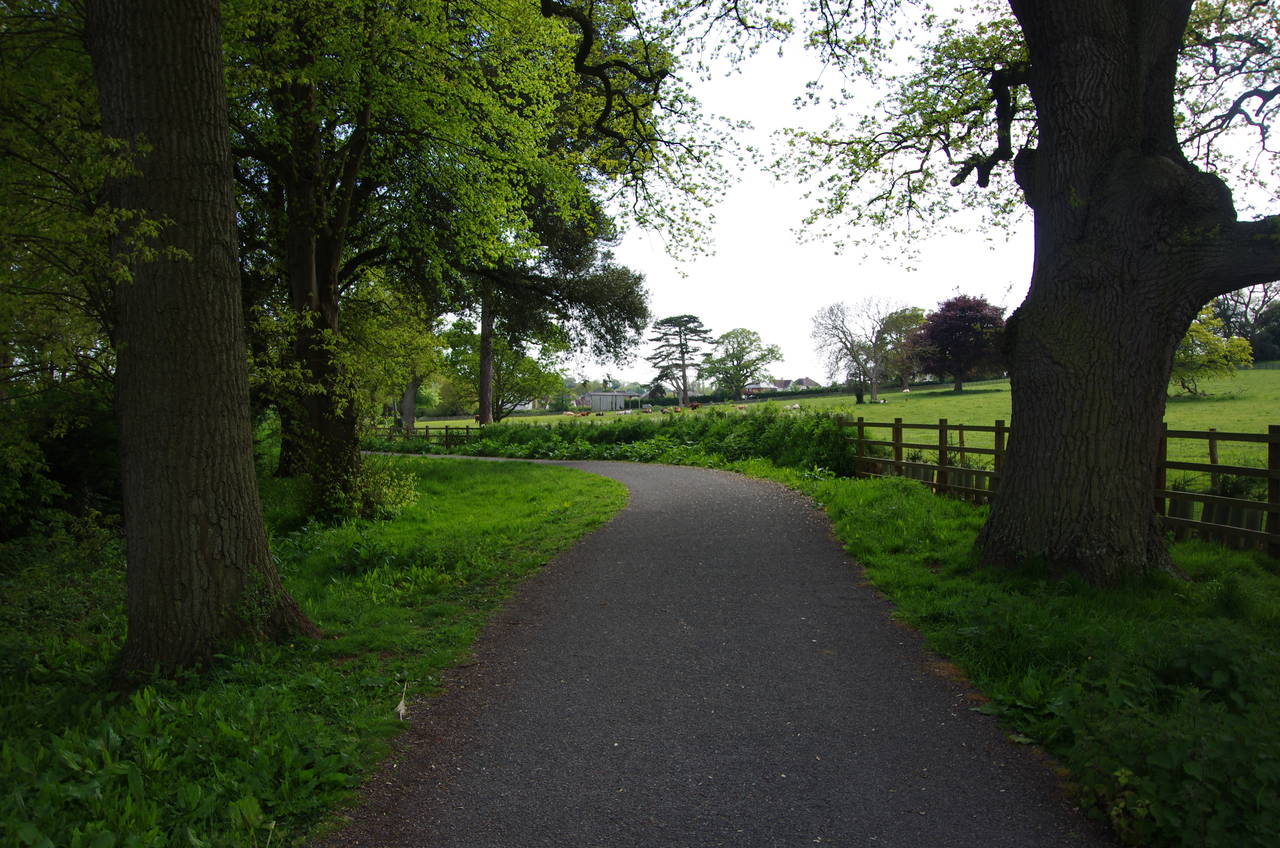
I made quite a late start to this stage of the walk, as I had read that most of this stretch of the Coast Path can only be walked close to low tide. As it turned out I could have gone an hour or so earlier, as the path seems to be usable for at least a couple of hours either side of low tide.
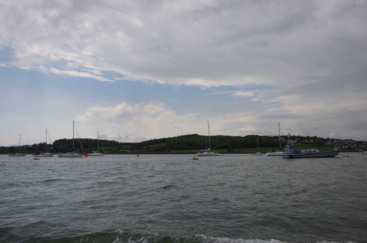
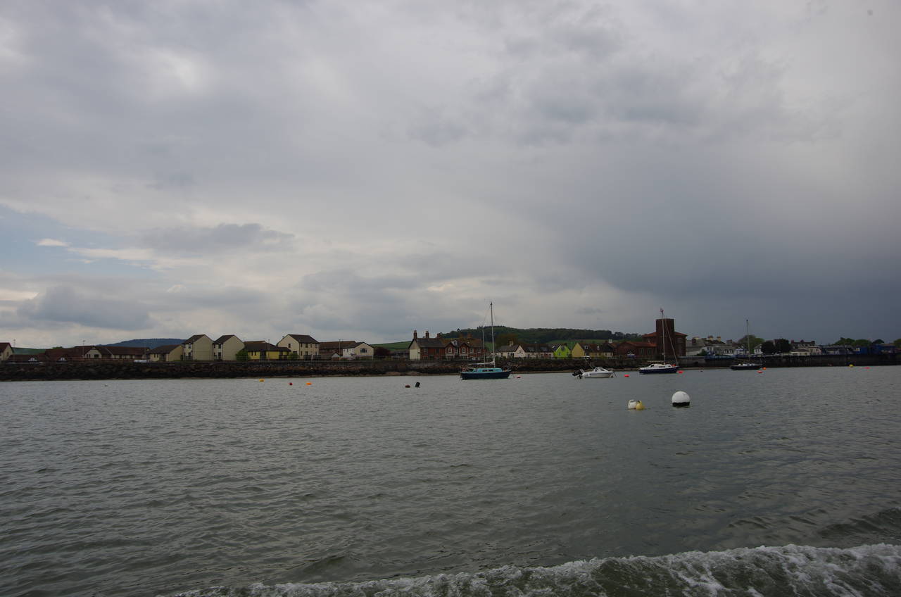
After spending the morning and early afternoon walking the Exe Estuary Trail between Topsham and Exmouth, I wandered over to the Exmouth Marina to catch the 2:30pm ferry across the River Exe to Starcross. The ferry heads out into the deep channel in the middle of the estuary (picture 1) before heading a couple of kilometres upstream to Starcross (picture 2).
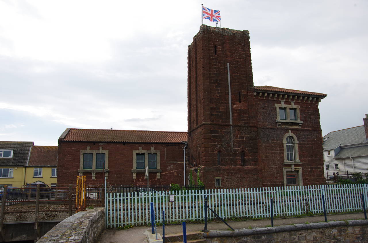
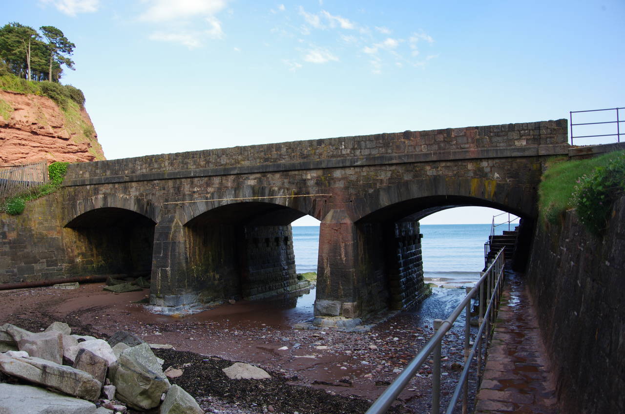
The ferry tied up to a pier that stands in front of an old stone building (picture 3) that was once a pumping station for Brunel's experimental Atmospheric Railway, which ran from Exeter to Newton Abbott. A dozen of these pumping stations, containing stationery steam engines, powered the railway by literally vacuuming the trains along the tracks by means of a pipe laid between the rails. The railway operated passenger services for a few days short of a year in 1847/8, achieving speeds of up to 102 km/h before being forced to revert to using regular steam locomotives by technical and financial difficulties. The railway line itself remains one of Brunel's finest engineering achievements, as we'll see a bit later.
From the pier, one must walk halfway along one of the platforms of Starcross railway station to cross the Exeter to Plymouth railway line to the busy A379 road. The Coast Path heads down the pavement on the other side of the road, which runs southward alongside the railway line on the edge of the Exe Estuary. The path soon leaves Starcross behind, passing the Oak Meadow Golf Club, where a sign beside the road advertised the Starcross Scarecrow Festival, an annual event that has been held each June since 2005.
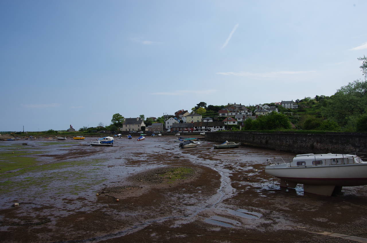
Beyond the golf course, the road reaches the village of Cockwood and skirts around the back of the harbour (picture 4), which is separated from the Exe by the railway embankment. The harbour had almost completely drained of water on the falling tide.
(5) Approaching Dawlish Warren
(6) Dawlish Warren
(7) Langstone Rock
(8) View towards Dawlish
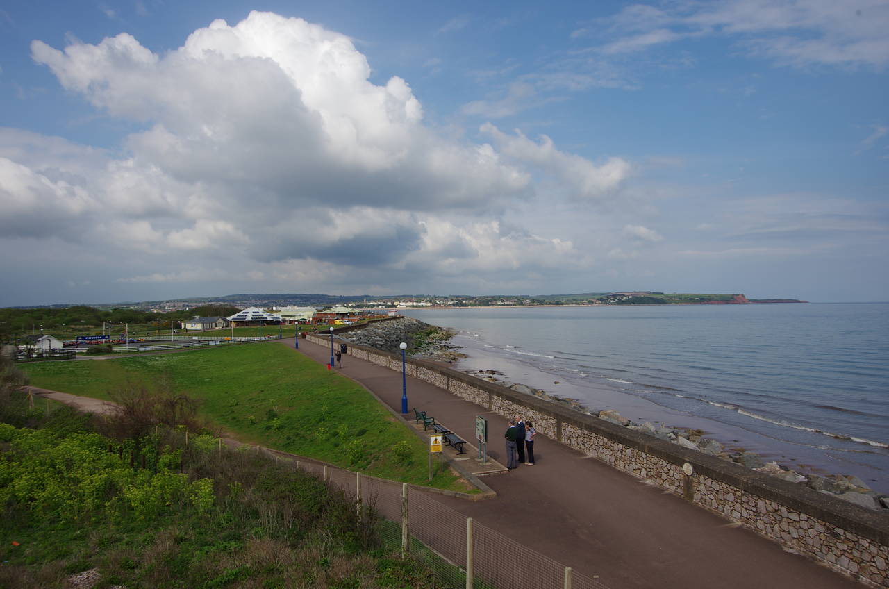
South of the harbour the road draws up beside the railway line again and the Coast Path follows it for another couple of kilometres passing through the hamlet of Eastdon on the way to the resort town of Dawlish Warren. For part of the way bicycle paths take the path off the road (picture 5) before the route returns to the pavement on the edge of the town. After passing various caravan parks and motels, the main road bears right and the Coast Path bears left on Beach Road into the carpark of Dawlish Warren Station.
At the far end of the carpark, the route crosses a footbridge over the railway to join a concrete path along the sea wall. From atop the bridge there are views across the mouth of the Exe towards Exmouth (picture 6).
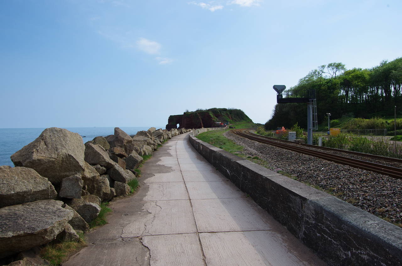
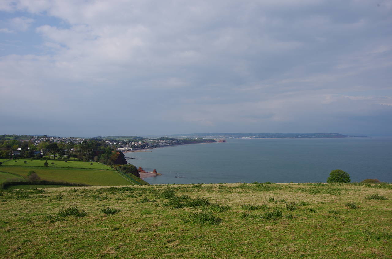
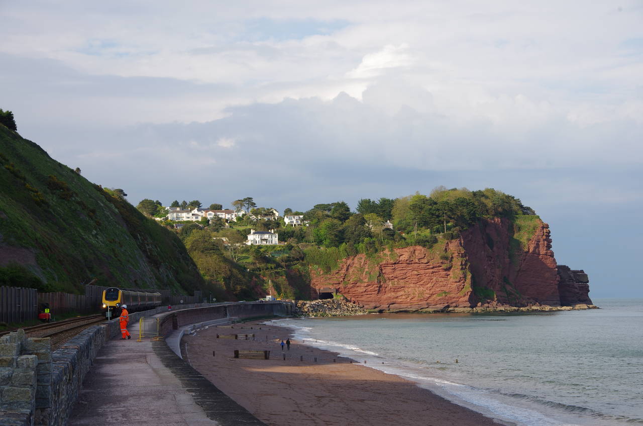
The Coast Path follows the sea wall southwards down to the red sandstone outcrop of Langstone Rock (picture 7), which marks the western extremity of the Exe Estuary. The coastline bends right behind the rock, and once around the corner there are views across the bay towards the town of Dawlish (not to be confused with Dawlish Warren) and beyond (picture 8).
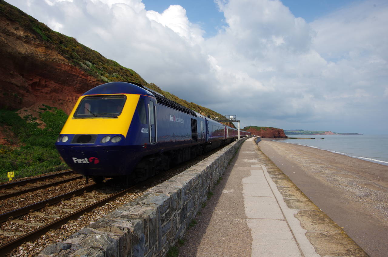
(9) First Great Western Intercity 125
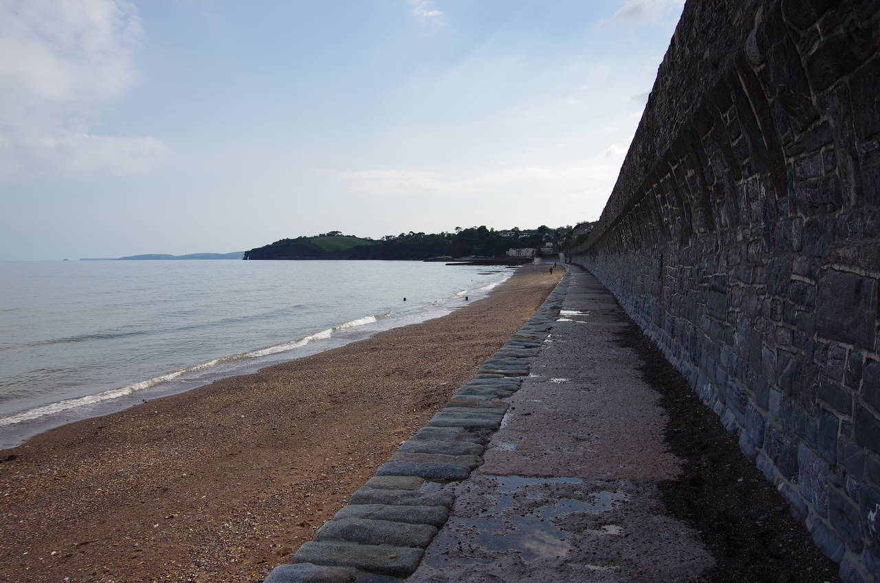
(10) Low-tide path approaching Dawlish
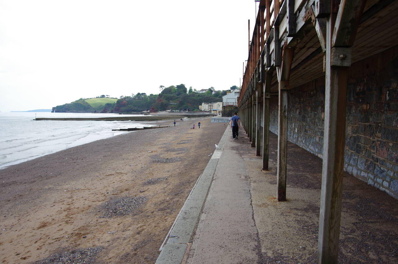
(11) Path next to Dawlish Station
(12) Dawlish
The railway line is quite busy, being the only line connecting Devon and Cornwall to the rest of England, and I was passed by trains every few minutes, including several of the high-speed Intercity 125's operated by First Great Western (picture 9). These diesel trains have a top speed of 125 miles per hour (201 kilometres per hour) and are used for many of the long-distance services between London and the south-west and Wales.
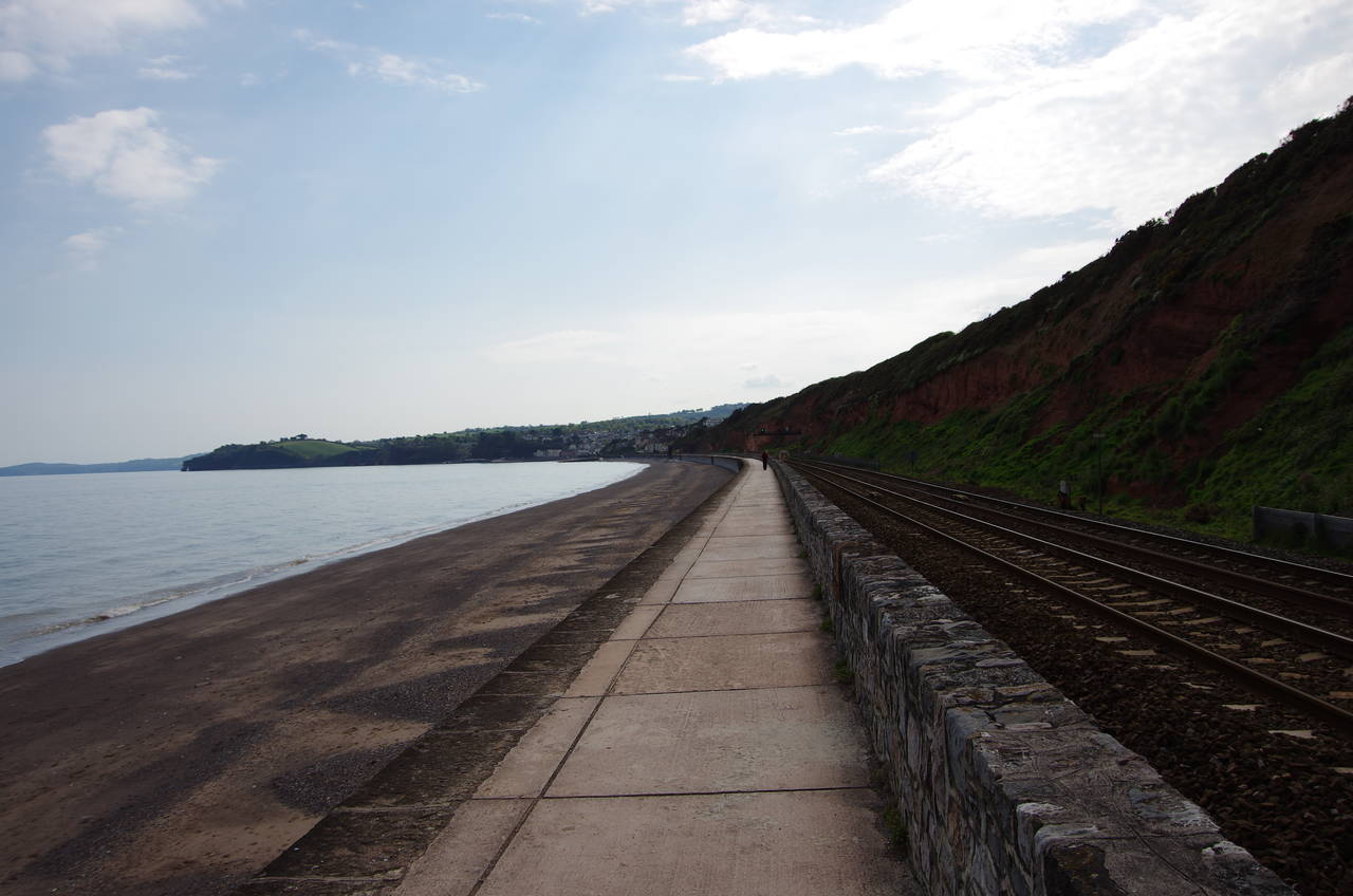
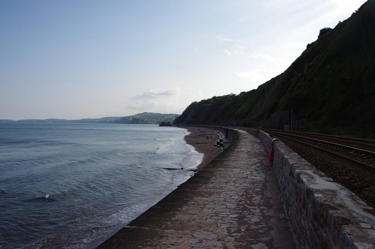
When the path along the sea wall reaches the edge of Dawlish, a section of about 300 metres is several metres lower than the rest (picture 10). This section of the path is underwater at high-tide and was covered with sand and pebbles washed up onto it by the waves.
The sea wall that protects the railway line is constantly being undermined by the sea, regularly necessitating expensive repairs. In February 2014 a large section of the sea wall and the trackbed was washed away in a fierce storm, leaving part of the railway line hanging in mid air. Amazingly, the damage was repaired in just under two months and the line was reopened in early April.
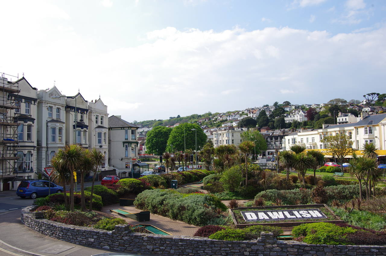
At the end of the low section, the path climbs a ramp back up to the level of the railway tracks, but dips down again just before a footbridge at the eastern end of Dawlish Station. The path runs alongside the seaward side of the station, with one of the platforms overhanging the path (picture 11). At the far end of the station the Coast Path leaves the sea wall, passing under the railway to emerge on Station Road opposite an attractive public garden (picture 12).
(13) Lea Mount
(14) Dawlish
(15) Lea Mount Gardens
(16) Path to Horse Cove
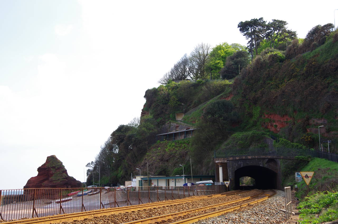
From the station, the Coast Path heads along the landward side of the tracks on Marine Parade, which approaches Lea Mount. The railway tracks disappear into a tunnel through Lea Mount (picture 13) -- the first of five tunnels through the cliffs in quick succession that help to make the line one of the most scenic in England, and all the more impressive considering that they were built in the 1840's using picks and shovels.
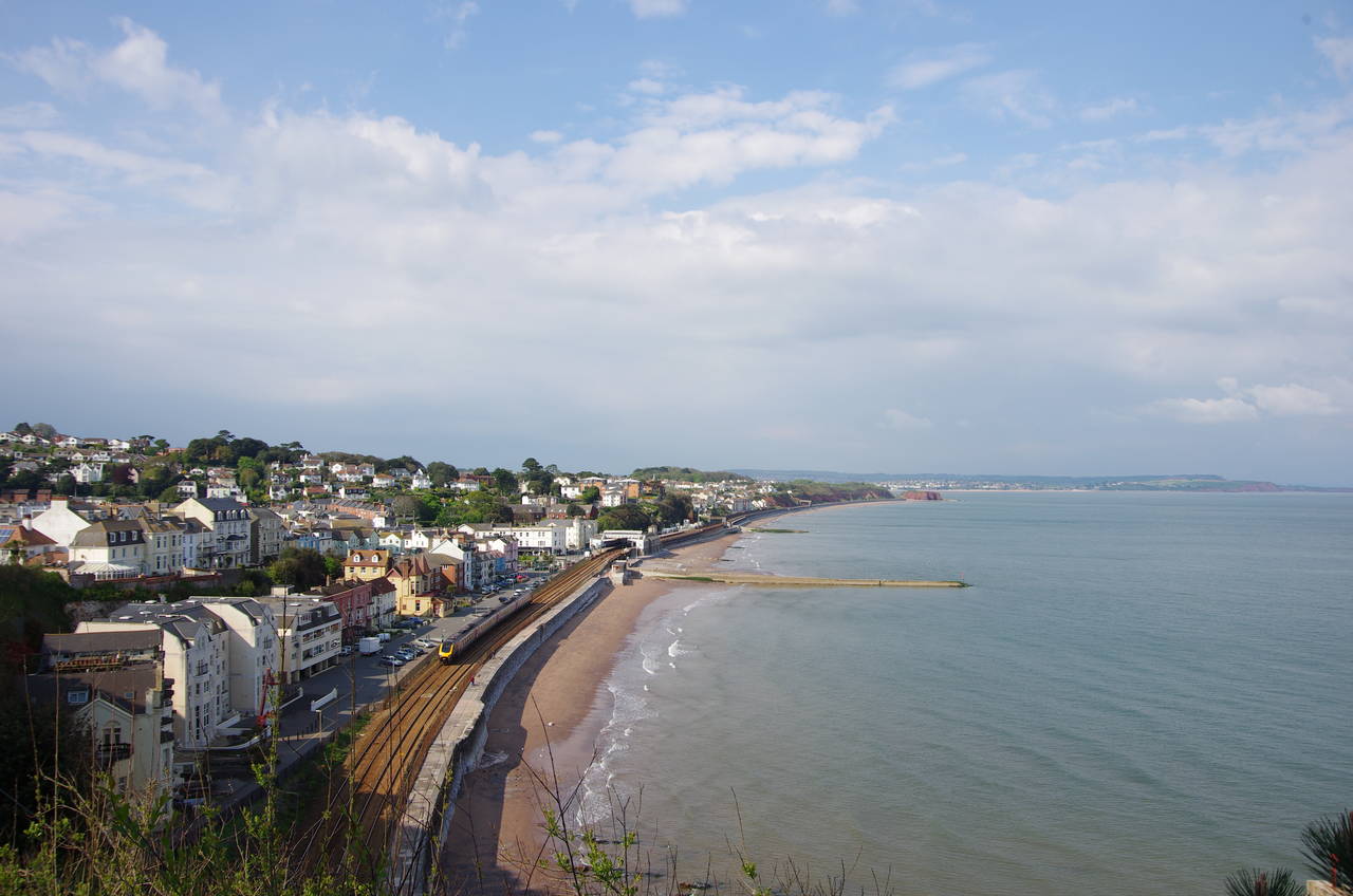
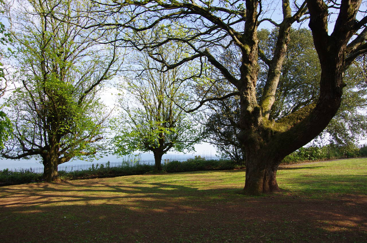
At the end of Marine Parade, the route zigzags up the side of Lea Mount above the tunnel entrance on a narrow footpath that gives great views back over Dawlish and the mouth of the River Exe (picture 14). At the top of the climb the path enters the peaceful Lea Mount Gardens (picture 15), crossing diagonally to join Teignmouth Road for 100 metres before bearing left down a shady footpath to Old Teignmouth Road. The road bends back to the right about half way along and eventually returns to Teignmouth Road, where the Coast Path immediately turns left down some wooden steps to take a fenced gravel footpath down towards Horse Cove (picture 16).
(17) View back from East Down
(18) Narrow path under railway
(19) Path beside railway
(20) View back to Holcombe
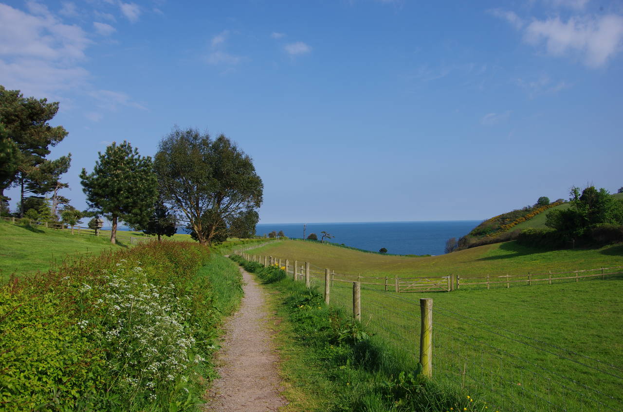
The path reaches the cliff edge above Horse Cove and then turns right to cross a steep-sided combe to East Down. On regaining the hilltop there are more good views back towards Dawlish and Exmouth (picture 17), before the path becomes enclosed by scrub as it winds it's way back inland between fields to reach Windward Lane on the edge of the town of Holcombe.
About thirty metres to the right the route rejoins Teignmouth Road, following it for about 100 metres until Smugglers Lane curves away to the left just beyond a bus stop. The lane leads down to the coast once again, where the route takes a narrow and slippery path under the railway line (picture 18) to join another section of the sea wall (picture 19). The path under the railway is also under water at high tide and an alternate route continues along Teignmouth Road instead of joining Smugglers Lane.
As the path atop the sea wall curves gently down the coast towards Teignmouth, there are some nice views back to Holcombe and the last of the five railway tunnels through the cliffs (picture 20).
(21) Sprey Point
(22) Teignmouth
(23) Grand Pier
(24) Teignmouth Lighthouse
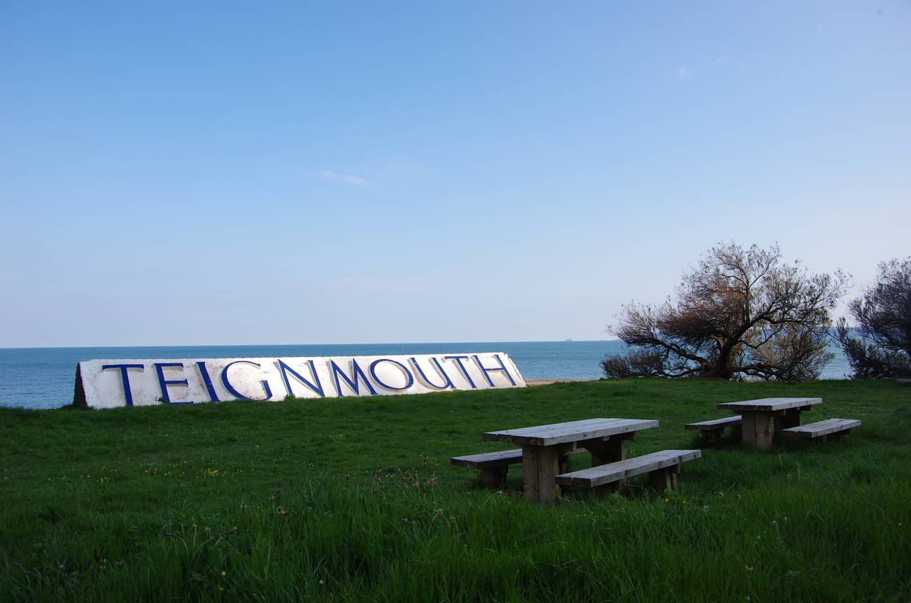
About a kilometre along the sea wall the path passes by an old quay at Sprey Point that is now home to a picnic area and a large sign (picture 21) that may prove helpful to any train passengers who happen to have forgotten where they are. In several locations along this stretch of the path, work was being carried out to prevent the crumbling sandstone cliffs from collapsing onto the railway line.
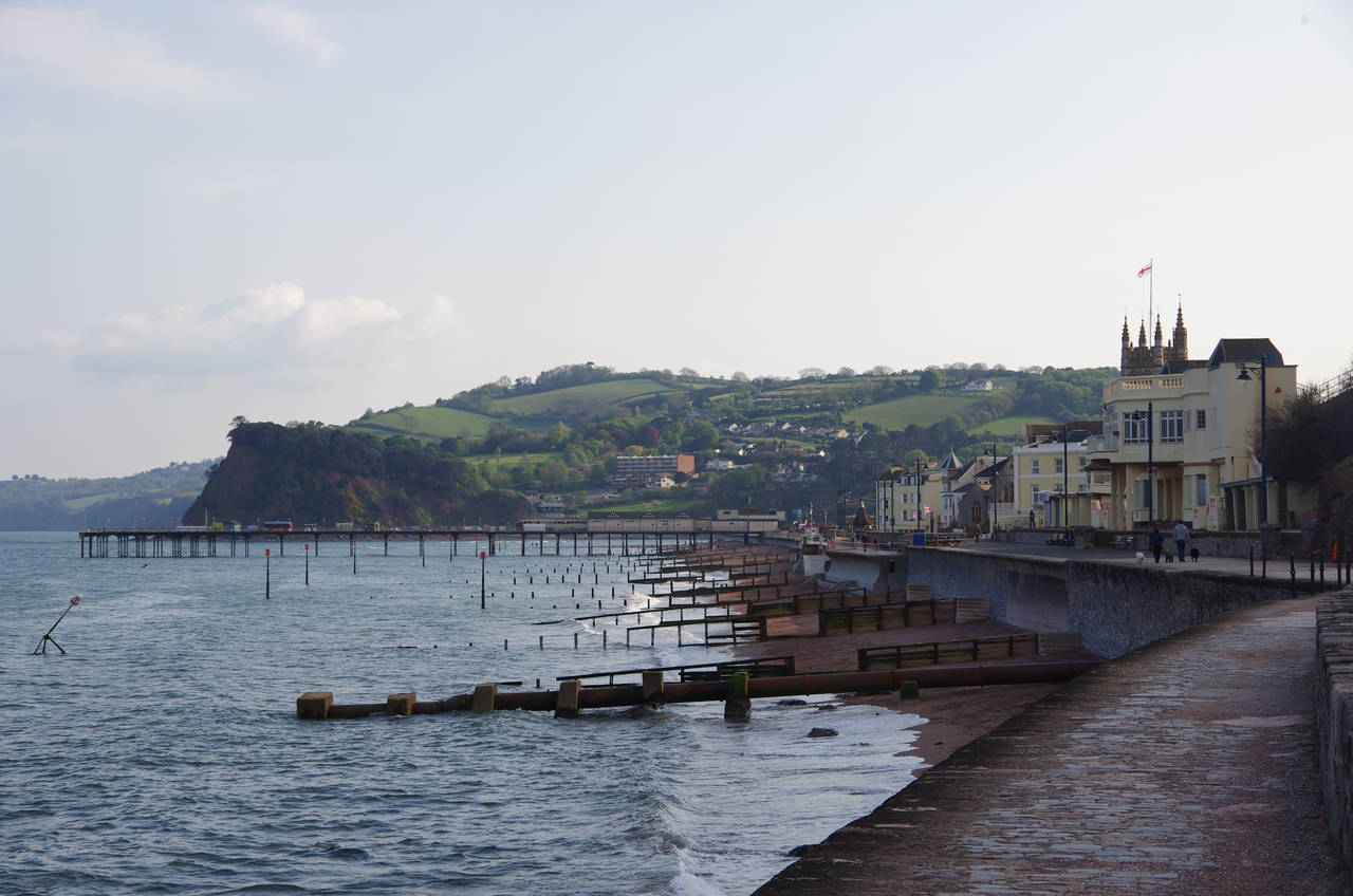
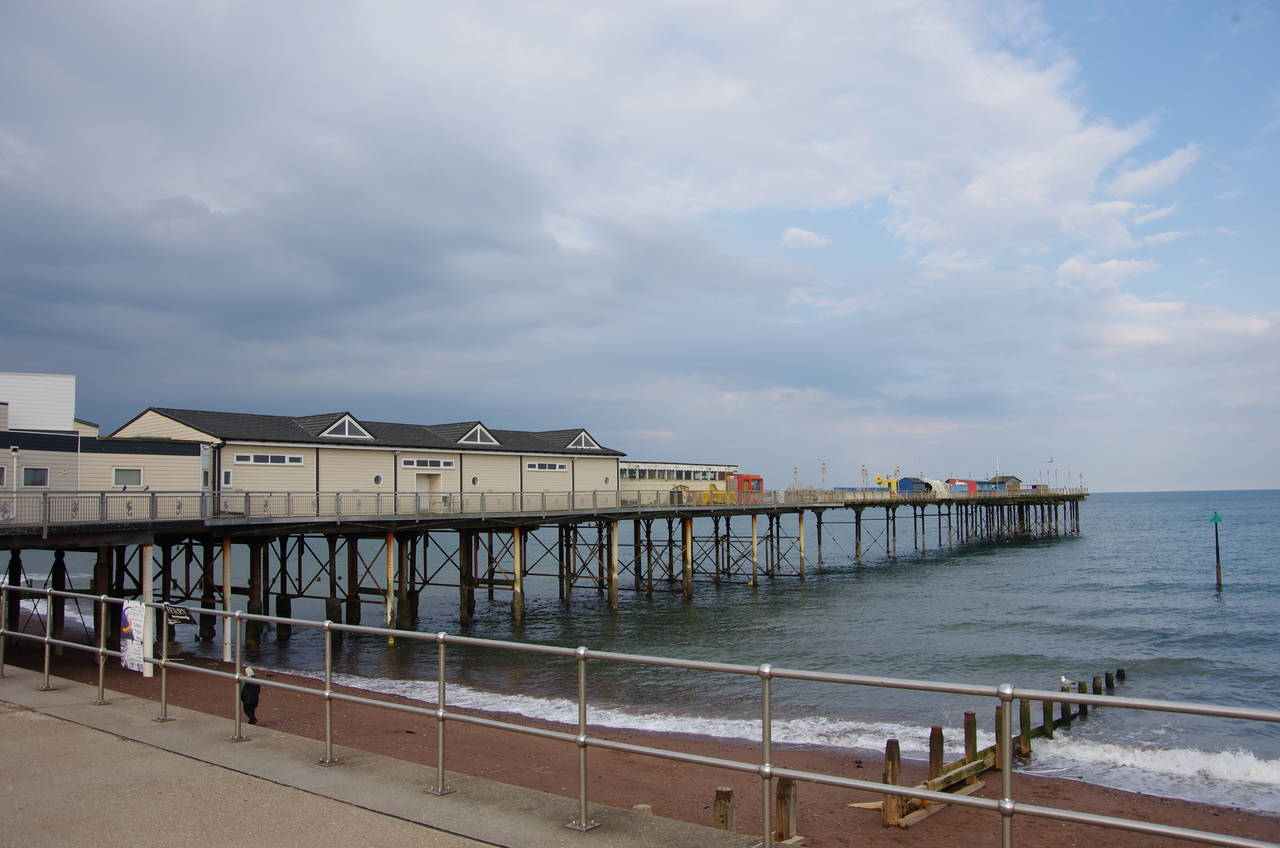
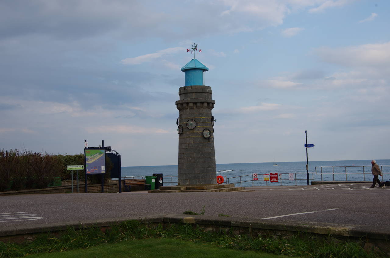
After another kilometre the path reaches the edge of Teignmouth, where the railway line finally parts company with the coast and cuts across the back of the town before heading along the bank of the River Teign to the town of Newton Abbot. The Coast Path, however, continues along Teignmouth's seafront (picture 22), passing the pier (picture 23) and a small lighthouse dating from 1845 (picture 24) before cutting across the narrow peninsula that separates the seafront from the harbour on the River Teign.
A pedestrian ferry crosses the harbour to Shaldon on the far bank of the river, but this was the end of the afternoon's walk for me, with exactly 13 kilometres completed. After wandering around the town centre for a while I caught a train for the scenic sunset journey back along the coast and the River Exe to Exeter.