SOLENT WAY
Stage 4: Lymington to Milford-on-Sea
Sunday, May 13, 2012
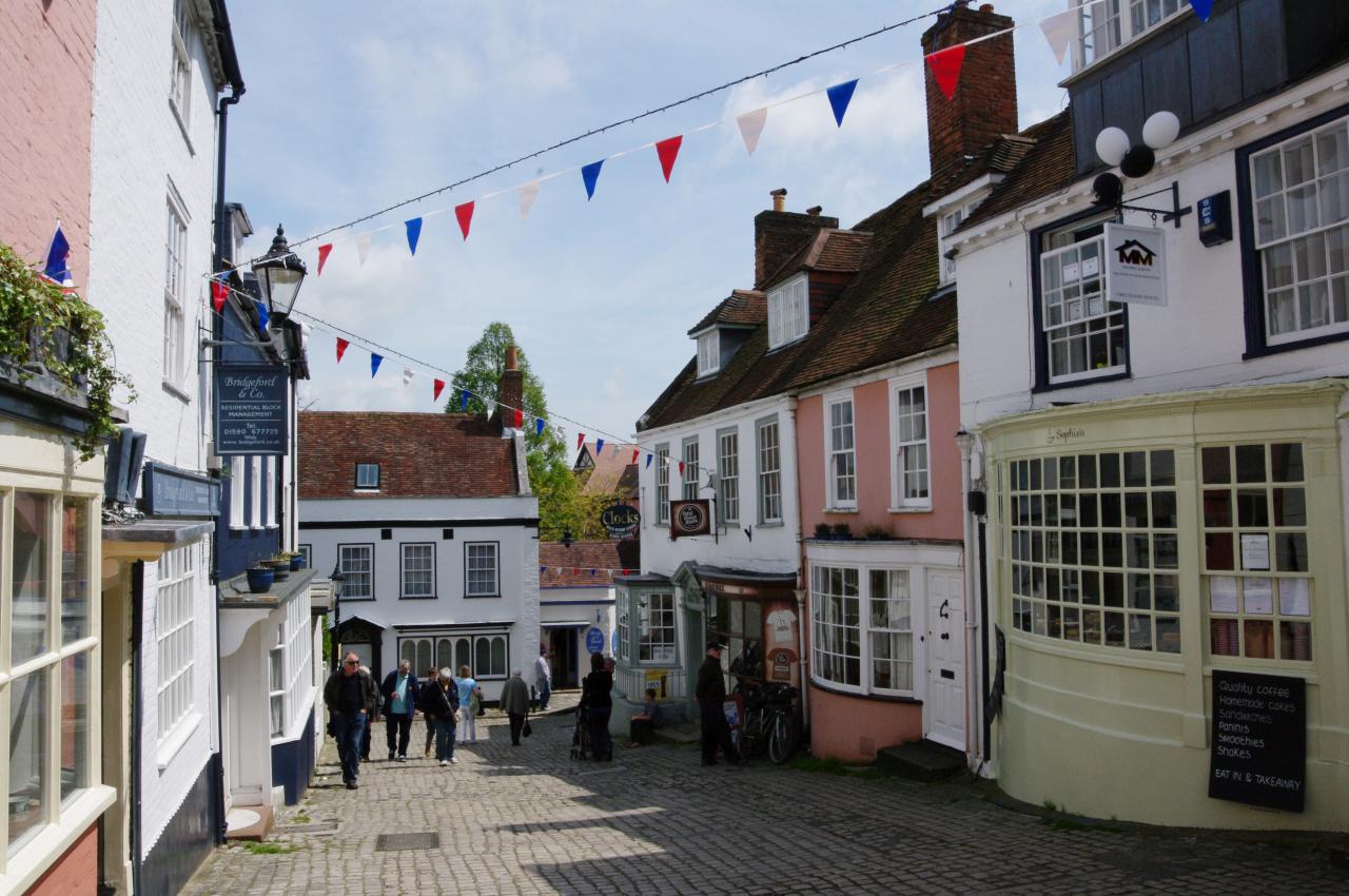
(1) Quay Hill, Lymington
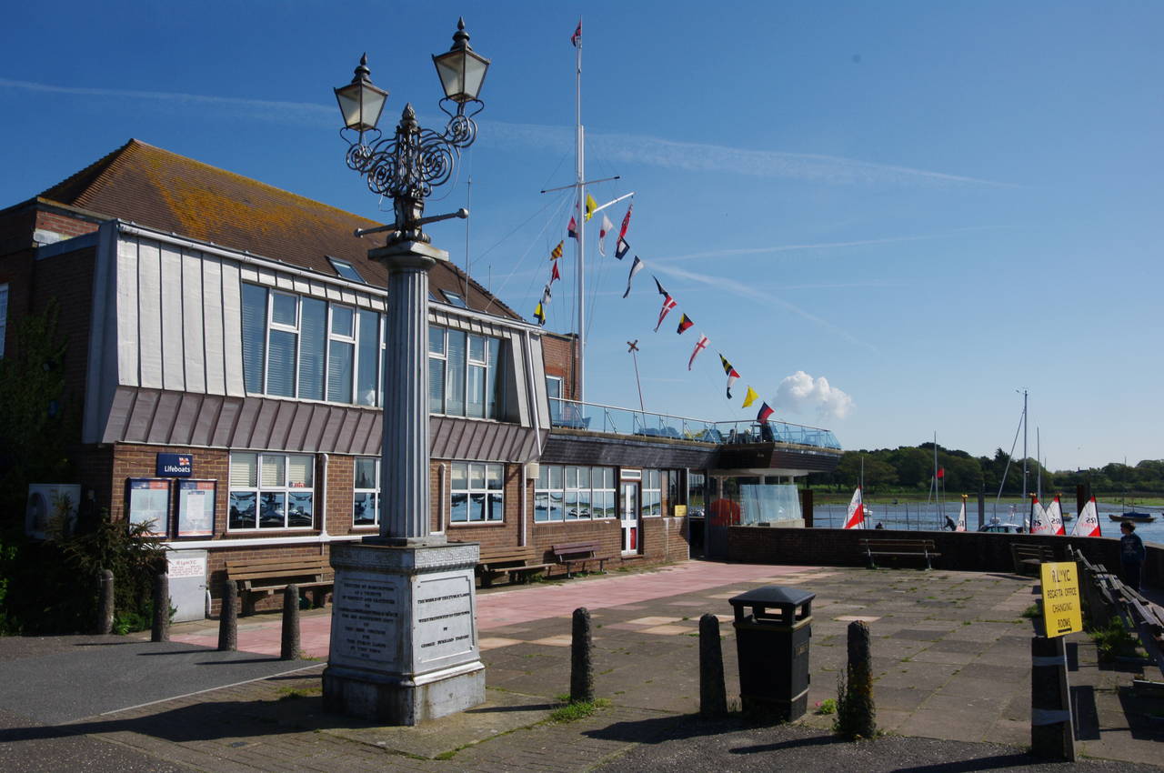
(2) Lymington Town Quay
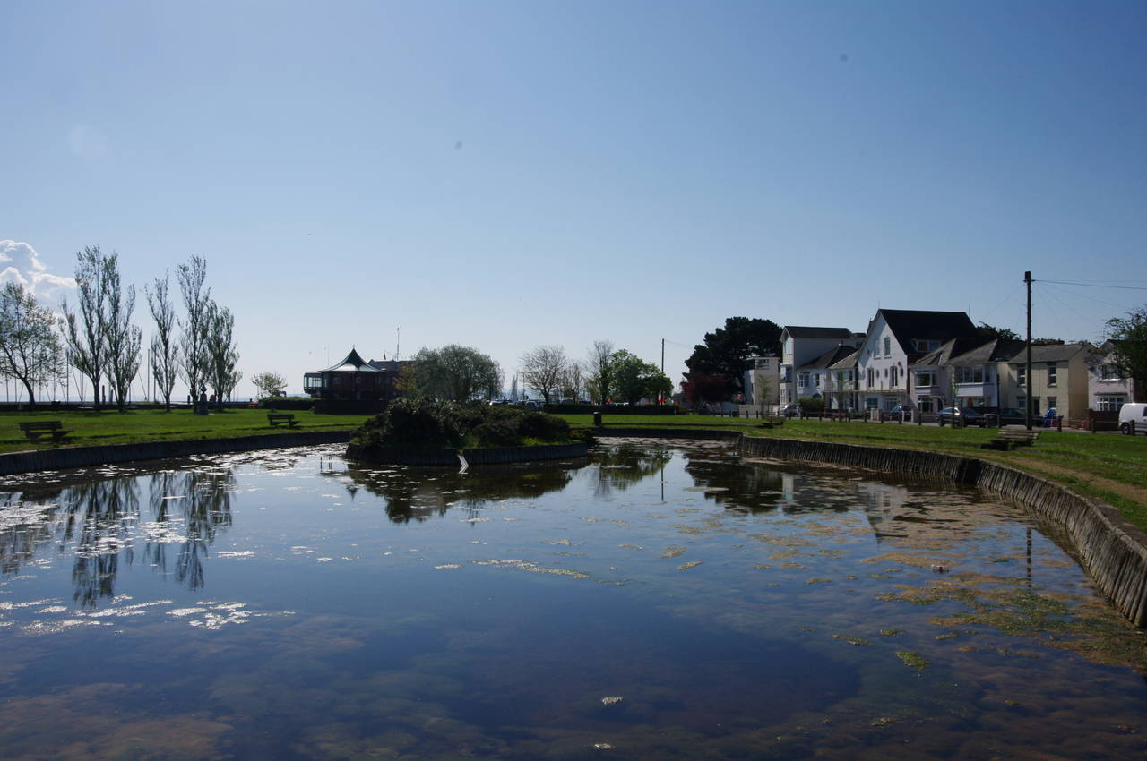
(3) Bath Road Recreation Ground

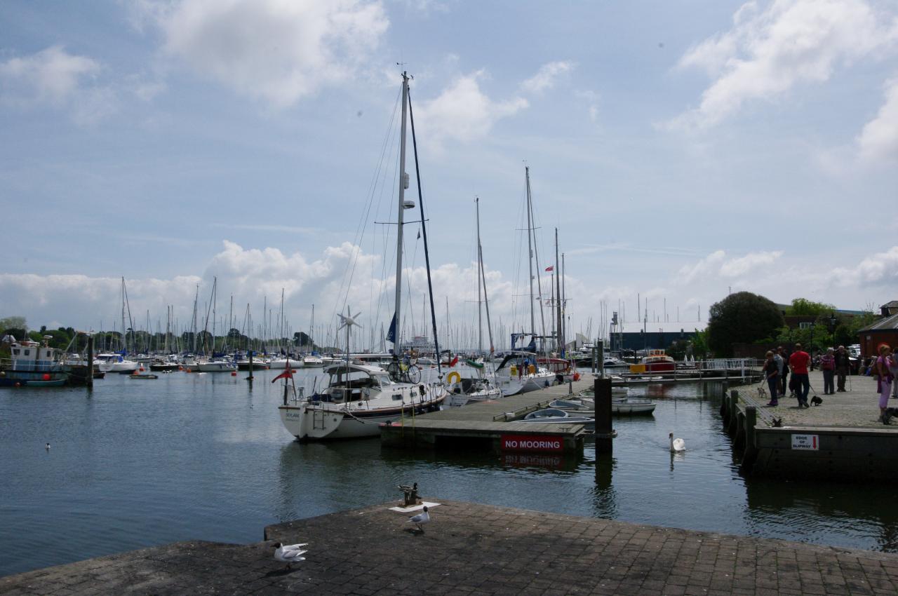
(4) Lymington Marina
My final day on the Solent Way began at the foot of Lymington's High Street, from which I walked down the steep cobbled Quay Hill (picture 1), which soon bends round to the right to run along the Town Quay (picture 2).
From the Quay, the Solent Way continues ahead along Quay Road, which becomes Bath Road after the next junction, running past a large boatyard to the Bath Road Recreation Ground. The route cuts across the recreation ground, passing an ornamental pond in the middle (picture 3) before reaching the water's edge at the Lymington Marina (picture 4). Across the river from the marina is the Lymington Pier ferry terminal, where a car ferry was waiting to depart for Yarmouth on the Isle of Wight.
(5) Gas lighting monument
(6) Lymington Sea Water Baths
(7) Path beside Normandy Marsh
(8) Normandy Marsh
The Solent Way heads downstream along the embankment, soon passing the Royal Lymington Yacht Club, where there is another monument to Admiral Sir Harry Neale who gave the town the iron columns used to provide gas street lighting for the first time on 20th September 1832 (picture 5).
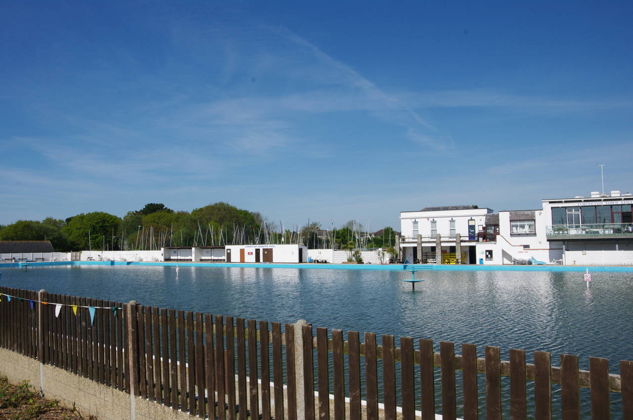
After crossing a slipway, the route heads to the left of the offices of the Lymington Sailing Club and along the sea wall around two sides of the Lymington Sea Water Baths, a public swimming pool dating from 1833. To the left of the pool is part of a large marina and at the end of the pool the path continues ahead into the marina's car park, where there were many more boats out of the water.
Beyond the marina's offices, I found a Solent Way signpost on the right of the road pointing vaguely towards a line of closely parked boats where there was no obvious path. About thirty metres further along on the left, I found a more helpful sign (though rather well hidden behind a small palm tree), pointing along a roped off path between the boats. This path leads to the edge of the Normandy Marsh at the mouth of the Lymington River.
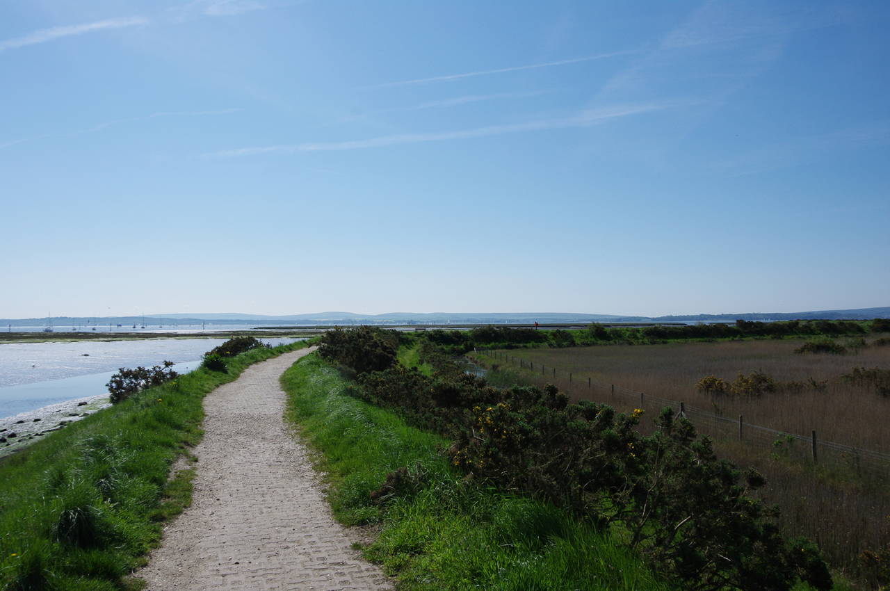
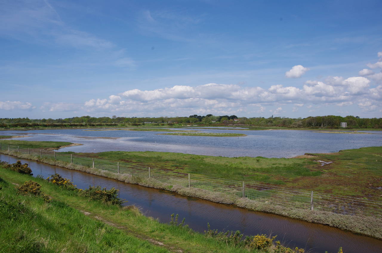
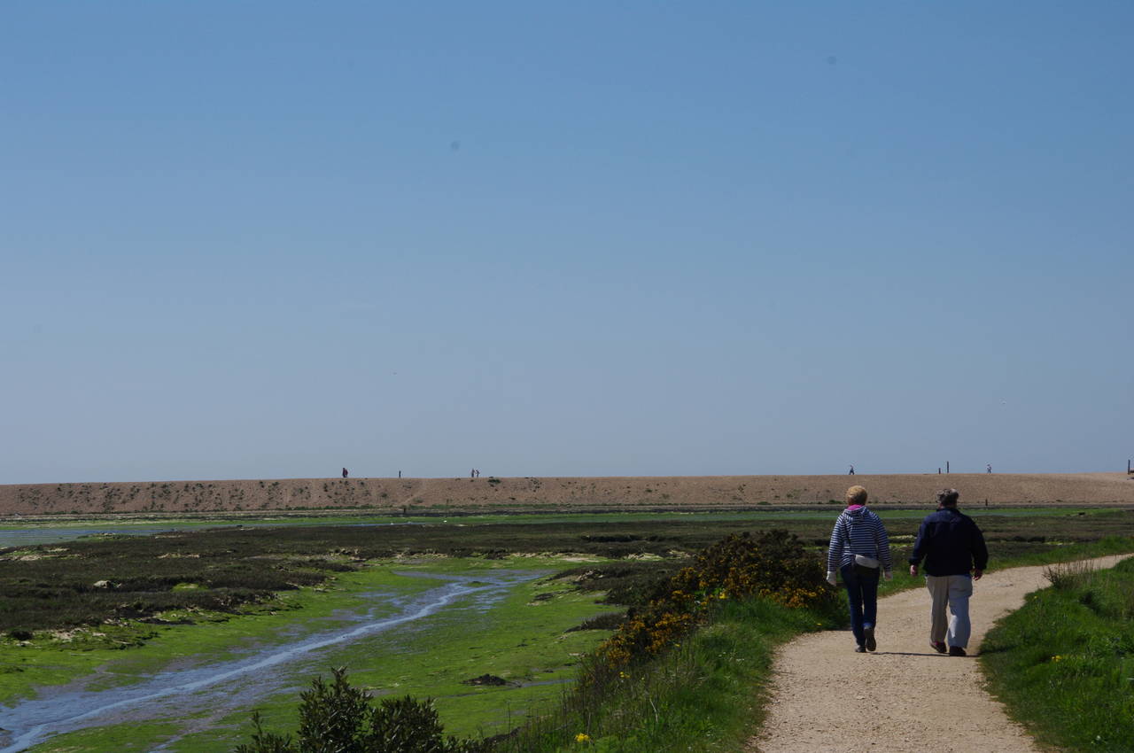
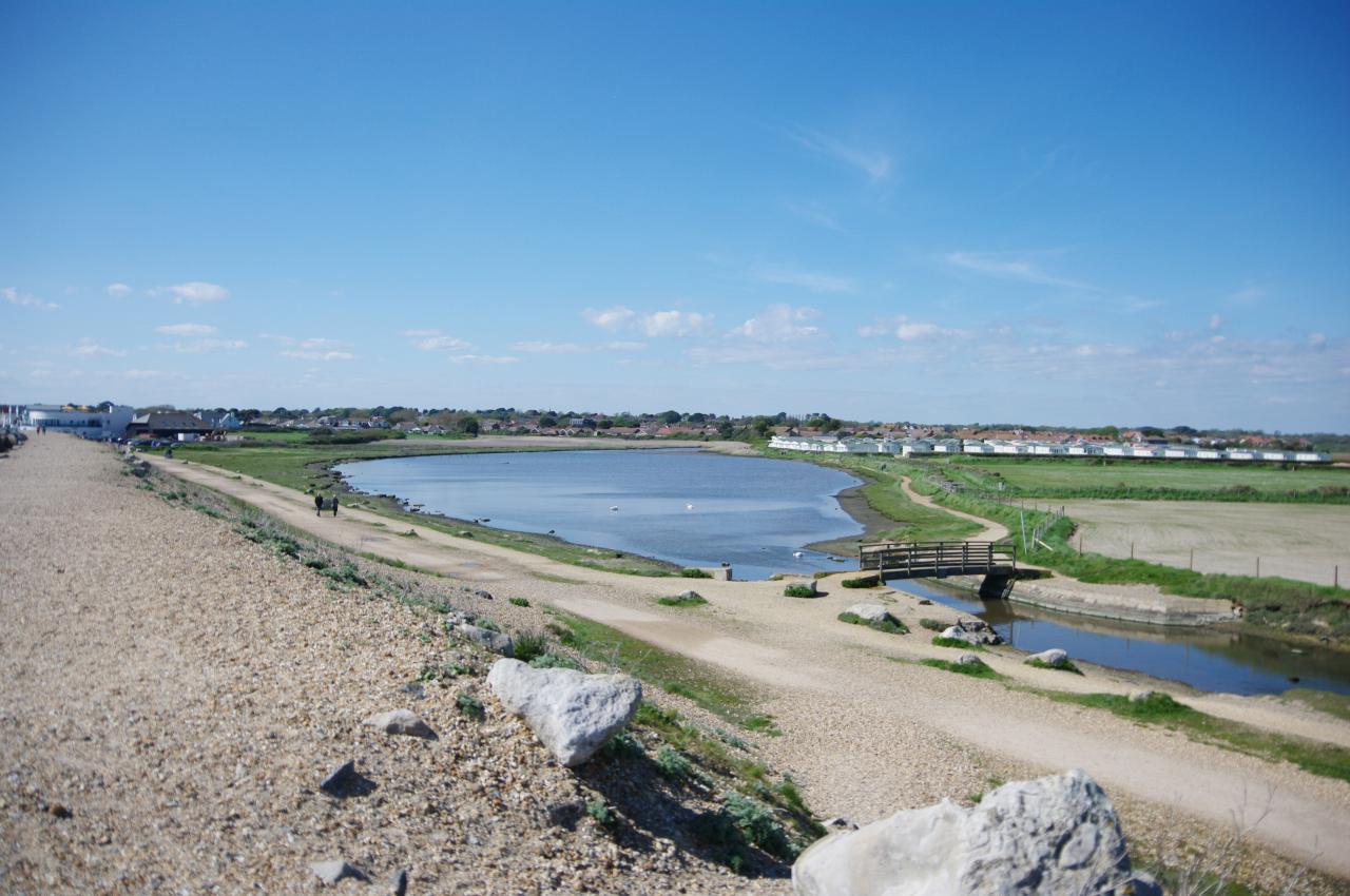
The Solent Way follows a well-worn path that twists and turns along the edge of the marsh on the top of a raised floodbank, passing more of the marina before returning to the banks of the Solent for the first time since entering Southampton Water near Warsash. For the next one and a half kilometres, the path follows the floodbank around three sides of Normandy Marsh (picture 7). The eastern end of the marsh was filled with long grass and reeds, while the western end had a large lake where hundreds of seabirds could be seen foraging on a couple of small grassy islands out in the middle (picture 8).
(9) Eight Acre Pond
(10) Woodside Farm
(11) Sluice beside Oxey Marsh
(12) Low tide beside Oxey Marsh
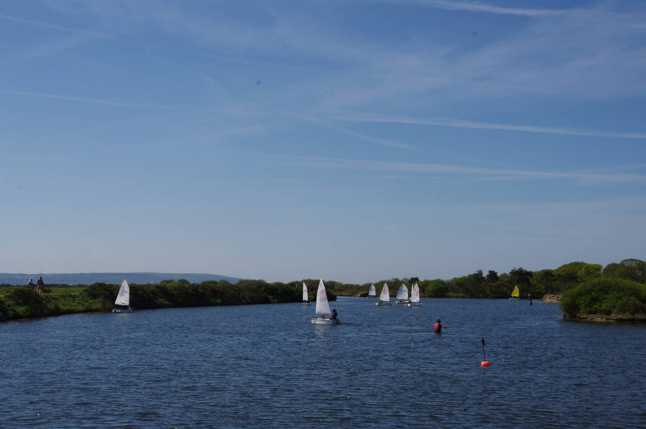
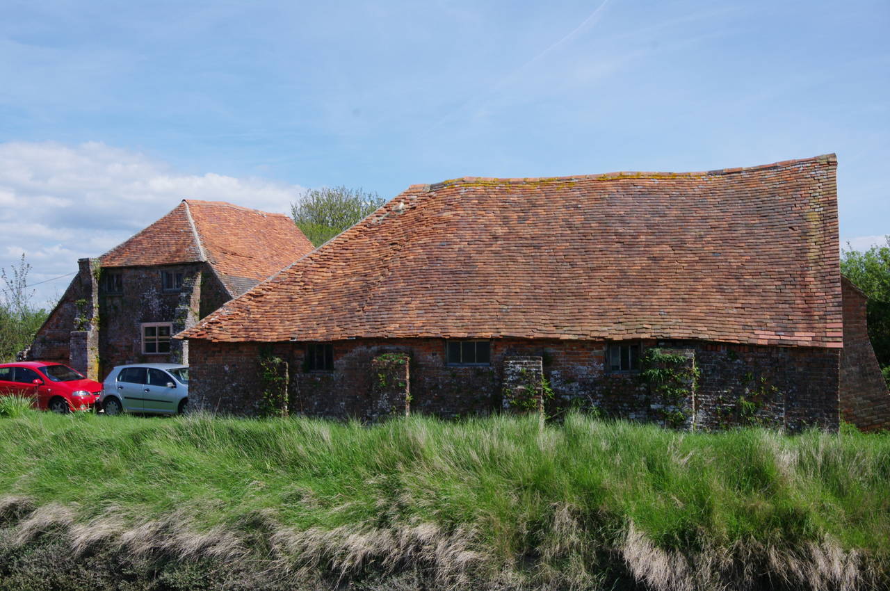
Leaving Normandy Marsh behind the path heads a little inland along the side of Eight Acre Pond, where a group of children were learning to sail some small boats in the shallow water (picture 9). The Solent Way turns left at the end of a wooden fence and follows a path through the trees behind the lake, past the neatly landscaped Salterns Cottage and then along a shady path to the ancient looking buildings of Woodside Farm (picture 10).
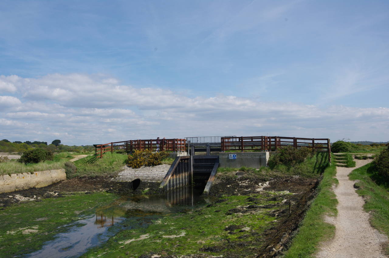
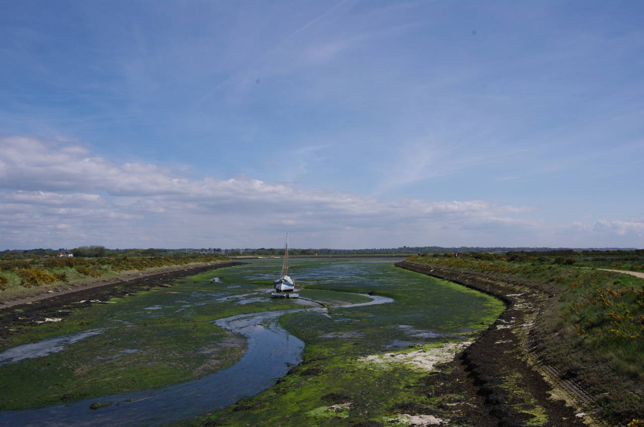
The path goes around the end of a shallow waterway and then turns along the right hand side. After about 200 metres, the waterway and the path both turn left, now on the inland side of Oxey Marsh, with a sluice gate ahead (picture 11). On the other side of the sluice, a sailing boat was temporarily beached by the low tide (picture 12).
(13) Path beside Oxey Marsh
(14) View to Hurst Castle and the Needles
(15) Pennington Marshes
(16) Keyhaven Marshes
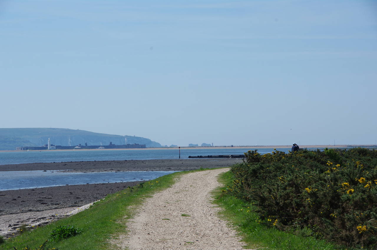
The Way follows the floodbank around two sides of Oxey Marsh to return to the Solent with the low hills of the western Isle of Wight in the background (picture 13).
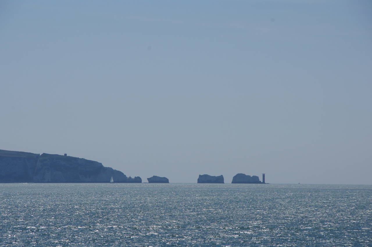
Rounding the corner to follow the floodbank along the third side of Oxey Marsh, one can see the long shingle bank of Hurst Spit stretching out into the Solent ahead and to the left, with a lighthouse and a large fortress at its far end (picture 14, zoomed in), on the route of the Solent Way but still almost two hours walk away. Beyond those, one can also see the four chalk stacks of the Needles and another lighthouse rising out of the sea just off the western tip of the Isle of Wight.
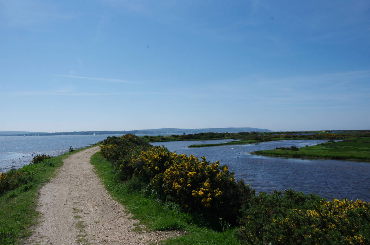
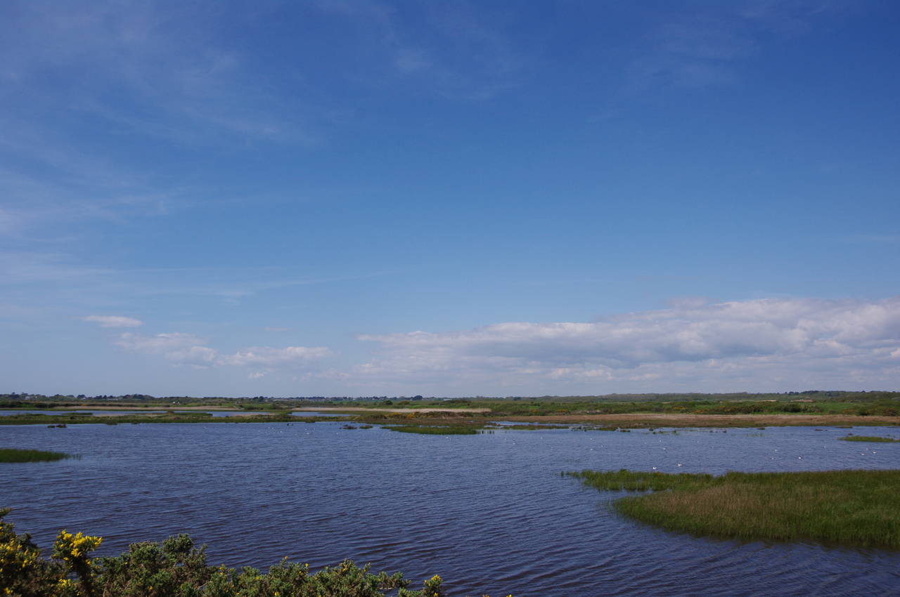
The Solent Way keeps to the top of the floodbank beside the Solent for a little over three kilometres, soon leaving Oxey Marsh behind and continuing past the larger Pennington Marshes (picture 15) and finally the Keyhaven Marshes (picture 16). This was a very peaceful stretch of the path, well out of earshot of roads and motorboats, and with plenty of wildlife in the marshes.
(17) Approaching Keyhaven
(18) Keyhaven Harbour Nature Reserve
(19) View towards The Needles
(20) Hurst Spit
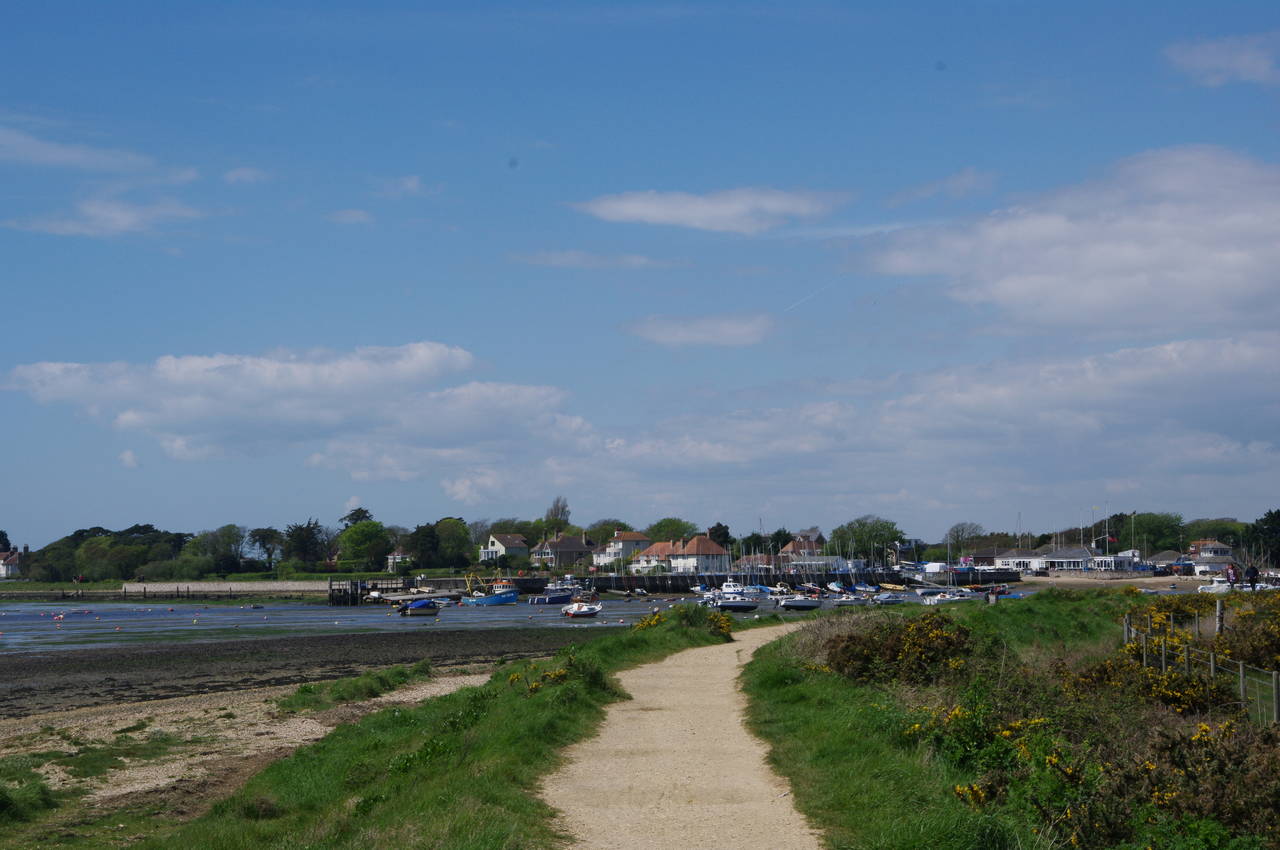
Eventually the path curves around the far end of Keyhaven Marsh, running along the side of Keyhaven Harbour, with the village of Keyhaven on the far side (picture 17). When the path reaches a carpark, the Way turns left and follows the road around the back of the harbour towards the village. Reaching another carpark, the route turns sharp left and follows the harbour wall past a slipway, the Keyhaven Yacht Club and a boatyard, before continuing out of the village beside another expanse of marshland.
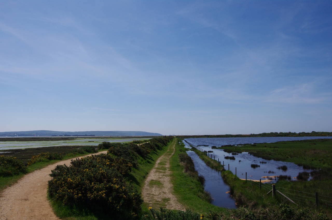
Less than 100 metres beyond the boatyard, the sea wall turns right, and the Solent Way follows suit, now running for about a kilometre up to the landward end of Hurst Spit. To the right are freshwater marshes, while to the left are the shallow tidal marshes of the Keyhaven Harbour Nature Reserve with the tall shingle spit beyond protecting them from the wind and waves of the open sea (picture 18). As I was passing by not long after low tide, much of the vegetation was revealed, while at high tide this is all submerged.
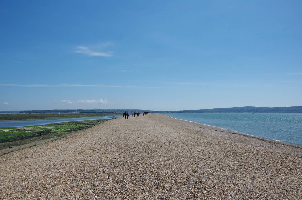
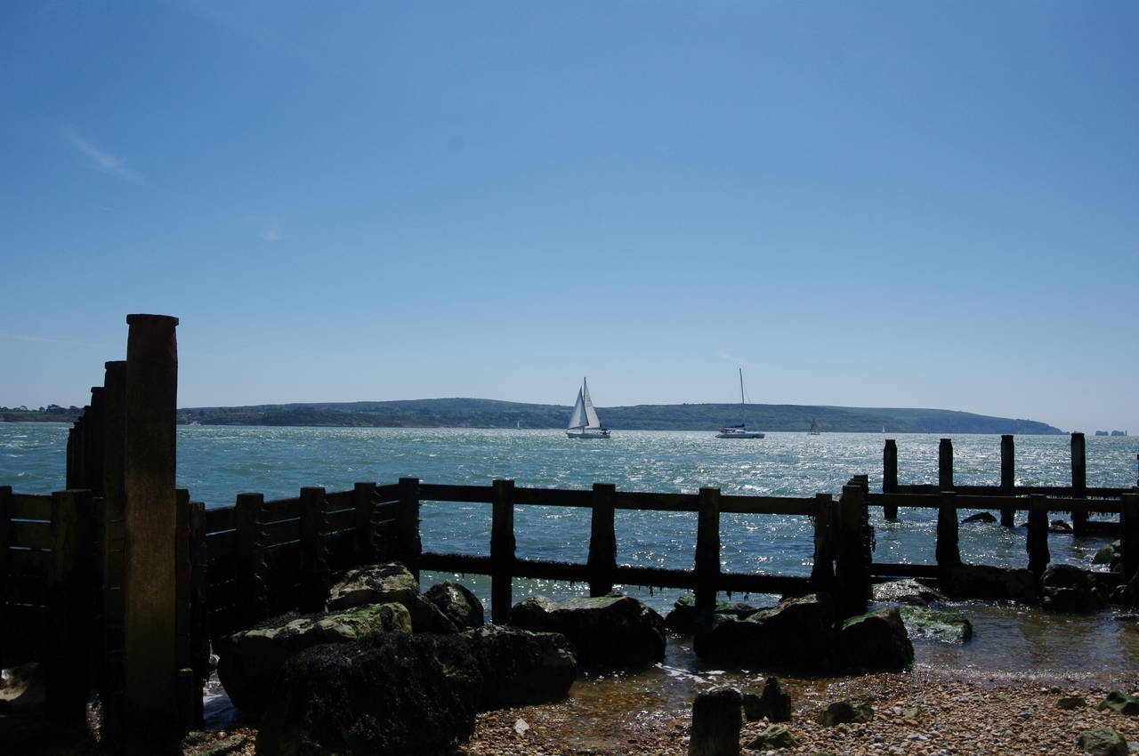
About half way up to the spit, the sea wall ends and the Solent Way follows Saltgrass Road the rest of the way. Hurst Spit was obviously a popular attraction, as there was a long line of cars parked on the edge of the road. The very last of these was an ice-cream van, from which I purchased a double cone before crossing a wooden footbridge over the Danes Stream and climbing the path up onto the top of the spit, where I found a large boulder to sit on while I enjoyed my ice-cream. From this vantage point I had a good view across the Solent to The Needles (picture 19) and along Hurst Spit, where quite a few people were wandering along the shingle (picture 20).
Hurst Spit is formed of millions of pieces of flint eroded from chalk cliffs further along the coast and washed up here over thousands of years. The gently curving spit stretches more than two kilometres across the western entrance of the Solent, ending only about 800 metres from the nearest point of the Isle of Wight. The spit is also constantly changing as new stones are washed up by the strong currents and others are washed away.
(21) Boats moored behind Hurst Spit
(22) Hurst Lighthouse and Castle
(23) Path around Hurst Castle
(24) View across the Solent
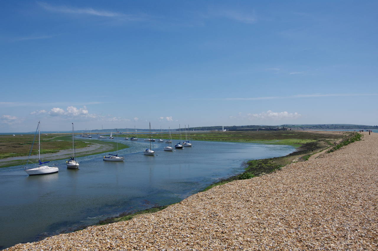
With renewed energy after my short rest, I set off to follow everyone else towards the castle at the far end of the spit. In a channel running through the marshes behind the spit, a few dozen yachts were moored in the relatively sheltered waters (picture 21).
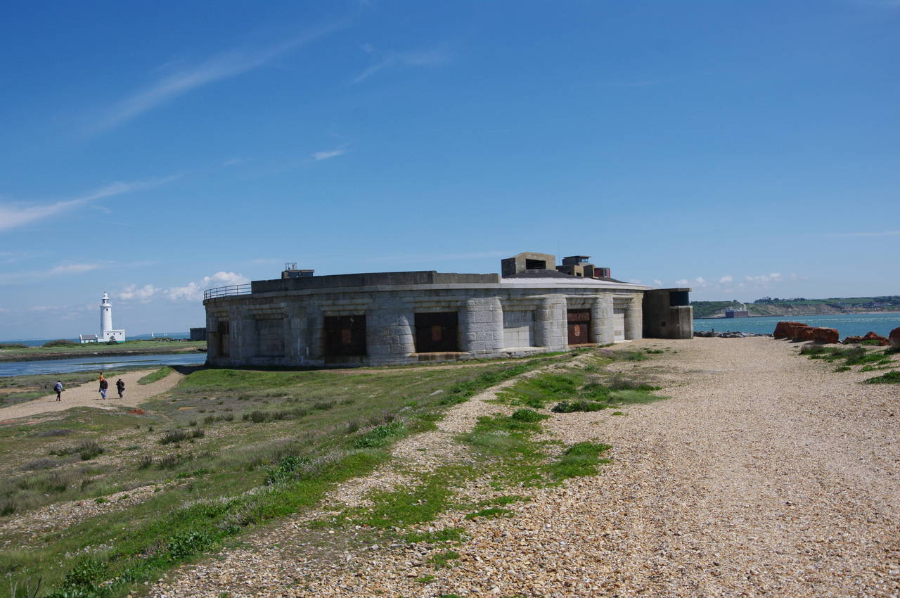
After almost half an hour of crunching my way along the flat top of the spit, I reached the western end of Hurst Castle (picture 22). The oldest parts of the castle are the central tower and bastions, completed in 1544 to defend the western approach to Southampton along the Solent, as part of Henry VIII's chain of coastal defences along the south coast of England. In 1648, during the English Civil War, Hurst Castle was briefly used as a prison for King Charles I, before he was sent to London for his trial and eventual execution. In the 19th century, the long east and west wings were added to house up to 30 heavy guns and the castle remained in active military use until after World War II. English Heritage now owns the castle and it is open to the public.
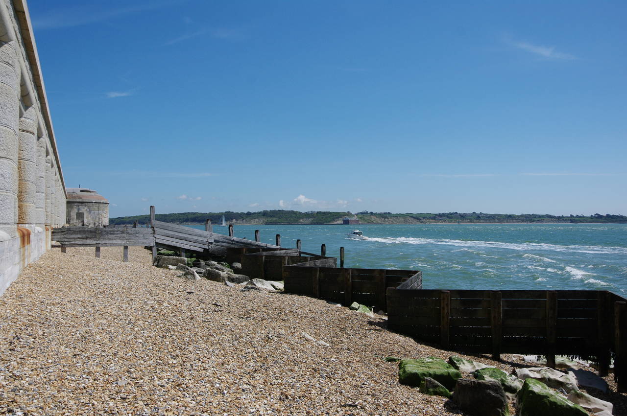
The Solent Way heads around the end of Hurst Spit, below the imposing walls of the castle, where various attempts have been made to protect the end of the spit from erosion (picture 23), with varying degres of success. Being the closest point on the mainland to the Isle of Wight, there were good views across to some of the small coastal communities on the north-west of the island and the chalk hills beyond (picture 24).
(25) Hurst Point Lighthouse
(26) Sturt Pond
(27) The end of the Solent Way
(28) The Smugglers' Inn, Milford-on-Sea
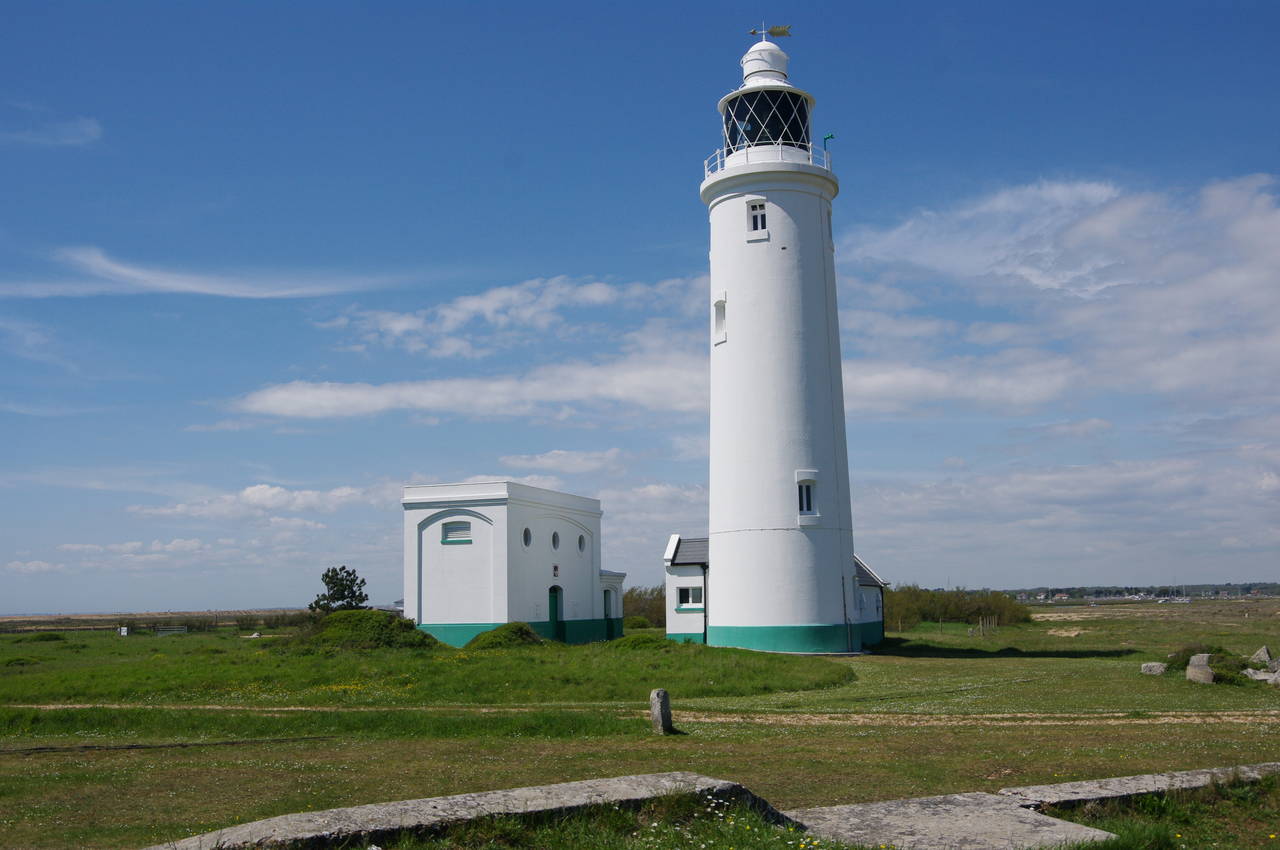
Rounding the east wing of the castle, the path comes up close to the lighthouse (picture 25), which was built between 1865 and 1867. From here, there are two choices for the Solent Way: one can either retrace one's steps along the spit or catch a small ferry to Keyhaven. Choosing the former, I completed a circuit of the castle and climbed back up onto the spit for the half-hour walk back to the point where I had first joined it via the footbridge over the Danes Stream.
The spit runs parallel to the Danes Stream for another 200 metres before a path leads down off the shingle ridge to another footbridge over the stream where it flows out of Sturt Pond (picture 26). Here the signposted route differs from that shown on the Ordnance Survey map. The map shows the route continuing along the beach another 600 metres to the seafront at Milford-on-Sea and then following Sea Road for another 600 metres into the centre of the town.
Instead, I took the signposted route, which crosses the footbridge and takes a path along the right hand side of Sturt Pond and then further upstream along the Danes Stream passing houses before crossing over the stream and crossing the carpark of the Milford-on-Sea tourist office to the official end of the Solent Way where Sea Road crosses the Danes Stream. My GPS showed 17.2 kilometres walked from Lymington.
I suspect that the discrepancy in the routes might be due to the fact that the waymarker that points the way over the Danes Stream is on the footbridge and there is no waymarker or signpost on the spit itself. If I had not been reading the guidebook for the walk before each stage, I would probably have been unaware of this turn and would have followed the route on the map, only to be a bit confused upon finding the signpost that marks the end of the route pointing a different way.
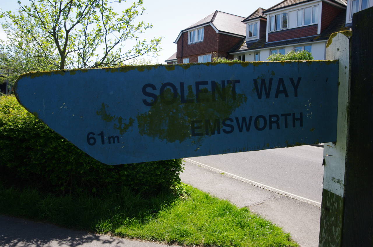
The rickety signpost shows 61 miles (98 kilometres) to Emsworth (picture 27), while according to my GPS, the total distance had been just over 104 kilometres. I presume that the signposted distance doesn't include the walk out to Hurst Castle and back.
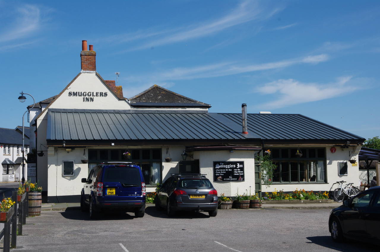
Directly across the Danes Stream from the end of the walk is The Smugglers' Inn (picture 28), a much more auspicious place to celebrate the end of my walk along the Solent Way. The pub dates from 1803 and is reputedly haunted, though I saw nothing supernatural, even after downing a pint of Fullers London Pride.
My walk along the Solent Way had been a very enjoyable one, despite walking further than usual each day to make up for several days lost to bad weather. There had been plenty to see along the walk, with several historic locations to explore, a good variety of landscapes, and some excellent pubs.
After visiting The Smugglers' Inn, I walked the route on the Ordnance Survey map to get back to Hurst Spit above Sturt Pond, where I began my next walk, the 36 kilometre Bournemouth Coast Path.