SOLENT WAY
Stage 3: Southampton to Lymington
Saturday, May 12, 2012
(1) Southampton Docks
(2) Ferry on Southampton Water

(3) Approaching Hythe Pier
(4) Hythe Pier
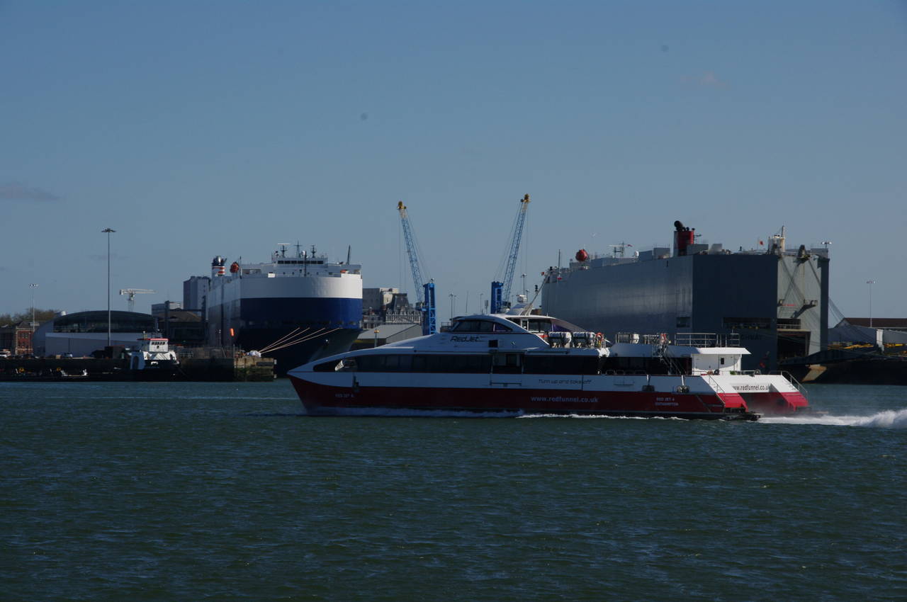
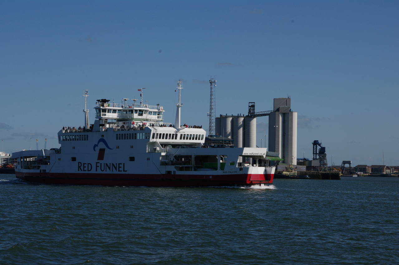
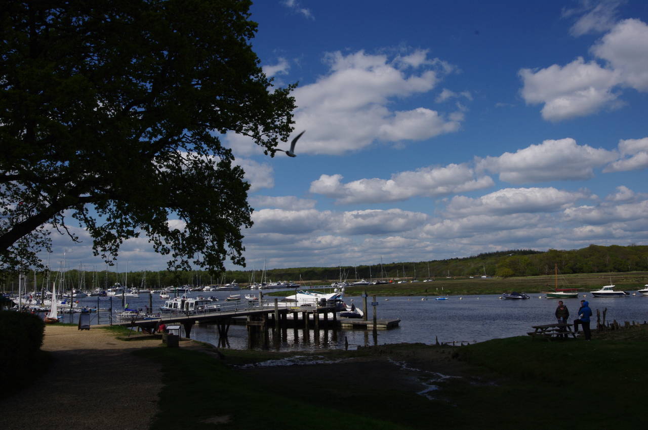
As with the previous day, my third day on the Solent Way began with a ferry ride. From the front of Southampton's Town Quay, I walked along the side of the building to the Red Funnel terminal, where I boarded the small Hythe Ferry for a ten minute journey down Southampton Water. The ferry heads south past Southampton's large complex of docks where several large cargo ships were loading and unloading. Southampton Docks also have terminals for large cruise ships and several other ferries, including a passenger catamaran (picture 1) and car ferry (picture 2) that cross back and forth to Cowes on the Isle of Wight.
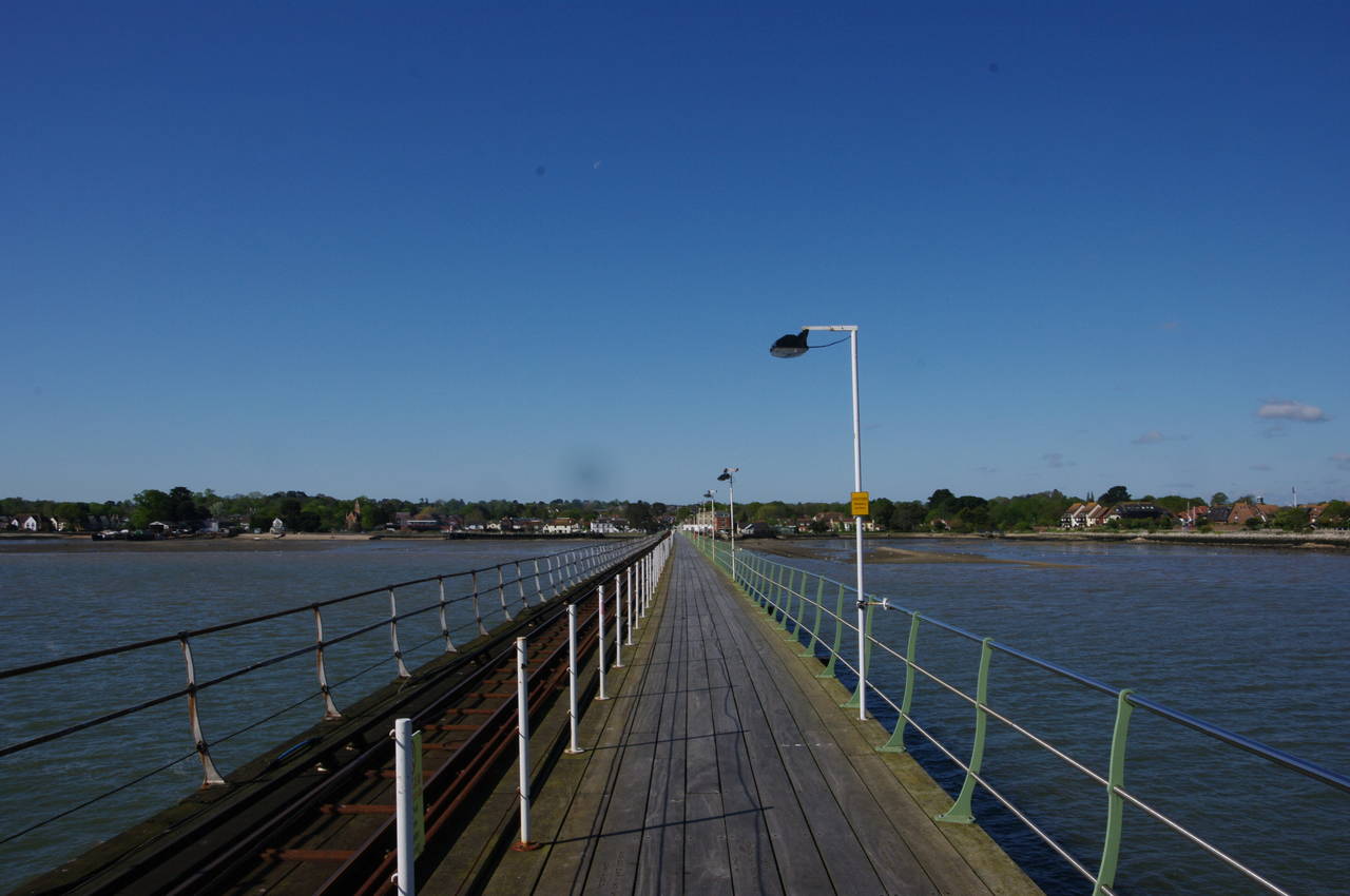
Before long the ferry arrived at the end of Hythe Pier (picture 3), which stretches out into Southampton Water for 640 metres from the shore of the village of Hythe (picture 4).
(5) Hythe Pier Train
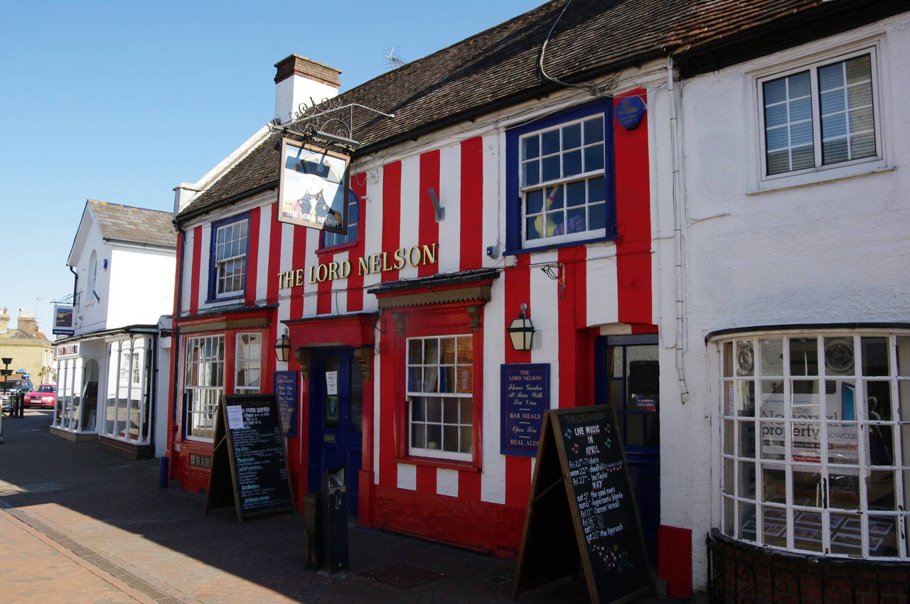
(6) Lord Nelson pub, High Street, Hythe
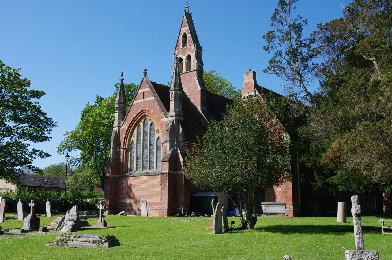
(7) St. John's Church, Hythe
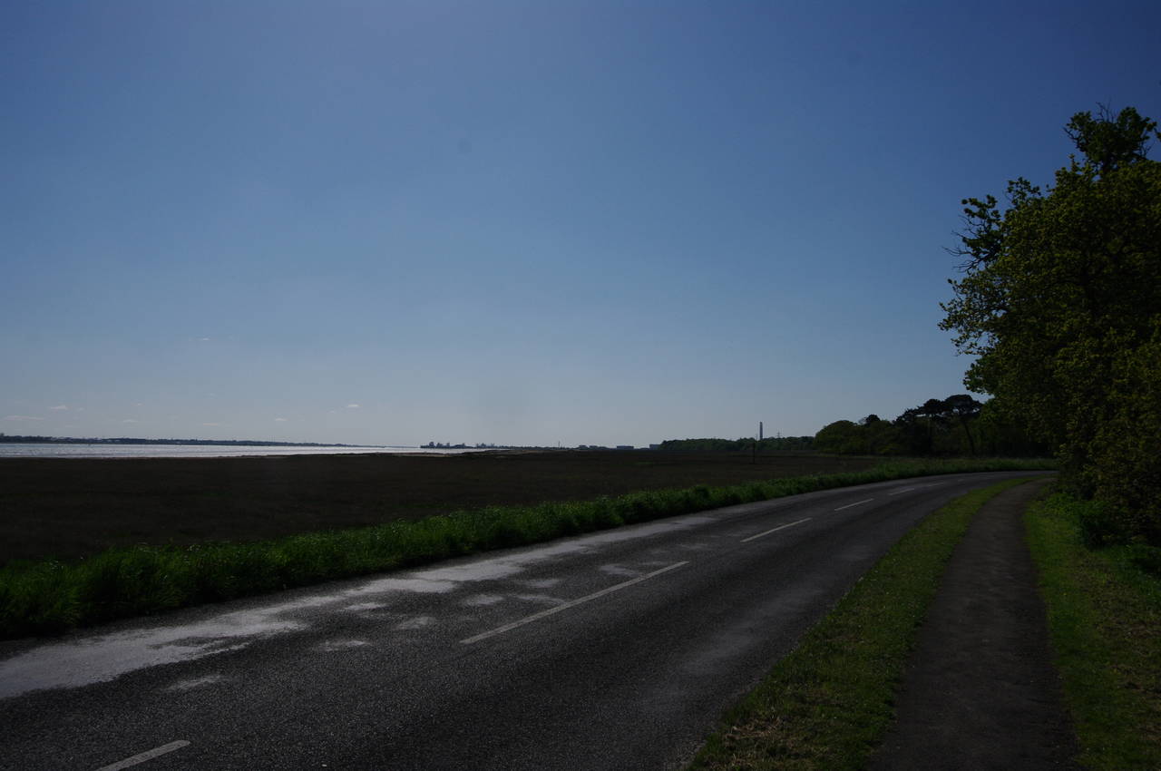
(8) Salt marshes by Shore Road
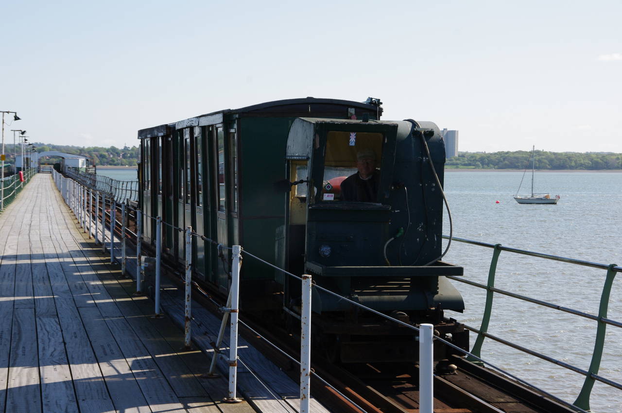
For those who don't fancy the walk to the shore, the world's oldest pier railway, opened in 1922, ferries passengers along the pier (picture 5). The Solent Way is a walking trail, however, so I walked along to the landward end of the pier, where the Solent Way turns left down Hythe's High Street.
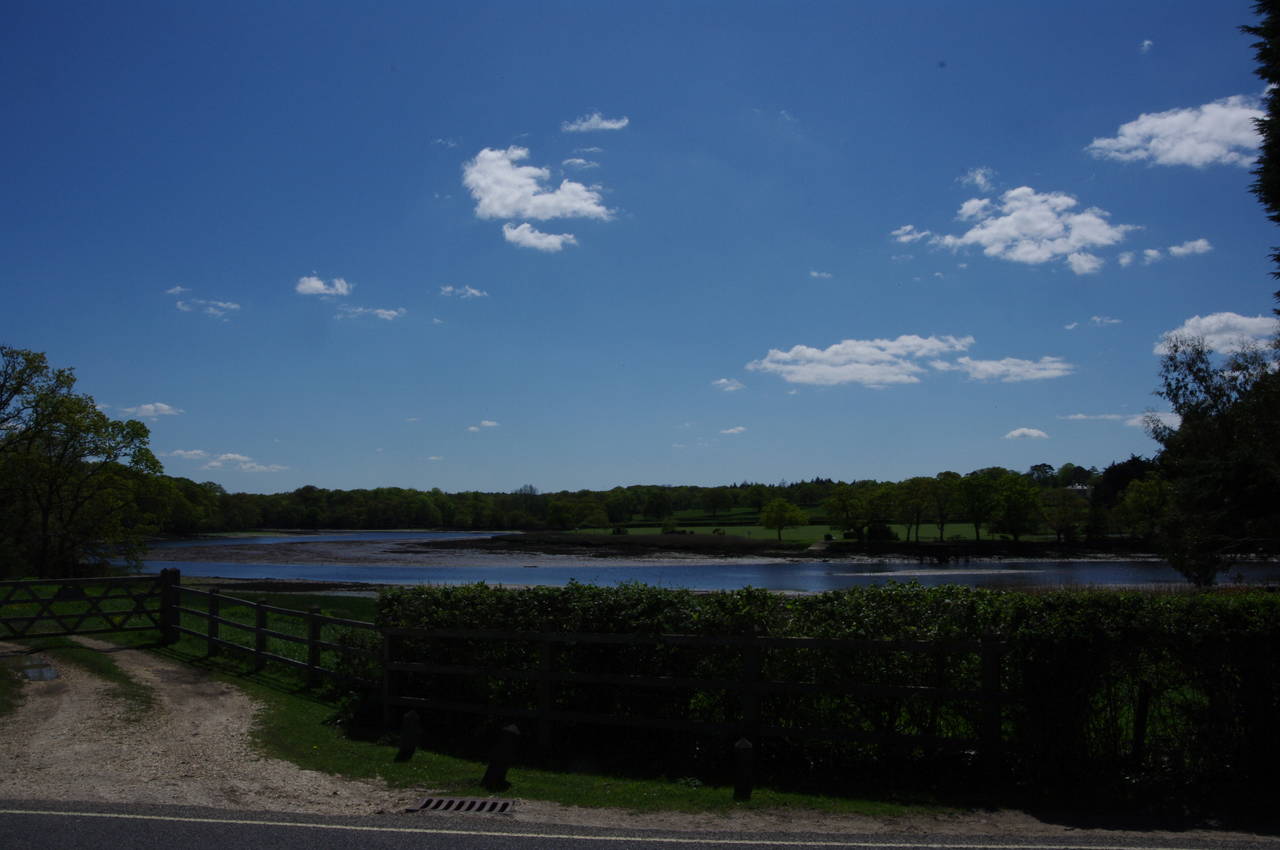
After passing the Lord Nelson pub, with its unusual striped exterior, the High Street curves to the right to meet St John's Street. The Solent Way turns left here (though I was unable to find any signage to make that obvious) and passes by St John's Church (picture 7). Just past the church, St John's Street becomes Shore Road and heads through an industrial area to the edge of an expanse of salt marshes on the bank of Southampton Water (picture 8).
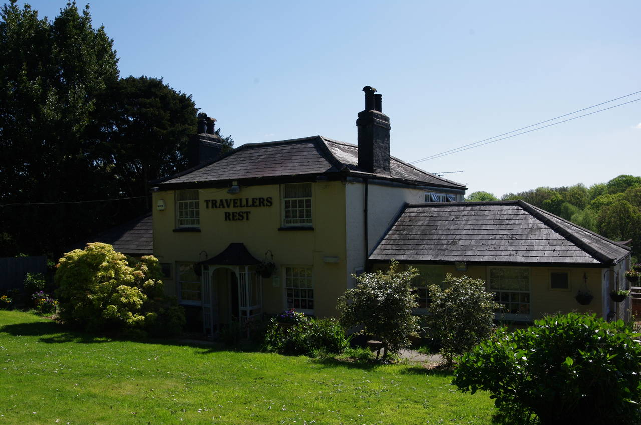
(9) The Travellers Rest
(10) Crampool Copse

(11) Forest Home pub, Hardley
(12) Fawley Inclosure
Shore Road soon curves away from the marshes, crossing a railway line that carries trains to and from the massive Fawley Oil Refinery, a little further south, which covers an area of around four square kilometres.
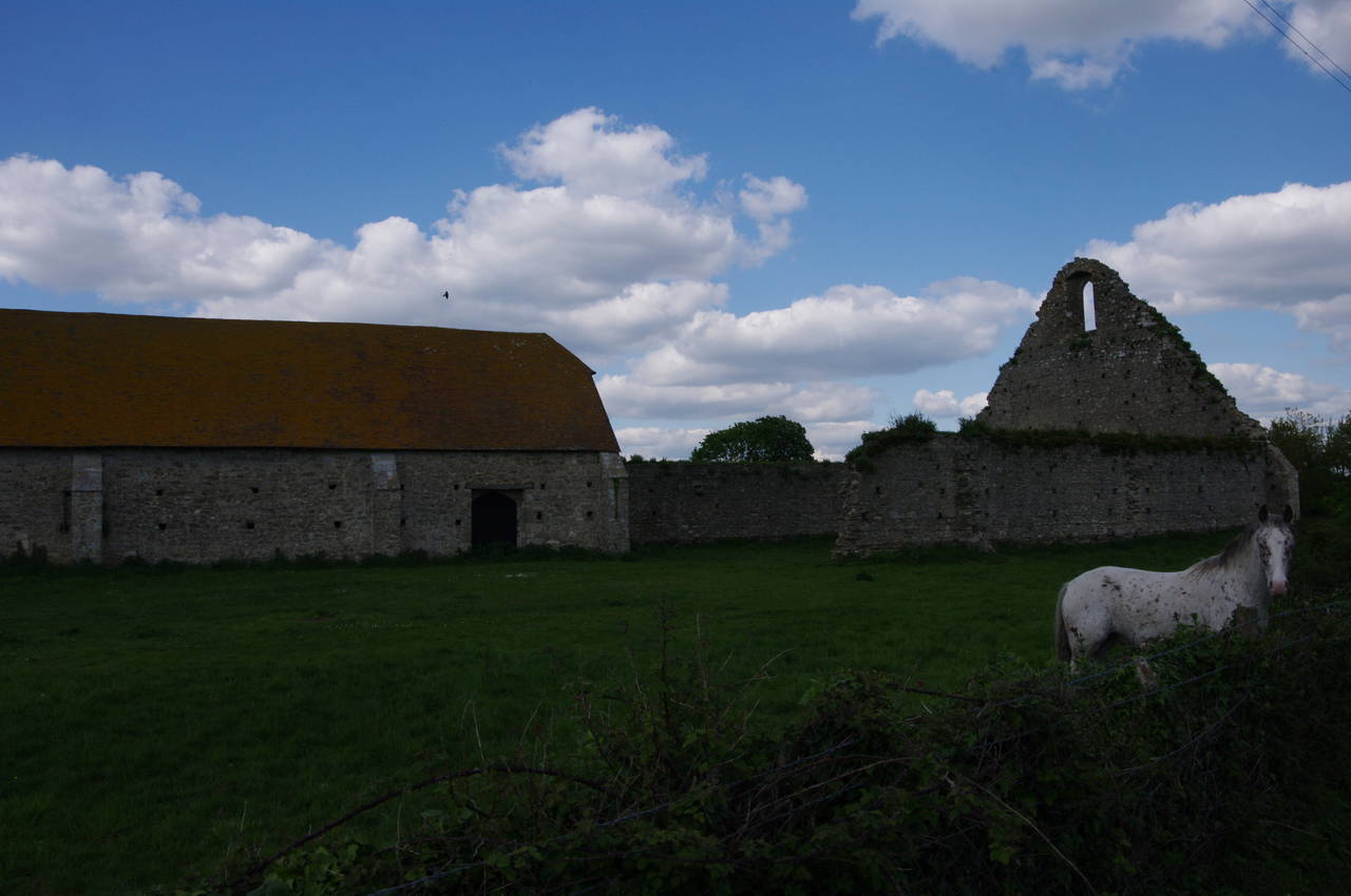
Over the railway line, the name of the road changes to Frost Lane and the Solent Way follows it for about three hundred metres to a left turn into Hart Hill. The route follows the shady lane to its far end, just beyond the secluded Travellers Rest pub (picture 9). The pub was closed, as it was only just after nine o'clock in the morning, but as I have read that the pub has a very good reputation with the locals, I will try to visit again.
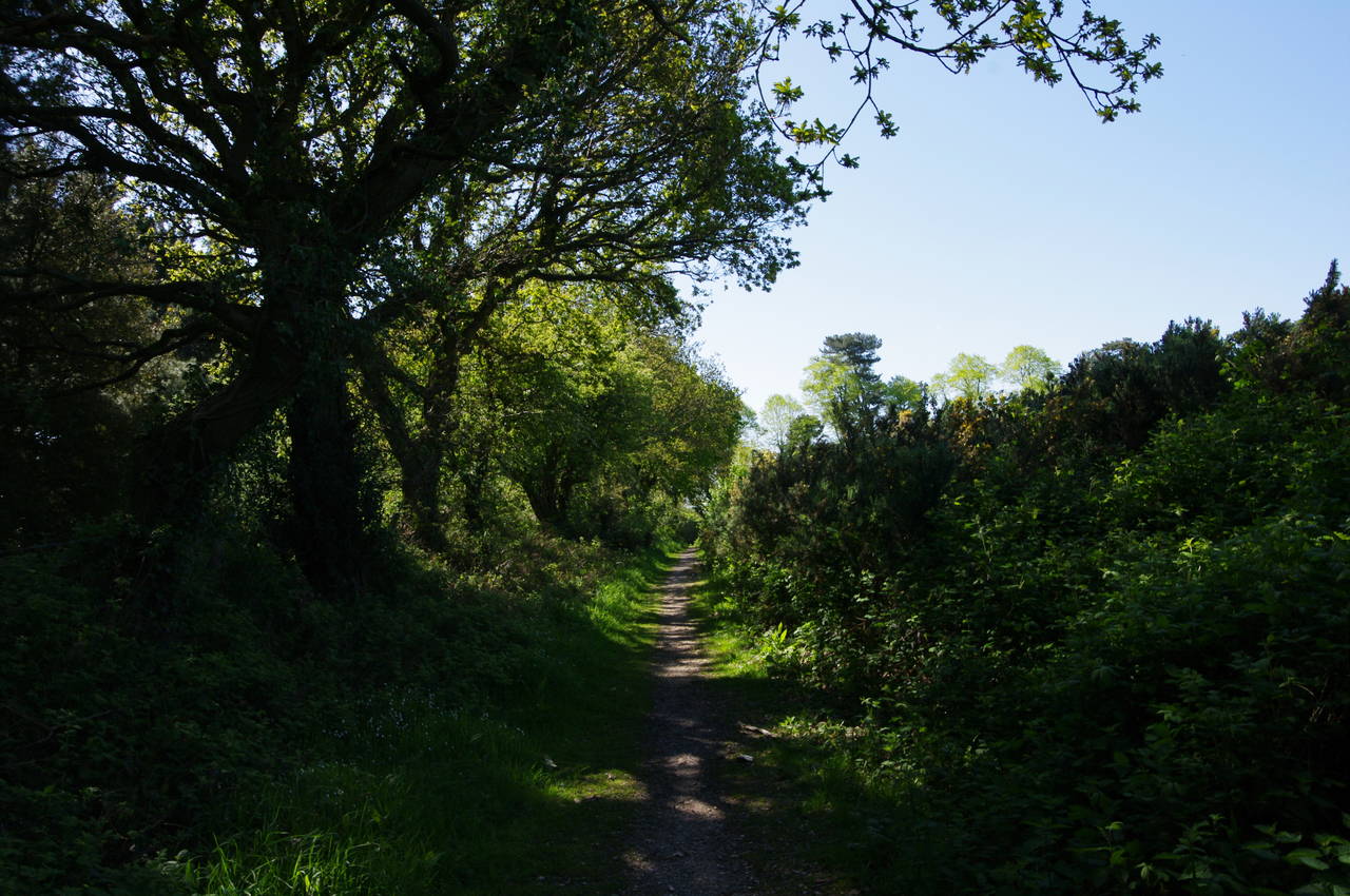
Just beyond the pub, the lane becomes a gravel driveway, leading up to a wooden gate. The route heads through the gate, across a small stream and into Crampool Copse (picture 10) for the Solent Way's first taste of the New Forest.
The New Forest, which occupies around 380 square kilometres in the southwest corner of Hampshire, is in fact not new at all, and strictly speaking it isn't a forest either. The area was designated as "new" by William the Conqueror in 1079 when he appropriated it as a royal deer-hunting park. At the end of the last ice-age the area was covered in woodland, but successive waves of clearing for agricultural use from the Bronze Age up to medieval times mean that barely a third of the natural woodland still exists today. The remaining area is a mixture of heath, grassland and tree plantations.
In 2005, the New Forest and almost 190 square kilometres of additional land became the New Forest National Park. While there are some sizable towns just outside the New Forest, within its boundaries the largest settlement is only 3000 people. Throughout much of the park, livestock and New Forest Ponies are allowed to roam freely and consequently there is a speed limit of 40 mph on almost all roads.
From Cranpool Copse, the Solent Way winds its way southwards along a well-worn path for about a kilometre before skirting around the right hand side of a fenced-off Esso petrol terminal. Following the terminal's access road, the route crosses Cadland Road and then follows New Road a short distance to meet the busy A326 Long Lane next to the Forest Home pub (picture 11). Crossing the road, the route joins Forest Lane, which doglegs to the right before crossing another road and following a broad but muddy track parallel to the A326.
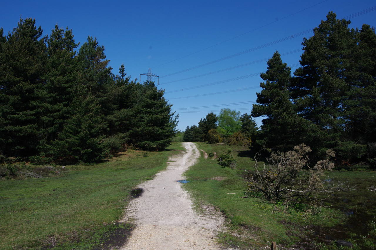
The track soon ends at a wooden gate, where the Solent Way enters the Fawley Inclosure (picture 12), an area of mixed heath and tree plantation. The route initially bears left to follow a chalky track between two small clumps of plantation trees before bearing back to the right to run parallel to the A326 and a high-voltage power line for a little more than a kilometre to the northwest corner of the inclosure.
(13) Beaulieu Heath
(14) The Royal Oak, Hilltop
(15) Beaulieu River
(16) Beaulieu Abbey Church
Reaching the corner, in sight of a large roundabout, the route turns left and runs parallel to the A3054 Beualieu Road (pronounced "Bew-ley" by the locals), just inside the edge of the Inclosure. In about 500 metres, the route reaches a chalky vehicle track and follows it up to the road.
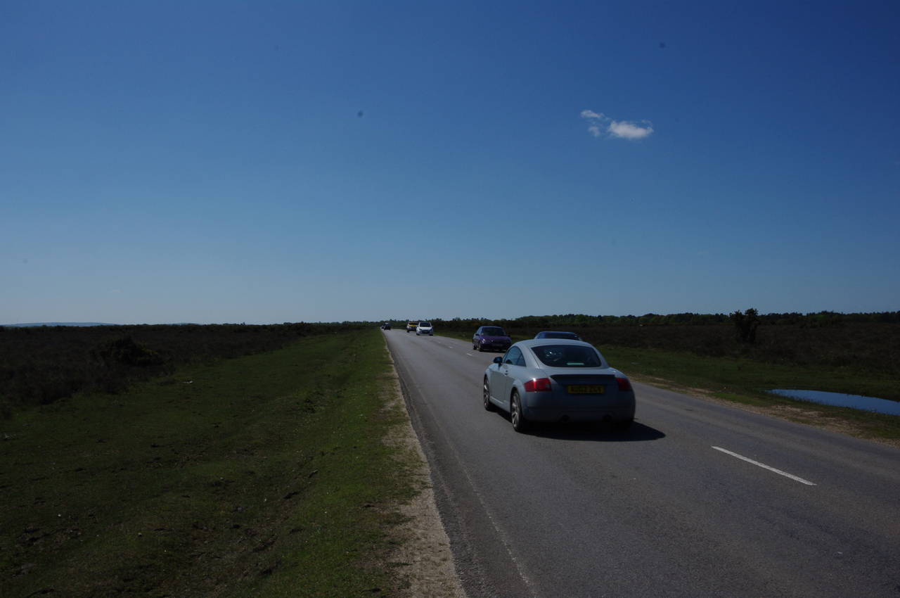
For the next two and a half kilometres, the Solent Way follows Beaulieu Road south across the wide open Beaulieu Heath, which for the most part is covered in stunted scrub due to the poor soil in this area. For most of the way one has to walk on the edge of the road, keeping a close eye on the traffic, as there is no footpath beside the road and the verge is uneven and quite marshy in places (picture 13).
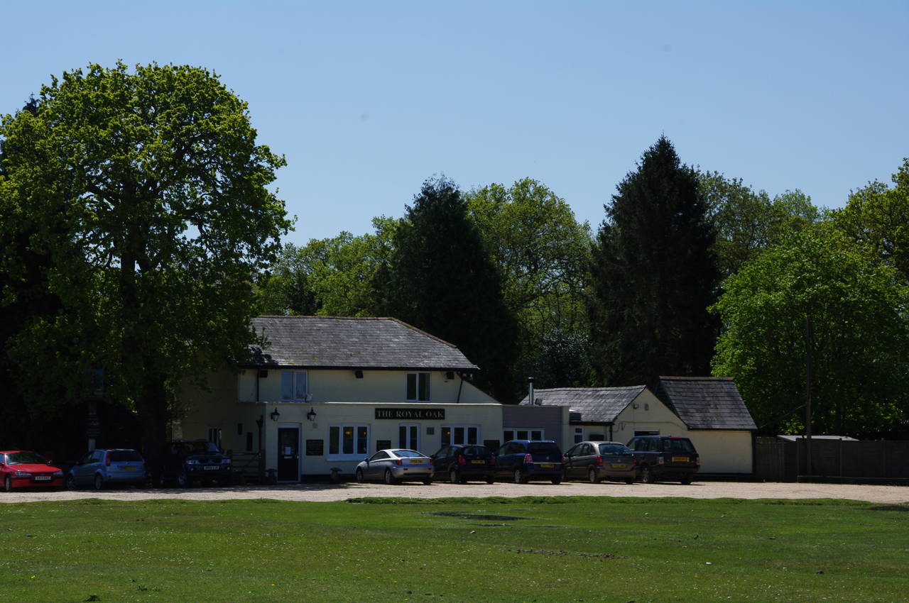
Towards the end of this road, I was passed by a very long convoy of motorcycles. I counted more than a hundred machines, finding myself standing at the road junction in front of the Royal Oak pub (picture 14) for four or five minutes before I was able to cross over and head inside for lunch.
The pub was quite busy, it being noon on a Saturday, but I still received a warm welcome and soon settled down at one of the tables in the pleasant garden behind the pub with a nice meal and a pint of Wadworth Bishop's Tipple. The Royal Oak was also serving beers from the Ringwood Brewery (on the western fringe of the New Forest), Adnams and Greene King and, unusually, three draught ciders (one is standard for most pubs).
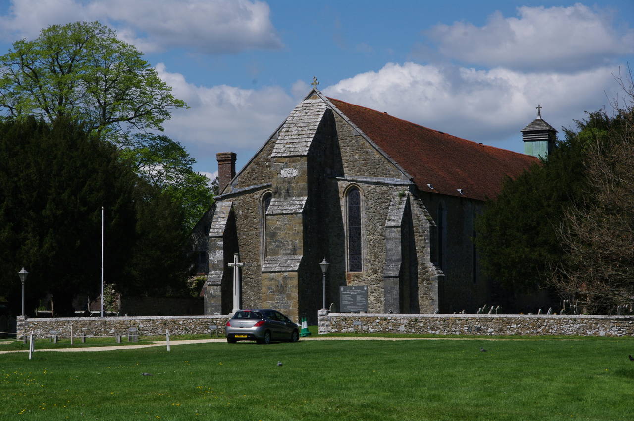
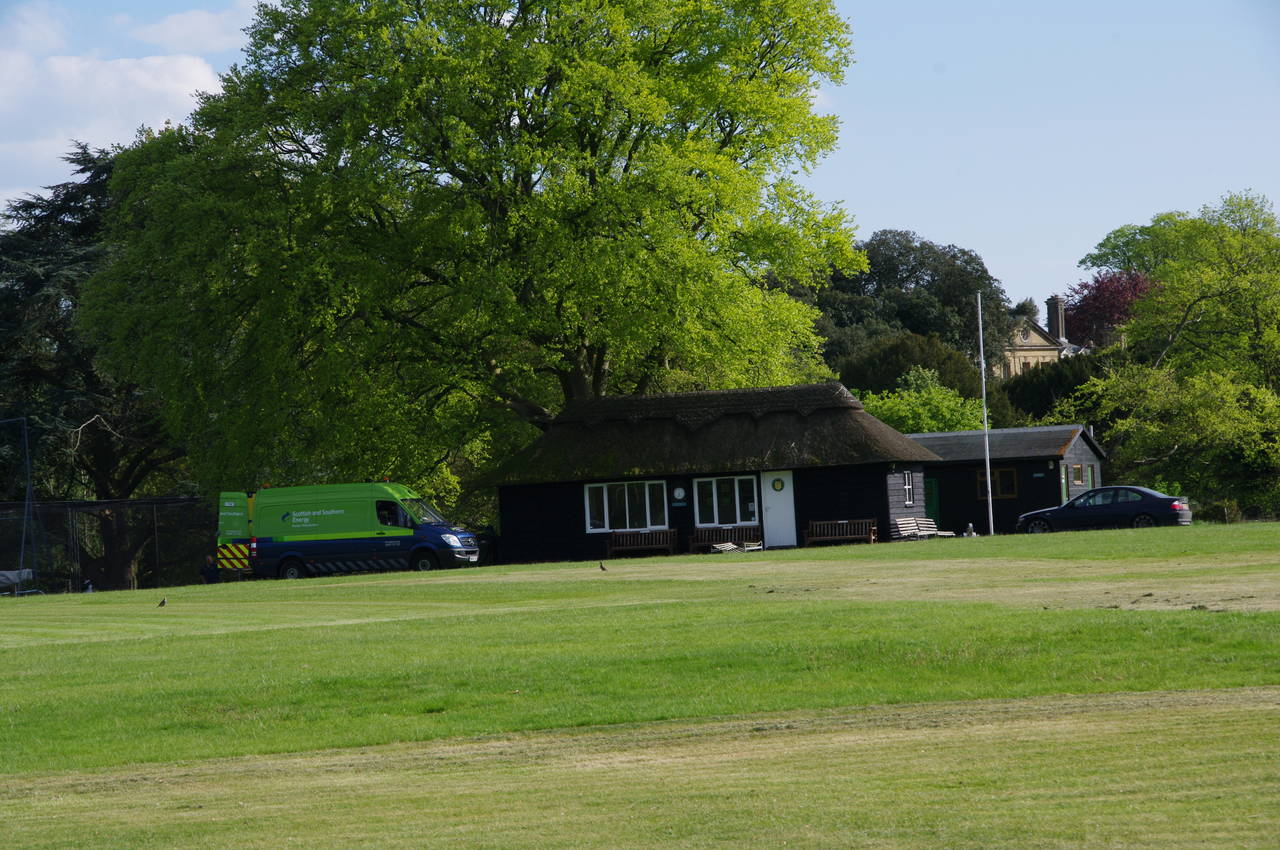
From the Royal Oak, the Solent Way continues down Beaulieu Road for another one and a half kilometres to the village of Beaulieu, again walking on the road for most of the way. After passing the first few houses, the road runs between the cricket field of the Beaulieu Estate and a picturesque bend in the Beaulieu River (picture 15). The Beaulieu Estate stretches along the right side of the road, with the Abbey Church of the Blessed Virgin and Holy Child set back a little from the road (picture 16). Behind the church, but not visible from the road are the ruins of the Beaulieu Abbey and elsewhere in the estate one can visit the National Motor Museum. The museum houses a large collection of vehicles from Formula 1 and James Bond cars to Mr Bean's mini.
(17) Approaching Jarvis Copse
(18) Keeping Copse
(19) Buckler's Hard
(20) Buckler's Hard
A little further on, the road bends right to cross over the river, with the village centre straight ahead. The Solent Way takes the first left turn into Fire Station Lane, avoiding the tourist-filled centre, though I did take some time to explore the village before moving on.
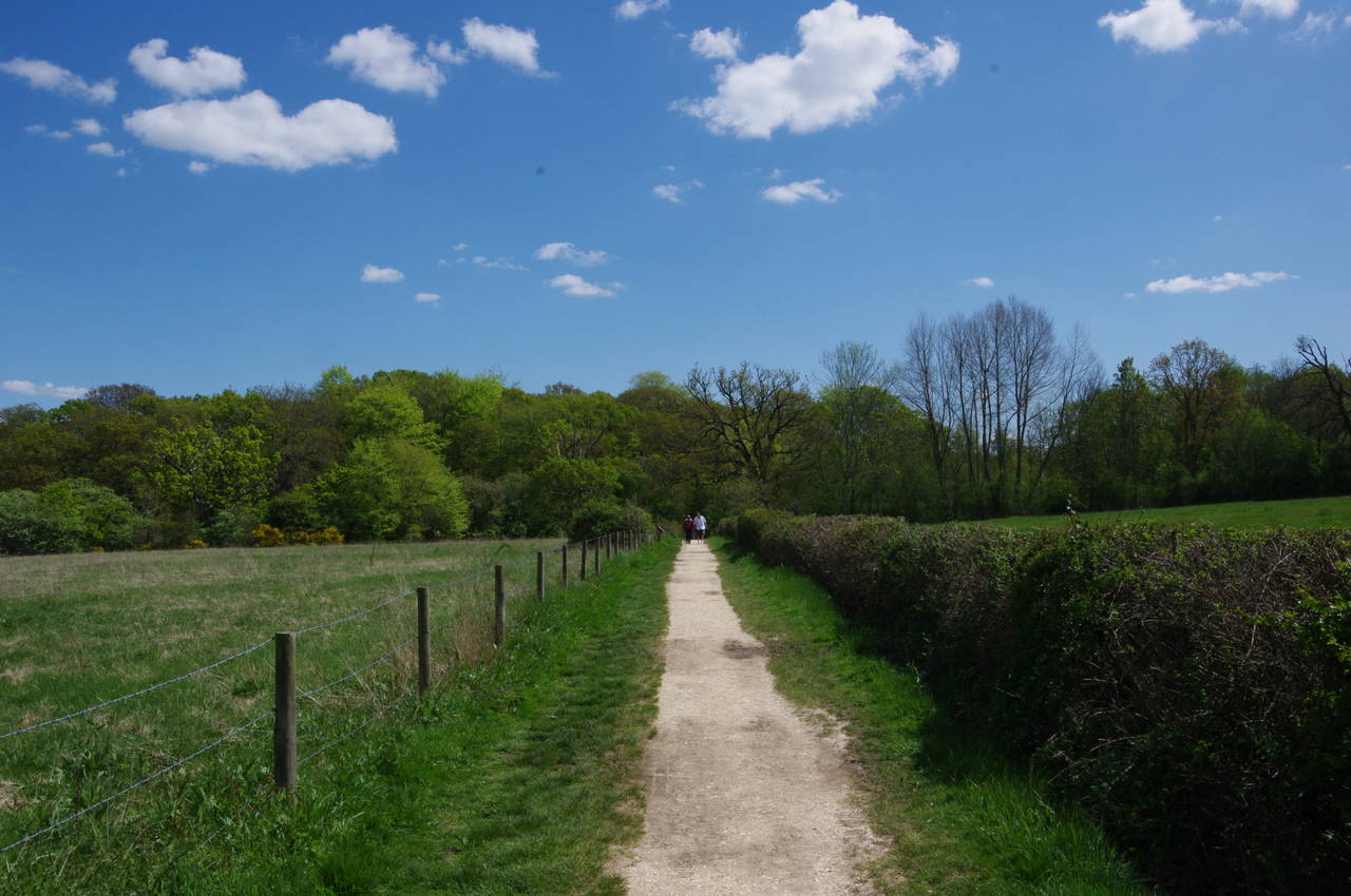
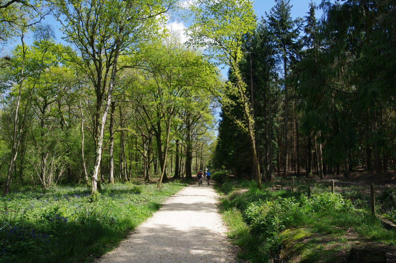
Fire Station Lane soon bends to the right around the village fire station, then passes through a wooden gate and becomes a chalky path across fields with the twisted course of the river a little way off to the left. In a few minutes the path cuts through a corner of Jarvis Copse (picture 17), along another field edge, then kinks left and right by a cottage before joining and broad track that runs straight ahead for about 1200 metres through Keeping Copse (picture 18) and Burnt Oak Copse. The shady woodland path was busy with weekend walkers and cyclists.
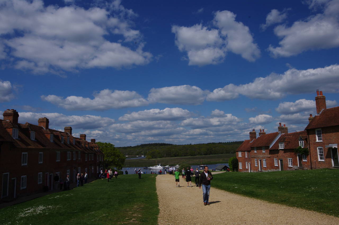
At the far edge of Burnt Oak Copse, the path turns right to head around the edge of Keeping Marsh and then behind a couple of boatyards to reach the village of Buckler's Hard, a hive of boating activity on the Beaulieu River (picture 19) and a very busy tourist hotspot. In the 18th century, Buckler's Hard was an important shipbuilding centre, constructing many of the ships in Lord Nelson's fleet.
The Solent Way follows the main footpath away from the river, heading uphill between two rows of 18th century shipbuilders' cottages. The view back down from the top (picture 20), is one that has been reproduced in countless tourist guidebooks.

(21) Salternshill Wood
(22) New Forest ponies near St Leonards
(23) Ruined chapel, St Leonards
(24) Ruined chapel, St Leonards
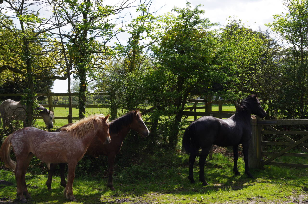
The tourist hordes quickly disappear as the Solent Way crosses a stile on the edge of the village and continues ahead on a narrow sealed lane between low hedges. After about a kilometre the lane bends right at a junction and heads west through Salternshill Wood to another junction where the route turns south for another 800 metres to the hamlet of St Leonards. On the edge of the wood I passed a group of New Forest ponies grazing on the edge of the road (picture 22).
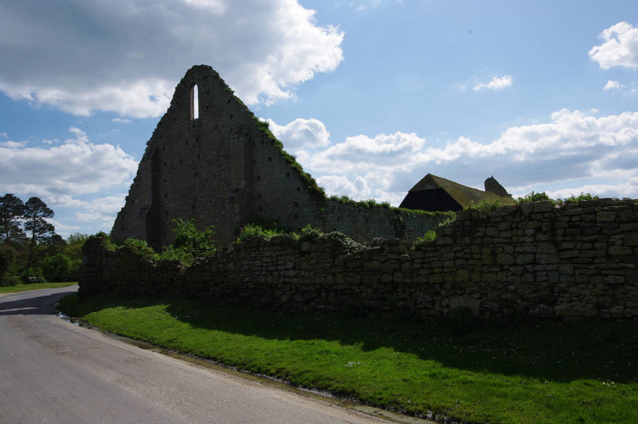
Reaching St Leonard's, I passed the ruins of a chapel (picture 23) before turning right on St Leonards Road. From the other side, I could see that a stable had been built inside the ruins (picture 24).
(25) View from Needs Oar Point Airfield
(26) Sowley Pond
(27) Pylewell Home Farm
(28) Pylewell Park Cricket Club
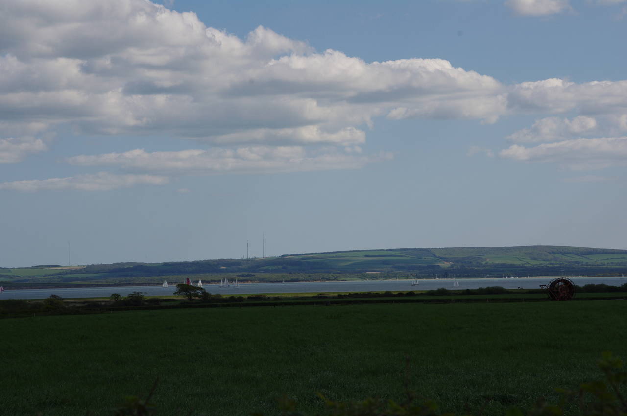
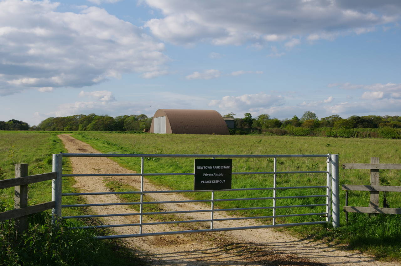
Thw Way follows St Leonard's Road through farmland for almost two and a half kilometres with very little traffic aside from the occasional group of cyclists. Part of the way along the road, in an area known as Needs Oar Point, I passed an information board explaining that an airstrip was built on the fields here in 1943 as a base for 100 Typhoon fighter-bombers to fly missions over France in preparation for the D-Day landings. The land was returned to farming in 1945 and there is little evidence of the airstrip's existence today. There are good views from here down the gentle slope to the Solent, about 1500 metres away, where I could see many sailing boats out on the water (picture 25).
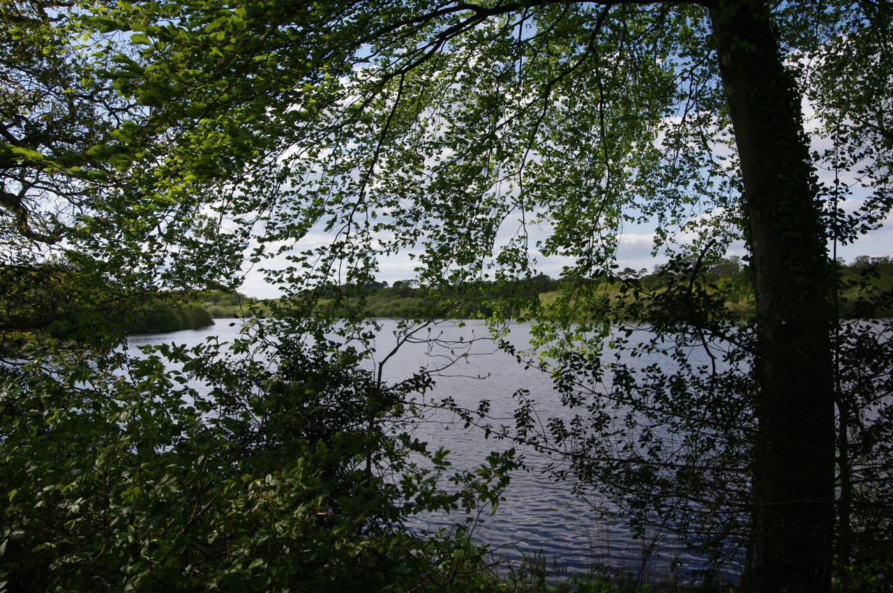
Eventually the road reaches a junction, where the Solent Way turns left on Sowley Lane. The lane heads southwest through more farmland for about a kilometre, then through woodland beside the large Sowley Pond (picture 26) for another kilometre. Just after leaving the woods, the Solent Way leaves the road through a wooden gate on the right and enters a field. The route follows the edge of the field parallel to the road as far as the corner of the field then turns right to climb away from the road to the next corner. The path then turns left through the field boundary and heads across the top of the next field and through the woods of Sowley Brooms to a stile on the far side. Continuing ahead along the edge of another field, the Solent Way arrives at a road junction at Pylewell Home Farm.
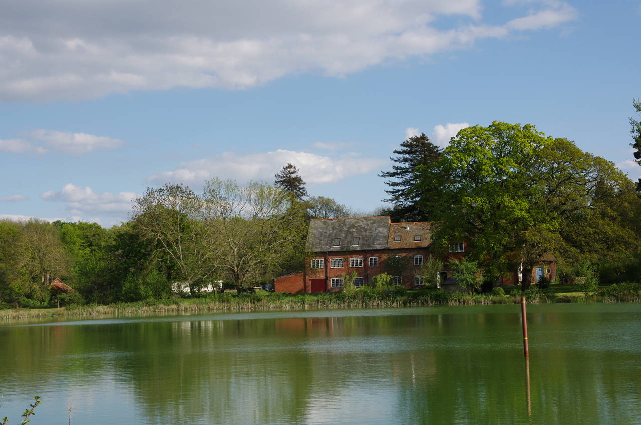
The Way continues ahead on a road for 150 metres, then when the road bends right the route continues ahead on a hedge-lined driveway. After crossing a wooden footbridge at the end of the driveway, the path passes the edge of a lake with a large farmhouse on the far side (picture 27). The path then heads through trees and along the boundary of the Pylewell Park Cricket Ground, which has an attractive thatched pavilion on the far side (picture 28).
(29) Pylewell House
(30) Lymington Airfield
(31) Walhampton Wood
(32) Memorial to Admiral Neale
The Way passes through a metal kissing gate at the corner of the cricket field and follows a driveway out to a lane. Another kissing gate opposite leads across the green pastures of Pylewell Park, with the grand Pylewell House briefly visible between trees some distance off to the left (picture 29). Reaching trees, the path bears right along the field edge to find a vehicle track leading through the trees and out to Shotts Lane, where a waymarker points to the right.
The lane crosses South Baddesley Road after three hundred metres then after a further 150 metres the route turns left across the Lymington Airfield. Like Needs Oar Point Airfield, this one was hastily created in 1943 and was used by American Thunderbolt fighter-bombers to attack sites in Normandy. Now in private ownership, the airstrip is still used and still has one of its original "blister hangars" (picture 30).
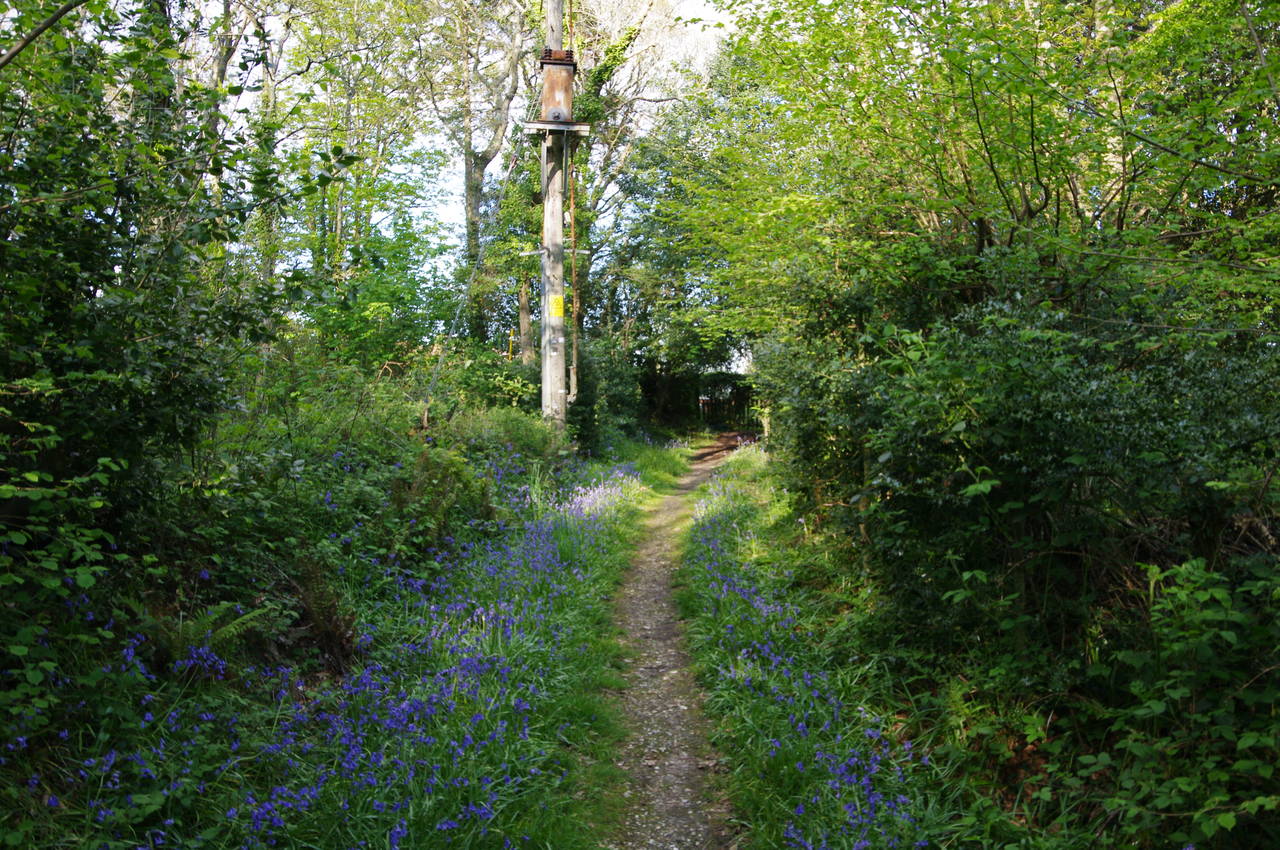
On the far side of the airstrip, the Solent Way passes the buildings of Snooks Farm then follows Snooks Lane a short distance to the left to find a wooden gate on the right that leads into Walhampton Wood. The path through the wood was lined with bluebells (picture 31), which flower for a few weeks in May.
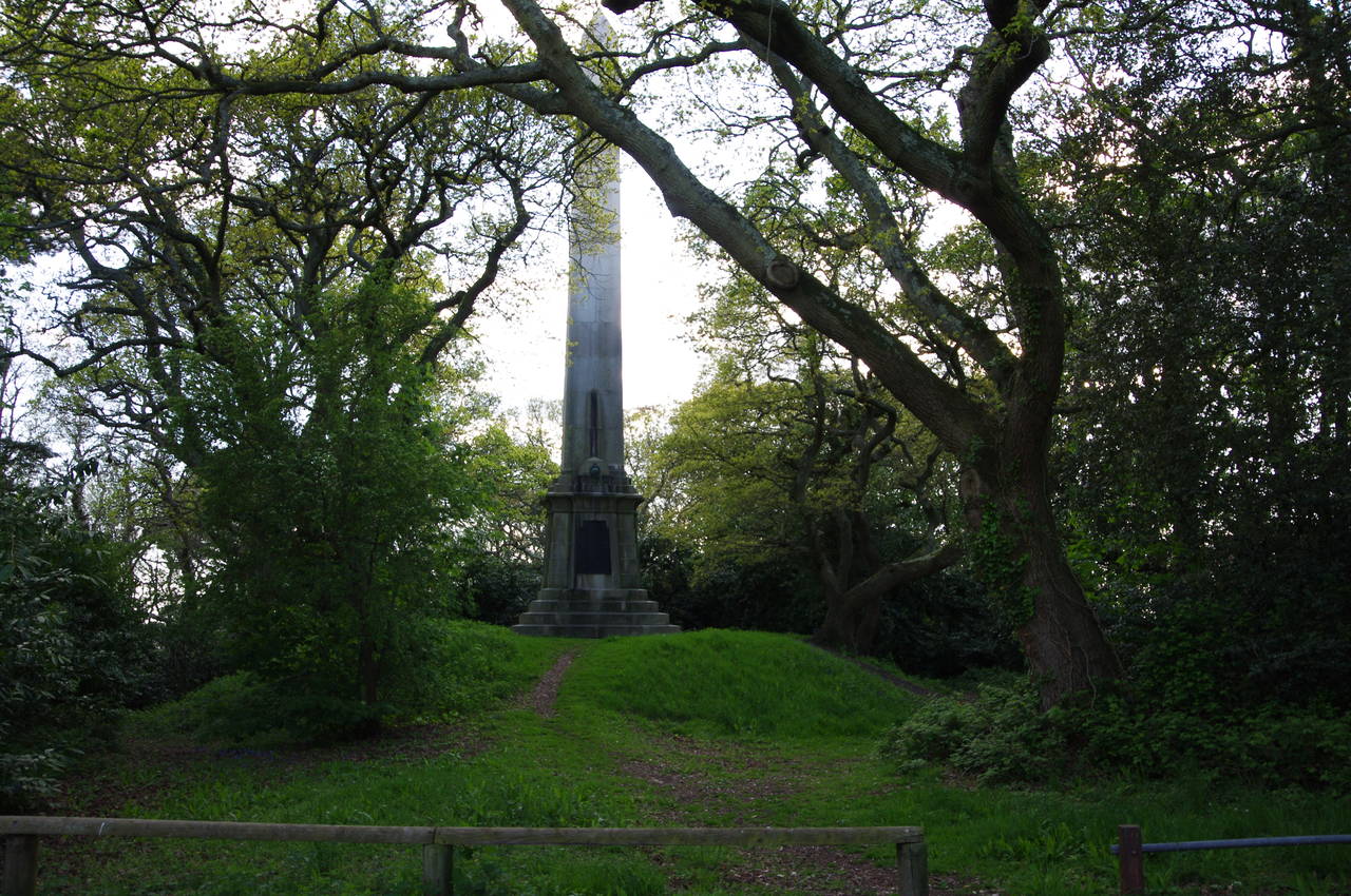
When the path emerges from the wood it runs along the edge of the Walhampton Golf Club and then along a farm driveway to reach Monument Lane, where the route turns right. When the lane bends to the right around the corner of the golf course, the Solent Way turns left through trees to pass a tall obelisk commemorating Admiral Sir Harry Burrard Neale, a 19th century member of parliament (picture 32).
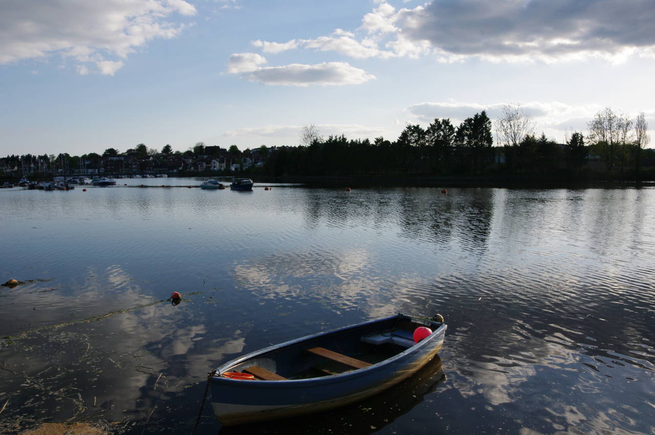
(33) Lymington River
(34) King's Head Inn, Lymington
(35) Lymington Town Station
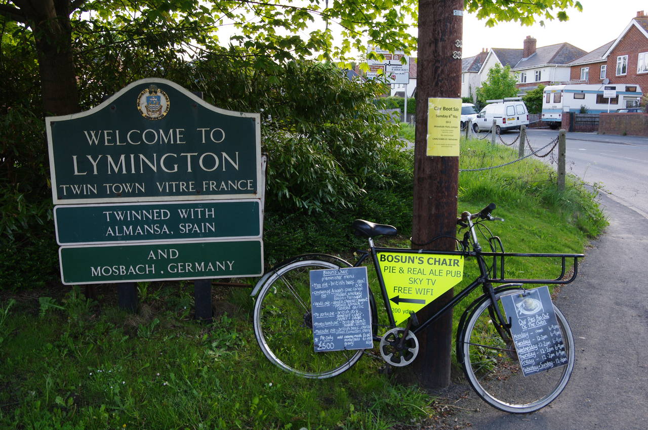
(36) Mobile advertising for the Bosun's Chair
A hundred metres further through the trees, the path reaches a wooden gate where it leaves the New Forest National Park and follows a driveway to Undershore Road on the bank of the Lymington River. Most of the town is located beyond the far bank (picture 33), and the Solent Way follows the road upstream to turn left into Bridge Road, which crosses the river and then the single-track branch railway line that connects Lymington to the south coast mainline at Brockenhurst.
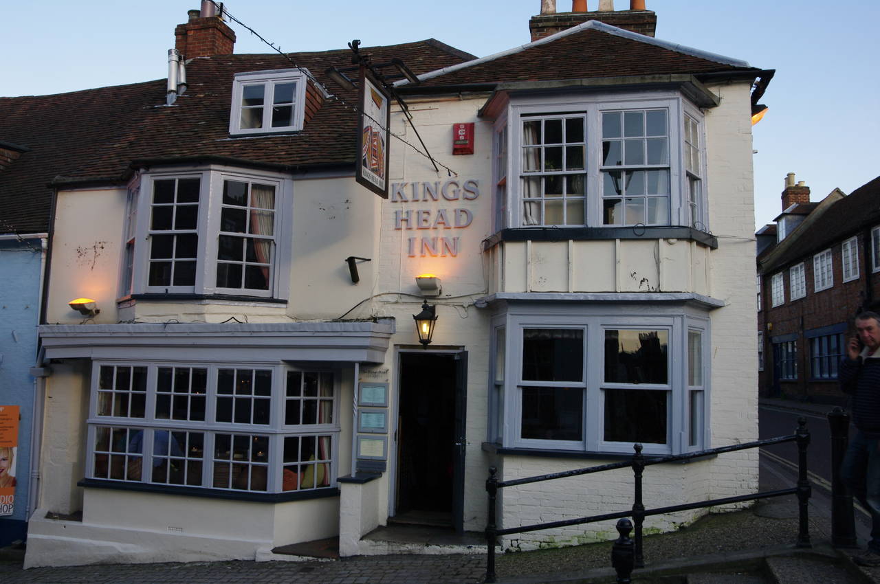
At a small roundabout, the route turns left to follow Gosport Road through the town to the foot of the High Street. Here the Solent Way turns left down the cobbled Quay Hill, which descends past the King's Head Inn (picture 34) and between touristy shops to the Town Quay. I decided that the pub was a good place to end the day's walk, having covered 27.7 kilometres.
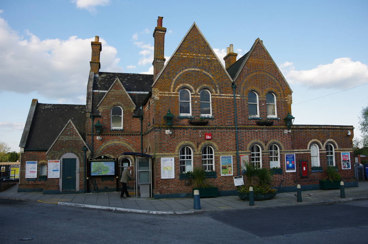
Afterwards, I backtracked one block along Gosport Road to Station Street, which leads down past the Bosun's Chair pub to Lymington Town Station (picture 35). A few days after the walk I visited the Bosun's Chair for lunch. The pub is well-known for its pricey but very tasty range of pies and for its method of advertising using old bicycles dotted strategically around the town, including one that I had passed earlier on Bridge Street (picture 36).