THE SAXON SHORE WAY
Stage 14: Rye to Hastings
Thursday, March 3rd 2011
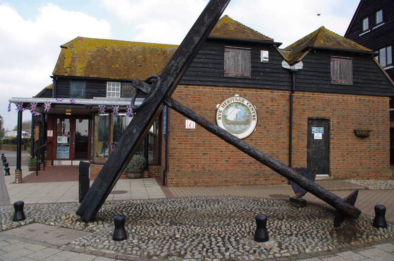
(1) Rye Heritage Centre
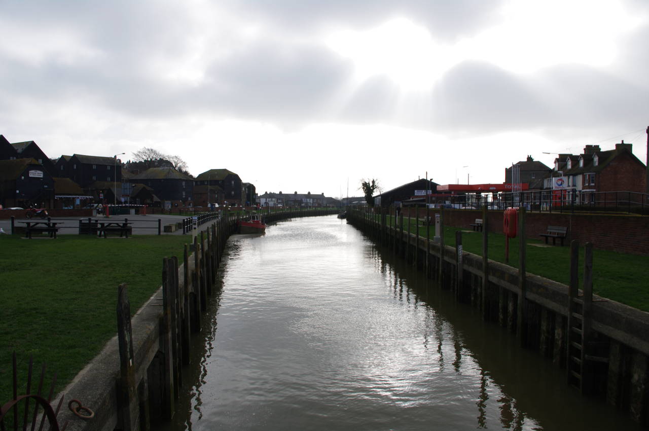
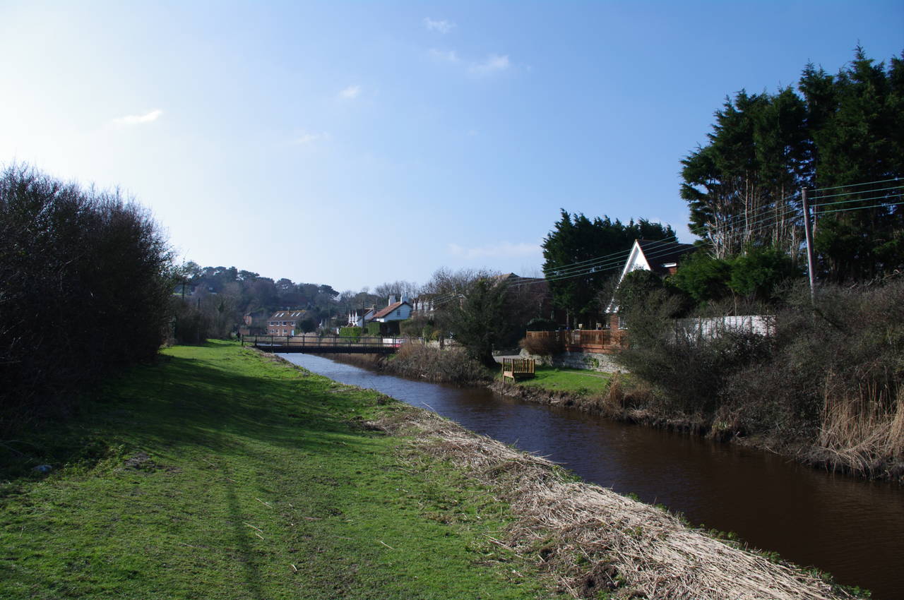
(2) River Brede, Rye
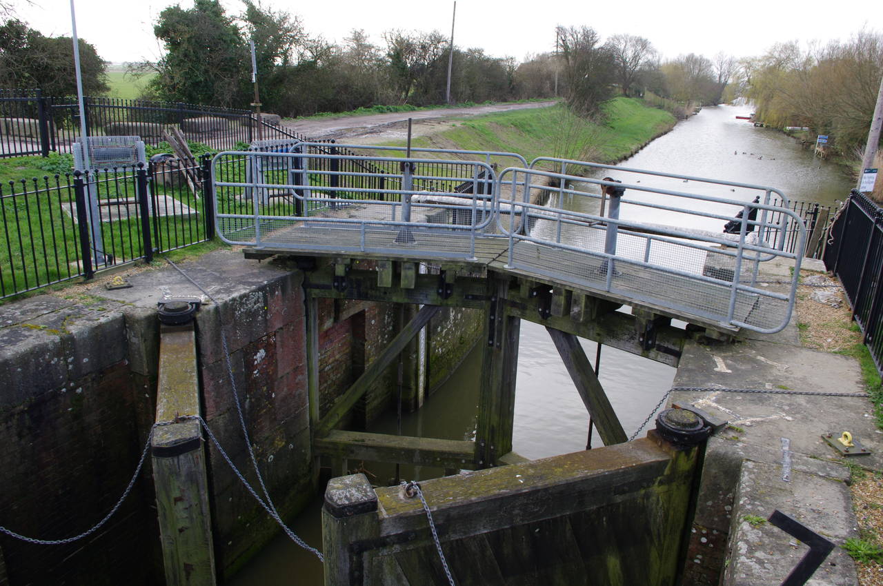
(3) Brede Sluice, Rye
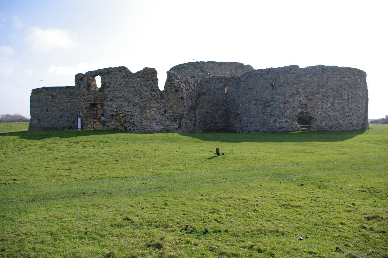
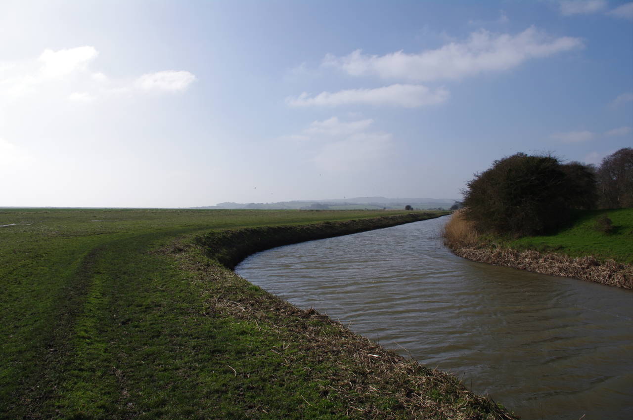
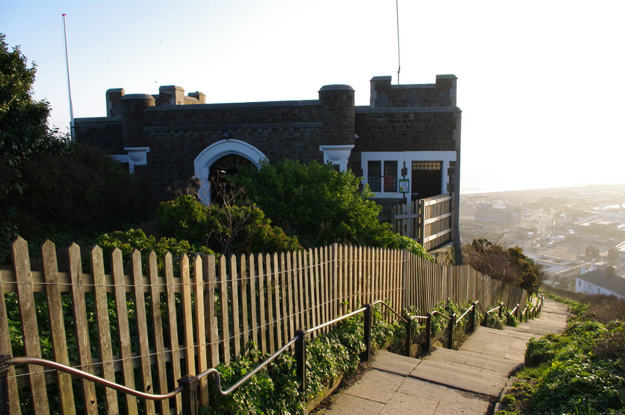
(4) Approaching Camber Castle
I walked this, the final section of the Saxon Shore Way, on Thursday, March 3rd 2011, setting off from the Rye Heritage Centre (picture 1) at around 9.30 in the morning.
From the Heritage Centre, the route of the Saxon Shore Way follows the main road for a short distance to a small roundabout, where it turns left across the River Brede (picture 2) and left again to head down New Winchelsea Road. A few hundred metres further on, the route turns left along Harbour Road to cross a bridge over the Brede Sluice (picture 3). The heavy wooden lock gates are visible in the foreground of the picture.
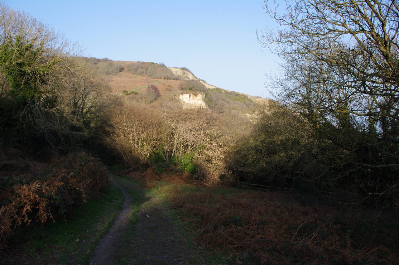
The route follows a track along the bank of the River Brede for a short distance until the track curves to the left around some houses before returning to the river. A short distance further along the river the route bears off to the left beside a drainage ditch and crosses the Rye Marshes Nature Reserve to pass a little to the right of Camber Castle (picture 4). As I approached the castle, the sun emerged from the clouds, which were rapidly disappearing over the horizon.
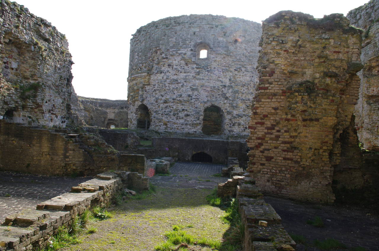
(5) Inside Camber Castle
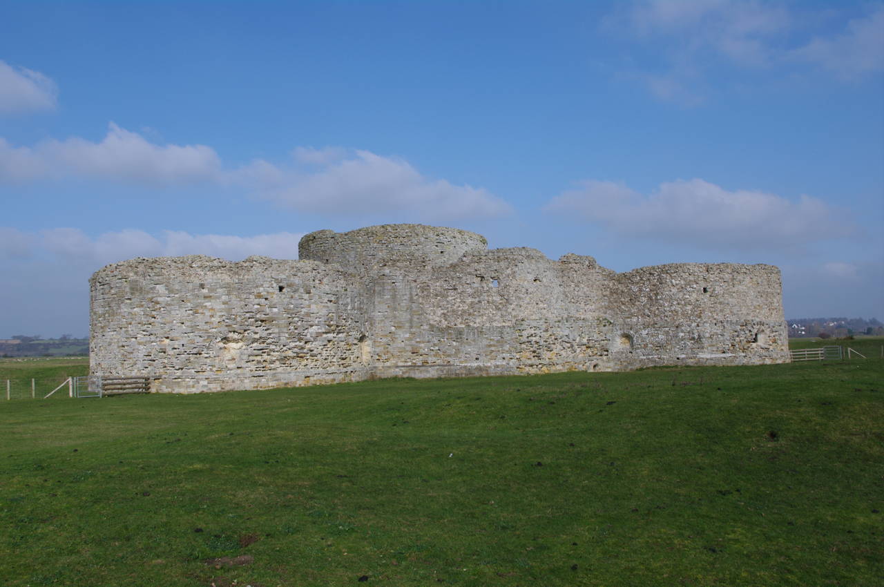
(6) Camber Castle in sunshine
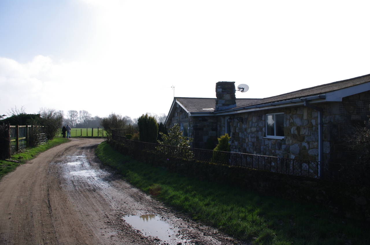
(7) Castle Farm
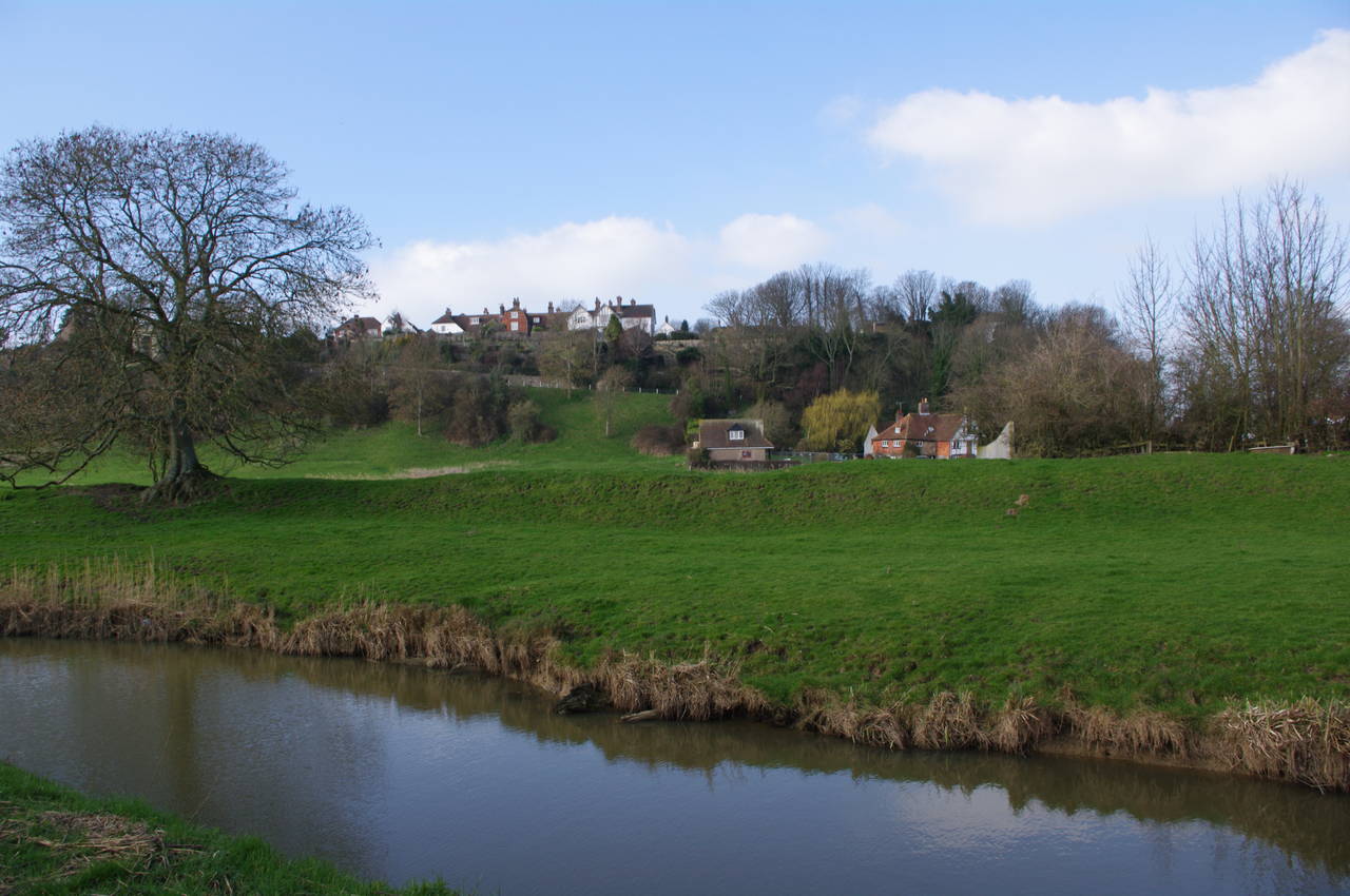
(8) Royal Military Canal below Winchelsea
Camber Castle was built in 1539 as part of Henry VIII's coastal defences, but was abandoned a century later when the changing coastline had left it marooned inland. The castle is designed in the shape of a Tudor rose, similar to Deal Castle, thought the latter is much better preserved.
The castle was closed when I arrived, though I was able to take a peek inside the walls through the bars of the front gate (picture 5). After walking around the castle I rejoined the Saxon Shore Way, which takes a slightly curved path across the fields to the south of the castle. From this side the castle looked quite different with the sun shining directly on it (picture 6).
I soon reached a gate next to River Brede Farm, turning right onto a rough vehicle track which passes a pretty stone cottage at Castle Farm (picture 7). The track soon joins a sealed driveway in front of River Brede Farm, where the route turns left, following the driveway until it emerges at a bend in Sea Road.
The route then follows Sea Road straight ahead for around a kilometre, with the houses of Winchelsea on top of the cliff ahead. Just before Sea Road joins the A259, the route leaves the road and follows a grassy footpath along the left bank of the Royal Military Canal with good views across the canal and up to Winchelsea (picture 8).
(9) Royal Military Canal and Pett Level
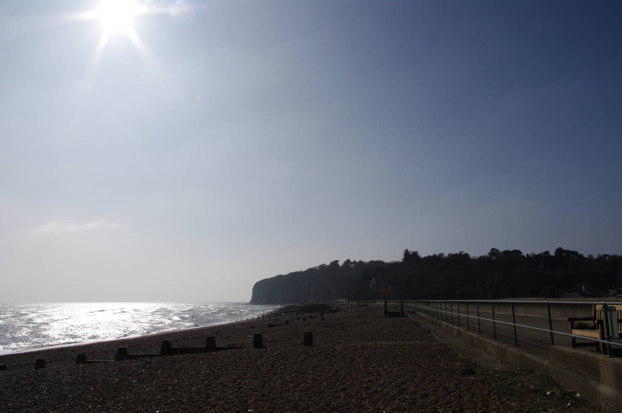
(10) Royal Military Canal, Cliff End
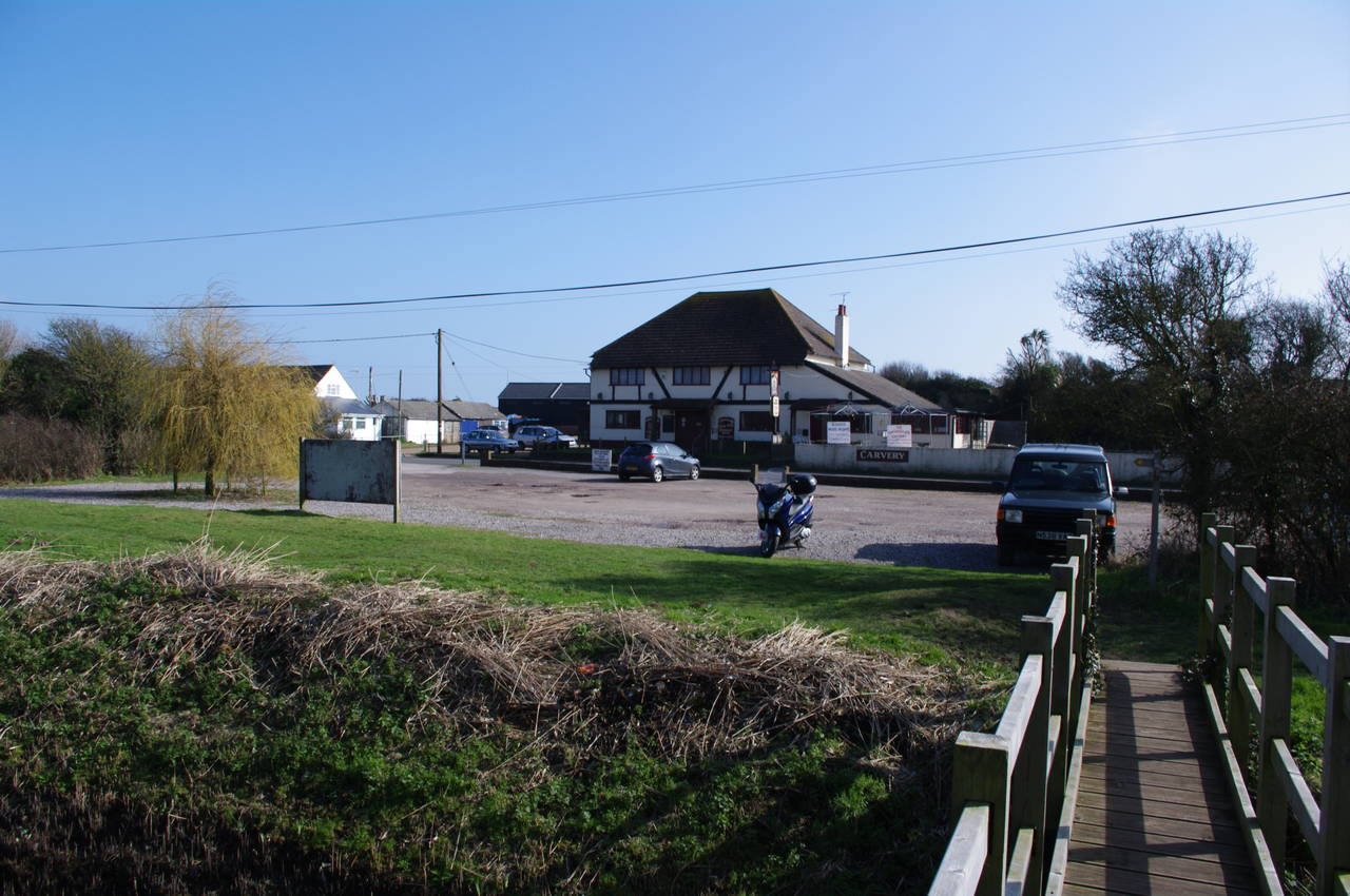
(11) The Smuggler, Cliff End
(12) View towards Fairlight
The ancient town of Winchelsea gradually falls behind as the route follows the Royal Military Canal across the flat expanse of the Pett Level at the foot of the low cliffs that formed the coastline in Saxon times. By the time the path reaches a 45 degree bend in the canal a kilometre past Winchelsea, with the hills of Hastings Country Park rising above the horizon ahead (picture 9), the path felt very peaceful and isolated, with just the rustling of the stiff breeze disturbing the long grass beside the path for company.
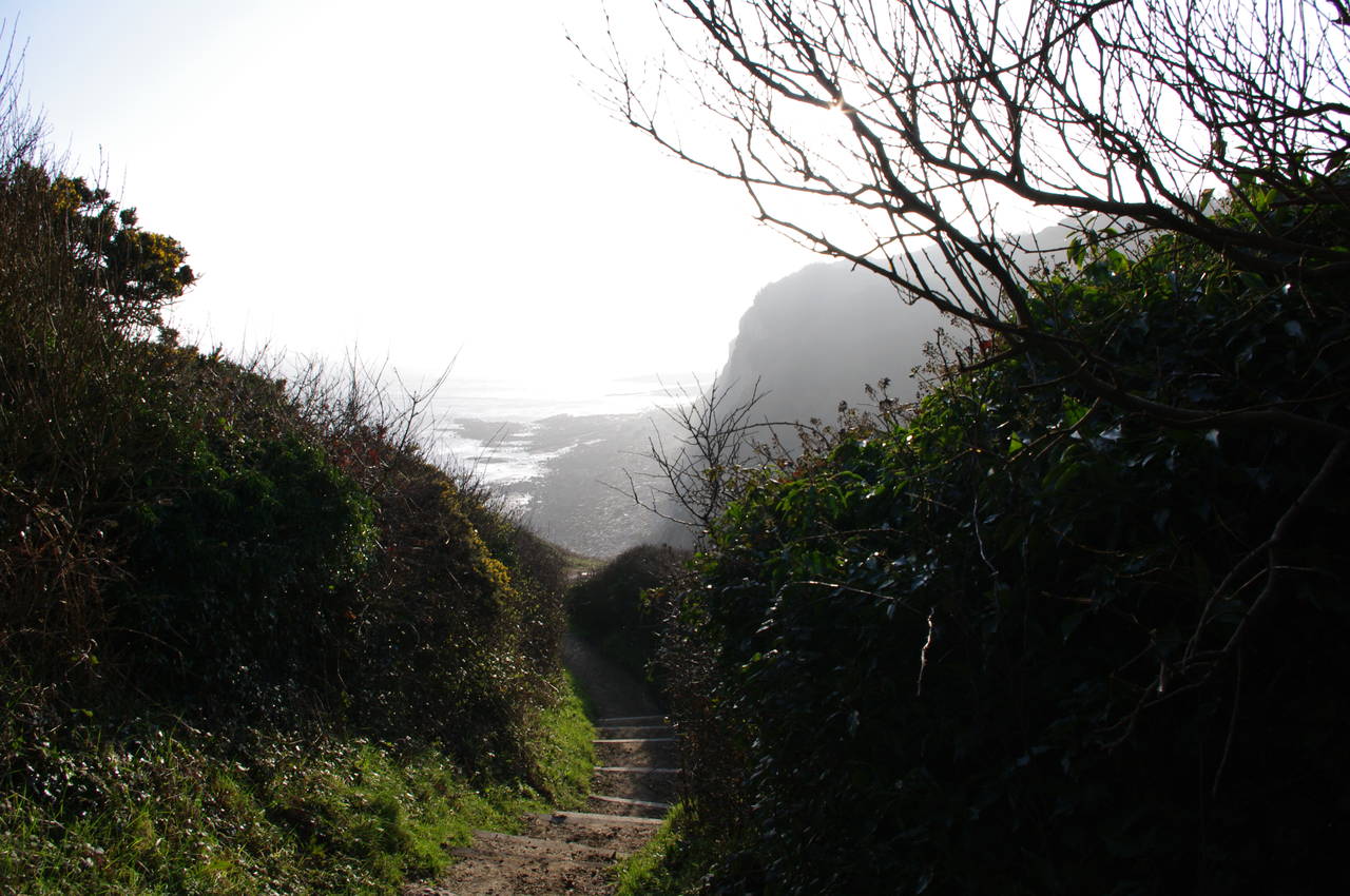
The route continues to follow the Royal Military Canal southwest for a little over a kilometre before another bend takes the canal directly south towards the English Channel. Just before the sea wall is reached, four kilometres from Winchelsea, the canal makes one final turn to the right to run parallel to the coast and into the village of Cliff End (picture 10). The path ignores the first bridge across the canal (a wide concrete bridge) and continues along the left bank until it reaches a narrow wooden footbridge behind the car park of the Smuggler pub (picture 11).
At this point, I left the Saxon Shore Way and headed across the road to the pub, where I enjoyed a nice chicken curry and a pint. When I had finished my lunch, I walked around behind the pub and sat on the shingle beach for a few minutes in the bright sun. To the west there were views to the cliffs of Fairlight, which I would be walking along shortly (picture 12). By now the sky was almost completely clear of clouds, though some of the previous day's haze still remained.
(13) View from Fairlight
(14) Fairlight Cove
(15) Hastings Country Park
(16) Signpost, Hastings Country Park
Rejoining the Saxon Shore Way, I crossed the footbridge over the Royal Military Canal and turned left to follow the bank for the last hundred metres of the canal. The route then turns right along a road, starting to head uphill. After a short distance the road passes a signpost pointing to Pett Village and just beyond this the Saxon Shore Way follows a driveway to the left for a few metres before taking a footpath on the right. Unfortunately there is no waymarking on the road, so the turn is easy to miss, though there is a marker post where the footpath leaves the driveway.
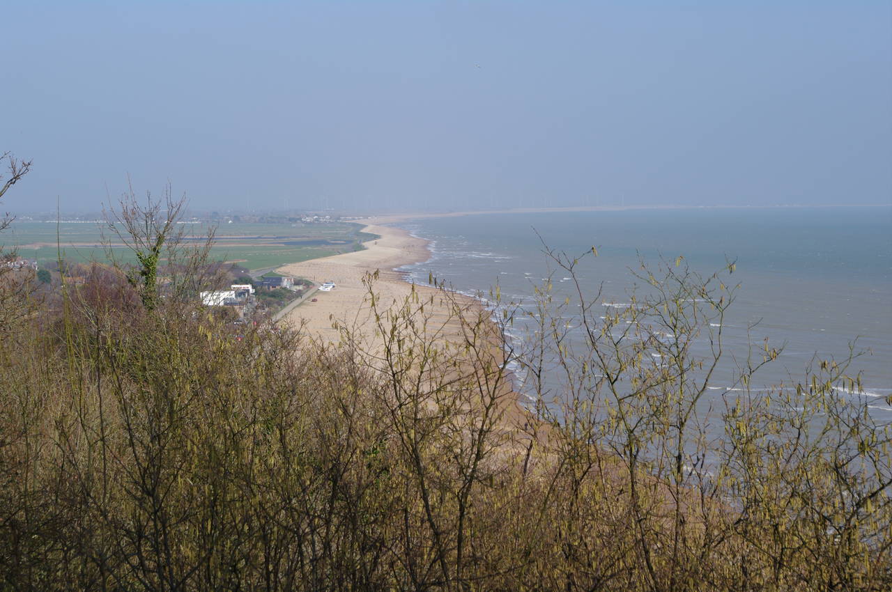
The footpath climbs steadily up to the cliff tops of Fairlight, from which one can look down to Cliff End and across Romney Marsh towards Camber (picture 13), where the tall white turbines of the Romney Marsh Wind Farm were turning quite rapidly in the strong breeze, though my camera didn't do a good job of picking these up due to the haze in the atmosphere.
The path levels out and continues across the National Trust's Fairlight reserve. Soon the path begins to descend beside grassy fields towards Fairlight Cove (picture 14). Just after the path curves to the right around a house, a waymarker on a tall post points through a gap in the trees on the left and out to a road. The route crosses the road (called Sea Wall) and continues straight ahead along Lower Waites Lane.
From here the route zig-zags through the streets of Fairlight Cove. At the far end of Lower Waites Lane, the route turns left along Smugglers Way, and at the end of that turns right into Brambles Way. At the end of Brambles Way, the route turns left into Shepherds Way, which heads back up to the cliff edge, where the route turns right into Channel Way, which leads along the cliff top into the Hastings Country Park.
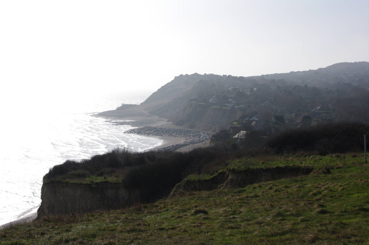
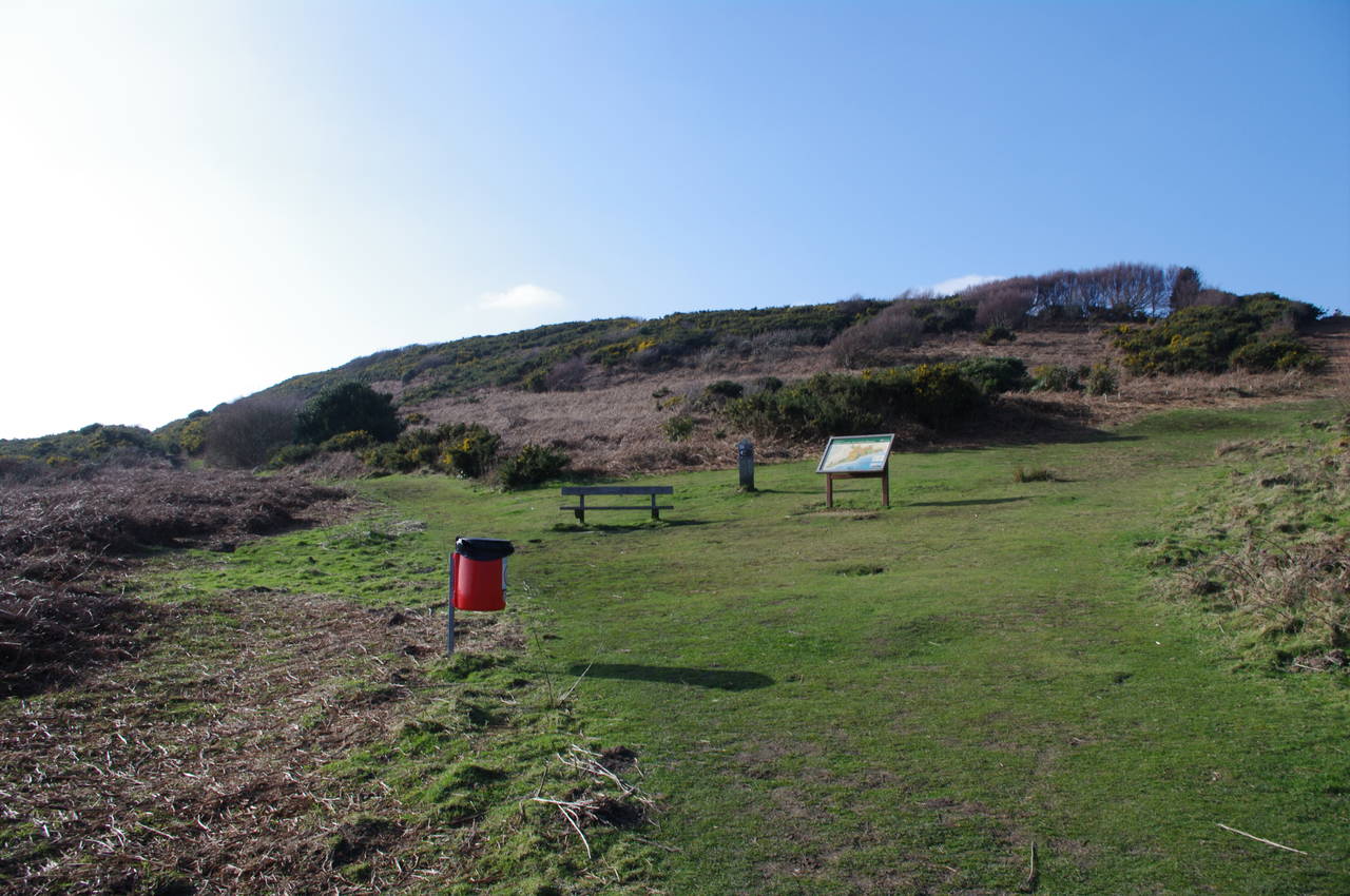
Just through the gate of the country park, the path forks, but there is no waymarker here for the Saxon Shore Way. The right hand path soon leads to a clearing where there is an information board, and a good view up to an area known as Firehills (picture 15).
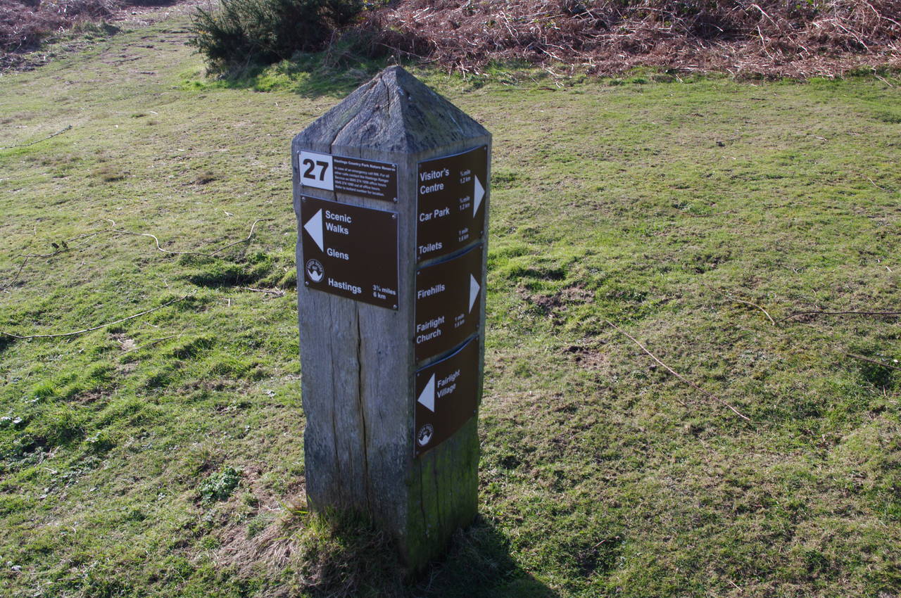
The clearing also has a large marker post which confirms the route of the Saxon Shore Way (picture 16), and shows a distance of six kilometres to Hastings and the end of the Saxon Shore Way. There are quite a few of these marker posts in the Hastings Country Park, though the distances marked on them were usually in multiples of four hundred metres and some of them proved to be quite inaccurate.
(17) Hastings Country Park
(18) Approaching Warren Glen
(19) Steps down to Warren Glen
(20) Warren Glen
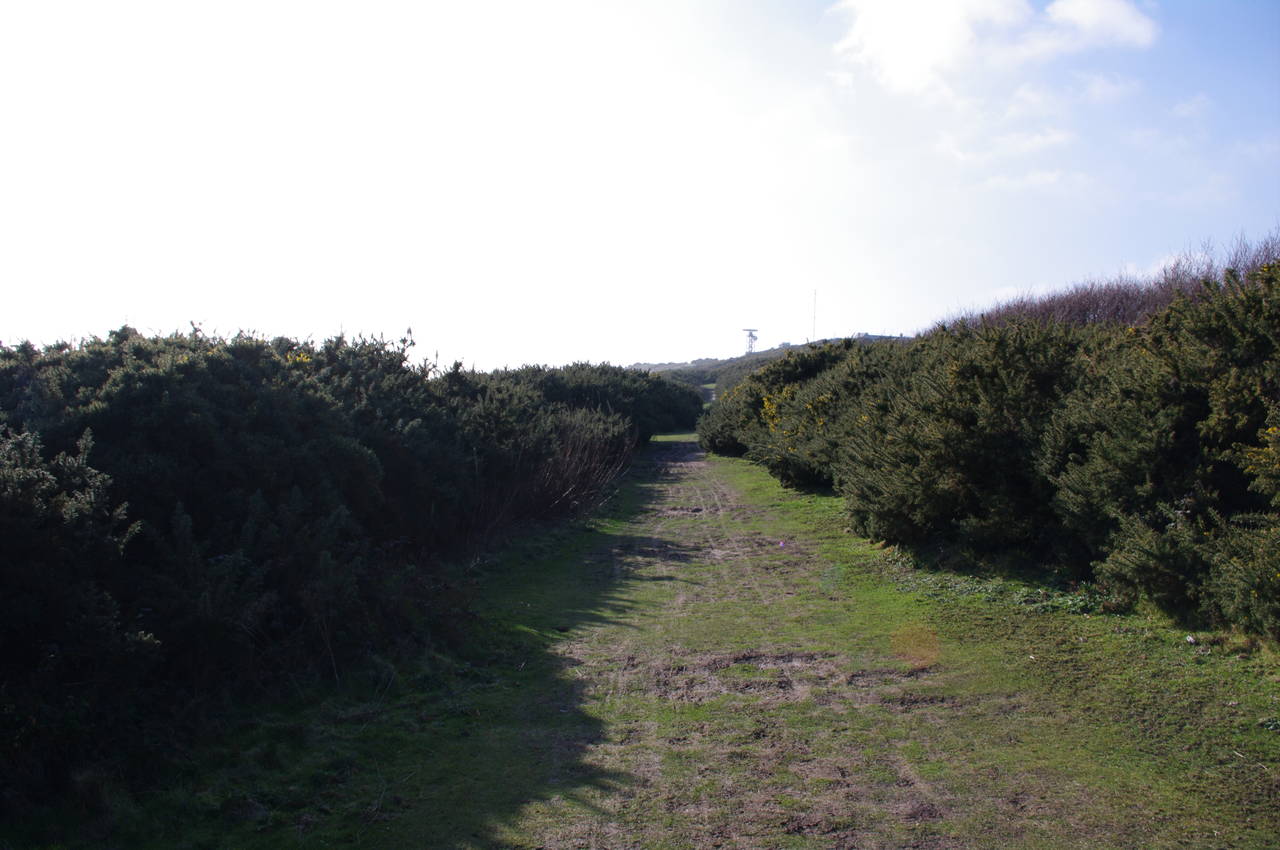
From the clearing the path heads over the hills through very thick scrub (picture 17), which often encroaches very close to the paths, and I was glad to be wearing thick winter clothes to protect me from the scratchy foliage. Eventually the path emerges into a more open area just above a coast guard radar station (the radar mast can just be seen in the distance in the larger version of picture 17). Here I was doubly glad of my choice of attire, as the cold wind was blowing very hard, forcing me to stop and fish my gloves out of my backpack.
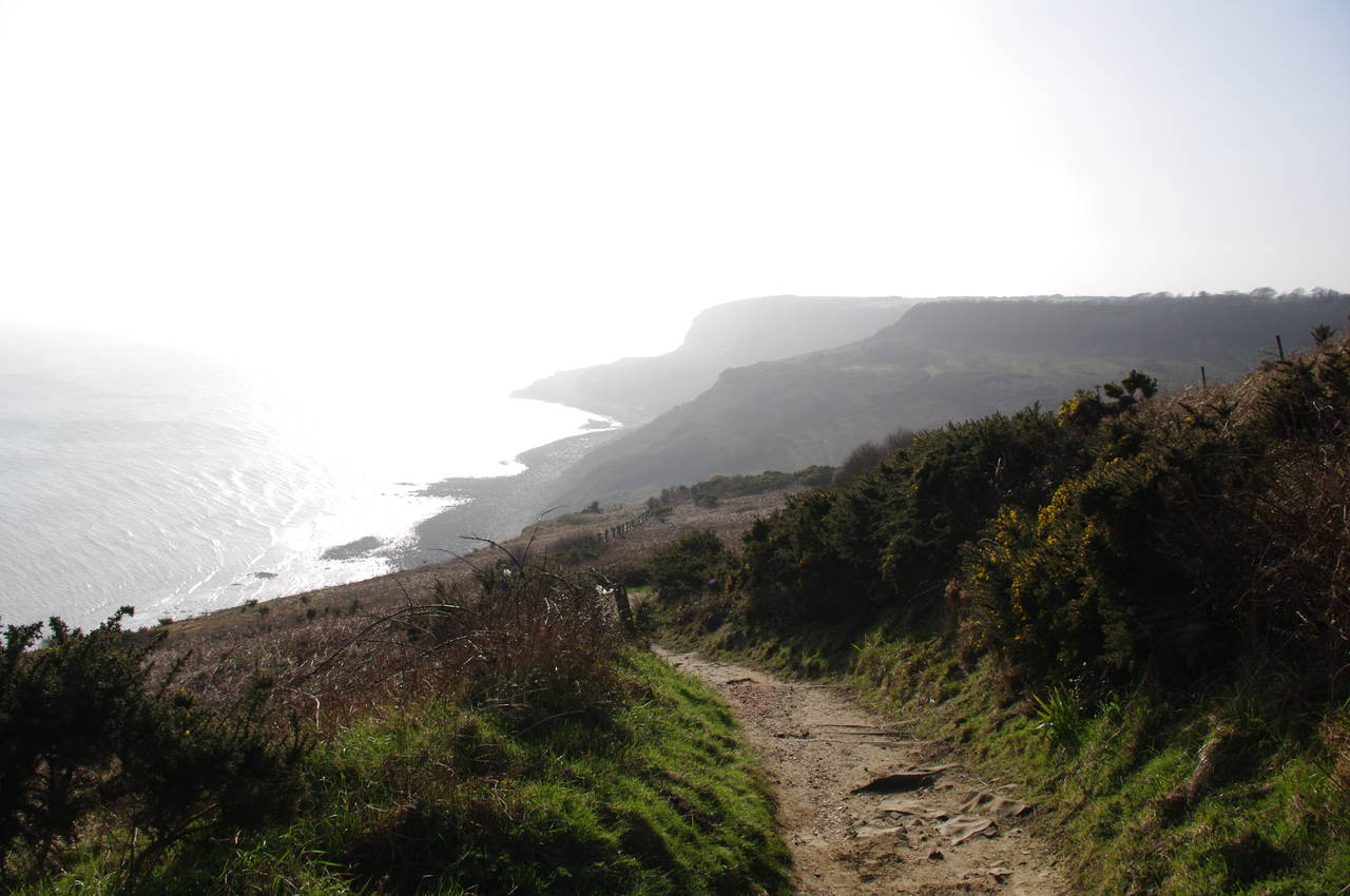
The path then heads downhill to the left, passing close by the radar dish and back to the cliff edge. Soon the path starts to descend into Warren Glen, the first of three glens on the path; glens are large gaps cut into the cliffs by streams. From the top of the descent, I could see the hills between these three glens silhouetted by the afternoon sun (picture 18), which was now directly ahead and gradually getting lower in the sky.
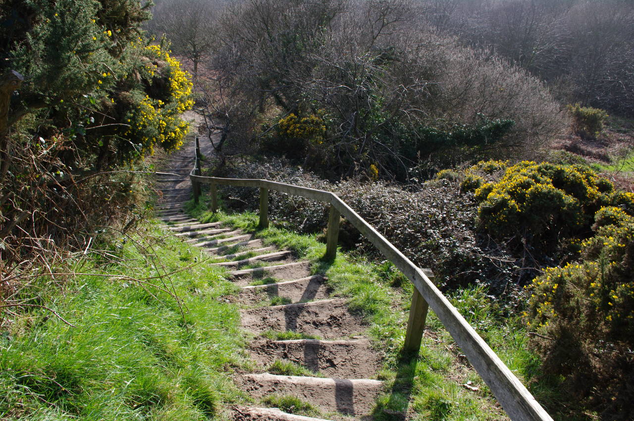
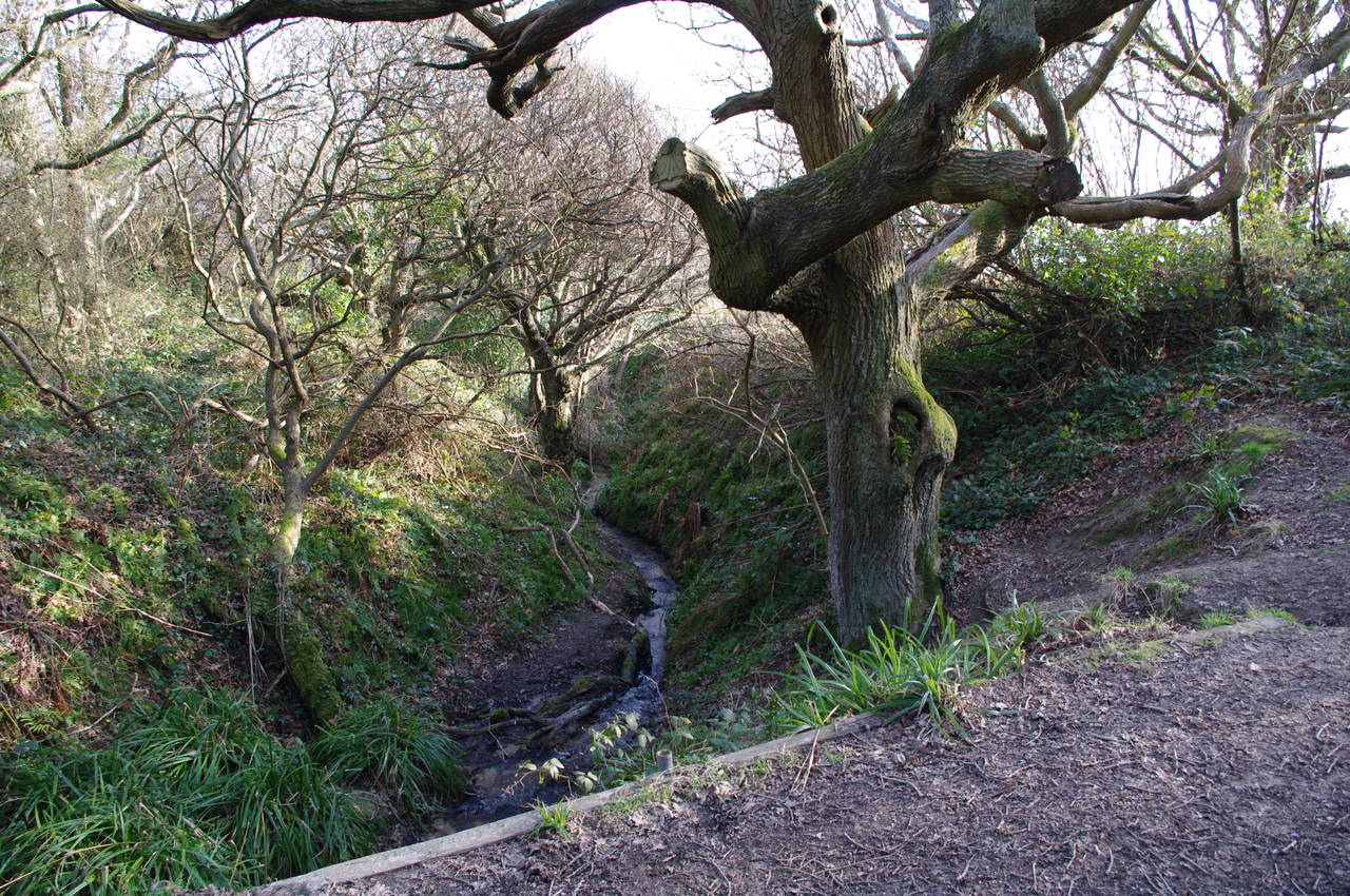
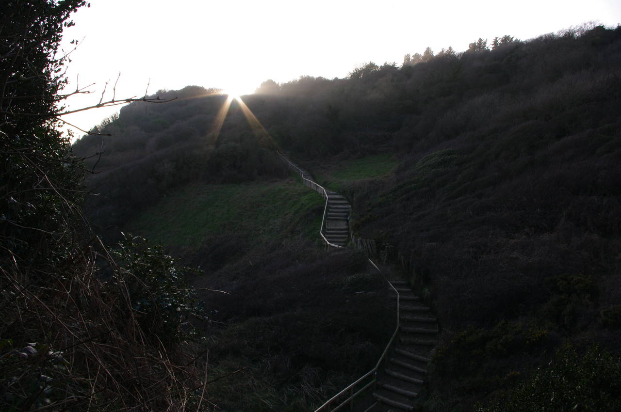
The path down into Warren Glen is quite steep in places and there are many wooden steps built into the hillside (picture 19). At the bottom of Warren Glen, the path crosses a small stream (picture 20), and then begins to climb again. The path leads steeply uphill through a patch of woodland and then over the open, grassy hilltop before descending again to Fairlight Glen.
I had read that there was a small beach where the stream through Fairlight Glen flows into the English Channel, but signs posted where the main path crosses the stream indicated that the beach was closed due to recent rock falls. The coastline here is constantly changing due to coastal erosion.
(21) View back across Fairlight Glen
(22) Path down to Ecclesbourne Glen
(23) Ecclesbourne Glen
(24) View back across Ecclesbourne Glen
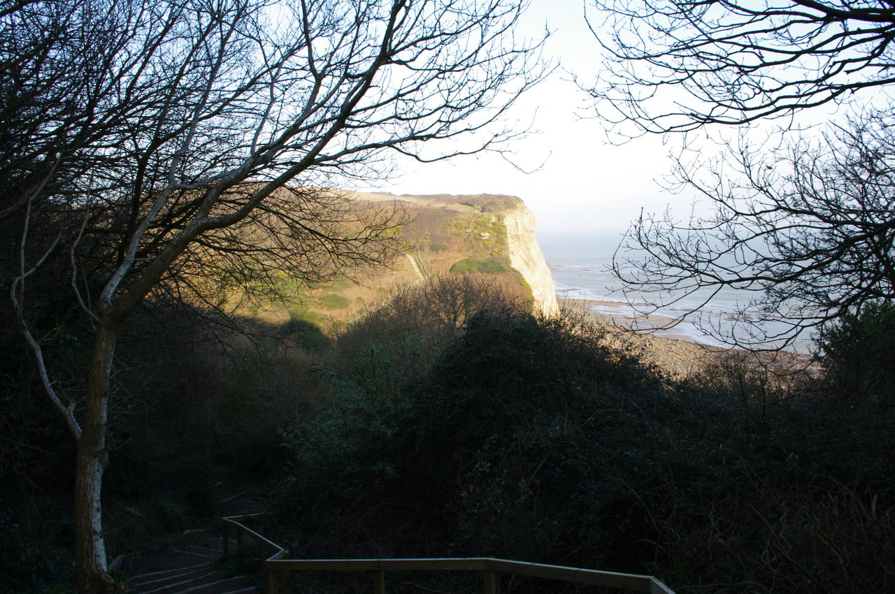
Another steep climb brings the path up the next hill, where I took picture 21 looking back across Fairlight Glen. The top of the hill is open and grassy with sheep fields off to the right. The route follows a wide, fence-lined path over the crest of the hill before the path descends once more to Ecclesbourne Glen. The path down to Ecclesbourne Glen (picture 22) seemed to be the steepest and longest of the three glens. There were steps for much of the way and for the last half of the descent I could see more steps snaking their way up into the trees on the other side of the glen, though with the sun directly ahead I couldn't get a good picture until I had descended into the shadow of the next hill (picture 23). Looking back from near the top of the next hill, I could see most of the path down into the glen and the late-afternoon sun shining on the cliff face (picture 24).
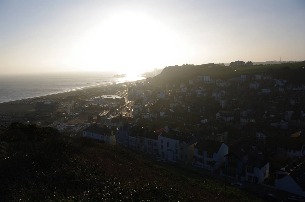
(25) Hastings Old Town and seafront
(26) East Hill Lift Terminus
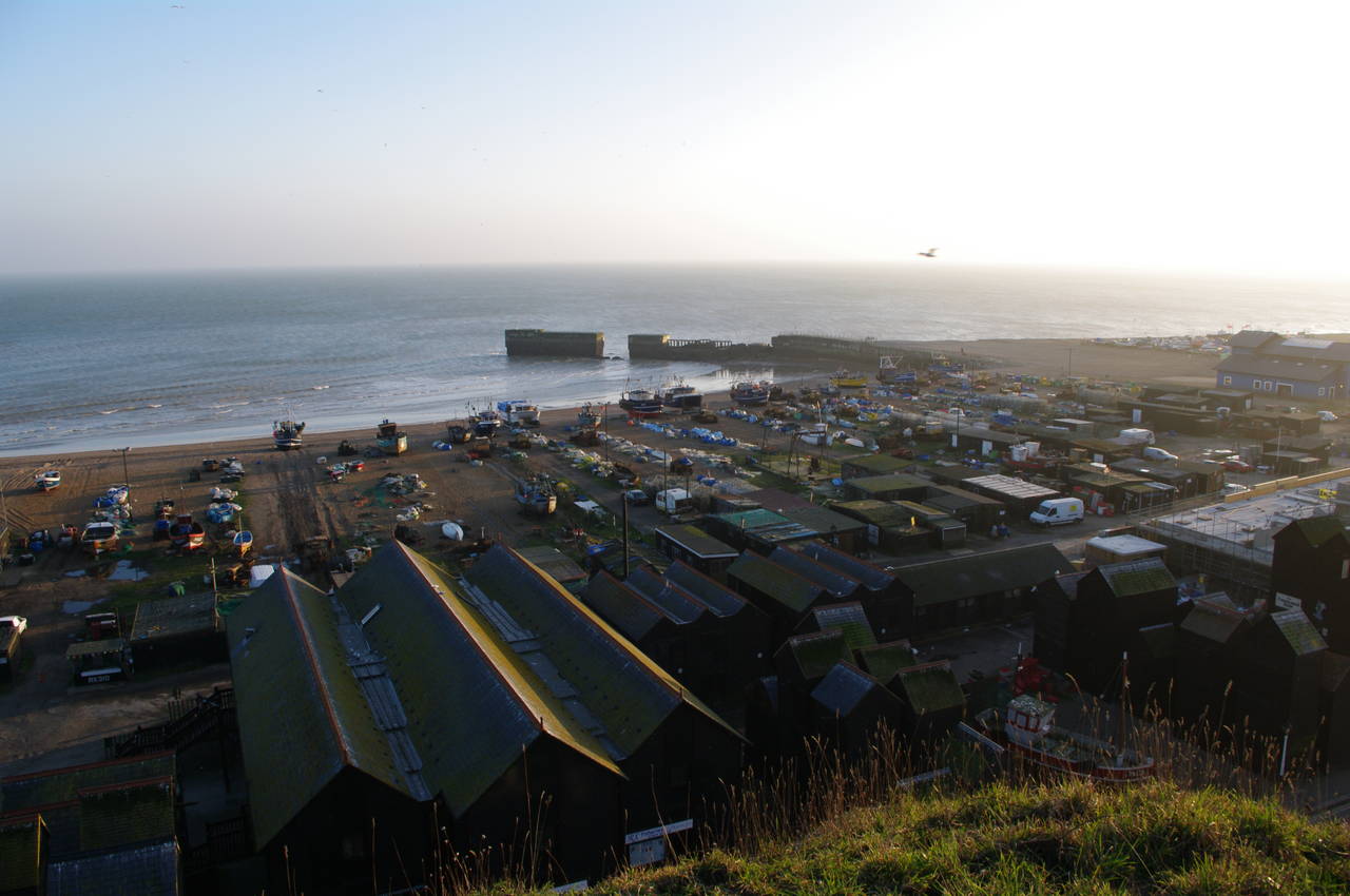
(27) Hastings Harbour
(28) Tamarisk Steps, Hastings
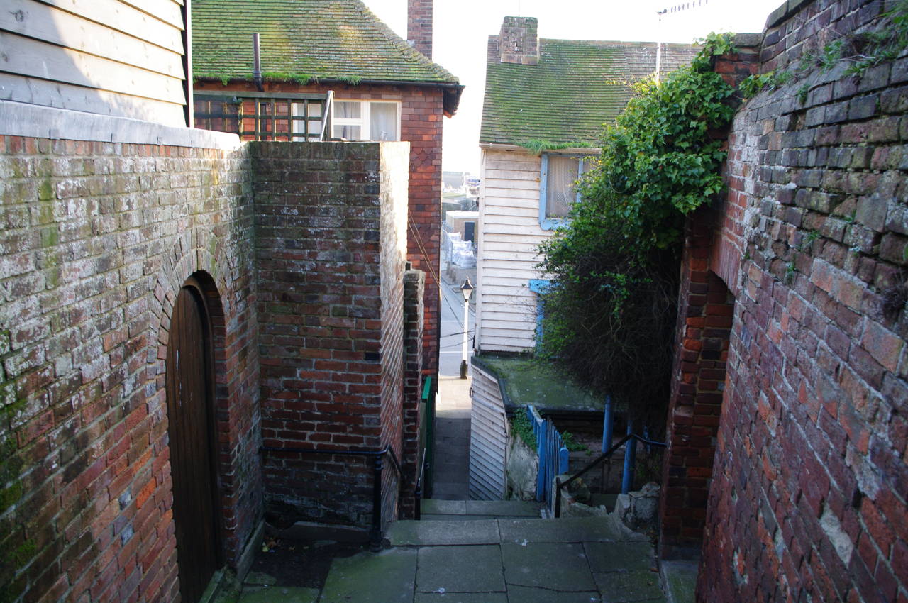
Eventually the path levels out and emerges from the trees to cross the grassy expanse of East Hill. Gradually the houses of Hastings Old Town come into view as the path heads down to join a long flight of steps with the town and seafront below (picture 25). The steps soon pass the upper end of the East Hill Funicular Railway (picture 26), and continue down the side of the hill above the "harbour", where many boats were pulled up on the beach (picture 27). At the bottom of the steps, the route turns left along a road for a few meters to reach the Tamarisk Steps (picture 28), which descend steeply between houses to reach Rock-a-Nore Road.
(29) Fisherman's Huts
(30) Sunset over Hastings Pier

(31) Hastings Pier
(32) White Rock Theatre
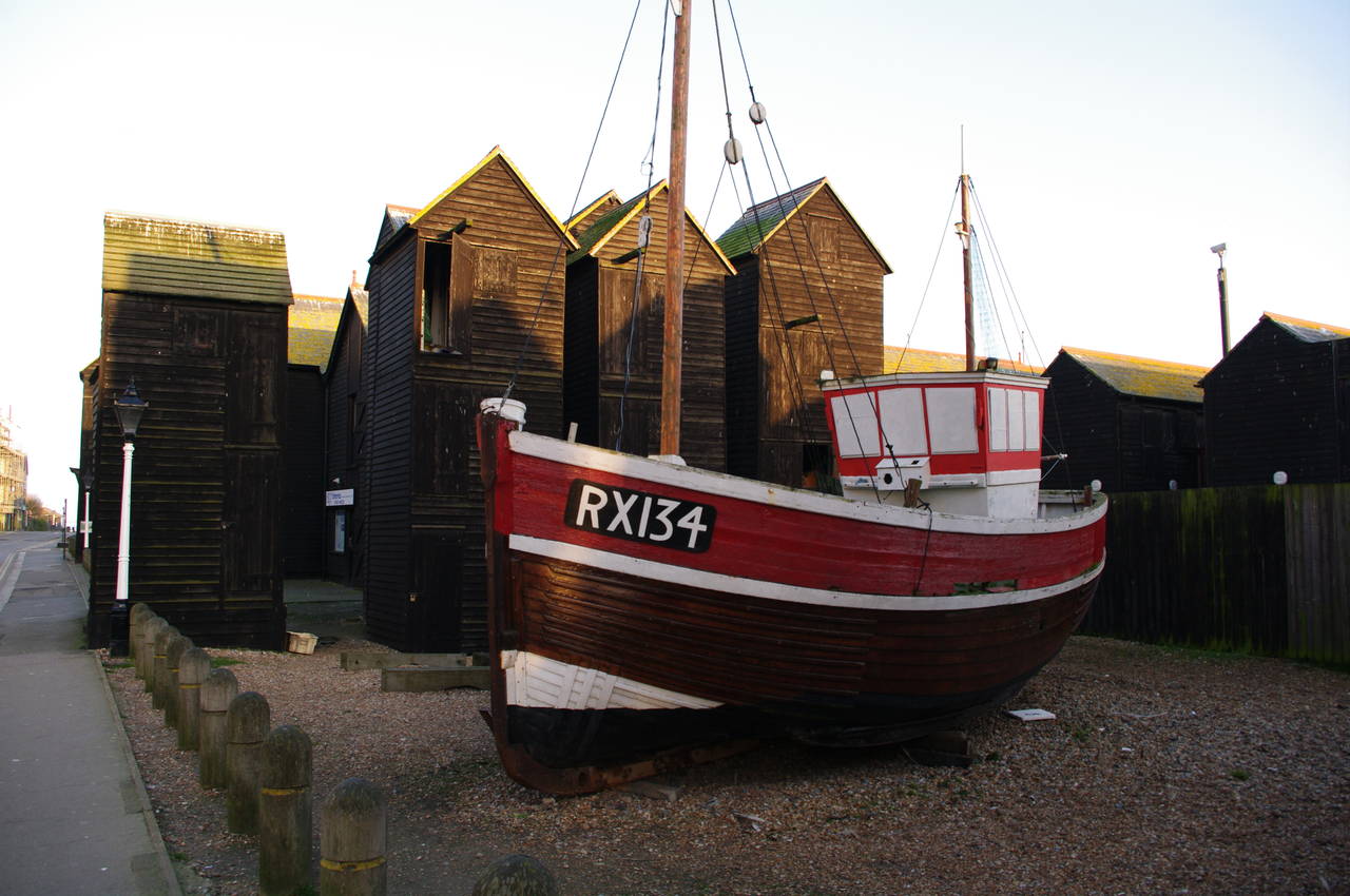
At the bottom of the steps I crossed the road to the rightmost group of old wooden fishermans' huts (picture 29), where the Saxon Shore Way ends, 19.6km from Rye and 257km from Gravesend.
This part of Hastings Harbour has many of these huts, some of which are home to the Shipwreck Museum and a number of seafood shops.
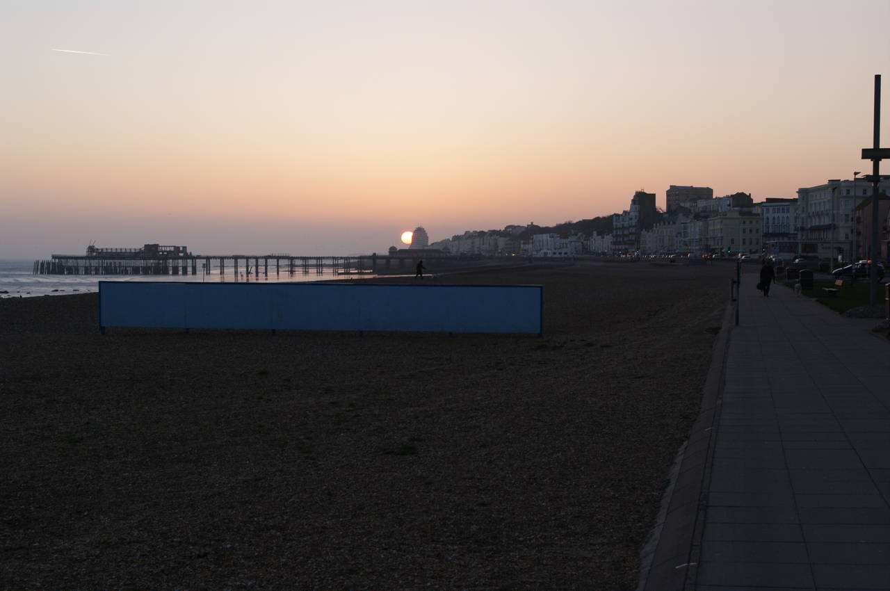
Having completed the official part of the walk, I headed west along the beachfront footpath passing a large amusement parlour, a boating lake and a mini-golf course next to the harbour, then continued along the beach towards the Hastings Pier as the sun set in front of me (picture 30). As I got nearer the pier, I noticed a couple of cyclists riding along the wet sand exposed by the receding tide.
Sadly, the pier itself was closed, having been badly damaged by a fire on 5th October 2010 and the damage was still very evident (picture 31). A sign on the construction fence that had been erected at the landward end of the pier attempted to reassure visitors that the pier was not going to be demolished. [A reader informed me that the pier has since been renovated and re-opened to the public on 27th April 2016.]
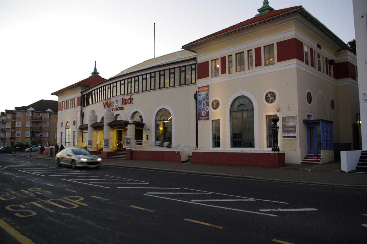
Opposite the pier is the magnificent White Rock Theatre (picture 32), which happens to be right next to the White Rock Hotel, where I stayed while completing the last three stages of the Saxon Shore Way. In the hotel's bar, I celebrated completing the walk with a pint of Ruby Mild.
The Saxon Shore Way has been an interesting trail to walk, with a great variety of river, coastal and inland scenery, Roman fortresses, Norman castles at Rochester and Dover, Henry VIII's castles at Deal and Camber, ancient towns like Faversham and Rye, the high cliffs of Dover and the flat wetlands around the Swale and Romney Marsh, and of course, a good number of interesting pubs to visit.
Access to the trail is good, with train stations at regular intervals along most of the trail. In summer it would probably be possible to do the entire walk in stages between train stations, though in winter this is more difficult due to the short daylight hours and the muddy state of some parts of the trail. Fortunately, there are reasonably regular bus services to many of the towns and villages that have no train station.