THE RIDGEWAY NATIONAL TRAIL
Stage 3: Court Hill to Goring
Saturday, October 13, 2012
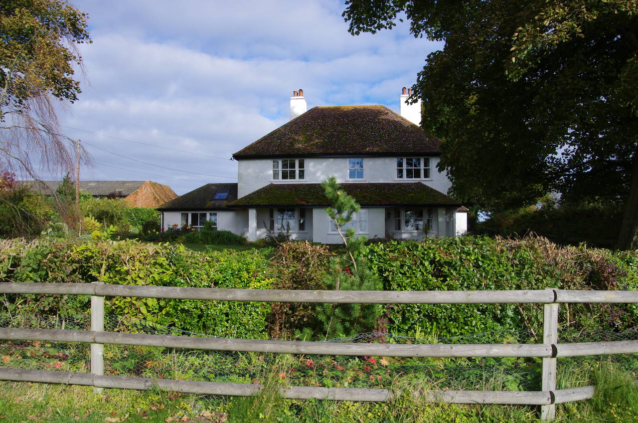
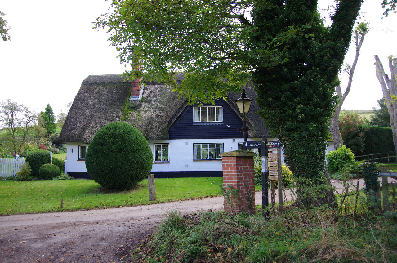
(1) White House Farm
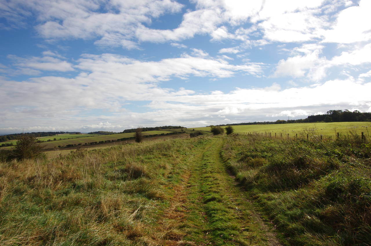
(2) Path towards B4494 crossing
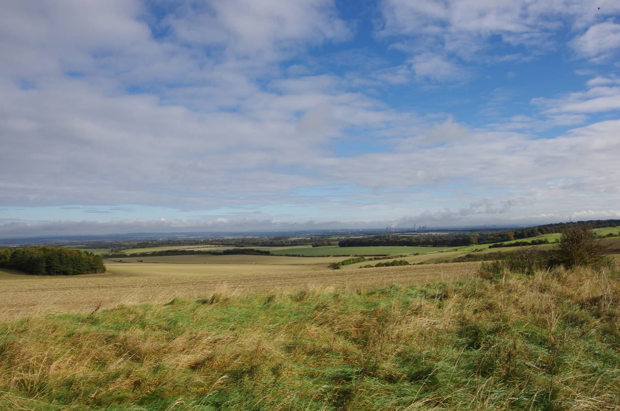
(3) View towards Didcot
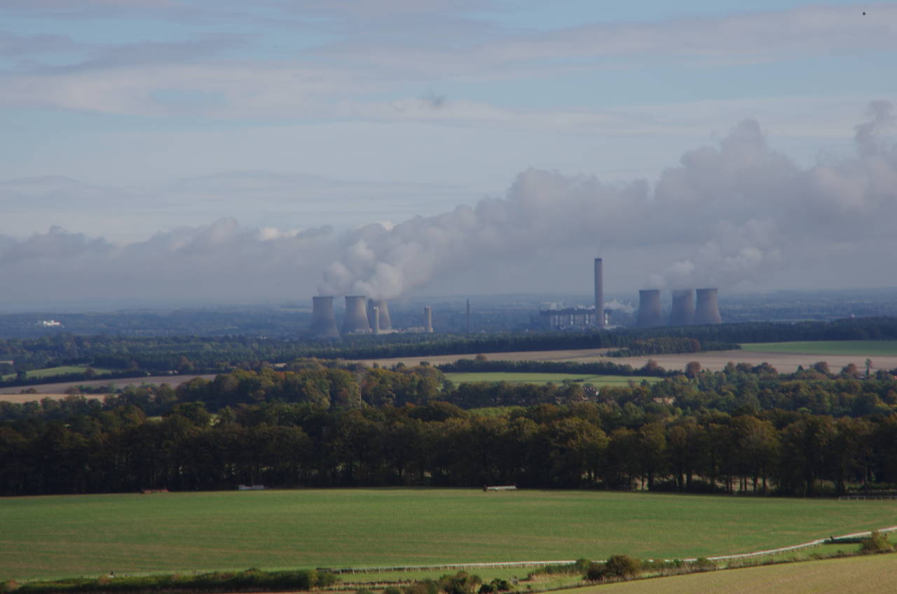
(4) Didcot Power Stations
Arriving back in Wantage on a clear, sunny morning, I acquired some supplies in the central Market Place before retracing my steps of the previous afternoon along the footpath to the village of Letcombe Regis, then back up to the top of the ridge via Court Hill Road and the A338 Manor Road. By the time I had reached the point where the Ridgeway joins the A338, I had already walked a little more than five kilometres.
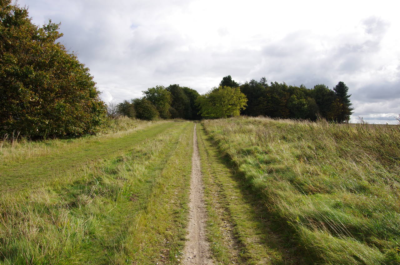
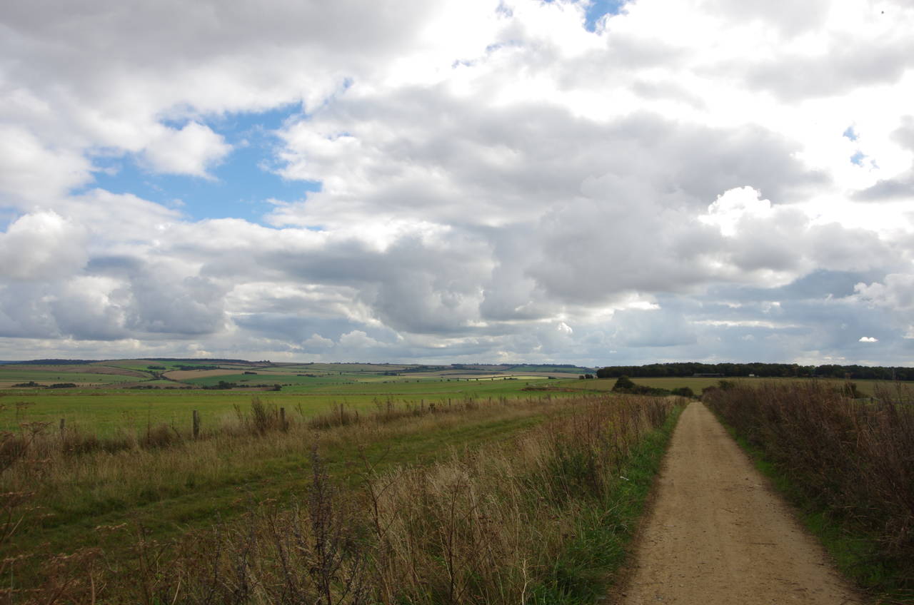
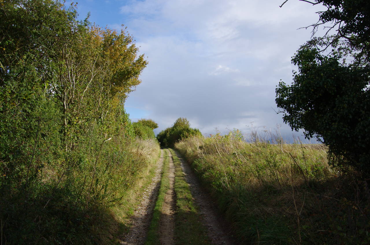
The Ridgeway follows the A338 south for 80 metres before turning left onto a smooth gravel track that runs ahead for the next kilometre, passing by the buildings of White House Farm, which appropriately enough has an attractive white farm house (picture 1). Reaching a small patch of woodland, the track swings left, soon arriving at a junction with a big grassy triangle.
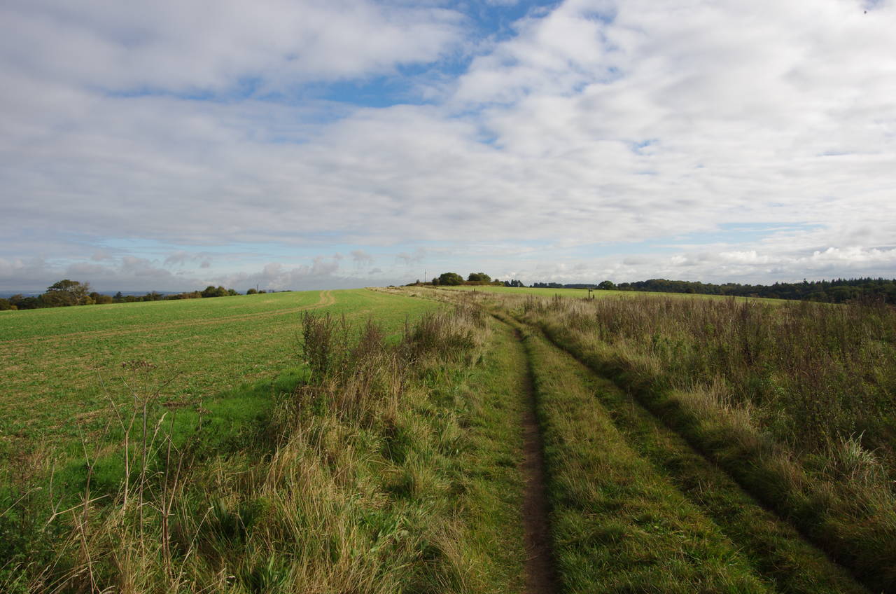
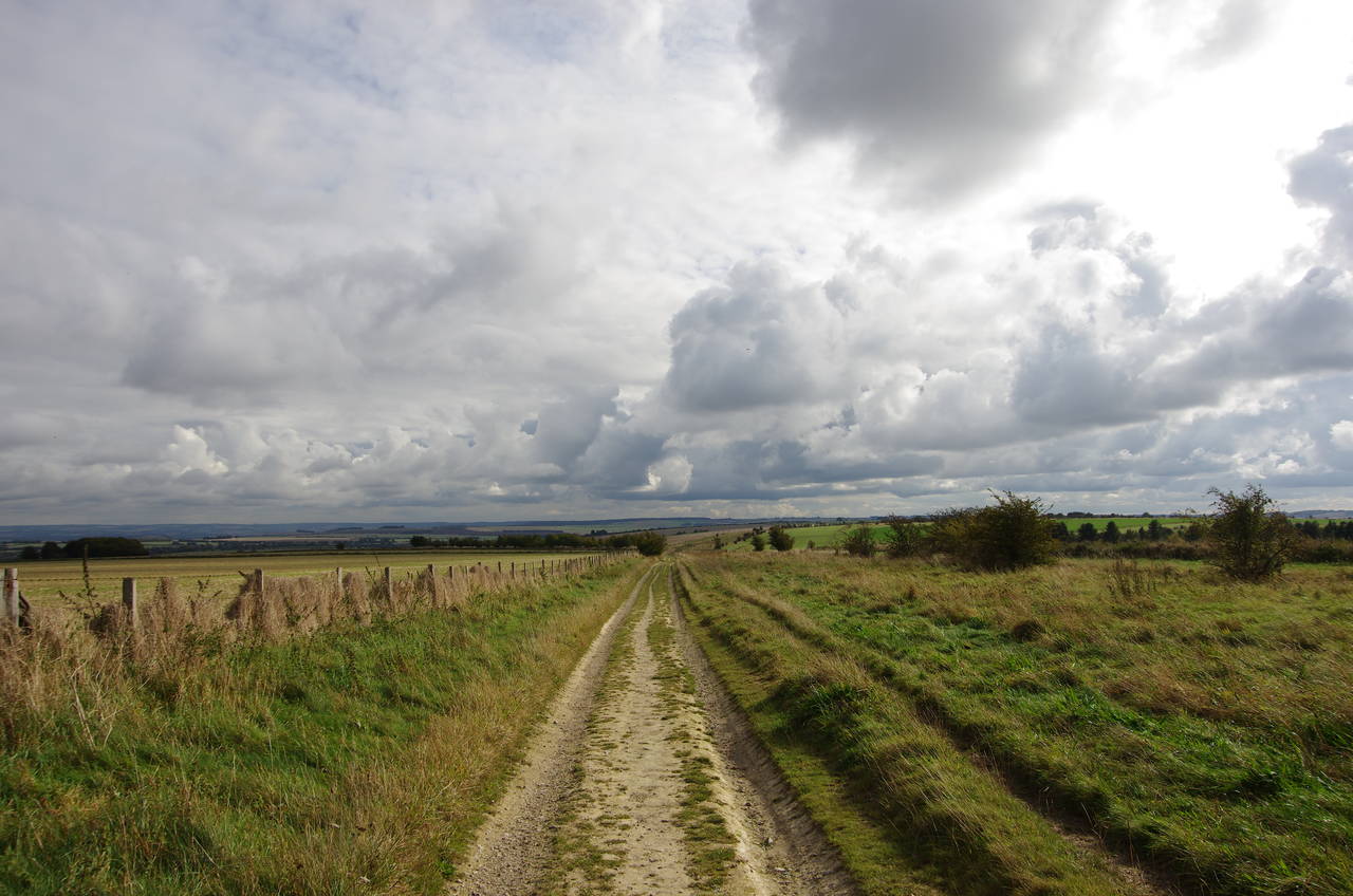
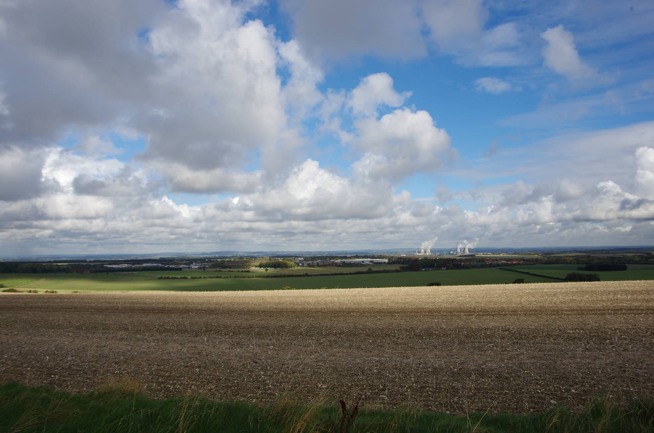
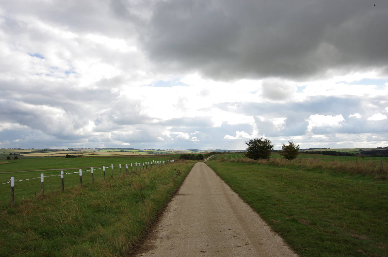
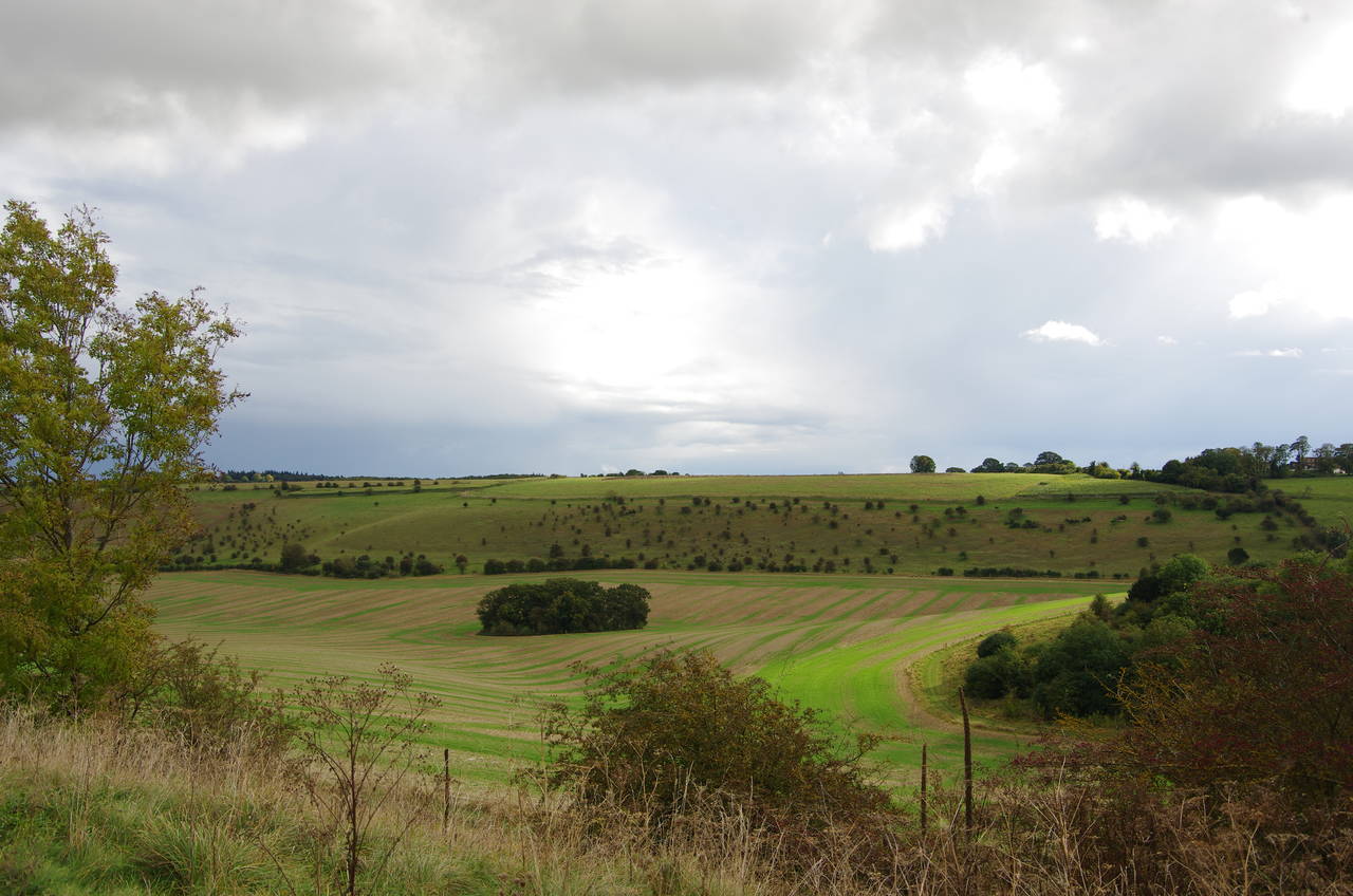
The route turns right here, following a broad grassy track between fields (picture 2) for a little more than a kilometre to reach the B4494 road. Along this section of the path there are good views to the north towards the town of Didcot (picture 3) and it's twin power stations (picture 4, zoomed), which had been visible for the latter half of the previous stage of the walk and would remain visible for a couple more hours of this stage.
(5) Betterton Down
(6) Baron Wantage Monument
(7) Ridgeway Down
(8) East Ginge Down
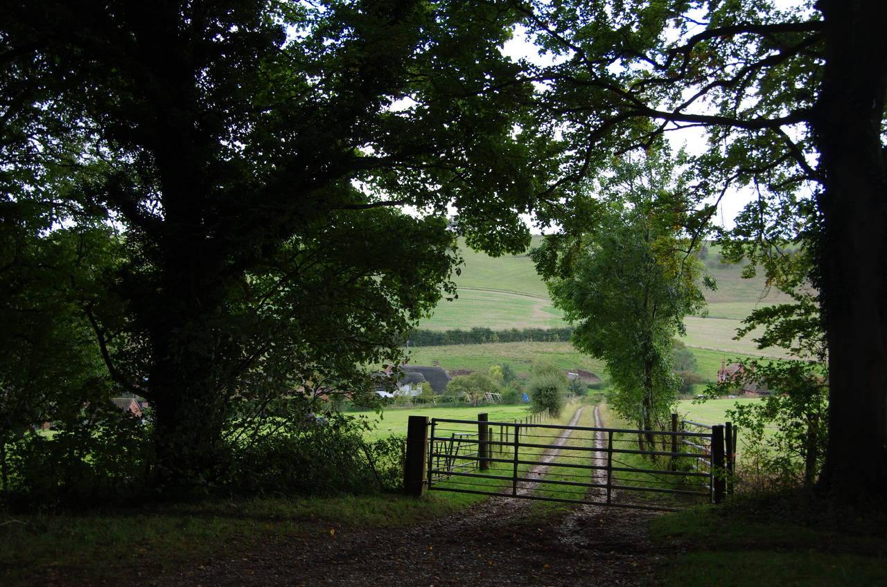
The Ridgeway crosses the B4494 Chain Hill to a small carpark. At the far end of the carpark, a private road runs straight ahead beyond a gate, while the Ridgeway bears right on a grassy path across Betterton Down (picture 5).
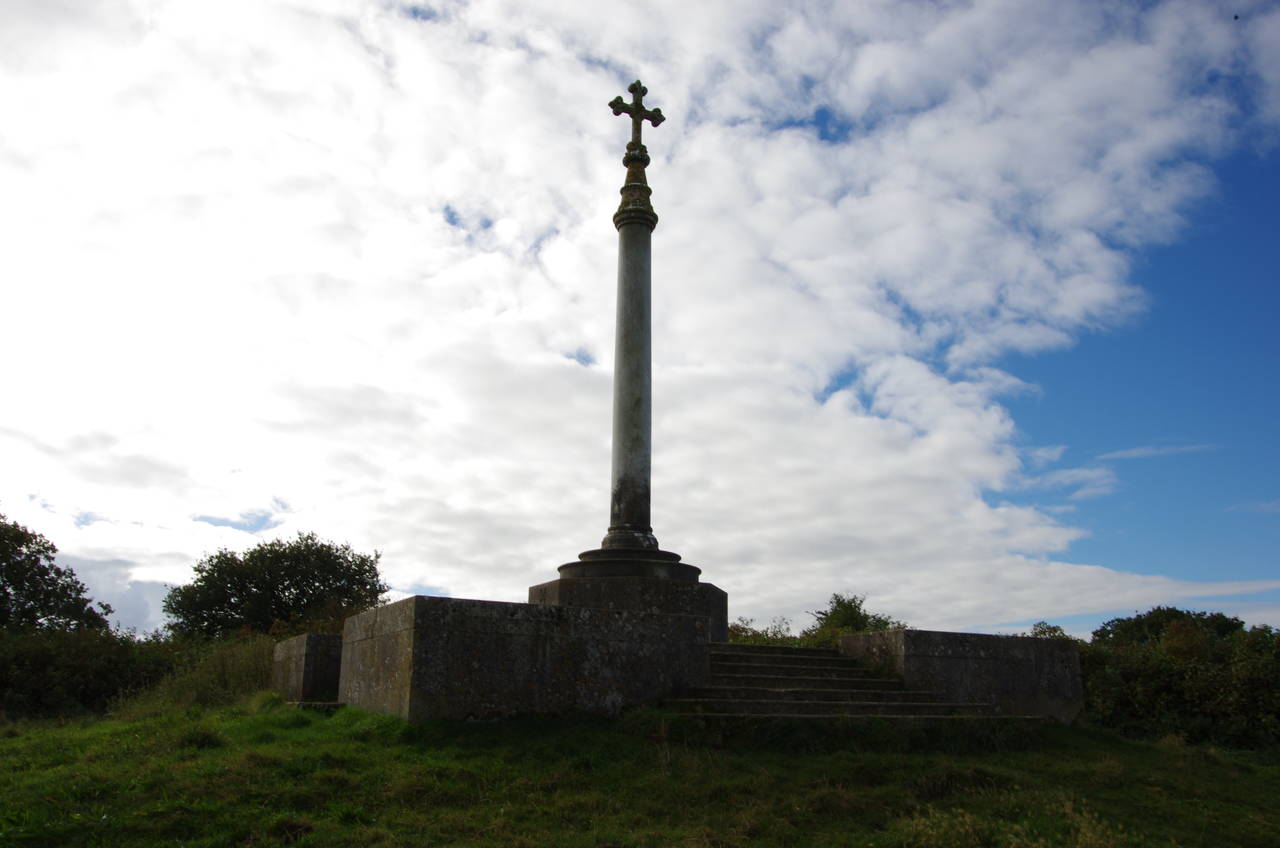
At the summit of the down, the path passes by a tall, weathered marble column topped by a cross, and built on top of a Bronze Age barrow (picture 6). This monument commemorates local identity Baron Wantage (1832-1901) and his military service in the Crimean War as a young man.
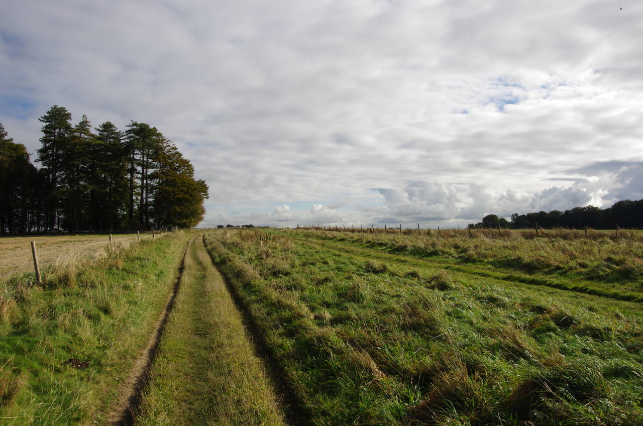
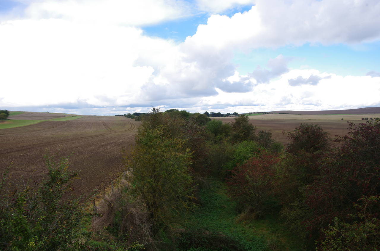
From the monument the path heads downhill for a little while, bearing slightly right at a junction of tracks before climbing gently uphill for the next kilometre to pass by the end of a line of tall conifers on Ridgeway Down (picture 7). Not far beyond this windbreak, a reservoir lies hidden inside a square plantation of trees in the middle of a field. At the far end of the field the Ridgeway crosses over a track called Coldharbour Road and passes along the edge of Greatbottom Wood before setting out across East Ginge Down (picture 8).
(9) Cuckhamsley Hill
(10) East Hendred Down
(11) Cyclists on Bury Down
(12) View towards Didcot
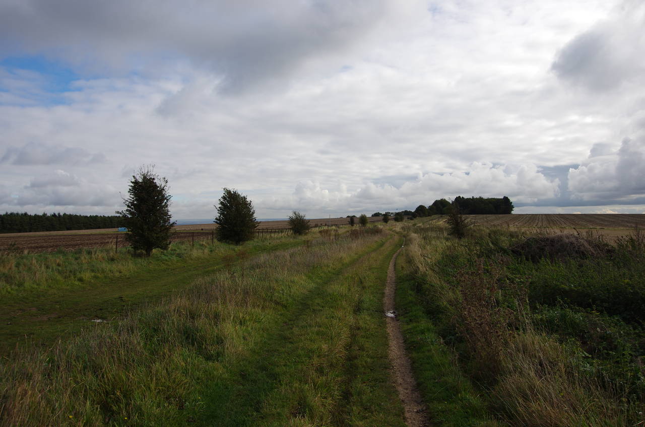
After a kilometre of level walking the path ascends gently to pass through a small plantation of trees atop Cuckhamsley Hill (picture 9), emerging at a crossroads of tracks with small carparks on each side.
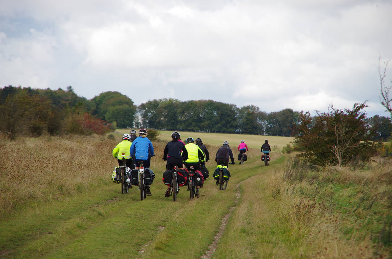
The trail continues ahead for another two kilometres across East Hendred Down (picture 10) and on to Bury Down, where I was passed by large party of cyclists who appeared to be on a long journey of their own, with heavy saddlebags strapped to their bikes (picture 11). From Bury Down there were more good views towards Didcot, now a little closer than before (picture 12).
(13) Bury Down
(14) Tunnel under the A34
(15) Tunnel under the A34
(16) View towards East Ilsley
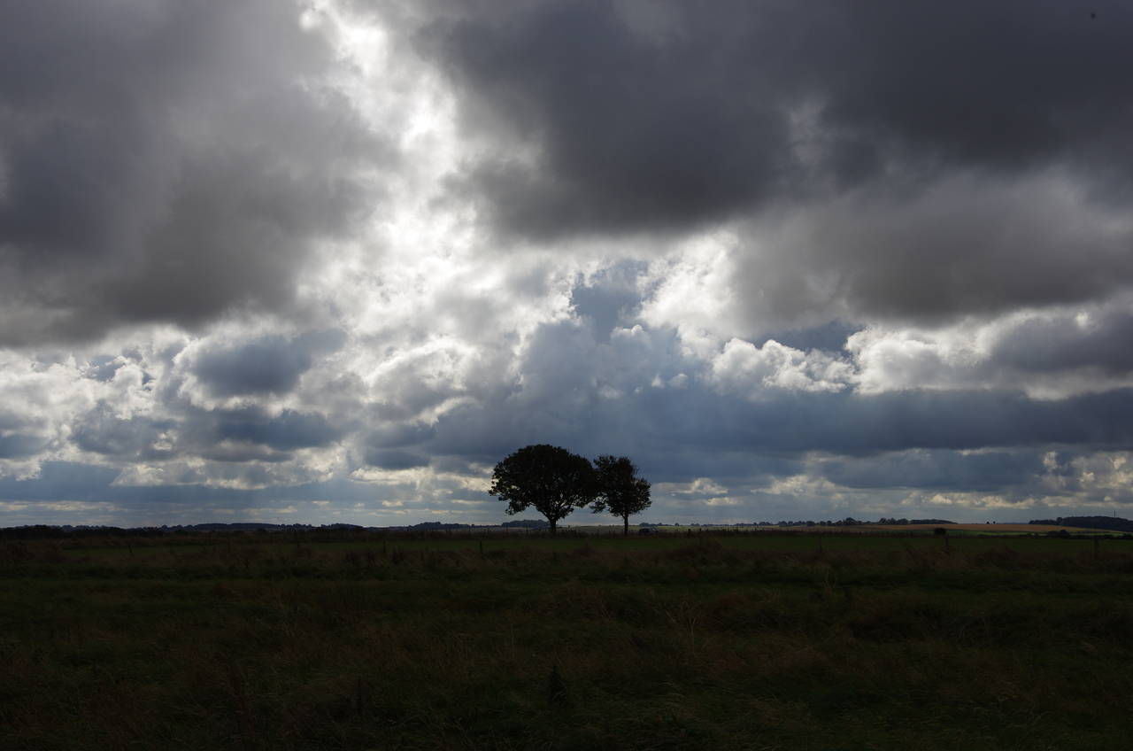
At the top of Bury Down the track crosses the minor Bury Lane, with carparks on both sides. Just beyond this crossing I noticed that some dark clouds were starting to sneak up behind me (picture 13).
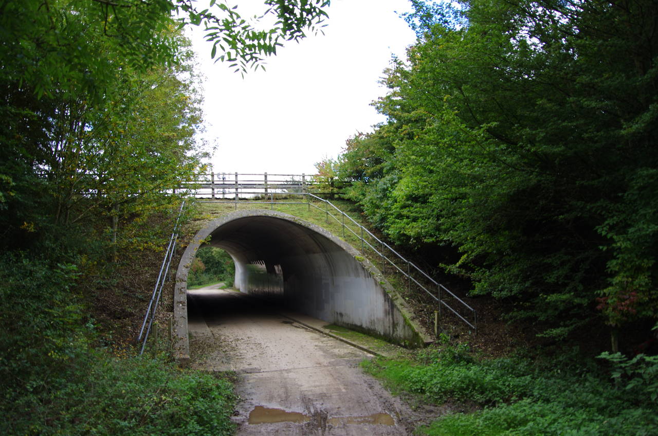
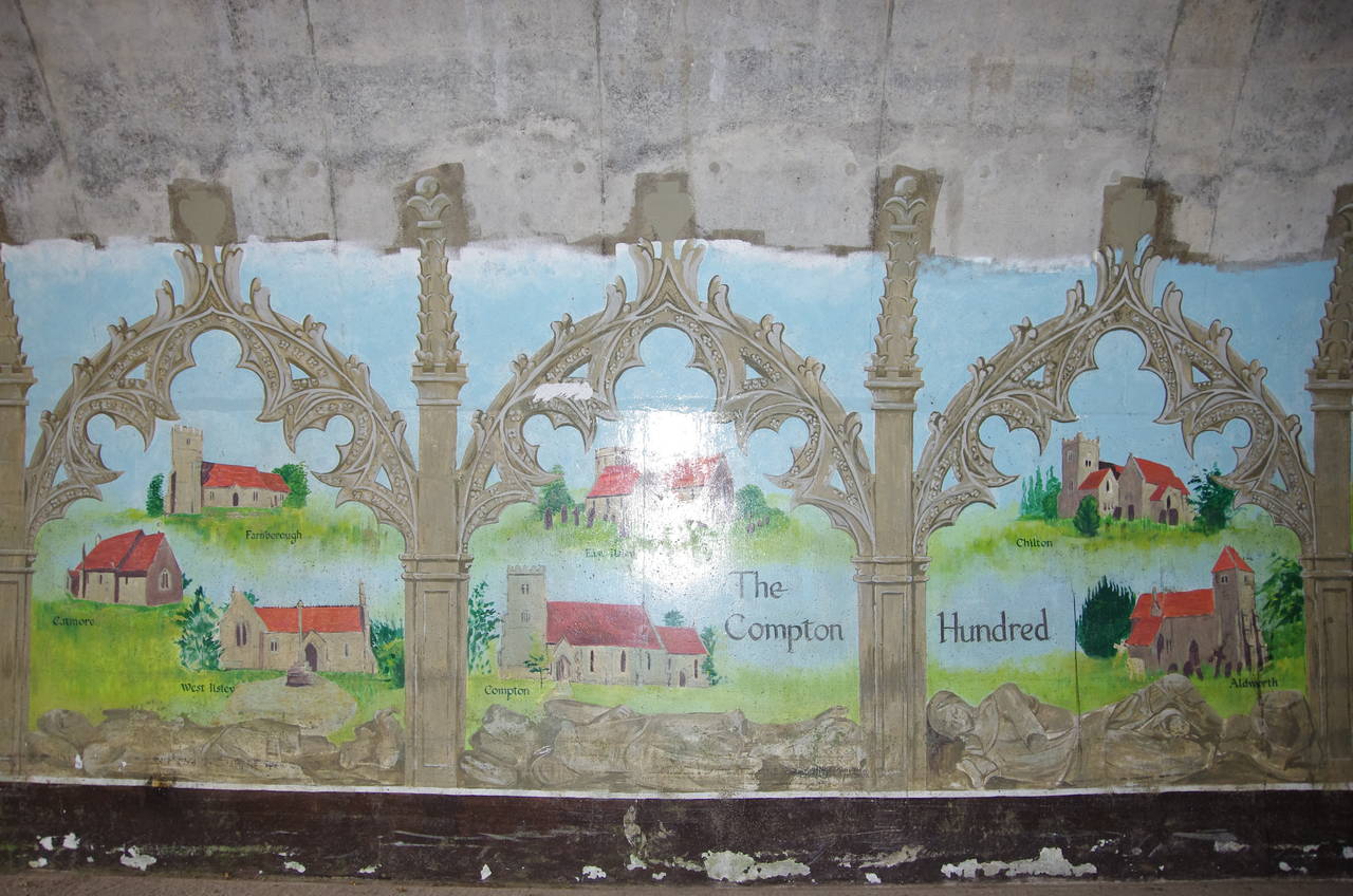
From the top of Bury Down one can hear the roar of the busy A34, still about 1,200 metres ahead. A broad and grassy track continues across Bury Down, dipping down into a patch of trees and following a fenced path to a tunnel under the road (picture 14). A mural on one of the walls depicts local churches and historical scenes (picture 15), but with traffic thundering by overhead, this wasn't a place that encouraged lingering.
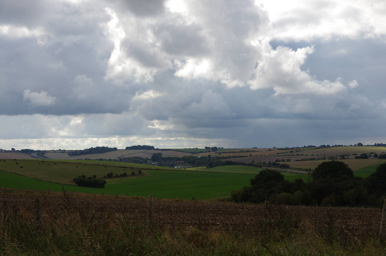
Emerging on the other side of the road, the path continues across farming land on Sheep Down. After passing by a small wood there are views towards the village of East Ilsley to the south of the ridge (picture 16).
(17) Sheep Down
(18) Churn Road
(19) Trackbed of dismantled railway
(20) Roden Downs
The track crosses Sheep Down (picture 17) and Several Down for another kilometre before joining the surfaced Churn Road for another kilometre, with more horse gallops to the left of the road (picture 18).
By the time I reached a crossroads where the Ridgeway turns left, the dark clouds I had noticed earlier had caught up with me and I had to stop to hastily pull on my waterproofs just in time to avoid being saturated by a sudden downpour. The rain was short-lived however and within three or four minutes it was gone.
Running north-east now, and still beside horse gallops, the Ridgeway heads down into the shallow valley, reaching a humped bridge over a disused railway line after just over a kilometre. The line ran from Didcot to Newbury and on to Southampton from 1882 to 1962 before being closed and dismantled. Looking along the former trackbed from the bridge, one can see how completely nature has reclaimed the land in the last fifty years (picture 19).
Beyond the bridge, the path climbs over the first low hump of Roden Downs, bearing right at a fork before climbing the next low hill (picture 20).
(21) Roden Downs
(22) Streatley Warren
(23) Streatley Warren
(24) Signpost near Post Box Cottages
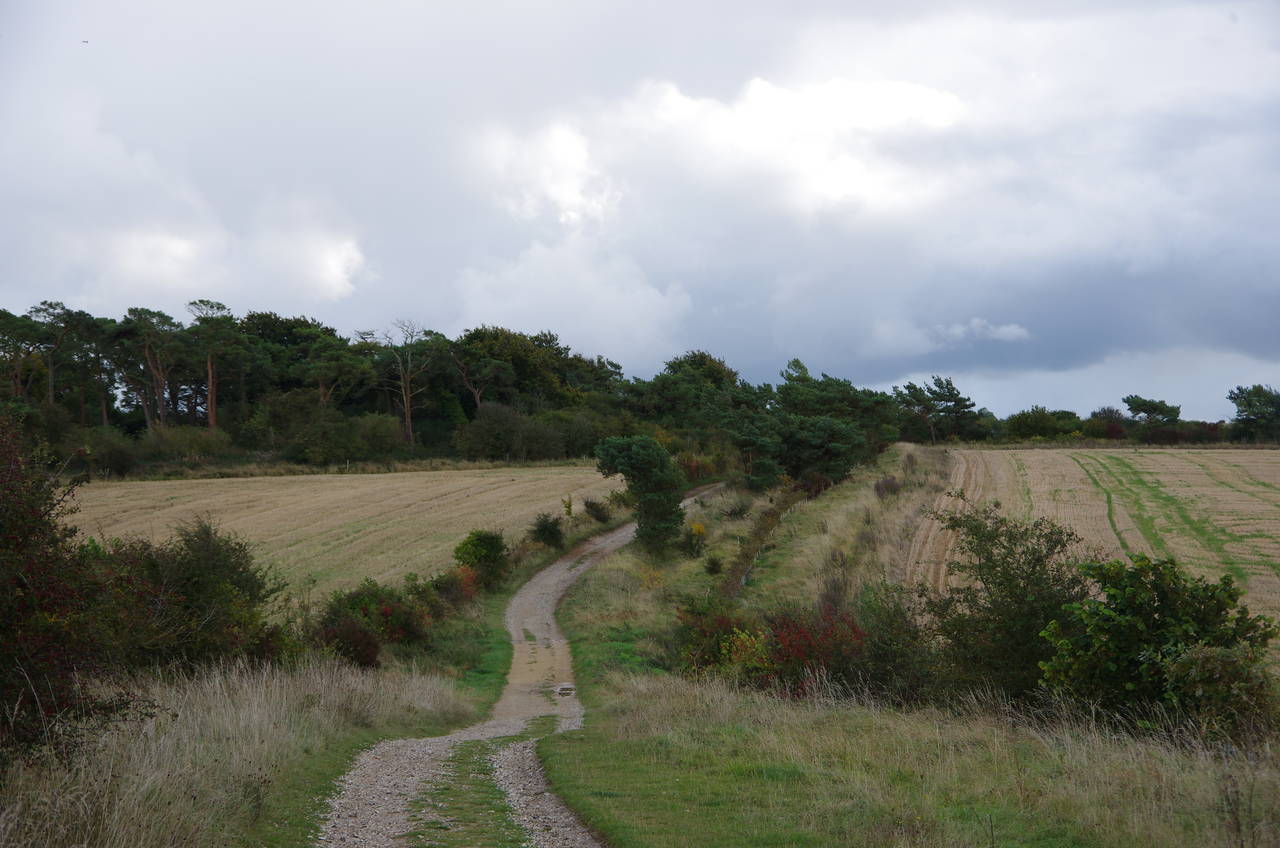
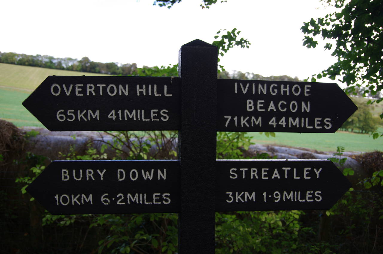
After crossing the hill on a hedge-lined track (picture 21), the Ridgeway heads straight across a junction of paths and begins a very long and gentle descent into the Thames Valley. After a kilometre, the path begins to run above the steep-sided hollow of Streatley Warren (picture 22), the path gradually becoming tree-lined as it continues its gradual descent over the next two kilometres (picture 23) to reach a junction with a tarmac road. Just before reaching the road, a signpost showed that I was getting close to the half-way point of the trail (picture 24).
(25) Post Box Cottage
(26) Pasture beside Rectory Road
(27) Rectory Road
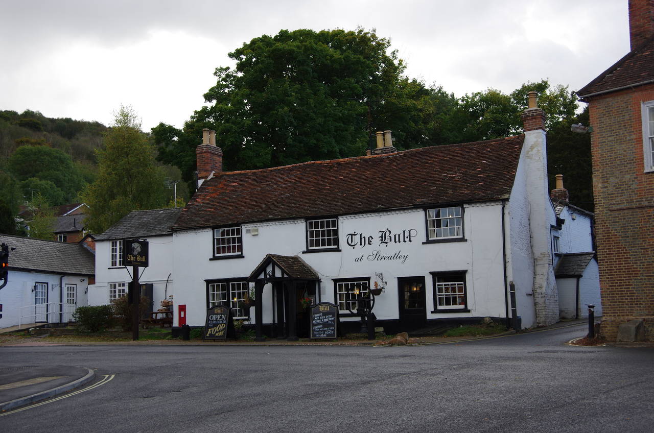
(28) The Bull, Streatley
The Ridgeway turns left opposite a group of cottages, known as the Post Box Cottages, presumably due to a post box built into a brick pillar beside the road (picture 25). Heading along the quiet Rectory Road for the next two kilometres, there are views of steep pastures (picture 26) and a series of attractive farmhouses (picture 27).
Not long after passing by the Goring and Streatley Golf Club on the edge of the town of Streatley, Rectory Road curves to the right and merges into the A417 Wantage Road, which in turn merges into the A439 Wallingford Road after another 400 metres. After a further 300 metres, the road reaches a crossroads in the centre of Streatley, where a pub called The Bull stands up on the right (picture 28).
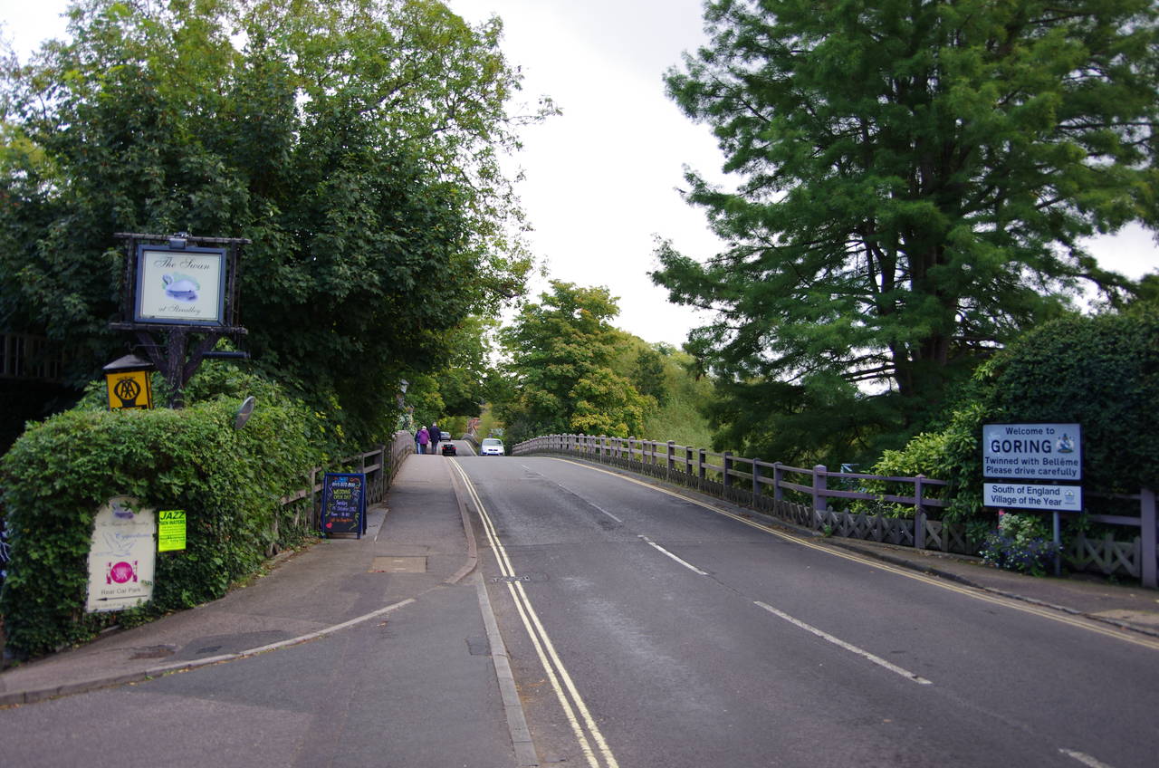
(29) Bridge over the Thames to Goring
(30) The Swan, Streatley
(31) Goring Weir and Lock
(32) Goring Village Hall
The Ridgeway turns left at the crossroads, heading downhill on High Street to reach a bridge across the River Thames (picture 29). The river crossing to the town of Goring-on-Thames is shared with another National Trail, The Thames Path, which I had managed to complete a little over a year earlier.
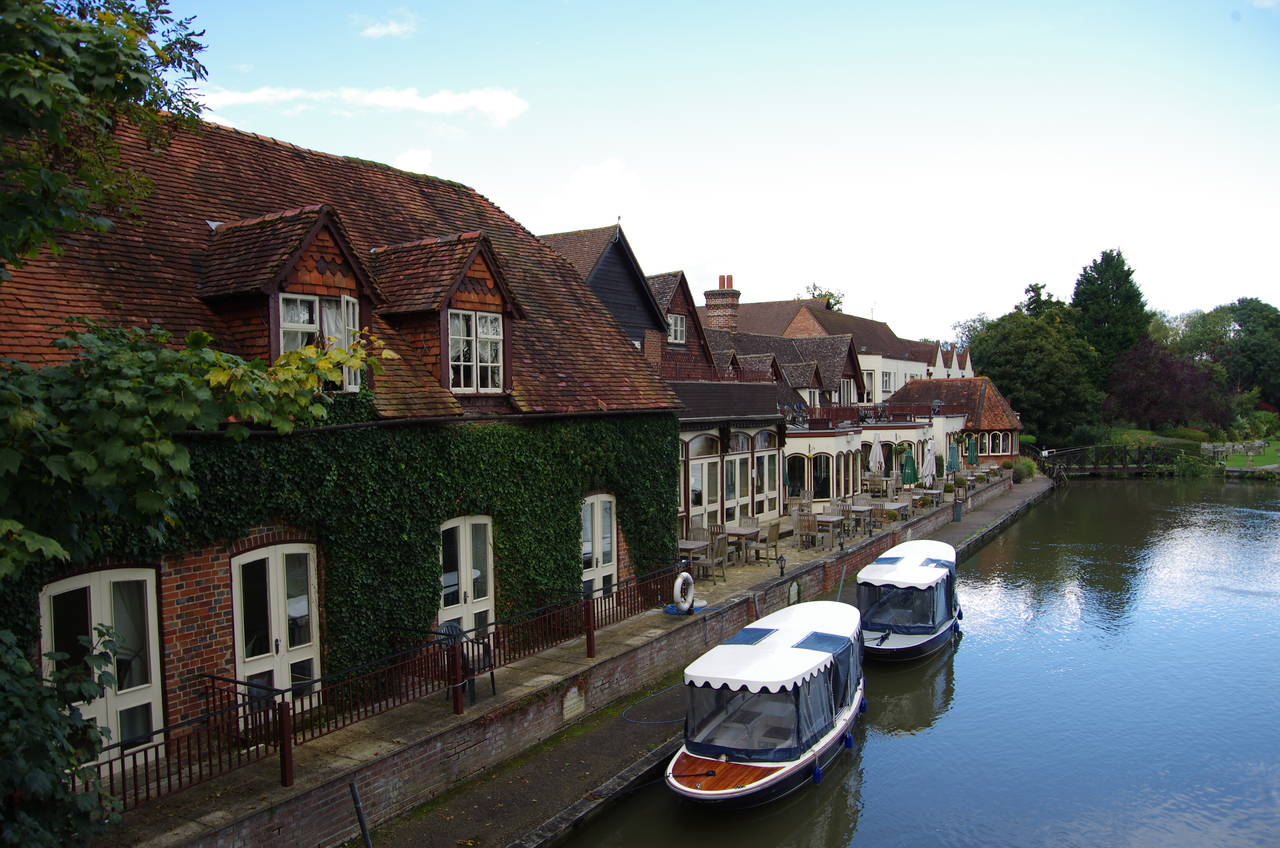
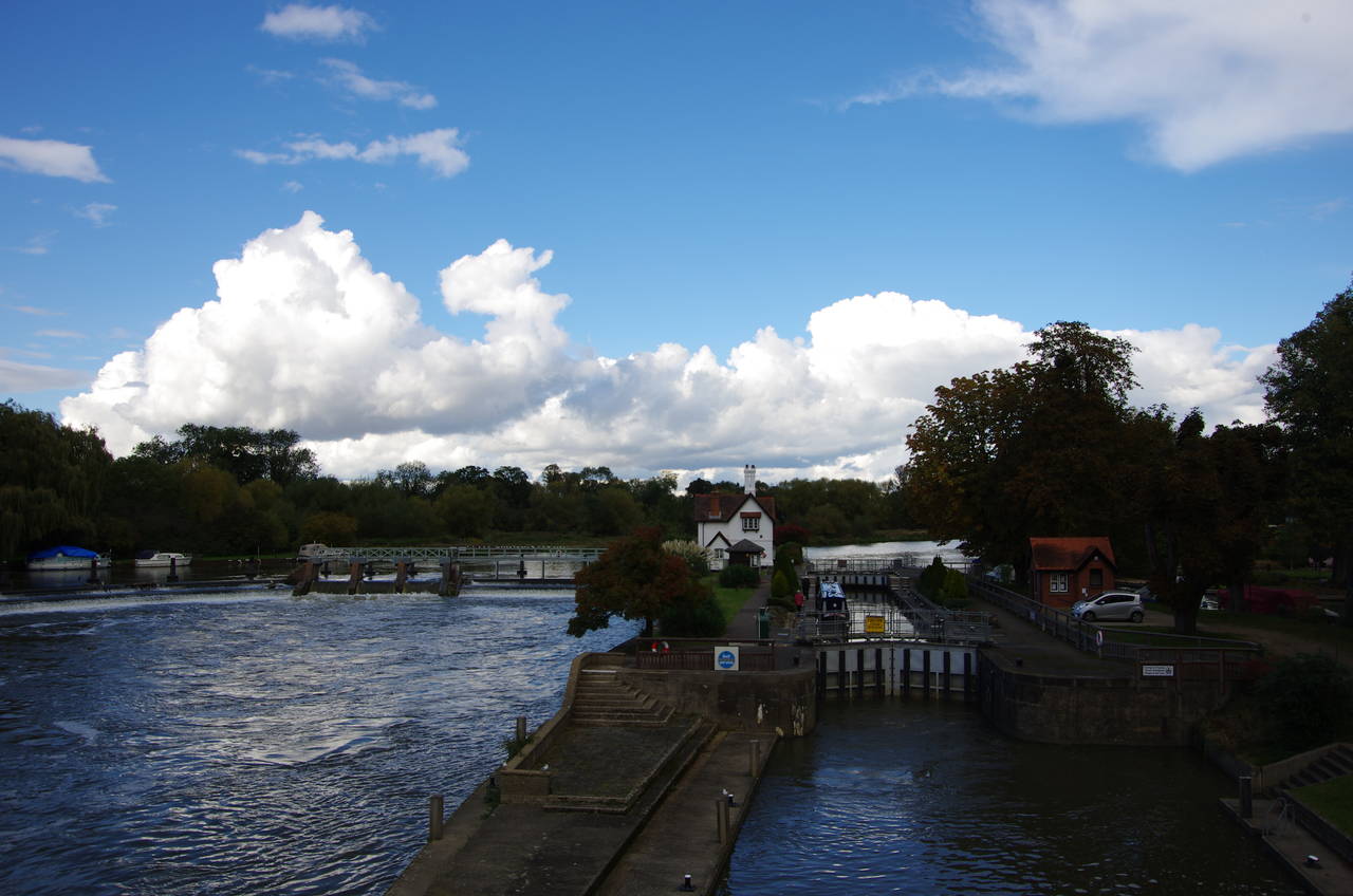
From the bridge one can see the rather inviting riverside terrace of The Swan pub (picture 30) before the bridge crosses over a little island that separates two weirs. The bridge continues across the navigable channel of the river, with the main Goring Weir and Goring Lock just upstream (picture 31).
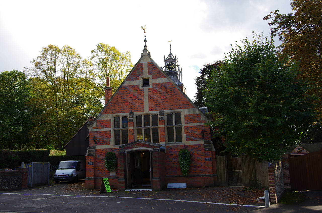
Arriving on the Goring side of the Thames, the Ridgeway continues ahead for another 100 metres to turn left into Thames Road, opposite the Goring Village Hall (picture 32). By now it was raining again, so I decided to leave the Ridgeway and head into the town for a while to see if it was just another passing shower that I could wait out. It was only a quarter past three in the afternoon, so if the weather was co-operative it would be quite feasible to continue as far as Wallingford, another nine kilometres along the Ridgeway,
At this point my GPS was showing 23.4 kilometres walked on the Ridgeway and 28.8 kilometres for the day. As it turned out that would be as far as I would get this day. The rain soon got heavier as a thunderstorm passed over and with more on the horizon I decided to try again tomorrow, heading up through the town to Goring Station to catch a train back to Swindon, where another in the line of storms was passing over as I alighted at Swindon Station.