THE RIDGEWAY NATIONAL TRAIL
Stage 2: Foxhill to Court Hill
Friday, October 12, 2012
(1) Foxhill
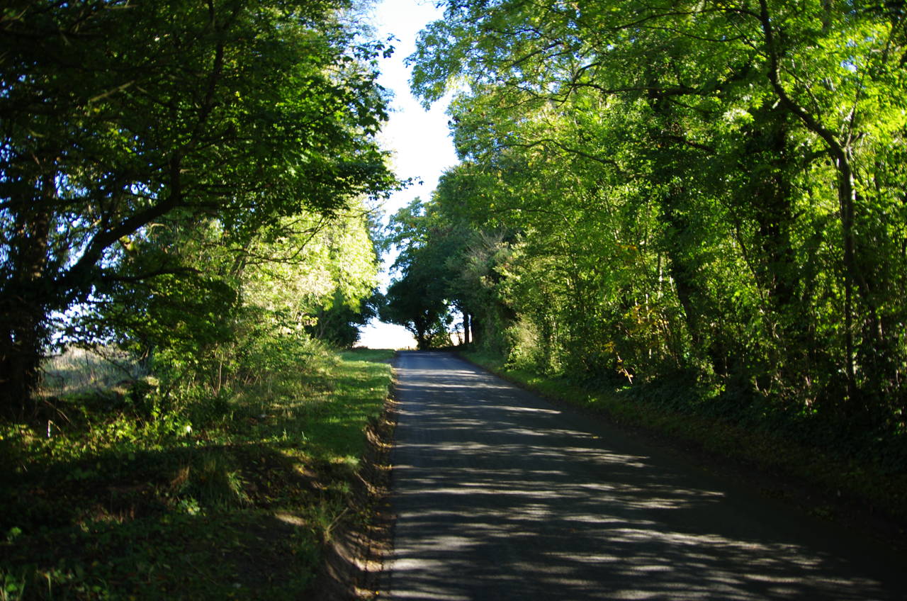
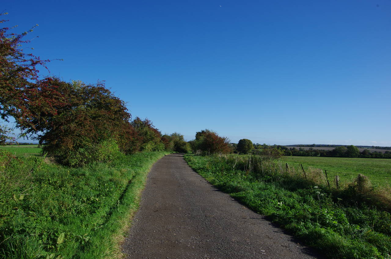
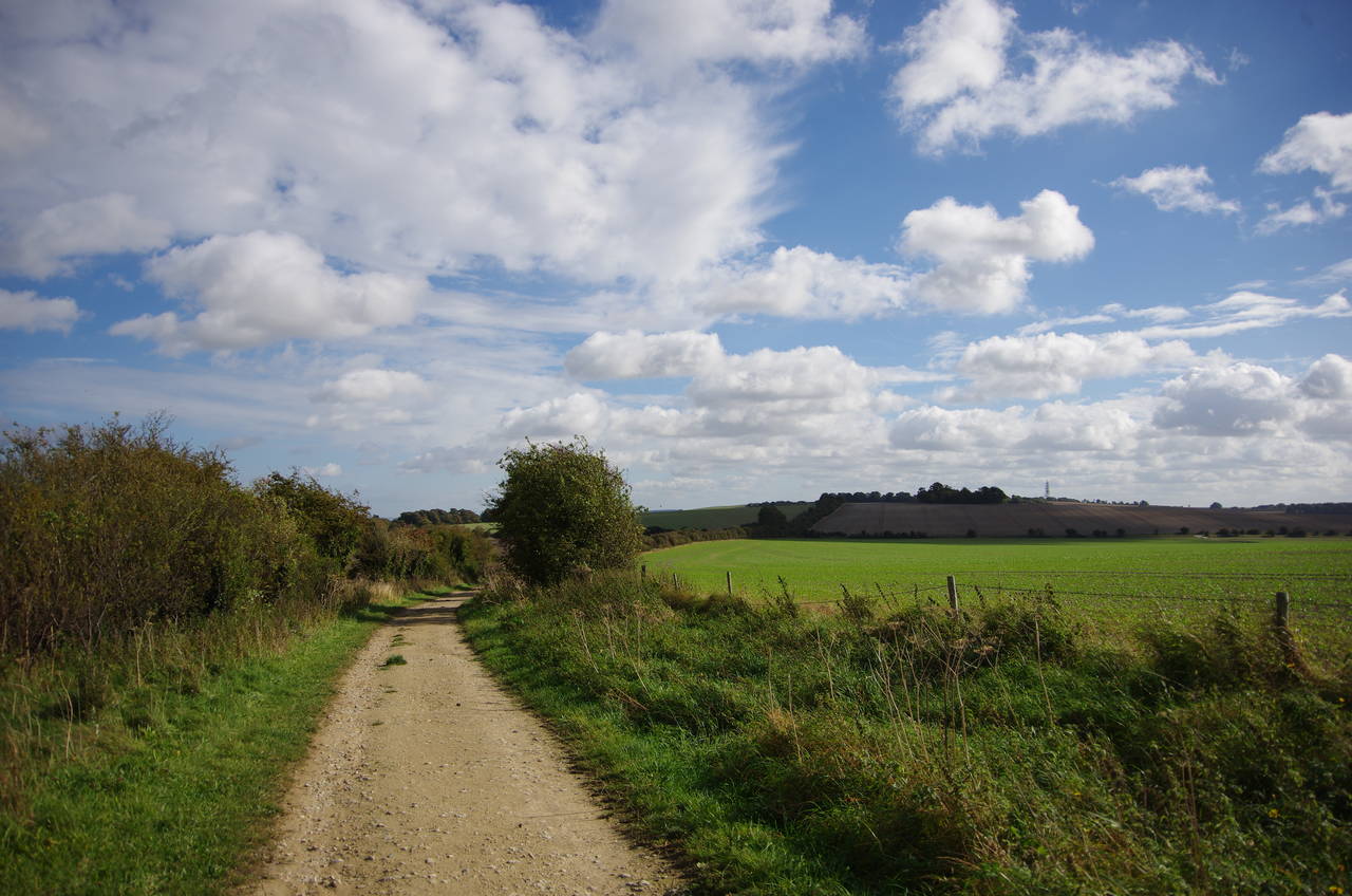
(2) Lane leaving Foxhill
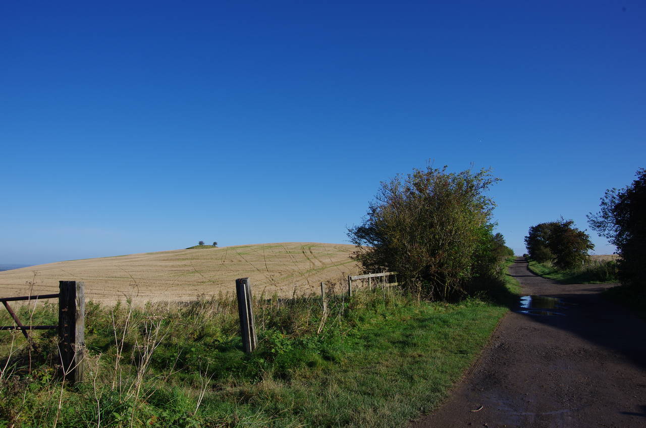
(3) Charlbury Hill
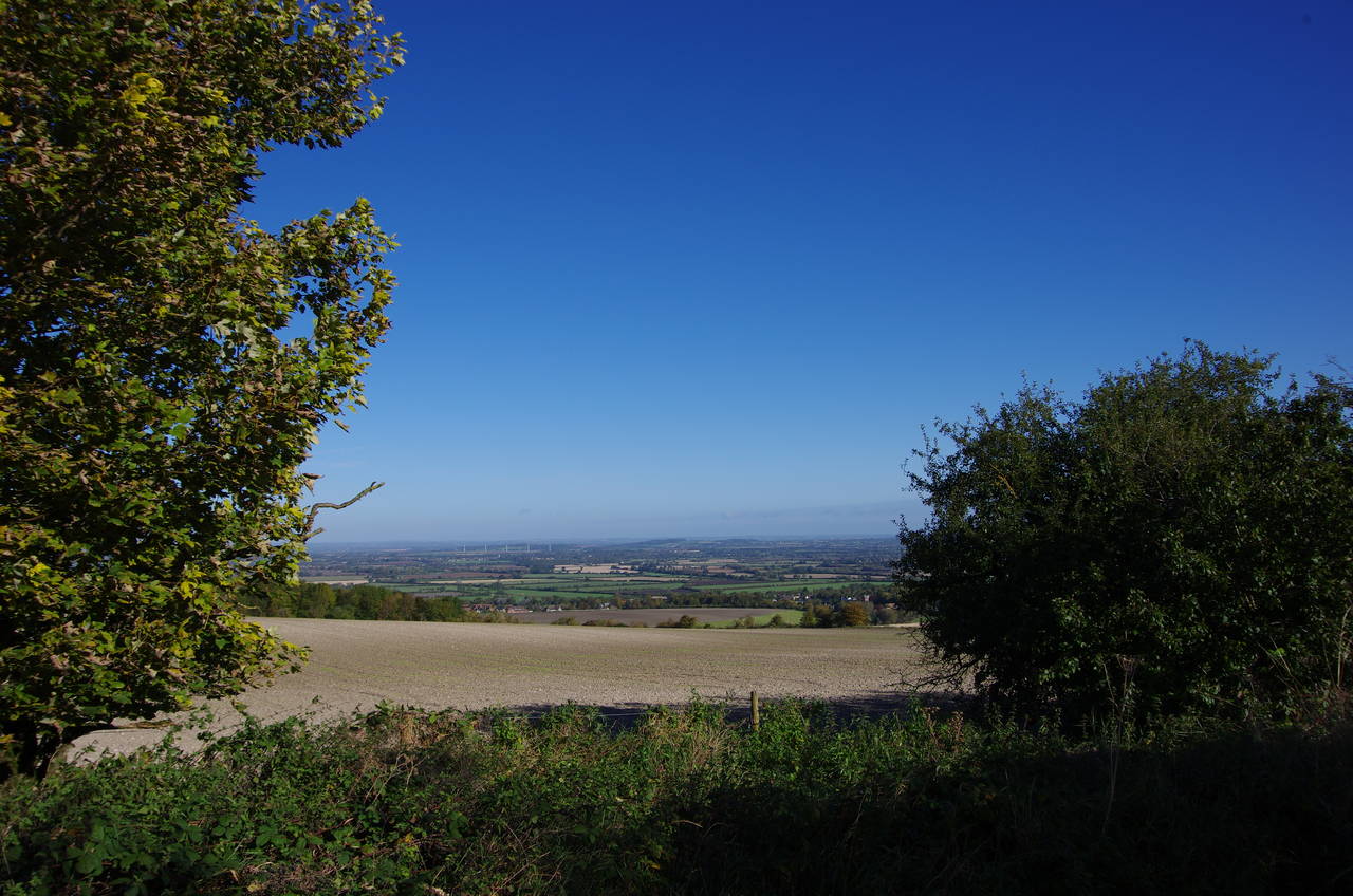
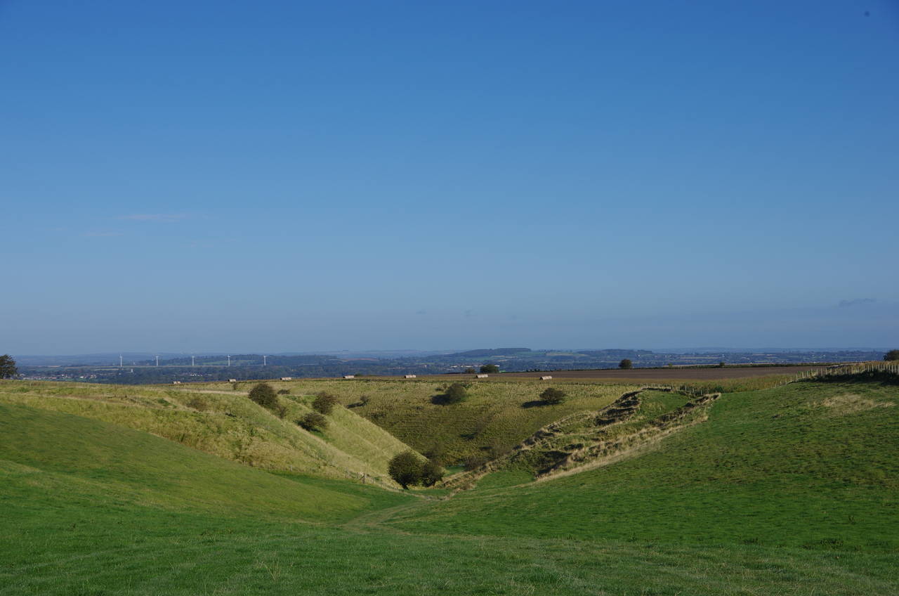
(4) View from Charlbury Hill
After a day off due to heavy rain, I awoke to a cloudless sky and was so eager to get back out on the Ridgeway that I turned up at the Swindon bus station a good 20 minutes before the first bus of the day to Foxhill was due to depart. When I did arrive in Foxhill (picture 1), I found the ground was still a little damp despite the bright autumn sun.
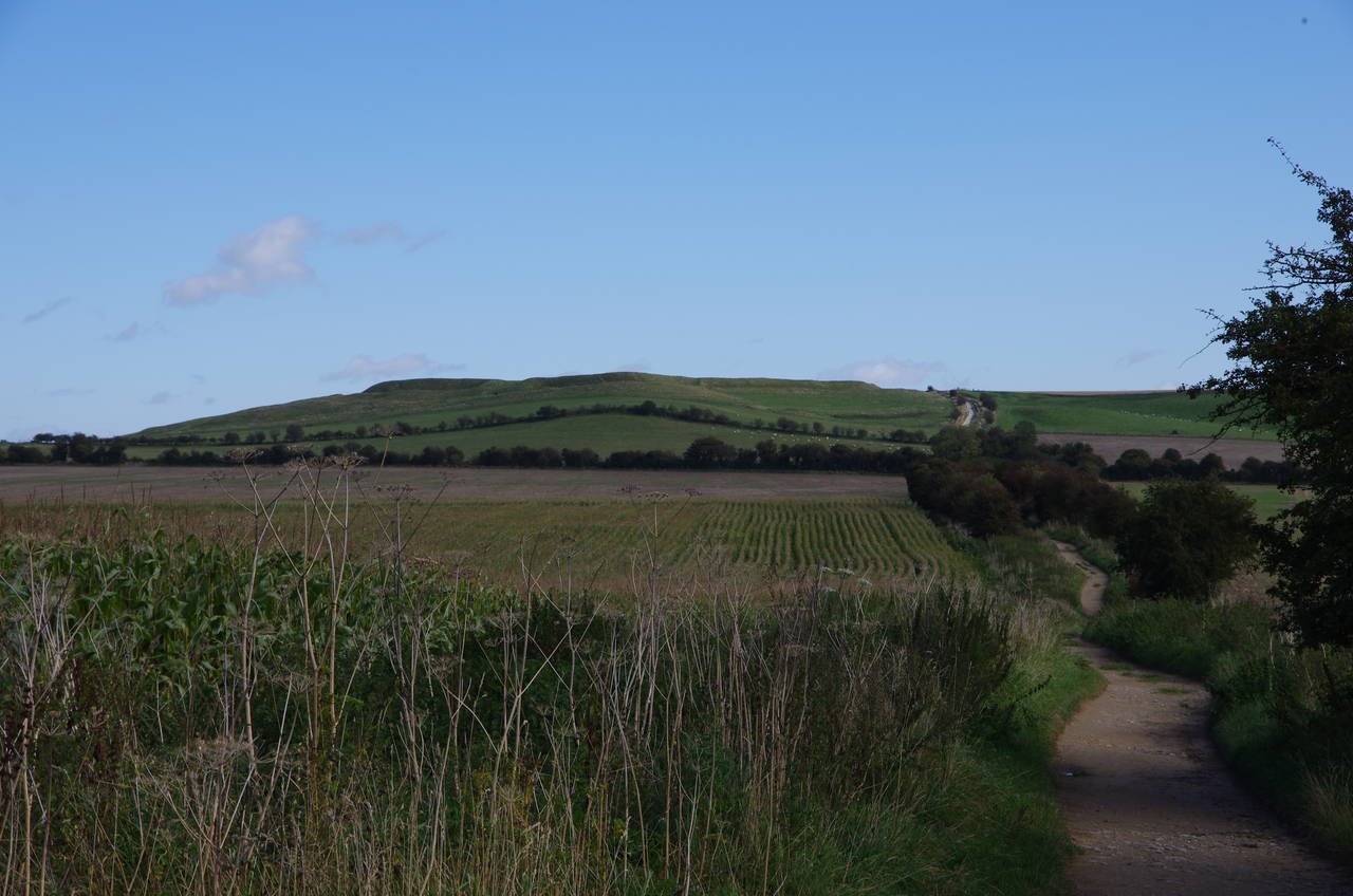
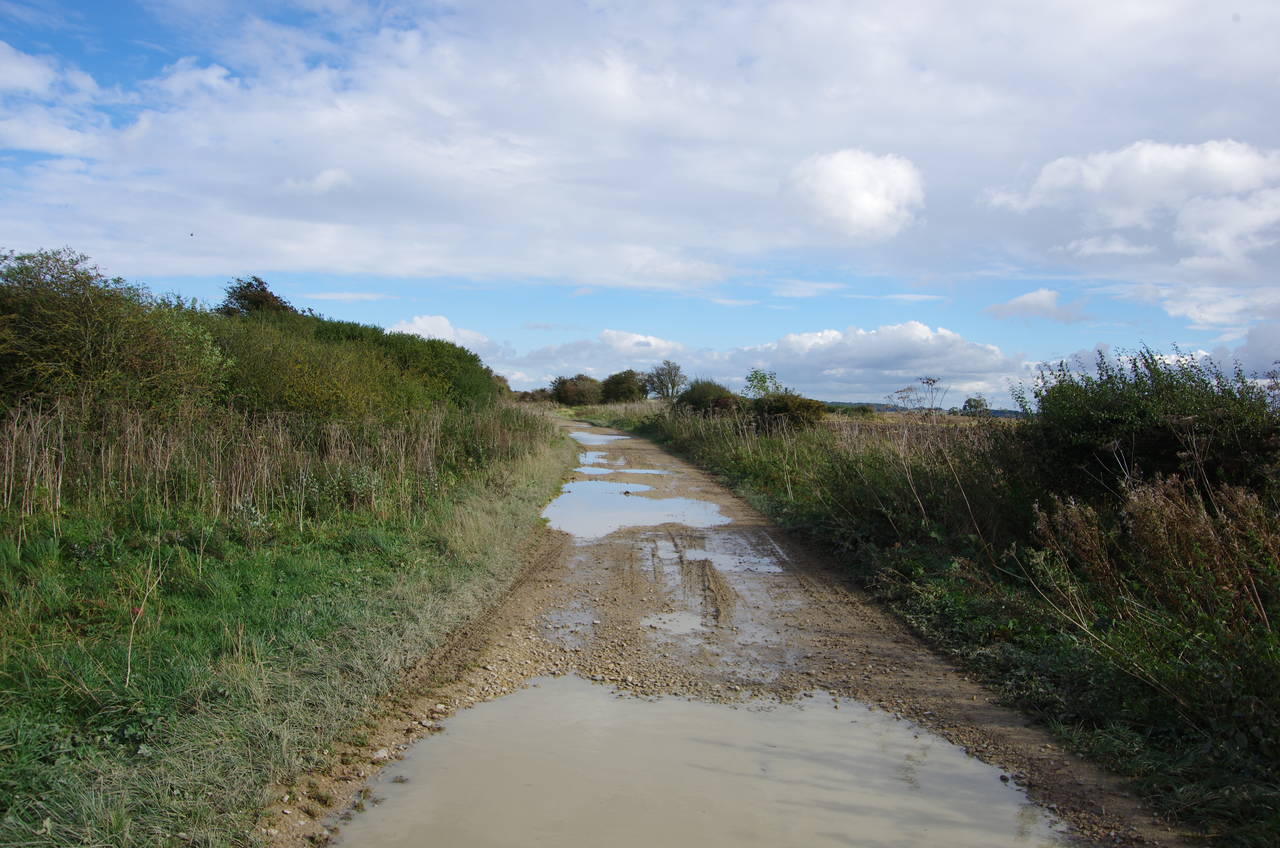
From the crossroads in the centre of the village, the Ridgeway sets off in a north-easterly direction along a shady lane (picture 2). After about 200 metres, the trail bears right to leave the lane on a smooth gravel track that climbs steadily up Charlbury Hill, though the path doesn't go right to the top of the hill, instead passing about 150 metres to the right of the prominent mound at the summit (picture 3). After the rutted tracks of the previous stage, the nice even surface of this section of the trail was much easier to walk on and I was able to keep up a good pace despite regular stops to take photos.
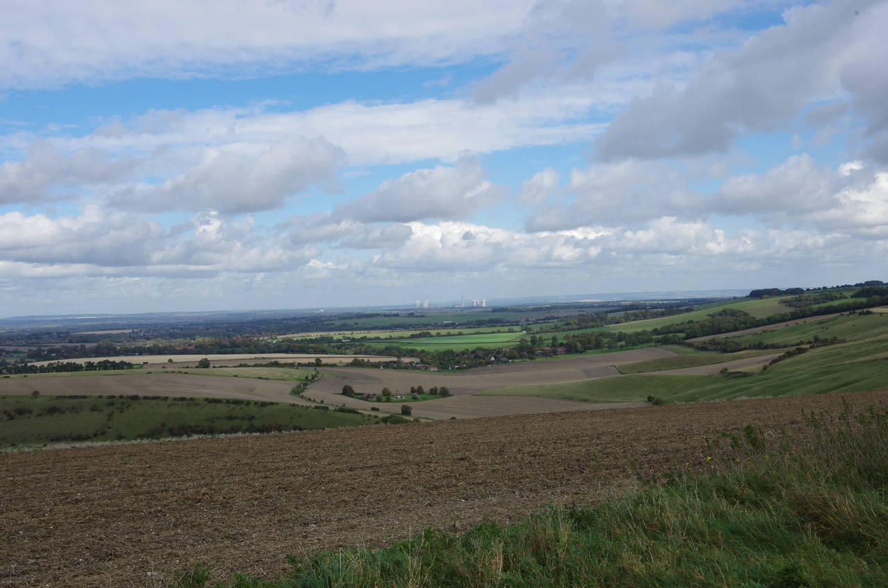
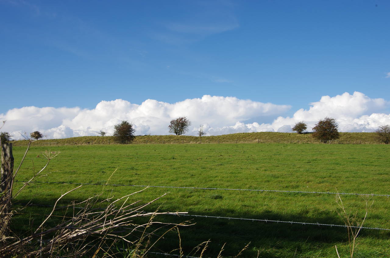
Both before and after passing below the summit, there are good views away to the north-west (picture 4), where a small windfarm with five turbines was a good landmark against which to measure my progress for the next few kilometres
(5) Coombe near Charlbury Hill
(6) Idstone Hill
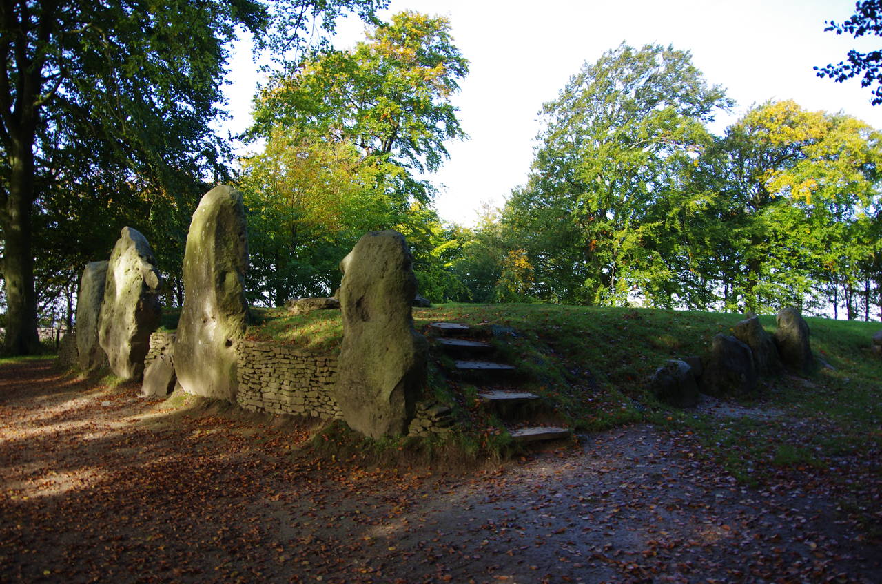
(7) Wayland's Smithy
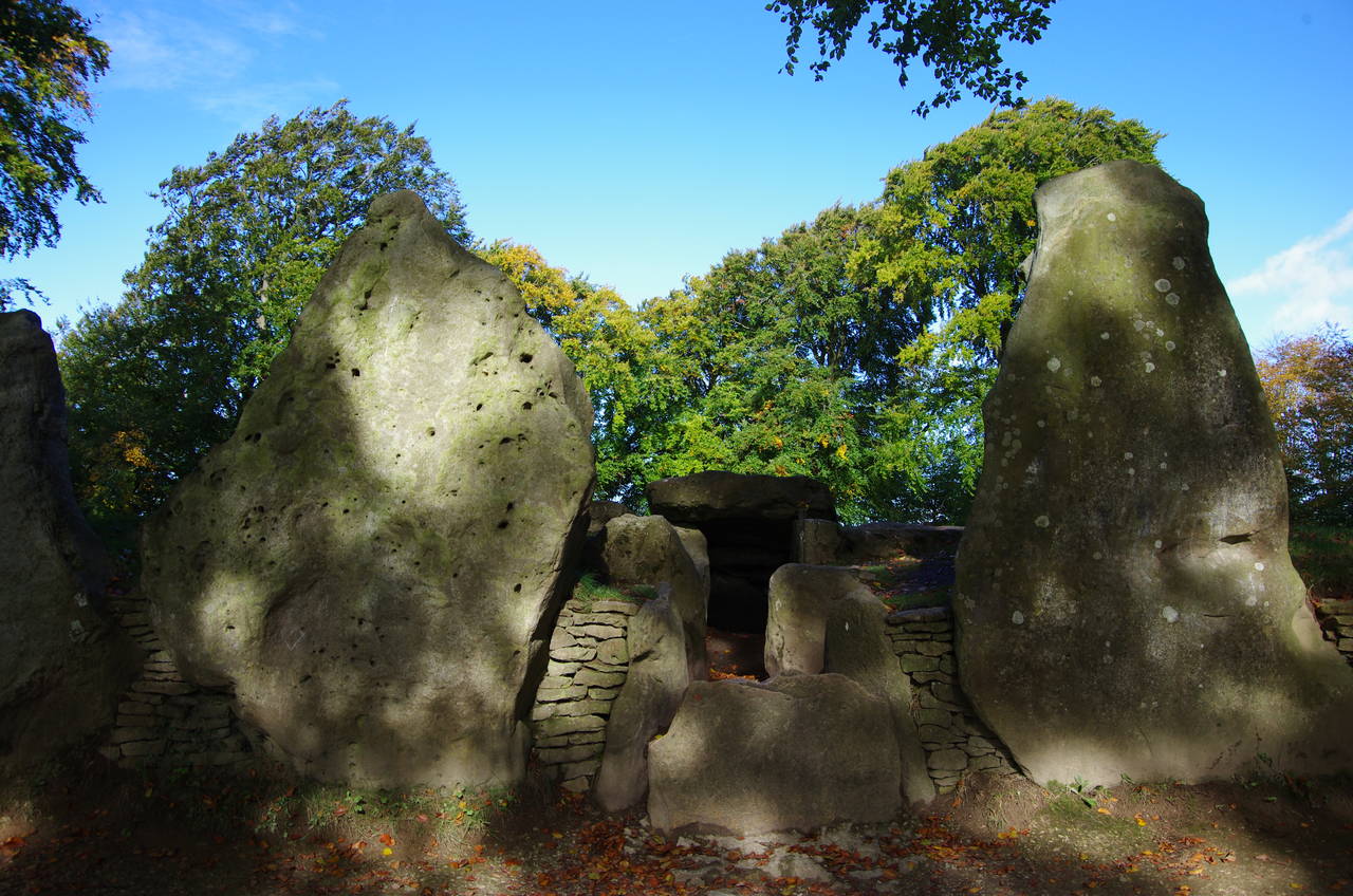
(8) Wayland's Smithy
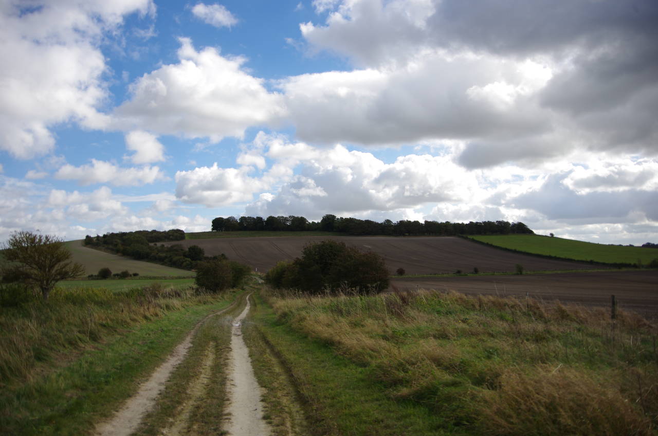
Around two kilometres after leaving the road near Foxhill, a steep-sided coombe to the left of the track (picture 5) has a path down to the village of Bishopstone, which lies hidden at the foot of the chalk ridge. The Ridgeway continues ahead however, crossing the county boundary from Wiltshire into Oxfordshire shortly after passing by Ridgeway Farm. The fairly level and mostly tree-lined path crosses the farmland of Idstone Hill (picture 6) for another couple of kilometres to reach a crossing of the B4000 Ashbury Hill, the first paved road to cross the Ridgeway since leaving Foxhill.
Having covered 5.3 kilometres so far, the only other person I had seen was a solitary horse-rider. The lack of people on the trail was a bit of a surprise given the perfect walking weather.
Beyond the B4000 crossing, the quality of the surface soon deteriorates back to a similar kind of rutted surface to that of a couple of long stretches of the previous stage of the walk. After passing between a couple of fields, the track runs through a long strip of woodland. At the first cross track the Ridgeway is joined by another long-distance path, called the D'Arcy Dalton Way, which comes down 106 kilometres from Wormleighton in Warwickshire.
250 metres further along the Ridgeway, a signpost indicates a short diversion through a wooden gate and along a fenced path to a circle of trees in the middle of a large field; the end point of the D'arcy Dalton Way. Within the circle of trees is Wayland's Smithy (picture 7), a 55-metre long Neolithic (or New Stone Age) chambered long-barrow built around 3,400 BC. Four large standing stones guard the small anti-chamber at the entrance (picture 8), which is the only part of the interior that is accessible to the public.
The archaeologists who first excavated the barrow in 1919 found the bones of eight people inside the barrow's stone chambers. They also discovered that the barrow had been built over a smaller barrow, believed to be between 50 and 190 years older, and which contained the bones of a further 15 prehistoric people.
While I was walking around the barrow, a middle-aged couple, the first people I had seen on foot so far, wandered up for a look at the barrow. It turned out that they too were planning to walk the entire Ridgeway, though they were a little less ambitious than I was about how many days it would take.
(9) View towards Uffington Castle
(10) White Horse Hill
(11) Uffington Castle
(12) Uffington Castle
Back on the Ridgeway, the tree-lined path crosses a rough unsealed road after about 300 metres, beyond which the trees thin out to allow good views across the shallow valley ahead to the earthworks of the Uffington Castle hill-fort on White Horse Hill (picture 9), still almost two kilometres away.
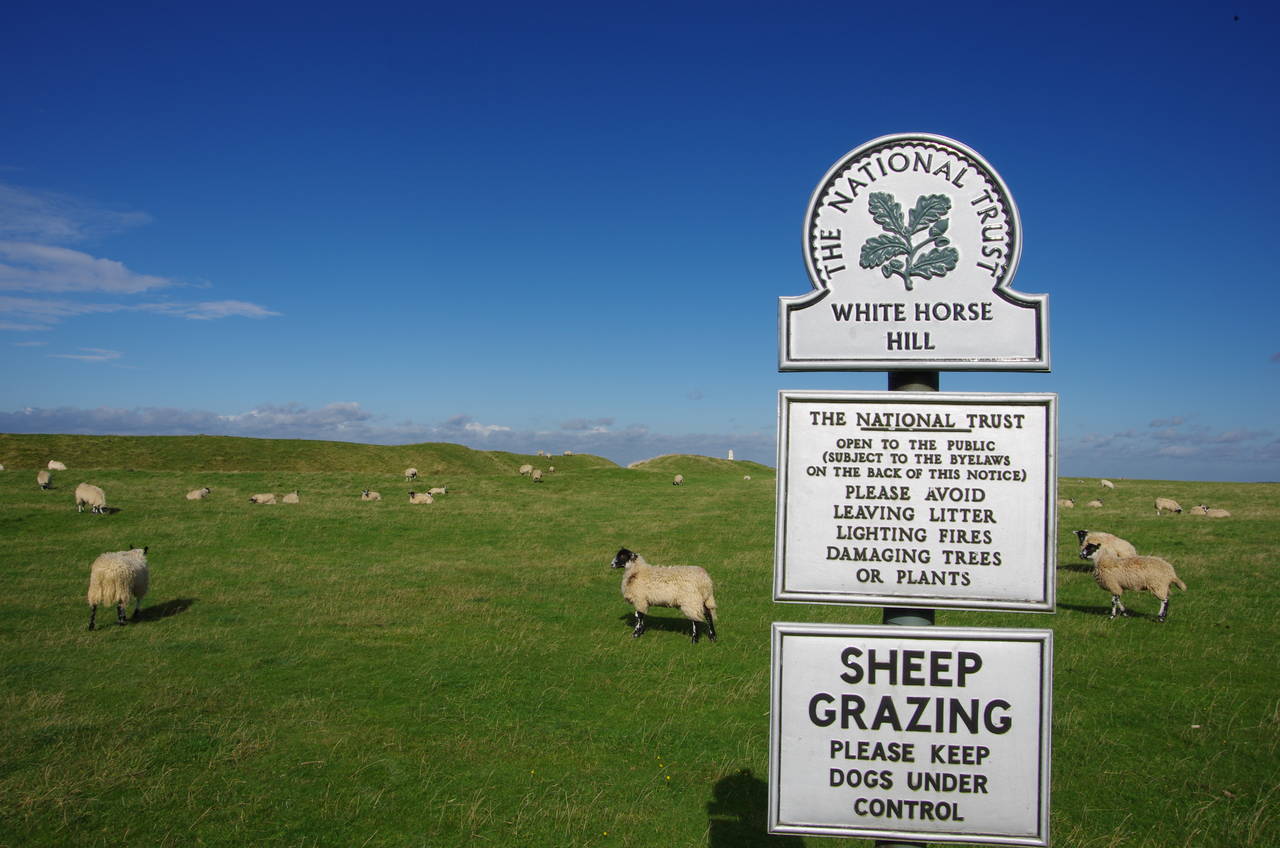
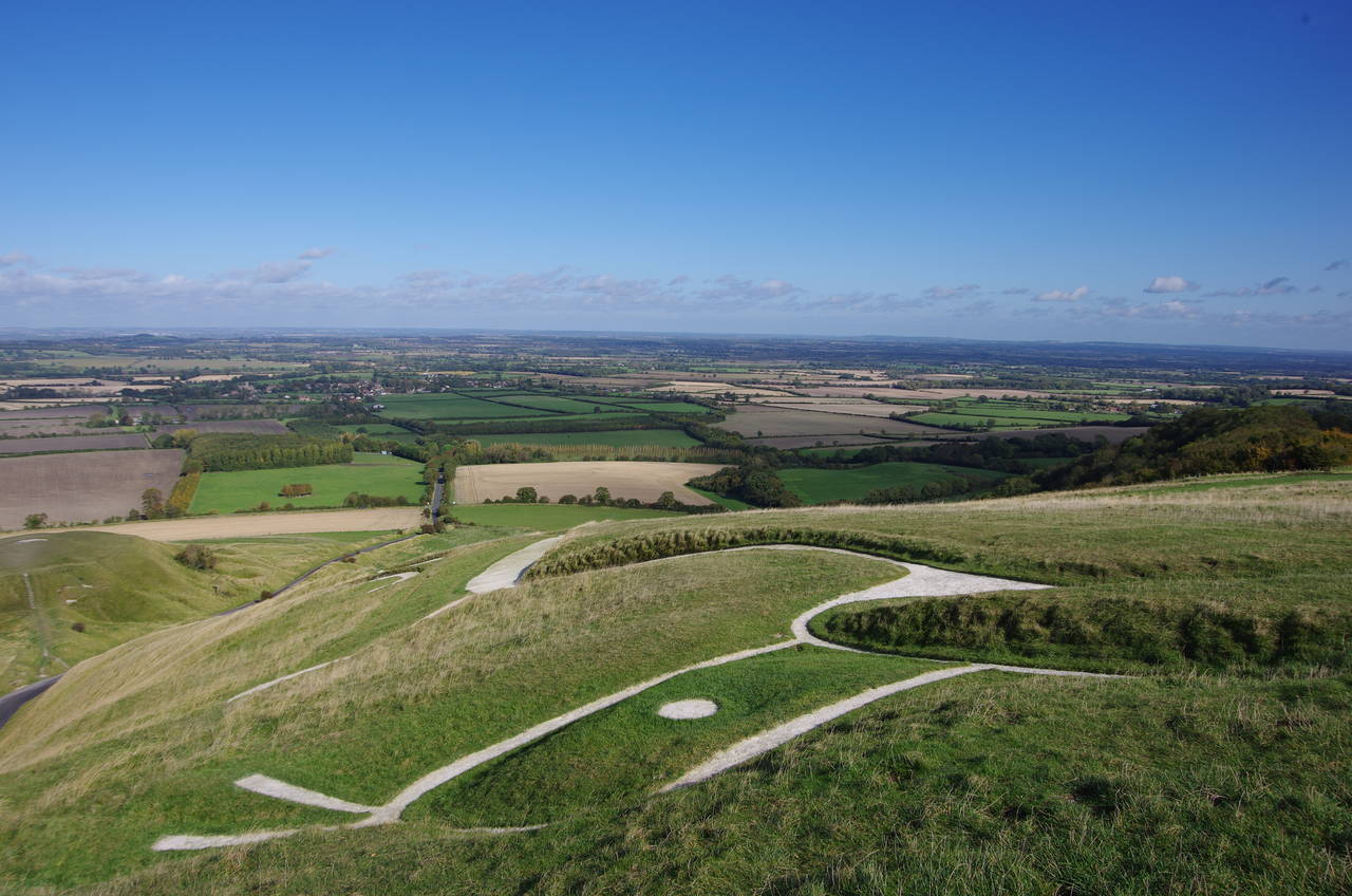
Climbing gently out of the valley on a broad chalky track, the Ridgeway passes close by the southern ramparts of the castle. Just beyond the high bank, a gate gives access to a large sheep-grazed plateau on top of White Horse Hill (picture 10), which is owned by the National Trust. It is well worth taking this diversion from the path to explore White Horse Hill, which has several interesting features.
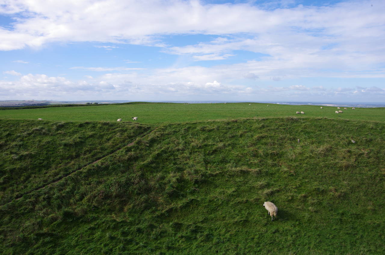
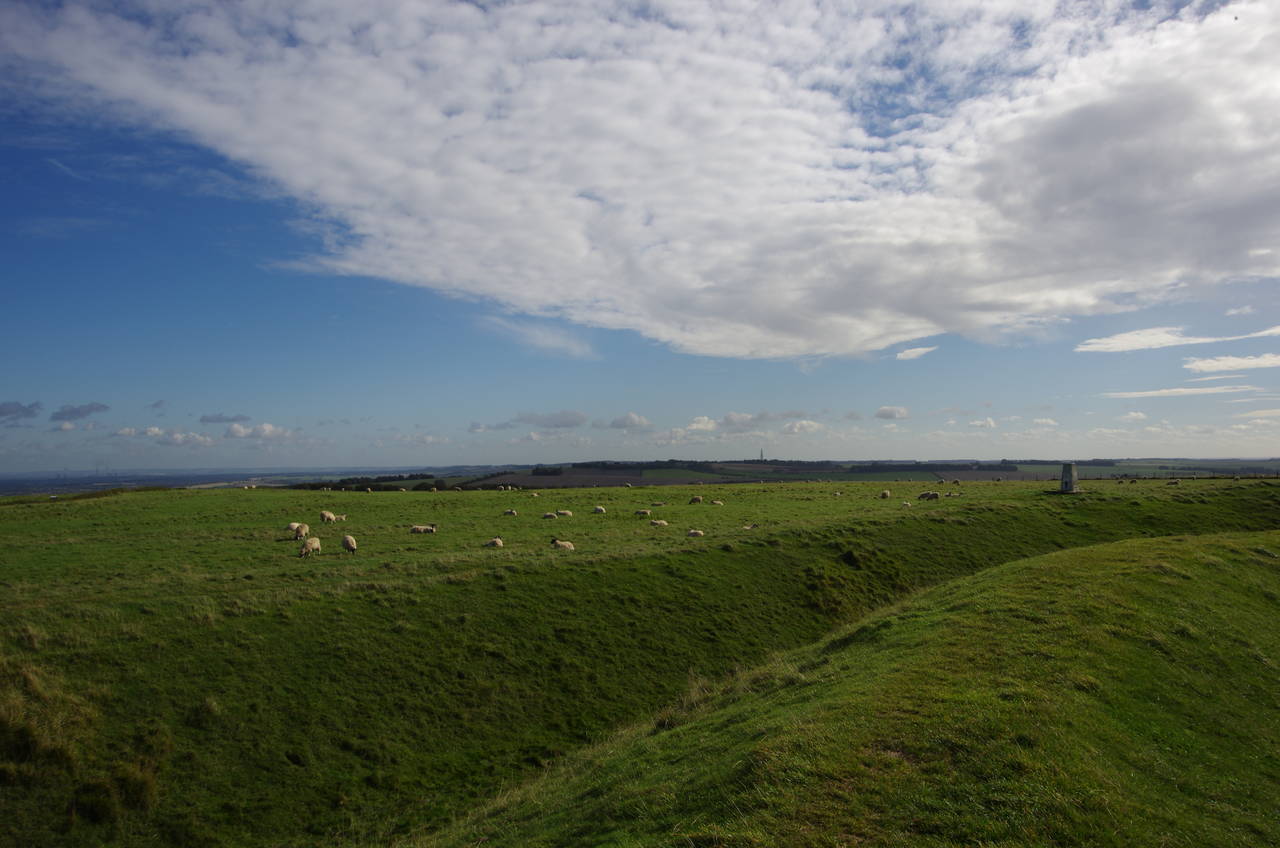
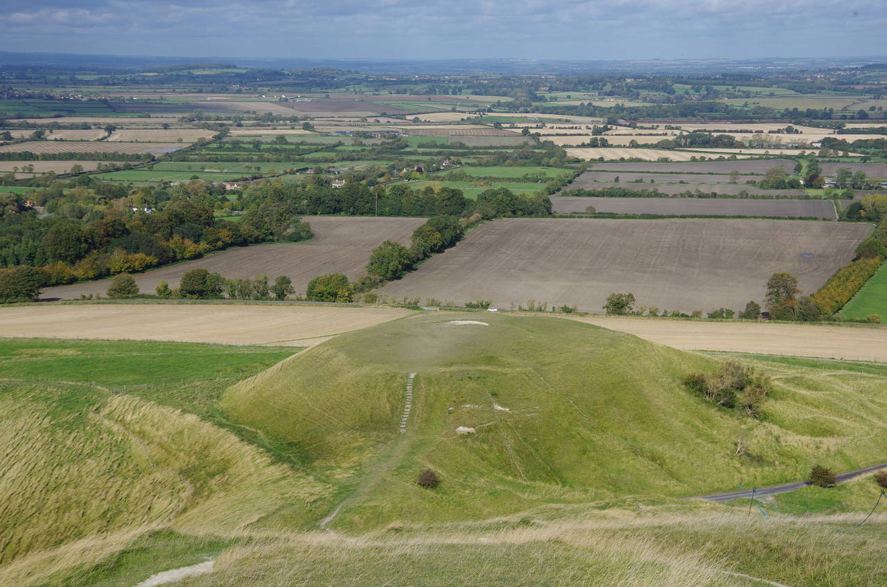
To the left one can climb the double defensive banks of Uffington Castle to admire the scale of the 3.2 hectare fort (picture 11). A trig pillar atop the outer bank of puts the summit of the hill at 261 metres above sea level.
(13) Uffington White Horse
(14) Uffington White Horse
(15) The Manger
(16) Dragon Hill
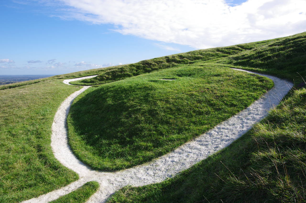
The real highlight of White Horse Hill lies a short distance to the north-east of the hill-fort. On the steep hillside just over the northern edge of the escarpment, one can visit the Uffington White Horse (pictures 13 and 14), believed to be the oldest of Britain's chalk figures. The 110-metre long outline was created sometime between 1,400 BC and 600 BC by cutting trenches into the hillside and filling them with crushed chalk. The figure lends its name to the vast flat plain to the north, known as the Vale of White Horse, much of which is visible from this vantage point.
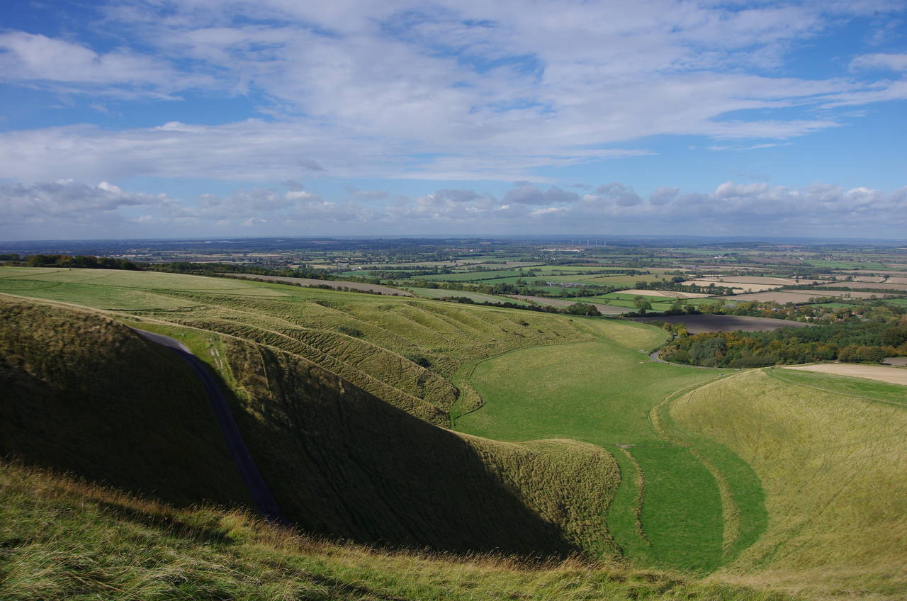
The white horse is positioned at the top of a deep coombe in the escarpment, known as The Manger, with a very steep road running across it about fifty metres below the white horse (picture 15). A little further to the right, the flat-topped Dragon Hill (picture 16), is said to be the place where St George slew a mighty dragon, it's blood creating a bare patch on top of the hill where grass never grows.
Visiting White Horse Hill really was one of the highlights of the walk and with such a superb view and perfect weather it was rather hard to put my camera down and even harder to leave.
(17) Rams Hill
(18) View towards Rubblepit Plantation
(19) Horse and buggy near Rubblepit Plantation
(20) Sparsholt Firs
The next section of the Ridgeway continues along the chalk track, dipping down from White Horse Hill before crossing Rams Hill (picture 17), where the remains of another hill-fort are marked on the map but have been all but obliterated after many years of being ploughed over.
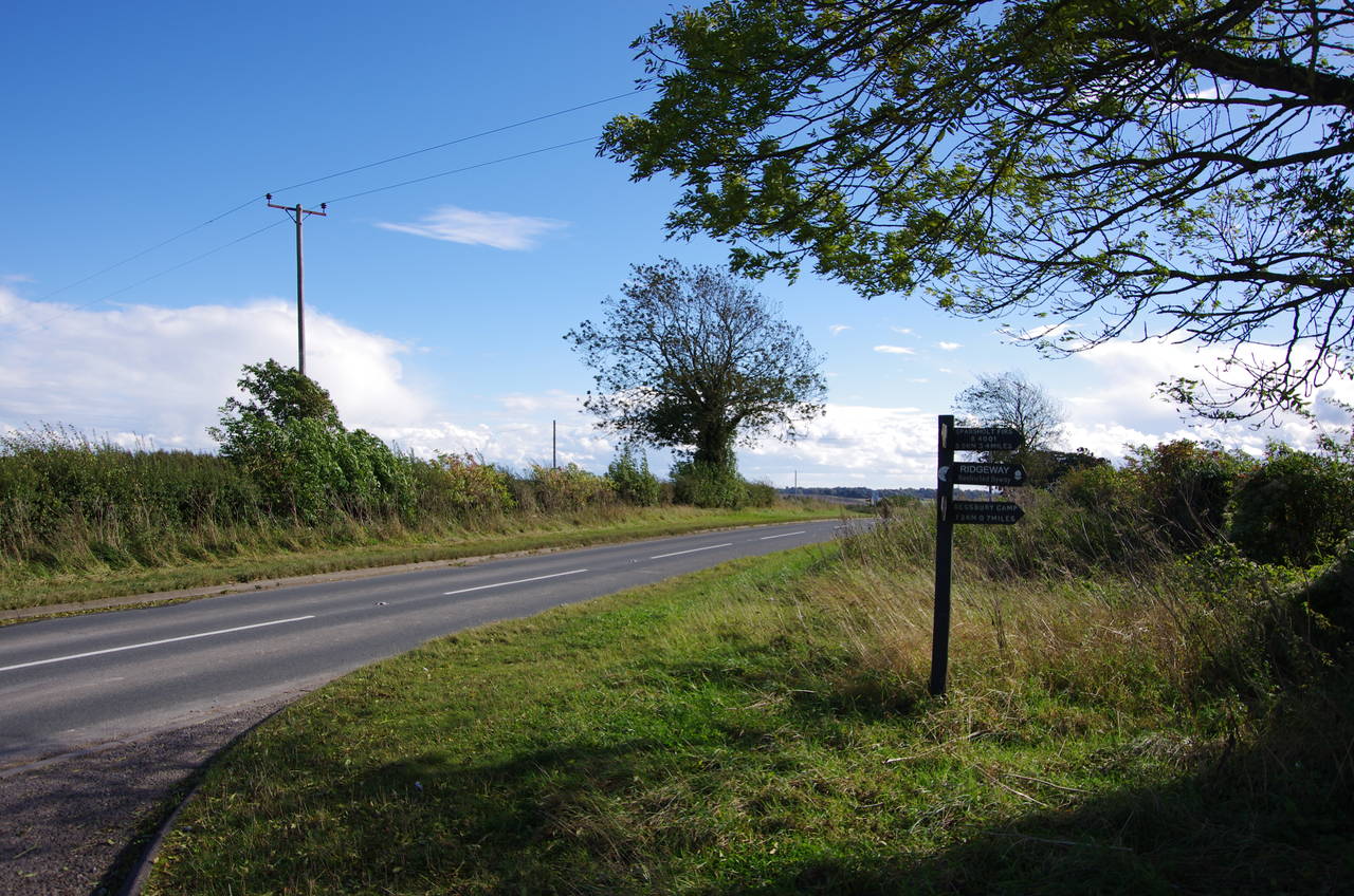
Two kilometres from White Horse Hill, the path crosses over Blowingstone Road, which runs down to the village of Kingston Lisle. The next kilometre takes the path over the low Kingston Hill to the next cross-track, which descends to the village of Sparsholt. Continuing ahead, the path climbs more steeply to pass by the end of the interestingly-named Rubblepit Plantation (picture 18).
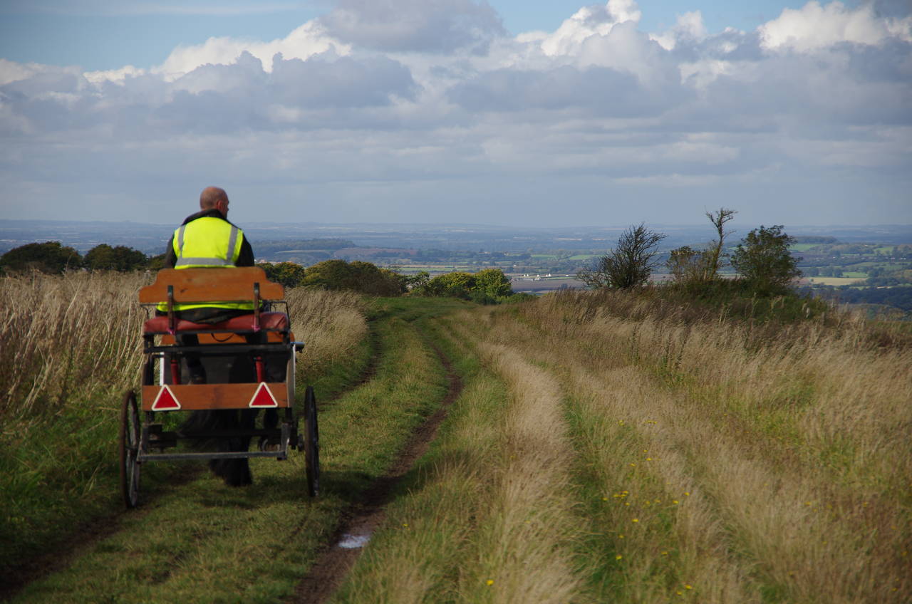
From the top of the hill, the path becomes grassy once again and runs along a flat ridge, where I was soon passed by a gentleman riding in a small horse-drawn buggy (picture 19). About 500 metres along the ridge, the grassy track joins a gravel farm road that continues along the ridge for another 500 metres to Sparsholt Firs (picture 20), a large stand of trees at a junction of tracks. Bearing right when the track meets another, the Ridgeway heads through the trees to cross over the B4001 road, which comes up to cross the ridge here.
(21) Devil's Punchbowl
(22) Parsonage Hill
(23) Segsbury Farm
(24) Segsbury Camp
The track soon becomes grassy again, running over Hackpen Hill (the second hill of this name on the Ridgeway), where a large coombe downhill to the left of the path is called the Devil's Punchbowl (picture 21). A prominent landmark in the distance was the pair of power stations at Didcot, with six 114-metre high cooling towers and a 199.5-metre high chimney, sending massive clouds of steam and smoke into the air. The coal-fired A station, opened in 1968, ceased operation a few months after my walk, on 22 March 2013, as part of the EU's push for cleaner energy, while the gas-fired B station, opened in 1997 is due for closure in 2023.
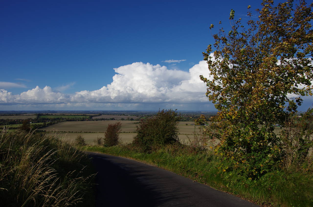
Further on, the relatively flat path runs across Warren Down, with a very long horse gallop close to the right-hand side of the path for well over a kilometre. About three kilometres from Sparsholt Firs, the Ridgeway reaches the next road crossing, over a minor road called Gramp's Hill.
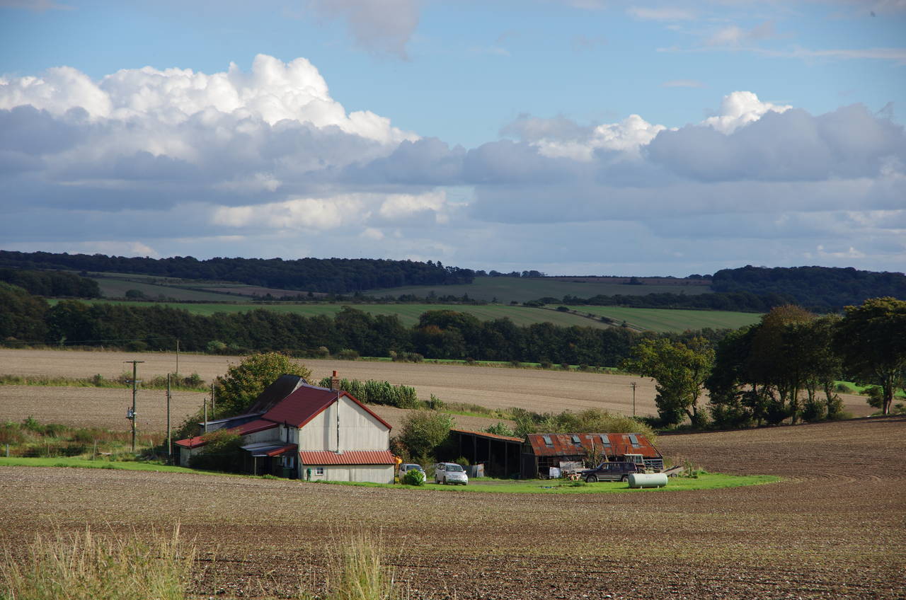
Beyond the crossing, the wide track becomes stony and potholed with a number of very large puddles as it climbs gently over Parsonage Hill (picture 22) before passing between Segsbury Farm on the right (picture 23) and the Segsbury Camp, another Iron Age hill-fort, on the left (picture 24).
(25) Segsbury Camp
(26) A338 Crossing at Court Hill
(27) Court Hill Road
(28) The Greyhound Inn, Letcombe Regis
The ramparts of the fort run alongside the track for about 400 metres (picture 25) before they curve away. Another 700 metres along the track, the Ridgeway arrives at the A338 Manor Road beside a small group of houses on Court Hill.
A signpost here points to the right along the road, but this was as far as I was going on the Ridgeway today. It was only about half past one in the afternoon, but I had planned to do some exploring off the trail in the afternoon. At this point my GPS showed that I had walked 20.4 kilometres since leaving Foxhill, 19.4 kilometres of that on the Ridgeway.
Around 400 metres to the left along Manor Road, I turned left onto Court Hill Road. A short distance along the road on the left is the Court Hill Centre, a small function centre with an adjoining camping ground and a cozy tea room, where I was just in time to order a late lunch.
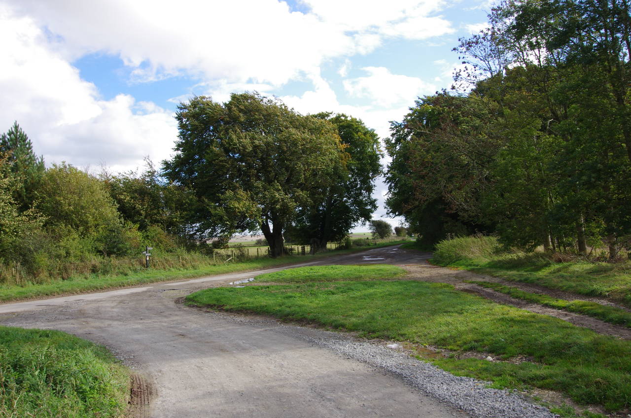
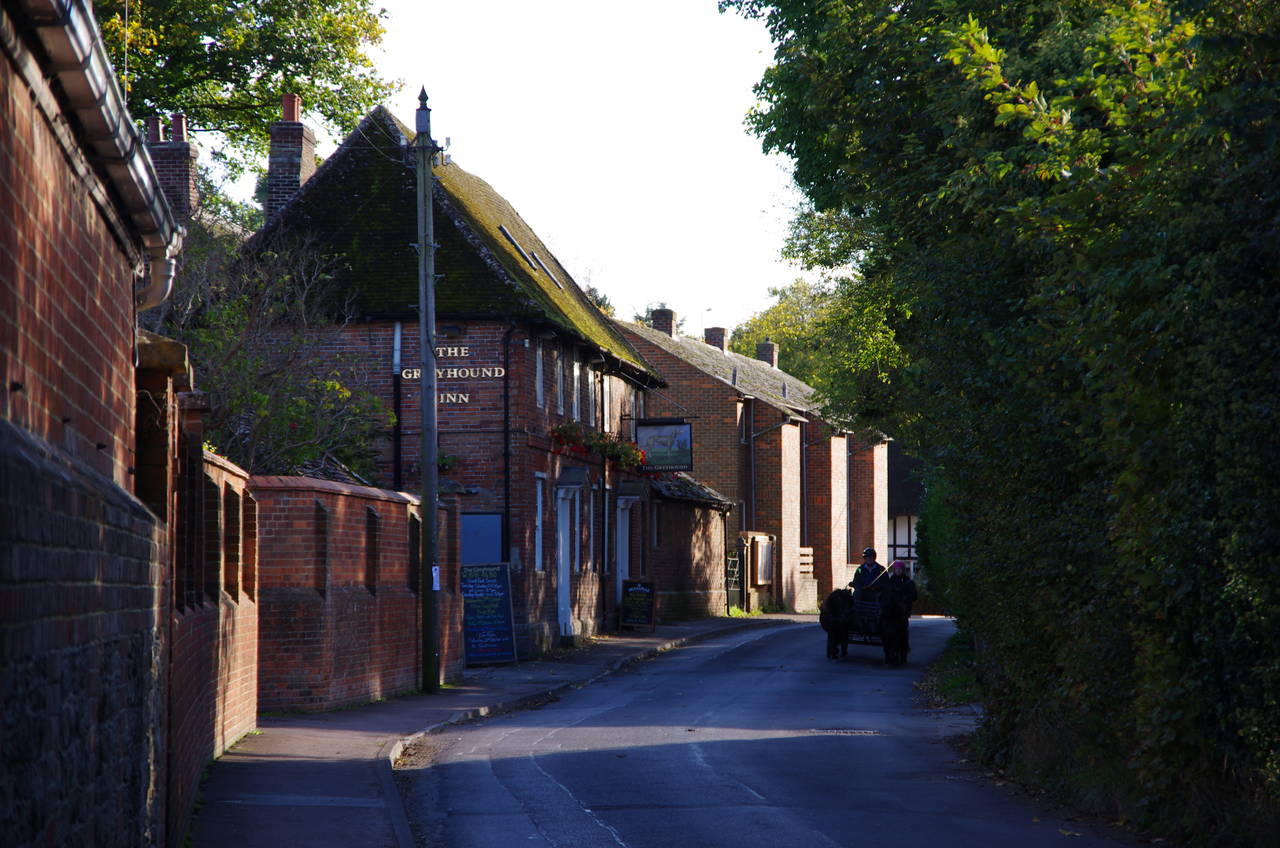
Emerging back into the bright sunlight about 45 minutes later, I rejoined Court Hill Road (picture 27), which runs down to the village of Letcombe Regis, about two kilometres away. At the first crossroads in the village a signpost points right for the town of Wantage, but first I turned left on Main Street, where another horse-drawn buggy was trundling by the Greyhound Inn (picture 28).
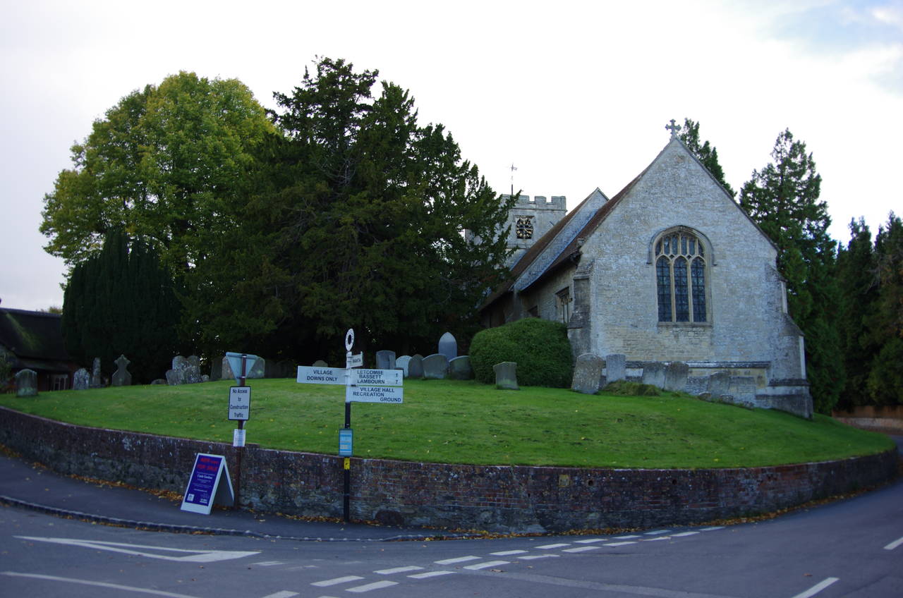
(29) St Andrews Church, Letcombe Regis
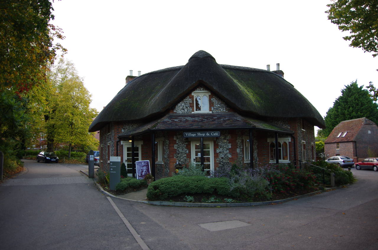
(30) Village shop, Letcombe Regis
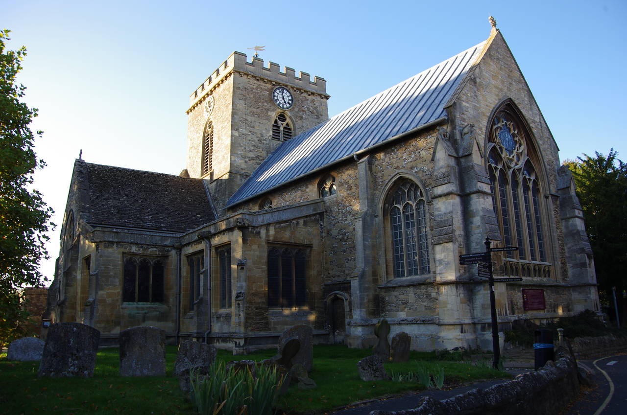
(31) Church of St Peter and St Paul, Wantage
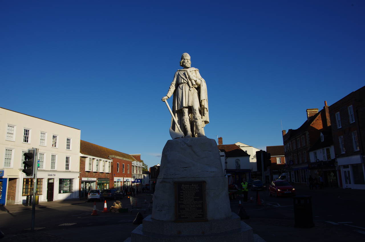
(32) King Alfred Statue, Wantage Marketplace
Following the street further leads to St Andrews Church (picture 25), while just to the left of the church the thatched village shop (picture 26) stands at the entrance of a large new housing development. The road to the right of the church leads round to a pleasant shady picnic spot by Letcombe Brook.
Returning to the crossroads on Court Hill Road, I followed the signposted route for the town of Wantage, which goes along a short residential street to the edge of the village and then ahead on a tarmac path between fields to the B4507 on the edge of Wantage.
A shortcut through a public carpark leads to Church Street, where the small Vale and Downland Museum stands a short distance up on the left, opposite the Church of St Peter and St Paul (picture 31). From there I followed a lane to the right-hand end of the church where a right turn leads to the Market Place, where a statue of the Saxon King Alfred the Great stands in the centre (picture 32).
After exploring the town centre for another hour or so, I caught a bus up to Didcot Parkway Station to get a train back to Swindon. As the train set out from Didcot Parkway, I got a much closer look at the power stations I had seen from the Ridgeway earlier in the day, as the railway line runs very close to them.