OFFA'S DYKE PATH NATIONAL TRAIL
Stage 12: Castell Dinas Brân to Llandegla
Sunday, September 8, 2019
(1) Castell Dinas Brân
(2) Castell Dinas Brân
(3) View over Llangollen
(4) View up the Dee Valley
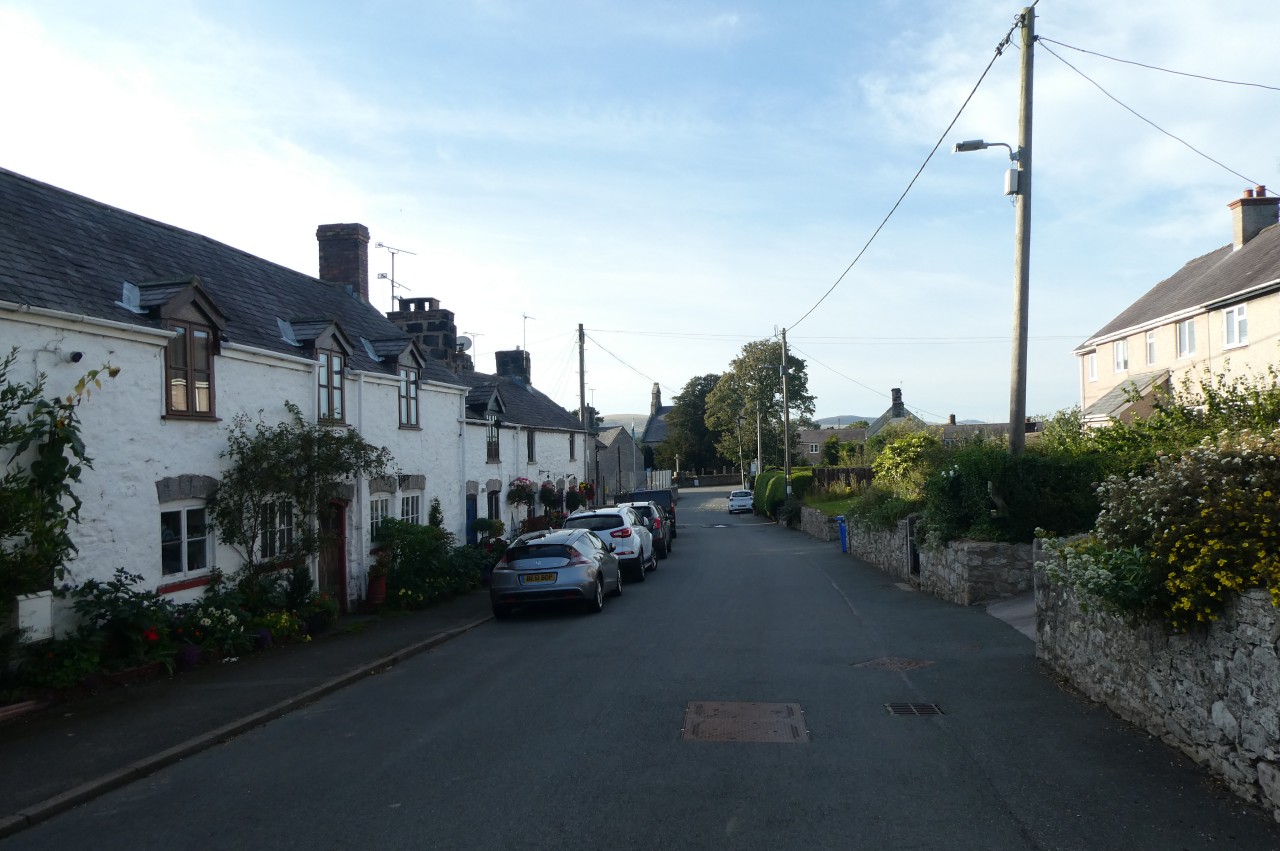
A gloriously sunny autumn morning greeted me when it was time to move on from Llangollen. Aside from the initial stiff climb out of Llangollen, it was going to be a relatively easy day's walking, covering about sixteen kilometres, with 13.4 of that being on Offa's Dyke Path.
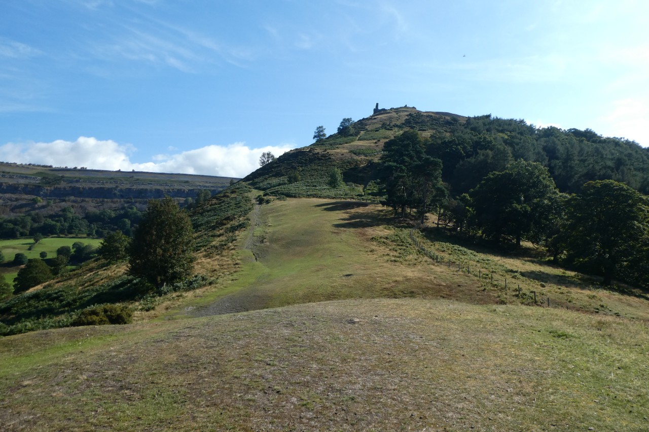
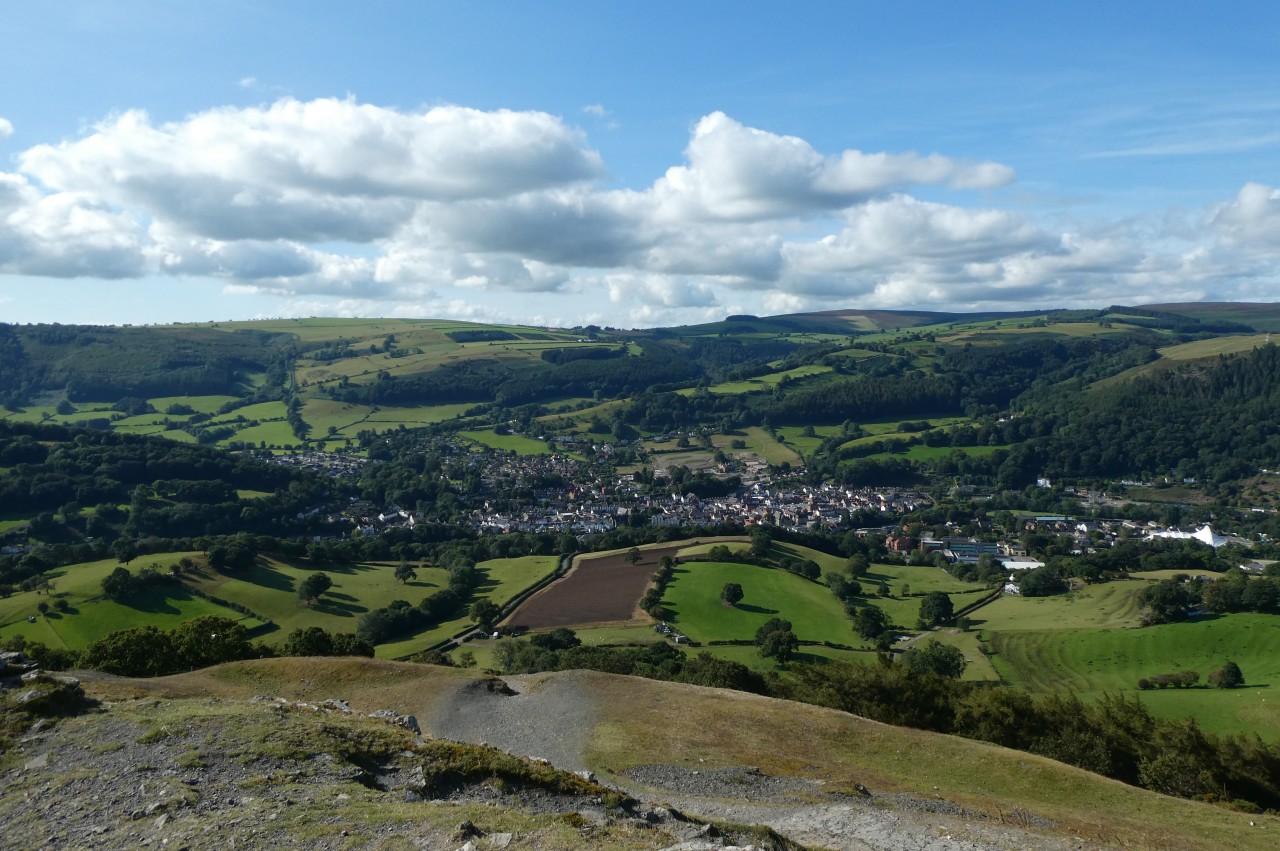
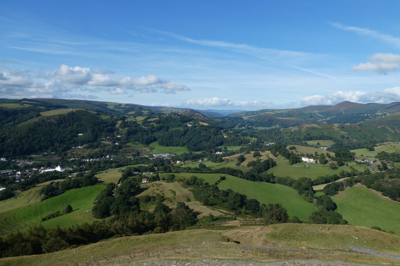
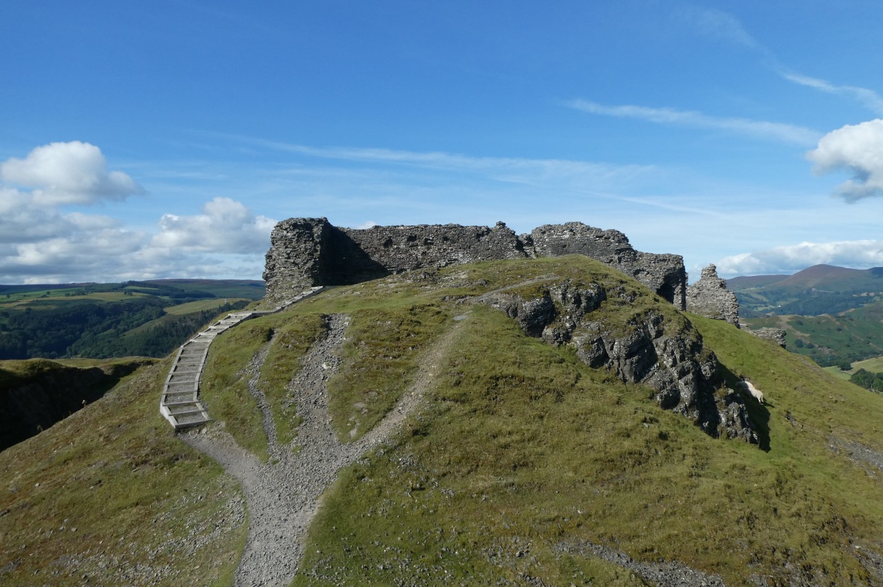
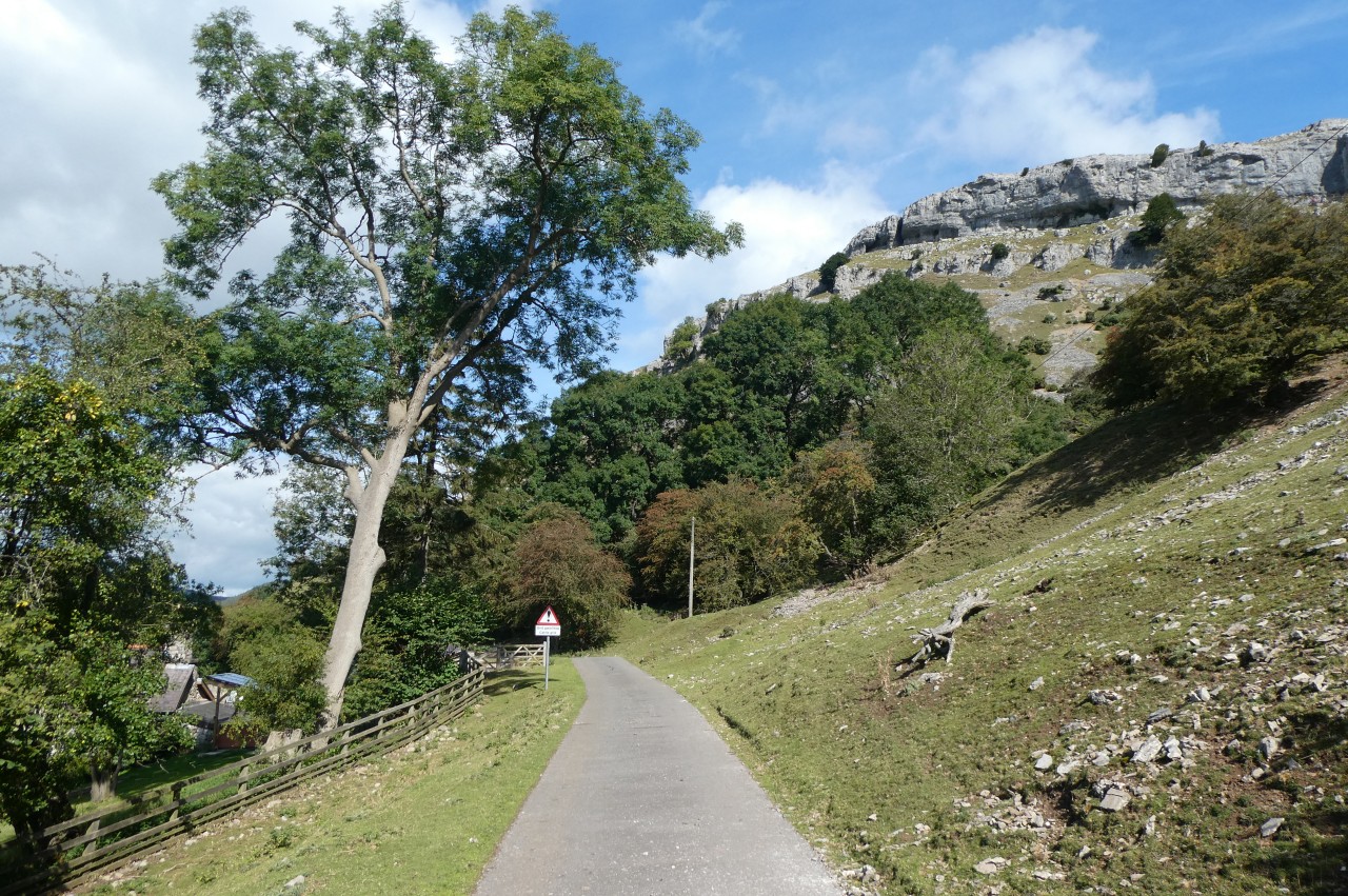
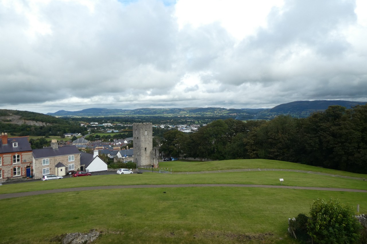
Starting on Llangollen Bridge, I headed back up to Llangollen Wharf, crossed the bridge over the Llangollen Canal and took a signposted footpath northward up the side of the Dinas Brân School and out of town. Ahead, across Geufron and Tirionfa farms, I found the path that zig-zags up the steep western side of Dinas Brân (picture 1) to the hilltop ruins of its medieval castle (picture 2). From the top of the path, there are fine views back over the town of Llangollen, some 250 metres below (picture 3) and further to the right up the Dee Valley (picture 4).
(5) Castell Dinas Brân
(6) Castell Dinas Brân
(7) Descending from Castell Dinas Brân
(8) View over Tan-y-castell Farm
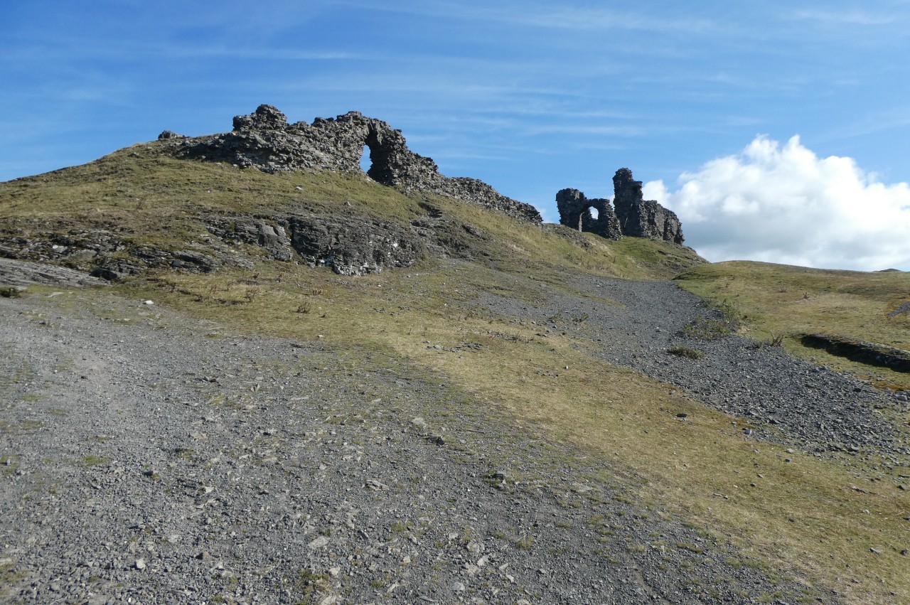
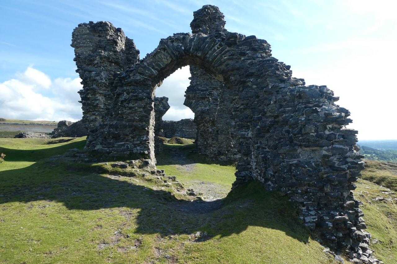
The medieval castle, built on the site of an earlier Iron Age hillfort dating from around 600 B.C., was a roughly rectangular structure with a defensive ditch hewn out of the rock on two sides and the steep hillside offering a good natural defense on the other two sides. The castle had a relatively short life, built for the Welsh prince Gruffudd ap Madoc during the 1260s, burnt and abandoned by its Welsh defenders in the face of an English attack in 1277, briefly garrisoned by the English and then finally abandoned for good in 1282. All that remains today are fragments of thick stone walls and arches (picture 5) and one more substantial L-shaped section of wall that was part of the castle keep (picture 6).
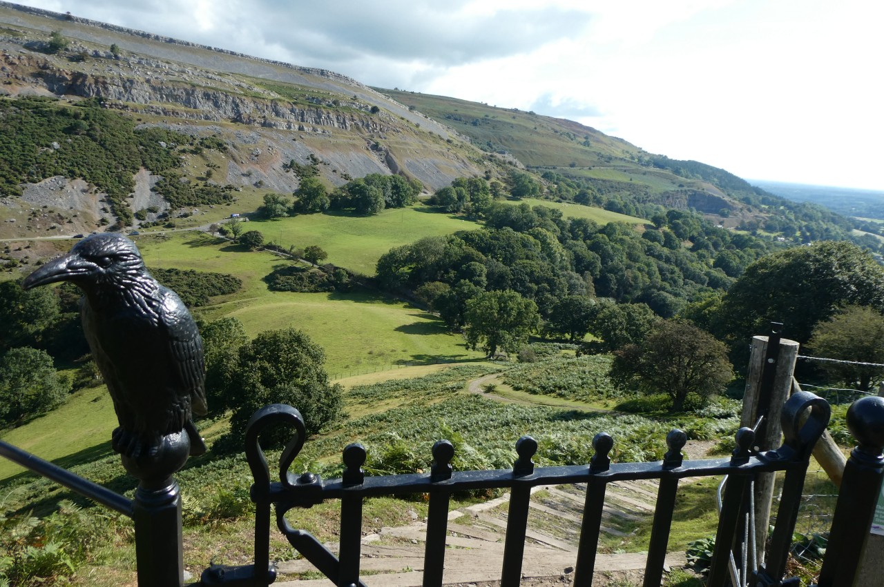
One of the possible translations of Castell Dinas Brân is "crow castle", which is what my friend who played here as a child calls it. At the top of the footpath leading down the north-eastern side of the hill, a gatepost is adorned with a statue of a crow (picture 7).
From this point there is also a good view across Tan-y-castell Farm to the Panorama Walk running along the foot of the Eglwyseg Escarpment (picture 8) before the footpath snakes its way down the steep hillside to join the lane coming up from Llangollen near the junction where I had left the Panorama Walk and Offa's Dyke Path a few evenings previously.
(9) Dinbren Uchaf
(10) Bryn Goleu
(11) Eglwyseg Mountain
(12) Eglwyseg Valley
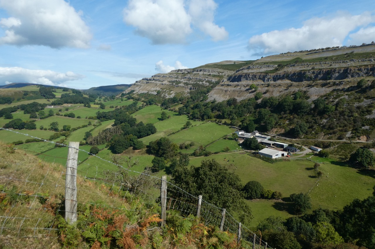
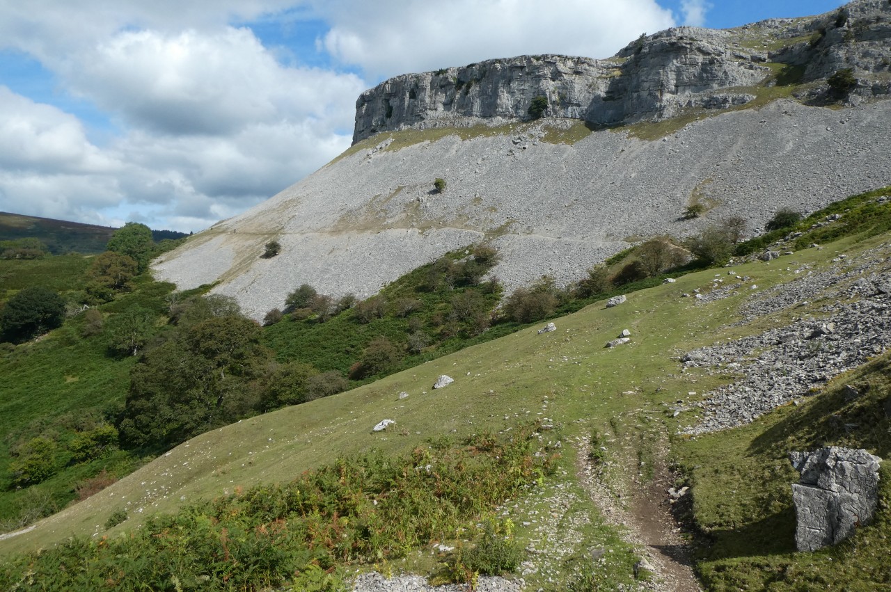
The Panorama Walk descends past Tan-y-castell then climbs over a rise before descending gently past more farm buildings at Dinbren Uchaf with the crags of Creigiau Eglwyseg looming above (picture 9). The limestone rocks of the Eglwyseg Mountain were laid down on a shallow seabed around 340 million years ago and the escarpment on the western side has been shaped by the elements into a series of semicircular cliffs with up to six distinct layers of limestone exposed above a steep scree-covered slope.
Almost a kilometre beyond Dinbren Uchaf, Offa's Dyke Path turns through a gate on the right to follow a track into a deep cleft in the escarpment (picture 10). This is a popular location for rock climbers during the half of the year when the crevices in the crags aren't being used by nesting birds.
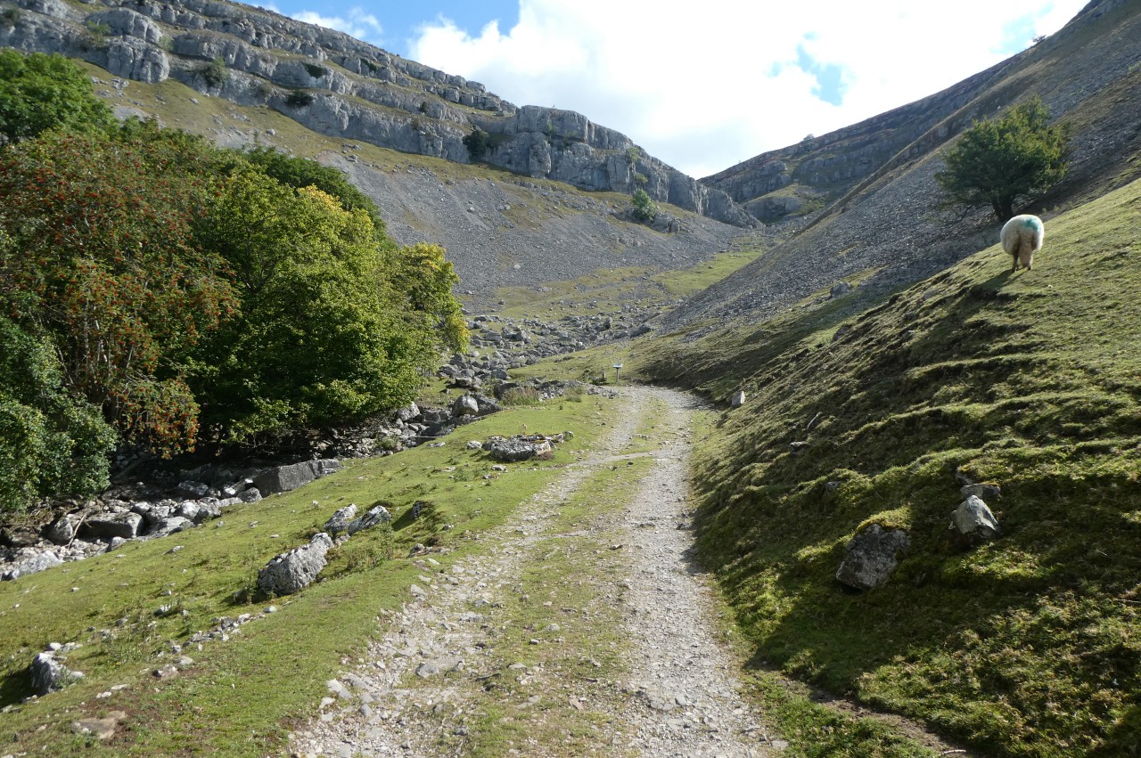
The track soon bends around to the left, crossing the dry bed of a stream that runs down from the top of the cliffs in wet weather, then becomes a narrow footpath passing above the lonely cottage of Bryn Goleu before heading out across the scree slope (picture 11). This path gradually works it's way higher above the fertile Eglwyseg Valley (picture 12), but despite the narrow and precipitous path, a couple of times I had to step out of the way of daredevils on mountain bikes.
(13) Craig Arthur

(14) World's End
(15) Road between Cyrn-y-Brain and Cefn y Cist
(16) Path towards Llandegla Forest
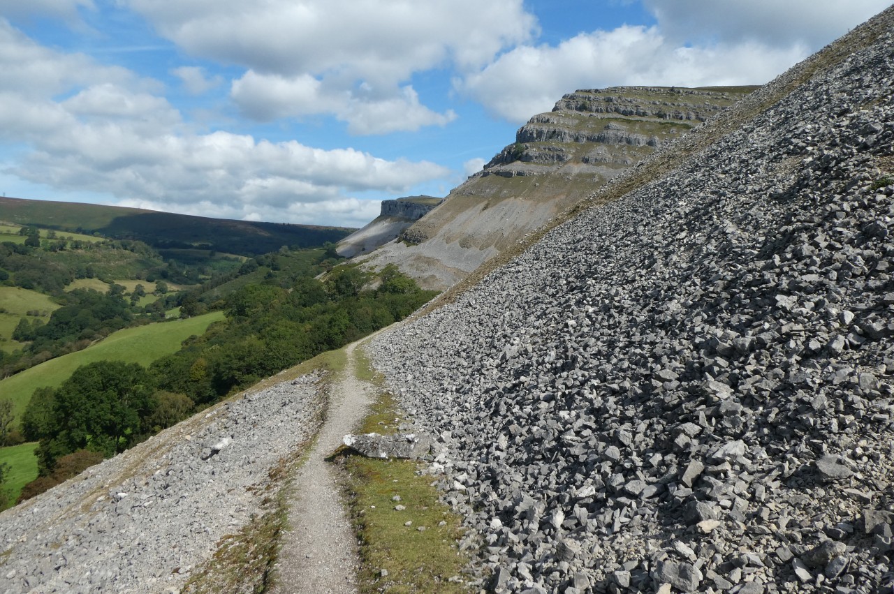
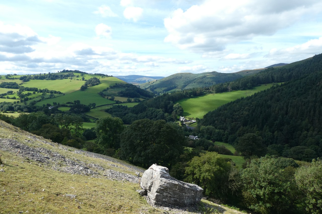
Having traversed two of the semicircular cliffs, the Path reaches Craig Arthur, perhaps the most spectacular part of the escarpment, where the layers of limestone stack up vertically (picture 13). Part of the way around the cliff, as the path curves around towards the north-east, the ground cover changes from scree to bracken and soon the path begins a gradual descent back into the valley, rejoining the road just before a hairpin bend where it turns across the infant Eglwyseg River (a minor tributary of the Dee) close to its source in the wooded combe of World's End (picture 14).
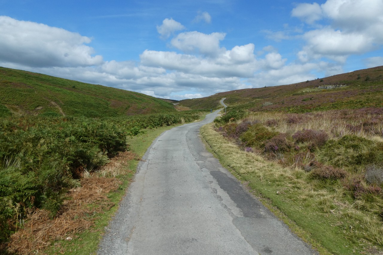
After fording the very shallow river, the road and the Path now make a long, steady climb out of the Eglwyseg Valley and onto open moorland with the heathery peaks of Cyrn-y-Brain on the left and Cefn y Cist on the right (picture 15).
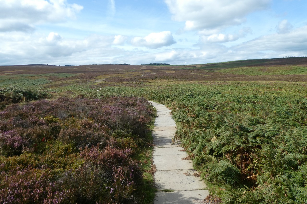
After 1,900 metres, Offa's Dyke Path turns off the lonely road where a knee-high etched slab of slate makes a more environmentally sympathetic waymarker than a fingerpost. Unfortunately, the Ordnance Survey map showed the wrong route here (and still does at the time of writing). The map shows the Path turning off the road 150 metres earlier on an unsignposted path that soon veers away almost ninety degrees left toward the summit of Cyrn-y-Brain. The map's path across the next 1,400 metres of marshy moorland simply doesn't exist and doesn't even show the correct point to aim for to get off the moorland.
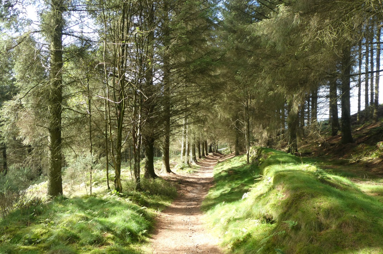
Fortunately, I realised fairly quickly that I was probably on the wrong path and the copy of the OpenStreetMap on my GPS showed the correct path (as does Google Maps). Back on the right route, I crossed the boggy moorland on a narrow path partly surfaced with stepping stones and duckboards (picture 16), reaching a gate on the edge of the Llandegla Forest.
The commercial timber plantation was established in the 1970s and covers more than six square kilometres, making it one of the largest in Wales. In recent years the original spruce and larch trees have become mature enough for harvesting and a cycle of felling and replanting has begun, leaving some large bare patches within the forest. Despite this, the forest is a very popular area for walkers and mountain bikers.
(17) Llandegla Forest
(18) Llandegla Forest
(19) Hafod Bilston
(20) Approaching Llandegla
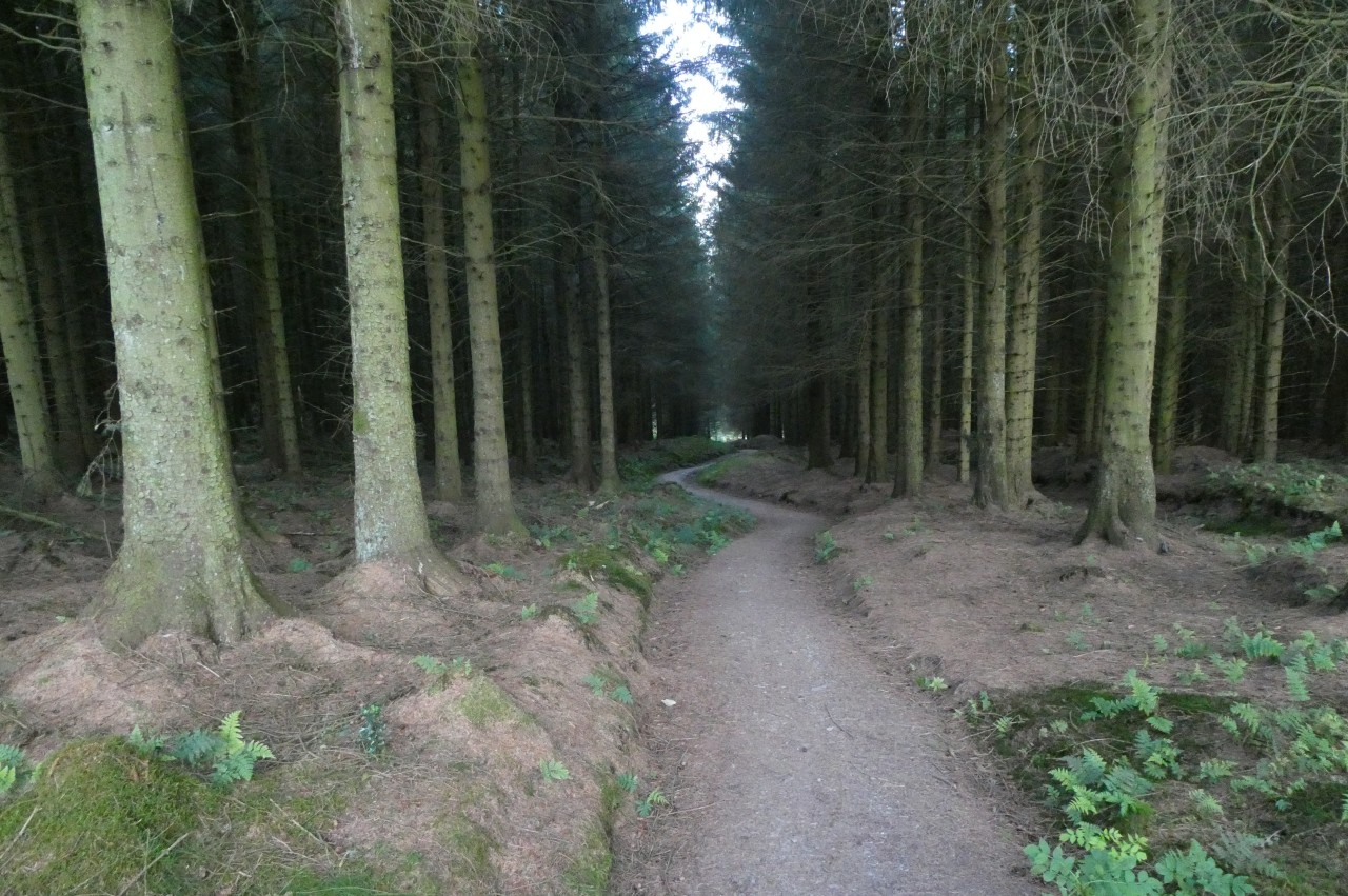
Through the gate, a forestry track goes ahead between two blocks of the forest where young trees were just beginning to grow amongst the stumps of felled trees. Beyond a couple of cross-tracks, the track becomes a narrower footpath past mature trees growing on the left, then after crossing another forestry track the path goes through the middle of a dark, claustrophobic plantation (picture 17). Across another large section of cleared forest the Path enters an airy stretch of woodland (picture 18), where I could hear groups of excited mountain bikers nearby but never caught sight of them, though Offa's Dyke Path and the mountain-biking paths do cross each other in several places.
Beyond another gate, the mountain-bikers are left behind and the Path heads gently downhill through the trees to arrive at the hamlet of Hafod Bilston (picture 19). Turning right along the lane, between stone cottages, the Path soon reaches a fingerpost on the left pointing along the right edge of a field. Through a gate in the corner of the field, the Path switches sides of the fence and begins to descend towards the village of Llandegla (picture 20).
(21) Bethania Methodist Chapel
(22) Allt yr Efail
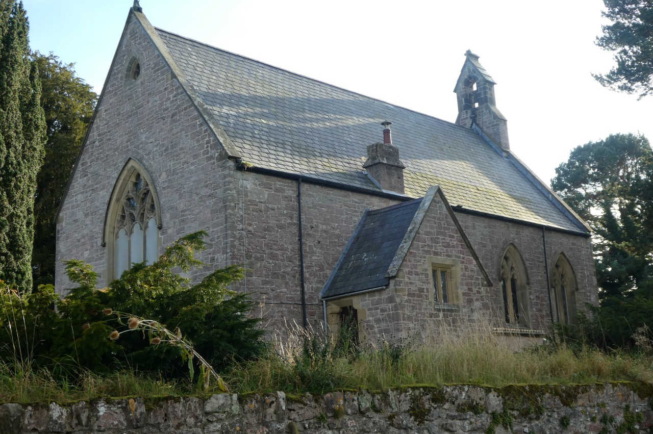
(23) St Tecla's Parish Church
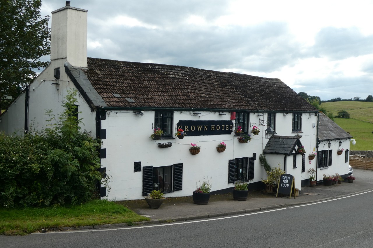
(24) Crown Hotel
Halfway down the field, just beyond an electricity pylon, the Path goes through a kissing gate and cuts across the corner of the next field to a footbridge over a tiny stream. Ahead across one more grassy sheep pasture, the Path climbs past the right side of a large farmhouse to find steps up to the side of the A525.
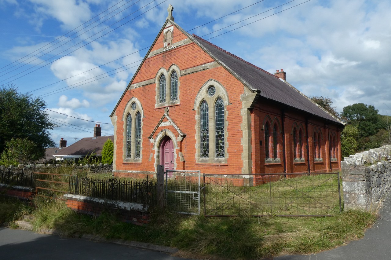
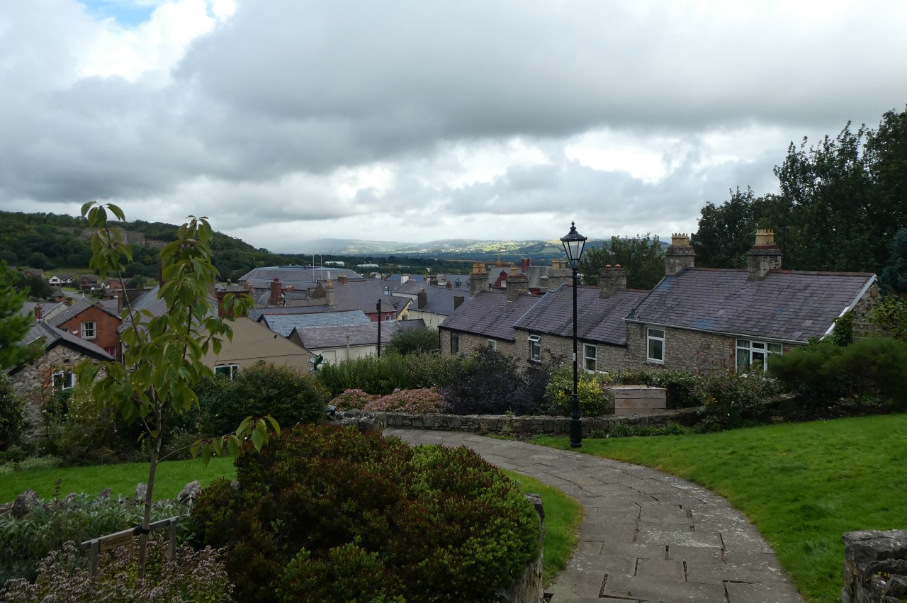
The narrow verge is followed to the left for seventy metres, then one must cross the busy road carefully to take a narrow footpath up between houses to a lane. To the left, the lane heads up to a crossroads with the A5104 and ahead is Llandegla's long (and mostly residential) main street, Allt yr Efail. Halfway up the street, I passed the Bethania Methodist Chapel (picture 21) before heading the rest of the way along the quiet street (picture 22) to reach the Church of St Tecla, and the end of this stage of Offa's Dyke Path, at the northern end of the village (picture 23)
Inside the church is a local history exhibit, from which I learned that the village's most famous son is Elihu Yale, who funded the creation of the prestigious Yale University in the United States in 1701.
Across the road from the church is Llandegla's very welcoming community shop and cafe, where I stopped for afternoon tea. Somewhat refreshed, I then walked all the way back down to the crossroads and a short distance along the B5104 to another crossroads by the Crown pub (picture 24). A couple of minutes walk further south on the A5104 is the Llyn Rhys Farm Campsite, where I set up my tent next to the trickling River Alyn before returning to the pub for dinner. I didn't stay in the pub too long though, as I was keen to get an early night in anticipation of making an early start the next morning for what would be the longest stage of my walk.
Addendum: Denbigh, Monday, September 9, 2019
(25) Denbigh War Memorial
(26) "Dr Livingstone, I Presume"
(27) Temple Bar Garden

(28) Burgess Gate
Alas, my best laid plans were foiled by the weather once again, as I spent the early hours of the next morning struggling to sleep with heavy rain lashing my tent. With no let up in the rain by eight o'clock, I decided to take a day off the trail and spend the day exploring the town of Denbigh, a 45-minute bus ride north-west from Llandegla.
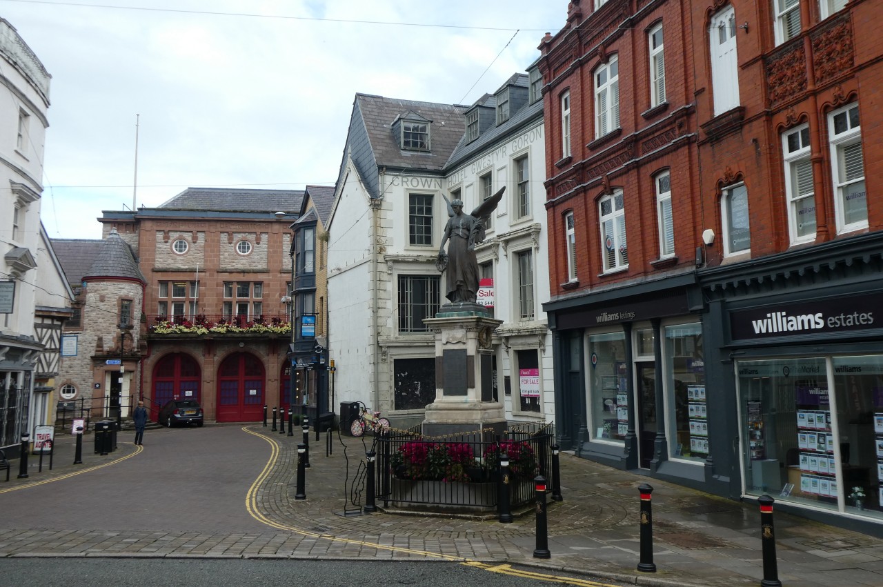
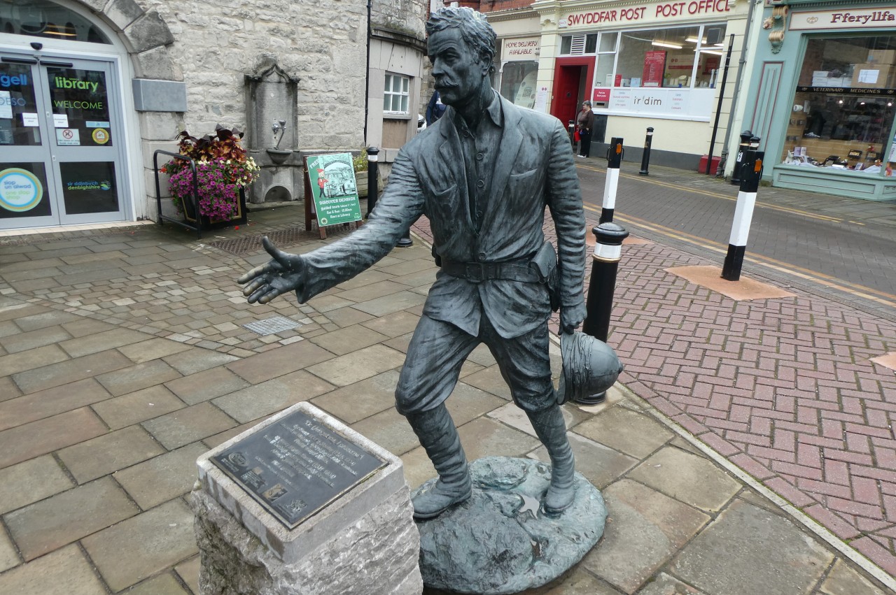
I alighted from the bus on Vale Street and walked up the hill to Hall Square, where Denbigh's War Memorial stands in front of the Crown Hotel (picture 25). Opposite the War Memorial, by the library is a statue of Sir Henry Morton Stanley (picture 26), who was born in Denbigh in 1841 and found fame for his expeditions to explore Africa and his successful search for missing fellow explorer Dr. David Livingstone.
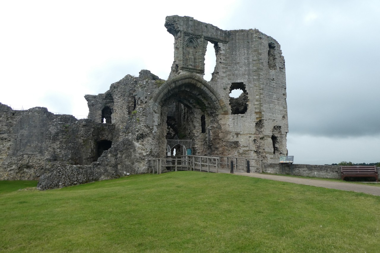
A little further along the road, now High Street, a narrow footpath squeezes between a Boots Pharmacy and The Old Vaults to climb through the pleasant little Temple Bar Garden (picture 27). Steps climb from the garden to the Burgess Gate (picture 28), part of Denbigh's town wall, which encircled the medieval town and castle on the hilltop just south of the present-day town centre. After pausing to read through a set of information panels in on the the gate's rooms, I continued up Castle Hill to visit the ruin of Denbigh Castle.
(29) Denbigh Castle
(30) Denbigh Castle

(31) Denbigh Castle
(32) View toward the Clwydian Mountains
The castle and town wall date from 1282, when construction began on the orders of the English King Edward I. By the end of the 15th century Wars of the Roses, much of the original town has been destroyed and it was re-established further down the hill and outside of the medieval wall, growing steadily on the profits of the local textile and agricultural industries. Back up the hill, the castle remained in use until 1646, when its Royalist garrison surrendered to the Parliamentarians during the English Civil War. In 1659, the Royalists briefly regained control of the castle, after which the walls were partially demolished by the Parliamentarians to prevent further military use of the castle, beginning the site's gradual decline into ruins.
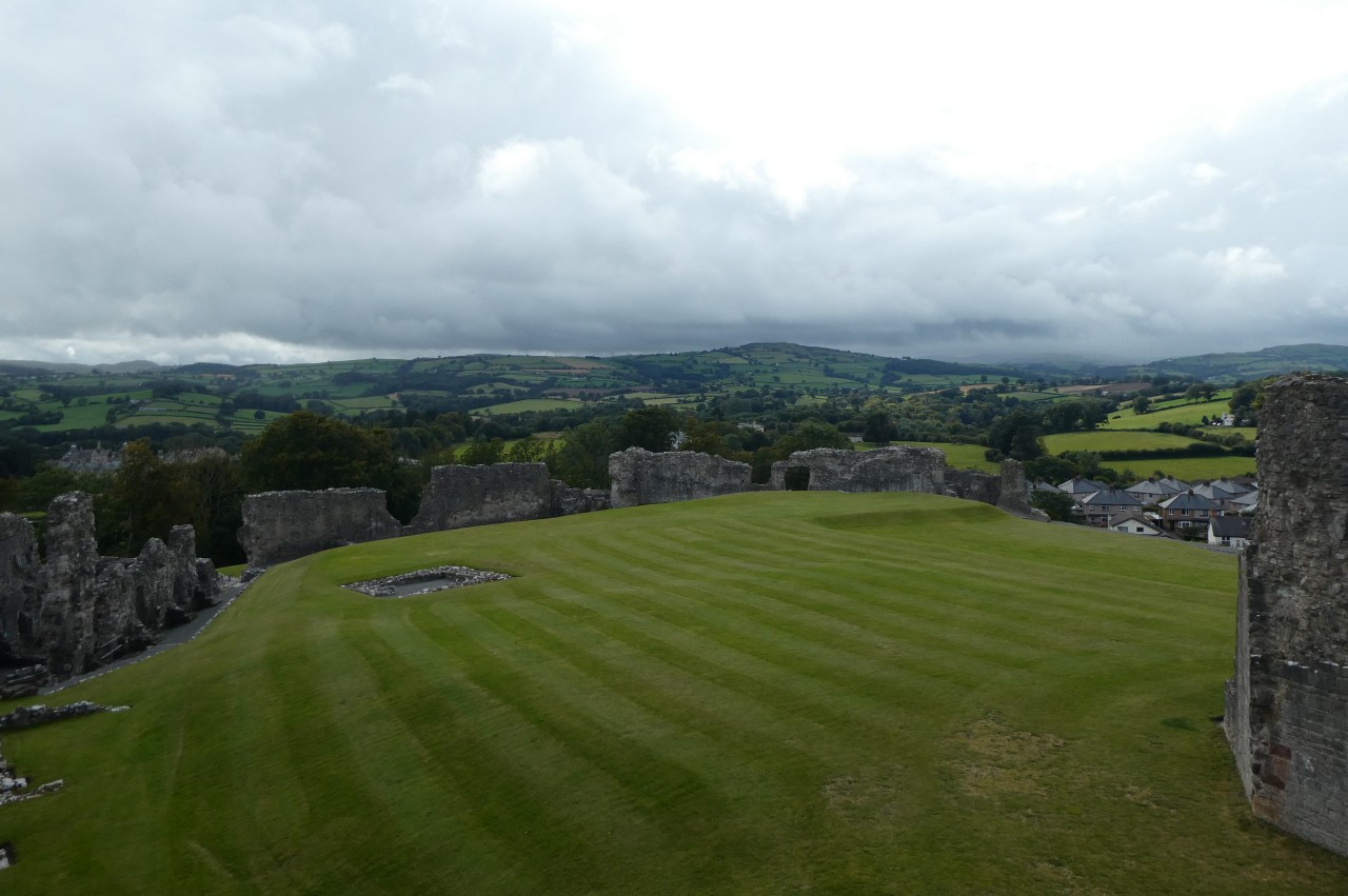
Through the ruined castle gatehouse (picture 29), the visitor enters the large bailey (picture 30). Originally, the inside of the sturdy walls were lined with a variety of buildings around a central courtyard, but now only foundations remain (picture 31). The section of the wall facing the town centre is in the best condition and one can climb to the top for a good view over the town toward the Clwydian Mountains, which are traversed by the last two stages of the Offa's Dyke Path (picture 32).