MEDWAY VALLEY WALK
Stage 2: Maidstone to Rochester
Friday, July 22, 2016
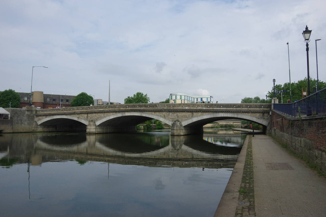
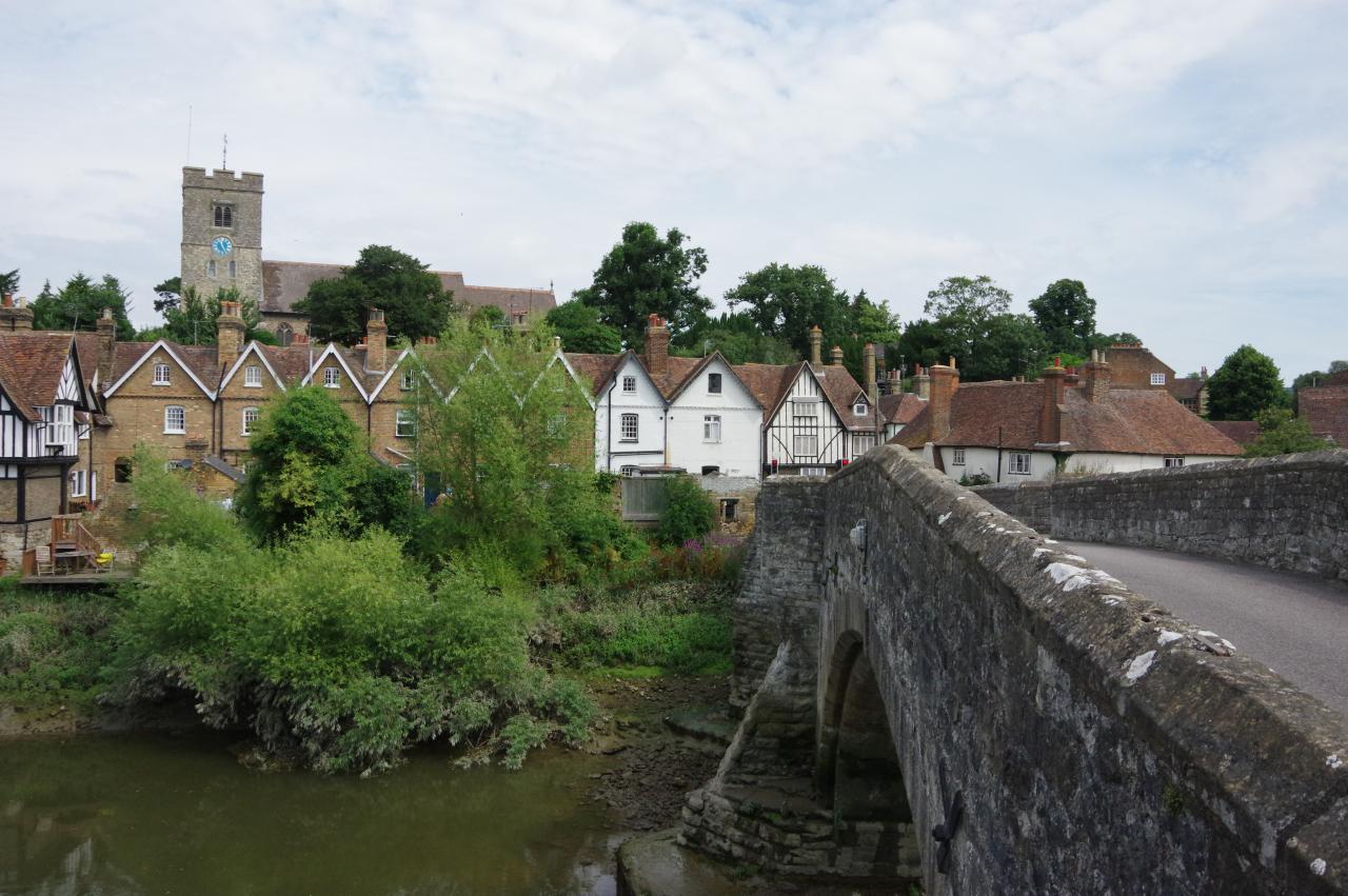
(1) Maidstone Bridge
(2) Maidstone
(3) River Medway
(4) Millennium Footbridge
I began the second and final leg of the Medway Valley Walk at the western end of Maidstone Bridge, shortly after nine o'clock in the morning, having travelled down from Strood by train on the Medway Valley Line.
The route crosses the bridge, turning right to descend a ramp to the riverside path a short distance upstream from the bridge, then turning downstream to head under the bridge (picture 1) and then soon under the rather less attractive concrete A229 bridge.
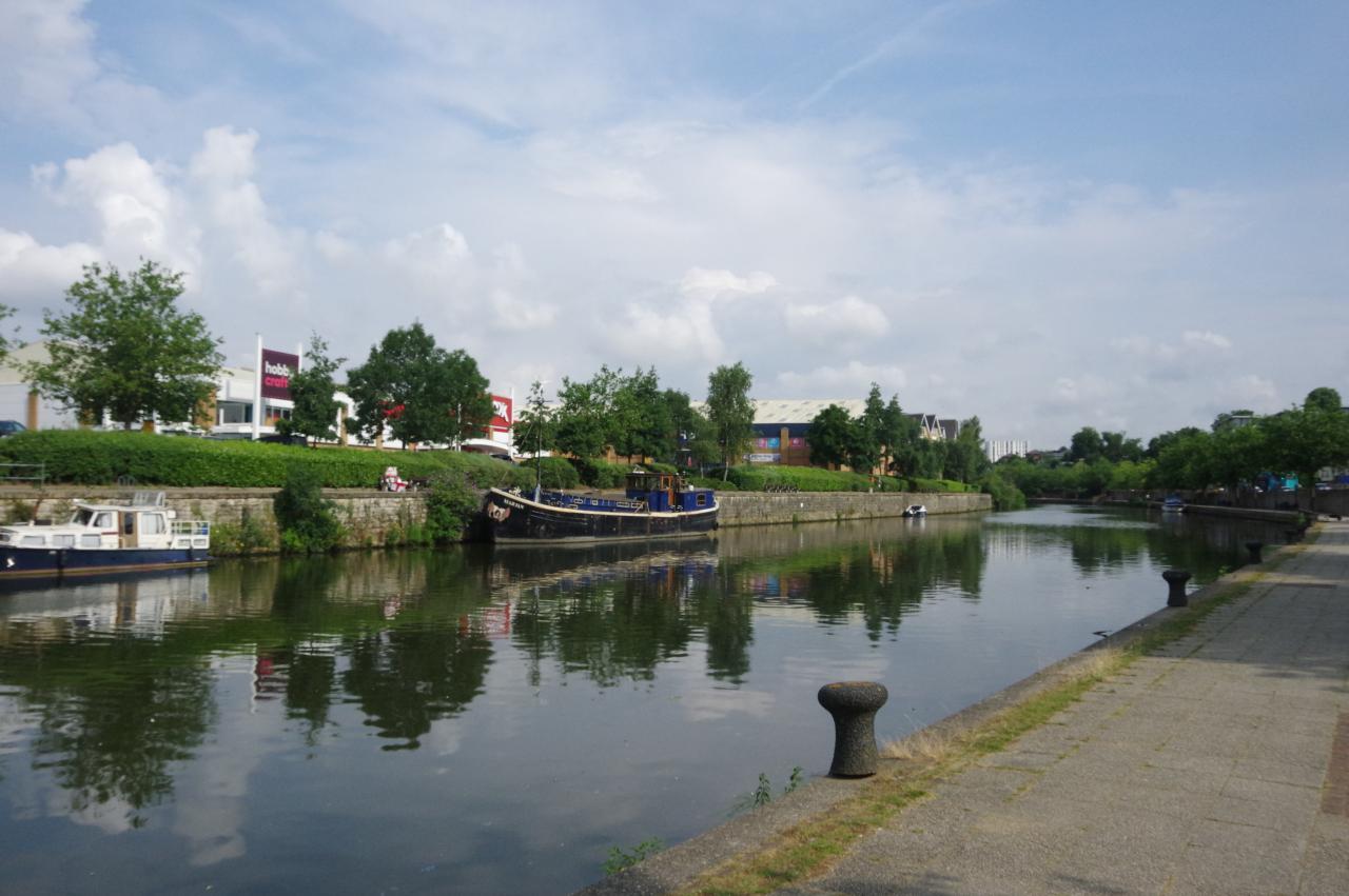
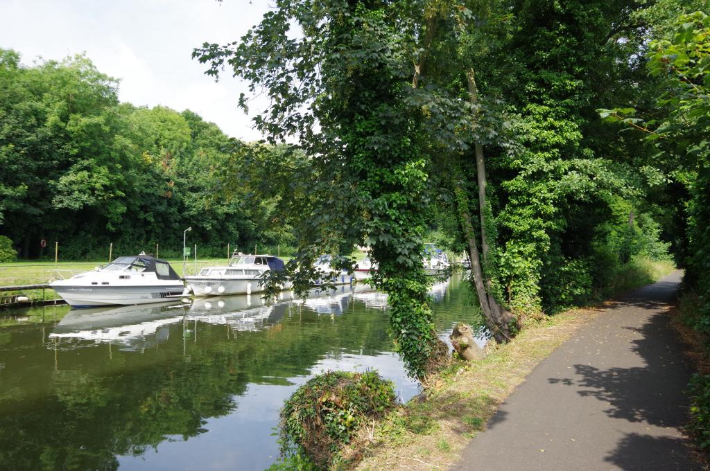
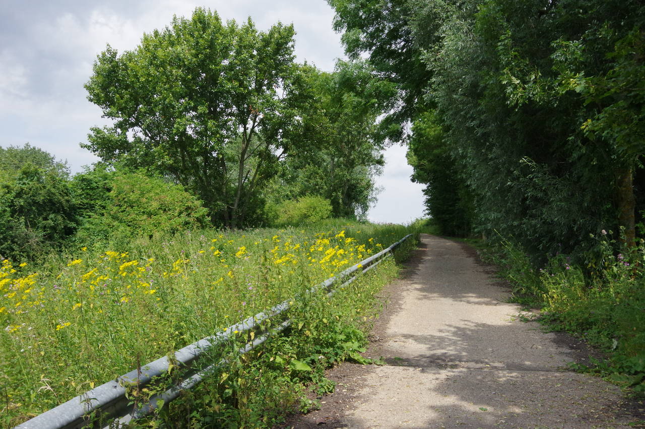
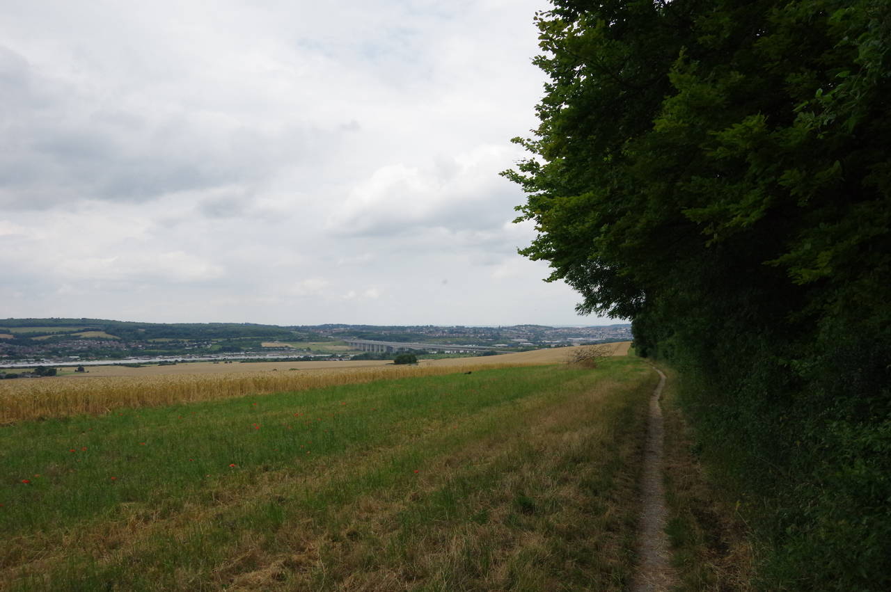
The path then continues downstream along a gentle curve of the riverbank (picture 2), running just below an embankment that carries the A229. On reaching a railway bridge that brings the tracks over the river to the nearby Maidstone East Station, the path is blocked by the bridge's stone pylon and has to briefly climb up to the road to pass under the bridge. The busy main road now bears away to the right and the Walk returns to the riverbank (picture 3), now on a narrower tarmac path among a strip of trees between the river and Gallagher Stadium, which has been the home ground of the Maidstone United Football Club since 2012. A little further downstream, the path passes under another of Maidstone's Millennium Footbridges (picture 4).
(5) Ringlestone
(6) Allington
(7) Allington Lock
(8) Crossing the M20
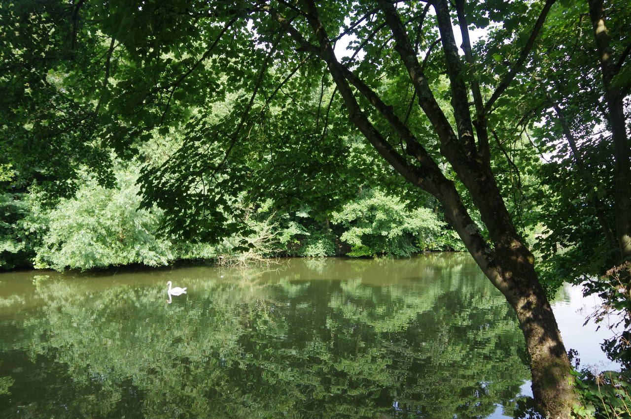
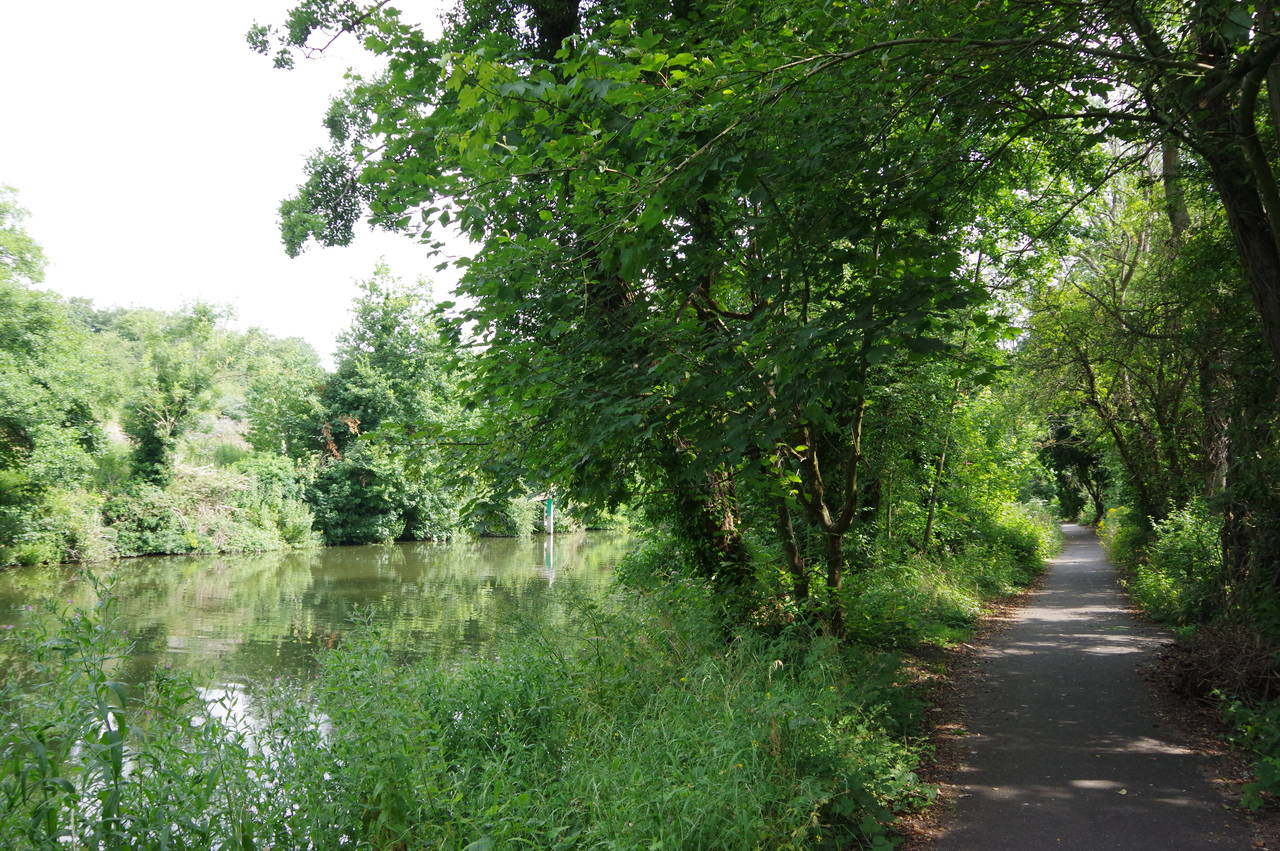
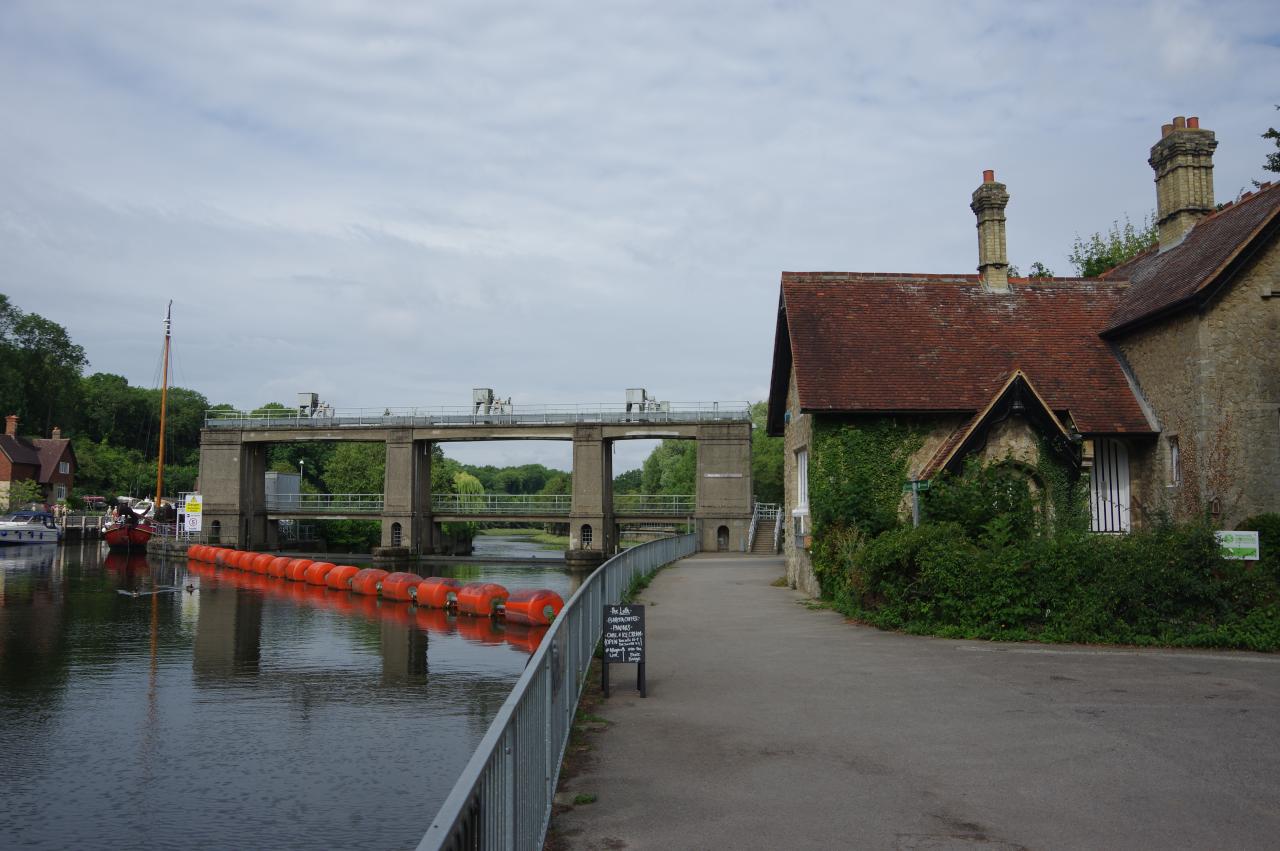
Beyond the bridge the river takes a long right-hand bend around the suburb of Ringlestone, where the opposite bank was lined with a long series of moorings (picture 5). A few hundred metres of unoccupied riverbank (picture 6) separates Ringlestone from Allington, where the river passes Allington Marina and then sweeps back to the left, changing course from northeast to due west as it approaches Allington Lock (picture 7). This is the lowest lock on the Medway and from here onwards the river is tidal.
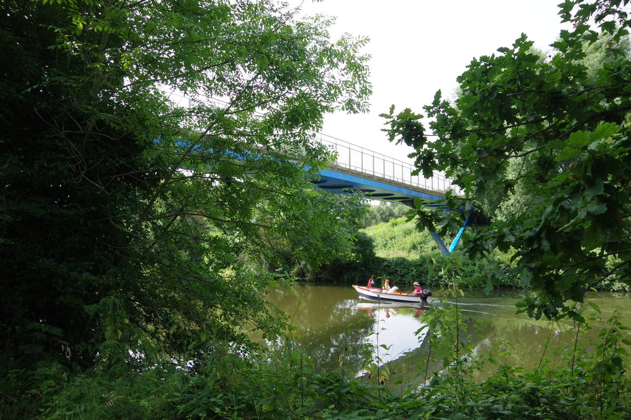
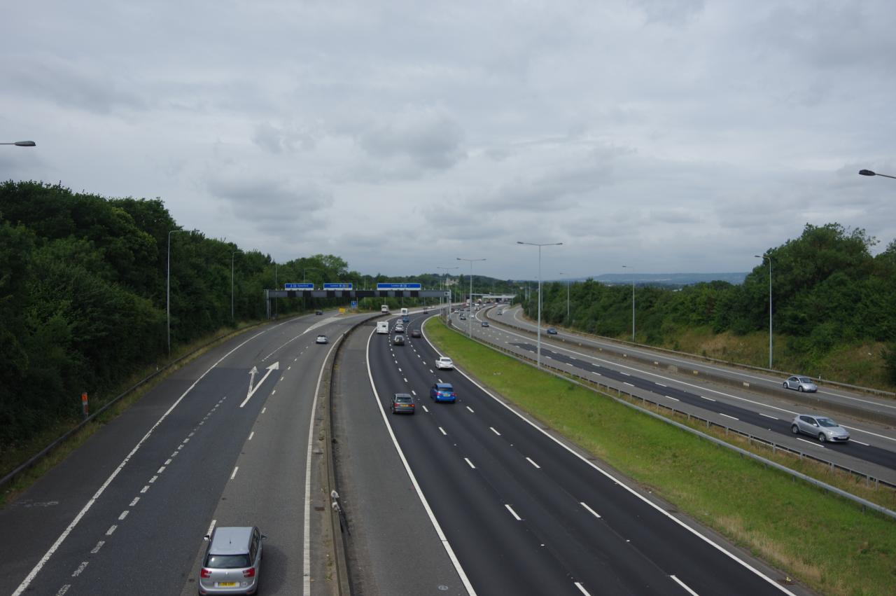
The Medway Valley Walk crosses a footbridge over the weir then runs along the length of the lock island to cross the lock gates to the left bank of the river. Just downstream from the lock, the path climbs away from the river, crossing the Medway Valley Line via stiles on either side of the tracks and then following an enclosed path up through trees to a footbridge over the thunderous M20 motorway (picture 8).
(9) Aylesford
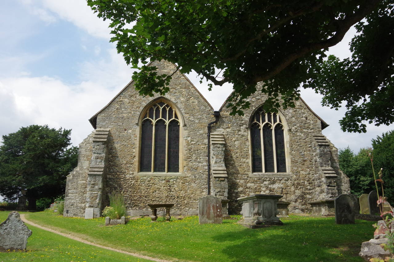
(10) St Peter and St Paul's Church, Aylesford
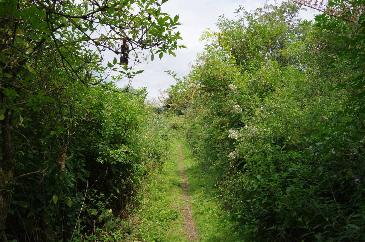
(11) Stingy Fly Alley
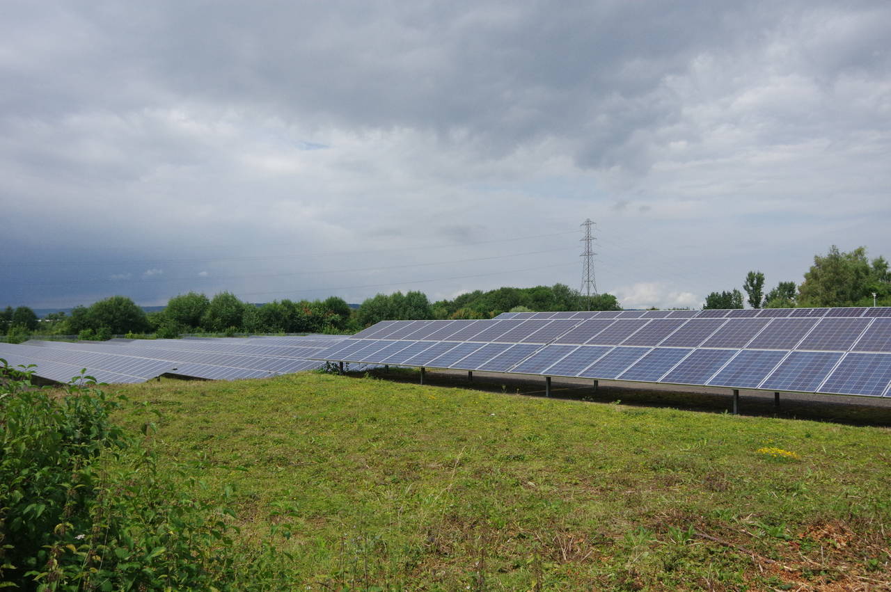
(12) Solar Farm
At the end of the footbridge, the Walk turns left through trees, soon emerging into a large field. The route skirts around the right-hand edge of the field to the end of the trees then continues ahead to a small copse where the path runs just inside the right-hand edge before turning right along the fence of an industrial area and then left on a narrow enclosed path alongside the Medway Valley Line. After about 200 metres the path reaches the end of Coldharbour Lane and turns right across the tracks to return to the tree-lined left bank of the Medway.
Soon passing some new riverside housing, the Walk reaches a concrete road bridge that crosses the river in the village of Aylesford, blocking the riverside path. The Walk turns uphill beside the bridge, briefly joining Station Road before taking the first turn on the right to cross the village's much more attractive medieval bridge (picture 9) to reach the High Street.
The route turns right, along the High Street, then turns left at the next intersection to climb Vicarage Close for about fifty metres to turn left again on Church Walk, below the parish church of St Peter and St Paul (picture 10). Church Walk runs across the hillside, below the churchyard and above the buildings of the High Street, eventually heading down a long ramp to rejoin the High Street, heading westward out of the village.
Three hundred metres ahead, by the entrance of Aylesford Priory, the main road swings away to the right but the Medway Valley Walk continues ahead on a quiet lane leading up to the gates of the large Aylesford Sewage Treatment Works. The lane continues straight through the middle of the works, fenced in on both sides before narrowing into a trail through dense scrub, known as Stingy Fly Alley (picture 11). Mercifully, vicious insects were absent on this occasion and after about 800 metres, I turned right alongside the fence of an electrical substation and then followed the narrow concrete lane of Old Church Road past a large solar farm (picture 12).
(13) Bushey Wood
(14) Old Church Lane
(15) St Mary's Church
(16) River Medway near Snodland
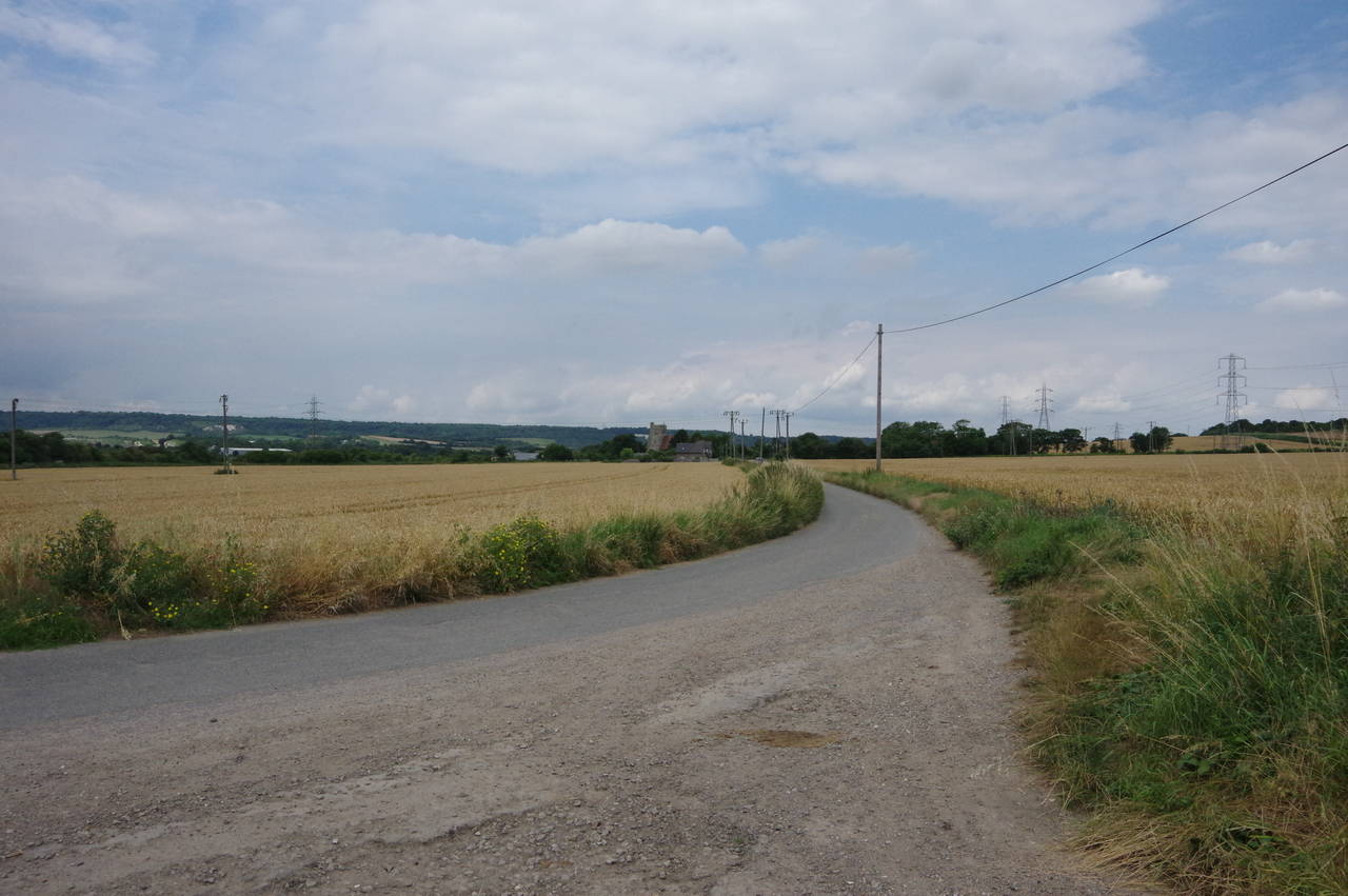
The road soon bends left to head northwards through Bushey Wood (picture 13). After a kilometre, the lane is blocked by a metal gate. Just before the gate is a driveway on the left, where the official route cuts through a patch of scrub to cross a field for about 300 metres to rejoin the road at a bend (picture 14). However, the path into the field wasn't signposted and was very overgrown, so I presume that most walkers heading in my direction just climb over the gate and keep walking along the lane. I was only able to identify the correct route by carefully examining my Ordnance Survey map.
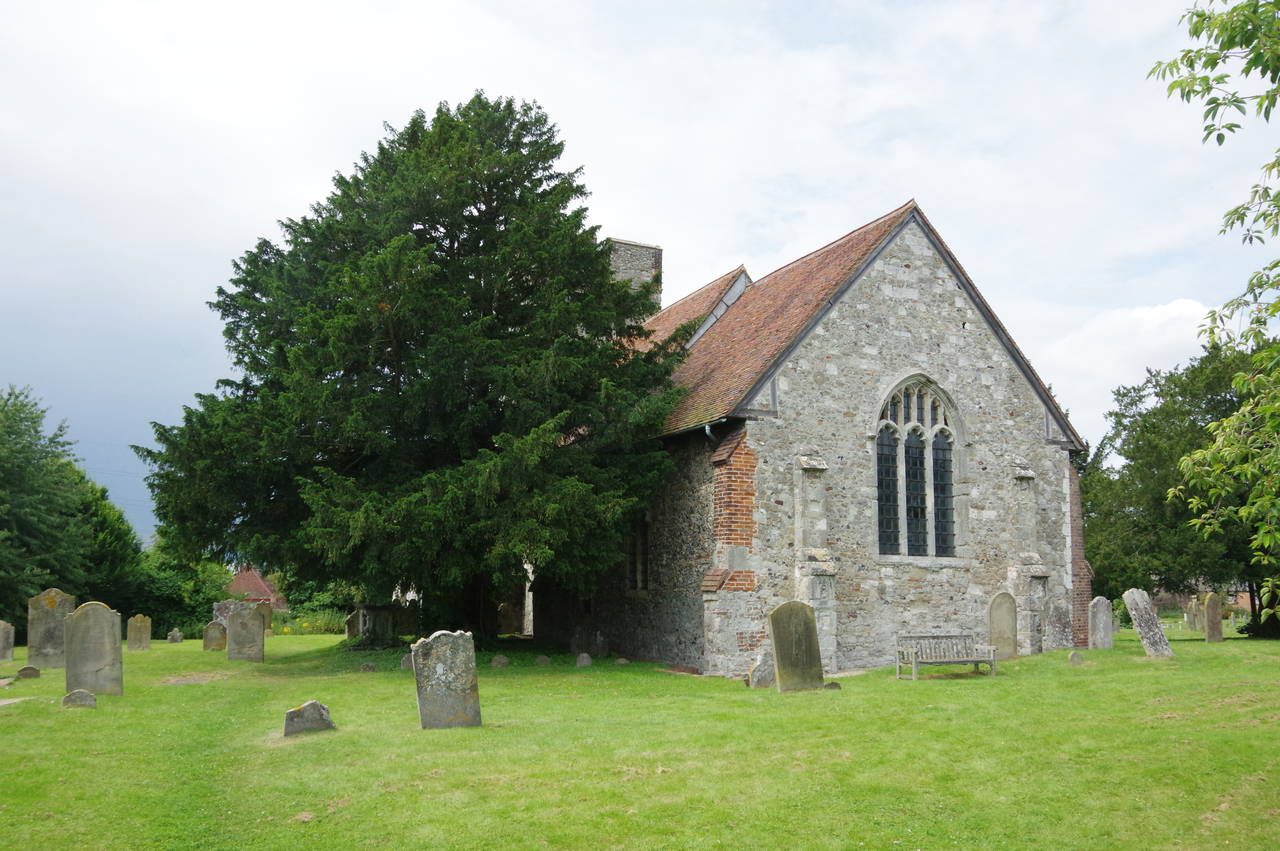
Now amongst wheat fields on the floor of the Medway Valley, the Walk follows the lane up to the isolated St Mary's Church at Burham Court (picture 15). At the near side of the church, a Medway Valley Walk signpost points along a track leading to the floodbank on the edge of the Medway, with a noisy factory ahead across the river in the village of Snodland (picture 16).
(17) Battle of the Medway Memorial
(18) View towards the North Downs
(19) Medway Inn, Wouldham
(20) Hill Road
The floodbank is followed along the edge of a one and a half kilometre loop of the river, with the floodbank enclosing three sides of a large area of tidal salt marsh that stretches most of the way back to the old church.
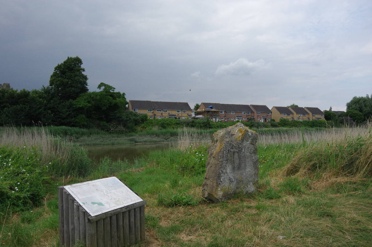
At the corner of the floodbank closest to Snodland stand a stone and a faded information board (picture 17) commemorating the Battle of the Medway, which took place in A.D. 43. The battle saw the invading Roman army win a decisive victory over the British tribes led by King Caratacus. The exact site of the battle is unknown but scholars believe that it was somewhere between Aylesford and Rochester.
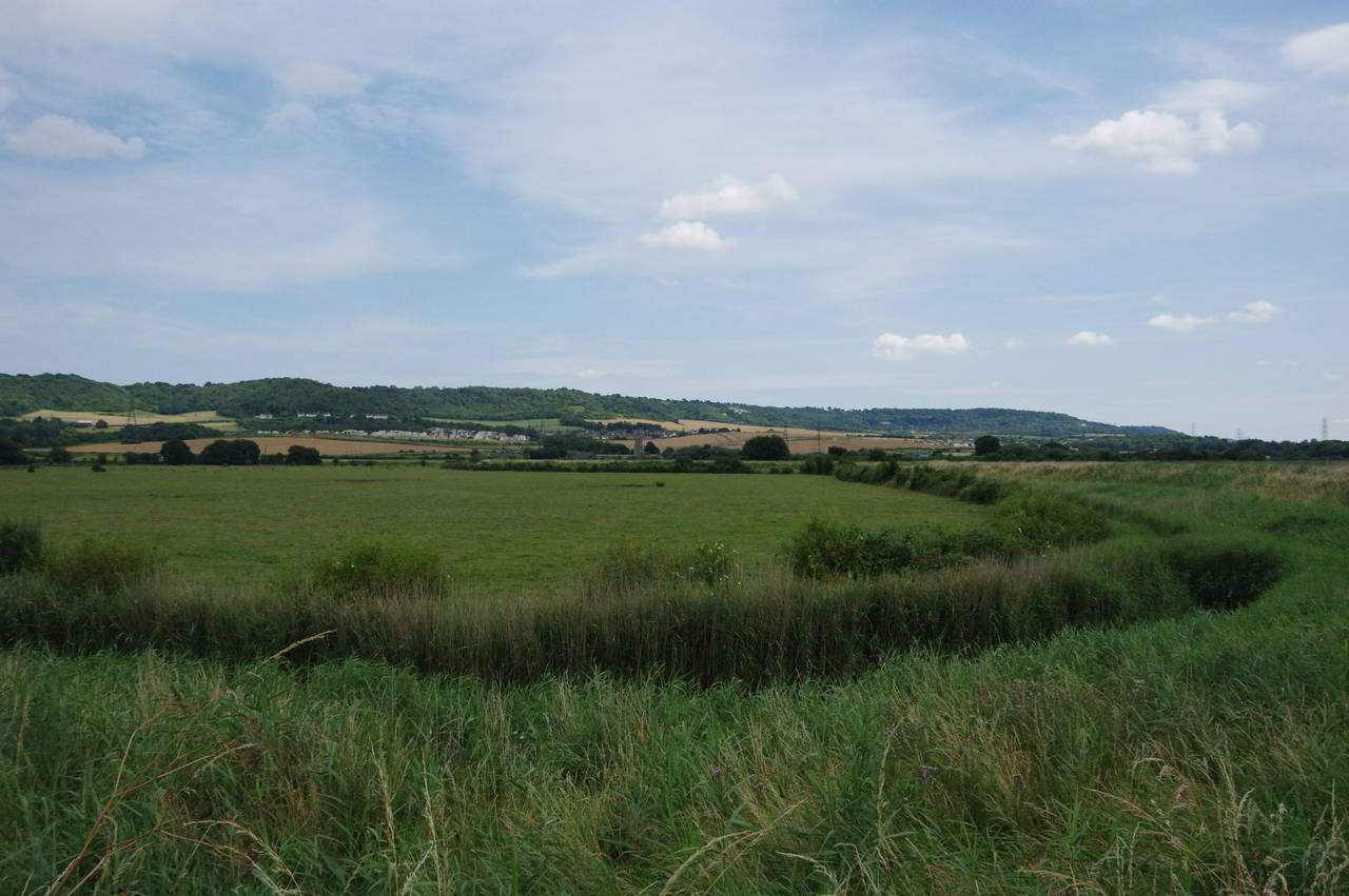
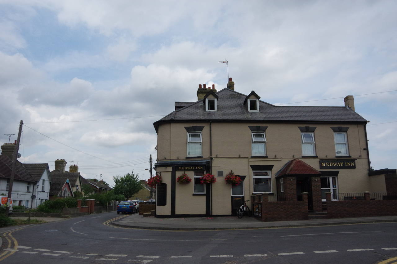
The path continues along the floodbank, with good views across the valley to the North Downs (picture 18), eventually rejoining the road about 400 metres north of the old church. Most of the next 1200 metres along the road to the village of Wouldham was one large building site, with a new housing estate called Portland Gardens in the early stages of construction. Sight of the river is soon lost as it bears away from the road and I found the walk through the new estate to be a bit of a trudge, though hopefully it will be more pleasant when construction finishes. Fortunately a stop for a quick pint at the Medway Inn (picture 19) at the near end of Wouldham's High Street renewed my energy for the remainder of the afternoon's walk.
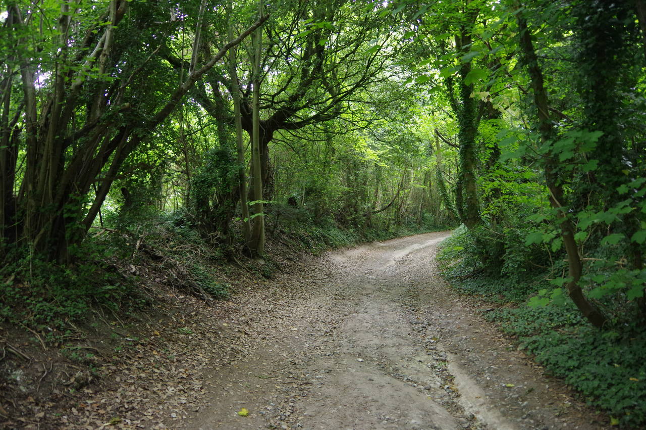
The Walk follows the High Street northwards through Wouldham, turning right into School Lane just before the end of the village. The lane climbs gently towards the North Downs, passing the All Saints School before leaving the village. After almost a kilometre the lane reaches an intersection with Pilgrims Way, crossing over and climbing through woods on an unsealed track called Hill Road (picture 20).
(21) Shoulder of Mutton Wood
(22) Medway Bridges
(23) Borstal Recreation Ground
(24) Esplanade, Rochester
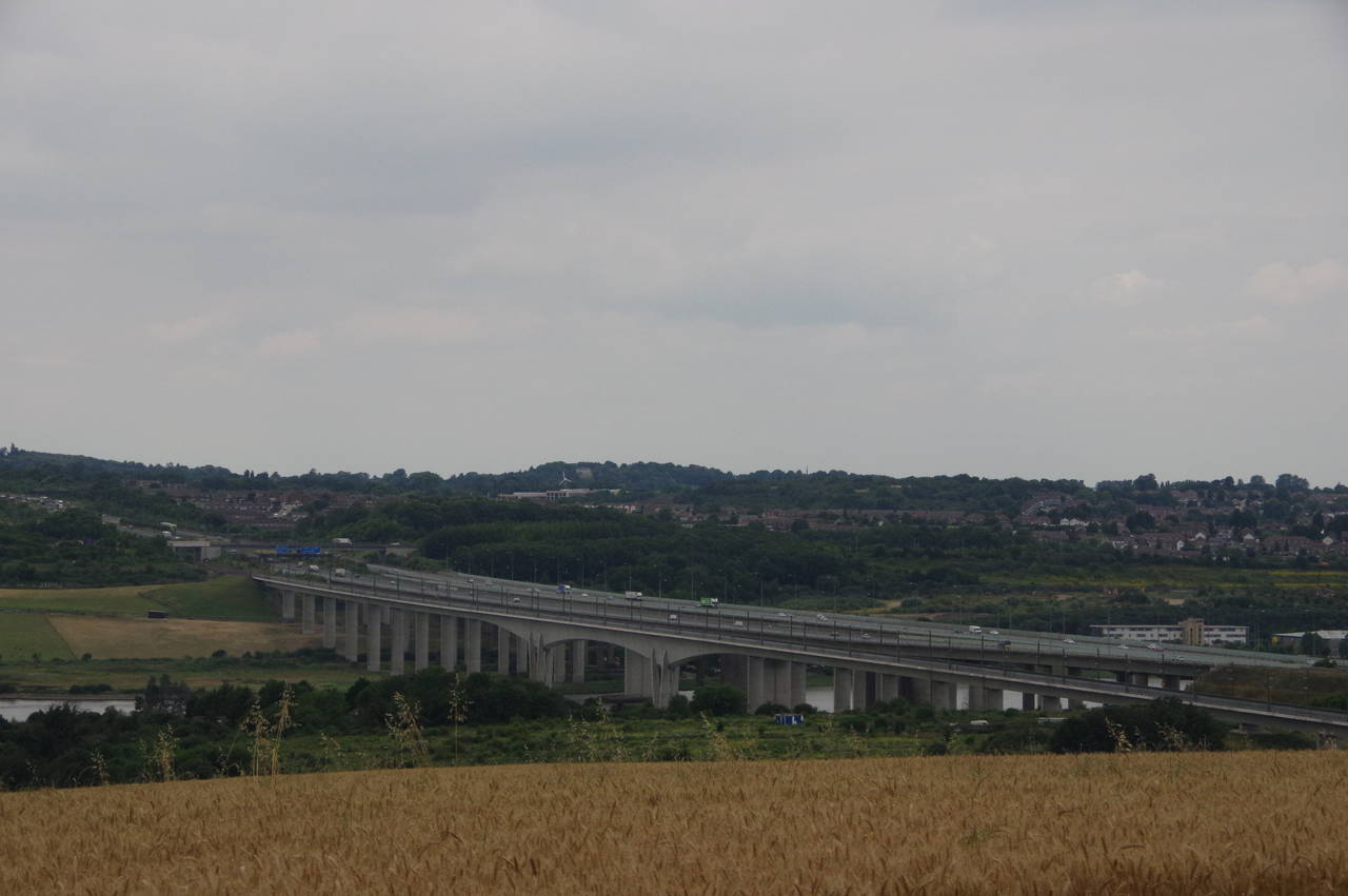
At the top of Hill Road, the Walk reaches a junction with the North Downs Way National Trail, which I walked back in the summer of 2010. Turning left along the North Downs Way, the Walk emerges in the open at the top of a large field, following the well-worn trail along the edge of Shoulder of Mutton Wood with good views across the Medway Valley (picture 21). The view is dominated by the Medway Bridges (picture 22), which carry the M2 and the Channel Tunnel railway line over the river.
When the wood peters out, the trail begins to descend across Nashenden Down, joining a farm track that crosses a bridge over the Channel Tunnel railway and through Nashenden Farm to turn left along Nashenden Farm Lane, parallel with the M2. At the end of the lane the Walk turns right on Wouldham Road, passing under the M2 and then parting company with the North Downs Way, which turns off to head over the Medway Bridge.
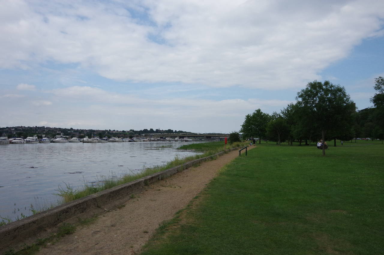
The Walk continues along the road as far as a Co-Op store, turning left down an untidy public footpath and heading downhill for almost 400 metres before turning right on an enclosed path to the entrance of the Medway Bridge Marina. Just ahead, a path enters the large Borstal Recreation Ground (picture 23), running along the middle of a strip of trees separating the playing fields and the Medway. At the far end of the recreation ground, the Walk joins the riverside Esplanade (picture 24), which is followed past a residential area until the riverside footpath forks off away from the road, passing some modern apartments before entering the pleasant Esplanade Park.
(25) Esplanade Park
(26) Rochester Castle
(27) Rochester Bridge
(28) The end of the walk
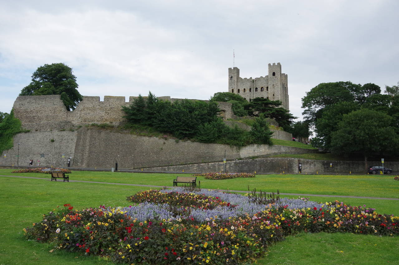
The path runs along the edge of the park (picture 25), past the clubhouse and jetty of the Rochester Cruising Club, and into a more manicured section of the park, overlooked by the imposing curtain wall and towering keep of Rochester Castle (picture 26), the tallest castle keep in England at 34 metres.
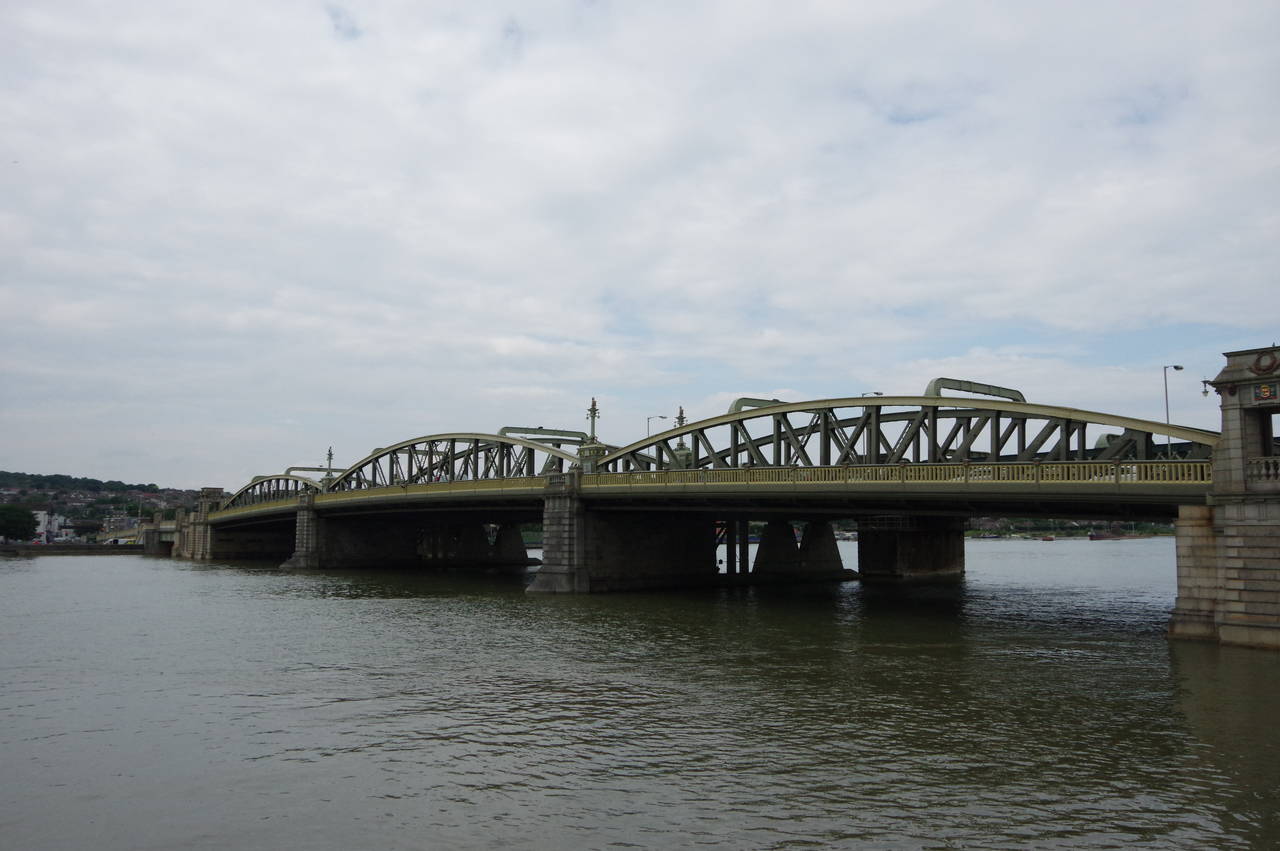
Just beyond another jetty, the path merges back onto the Esplanade and joins the Saxon Shore Way, which I had walked here at the very end of 2010, for the final short walk up to Rochester Bridge (picture 27). At some seats by the end of the bridge (picture 28), the Medway Valley Walk ends, 21.4 kilometres from the start of the day's walk in Maidstone.
I had made very good time on this walk, covering the distance in just a few minutes over six hours, finishing a little after three in the afternoon. When I had planned the walk I had been a little worried about the time as I had a front-row ticket to see one of my favourite bands, The Proclaimers, play a concert over at the Chatham Central Theatre that evening. As it turned out I needn't have worried as I had plenty of time to relax after the walk and to get ready for my evening out. To cap off a great day, the concert was marvellous.
(29) Rochester Castle
(30) Rochester Cathedral
(31) College Gate
(32) Rochester High Street
A couple of evenings before this walk I had the opportunity to wander around Rochester in brighter weather than I'd had on the Medway Valley Walk.
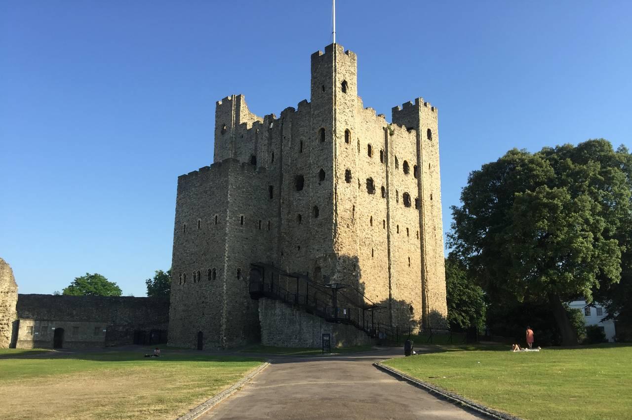
As with Tonbridge Castle, the grounds of Rochester Castle are now a public park. The castle keep (picture 29) is in the care of English Heritage and is open to the public for a small fee. While the interior of the keep was ruined centuries ago, enough survives that one can climb all the way up to the top to enjoy tremendous views over Rochester and the Medway Valley, which I did while walking the Saxon Shore Way on the last day of 2010.
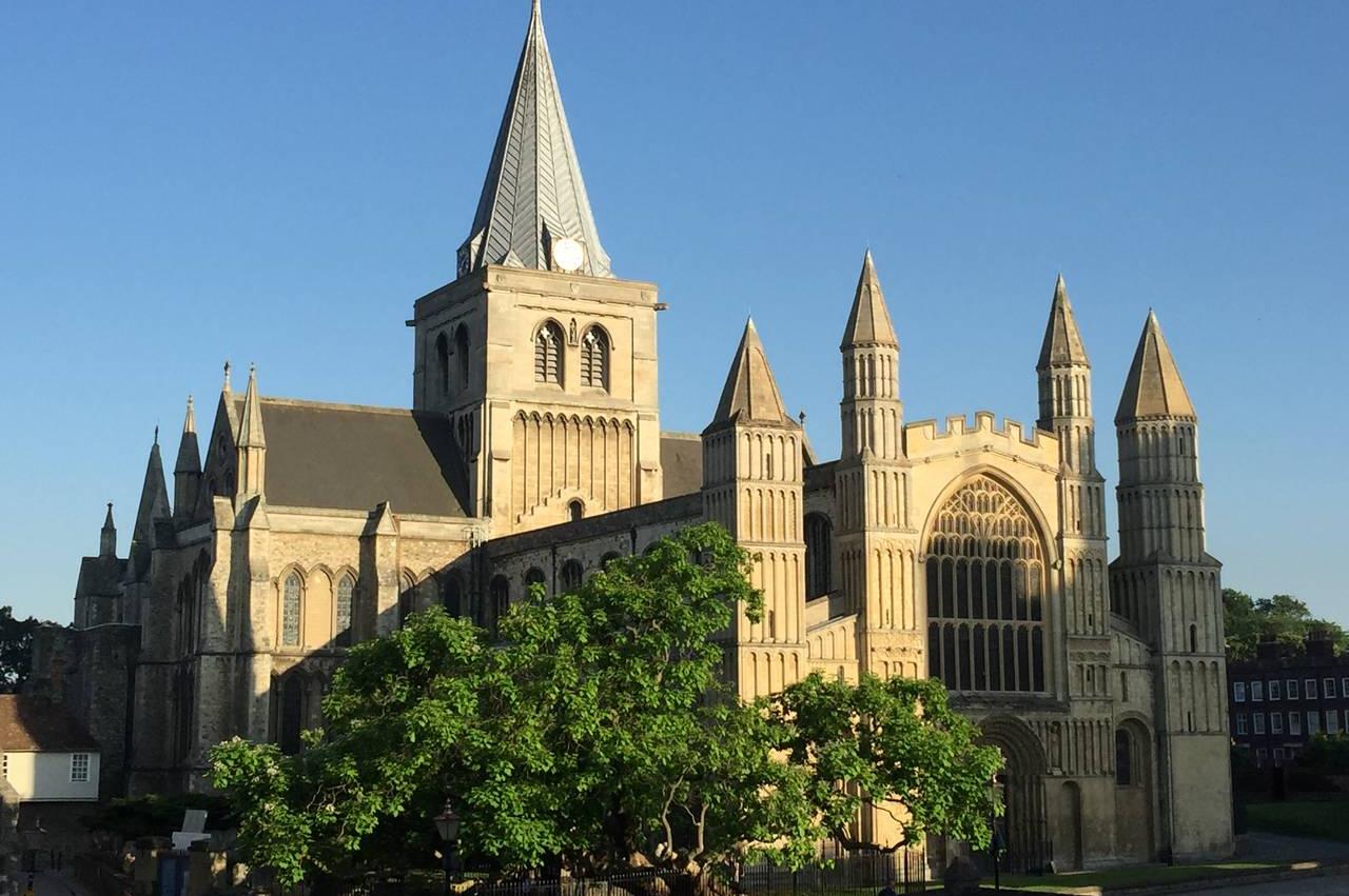
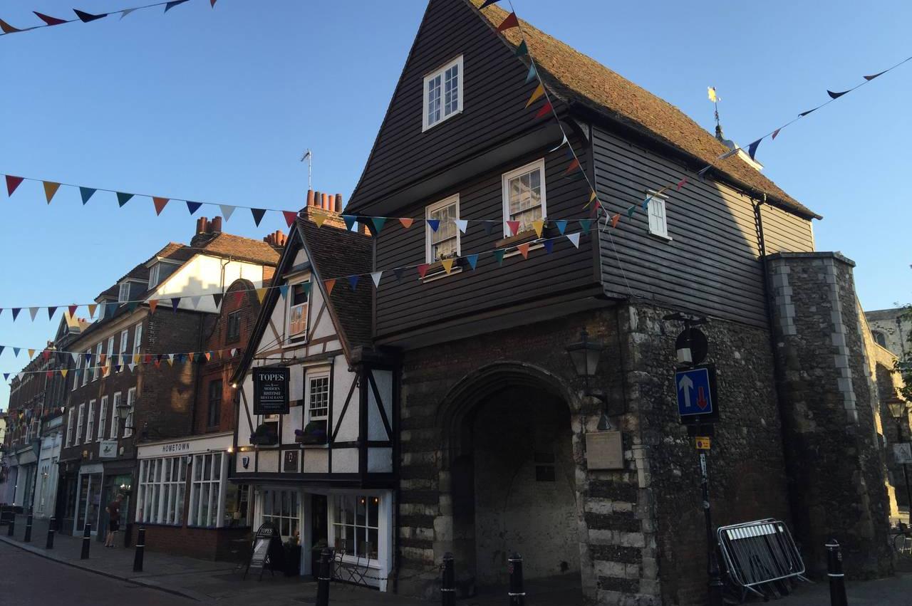
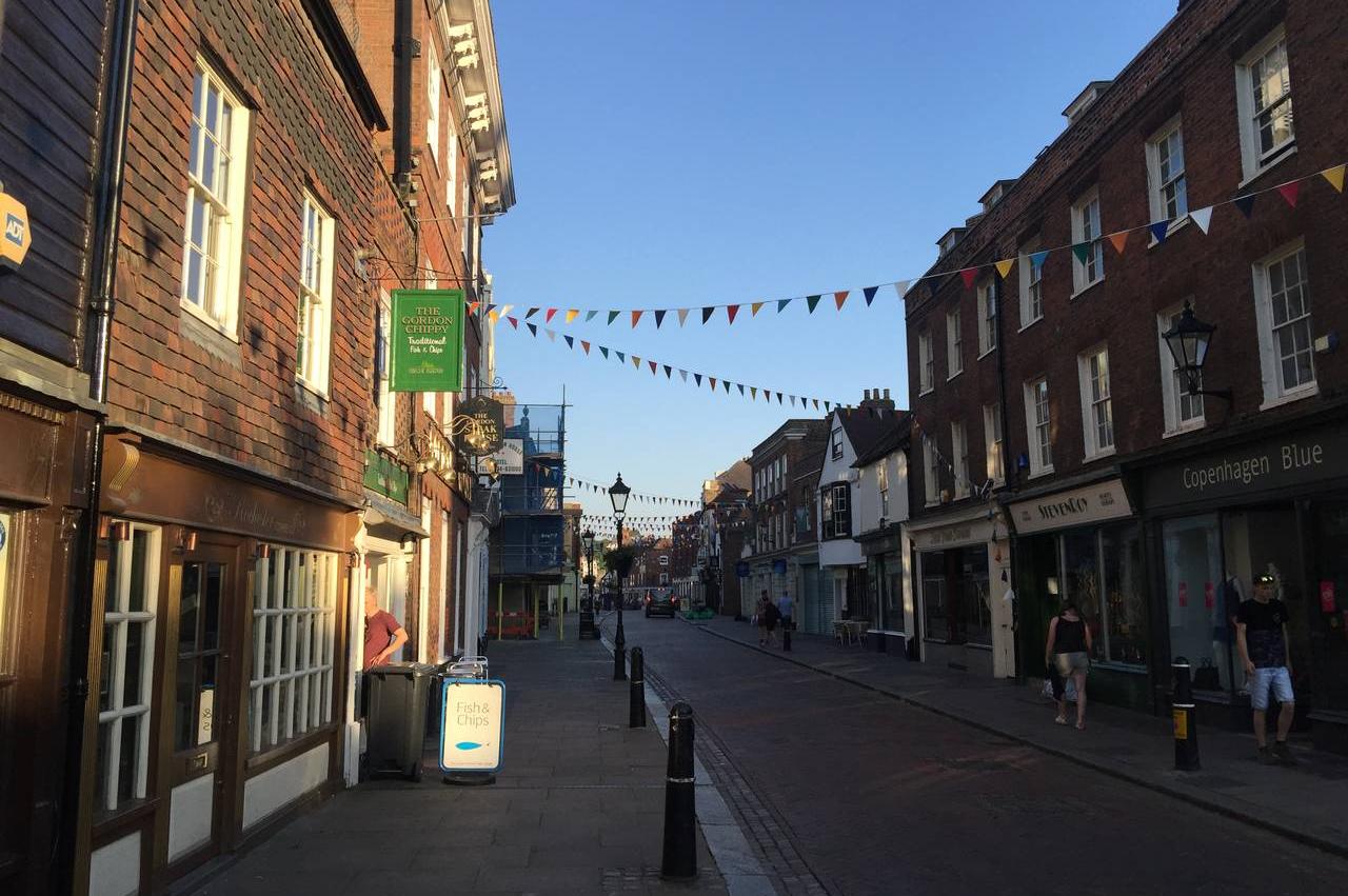
Behind the castle stands Rochester Cathedral (picture 30), where construction began in 1080, forty-seven years before work started on the castle. Heading left from the front of the cathedral, Rochester's High Street is reached by passing through College Gate (picture 31), which bears one of several plaques attached to buildings around the town that recall their use in the literary works of Charles Dickens. Continuing down the long High Street there is an interesting mix of old and new buildings (picture 32), which I would love to have more time to explore.