KENNET AND AVON CANAL PATH, Stage 1
and RIVER AVON TRAIL, Stage 2:
Bristol to Bath
Tuesday, August 23, 2016
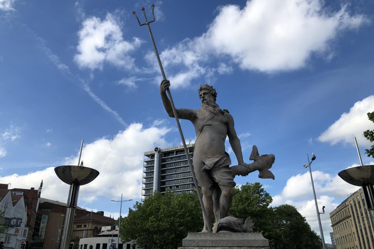
(1) Statue of Neptune
(2) Cascade Steps
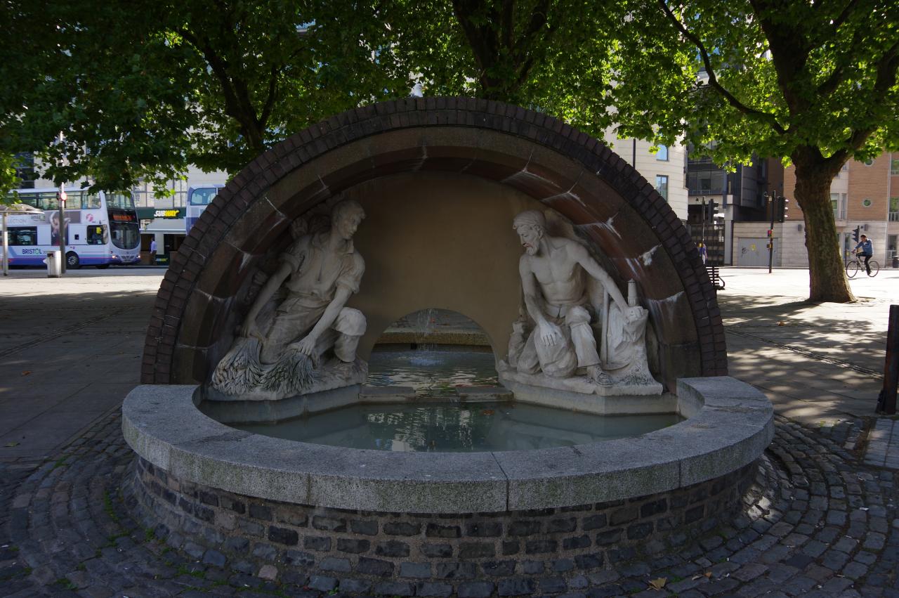
(3) King George V Memorial Fountain
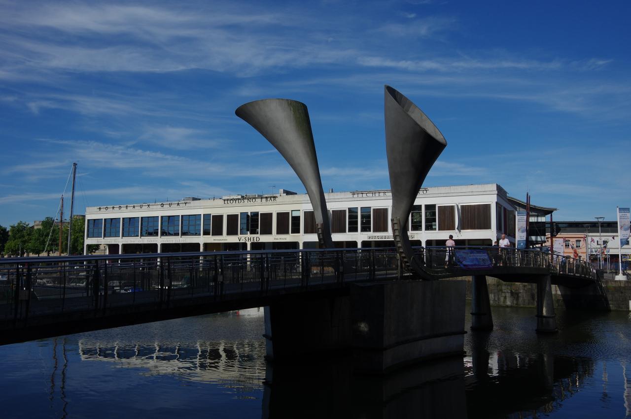
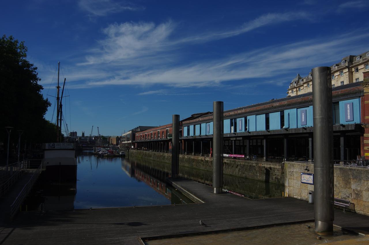
(4) Pero's Bridge
The Kennet and Avon Canal Path begins in the heart of Bristol at a statue of the Roman god Neptune (picture 1) in an open area between the busy parallel roads of St Augustine's Parade and Broad Quay. The Path initially heads south past a series of fountains and a line of metal columns that resemble the chimneys of steam ships to reach the Cascade Steps, which overlook the end of a branch of Bristol's Floating Harbour (picture 2).
The Path heads down the left side of the harbour, passing the King George V Memorial Fountain (picture 3) and following Narrow Quay as far as Pero's Bridge (picture 4). The two large horns on the bridge are counterweights that allow the central span to tilt upwards for boats to pass through, though I have yet to see it when it's open.
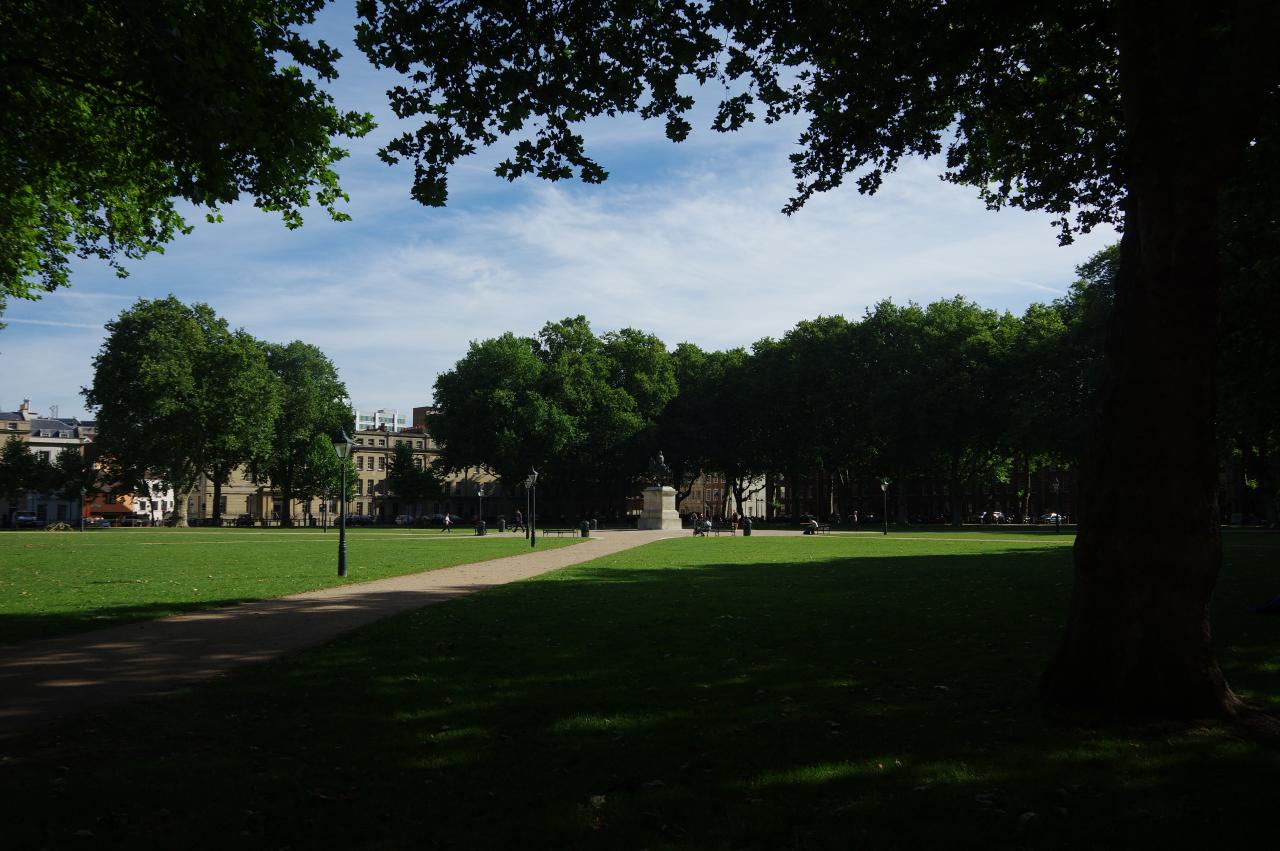
(5) Queen Square
(6) Houses by Queen Square
(7) Redcliffe Bridge and St Mary Redcliffe
(8) Bristol Lost Ships Memorial
Rather than turning right to cross Pero's Bridge, the Path turns left to follow Farr's Lane between buildings, crossing Prince Street to join the River Avon Trail as it continues ahead along Royal Oak Avenue to the corner of Queen Square (picture 5).
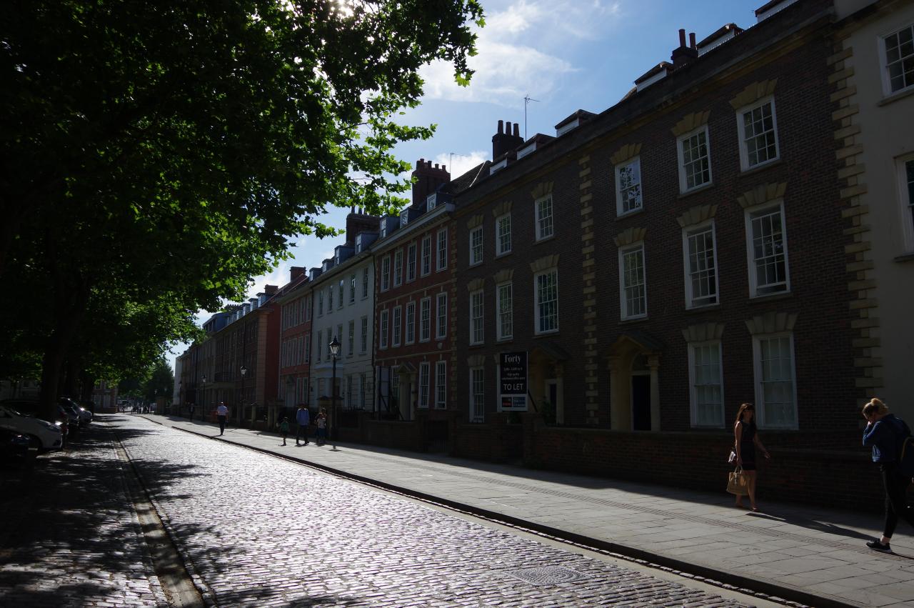
Queen Square has a somewhat chequered history. It was established at the beginning of the 18th century and named after Queen Anne, who visited Bristol in 1702. In 1831, the square was the scene of a three day long riot, which saw many of the square's houses damaged or destroyed. The riot marked the start of a long decline and in the 1930's a major road was built across the square.
In the early 1990's, Bristol's approach to traffic management changed. The road was removed and the square restored to its early-19th century layout, with the 1733 statue of William III on horseback in the centre. The south side of the square, along which the Kennet and Avon Canal Path passes, is lined by 18th century houses (picture 6), while the other three sides have mainly newer buildings. Most of the buildings surrounding the square are now commercial offices rather than residences.
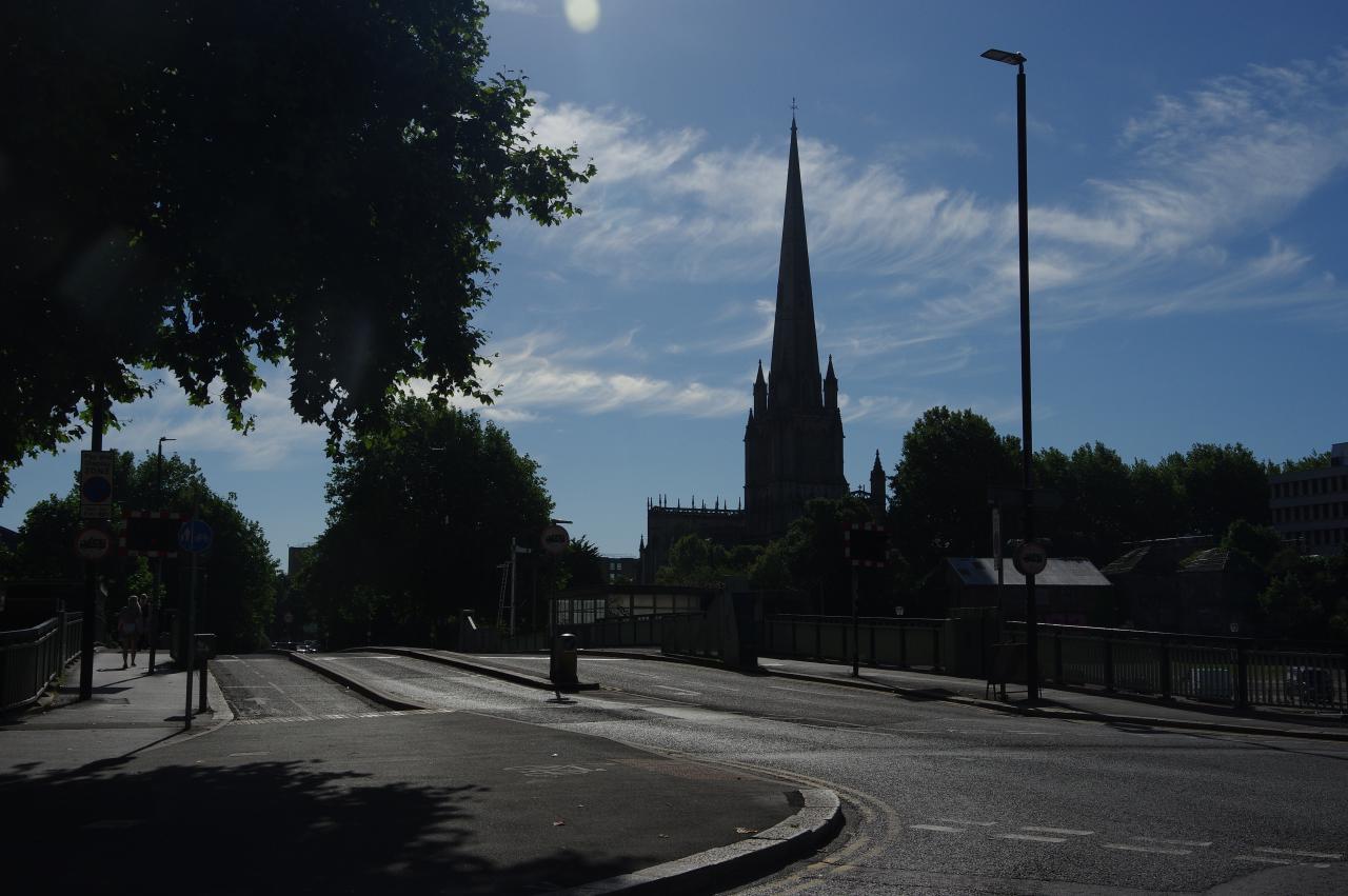
From the south-east corner of Queen Square, the Path continues ahead on the short Bell Avenue to turn left onto Welsh Back. At the corner there is a good view across Redcliffe Bridge to the tall spire of the Church of St Mary Redcliffe (picture 7).
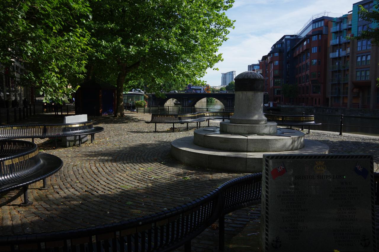
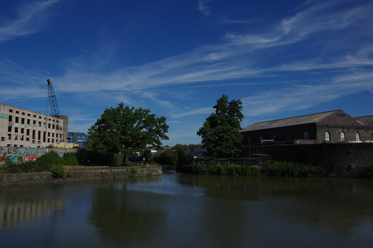
Towards the far end of Welsh Back, once again beside the Floating Harbour on part of the original course of the River Avon, is a memorial to the ships of Bristol's Merchant Navy that were lost in the two world wars (picture 8).
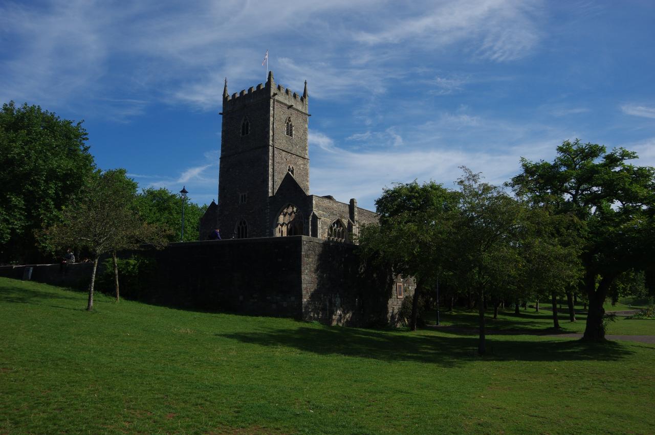
(9) St Peter's Church, Castle Park
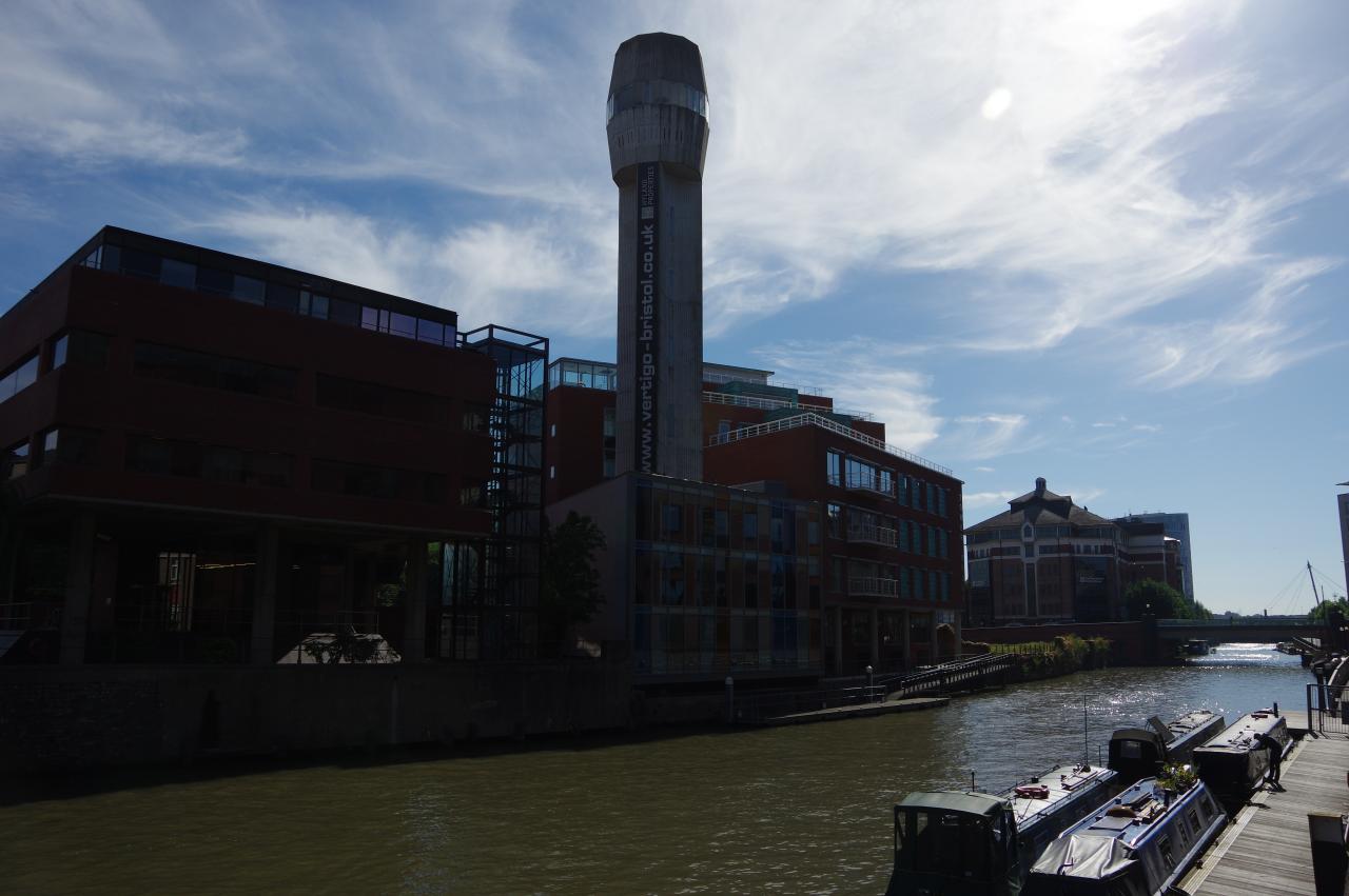
(10) Finzels Reach
(11) Valentine Bridge
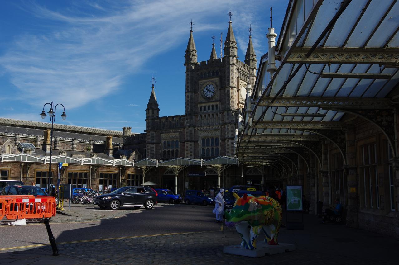
(12) Bristol Temple Meads Station
At the end of Welsh Back the route turns right and a pedestrian crossing over the end of Bristol Bridge leads to a wide pavement that runs along the edge of Castle Park, beside the Avon. The park was the site of a Norman castle, which was partially demolished during the Civil War and little of the structure is still visible. Today, the most prominent feature of the park is the empty shell of St Peter's Church (picture 9), which was bombed during the Bristol Blitz on the night of 24 November 1940. What remains of the 15th century church has been preserved as a memorial to Bristol's civilian war dead.
The Canal Path leaves Castle Park via a footbridge over part of the castle moat, continuing on a riverside footpath to St Phillip's Bridge. After crossing the river on the bridge, the route joins another riverside footpath, on a stretch of the river known as Finzels Reach. Across the river is a tall concrete tower once used to make the small lead pellets in shotgun ammunition (picture 10).
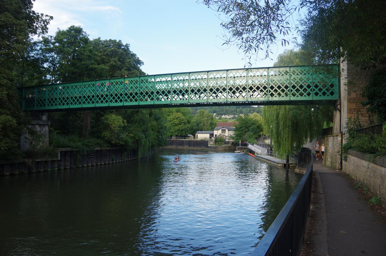
The path continues along Temple Quay, where about a dozen narrowboats were moored, under Temple Bridge and onward to the S-shaped Valentine footbridge (picture 11). Here the path bears away from the river and crosses a carpark to head through Bristol Temple Meads Station, emerging from the main entrance under the iconic Victorian clock tower (picture 12).
(13) Totterdown Basin
(14) Feeder Canal
(15) Marsh Lane Bridge
(16) Netham Park
The Canal Path follows the pavement on the left-hand side of the busy station forecourt, turning left onto Temple Gate and soon left again to follow Cattle Market Road beside the Avon and under the end of the station platforms. This path of the river is actually the eastern end of the New Cut, dug to take the river around to the south of the Floating Harbour, which utilises the original course of the river through the centre of Bristol.
About 200 metres ahead, now on Feeder Road, the Path crosses the original course of the river at Totterdown Basin (picture 13), where the Floating Harbour emerges through a narrow bottleneck on the left while the Avon was diverted into the New Cut about 100 metres over to the right.
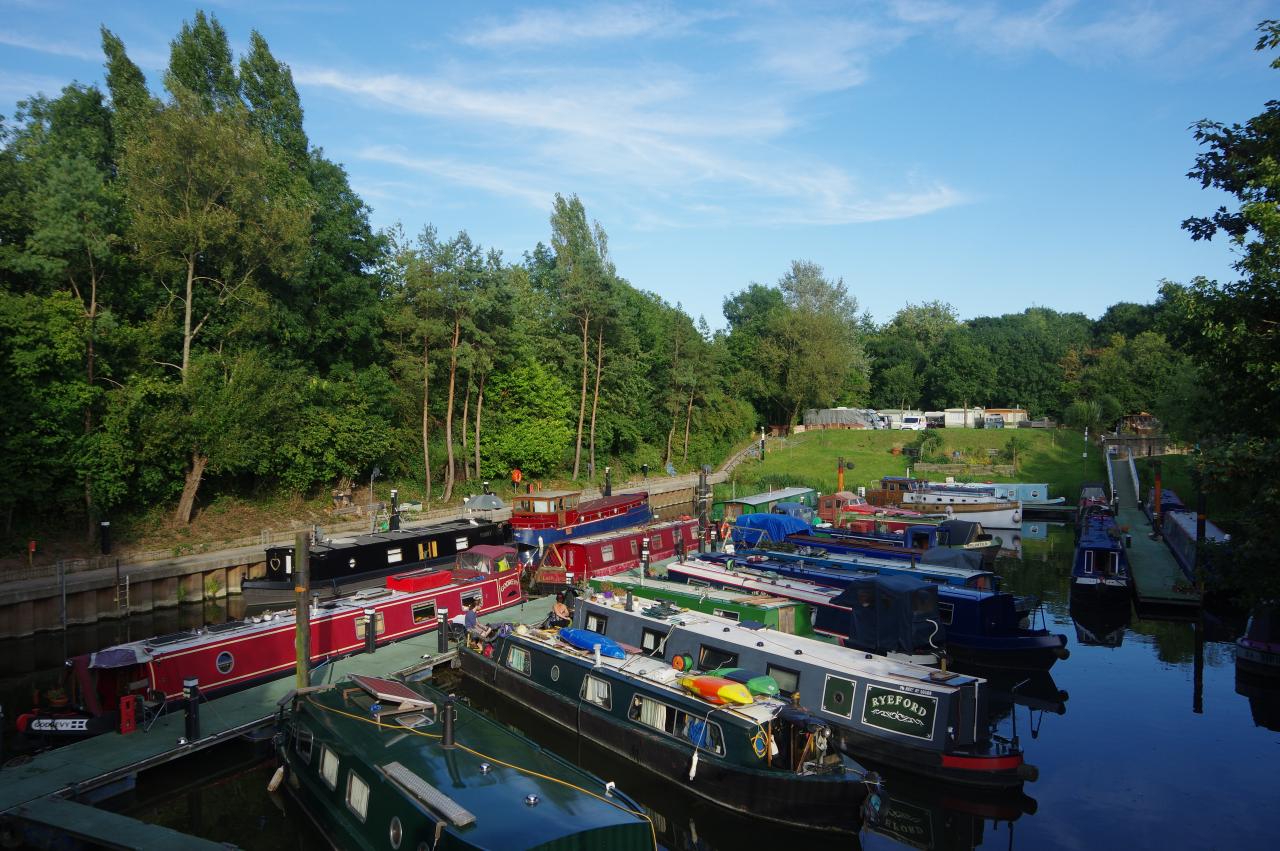
At this point the Kennet and Avon Canal Path and the River Avon Trail temporarily diverge, with the former continuing ahead along Feeder Road alongside the Feeder Canal, while the latter follows the river. The two paths enclose an industrial area known as St Phillip's Marsh.
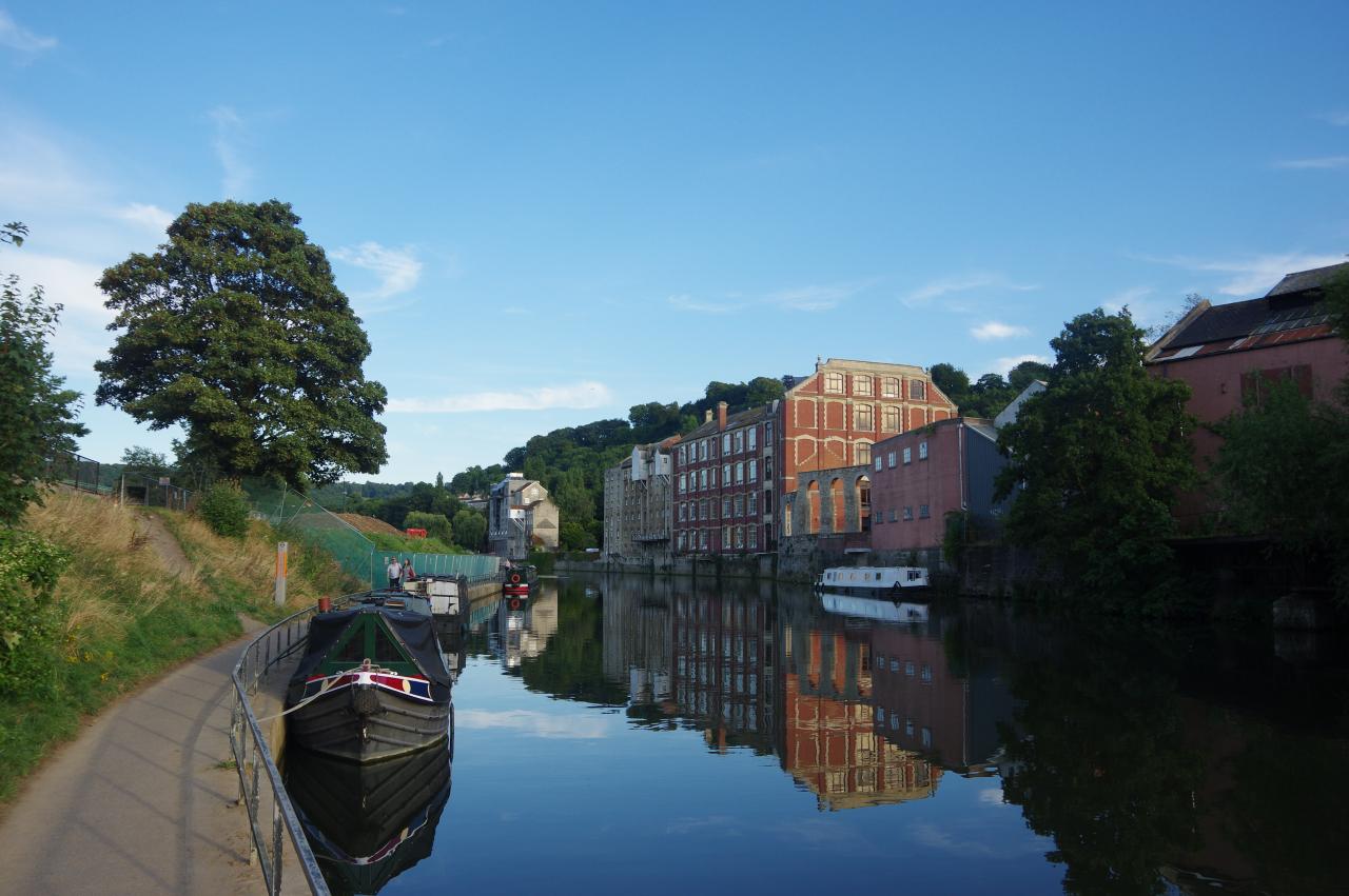
I chose to follow the Feeder Canal (picture 14). As the name suggests, the canal was dug to feed water into the Floating Harbour. About 1200 metres along the canal the two paths meet up again, just before turning left to cross the canal via Marsh Lane Bridge (picture 15).
Across the bridge the route turns right to follow a tarmac path across the wooded lower edge of the large Netham Park (picture 16). Walking through this green and pleasant park, it's hard to believe that from the 1840's until 1949, the park was part of the vast Netham Chemical Works. The recreation ground up the slope to the left was created by grassing over the factory's massive waste tip.
(17) Netham Lock
(18) Riverside houses below Troopers Hill
(19) Conham River Park
(20) Beese's Riverside Bar and Tea Garden
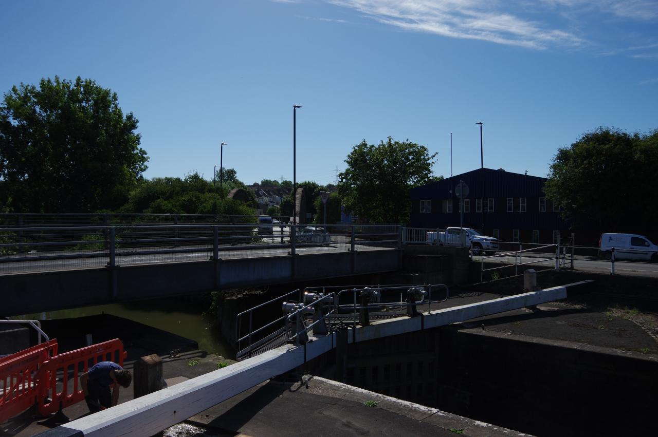
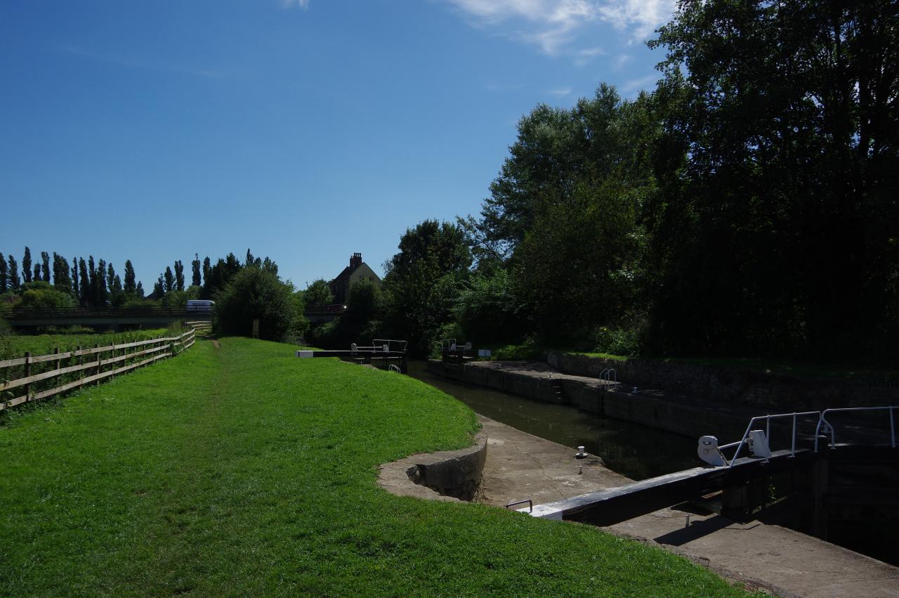
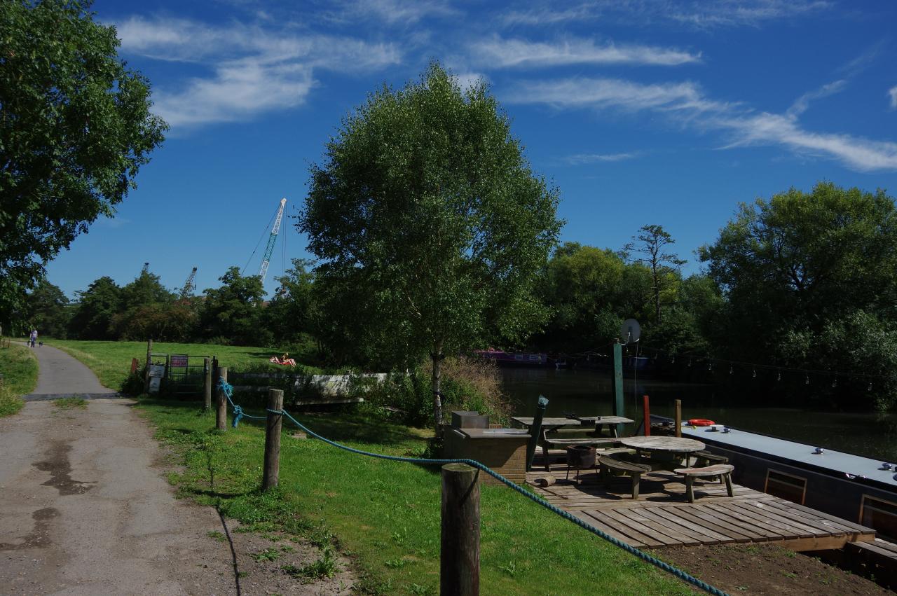
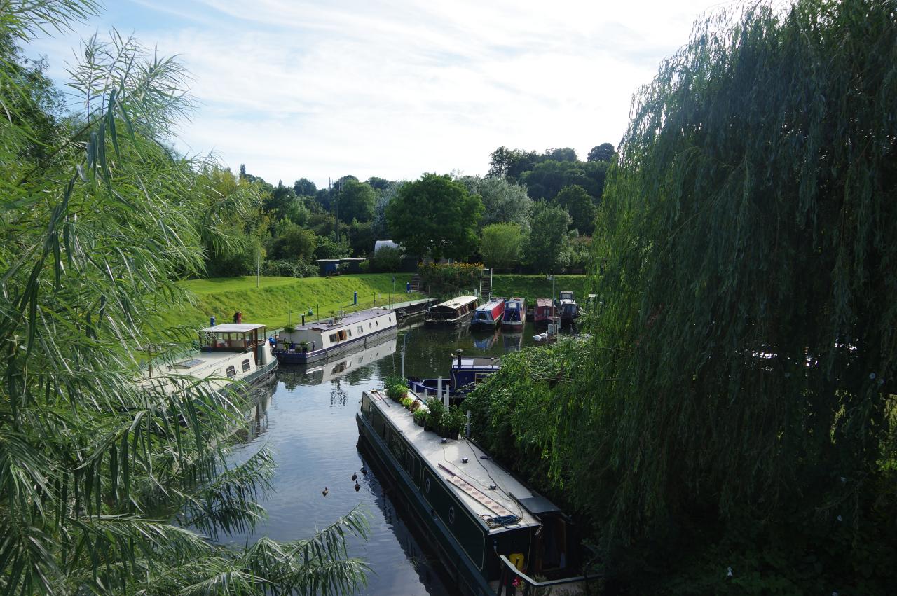
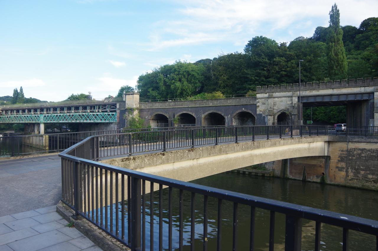
At the end of Netham Park, the path emerges beside Netham Lock (picture 17), the upper limit of the Floating Harbour. Built in 1804 as part of the construction of the Floating Harbour, the lock is now crossed by two fairly low road bridges, preventing access to boats more than three metres high above the waterline.
The path crosses both roads to join an untidy waterside path below a large carpark. To the right is the spot where the Feeder Canal diverges from the natural course of the Avon.
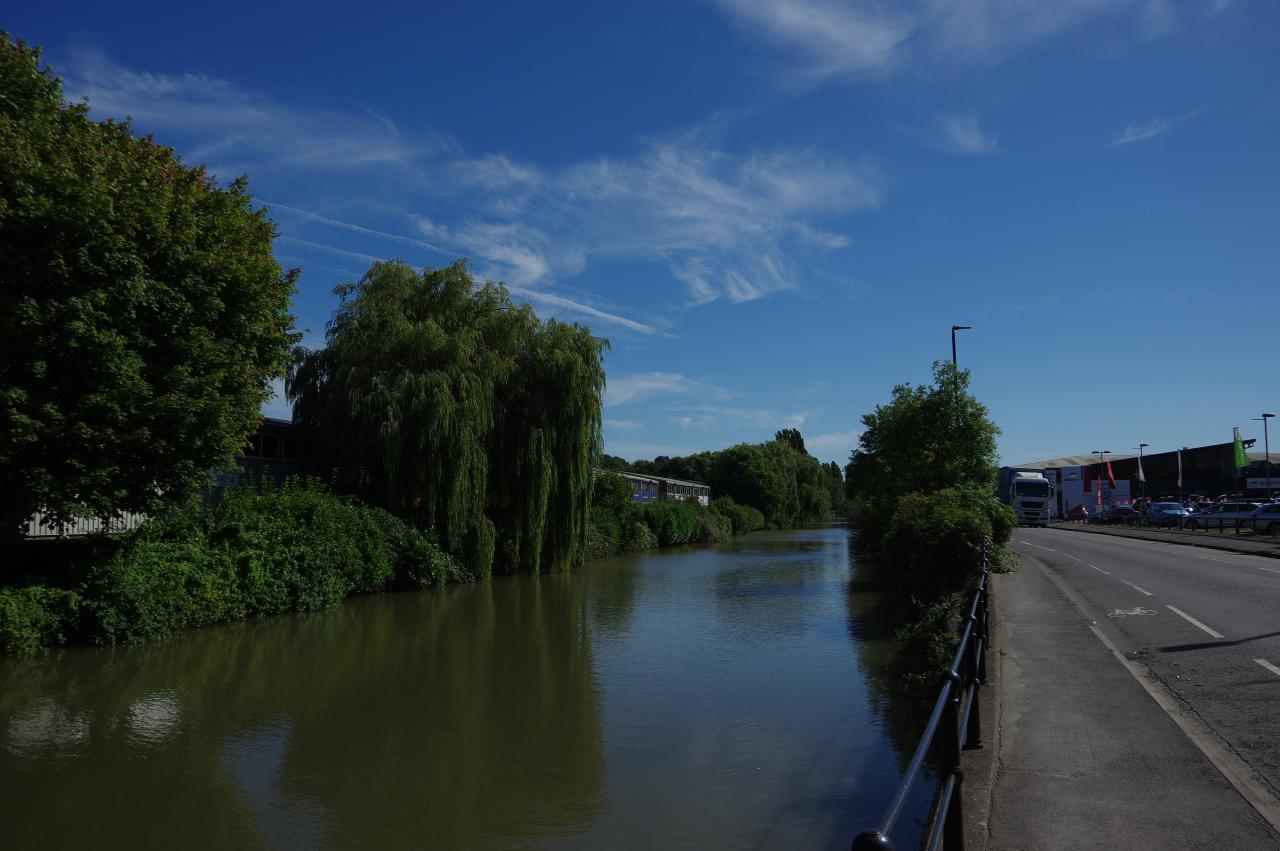
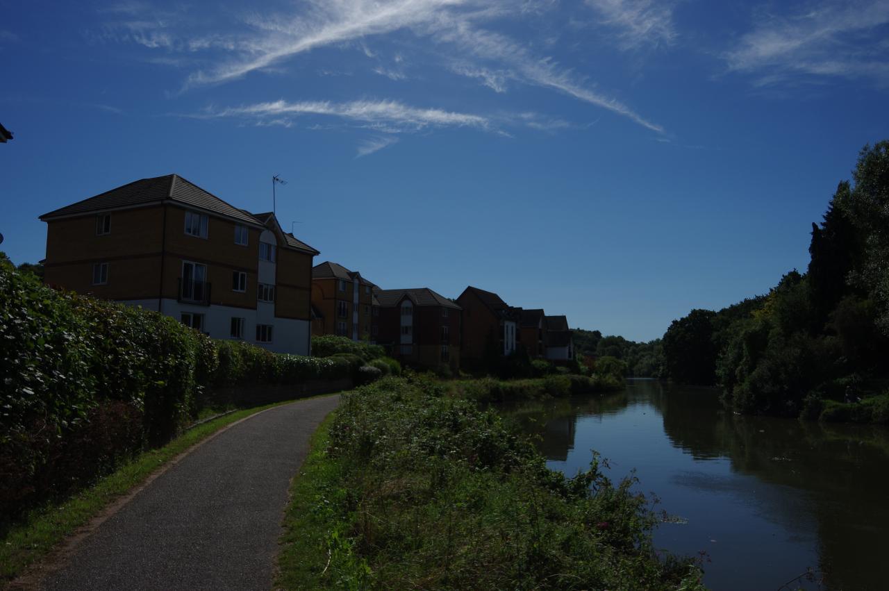
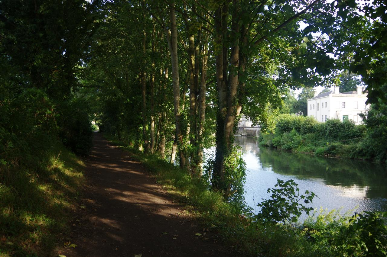
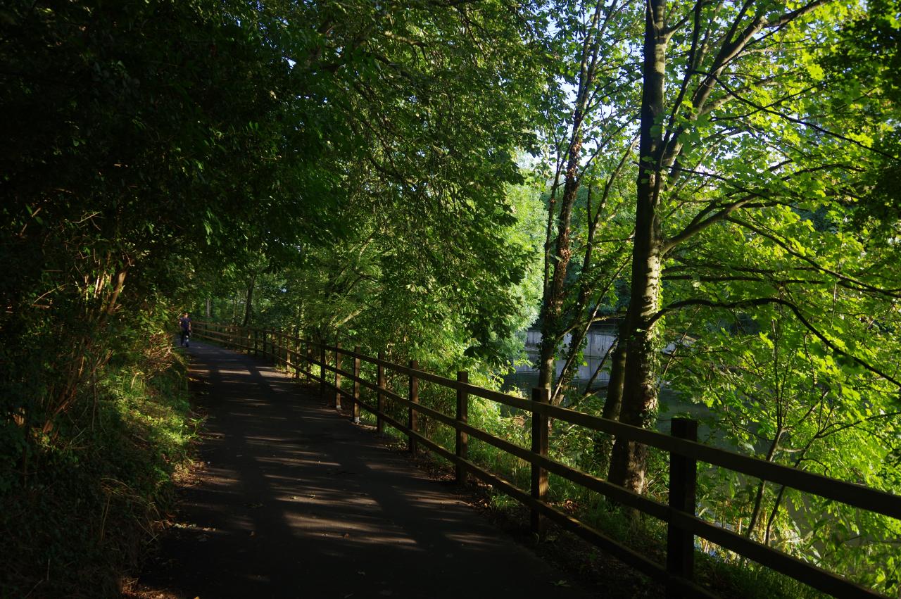
For the next kilometre the riverside path passes along the edge of the industrial suburb of Crew's Hole. Eventually the river swings to the right below Troopers Hill, and the scenery transitions from industrial to residential (picture 18). Beyond the last house, the path merges into Conham Road, where the pavement on the left side must be followed through woodland around the next right-hand bend in the river.
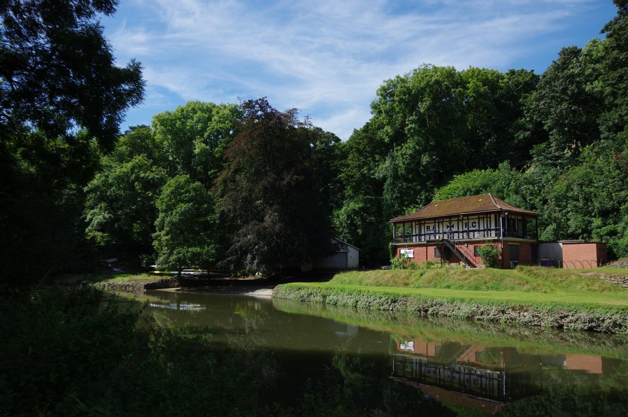
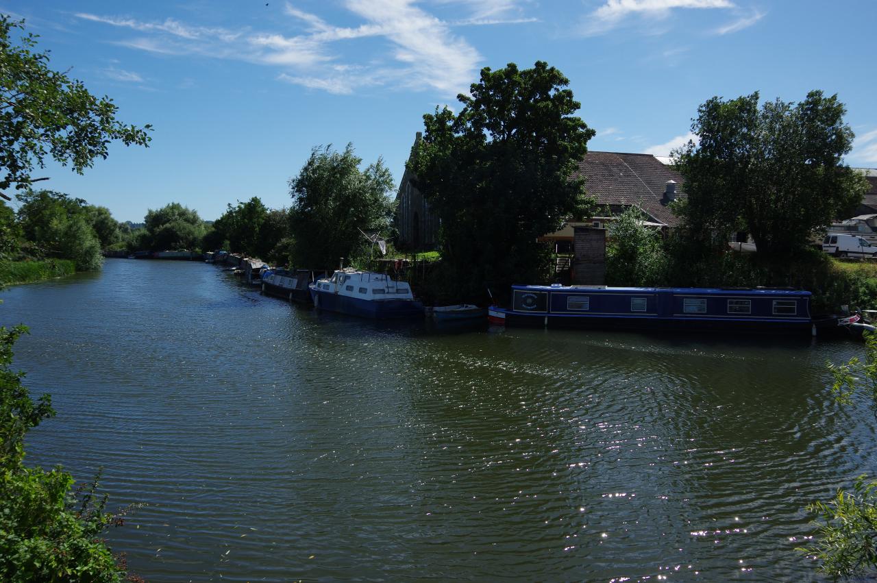
About 300 metres along the road, the route leaves the road to take a shady riverside footpath into Conham River Park. As the river begins to bend back to the left, two rowing clubs are passed on the opposite bank. The second of these is the Bristol Ariel Rowing Club (picture 19), which has the club's initials in large lettering on the front wall.
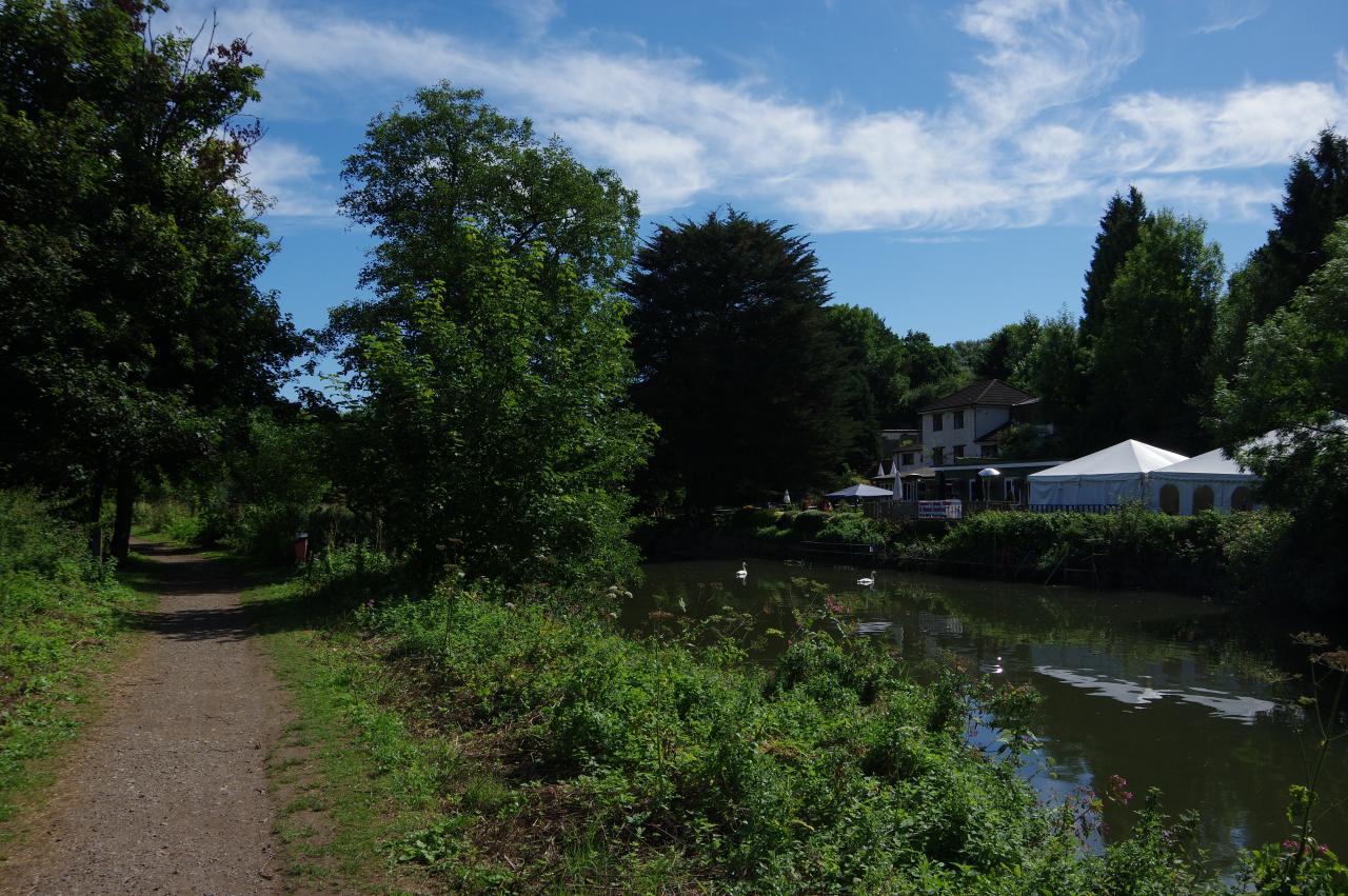
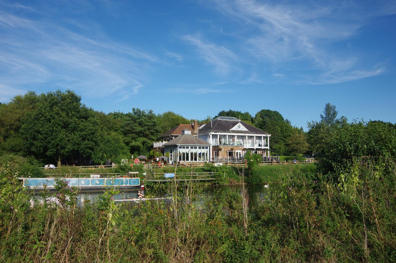
After curving around 180 degrees, the course of the river straightens and passes Beese's Riverside Bar and Tea Garden, which nestles among the trees on the opposite bank (picture 20). From spring until autumn, walkers in desperate need of refreshment can catch a ferry across the river to the bar from a small shelter a little further along the path.
While the woodlands here appear mature, they are in fact relatively young, with most of the trees having been planted in the 1970's. Prior to that Conham River Park was the site of a sewage works, a copper works and several quarries.
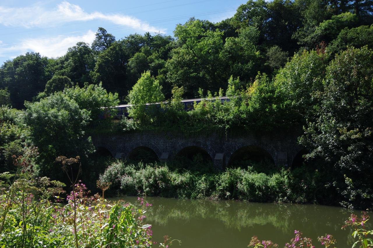
(21) Railway viaduct in Hanham Gorge
(22) Riverside cottages
(23) Old Lock and Weir Inn, Hanham
(24) Path below Cleeve Wood
Before long the river bends to the right again to run through the wooded Hanham Gorge. As the river bends back to the left a railway viaduct carrying the Great Western Mainline can be seen on the other side (picture 21), a little to the left of where the line disappears into a tunnel under Broom Hill on its way to Bristol Temple Meads. As the path reaches a row of riverside cottages (picture 22), the river bears away from the railway and about 600 metres later passes under the dual carriageway of the A4174.
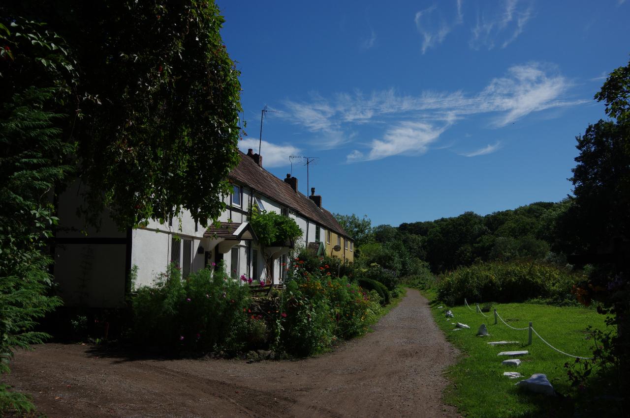
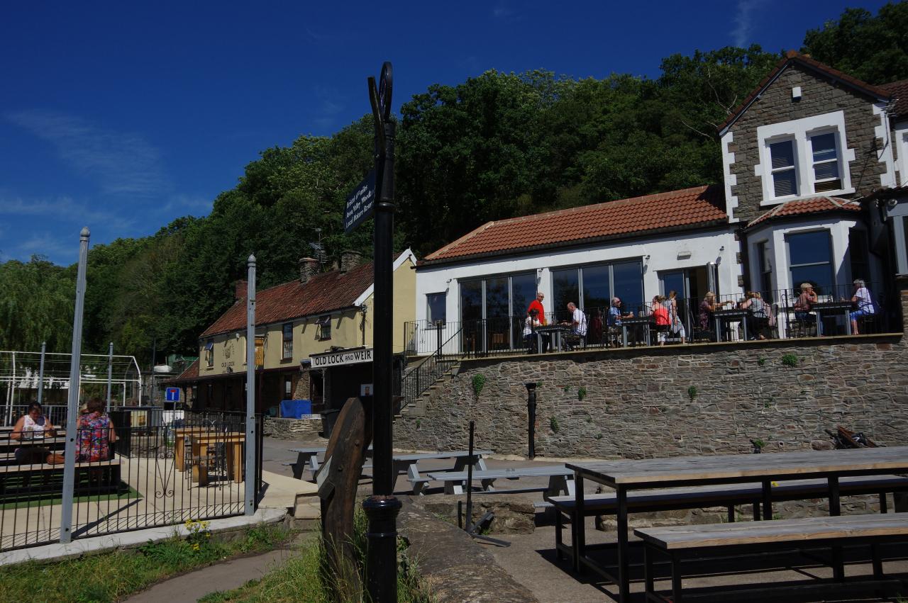
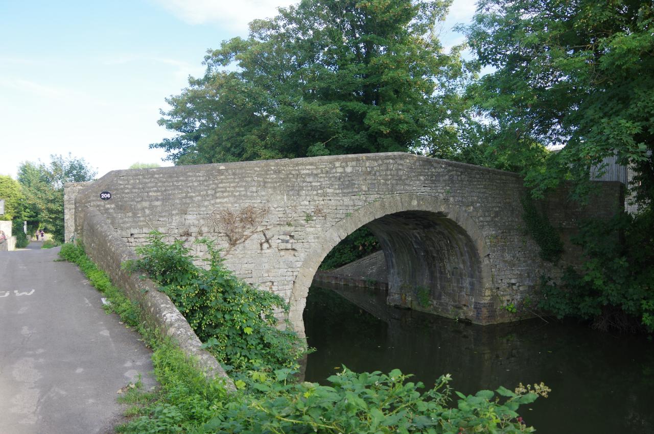
The path soon joins Ferry Road in the hamlet of Hanham, passing another row of cottages and the Hanham Weir to reach the Old Lock and Weir Inn (picture 23). Hanham Lock (lock number one on the Kennet and Avon Canal) is tucked away between the wooded lock island and the far bank of the river. An information board by the river points out that the Pennant Sandstone used to build the locks on the Kennet and Avon Canal was quarried at Hanham. Beyond the pub, the path follows the riverbank as it bends first to the right then sharp left to run beside paddocks below the steep, wooded hillside of Cleeve Wood (picture 24).
(25) Fields opposite Somerdale
(26) Keynsham Lock
(27) The Lock Keeper, Keynsham
(28) Portavon Marina
Towards the end of Cleeve Wood, the river sweeps around to the right and the path passes Londonderry Farm and the remains of Londonderry Wharf, where coal from nearby Kingswood was shipped out in the mid-19th century. Soon the riverside path is running along the edge of open fields (picture 25), opposite the former Cadbury chocolate factory in Somerdale, which closed in 2011 and was being redeveloped into retirement apartments, though there was little to see as the view across the river is mostly screened by trees. After the path passes a small brick tower surrounded by bushes, the river curves back to the left to reach Keynsham Lock (picture 26).
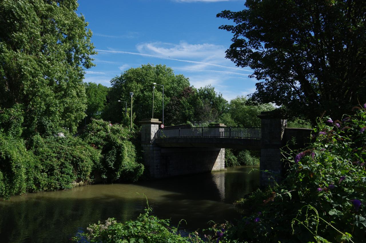
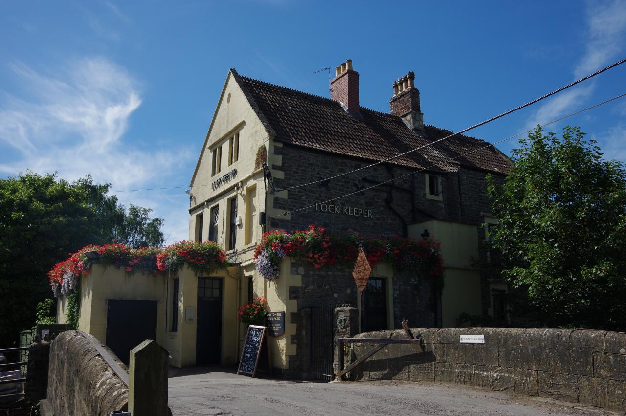
Just ahead, the grassy path passes under the A4175 Keynsham Road and then crosses over a lane leading across bridge 213 to the Lock Keeper pub (picture 27). The path then continues on along a curved embankment that separates the River Avon on the right from the Portavon Marina on the left (picture 28).
(29) A well-appointed mooring
(30) River Avon
(31) View towards Kelston Round Hill
(32) Avon Valley Railway
The embankment bends left around the marina, straightening to pass riverside moorings. A little further on, the path merges onto a tarmac track, passing a mooring that is a little better equipped than most (picture 29). When the track passes a gantry that carries a small pipeline over the river to an industrial estate, the Canal Path bears right, following the edge of a grassy meadow by the river once more.
The Canal Path follows the Avon as it snakes its way along the edge of Holm Mead for a little more than two kilometres. For the first third of this rather scenic stretch of the path, the far bank of the river is lined with a long series of moorings (picture 30), while to the left there are views across the large meadows and up to Kelston Round Hill (picture 31).
Eventually, the path reaches a picnic area below a railway bridge and turns away from the river to climb a tarmac path up onto the bridge (picture 32), which carries both the Avon Valley Railway and the Bristol and Bath Railway Path over the Avon. The Avon Valley Railway runs steam trains along a five-kilometre stretch of the disused branch line between Bath and Mangotsfield, while the Railway Path follows most of the route of the former branch line and is primarily a cycling path.
(33) View downstream from Avon Valley Railway bridge
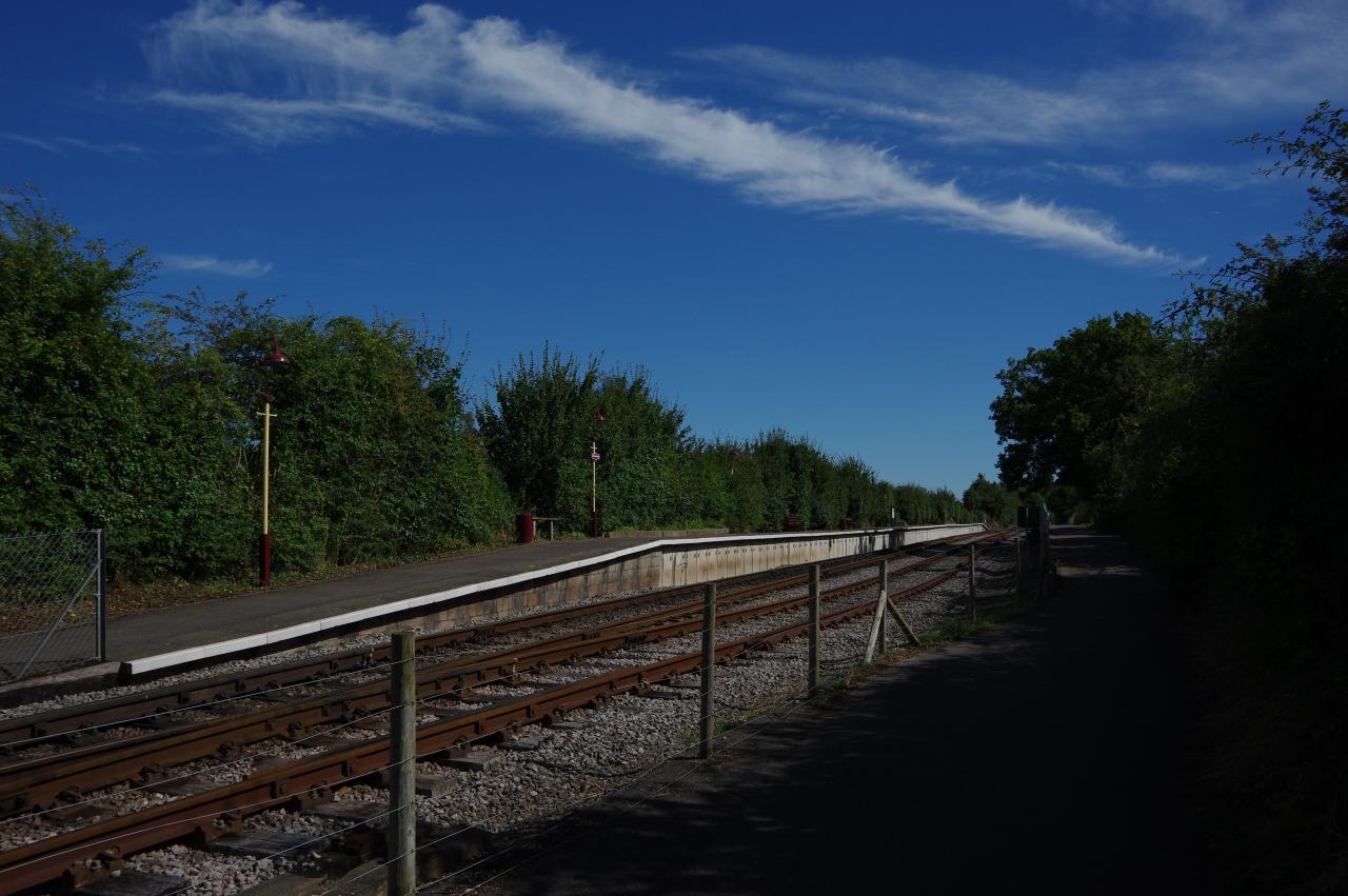
(34) Avon Riverside Station
(35) Swineford Lock
(36) Saltford Sewage Treatment Works Scientific Centre
From the bridge there is a view downstream (picture 33) before the path reaches the platform of Avon Riverside Station (picture 34). Through a gate on the right the Canal Path turns 180 degrees and heads back down to the river and under the bridge to join a grassy track along the right bank of the Avon, this time separated from the fields by a wire fence.
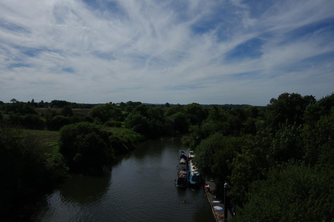
After about a kilometre of easy walking the track goes through a wooden gate onto the grassy side of Swineford Lock (picture 35, looking back from the upstream end of the lock), which stands at a right hand bend of the river. The small village of Swineford is on the other side of the river, beyond the weir, but there is no pedestrian crossing of the river here.
The Canal Path continues along the shady riverside of Saltford Mead for another 500 metres then suddenly turns away from the river at right angles to follow an enclosed path along the perimeter fence of the Saltford Sewage Treatment Works. When the fence turns left the Path does likewise, running along the right edge of a field then going ahead through gate and along an enclosed track that runs parallel to Mead Lane for a while before eventually merging into it beside the Works' Scientific Centre (picture 36).
(37) Saltford Lock
(38) Beerstalker
(39) Saltford Brass Mill
(40) Riverside Inn, Saltford
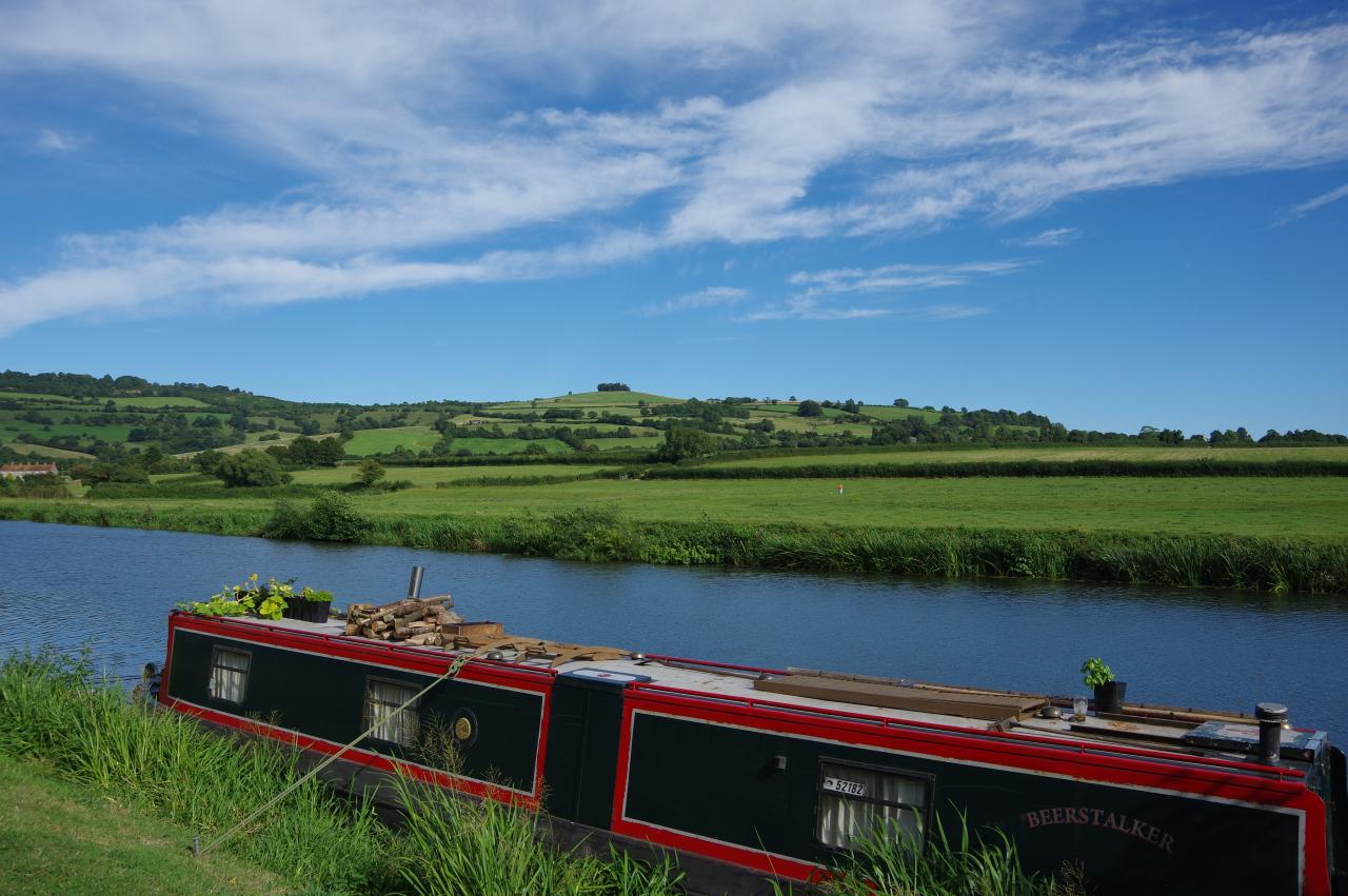
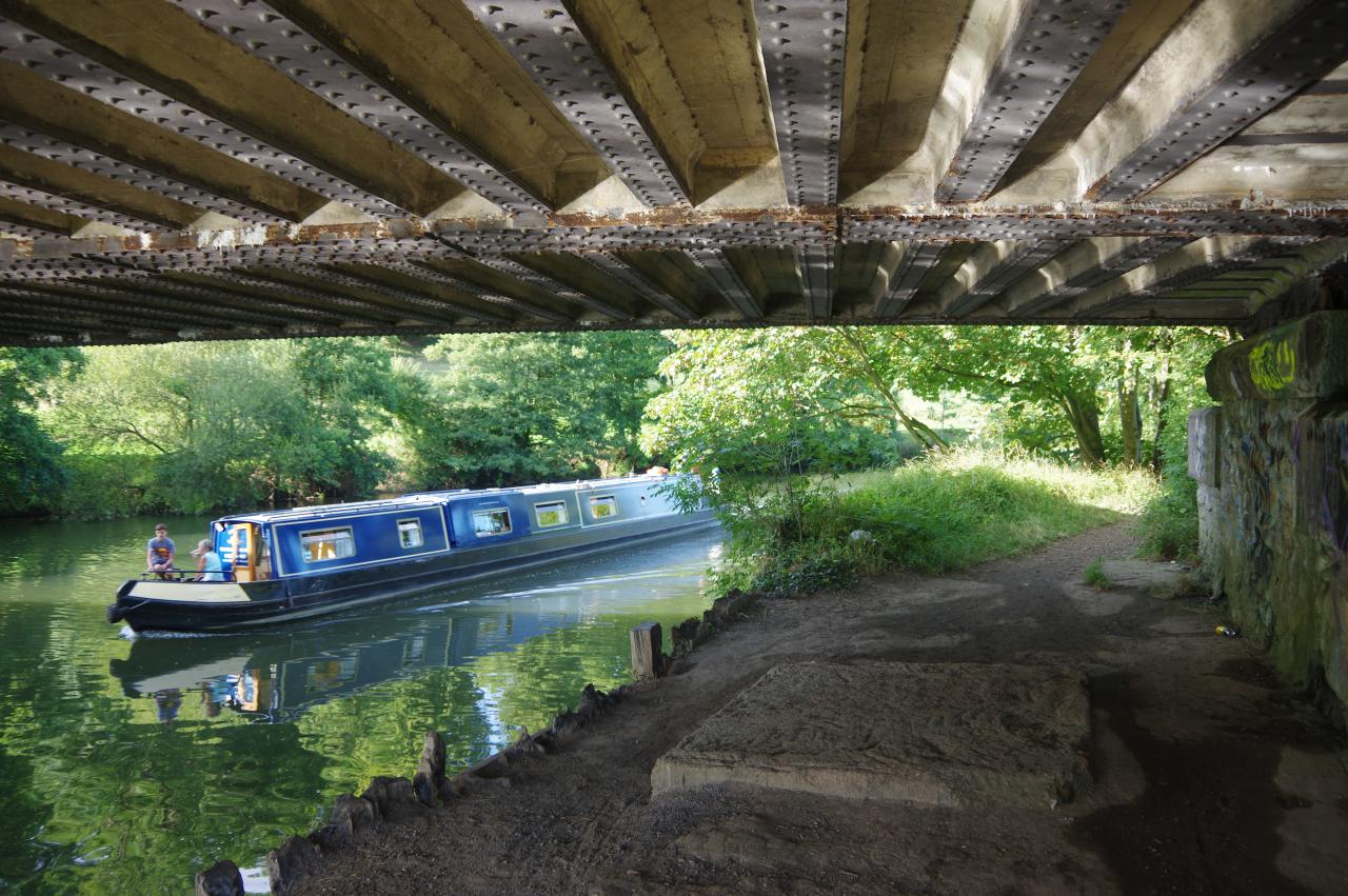
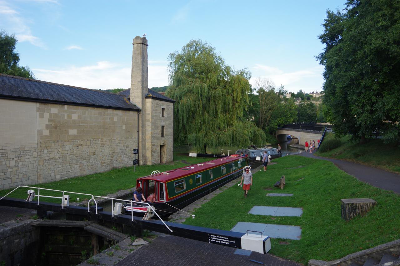
Mead Lane soon passes the Jolly Sailor pub and the Canal Path turns through the pub's carpark to reach the side of Saltford Lock, where a narrow boat heading downstream had just entered the lock (picture 37). After following a narrow path along the lockside and past a row of moorings, the Canal Path rejoins Mead Lane, which now runs alongside the river. One of the narrowboats I passed along this reach of the river was called Beerstalker (picture 38) — perhaps named by someone who shares my interest in English ale. In the distance across the river was the clump of trees on the top of the 218-metre Kelston Round Hill, which had been visible for the last hour or so.
At the next bend in the river, Mead Lane continues ahead, leaving the riverside to pass under a brick and stone bridge carrying the Bristol and Bath Railway Path. Ahead is Saltford's High Street, but the Canal Path turns left past the Bird In Hand pub to follow The Shallows back to the riverside. After passing by the former Saltford Brass Mill (picture 39), the Canal Path leaves the road, turning left at a public footpath sign to follow a short enclosed path back to the river. A riverside footpath then heads past the large Riverside Inn (picture 40), which stands opposite Kelston Lock.
Historically there were several brass mills along the river. Brass is made from copper and zinc, and both of these were mined in the Avon Valley. Saltford Brass Mill is the last one to survive and is a scheduled ancient monument. It ceased operation in 1925, but has since been restored and is open to the public on a few days each month.
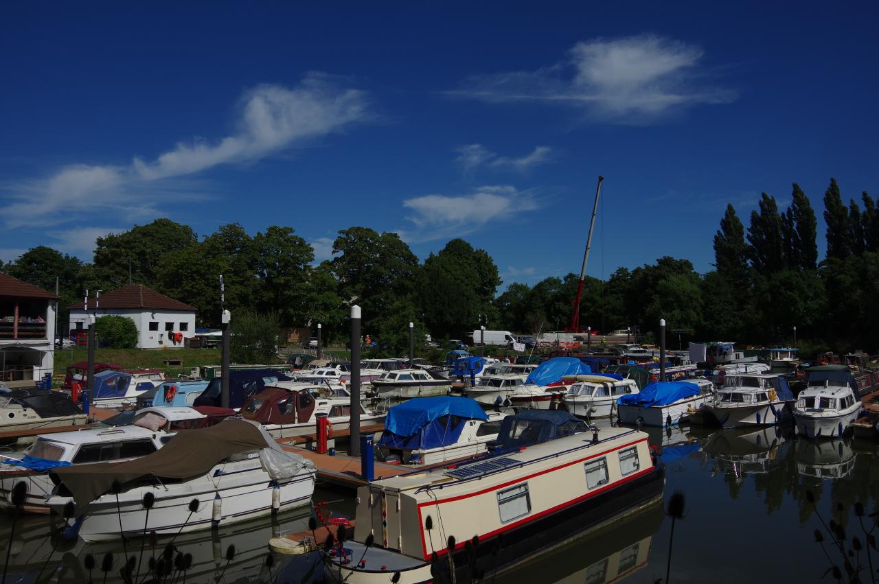
(41) Saltford Marina
(42) Path under bridge carrying the Bristol and Bath Railway Path
(43) The Boathouse pub
(44) New Bridge
The tarmac path soon ends at steps up to a footbridge over the entrance of the Saltford Marina (picture 41). On the other side a grassy riverside path leads past three large boathouses before briefly diverting away from the river to pass around a private garden belonging to a group of moorings. On returning to the riverbank the path is confined to a narrow, but well-wooded, strip of land beside the Great Western Mainline for the next kilometre.
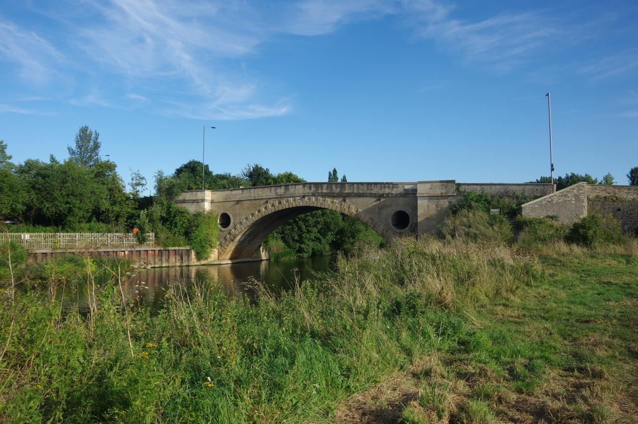
The river eventually curves away from the tracks and the Canal Path runs along the side of a large field before passing under the Bristol and Bath Railway Path for a third time (picture 42). After following the river along the edges of two more very large fields, the path passes opposite the Boathouse pub (picture 43) before climbing steps to the attractive New Bridge (picture 44). The New Bridge was built in 1734 and now carries the A4 out of Bath. In the early 20th century it also carried trams.
(45) Bath Marina
(46) Brassmill Lane Park

(47) Weston Lock
(48) Bridge over Weston Cut
The Canal Path uses the left-hand pavement to cross the bridge before steps lead down to a path under the end of the bridge. The riverside path is now in Newbridge, the westernmost suburb of Bath.
Almost immediately the path crosses an arched footbridge over the entrance of the Bath Marina (picture 45), continuing past a caravan park to pass under the Bristol and Bath Railway Path for the final time — that path ends nearby. Beyond some office buildings, the riverside path reaches Brassmill Lane Park (picture 46), near the site of another of the Avon's former Brass Mills.
Just ahead is Weston Lock (picture 47), at the beginning of the Weston Cut, a 500 metre long channel dug in 1727 as part of the construction of the Avon Navigation. The large lock island created by the Weston Cut is now occupied by a bus depot, accessible via a stone bridge over the Cut (picture 48).
(49) Windsor Bridge
(50) Hot air balloon over Bath
(51) Returning to the riverside
(52) Green Park
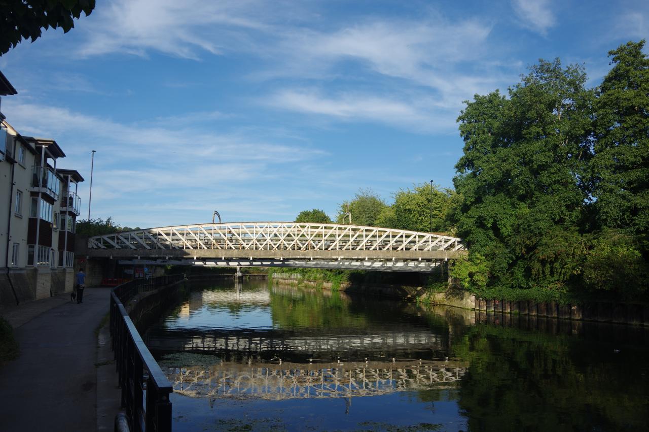
After the Weston Cut rejoins the River Avon, the path passes by riverside office buildings and passes under a metal footbridge and a disused railway bridge before reaching Windsor Bridge (picture 49). A barrier across the towpath under the bridge bore signs indicating that the next stretch of the towpath had been closed to allow replacement of the next road bridge, curiously named the Destructor Bridge. Those works were obviously running well behind schedule as the signage claimed the towpath would reopen eleven months before the date of my visit.
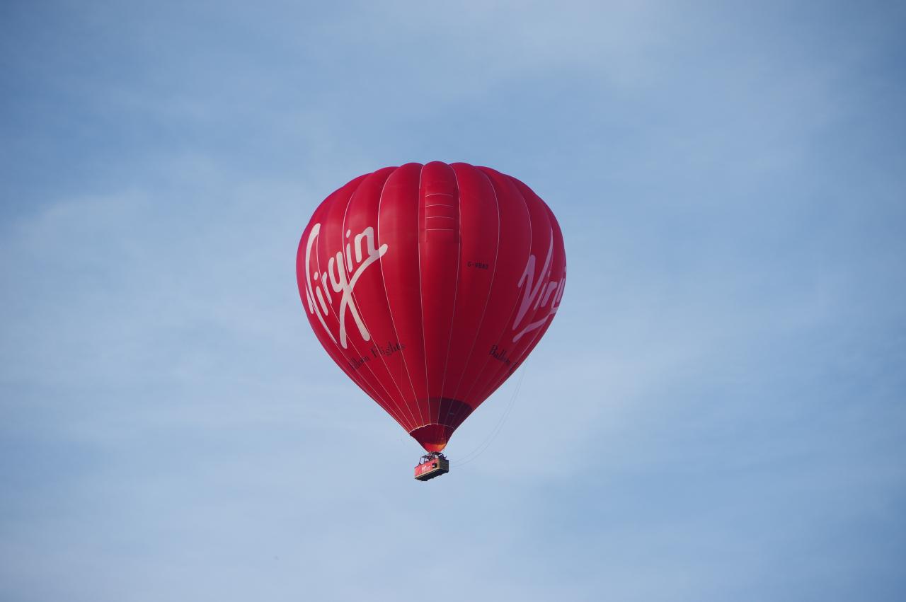
This blockage necessitated a diversion along the busy A4, skipping about 700 metres of the towpath. While walking alongside the A4 I spotted a large hot air balloon floating silently over the rooftops of Bath's northern suburbs (picture 50). I found my way back to the towpath by a small park just upstream from Victoria Bridge, following the broad, shady path (picture 51) under the Stanier Road Bridge and the Midland Bridge to reach Green Park (picture 52).
(53) Path upstream from Green Park
(54) Footbridge across the River Avon
(55) Halfpenny Bridge
(56) Widcombe Lock and Thimble Mill
From Green Park, the path continues beside the river opposite some large former warehouses (picture 53). The Canal Path ascends to road level to pass the next bridge, then turns right about 50 metres further on, by the corner of Bath Bus Station, to cross a footbridge over to the south bank of the Avon (picture 54). Information boards by the bridge detailed plans to redevelop the riverside between Green Park and the Bus Station, including building a new pedestrian bridge.
The Path turns along the riverside and under the railway bridge that crosses the river diagonally from Bath Spa Station, then soon passes under Halfpenny Bridge (picture 55), a pedestrian crossing leading to the back of the station.
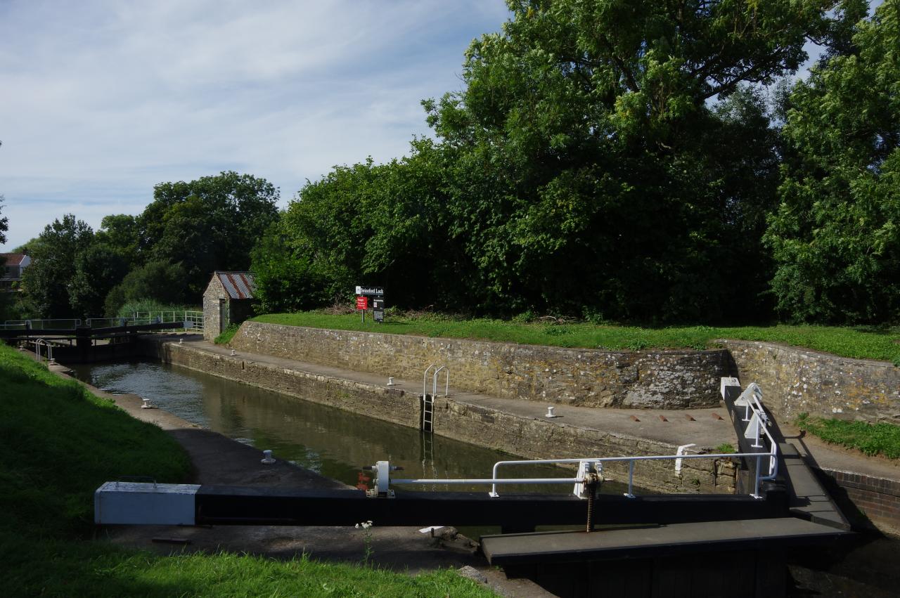
Just as the river begins to curve left, the path reaches Widcombe Lock (picture 56), where the Kennet and Avon Canal finally leaves the River Avon, and where I left the Canal Path for the day, having walked 29.2 kilometres. Beside the lock is Thimble Mill, which was built to house a steam pump that supplied water from the Avon to the next five locks on the canal.
(57) Parade Gardens and Bath Abbey
(58) Beazer Maze
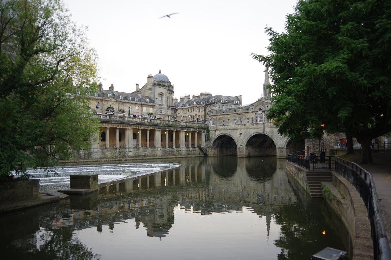
(59) Bath Weir and Pultenay Bridge
(60) Pultenay Bridge
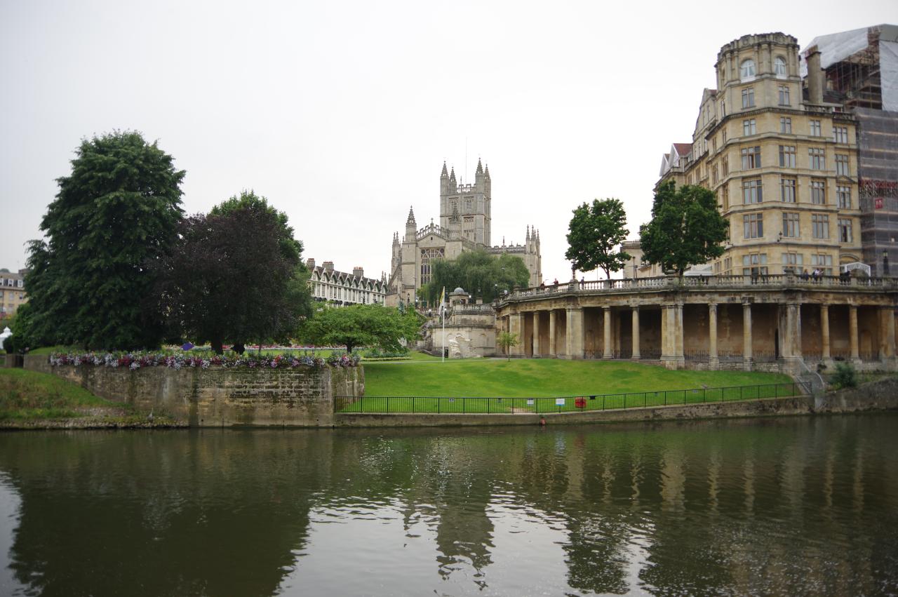
The River Avon Trail continues for another 700 metres beyond the junction with the Kennet and Avon Canal. The Trail crosses the bridge over the end of Widcombe Lock and continues along the riverside, passing under the railway again and continuing along the short Spring Gardens Road to join another riverside footpath that passes the Bath Cricket Club. After passing under a road bridge the path passes the Bath Rugby ground. Across the river is a good view of the Parade Gardens and Bath Abbey (picture 57).
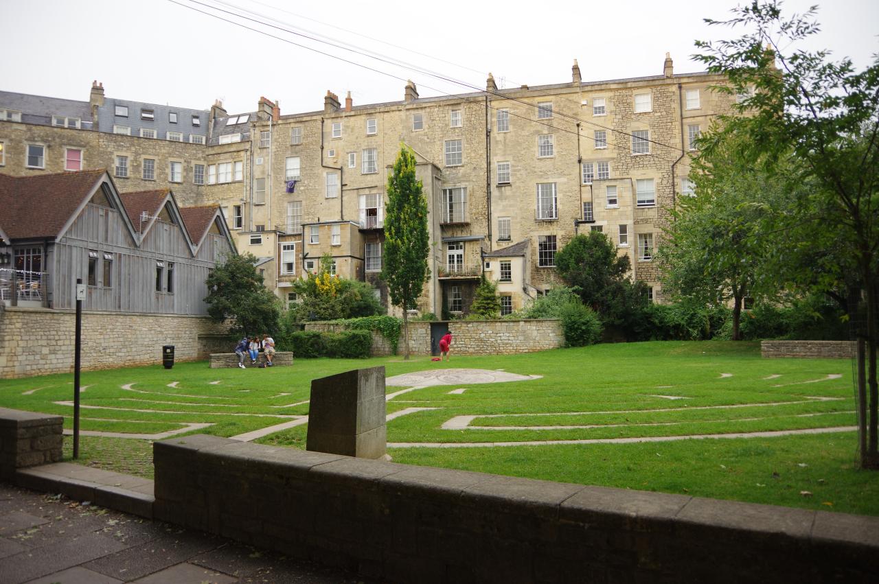
Next to the rugby ground is the Beazer Maze (picture 58), while ahead Pultenay Bridge stands just upstream from the semicircular Bath Weir (picture 59). The River Avon Trail ends on the shop-lined Pultenay Bridge (picture 60), which was built in Bath Stone in 1773. Bath's historic city-centre is just over the bridge, and I proceeded in that direction in search of a celebratory ale.