ISLE OF WIGHT COAST PATH
Stage 2: Sandown to Brighstone
Tuesday, May 22, 2012
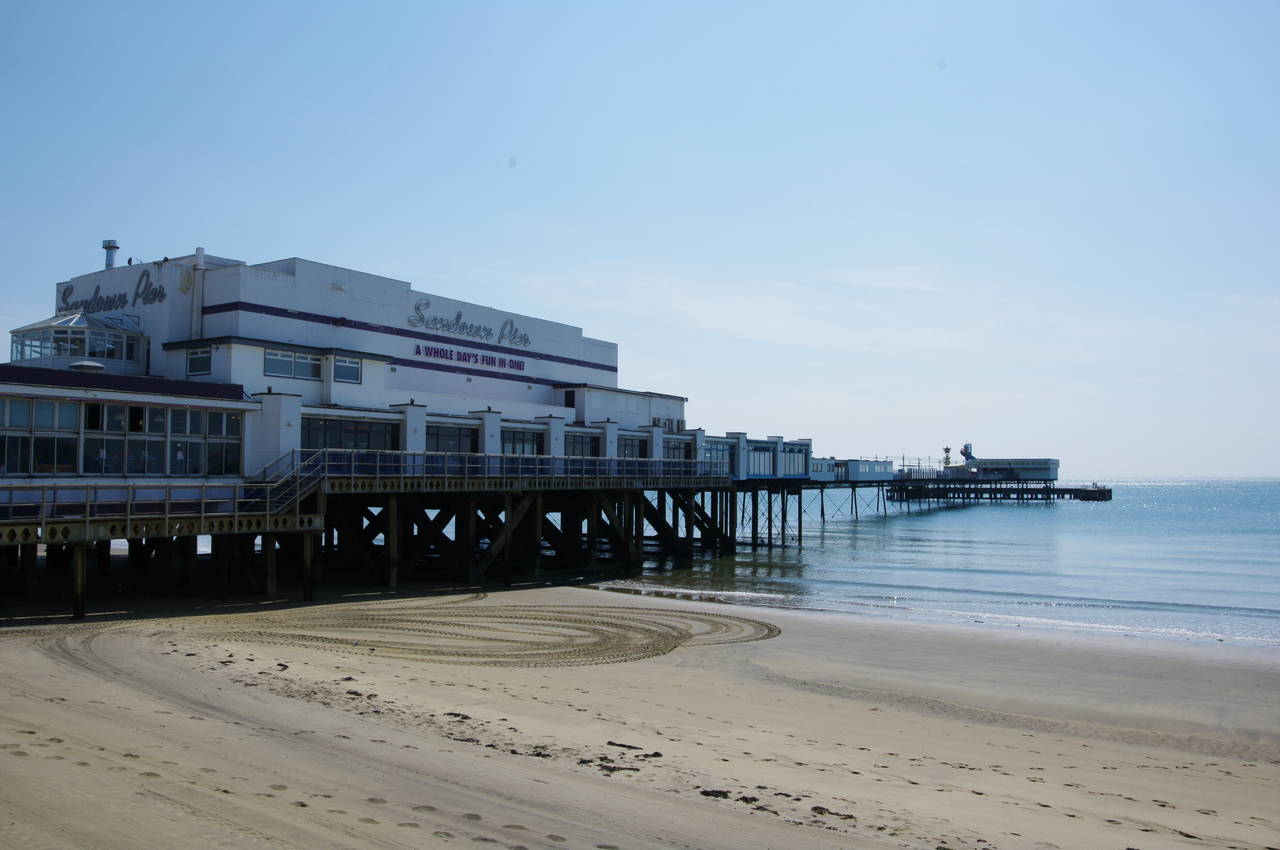
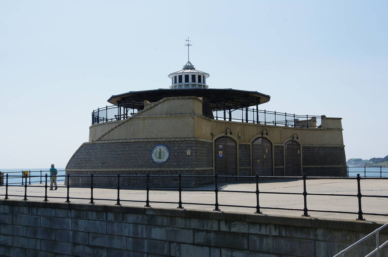
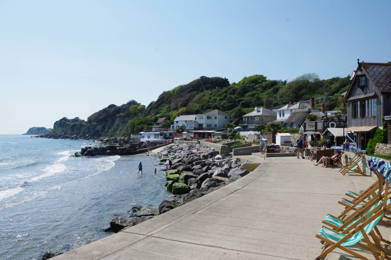
(1) Sandown Pier
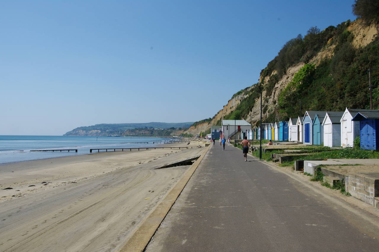
(2) Welcome Beach
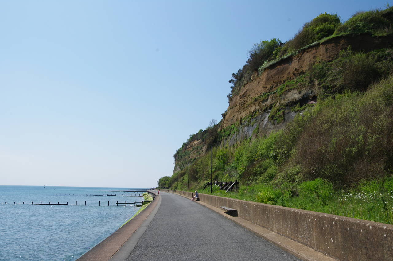
(3) Cliffs below Lake

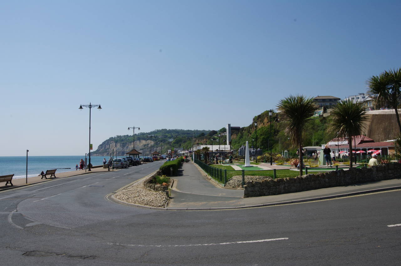
(4) Hope Beach
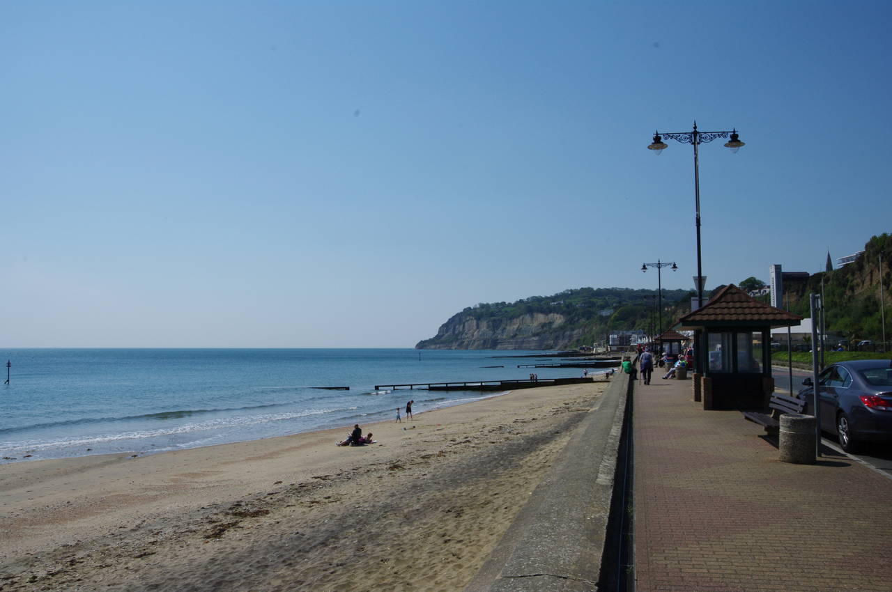
The second day of my walk around the Isle of Wight began at Sandown Pier (picture 1). The pier first opened in 1879 after three years of construction, being extended to its current 265 metre length in 1895. In days gone by, the pier housed a theatre, but nowadays it is home to a bowling alley, amusement arcade and indoor crazy golf.
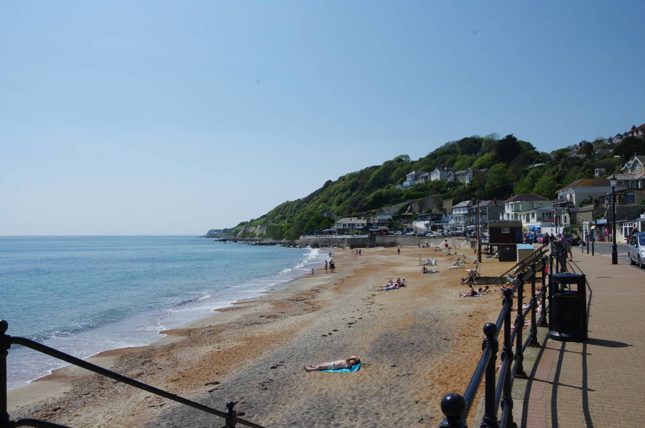
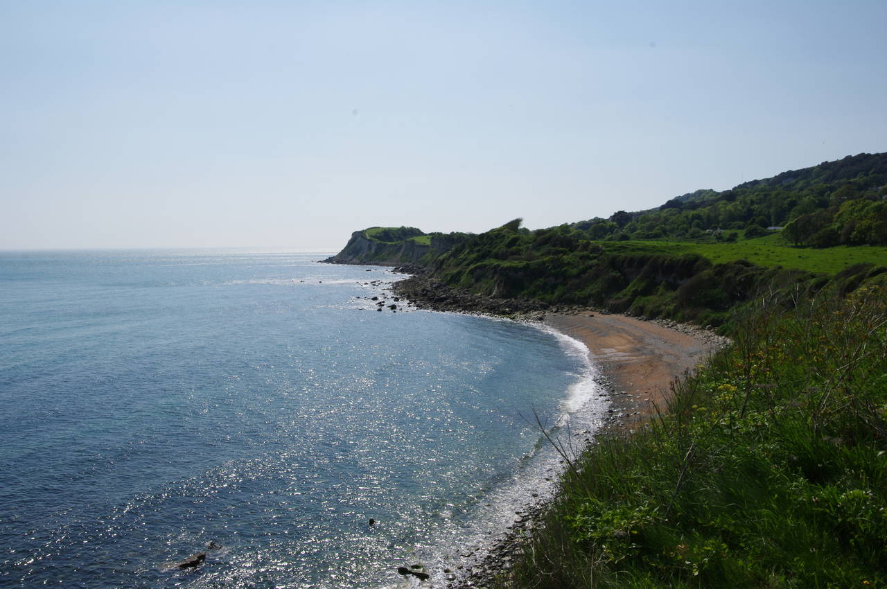
For the first three kilometres of the day's walk, the Coast Path heads around the gentle curve of Sandown Bay on a broad path atop the sea wall and below sandstone cliffs (picture 2). Much of this stretch of the path is lined with beach huts, though there are a couple of stretches where you can get a little closer to the cliffs (picture 3). Being a perfect sunny morning, there were many people out enjoying a walk, a run, or just sipping a cool drink out in front of their hut.
Hidden from view above the crumbly cliffs is the virtually contiguous urban expanse of the towns of Sandown, Lake and Shanklin. At the end of the second beach, Hope Beach (picture 4), the path passes the Journey's End Café (not nearly the end of my journey) and then heads behind a carpark that occupies a section of the sea wall that juts out about 50 metres into the water, sheltering the end of the small beach.
(5) Esplanade Gardens, Shanklin
(6) Shanklin Beach
(7) Approaching Appley Steps
(8) View from Appley Steps
On the other side of the carpark, the Coast Path joins Shanklin's seafront by the Esplanade Gardens (picture 5). The route follows the Esplanade (picture 6), passing hotels and shops that line the foot of the cliff -- the bulk of Shanklin is up on top of the cliffs, out of sight of the beach.
When the Esplanade begins to climb uphill behind the Lazy Wave Café, the Coast Path follows it for a few meters more, passing behind the café and then bearing left off the road to follow a path behind a row of beach huts, past a flight of steps leading up to Shanklin Chine (a sandstone gorge, once home to smugglers, and now a tourist attraction) and then in front of the Fisherman's Cottage pub. Almost 100 metres beyond the pub, with the Luccombe Cliffs dominating the view ahead, the path leaves the beach and ascends the Appley Steps (picture 7), which zigzag their way up the vertical cliff face. On the way up the steps, there are good views back across the bay to Sandown and beyond to the chalk cliffs of Culver Down (picture 8).
(9) View back from Luccombe Cliffs
(10) Dunnose Cottage
(11) The Landslip
(12) Horseshoe Bay
After the lung-bursting climb up the steps, the path passes between two rows of clifftop benches before turning to the right, away from the clifftop. Passing the front of the Luccombe Manor Hotel, the route then turns left into Luccombe Road, gradually leaving the last few grand clifftop buildings of Shanklin behind as the road climbs gently.
At a fork in the road, the Coast Path keeps left, bypassing the village of Luccombe which lies a couple of minutes walk along the right branch of the road. A short distance further along the official path, just before a house labelled "Highcliff" in large letters on its wall, there are superb views back over Shanklin, Lake and Sandown from the National Trust's Luccombe Cliffs property (picture 9).
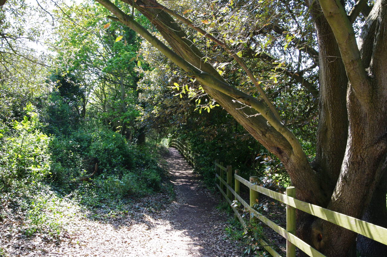
Soon the sealed road ends and the Coast Path continues into the trees on a narrow path, soon passing Luccombe Tea Garden and another cottage before reaching a signpost showing 1/2 mile to The Landslip on Footpath SS2. Following the sign, one soon passes by the thatched Dunnose Cottage (picture 10) and further on, the more modest Rosecliff Cottage. Here, rather than continuing ahead along the driveway, the Coast Path bears right of the gate on an earth path, soon entering The Landslip.
The area of The Landslip is geologically unstable and large sections have slid down towards the sea, including major landslips in 1810, 1928 and 1995. The Coast Path meanders through the woods that cover the The Landslip (picture 11), rising and falling steeply several times, sometimes with the assistance of steps built into the hillside, other times on trickier and occasionally quite slippery slopes.
After some quite strenuous walking, the path emerges from the woods a few hundred metres downhill from the village of Bonchurch, soon passing an attractive stone cottage before continuing along the clifftop above Monks Bay. At a fork in the path, the Coast Path bears left, crossing a small stream then descending behind a group of bungalows to rejoin the sea wall at Horseshoe Bay (picture 12).

(13) Wheelers Bay
(14) Ventnor Haven
(15) Water pumping station beside Ventnor Haven
(16) Ventnor Beach
The Coast Path follows the sea wall west around a series of very small bays, the first populated one being Wheelers Bay (picture 13), on the edge of the Victorian resort town of Ventnor. Around the next point the path passes by a long carpark to reach the tiny harbour of Ventnor Haven (picture 14). Just beyond the harbour stands a water pumping station that is cleverly disguised as a bandstand (picture 15).
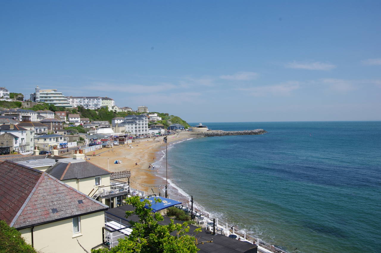
From the harbour, the Coast Path follows the Esplanade along the length of the town's beach (picture 16). The majority of Ventnor overlooks the beach from a hillside that has formed from countless landslips. These are still occurring and the town has lost a number of buildings to the shifting ground over the years.
(17) View back from Ventnor Park
(18) Ventnor Sign

(19) Descending to Castle Cove
(20) Steephill Cove
At the far end of the beach, the Esplanade climbs uphill to a carpark and into the clifftop Ventnor Park, from which there were good views back across the town (picture 17). The official route follows a tarmac path between the carpark and the clifftop, but, for reasons that were not apparent, a hundred-metre section of the path was closed, necessitating a diversion through the carpark.
At the end of the carpark stands a large chunk of rock with a couple of plaques affixed to it, explaining the construction of coastal defences below the chalk cliff to prevent erosion. One of the plaques reads:
This 6 tonne rock is an example of the 30,000 tonnes of carboniferous limestone quarried from the Mendip Hills, Somerset, and shipped to the site by barge, as used in the construction of the rock revetment.
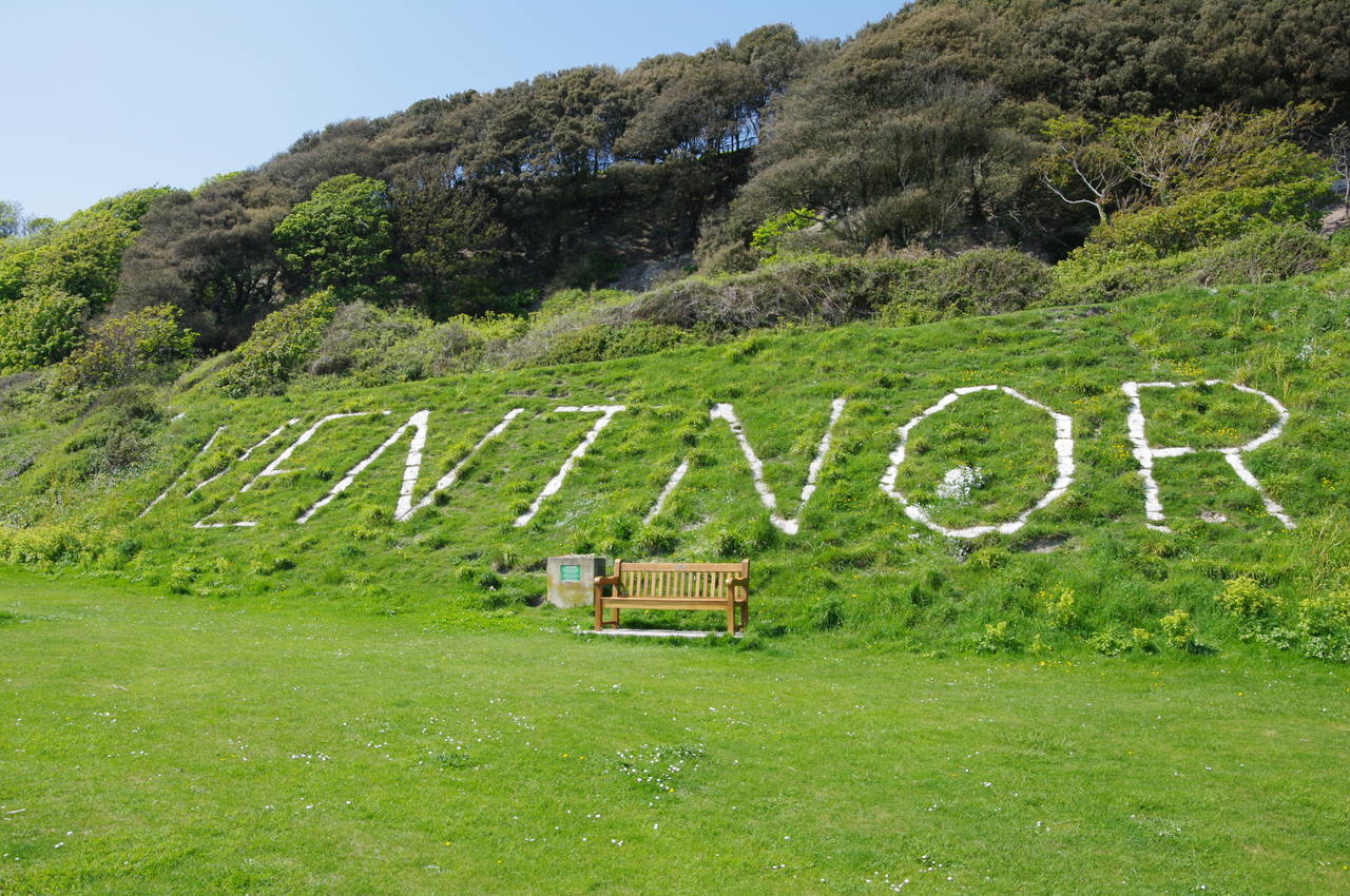
A short distance after rejoining the official path, I passed an unusual sign, spelling out the name of the town in four-metre high letters made from white concrete blocks (picture 18). The sign is intended as a navigational aid to shipping and until 1992 the letters were carved into the chalk hillside.
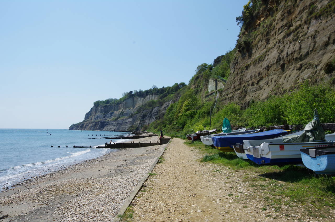
The Coast Path continues to follow tarmac paths along the undulating grassy clifftop for the next 500 metres before descending to the sea wall at Castle Cove (picture 19). Around the point, the path reaches a collection of cabins and deckchairs at Steephill Cove (picture 20). Beyond, one can see that the chalk cliffs the path crossed from Ventnor are no more, replaced by iron-rich red sandstone for the next stretch of the path.
(21) Path above Steephill Cove
(22) Ventnor Botanic Gardens
(23) Sir Richard's Cove
(24) Path above Sir Richard's Cove
Rather than heading around the cove, the Coast Path climbs steps up the hill then turns left to follow a pleasant shady path above the cove beside a post-and-rail fence (picture 21). Hidden from view uphill on the other side of the trees is the ground of the Ventnor Cricket Club.
To the west of the cricket ground, the path passes through the lower fringes of the Ventnor Botanic Gardens (picture 22), where the sheltered location provides a warm microclimate suitable for many plants that don't usually thrive this far north.
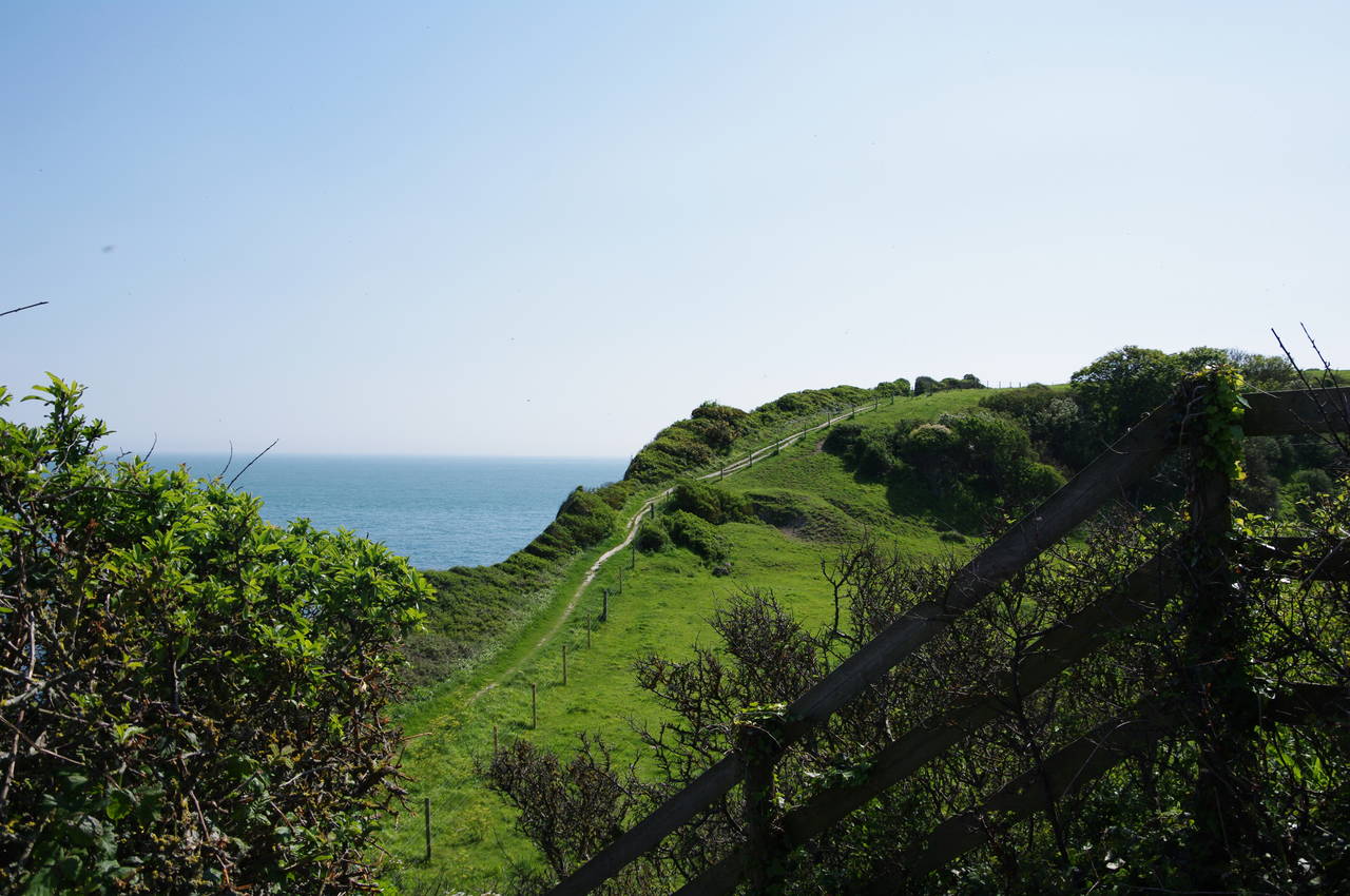
Leaving the Botanic Gardens, the Coast Path continues along the clifftop on open ground with good views ahead over the quiet Sir Richard's Cove (picture 23). Further on, the path rises and falls steeply a couple more times (picture 24) before reaching Woody Bay, where the path turns right to head inland, away from the spectacular clifftop views.
(25) High Hat
(26) View towards Whitwell
(27) The Undercliff
(28) House on Niton Down
Initially following a narrow footpath, then a farm lane, the path soon reaches a Coastal Path sign pointing left through a wooden kissing gate and along another farm track to another Coastal Path sign, this time pointing to the right, along the edge of a field and then uphill through trees to the edge of the village of St Lawrence.
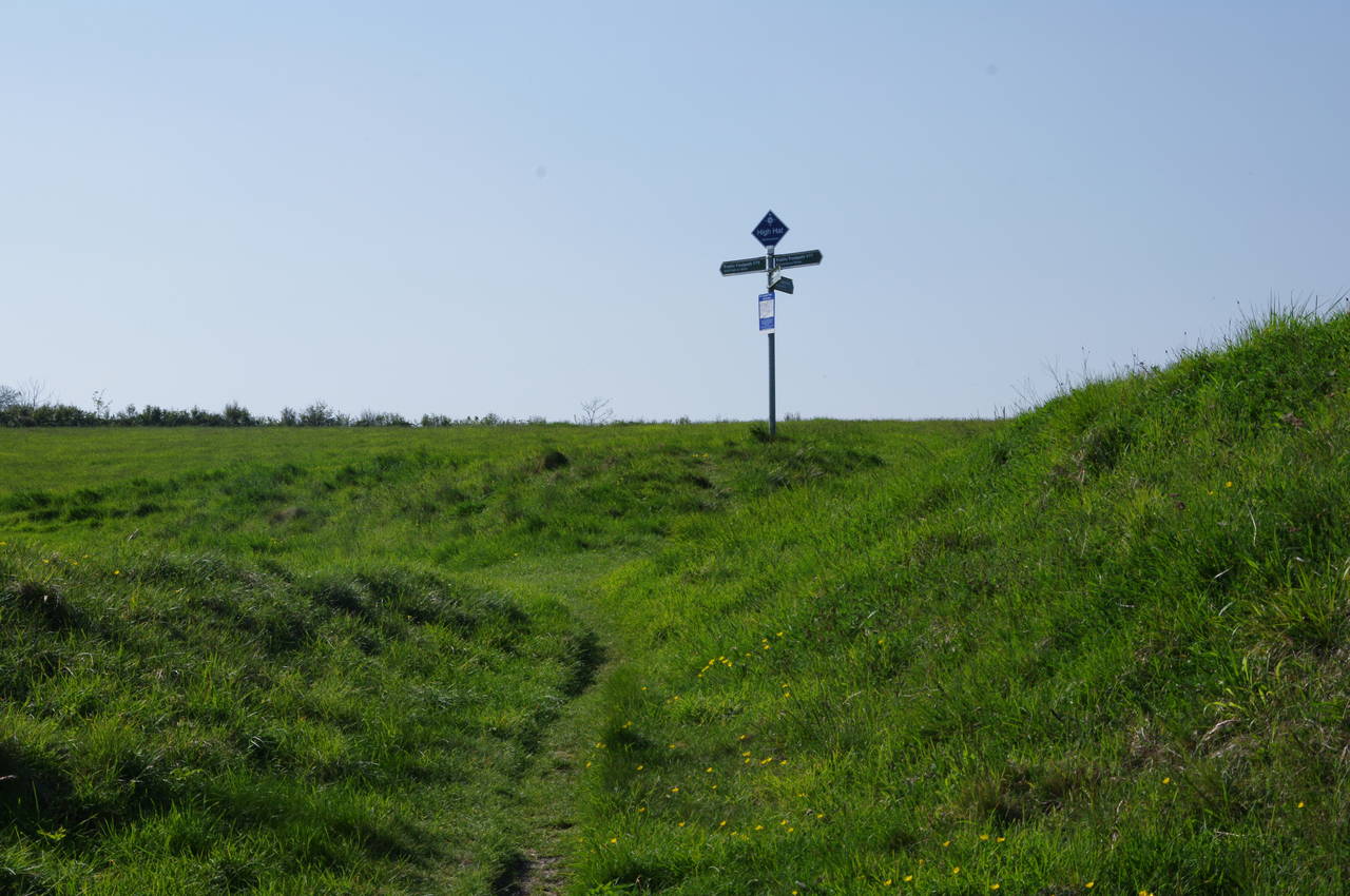
On reaching Woolverton Road, the Coast Path turns left for about 100 metres, then turns right into Old Park Road, which is followed uphill as it curves further to the right then heads up to meet the A3055 Undercliff Road. Across the main road and a few metres to the right, the path continues to climb up Spindlers Road and then at the top turns left into Seven Sisters Road. A short distance along the road, a signpost on the right for Public Footpath V81 points up a steep flight of steps by which the Coast Path ascends the steep cliff to the grassy hill of High Hat (picture 25).
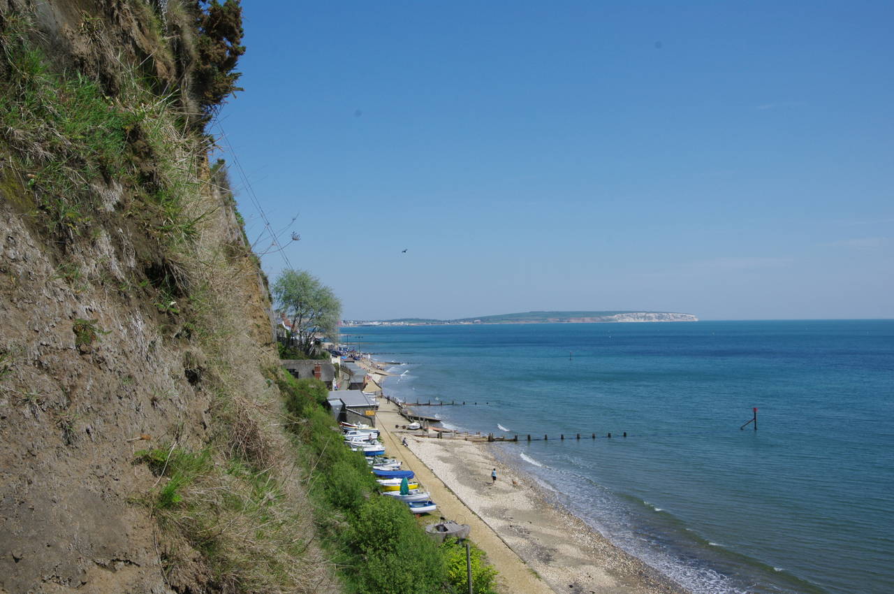
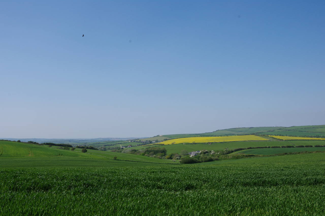
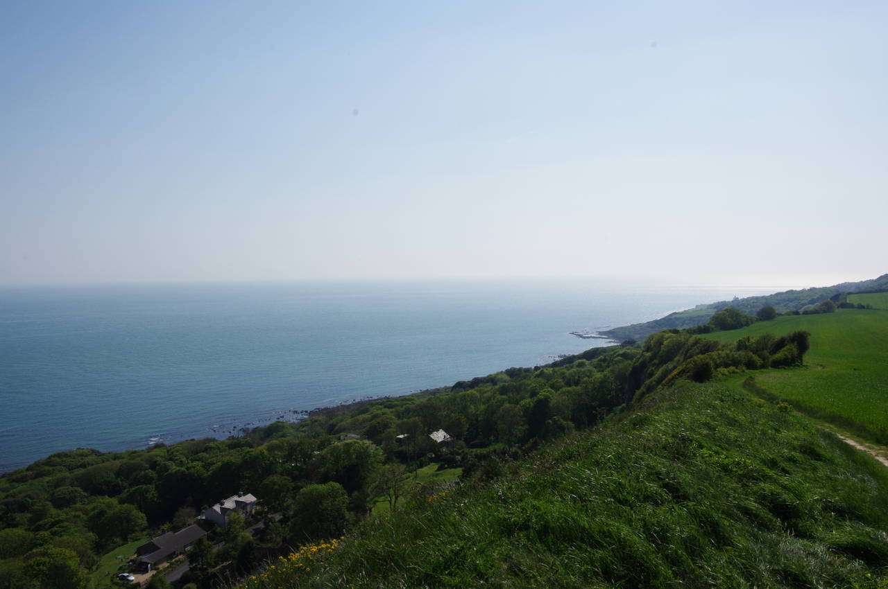
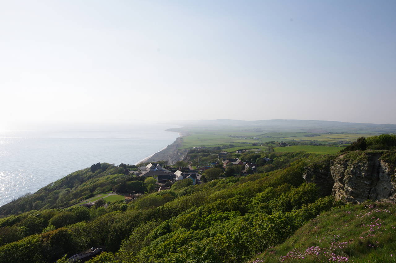
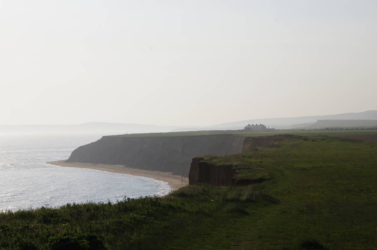
For the next three kilometres, the Coast Path follows the southern edge of the chalk downs to the village of Niton. To the north there are good views over the rolling farmland surrounding the village of Whitwell (picture 26), while to the south the views stretch across the Undercliff (picture 27) -- the strip of land between the high chalk cliffs and the sea, almost a kilometre wide in some places, formed over thousands of years by a long series of landslips. The Undercliff is the largest area of landslips in western Europe, stretching for around 13 kilometres from Luccombe Cliff in the east to Blackgang in the west.
Entering trees near the village of Niton, the path curves to the right then turns left at a Coastal Path signpost, to descend to the A3055 on the southern edge of the village. Crossing the road, here known as Barrack Shute, the path heads up a rough dirt track called Boyers Lane, soon climbing up to the grassy slopes of Niton Down. Before long, with St Catherine's Hill rising to the northwest, the path passes an incongruously placed house in the middle of a field to the right of the path (picture 28).
(29) St Catherine's Lighthouse
(30) St Catherine's Lighthouse
(31) Blackgang Chine
(32) Parish Church of St Andrew, Chale
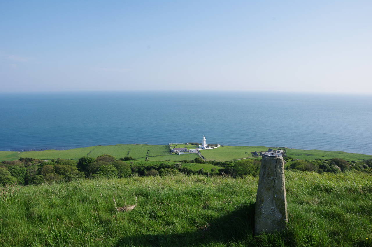
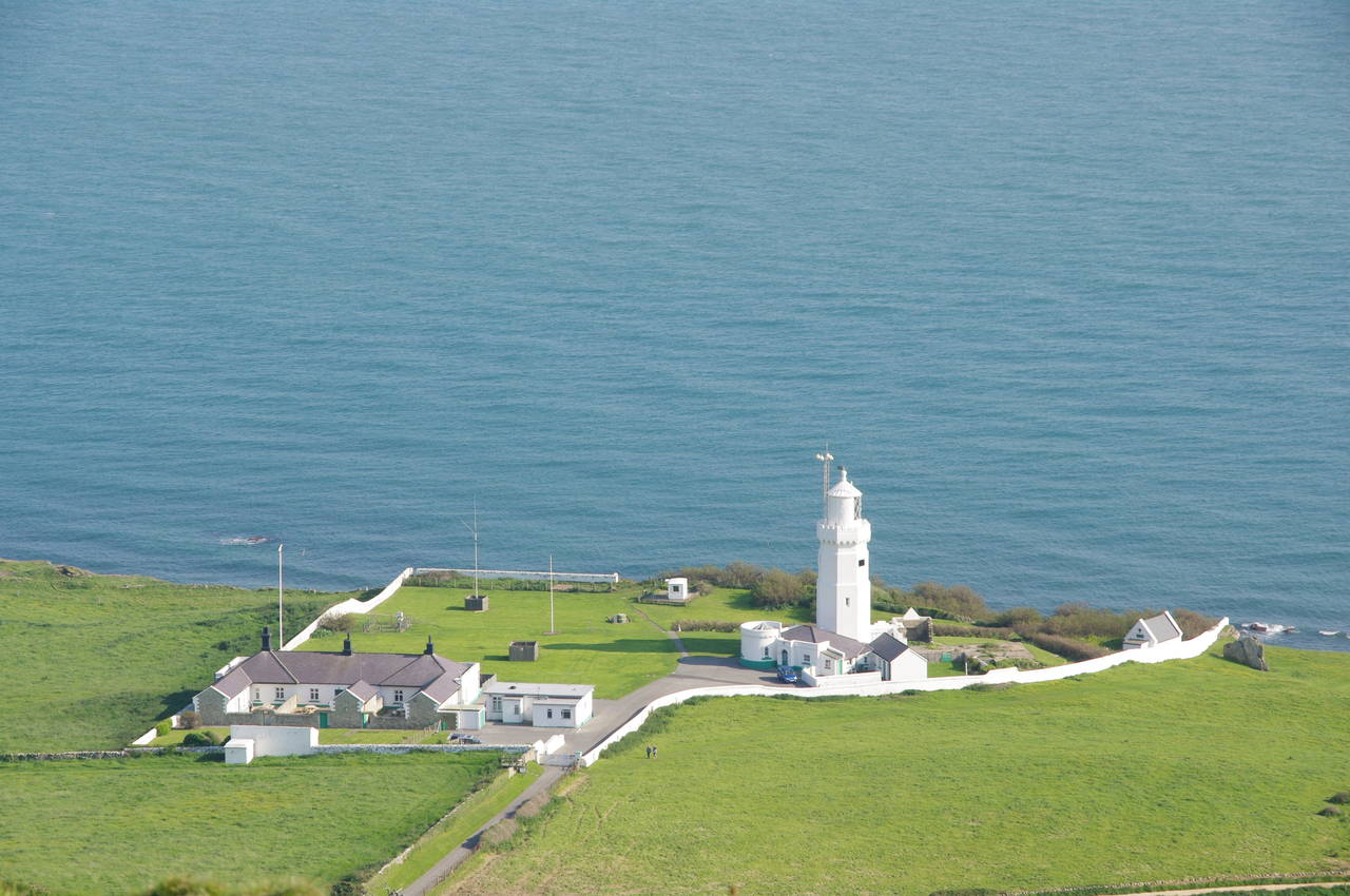
The path continues along the cliff edge, with the 27-metre St Catherine's Lighthouse standing on the Undercliff at the Isle of Wight's southernmost point (pictures 29 and 30). The lighthouse was first lit in March 1840 and fully automated in 1997. The powerful light can be seen nearly 50 kilometres out to sea in clear weather.
For the next one and a half kilometres, the path stays close to the cliff edge, heading towards Blackgang Chine (picture 31), a former haunt of smugglers, which has housed a large theme park since 1843. The cliffs start to descend as they curve around behind the chine and before long the path leaves the cliff edge and turns right along a field edge to the Blackgang Viewpoint carpark. Crossing the carpark to a Coastal Path sign just to the left of the exit, the route then crosses an area of scrub to follow a path through a small wood to a stile in the corner of a field. Crossing the stile, the path follows the edge of the field to a second stile by the A3055 Blackgang Road.
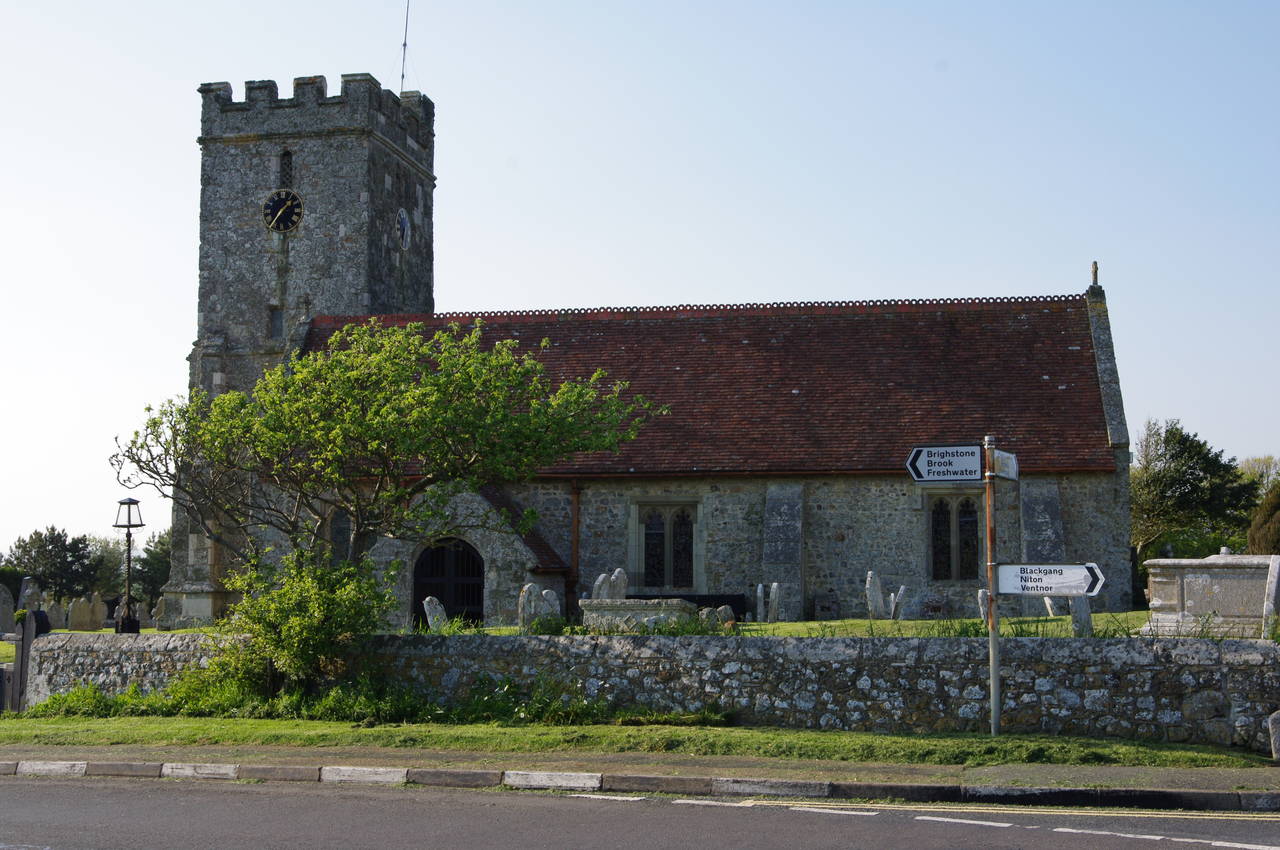
The Coast Path follows the grassy verge beside the road for almost 500 metres to the edge of the village of Chale, where a signpost on the left points along the fenced Public Bridleway C15. After another 500 metres or so, the bridleway emerges onto The Terrace, which is followed to the right for about 80 metres to rejoin the A3055, now called Military Road, in the middle of the village. Turning left, the path almost immediately passes the Parish Church of St Andrew (picture 32).
(33) Whale Chine
(34) Approaching Atherfield Point
(35) View back across Chale Bay
(36) View across Brighstone Bay
About 250 metres further along the road, directly opposite the driveway to the Wight Mouse Inn, a Coast Path sign by a stile points along a field edge path that takes the route back to the cliffs beside Walpen Chine, the clifftop path now looking out directly over the water with the Undercliff having been left behind.
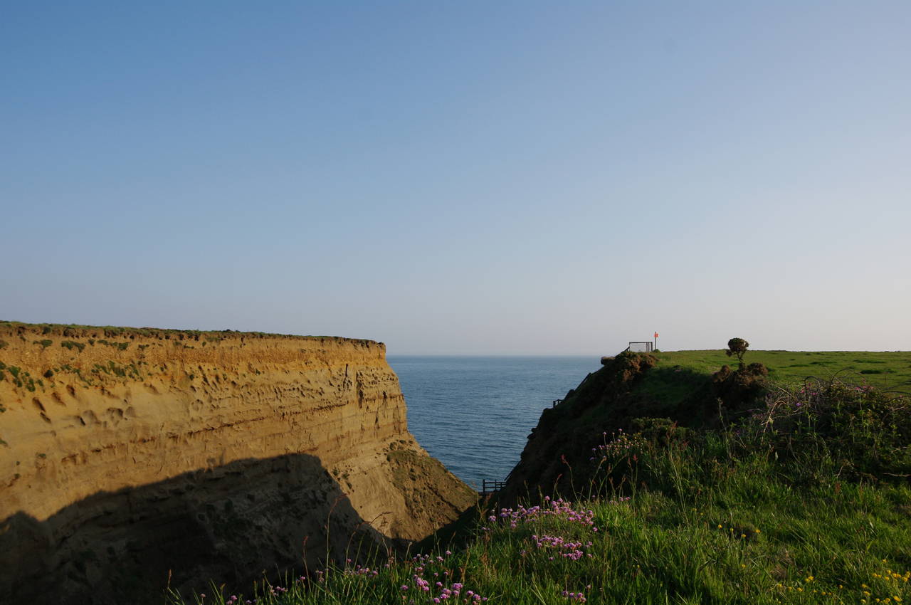
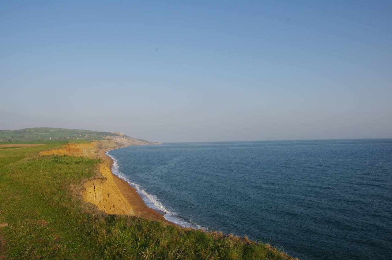
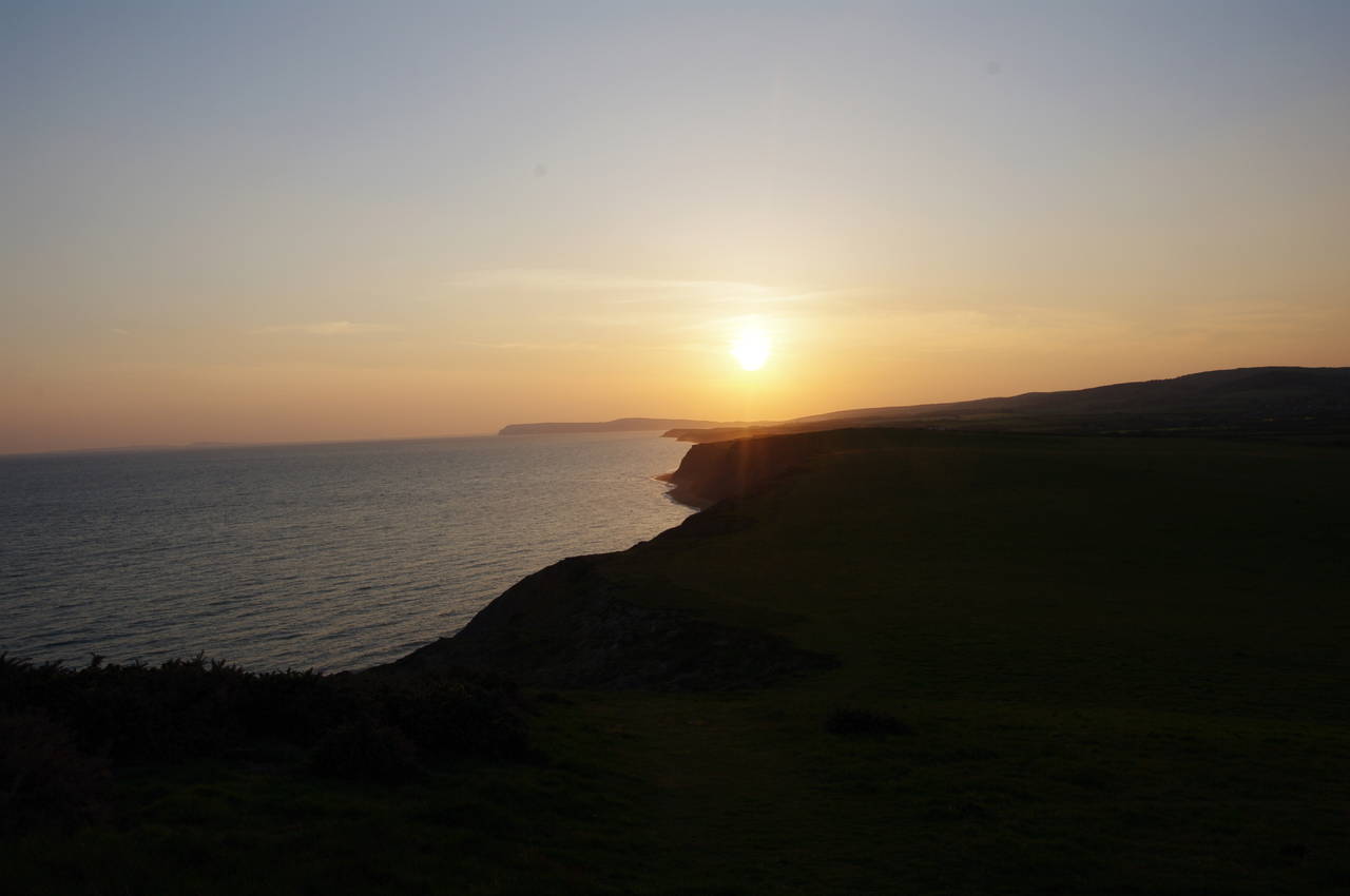
After about 800 metres, the path leaves the clifftop and crosses the middle of a field back to Military Road. After about 300 metres the road passes the end of Whale Chine (picture 33), one of several impressive steep-sided gorges that punctuate this part of the Coast Path. The path then heads back to the clifftop above the western side of Whale Chine and then on towards Atherfield Point, where a group of Coastguard cottages are the only buildings on the windswept grassland (picture 34). Looking back in the opposite direction, the late-afternoon sun gave a golden glow to the crumbly sandstone cliffs of Chale Bay (picture 35).
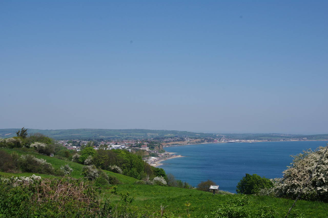
Rounding the tip of Atherfield Point, I was treated to a magnificent view along the West Wight coast (picture 36), across Brighstone Bay and beyond to Compton Down, still almost half a day's walk away.
(37) Shepherd's Chine
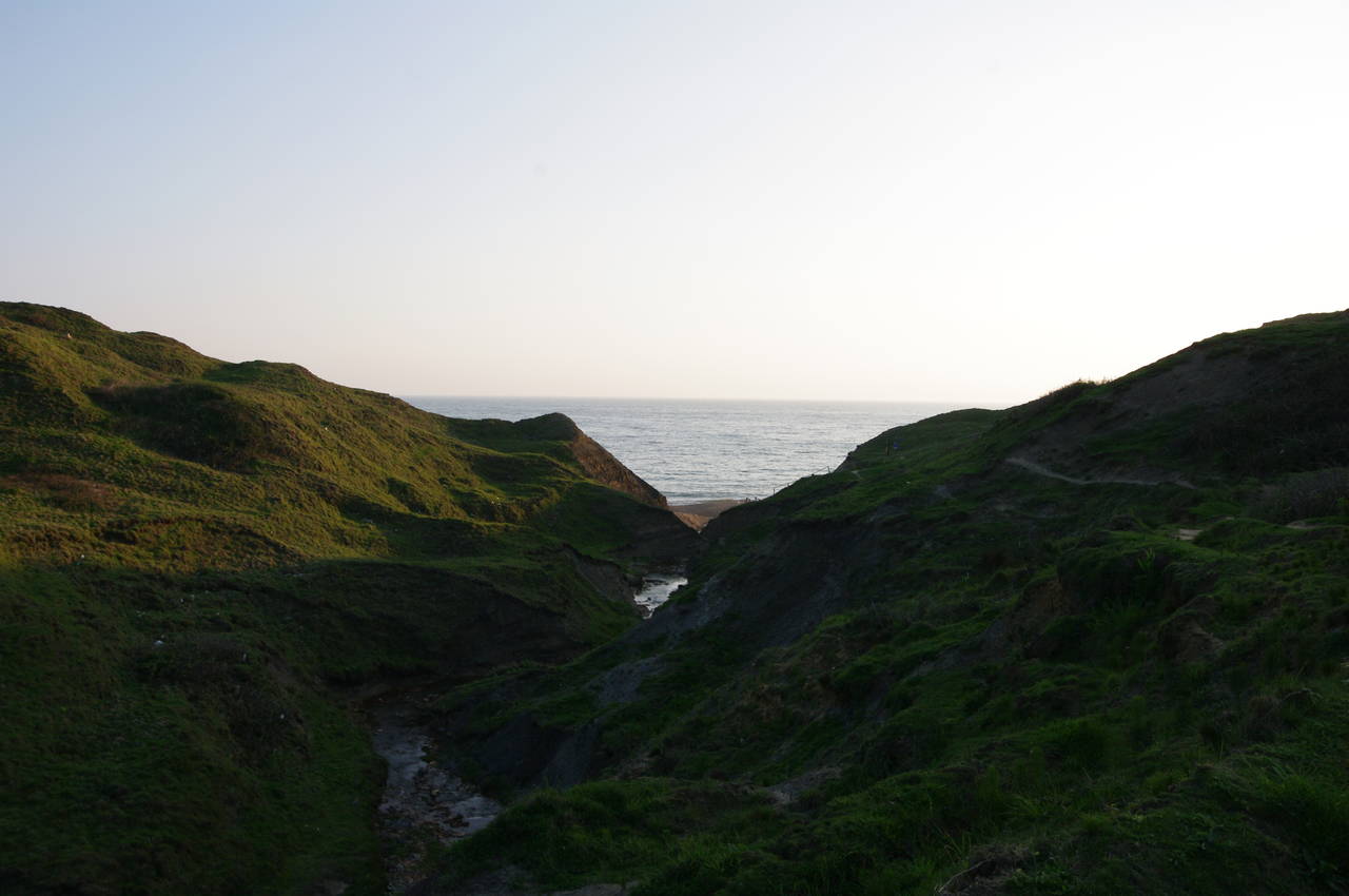
(38) Shepherd's Chine
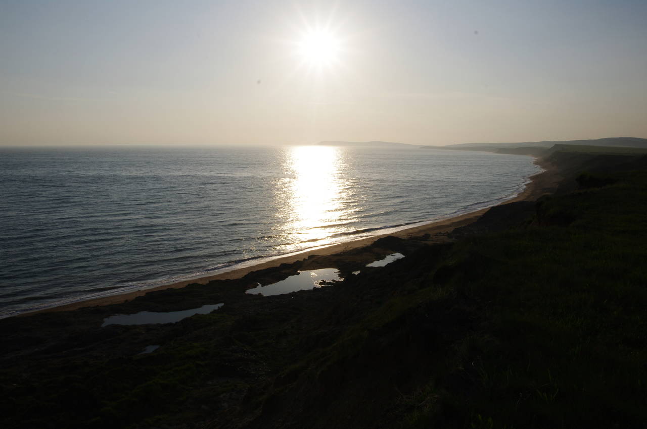
(39) Sunset over Brighstone Bay
(40) Marsh Chine
A short clifftop walk past two more fields brings the path to the edge of Shepherd's Chine (picture 37). The path initially heads inland alongside the chine, then after about 100 metres, a signpost points to a path that dips down into the chine then heads back towards the sea on a precarious and slippery path part of the way up the opposite bank of the chine (picture 38). Near the seaward end of the chine, an easier path leads up from the beach to the Chine Farm holiday camp on top of the cliffs.
The holiday camp occupies a large field between Shepherd's Chine and the smaller Cowleaze Chine, and the path once again has to divert a short distance inland to pass around the end of the latter, before returning to the clifftop path once more.
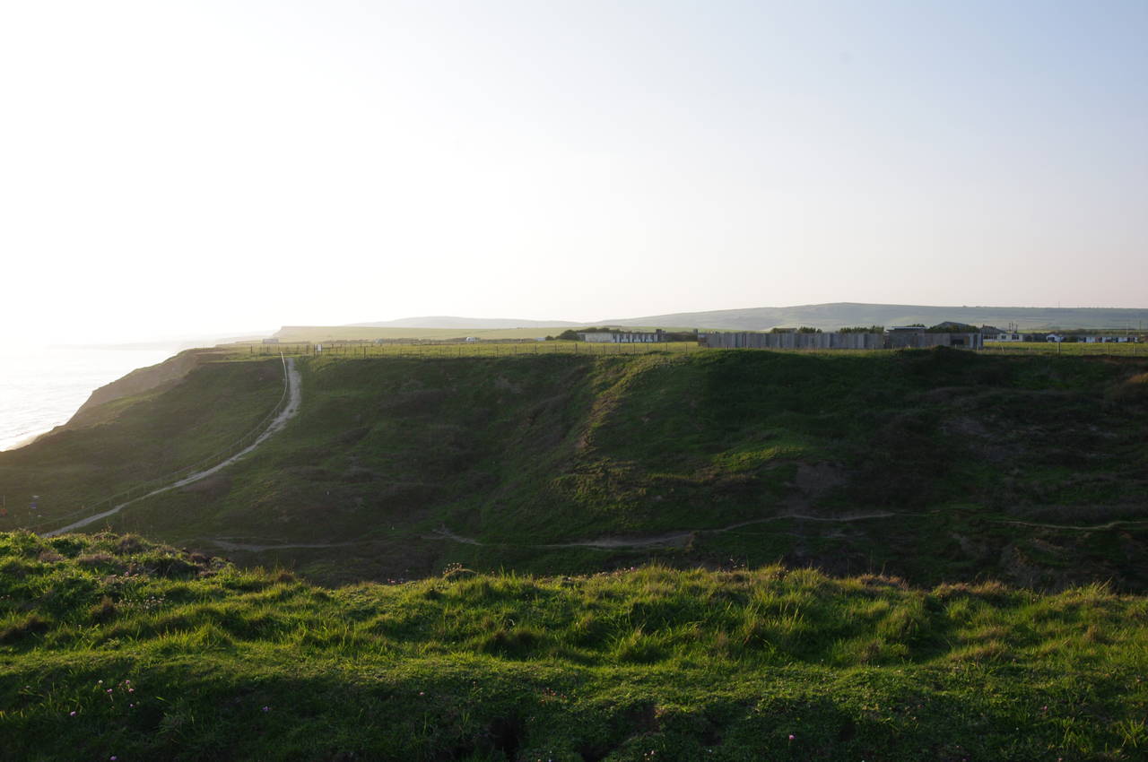
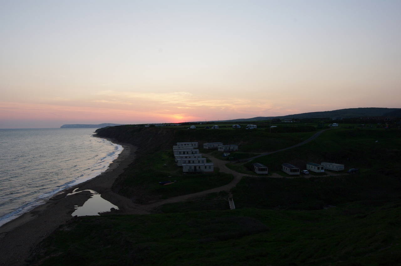
The last three kilometres of the walk, alongside a succession of fields between Cowleaze Chine and Marsh Chine, sticks close to the cliff edge all the way. This was a very peaceful stretch of walking, particularly with the sun getting ever lower up ahead (picture 39). I eventually reached Marsh Chine (picture 40) just as the sun disappeared behind the horizon.
The Coast Path goes straight ahead into the chine, crossing a footbridge over the stream to reach the group of chalets that shelter on the floor of the chine. The path then turns right to follow a track uphill from the chalets for a short distance to a Coastal Path signpost that points up to the left, across the Grange Farm campsite. Here I left the Coast Path for the day, having completed a further 29.2 kilometres of the route.
Heading uphill to cross Military Road into New Road and then following the latter into the centre of the village of Brighstone, it took me about 20 minutes to reach the comfort of the Three Bishops pub in the last of the fading light.