ISLE OF WIGHT COAST PATH
Stage 1: Ryde to Sandown
Monday, May 21, 2012
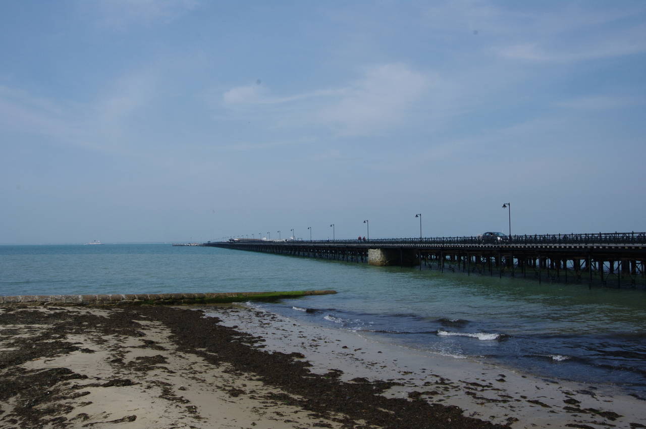
(1) Ryde Pier
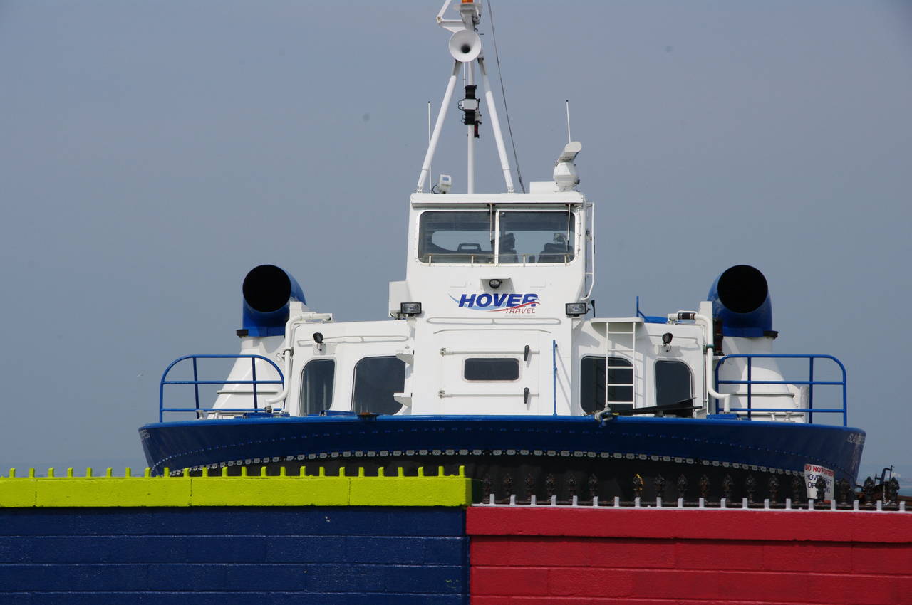
(2) Hovercraft
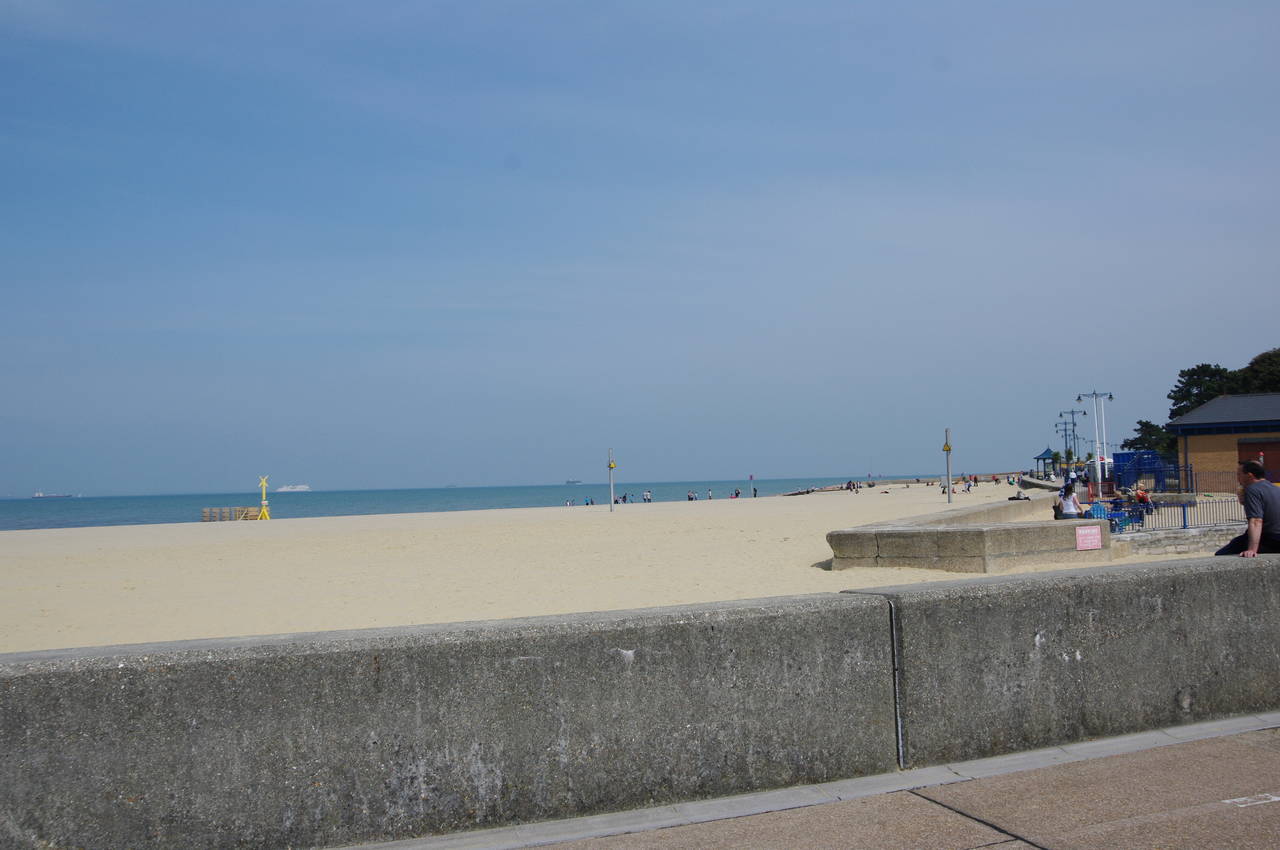
(3) Appley Beach
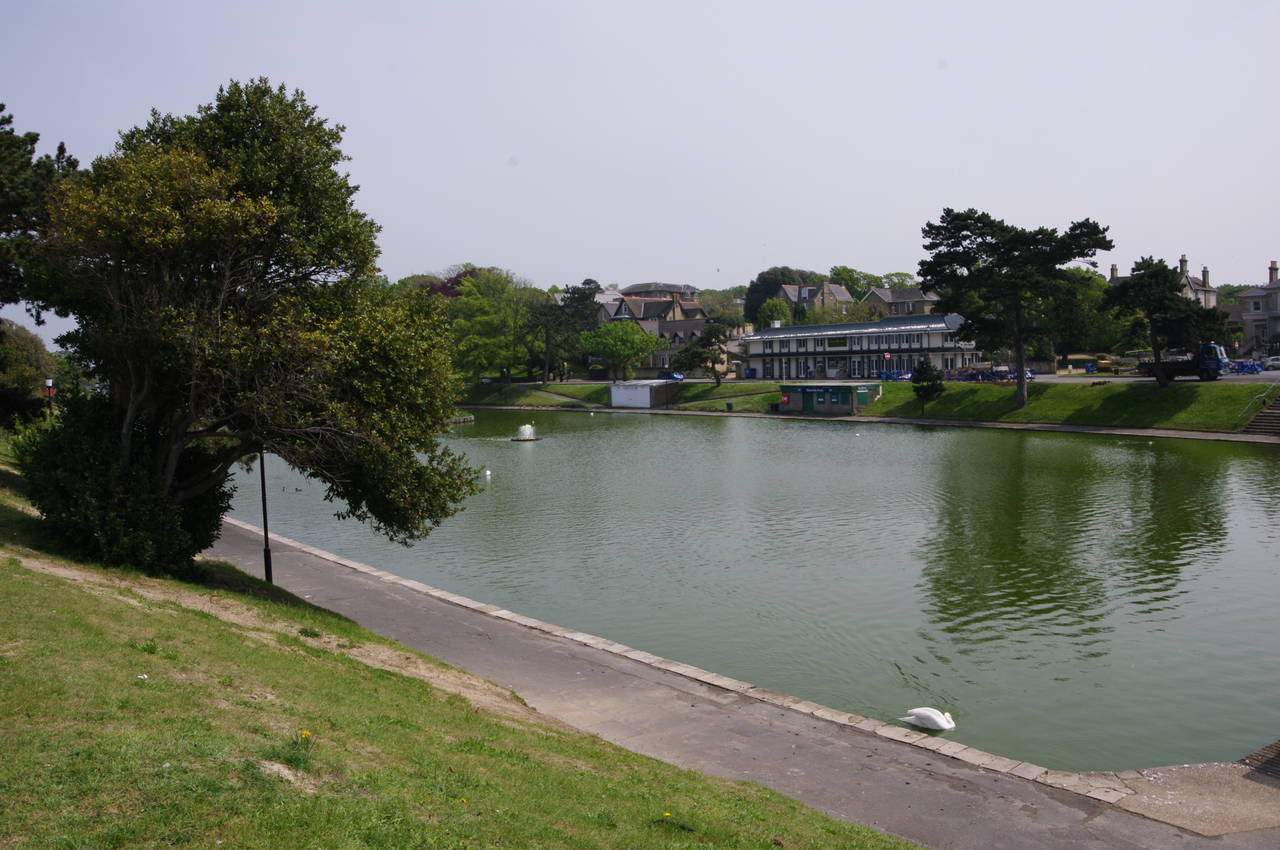
(4) Boating lake near Appley Beach
I began my walk around the Isle of Wight in the town of Ryde, which is situated on the northeastern coast of the island, roughly southwest of Southsea and Portsmouth on the mainland. I didn't start the walk until around two in the afternoon, having travelled over from Southsea by hovercraft before checking in to my accommodation in a cozy B&B not far from Ryde's centre.
My walk began at the landward end of Ryde Pier (picture 1). The oldest part of the pier, which now carries pedestrians and vehicles, was built in 1813 and 1814, stretching 527 metres out into the Solent to water deep enough for passengers to disembark from large boats. Over the following 20 years various extensions were added, increasing the length to 681 metres. In 1864 a second pier was built, next to the first, to carry trams, and in 1880 a third pier was built to carry steam trains. The tramway closed in 1969, and was partly demolished, while the railway pier now carries the Island Line's ex-London Underground trains up to the pier head. In 2011 the original pier was extensively restored and the pier is now a fine place for a walk at sunset.
From the buildings at the landward end of the pier, which house Ryde Esplanade railway station and the Ryde bus station, the Coast Path heads east along the Esplanade. Across the railway tracks, the hovercraft terminal (picture 2) occupies the sand between the pier and an ice-skating rink. The hovercraft service was England's first regular commercial service, beginning in 1965, and is now the country's last remaining commercial hovercraft service.
The railway line soon dips underground and the road continues past a ten-pin bowling alley, a pair of lawn-bowling greens and a small childrens' amusement park before the Coast Path joins a promenade at the western end of Appley Beach (picture 3). Across the road from the beach is a large boating lake, which seemed to have more swans than boats (picture 4).
(5) Appley Beach
(6) Beach huts, Appley Park

(7) Appley Tower
(8) Puckpool Point
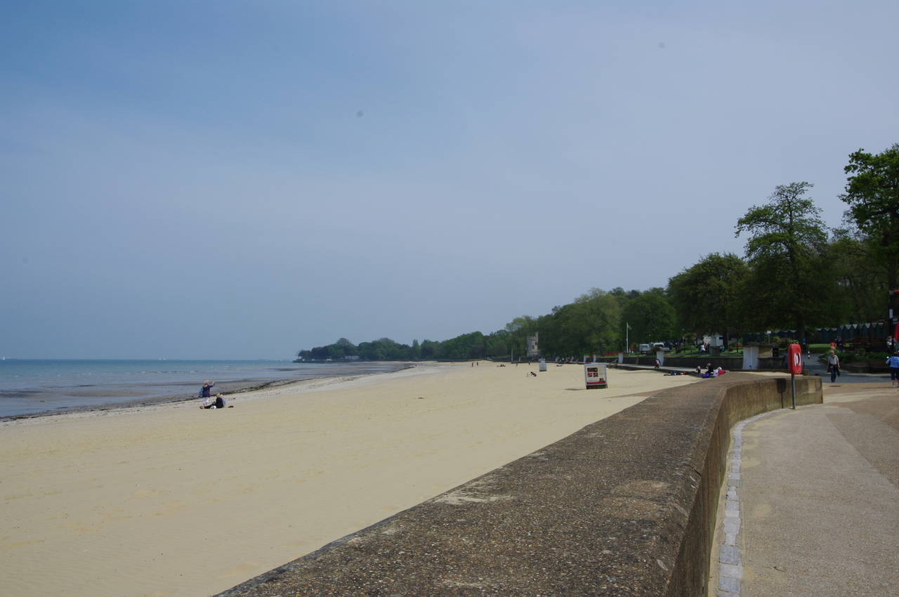
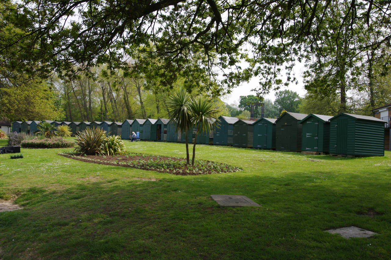
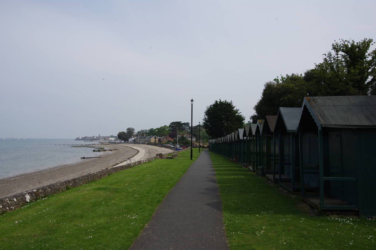
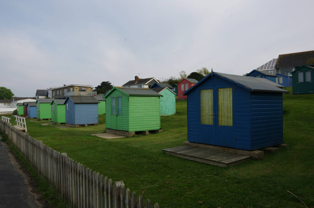
Beyond the boating lake, the Coast Path leaves the houses of Ryde behind and continues along the promenade between the white sands of Appley Beach (picture 5) and the pleasant gardens of Appley Park, where two long crescents of beach huts are set back amongst the trees (picture 6).
About half way along the beach, the path passes Appley Tower (picture 7), built in 1875 for eccentric local landowner Sir William Hutt, and now open to the public. On the opposite side of the path stands a monument for the ship HMS Sirius, which sailed from the Solent in May 1787 on an eight month journey to Australia as part of the First Fleet. The monument was donated by the Mosman Council in New South Wales and two identical copies stand at Mosman Bay in New South Wales and on Norfolk Island, where HMS Sirius ran aground and was wrecked in 1789.
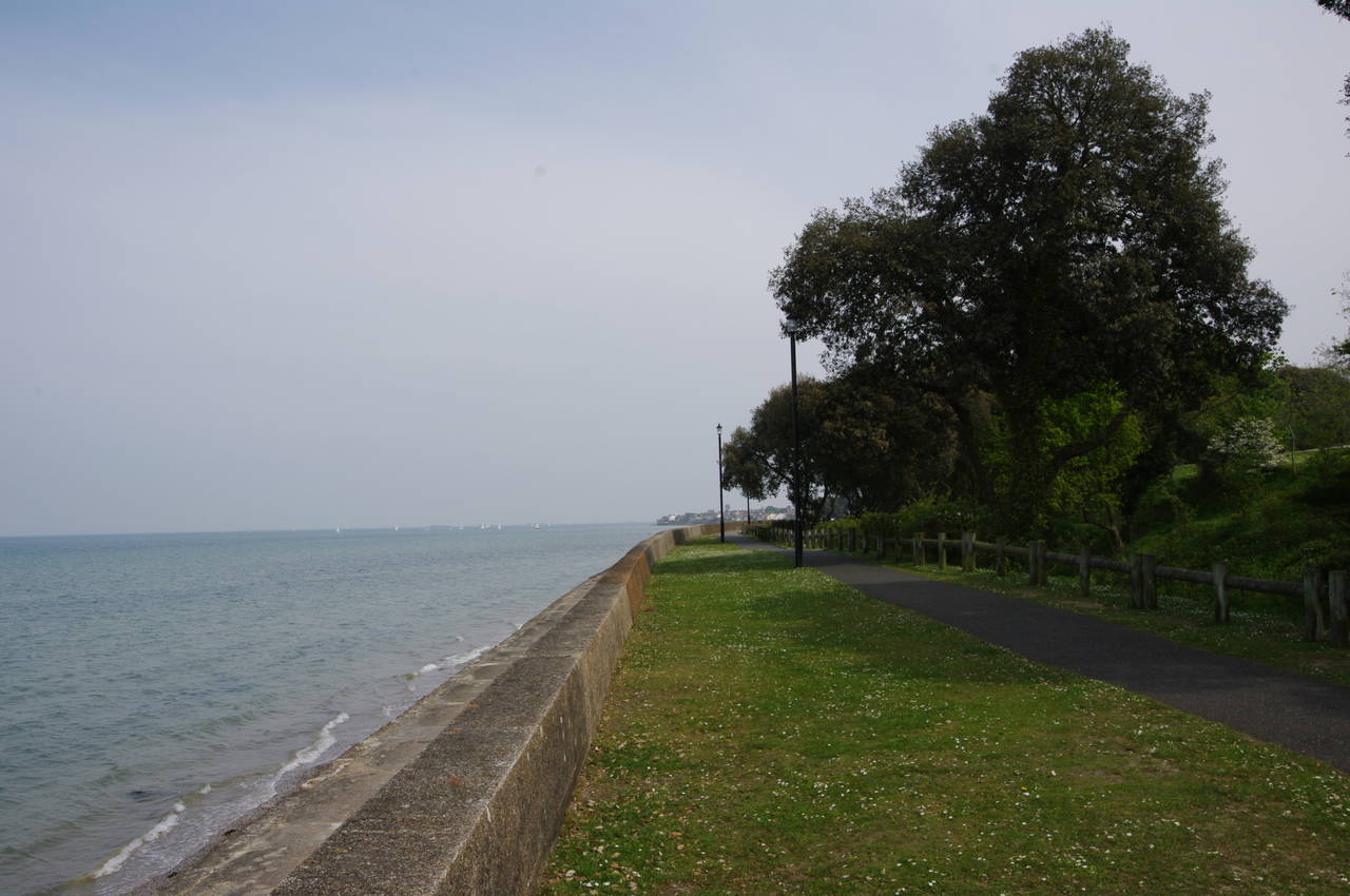
After another 500 metres, at the far end of Appley Beach, the path rounds Puckpool Point on the top of the sea wall (picture 8). From here there were hazy views across the Solent towards No Man's Land Fort and Horse Sand Fort, both built in the 1860's to protect the approach to Portsmouth. A battery was built on Puckpool Point between 1863 and 1865 as another part of the defences of the eastern Solent. The battery ceased functioning as a military establishment in 1927 and was opened as public park in 1929, though it saw further military use as a training base in World War II. While the guns are long gone, the earthern ramparts and concrete foundations of the battery are still present and show the scale of the battery that once had as many as 38 mortars trained on the marine approaches to Portsmouth.
(9) View ahead from Puckpool Point
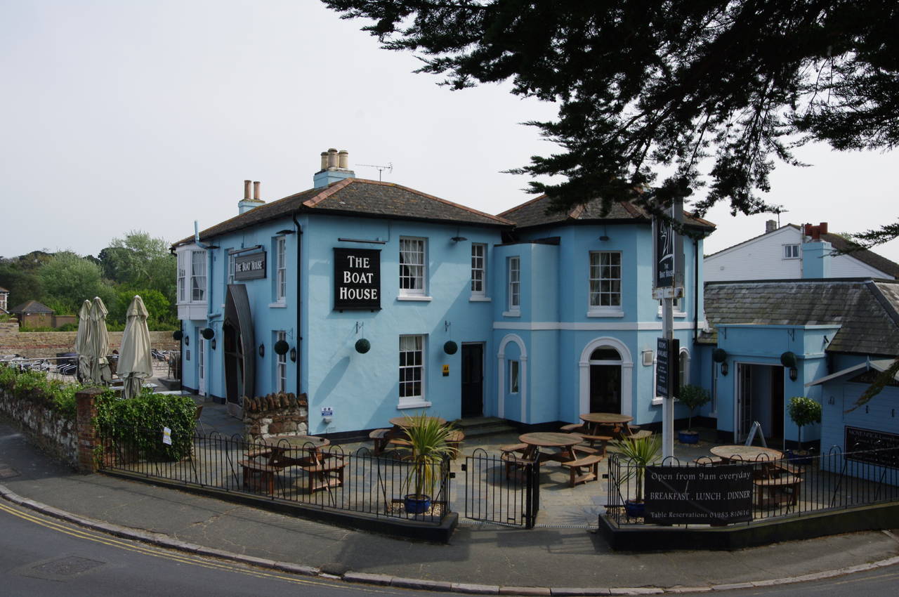
(10) The Boat House pub, Spring Vale
(11) Path beside Duver Road, Seaview
(12) Approaching Nettlestone Point
Once around the tip of Puckpool Point, the path passes a row of beach huts, with good views ahead towards Nettlestone Point (picture 9) and the shipping heading past it out in the Solent. Just beyond the huts, the Coast Path meets Springvale Road opposite the Boat House pub (picture 10).
The path crosses over to the right hand side of the road and follows the pavement past the houses of the village of Spring Vale for 400 metres to a junction where the road kinks slightly to the left and becomes Duver Road. The path crosses back to the left side of the road, where a footpath runs beside a low stone wall above the narrow, stony beach (picture 11). A plaque notes that the wall is part of a coastal protection scheme opened by Prince Phillip on the 10th of August 2004.
After about 400 metres, Duver Road turns away from the shore, having reached the small town of Seaview. The Coast Path continues ahead, following the top of the sea wall past the stone fences of seafront houses towards Nettlestone Point (picture 12).
(13) Seagrove Bay
(14) Path near Priory Hotel
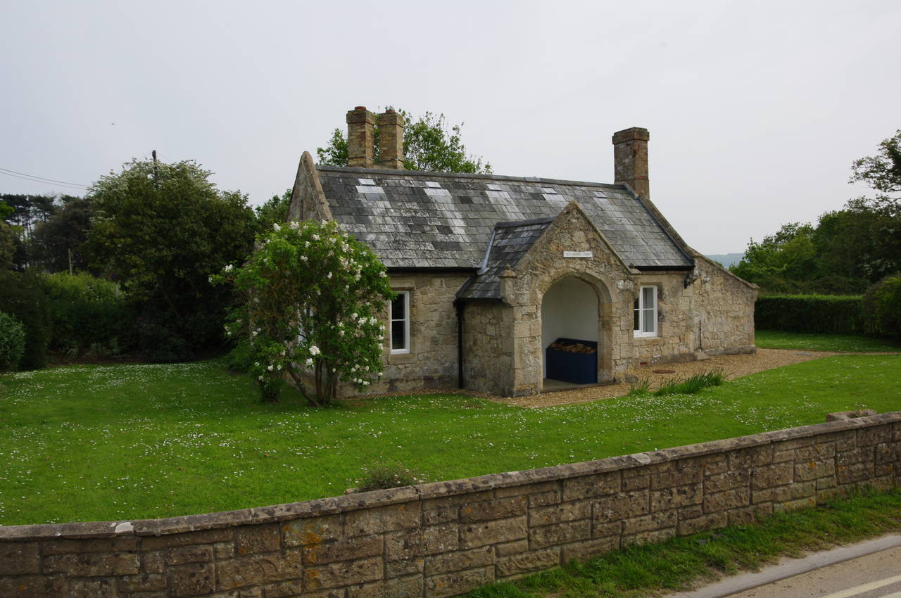
(15) Old Church Lodge
(16) St Helens Duver
On reaching the Point, the path has to briefly leave the shore to head around behind the buildings of the Seaview Yacht Club via the Esplanade. The road curves around the point before leaving the shore. Here a footpath heads down along the foot of the sea wall on the edge of Seagrove Bay (picture 13). At high-tide this part of the path is impassible and an alternate route along the road must be taken instead, but as I was passing by close to low tide it was safe to take the path along the shore.
When the path returns to the top of the sea wall, it passes by a couple of apartment buildings before following a gravel path that bears to the right, away from the shore. The path soon turns left along an unsealed lane, at the end of which a narrow path goes between houses to reach Ferniclose Road. The coast path follows this road uphill to the right, soon passing through a wooden gate and along a shady vehicle track.
After passing the gates of the Priory Hotel, the Coast Path follows a narrow path ahead for a few metres before turning sharp left along the edge of a small wood (picture 14). In 400 metres the path reaches a sealed lane (which also leads to the Priory Hotel), turning right along the tarmac.
The lane heads south beside a golf course and then past the entrance of the Nodes Point Holiday Park. After another 100 metres, a signpost on the left edge of the narrow lane directs the Coast Path off the tarmac and along footpath R85. The path descends across a small field, through a band of trees and across a small footbridge before heading along the left edge of the next field, reaching Duver Road opposite the attractive Old Church Lodge (picture 15).
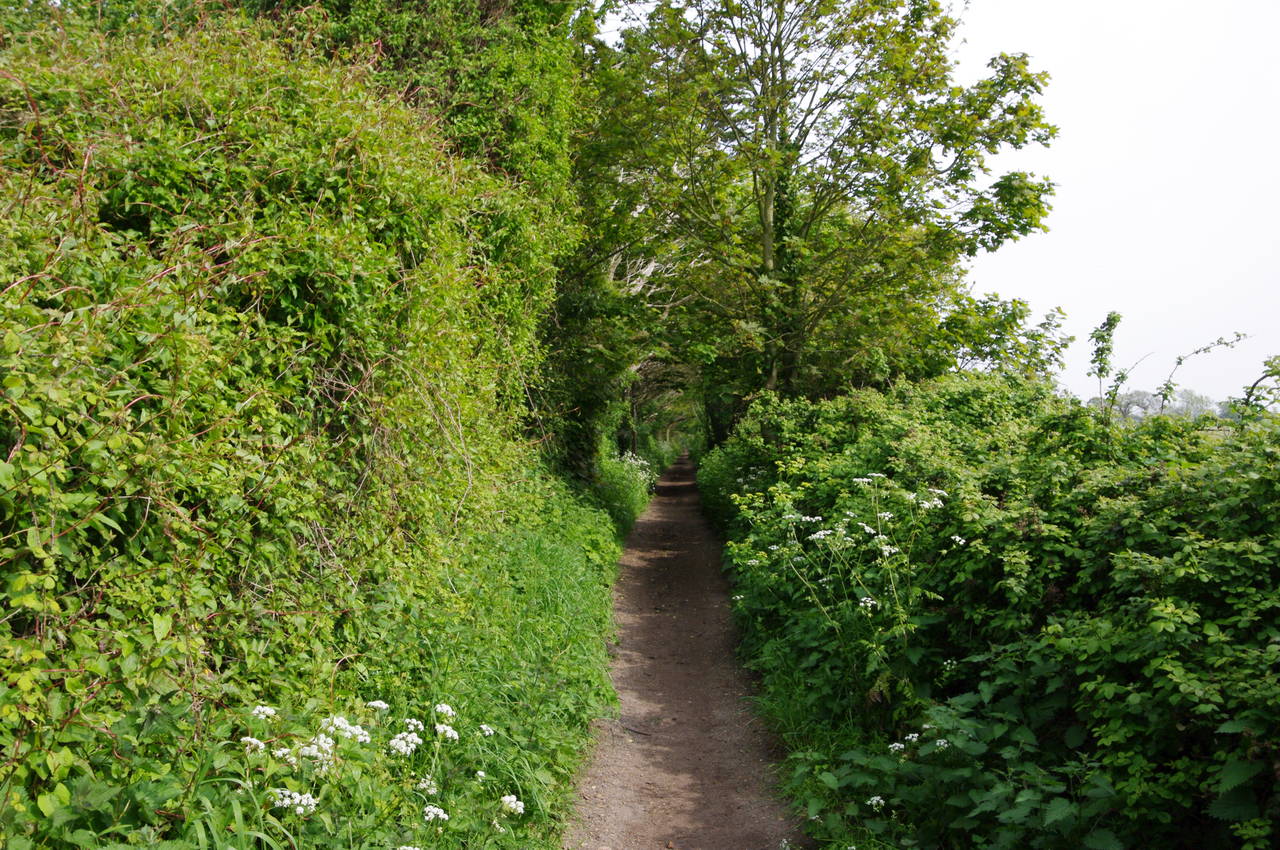
The Coast Path crosses the road and continues ahead along a lane just to the left of the lodge. The lane runs across an area of grassland known as St Helens Duver, formerly a golf course, given to the National Trust in 1961 and now returned to a more natural state (picture 16), though some features of the golf links are still quite obvious.
(17) Causeway beside Bembridge Harbour
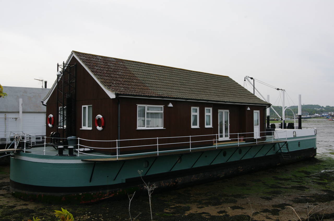
(18) Houseboat at Bembridge Harbour
(19) Royal Spithead Hotel, Bembridge
(20) Approaching Bembridge Lifeboat Station
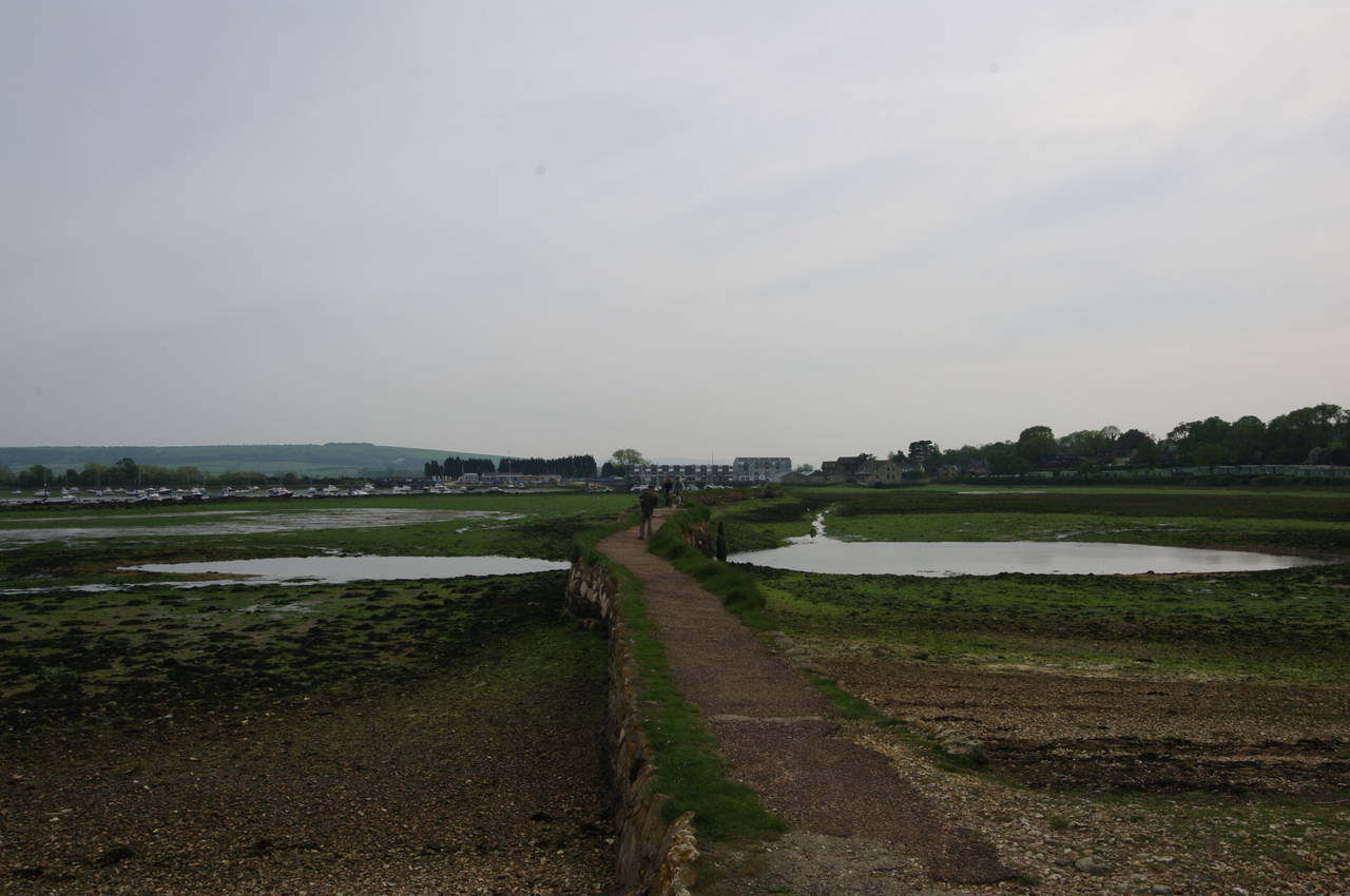
About 350 metres along the lane, the Coast Path bears right, leaving the road and crossing the grass to the right of a clump of trees to reach the end of a narrow causeway across the tidal marshes on the edge of Bembridge Harbour (picture 17). At the end of the causeway the path turns right then soon left to skirt around a small inlet and reach Latimer Road in the village of St Helens. Following Latimer Road left for 100 metres, the path then turns sharp left onto the B3395 Embankment Road, soon crossing the bridge over the River Yar.
For the next kilometre and a half, the Coast Path follows Embankment Road along the edge of Bembridge Harbour, passing all manner of boats from tiny rowing boats to a number of large houseboats (picture 18). The Embankment was built to enclose Brading Haven, the large area of formerly tidal marshland that stretches inland to the town of Brading, once a thriving port that has been left high and dry two kilometres from the sea since construction of the Embankment was completed in 1880. This was the culmination of many attempts dam part or all of the haven down the centuries, the earliest of these having been in 1338. A railway branch line originally ran along the embankment from St Helens to Bembridge, opening in 1882 and farewelling its last train in 1953.
Just after leaving the water's edge, the road bends sharply to the right in front of the Royal Spithead Hotel (picture 19). Part of the way around the bend, the Coast Path leaves the road and follows a rough gravel track, signed as Pump Lane.
The lane soon narrows to become an alleyway between houses before emerging onto Ducie Avenue, where the path turns left for about 50 metres until the tarmac curves to the right and then ends. The Coast Path continues ahead through woods, parallel to the shingle beach, initially on a grassy path and then on a rougher path through the undergrowth. After a few hundred metres, the path leaves the woods and runs for about 800 metres along the shingle beach, with the jetty of the Bembridge Lifeboat Station up ahead at Foreland (picture 20). The walk along the shingle was tough going, with the shingle sloping quite steeply towards the sea in places and shifting underfoot as I walked.
(21) Beach huts at Foreland
(22) The Crab & Lobster, Foreland
(23) View across Whitecliff Bay
(24) Yarborough Monument, Culver Down
Nearing the jetty, the route climbs some steps up to a footpath along the top of the sea wall, following it past a colourful group of beach huts (picture 21) and under the end of the jetty. About 100 metres further along the shore, a Coast Path signpost points up the grassy bank and away from the beach, just north of the Isle of Wight's most easterly point.
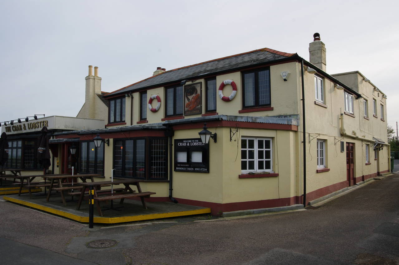
The route crosses a tarmac driveway and then continues ahead on an enclosed footpath to reach a residential part of Bembridge at Forelands Farm Lane, turning left along the lane, right into Howgate Road, then into the second street on the left, Beachfield Road. After the last house in the street, the route turns right, passing behind a coastguard station to reach the carpark of the clifftop Crab & Lobster pub (picture 22).
The Coast Path now takes a narrow path along the clifftop for about 100 metres to another carpark. Here I found the path blocked and a sign informing walkers that the next section was closed due to cliff erosion. A lengthy detour was signposted, heading back inland along Forelands Field Road and left into Howgate Road, just a few houses along from where I last left it. At the far end of the quiet residential street, after almost a kilometre, the alternative route turns right for about 50 metres then left into Hillway Road.
After about 500 metres, just past the Bembridge School, a big Coastal Path Diversion sign pointed down a gravel track called Jenny Streets Lane. The track soon narrows before skirting around the school gymnasium and returning to the official route of the Coast Path on a clifftop above Whitecliff Bay.
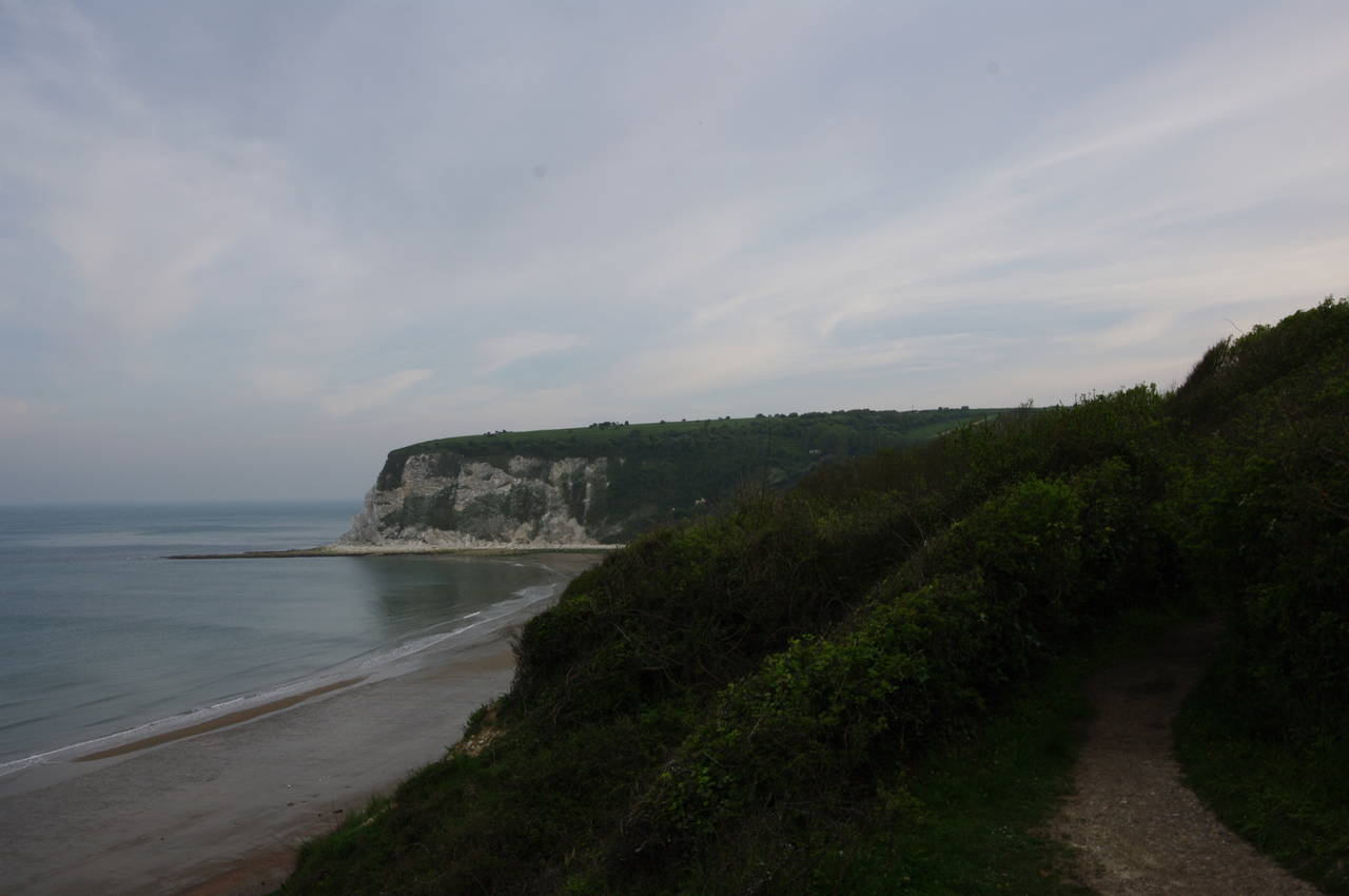
The route follows a narrow path through the trees on the clifftop. At first the path is quite enclosed, but after a short distance a gap in the foliage gives a good view across the calm bay (picture 23). A little further along the clifftop, the path bears right through a gap in the corner of a wire fence and cuts across a small picnic area and around the end of a steep path down to the beach. Returning to the clifftop, the path runs alongside another of the large caravan parks that are placed at regular intervals along the Isle of Wight's coast.
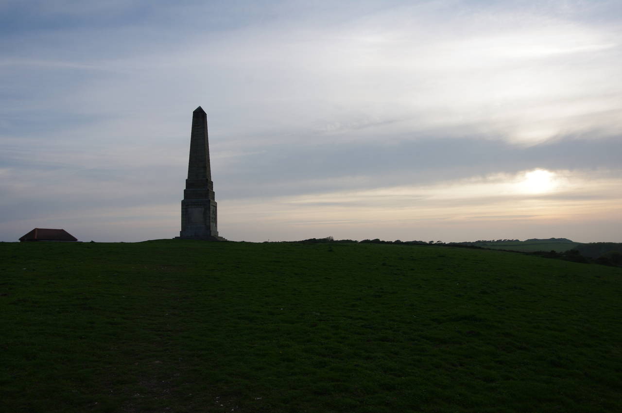
At the far end of the caravan park, the path snakes around the edge of a small field before climbing through a small patch of bushland to a stile. Back in the open, the path now climbs steeply up the grassy slope of Culver Down towards a tall stone obelisk (picture 24). The obelisk, in memory of Lord Yarborough, the first Commodore of the Royal Yacht Squadron was originally erected a few hundred metres to the east on the summit of Culver Down in 1849 before being moved here in 1867 to make way for a defensive gun battery overlooking the Solent.
(25) Sandown Bay
(26) Landslip, Red Cliffs

(27) View back towards Culver Cliff
(28) Approaching Sandown
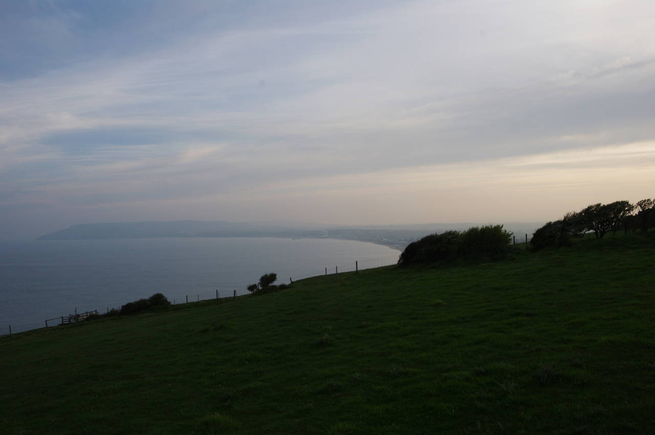
A few metres past the monument, the path goes through a metal kissing gate at the edge of Culver Down Road, which goes up to the gun emplacement on the left. The Coast Path goes in the other direction however, passing the Culver Haven Inn before bearing left off the road and back to the grassy top of Culver Cliff, almost 100 metres above Sandown Bay.
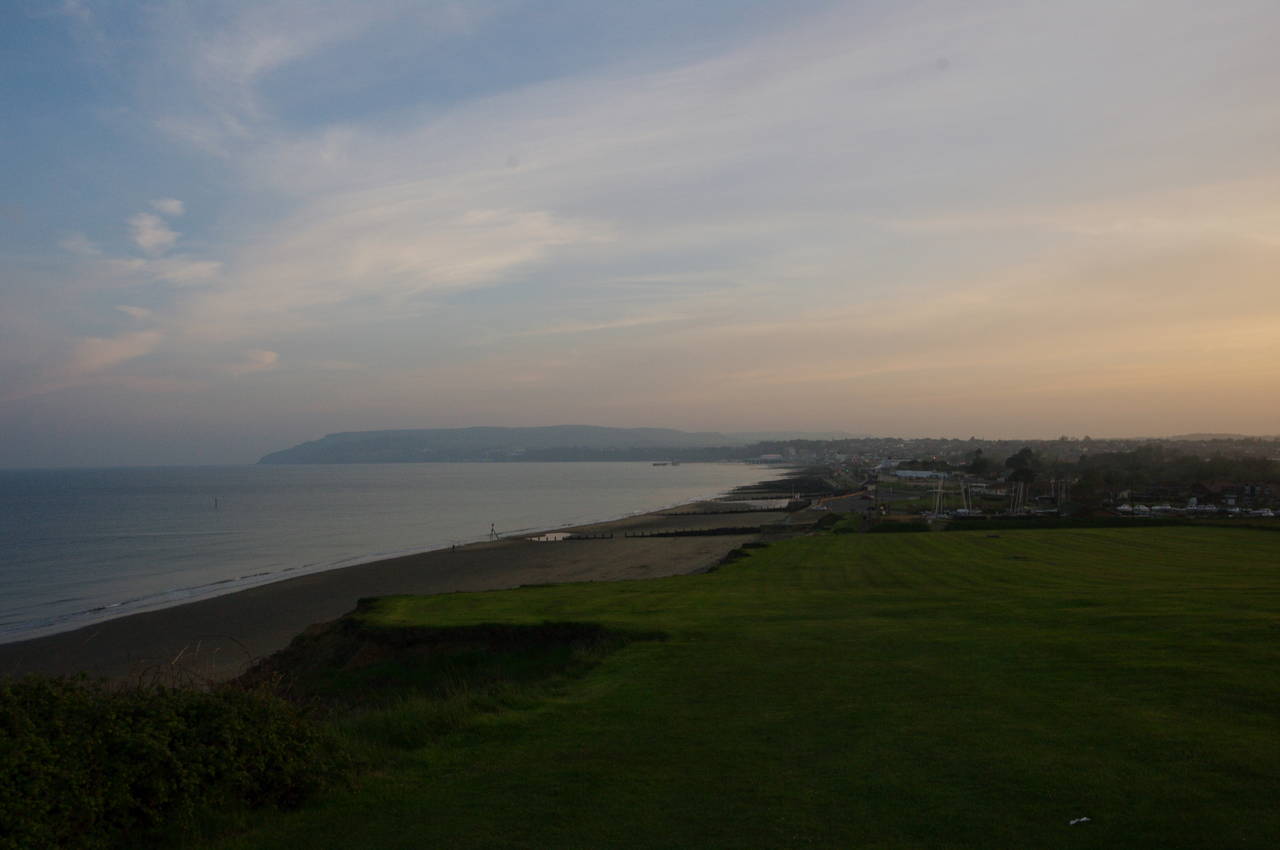
For the next three kilometres the Coast Path follows the cliff edge as it gently descends towards the town of Sandown. It was now only about 40 minutes before sunset and the view over the long sweep of the bay was quite difficult to see in the haze (picture 25). With the lack of any other people about on the path and hardly any sounds coming from the unusually calm sea far below, the descent from Culver Down was very peaceful, seeming far more isolated than it actually is.
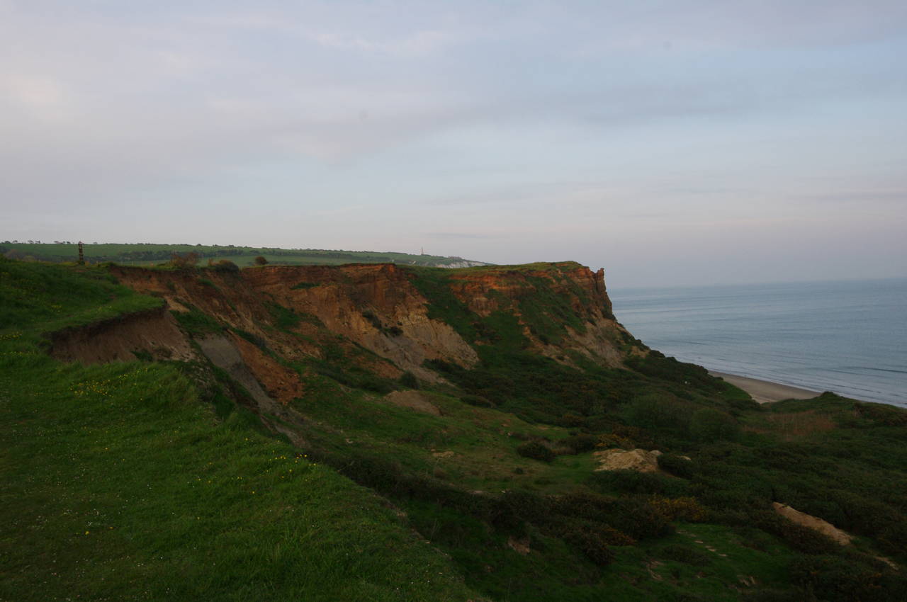
About 400 metres down from the road, the chalk cliff suddenly changes to the crumbly clay of the aptly-named Red Cliffs and for the rest of the descent the clifftop path winds its way around a series of spectacular landslips above a long, sandy beach (pictures 26 and 27). Towards the end of the descent, the Victorian town of Sandown, the island's largest resort town, gradually emerged from the haze (picture 28).
(29) Sundown at Sandown
(30) Seafront restaurants, Sandown
(31) War Memorial, Sandown
(32) Sandown Pier
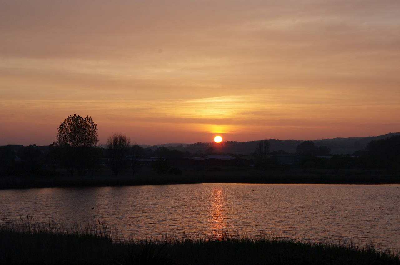
Nearing the bottom of the downs, the path passes the Sandown Bay Holiday Centre, a boatyard, and a large beachside carpark before Yaverland Road comes in from the right to join the coast next to the sea wall and the long line of groynes that protect Sandown's seafront from erosion. A few minutes walk along the road, which soon becomes Culver Parade, I paused opposite a small lake to watch the sun set over the hills that run across the middle of the island (picture 29).
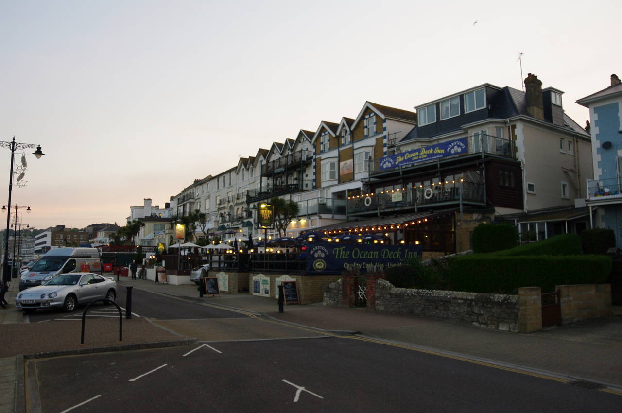
After another 500 metres, Culver Parade reaches a small roundabout where five streets converge. While Sandown's High Street continues straight ahead, the Coast Path goes left down the short Avenue Road Slipway to follow The Esplanade along the beach opposite a line of mostly Victorian hotels and restaurants (picture 30).
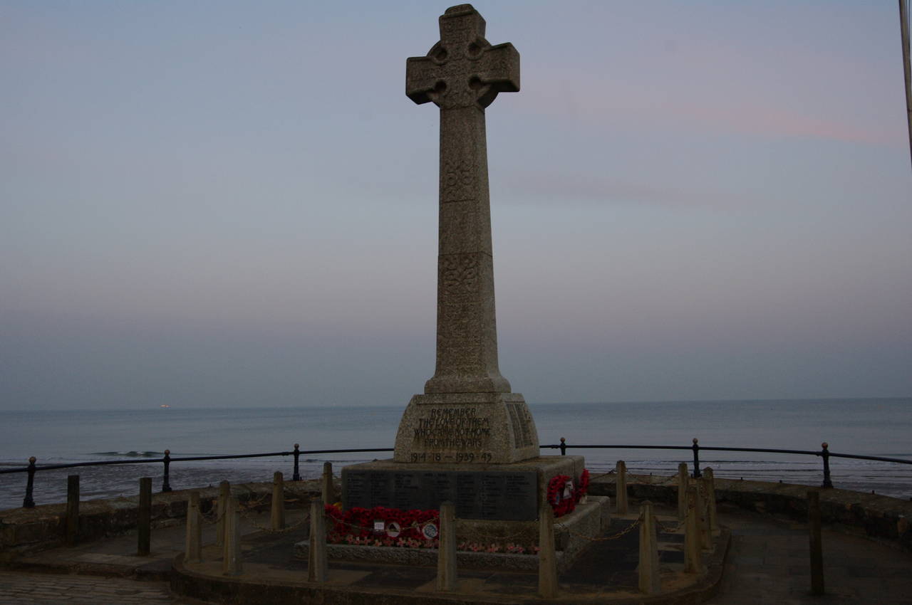
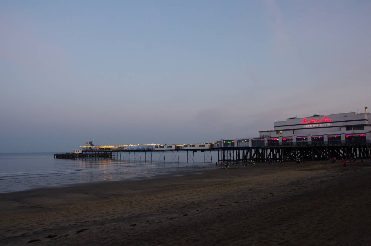
After around 400 metres the Esplanade passes by the town's memorial to the local soldiers who were lost in the two World Wars (picture 31), and after another hundred metres I reached the end of the evening's walk at Sandown Pier (picture 32), with my GPS showing 19.9 kilometres covered from Ryde Pier.
From the pier it was about fifteen minutes walk up through the town to the railway station to catch an Island Line train back to Ryde.