CAPITAL RING
Stage 6: Highgate to Woolwich Foot Tunnel
Monday, October 01, 2012
(1) Highgate Spinney
(2) Archway Road, Highgate
(3) Disused railway tunnel on Parkland Walk
(4) Parkland Walk
I returned to Highgate on a rather cold and gloomy morning to resume my walk around the Capital Ring. There had been some overnight rain, but that had stopped several hours earlier, so despite forecasts of more rain to come I decided to start the walk and see what happened with the weather. After all, there's virtually nowhere on the Capital Ring that isn't within easy reach of public transport.
One thing I've learned on my walking trips to England is to always carry wet weather gear, regardless of the state of the weather when I start walking. That rule has saved me a drenching on quite a few occasions.
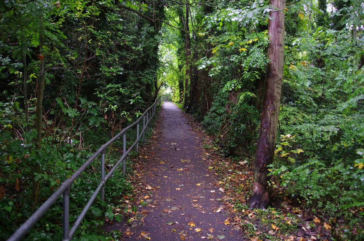
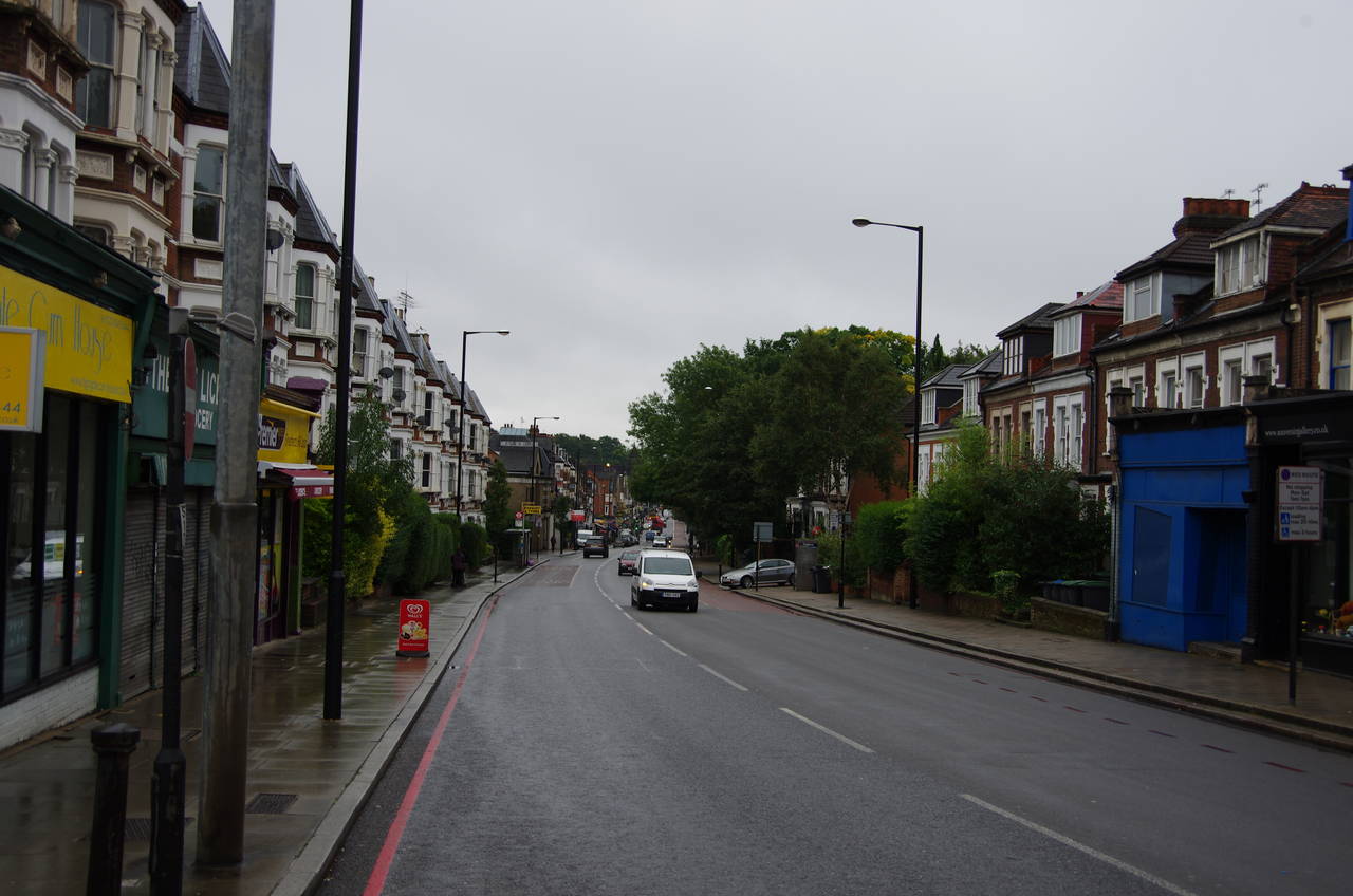
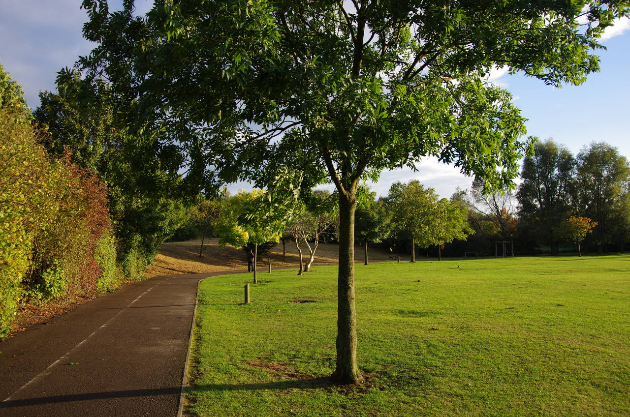
I rejoined the Capital Ring in Priory Gardens, a quiet residential street just behind Highgate Station. A footpath between numbers 63 and 65 leads into an area of woodland called Highgate Spinney (picture 1) and on to Shepherd's Hill opposite the Highgate Library. The route crosses over and turns right for 50 metres to a junction then left along the busy Archway Road (picture 2), then left again into Holmesdale Road after another 50 metres. A short distance along this road, a gate on the left takes the Capital Ring onto the Parkland Walk.
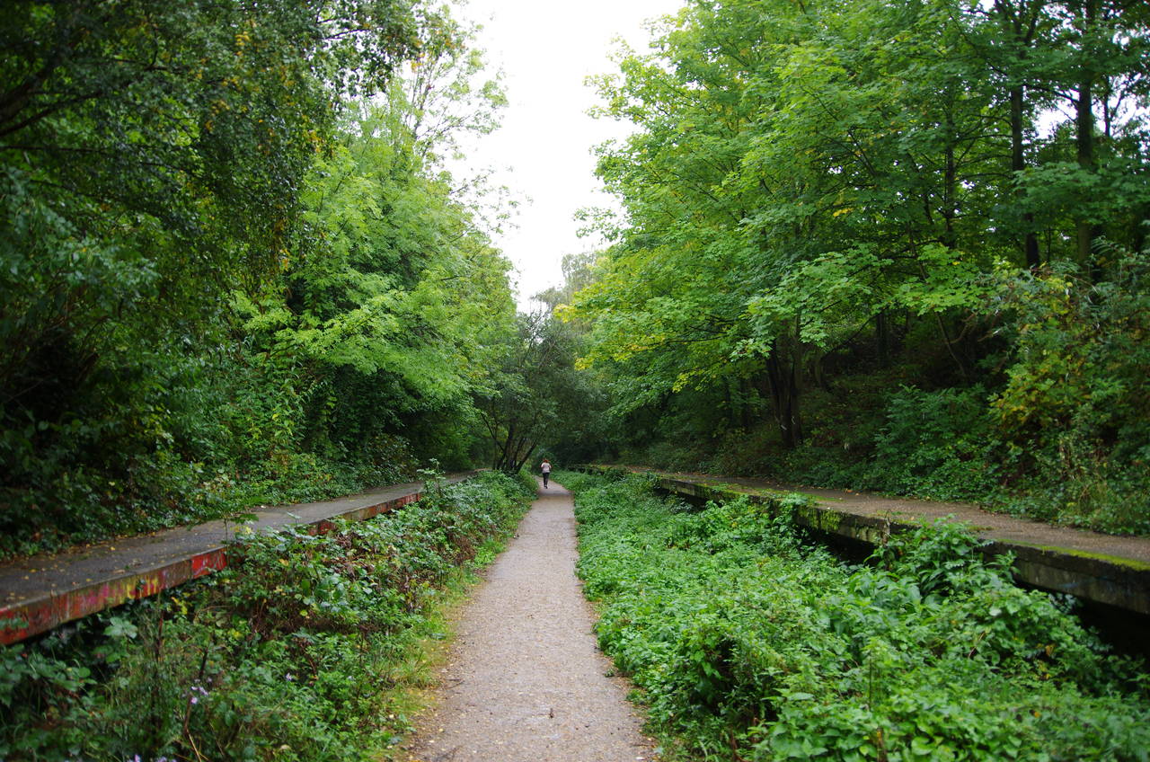
The Parkland Walk uses the trackbed of the same disused railway branch line that I had crossed in Highgate Wood near the end of the previous stage of my walk. Opened in 1867, the line ran from Finsbury Park to Edgware and operated until 1954 for passenger traffic before closing entirely in 1970. By 1984, the line had become the property of the Borough of Haringey, the tracks had been lifted and the land turned into a nature reserve and walking path.
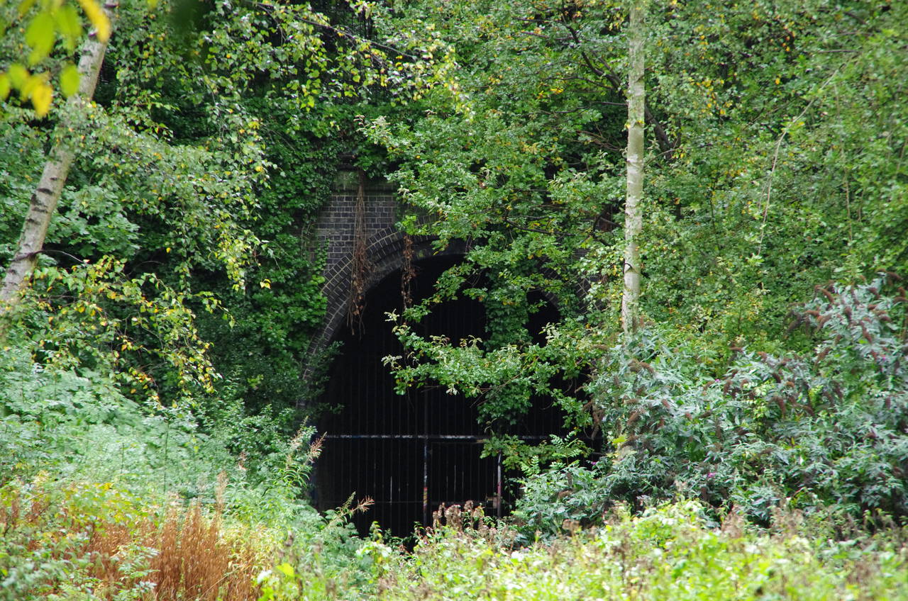
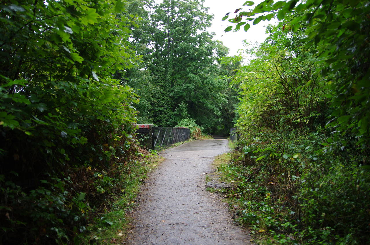
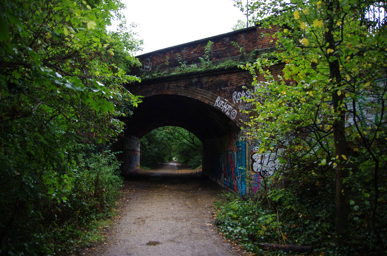
A short distance to the left of the entrance, one can see the opening of a tunnel that took the line under Highgate Hill (picture 3), but the Capital Ring turns right to follow the trackbed in the direction of Finsbury Park, almost three kilometres away. Every now and then the long stretch of greenery is broken by a former railway bridge carrying the path over urban streets (picture 4).
(5) Former Crouch End Station
(6) Path under Mountview Road
(7) East Coast Main Line
(8) Finsbury Park
About halfway to Finsbury Park, the path passes between the platforms of the former Crouch End Station (picture 5). It was interesting to see how far nature has gone towards reclaiming this territory in just over 40 years since the line closed.
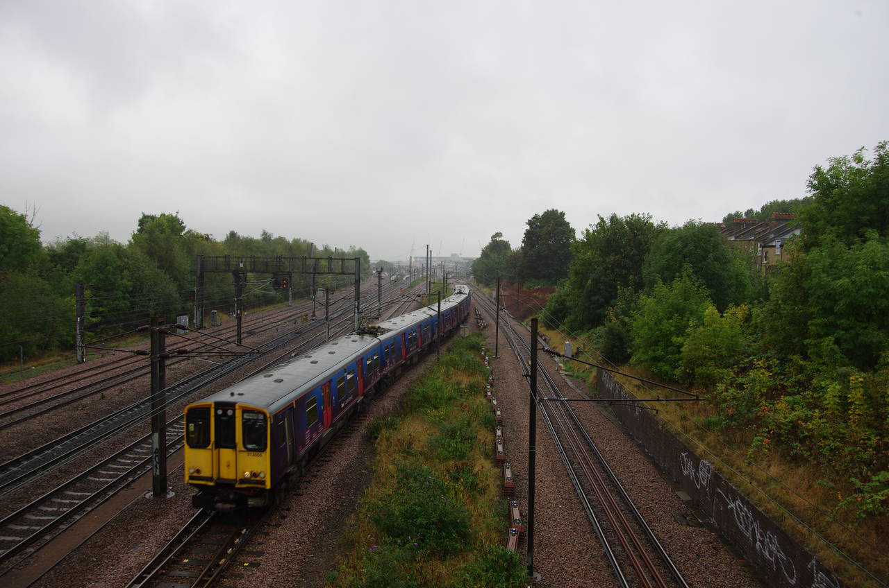
Continuing along the Parkland Walk, the Capital Ring visits the Borough of Islington for about 500 metres, passing under several more urban roads, including a rather substantial brick bridge carrying Mountview Road (picture 6). Returning to the Borough of Haringey, the trackbed then takes a long and gentle curve to the right to the point where the branch line used to join the East Coast Main Line, which carries trains between London and Scotland. Here a footbridge crosses over the railway (picture 7), to reach Finsbury Park (picture 8), one of North London's largest parks.
(9) Boating Lake, Finsbury Park
(10) McKenzie Flower Garden, Finsbury Park
(11) New River

(12) New River and East Reservoir, Stoke Newington
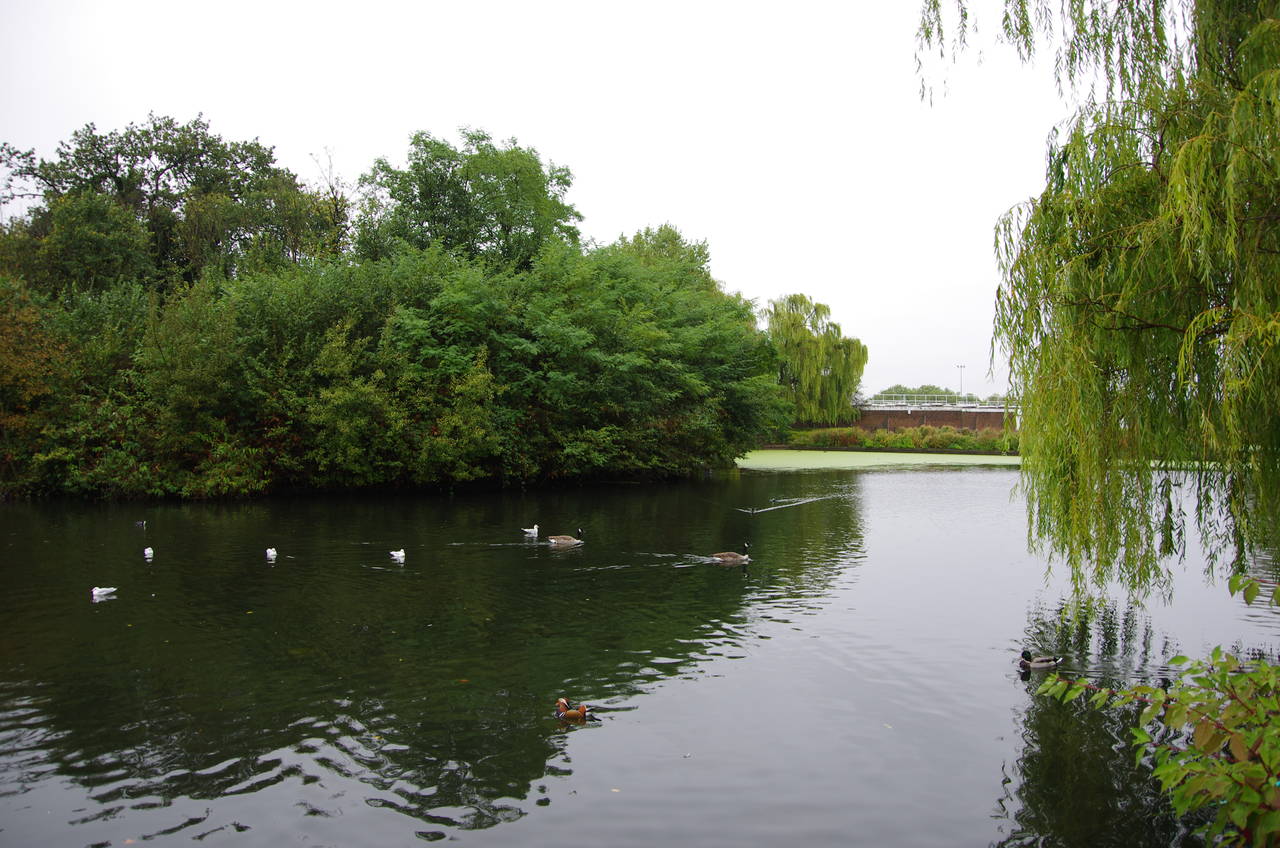
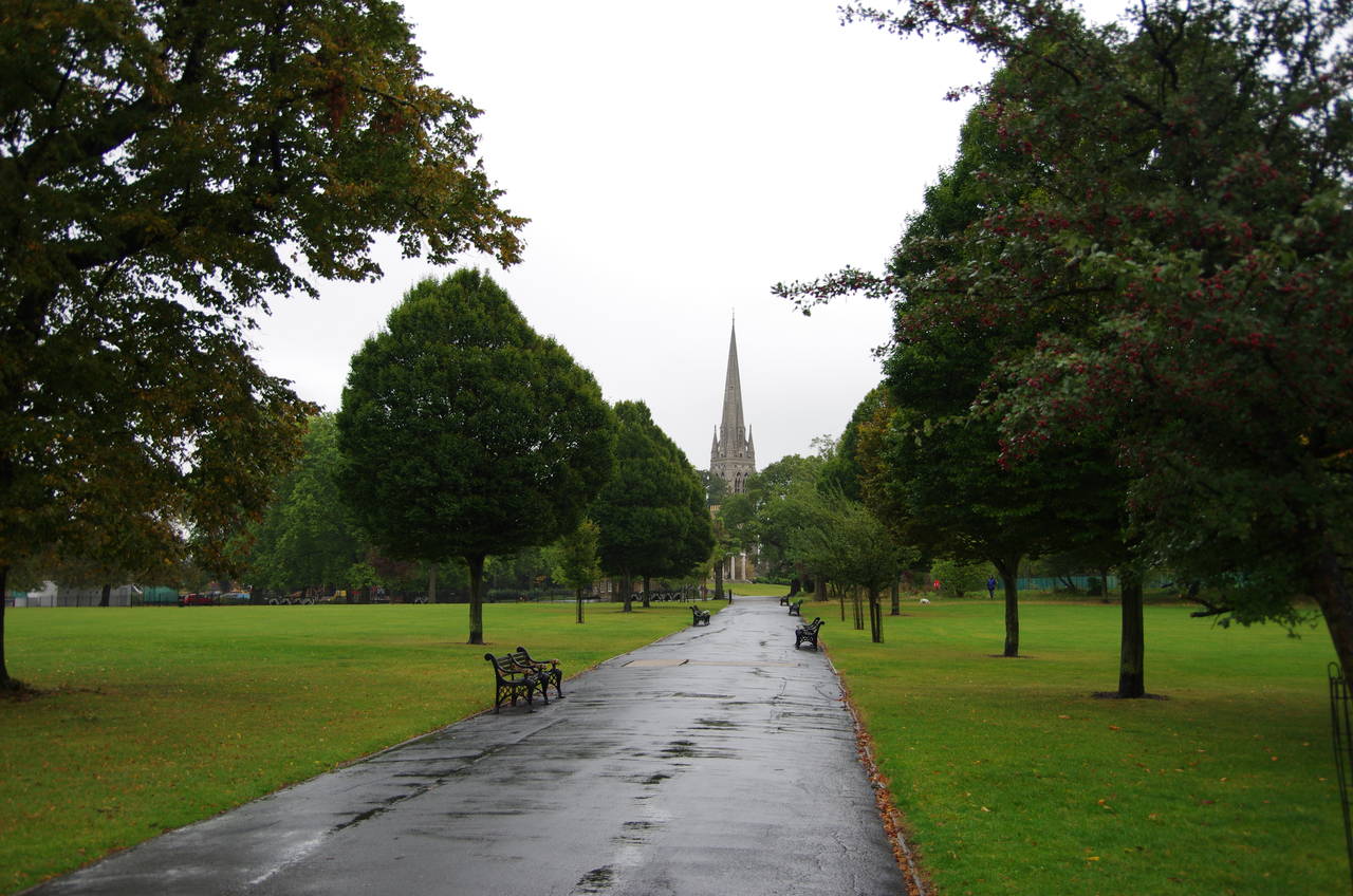
The Capital Ring continues ahead across Finsbury Park, passing a little to the right of the park café before skirting around the right-hand side of a playground to reach a path junction by the McKenzie Flower Garden. The Capital Ring bears right to head through the flower garden, but first I made a very short diversion to the left for a look at the park's boating lake (picture 9), and it's large population of ducks.
A tarmac footpath goes through the middle of the flower garden (picture 10), then continues ahead to a path junction where a main signpost stands next to a three sided shelter. The signpost indicates that the Capital Ring bears slightly left past the shelter and the end of an athletics track that encircles an American Football field. Beyond the next junction the path enters a more wooded corner of the park, curving to the right to leave the park beside the A105 Green Lanes. The Capital Ring crosses the road here, and in so doing crosses from the Borough of Haringey into the Borough of Hackney.
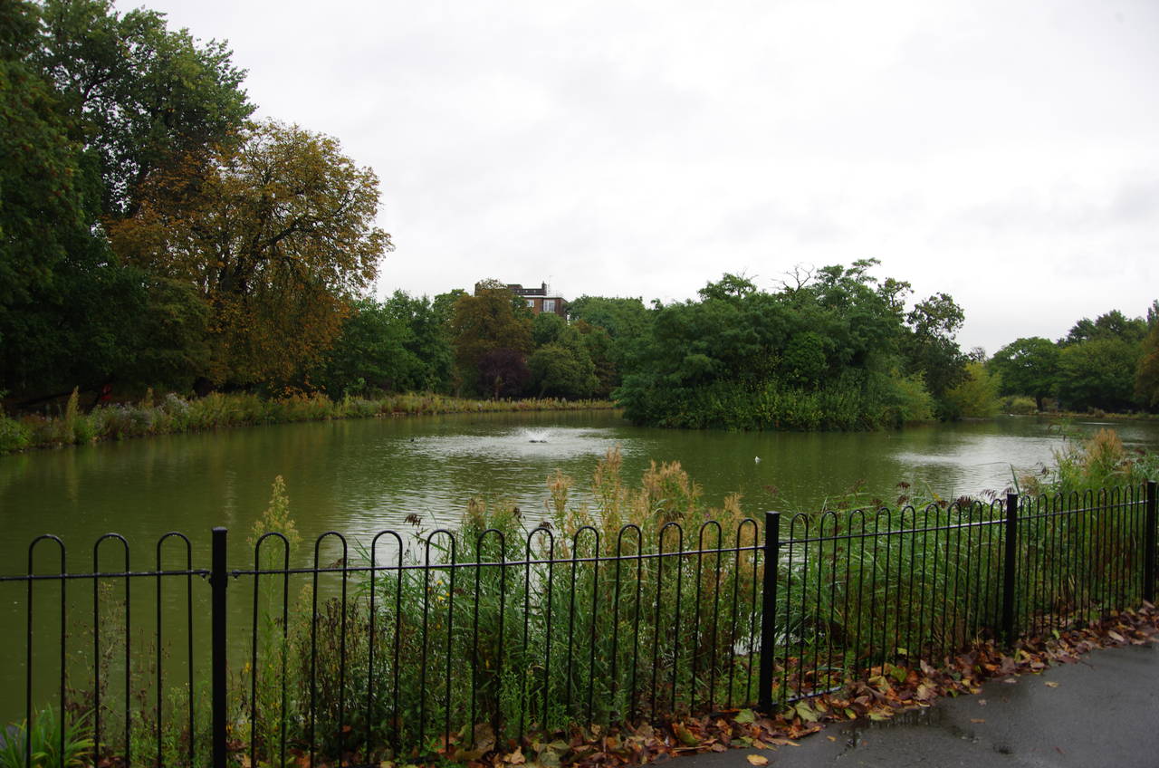
Twenty metres to the left, the route turns right along the New River Path (picture 11). In truth, the New River is neither new nor a river -- rather it is a shallow, artificially constructed waterway, completed in 1613, designed to bring fresh drinking water from the River Lea in Hertfordshire to London.
For the next 700 metres the Capital Ring follows the right bank of the New River by the back fence of a large council housing estate. On reaching the A503 Seven Sisters Road, the route uses a pedestrian crossing to the left before rejoining the New River, which soon bends around to the right to run beside the East Reservoir at Stoke Newington. As I headed along this section of the path it began to rain (picture 12) and by the time I reached Woodberry Grove, which separates the East Reservoir from the larger West Reservoir, it was coming down quite heavily and I decided to take shelter at a new apartment building next to the New River on the other side of the road.

(13) New River and West Reservoir, Stoke Newington
(14) The Castle, Stoke Newington
(15) Clissold Park
(16) Beckmere, Clissold Park
After donning my wet weather gear, I set off again, following the New River along the edge of the West Reservoir (picture 13). About halfway around the reservoir, the New River ends. The original course of the New River went several kilometres further, ending at Islington, but in 1946 the river was truncated to feed the reservoirs.
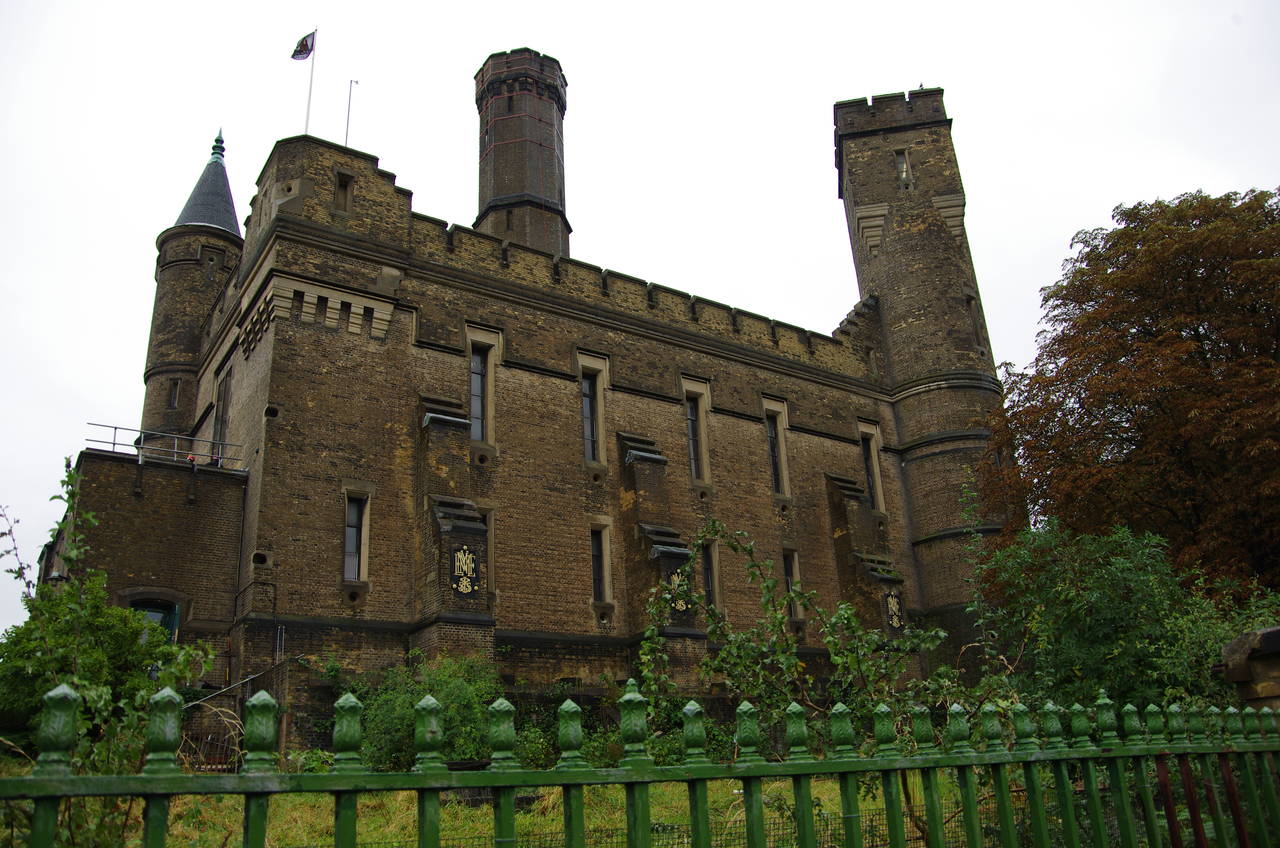
Near the end of the river a footbridge crosses over to the access road of the West Reservoir's sailing club and the Capital Ring follows the road to the right to a main signpost where the path turns left, joining the A105 Green Lanes for a second time. By the corner stands The Castle (picture 14), built in 1855 as another one of London's grand Victorian pumping stations, though it has since been turned into an indoor rock climbing centre.
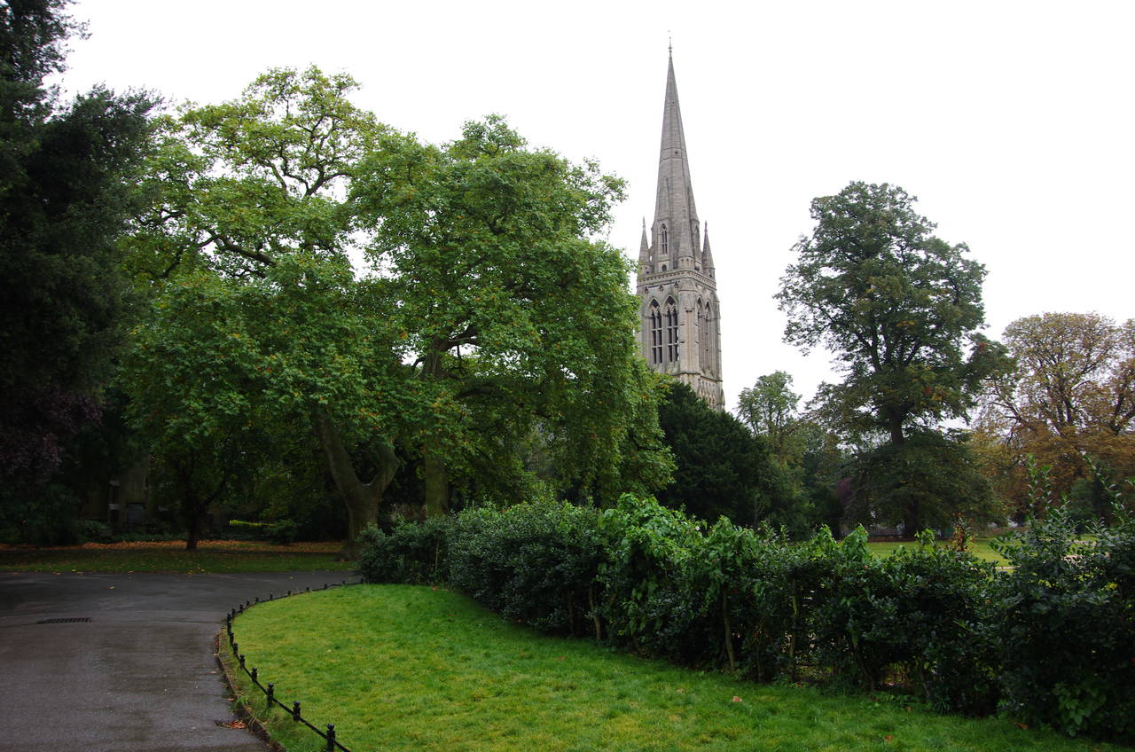
Following the left-hand pavement, the Capital Ring crosses over the B105 Lordship Park and then the more minor Greenway Close, just beyond which a gate takes the route into Clissold Park. At a path junction just inside the gate, the Capital Ring ignores the obvious broad footpath ahead with the spire of Stoke Newington's St Mary's Church rising above the trees beyond the far edge of the park (picture 15), and instead bears left onto a path along the edge of a small lake, Beckmere (picture 16). Between this lake and a second one, Runtzmere, the route turns right along another footpath to reach the side of Clissold House, the mansion after which the park takes its name.
(17) St Mary's Church, Stoke Newington
(18) Ancient Mother Church, Clissold Park
(19) Abney Park Cemetery
(20) Chapel in Abney Park Cemetery
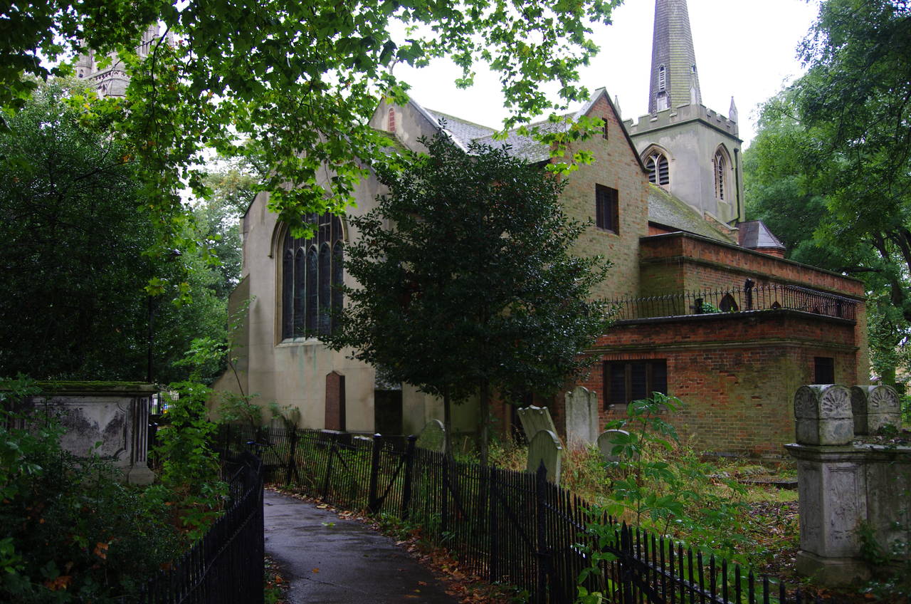
Heading around to the left of the house, the path has another good view of the 65 metre high spire of St Mary's (picture 17) before passing by its much smaller 16th-century predecessor, the Ancient Mother Church, hidden among the trees (picture 18). A fenced path through the old graveyard leads out to B104 Stoke Newington Church Street, opposite St Mary's. At a little over 6 kilometres from Trafalgar Square, this is the closest point of the Capital Ring to the centre of London.
Mercifully, the rain had been gradually easing off as I crossed the park and had just about stopped by the time I reached the road.
The Capital Ring turns left on Church Street, following it through the centre of Stoke Newington for about 550 metres. Towards the end of this stretch, the road passes the Daniel Defoe pub, named after the author and political dissenter, best known for writing Robinson Crusoe, who lived in Church Street.
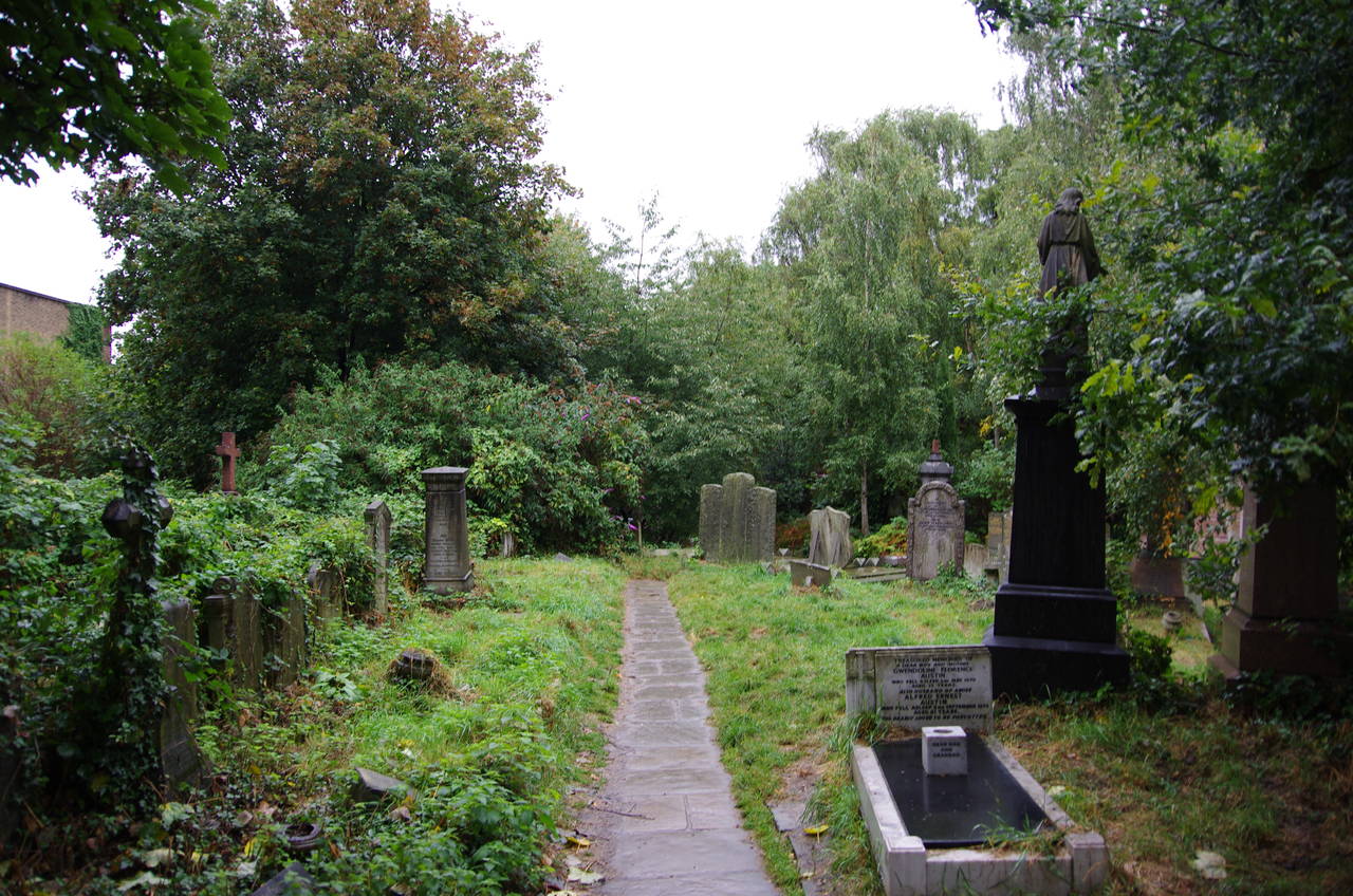
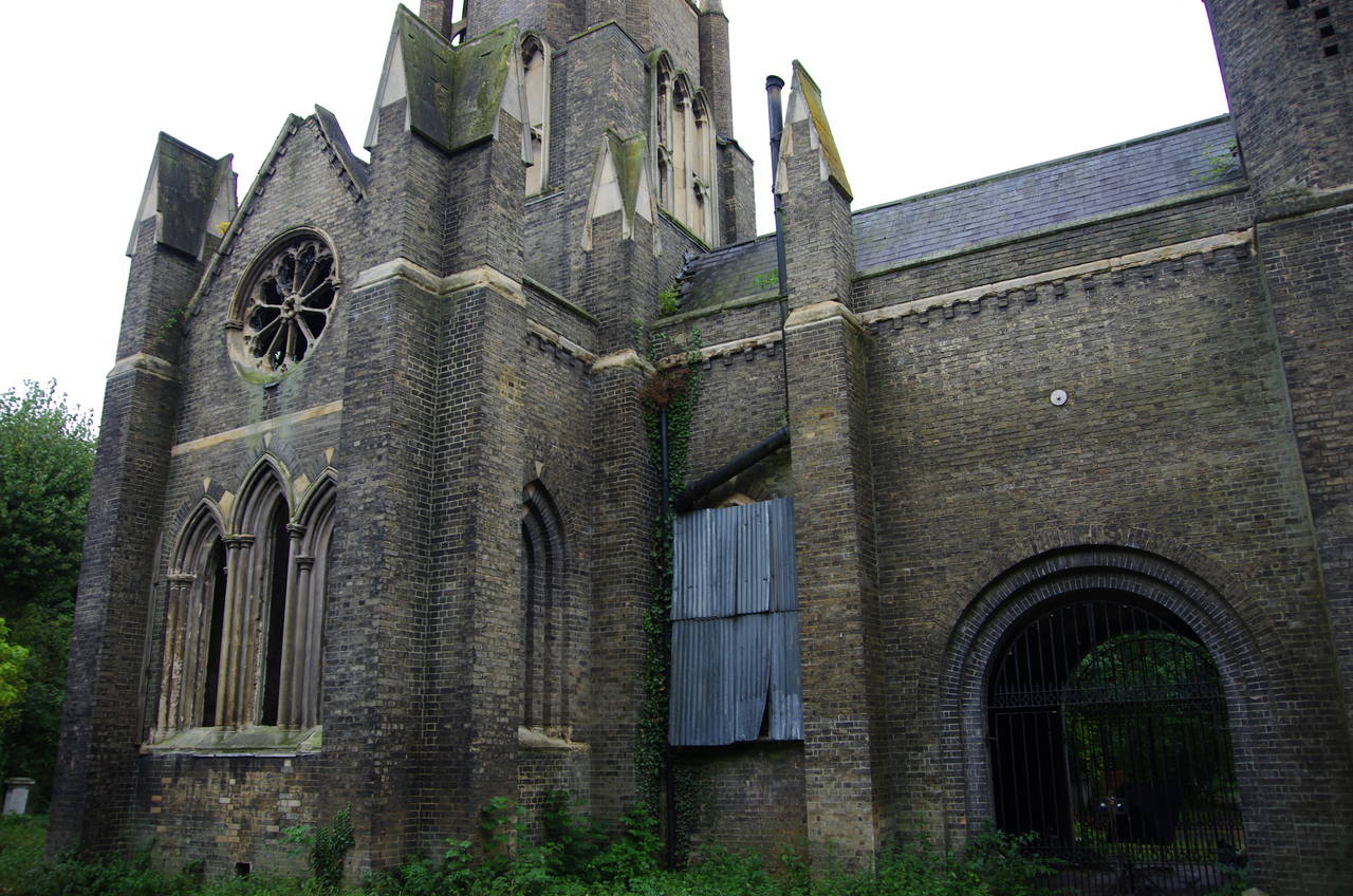
Just past the pub, the Capital Ring leaves the road via a gate on the left and ventures into a very different environment, the Abney Park Cemetery (picture 19). Officially, almost 197,000 Londoners were buried here between 1840 and 1978, when the 12.5 hectare site passed into the ownership of the local council. As a non-denominational cemetery, many of the people buried here were religious non-conformists who could not be laid to rest in London's other cemeteries. Since 1978, the rather overcrowded cemetery has only occasionally gained new residents and has become rather overgrown as nature has gradually taken over, giving the whole place a surprisingly pleasing air of decay, especially after the rain.
The Capital Ring follows narrow paths among the closely-packed graves to reach the disused chapel in the centre of the cemetery (picture 20). Among the notable graves passed on the way is that of William and Catherine Booth, who founded the Salvation Army in 1865. Turning right to pass the chapel, the Capital Ring follows a broader path out to the cemetery's main gate beside the A10 Stamford Hill.
(21) Springfield Park

(22) Springfield Park
(23) Horseshoe Bridge
(24) River Lea and Walthamstow Marshes
Across Stamford Hill and a few metres to the left, the Capital Ring turns into Cazenove Road. After about 250 metres, the route turns into the second street on the left, Kyverdale Road, which is only followed briefly to a right turn into Filey Avenue. The latter is followed all the way to it's junction with the A107 Upper Clapton Road, where the path turns left to make use of a zebra crossing then backtracks a few metres along the other side to turn into Springfield. Past a few houses, a gate on the left leads into Springfield Park.
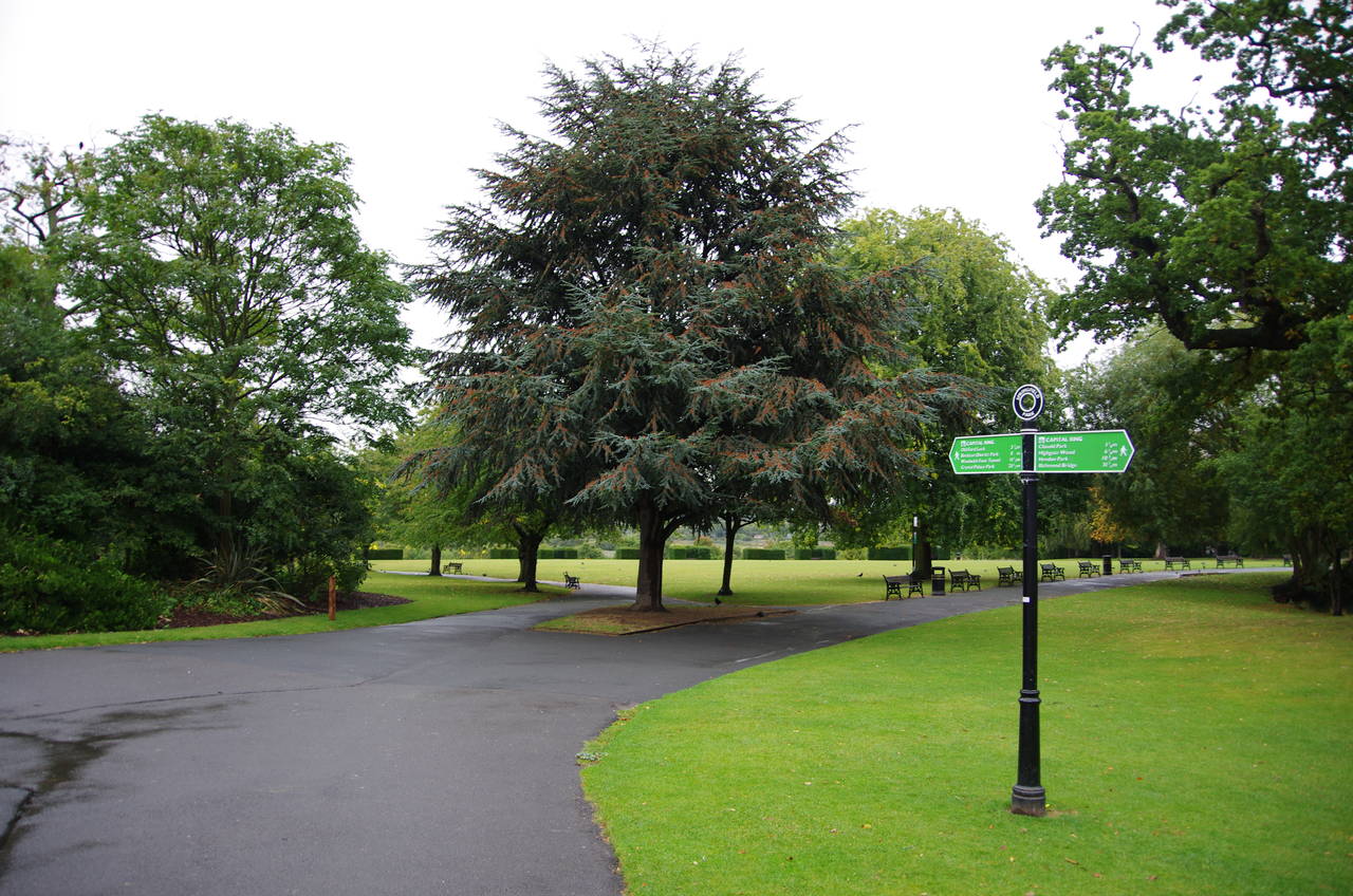
The path heads between the 19th-century Springfield House and a lake to a path junction where a main signpost (picture 21) indicates the route ahead on a tarmac path which soon heads downhill with good views across the Lea Valley (picture 22).
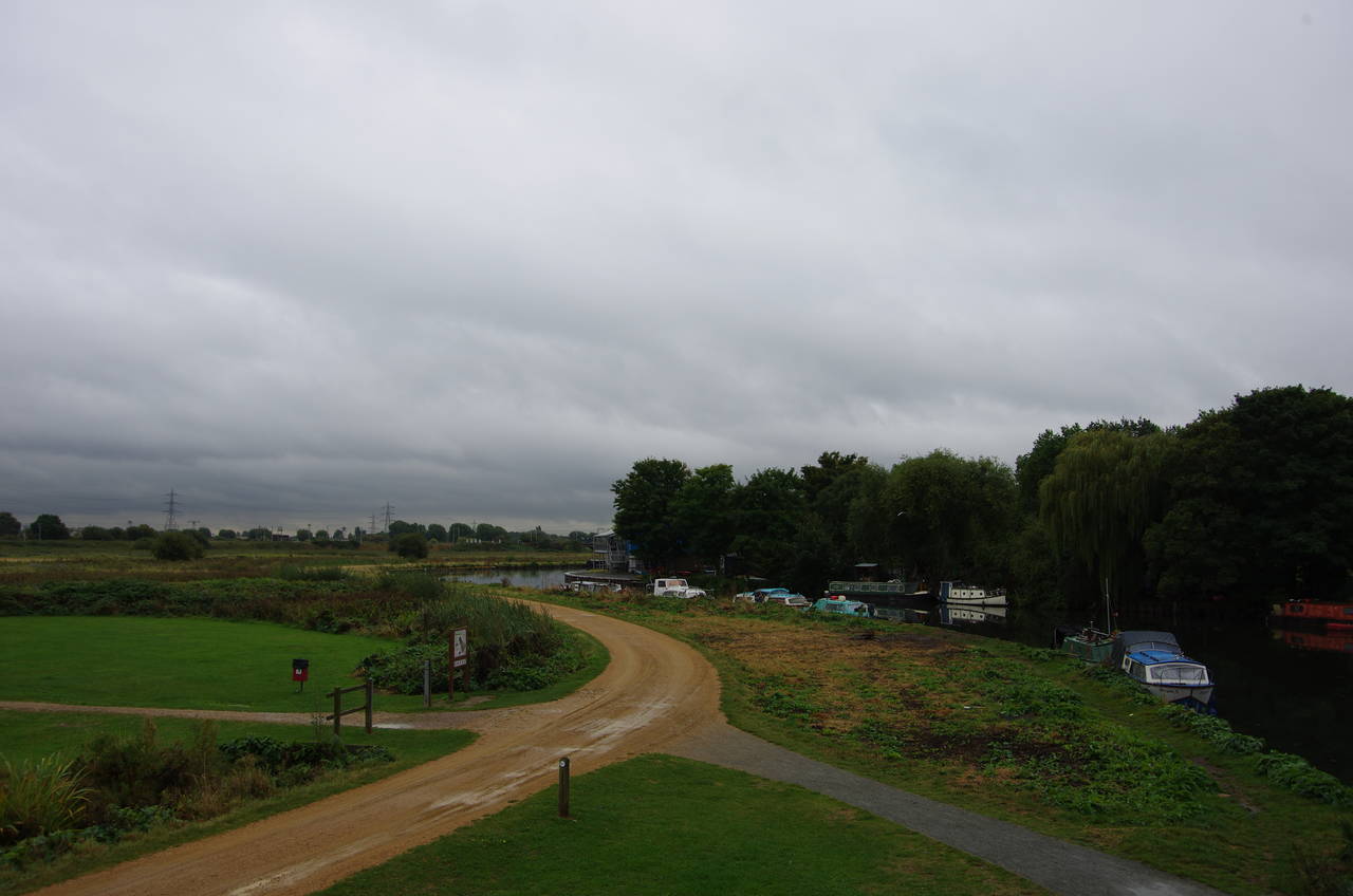
At another path junction at the bottom of the hill, the path bears right past tennis courts then leaves the park via a gate at the edge of the Lee Navigation, turning left towards the Horseshoe Bridge (picture 23). Crossing over the bridge, the Capital Ring leaves the Borough of Hackney behind for the Borough of Waltham Forest. Following a wide vehicle track downstream along the left bank of the River Lea beside the Walthamstow Marshes (picture 24), the Capital Ring is now in company with the Lea Valley Walk, a long-distance path that follows the River Lea for around 80 kilometres from its source near Luton to the Thames at Limehouse in east London.
While walking through this area I noticed an interesting quirk in the local names -- the river and the valley are signposted as Lea, but a number of man-made structures are named Lee, such as the Lee Navigation.
(25) Path beside River Lea
(26) Footbridge over River Lea
(27) Princess of Wales pub, Lea Bridge
(28) Lee Navigation
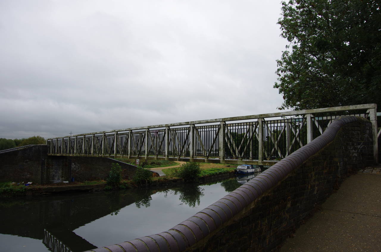
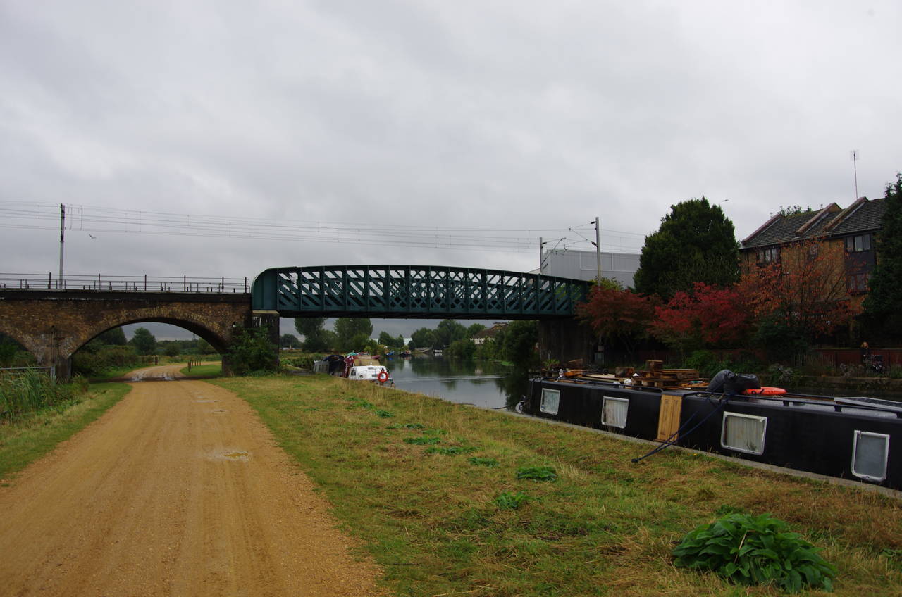
About 500 metres downstream, the river and the path pass under a railway viaduct that carries the main line to East Anglia and Stansted Airport (picture 25), then after another 500 metres, with the large white roof of the Lea Valley Ice Centre growing larger ahead, the path crosses another footbridge (picture 26) back over into the Borough of Hackney.
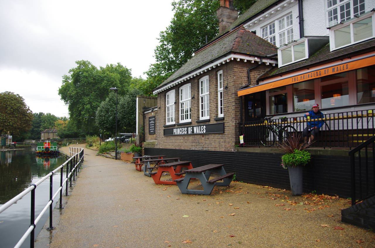
Around a bend in the river the path passes under Lea Bridge and along the terrace of the Princess of Wales pub (picture 27). Across the water, the River Lea leaves the Lee Navigation for a while, flowing over a weir.
The Capital Ring continues a little further along the bank of the Lee Navigation before crossing over the Curtain Gate Bridge to Hackney Marsh, which occupies the island between the river and the man-made canal of the Lee Navigation.
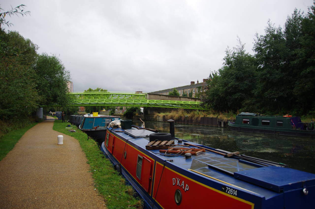
The Capital Ring follows the towpath down the left bank of the navigation, where a number of narrowboats were moored near a brightly coloured bridge that carries pipes across the canal (picture 28).
(29) Lee Navigation
(30) Olympic Park
(31) Old Ford Locks
(32) Rejoining the Greenway after diversion
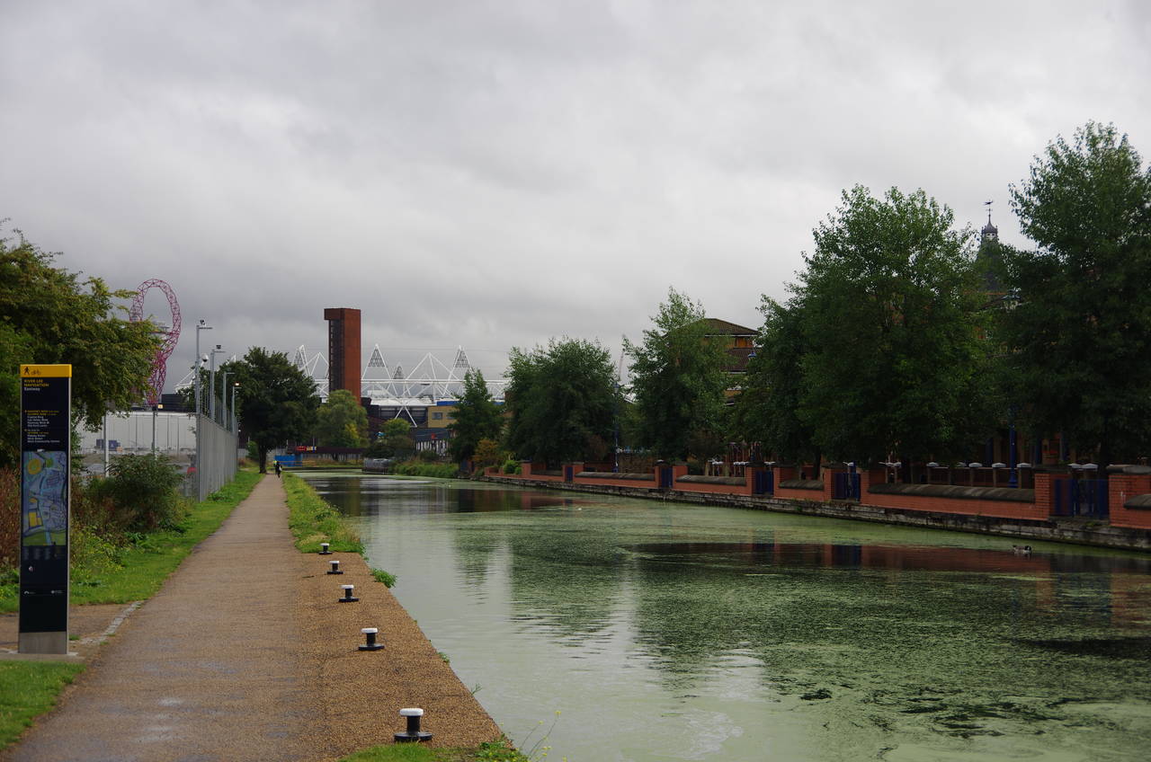
After following the Lee Navigation by Hackney Marsh (picture 29) for about two kilometres, the towpath passes under the A12 and reaches the London Olympic Park next to the Press Centre, though the main stadium is still quite some distance ahead (picture 30). The games had ended a few weeks before I did this walk, so the area was rather quiet.
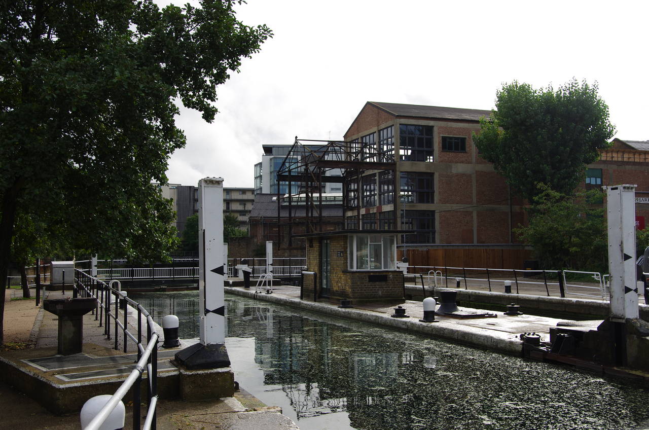
A high fence separated the towpath from the Olympic Park for the next kilometre as the Lee Navigation runs down to Old Ford Locks (picture 31), crossing the boundary between the boroughs of Waltham Forest and Tower Hamlets about halfway. Although the main Olympic stadium was visible for most of the way, the views were quite disappointing and I didn't manage to get a decent picture. Just beyond the locks, the path crosses a footbridge over the River Lea which rejoins the navigation from the left after flowing through the Olympic Park. Here the Capital Ring's brief visit to the Borough of Tower Hamlets ends as it passes into the Borough of Newham.
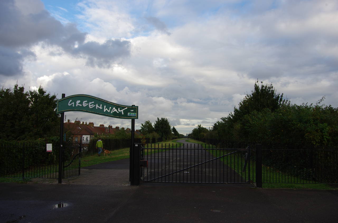
About 100 metres further along the towpath, the route of the Capital Ring turns left at a main signpost just after passing under a bridge, leaving the Lee Navigation and the Lea Valley Walk after sharing routes for almost five kilometres. At the top of a ramp, the route joins the Greenway -- a walking and cycling path that runs along the top of the 10 kilometre long Northern Outfall Sewage Embankment (with the ironic acronym NOSE), which carries around half a billion litres of waste to Beckton for treatment every day.
Unfortunately, at the time I did the walk the kilometre-long section of the Greenway that passes the Olympic stadium was closed. Diversion signs directed me to continue along the River Lea for another kilometre through a rather unattractive industrial landscape to reach the A118 Stratford High Street just beyond the point where the Bow Back River flows into the River Lea. Around 700 metres to the left along the High Street, the diversion rejoined the Capital Ring at a wide footbridge over the High Street. A sign by the foot of the bridge stated that the Greenway was closed from August 30 to September 9, but it seemed that the closure had been extended for some reason.
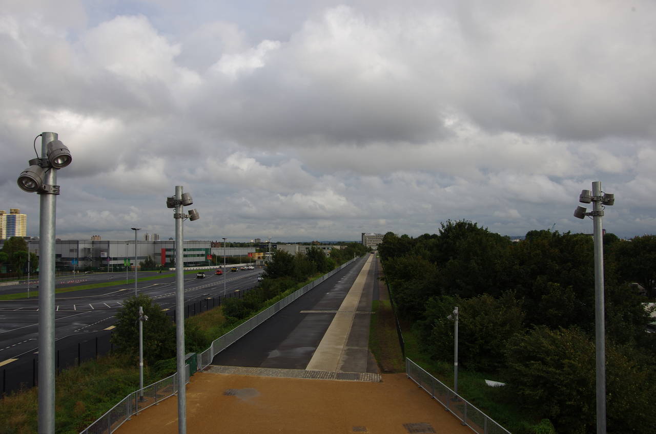
From the top of the footbridge there was a good view ahead along the next section of the Greenway (picture 32), though it might be difficult for future walkers to get a chance to take in this view. When I took a guided walking tour of the Olympic Park a few days later, the guide told us that the bridge, along with quite a number of the buildings constructed for the games, was only temporary and would be pulled down during the following year.
(33) Abbey Mills Pumping Station
(34) The Greenway, West Ham
(35) Jubilee Greenway paving stone
(36) Beckton District Park
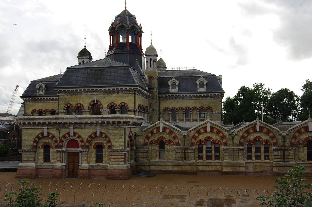
About 500 metres along this straight stretch of path, the Capital Ring crosses the Greenwich Meridian in front of the Abbey Mills Pumping Station (picture 33), the third of the fancy Victorian-era sewage pumping stations on the route. This one operated from 1868 until 1997, until being replaced by a new facility just behind the original, and is still known to many locals as The Temple of Sewage.
A few metres further, the Greenway bends slightly left, crossing a bridge over Channelsea, one of several minor channels of the River Lea that are collectively known as the Bow Back Rivers. Ahead, the path crosses Canning Road at ground level before taking a bridge over the tube's Jubilee Line, then a few hundred metres further, the Greenway bears right to cross over the tube's District Line.
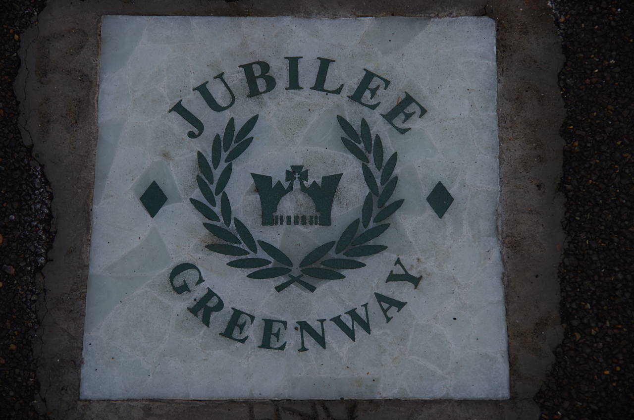
From here the Capital Ring follows the Greenway straight ahead for around three kilometres of easy, uneventful walking with the surrounding suburbs of West Ham and Plaistow largely hidden from view behind the summer foliage lining much of the path. The peaceful monotony is only broken by five road crossings, marked by metal gates and banners, the last being across Boundary Lane (picture 34). Embedded in the surface from time to time are tiles marking the Greenway as part of the longer Jubilee Greenway (picture 35), a 60 kilometre circular path linking Buckingham Palace in central London with various Olympic venues in London's east. I have noticed a few of those tiles in various places around London since the Jubilee Greenway was opened in 2009, including on the first few kilometres of the Capital Ring between Woolwich and Charlton.
About 300 metres past Boundary Lane, the Capital Ring finally departs from the Greenway, going down steps on the right then a short distance ahead on Stokes Road then left on Roman Road and shortly right on Noel Road and up onto a pedestrian footbridge over the A13 Newham Way. After descending the ramp on the other side, the Capital Ring heads away from the A13 on Viking Gardens, which leads to a gate into the Beckton District Park North, where the sun came out for the first time in the day (picture 36).
(37) Will Thorne Pavilion, Beckton District Park
(38) Royal Albert Docks
(39) London City Airport
(40) River Thames at Gallions Reach
The Capital Ring sticks to the tarmac path, which winds its way through the park, passing a variety of trees that were imported from around the world and are described on a series of plaques. Reaching Tollgate Road, the route crosses over into Beckton District Park South and continues to wind it's way through the pleasant park, eventually coming up beside Stansfeld Road just before passing the rather unusual looking Will Thorne Pavilion (picture 37).
A short distance past the pavilion, the route turns left at a main signpost, following a footpath under a line of trees across the park. For the last few kilometres, I had been considering finishing the day's walk here as it was getting quite late in the afternoon. However, with my GPS showing just over an hour left until sunset and the signpost giving a distance of 3.5 miles (5.6 kilometres) to the Woolwich Foot Tunnel, I decided to press on and see if I could finish the walk before the daylight ran out.
On the far side of the park, the route turns right to skirt around the edge of the park inside a narrow strip of trees with houses to the left and playing fields to the right. On reaching a path junction in the north-east corner of the park, the route bears left between houses to cross Harper Road and continue ahead on Savage Gardens alongside the playing fields of New Beckton Park. At the next corner of the park, the route turns right on a path along the next side of the park. When the path comes up to houses, it turns left beside them for about 100 metres before bearing right to follow the short Learoyd Gardens out to East Ham Manor Way, where the route turns right.
A short distance ahead, the Capital Ring crosses Cyprus Place just to the left of a mini-roundabout and jinks left then right to find a path leading to a footbridge over the Cyprus Station of the Dockland Light Railway, but under the A1020 Royal Albert Way.
Just ahead from the end of the footbridge the Capital Ring enters the Docklands Campus of the East London University. For some reason the entrance was being guarded by security officers who initially didn't want to let me through without a student identity card, despite this being a very clearly marked public right of way. Eventually, after a delay of about ten minutes, I managed to find a staff member in the nearby reception office who understood what a public right of way is and told them to let me go through.
Fifty metres ahead from the entrance, the Capital Ring comes up to the edge of the vast Royal Albert Dock. Opened in 1880 and handling commercial shipping until 1982, the Royal Albert Dock is almost two kilometres long. Together with the nearby Royal Victoria and King George V docks, this was the largest dock complex in the world at the time it was opened. By the edge of the dock are a number of interesting cylindrical student apartment buildings (picture 38), while on the far side of the water the runway of the London City Airport (picture 39) separates the Royal Albert Dock from the parallel King George V Dock. Looking along the dock to the right, the Millenium Dome and the tower blocks of Canary Wharf seemed quite close.
The route of the Capital Ring turns left along the dockside, following it to its end just before a road bridge over the docks. The route turns left here towards the large Gallions Roundabout, crossing the road that leads onto the bridge and skirting around the right-hand side of the roundabout to take the next right turn into Atlantis Avenue. The road is followed ahead for about 400 metres to its end, where the route continues ahead between bollards to meet the north bank of the River Thames at Gallions Reach. Across the river are the apartment blocks of Thamesmead, with the low hills traversed by the first stage of the Capital Ring in the distance behind them (picture 40).
(41) Gallions Marina Lock
(42) Galleons Point Estate
(43) Woolwich Ferry

(44) Self-portrait at the end of the walk
A rather untidy and overgrown path heads along the riverbank beside a flood wall for about 200 metres to reach the Gallions Marina Entrance Lock (picture 41), where the Capital Ring crosses over the lock gates. When the Royal Docks were in commercial use, the lock here gave access to the Royal Albert Dock and was more than ten times longer than the present one, measuring around 240 metres by 30 metres.
After following a road for about 100 metres, another ragged path leads to steps over the flood wall and between wire fences to the entrance lock of the King George V Dock, which has the same dimensions as the original lock of the Royal Albert Dock. Ships large enough to almost fill this lock don't actually use it any more, as they would not be able to pass under the road bridge that crosses over the far end of the lock.
After crossing the massive lock gates, the Capital Ring climbs steps over the flood wall and follows a riverside path along the edge of the large Galleons Point Estate (picture 42). (The difference in spelling seems to be intentional.) At the far end of the estate, the path turns briefly inland to leave the estate via a gate onto Barge House Road. Turning back to the river, the path follows the flood wall past some houses before skirting around a slipway then returning to the riverside path in Royal Victoria Gardens.
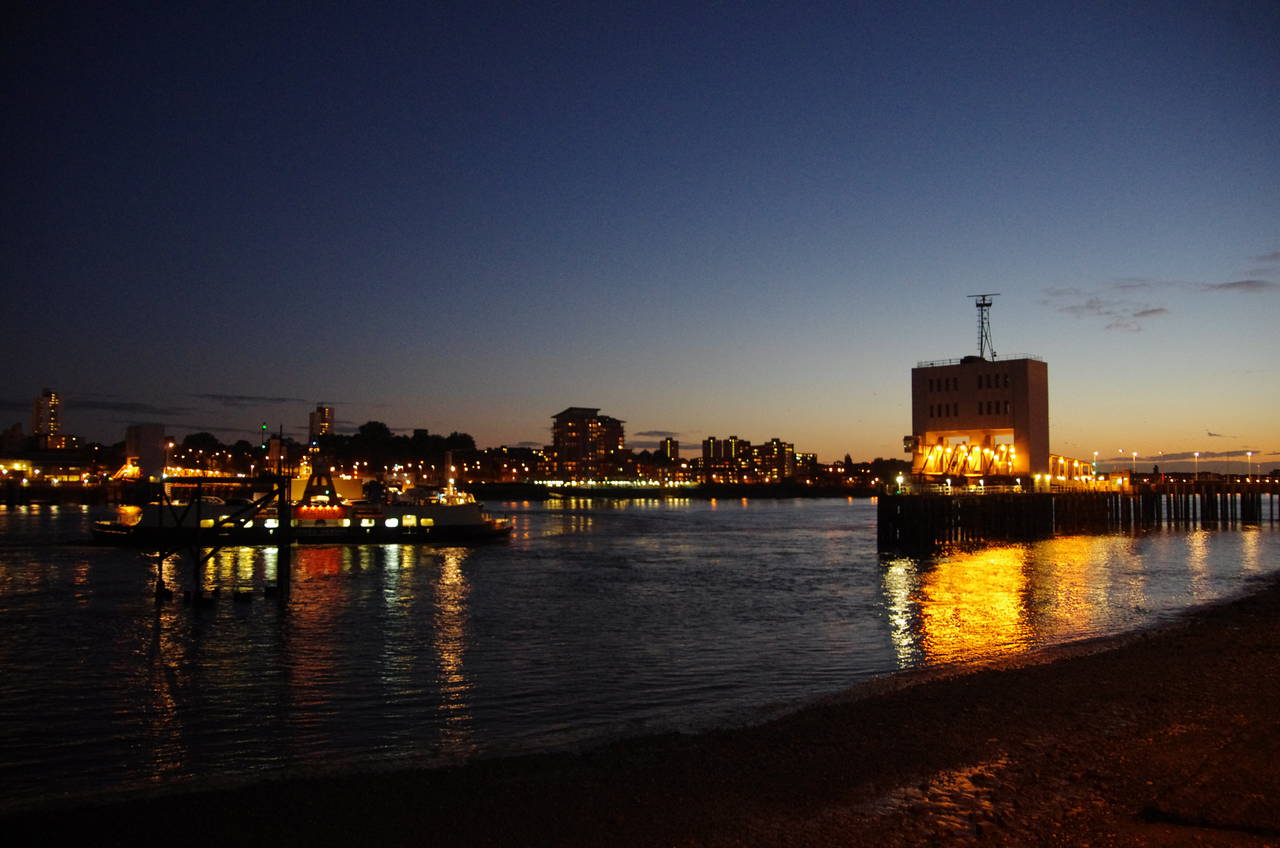
In the last of the daylight, I walked the riverside path past the gardens and along the access road of the Woolwich Ferry to the northern entrance of the Woolwich Foot Tunnel. As had been the case when I started the Capital Ring four months earlier, the tunnel was still closed for repairs, so I wasn't going to be able to walk the final 500 metres under the Thames to complete my circuit of London.
With the tunnel closed, I would instead have to complete the Capital Ring on the Woolwich Free Ferry (picture 43). From the tunnel entrance it was a short walk to follow the access road around to the left and onto the ferry pier. The short ferry journey took me back to the south bank of the Thames where I walked over to the south entrance of the Woolwich Foot Tunnel to take the traditional self-portrait at the end of my journey.
Before boarding the ferry, my GPS showed that I had walked a distance of 30.1 kilometres. This was a little more than the distance quoted on the first signpost of the day, mainly due to the diversion around the first section of the Greenway in the Olympic Park.
Overall, my walk around the Capital Ring had been quite an interesting one. I was able to see a lot of places that are off the regular tourist trail and have noted a number of those that I would like to go back to and explore further.
Addendum: Wednesday, 31 August 2016
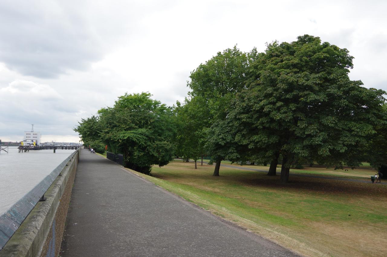
(45) Royal Victoria Gardens
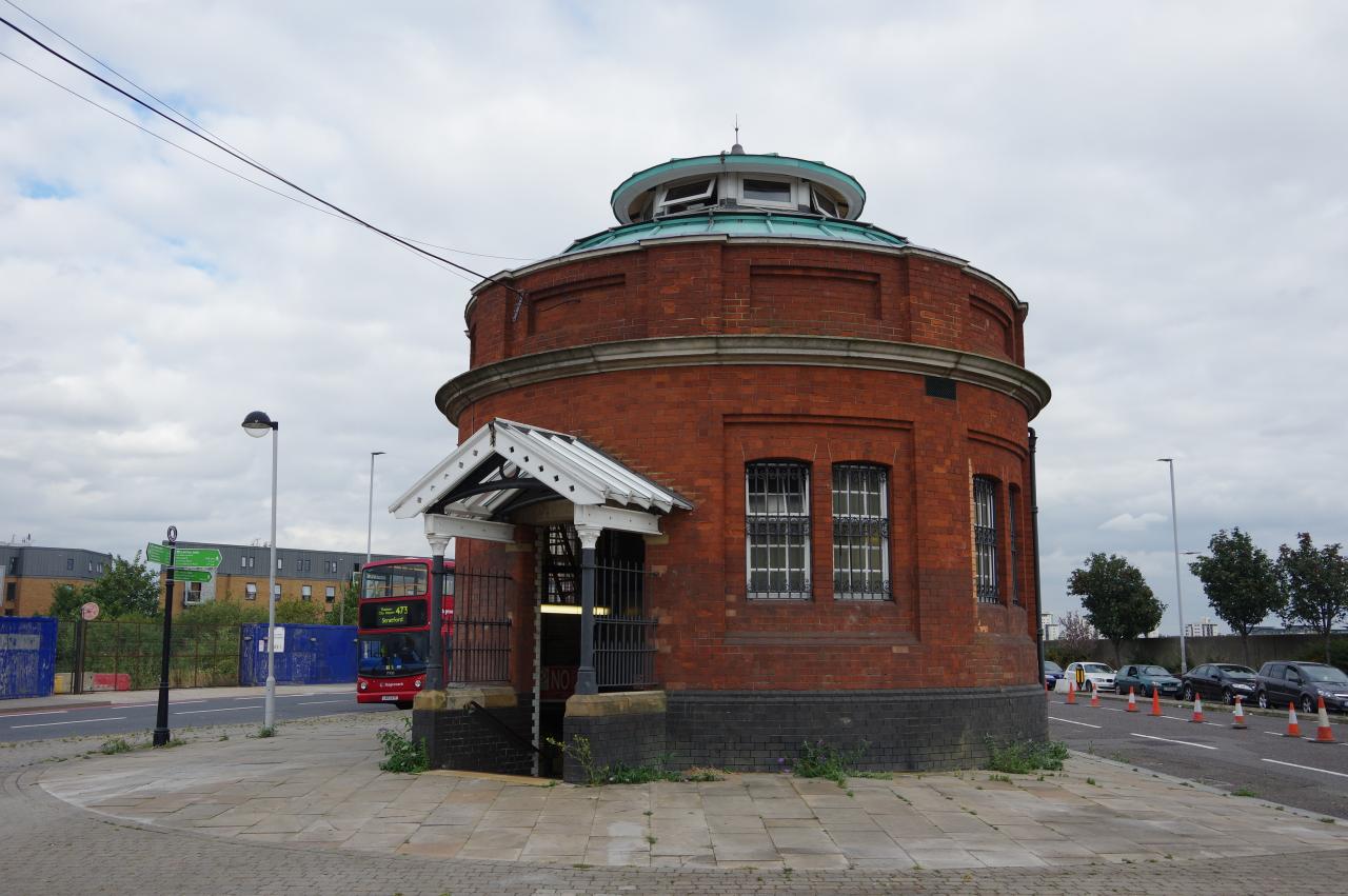
(46) North entrance to Woolwich Foot Tunnel
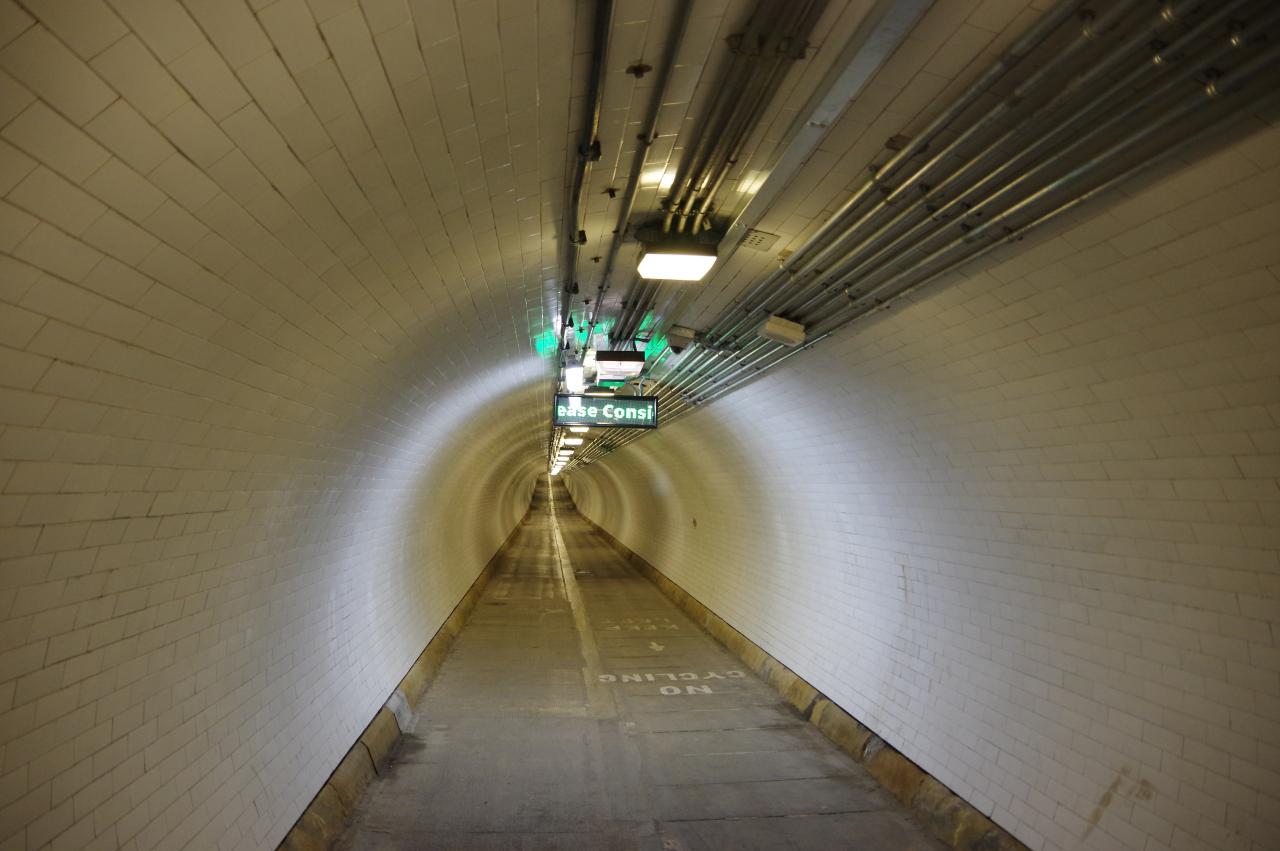
(47) Woolwich Foot Tunnel
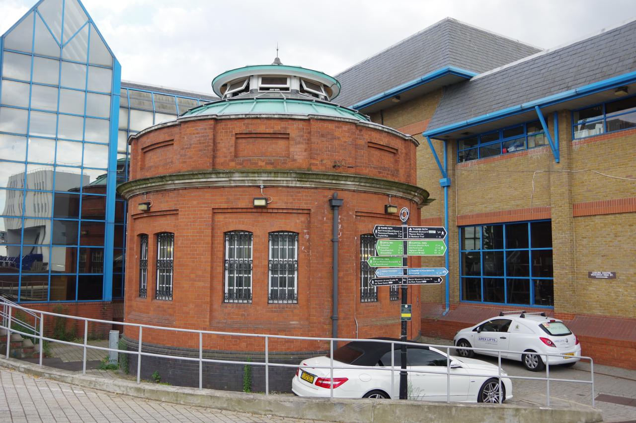
(48) South entrance to Woolwich Foot Tunnel
On the last day on August 2016 I returned to Woolwich, having learned that the Woolwich Foot Tunnel had reopened. I rode the DLR to King George V Station, then walked down to the Thames via the Royal Victoria Gardens (picture 45), from which it was a short walk westward along the riverside path to the entrance of the Woolwich Foot Tunnel (picture 46). Once I had descended the spiral staircase, the 504 metre tunnel (picture 47) was deserted aside from a couple of cyclists who zoomed by, evidently unable to comprehend the large and frequent "No Cycling" signs. After a few minutes I emerged on the south bank of the Thames, where the tunnel portal (picture 48) is surrounded on three sides by the Waterfront Leisure Centre. From there it is about ten minute's walk to Woolwich Arsenal Station.
The tunnel was opened in 1912 and refurbished between 2010 and 2014. Both entrance buildings are Grade II listed. A survey conducted in 2016 by the Friends of Greenwich and Woolwich Foot Tunnels found that around a thousand people were using the tunnel each day.