CAPITAL RING
Stage 4: Osterley Lock to Sudbury Hill
Saturday, September 29, 2012
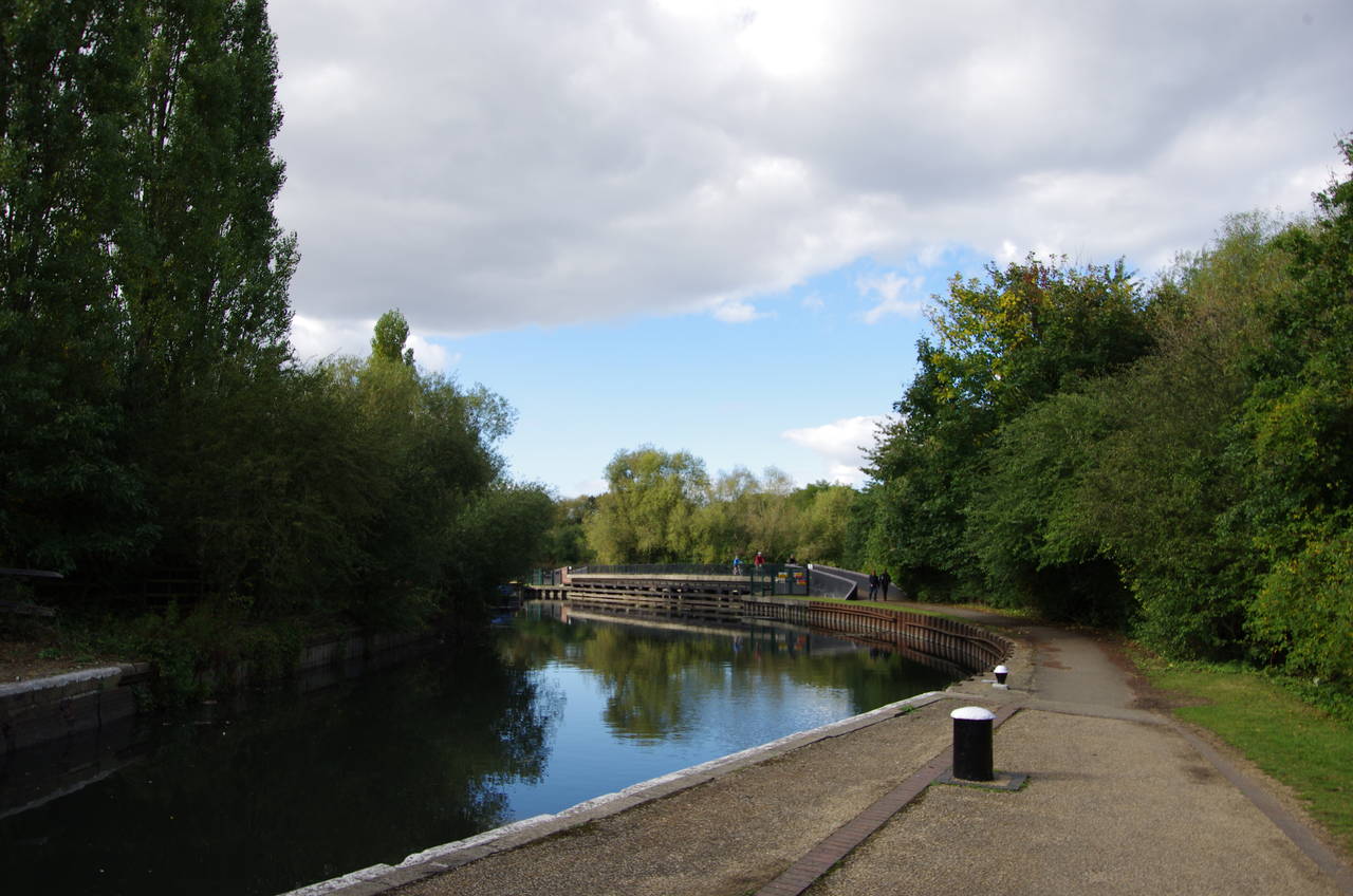
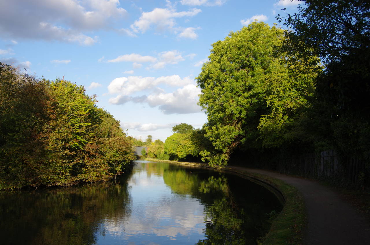
(1) Osterley Lock Island
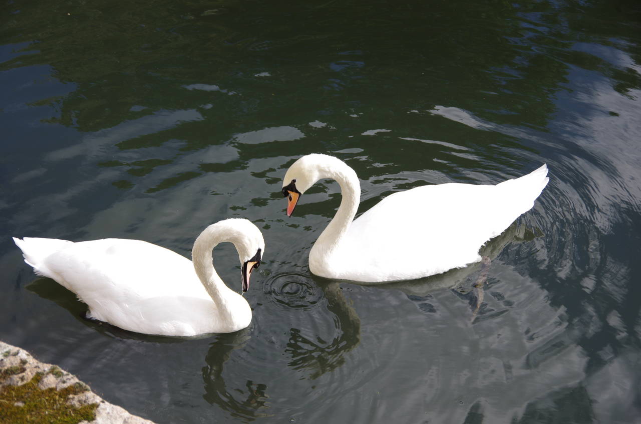
(2) Swans on the River Brent
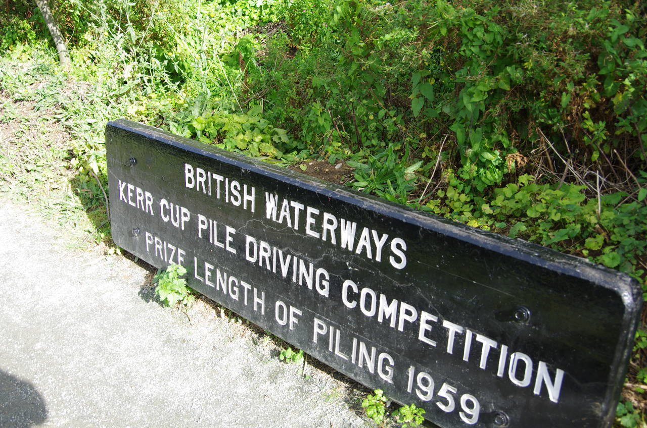
(3) "Prize length of Piling 1959"
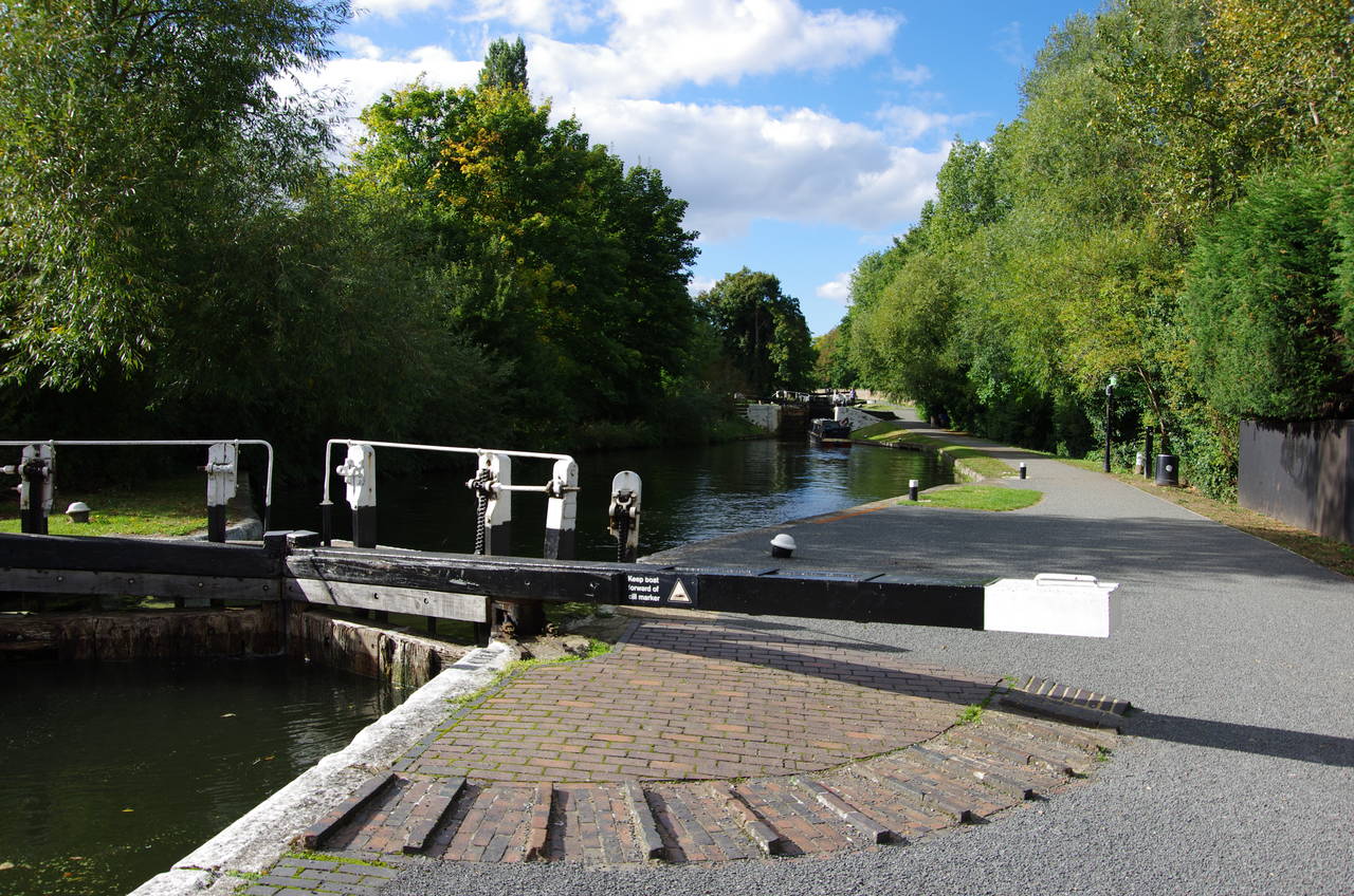
(4) Hanwell Locks
I found myself back in England rather earlier than I had expected due to my employer deciding to make our whole office redundant, giving me the opportunity to take a break before looking for another gig. Thus I was able to resume my walk around the Capital Ring just shy of four months since I had completed the previous stage, beginning with a relatively short afternoon's walking in lovely sunny weather.
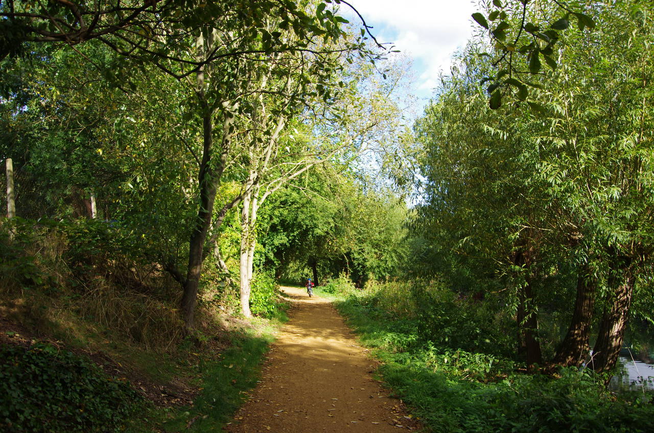
I began this stage of the walk beside Osterley Lock, on the little island that separates the lock from the main channel of the River Brent (picture 1). The Capital Ring heads upstream from the lockside, crossing over a footbridge at the end of the lock island to the right bank of the River Brent. A little further along the towpath I came across a pair of swans foraging in the calm water next to the bank (picture 2).
Around the next bend in the river I came across a large sign (picture 3) proclaiming the "Kerr Cup Pile Driving Competition Prize Length of Piling 1959", though no length of piling seemed to be evident in the vicinity. Beyond this, the Capital Ring follows the river between two factories and around one more bend to reach the Hanwell Locks (picture 4), a series of six locks that raise the river by around 16 metres over the next 500 metres.
(5) FitzHerbert Walk
(6) Hanwell Bridge
(7) Brent Meadow and Wharncliffe Viaduct
(8) Brent Lodge Park
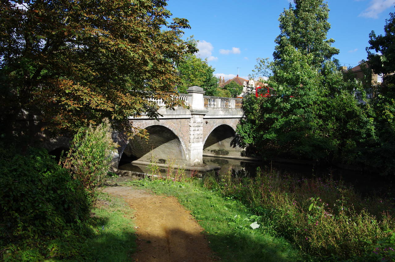
The Capital Ring crosses a footbridge onto the lock island just before the first lock then forks right just before the second lock, leaving the Grand Union Canal Path and following an earth path inside a narrow strip of woodland beside the main channel of the River Brent. This path, known as FitzHerbert Walk (picture 5), leads to the 18th-century Hanwell Bridge (picture 6), which the path passes beneath to enter Brent Meadow.
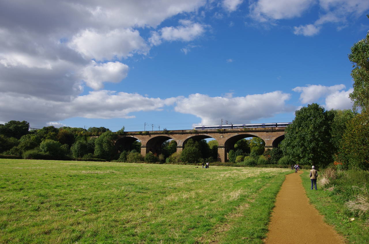
A tarmac path runs along the right-hand edge of the meadow, close to the River Brent, crossing a footbridge to the right bank just before heading under the impressive Wharncliffe Viaduct (picture 7) and into the Churchfields Recreation Ground. Opened in 1838, the 20-metre high, 270-metre long viaduct was the first major structure built to a design by the great Victorian engineer, Isambard Kingdom Brunel, and carries the four tracks of the Great Western Main Line, which runs from Paddington Station in central London to Wales and southwest England. Brunel had earlier designed Bristol's Clifton Suspension Bridge in 1828, but due to financial difficulties construction didn't begin until 1836 and wasn't completed until 1864.
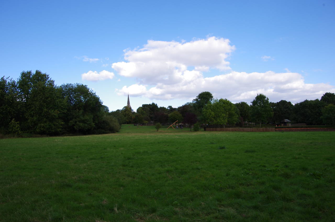
A fingerpost points along a tarmac path on the edge of the recreation ground with the tree-lined river just off to the left. The tarmac runs out but the route continues ahead into Brent Lodge Park with the park's Millennium Maze away to the right. The Capital Ring sticks closely to the River Brent as it winds its way along the park's southern and western sides. At times the spire of Hanwell's St Mary's Church is visible over the trees (picture 8).
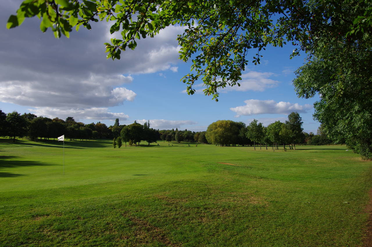
(9) Brent Valley Golf Course
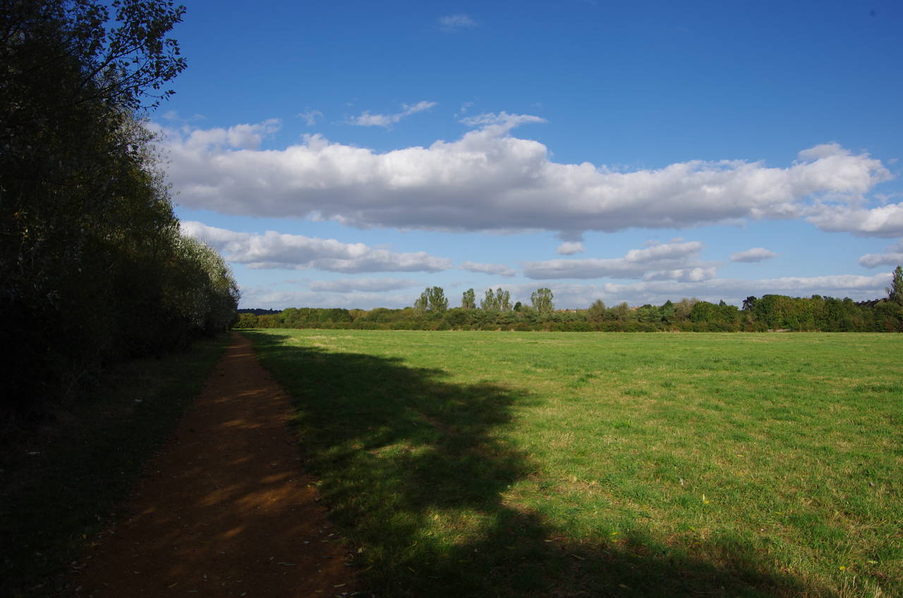
(10) Bitterns Field
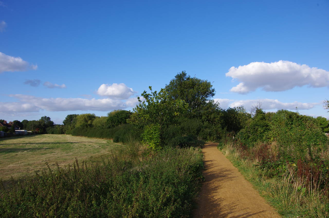
(11) Perivale Park
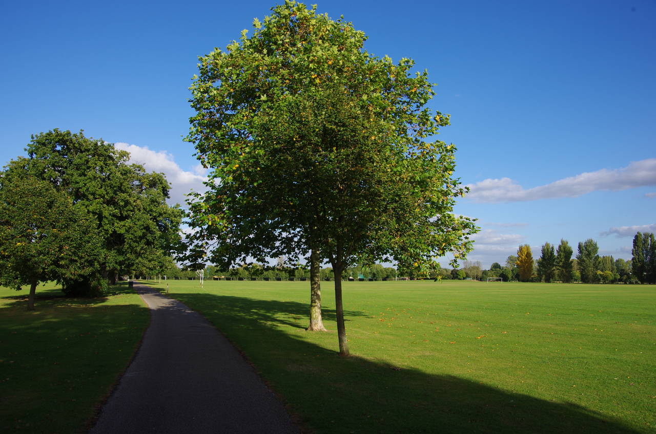
(12) Perivale Park
On the northern side of the park, the Capital Ring crosses a footbridge over the river and follows an earth path north, passing the Hanwell Cricket Club Ground before continuing on a shady path across the Brent Valley Golf Course (picture 9) until a signpost indicates a right turn to yet another crossing of the River Brent.
Turning left after crossing a footbridge, the Capital Ring follows the riverbank until a set of rough steps climbs up the embankment to Bitterns Field (picture 10), a traditional hay meadow. The path heads along the left-hand edge of the meadow, above the river, before steps at the far end return to the riverbank, which the path follows beside a rough hedge that screens a playing field. After about 200 metres the path comes up to the B455 Ruislip Road East next to the Greenford Bridge.
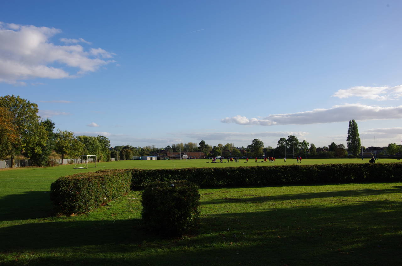
The route crosses the road and turns left over the bridge then turns sharp right into Costons Lane a short distance further. The lane soon bends to the left and as it straightens the Capital Ring departs to the right on a track leading into Perivale Park. The first little part of the park has been left to grow wild (picture 11) but after crossing the River Brent one last time the park becomes more manicured, with a golf course to the right and playing fields to the left. The path soon turns left along the edge of a rugby field to reach a main signpost where the path turns right under a line of trees (picture 12), passing more playing fields before bearing left by the corner of the Perivale Park Athletics Stadium, emerging from the park by the side of the A40 Western Avenue.
(13) Cayton Road Sports Ground
(14) Paradise Fields
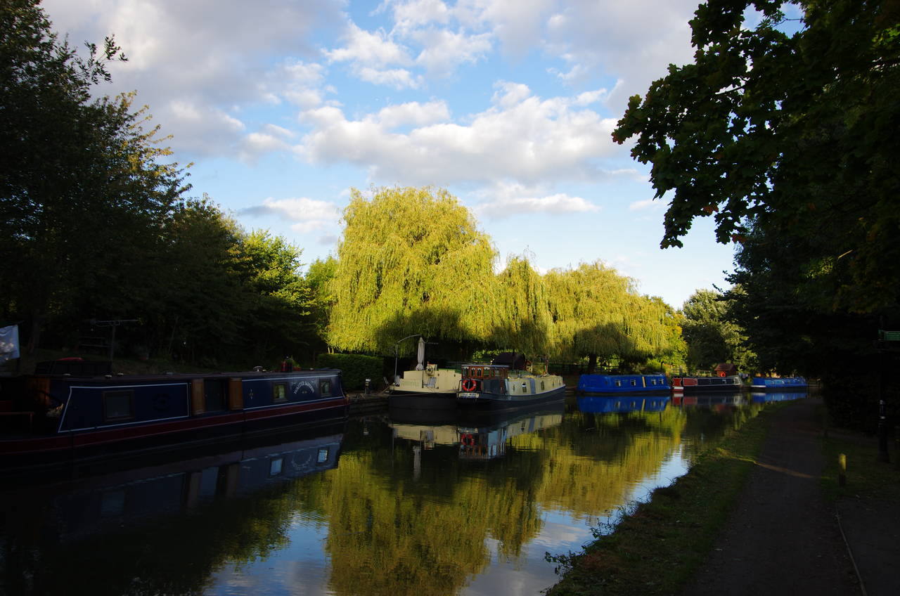
(15) Grand Union Canal, Paddington Arm
(16) Grand Union Canal, Paddington Arm
A footbridge a short distance to the right takes the Capital Ring over the very busy six-lane road, before the route turns into Cayton Road roughly opposite the point where it emerged from the park. Cayton Road soon ends at the Cayton Road Sports Ground, where the path skirts around the right-hand side next to a railway line. At the far end of the sports ground the path turns left to pass the end of a low hedge that divides the sports ground from the adjoining Cayton Green Park (picture 13). A few metres further, the route turns right into Bennetts Avenue, a gentle left-hand curve that reaches the A4127 Greenford Road after around 300 metres.
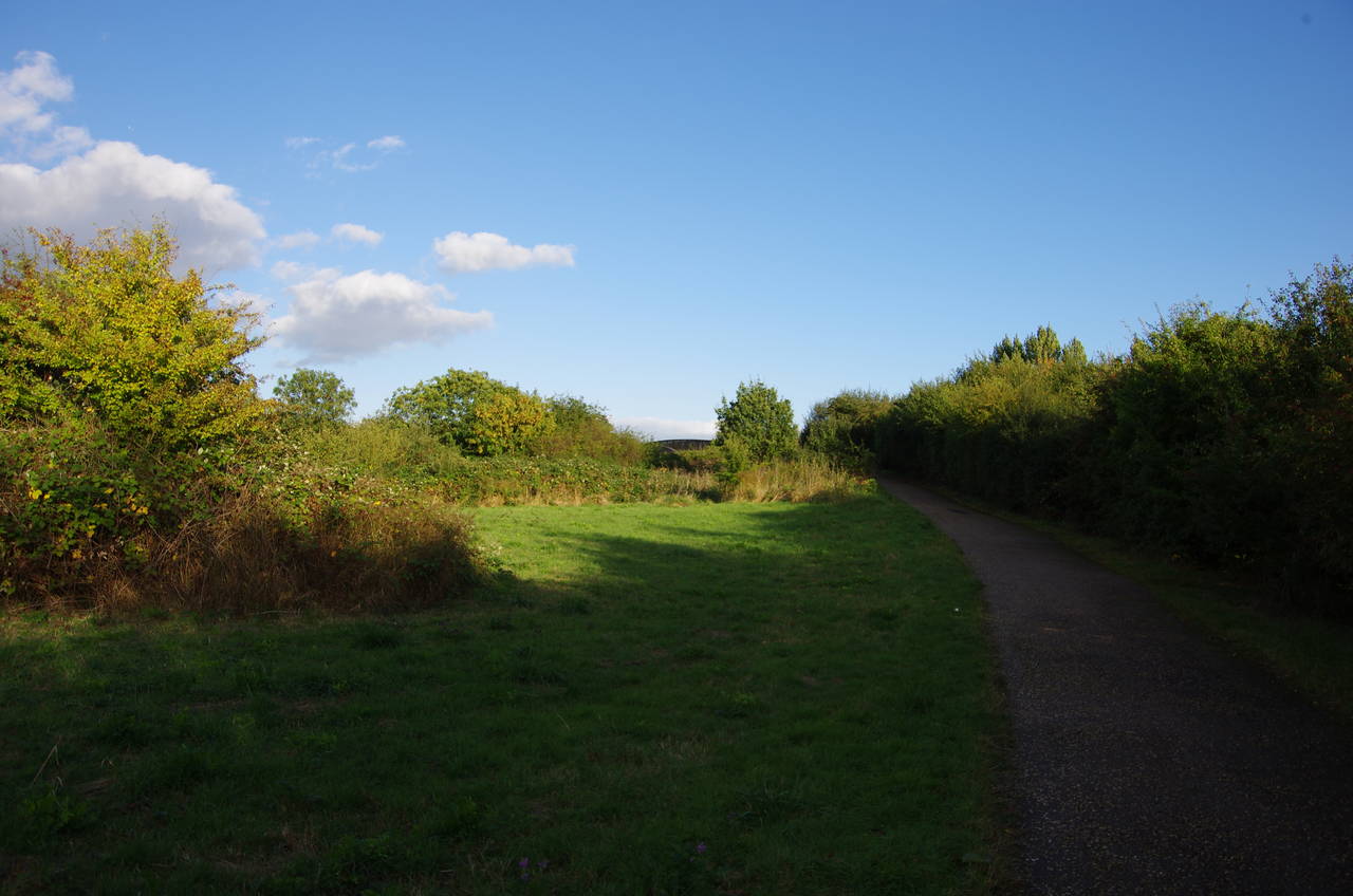
Turning right along the right-hand pavement, the route passes under a viaduct and a railway bridge, which carry the London to Birmingham Main Line and the tube's Central Line respectively, before crossing over Rockware Avenue. On the other side, the Capital Ring bears slightly right to take a tarmac path past the carpark of the Westway Cross Shopping Centre, then through a tunnel under the centre's access road into the Paradise Fields Wetlands (picture 14), a former golf course that has been gradually returned to a more natural state since the year 2000.
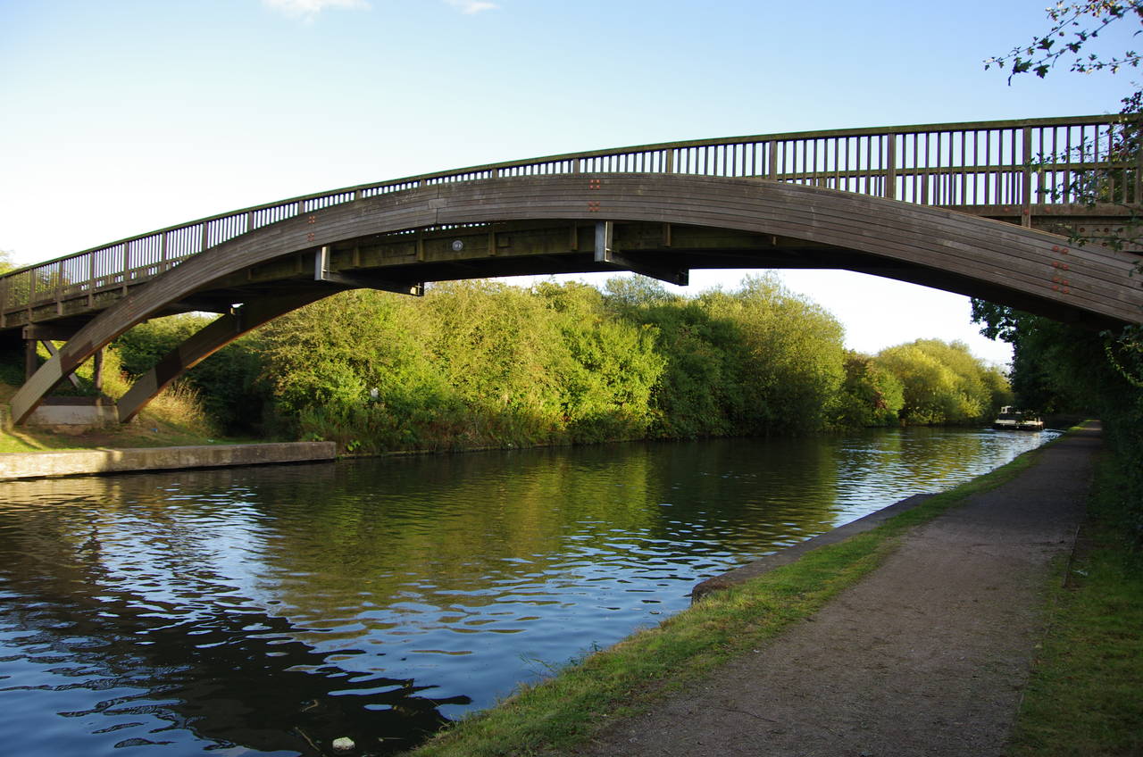
The footpath is followed through the wetlands for about 500 metres before it meets the Paddington Arm of the Grand Union Canal next to a sturdy wooden footbridge (picture 15). This branch of the canal connects the Paddington Basin, near Paddington Station with the main canal at Bull's Bridge, about nine kilometres away to the west.
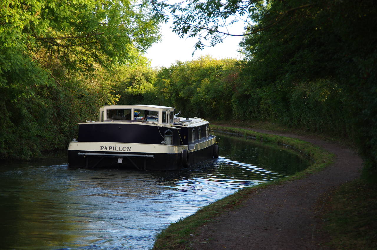
Rather than crossing the footbridge the Capital Ring instead joins the towpath beside the canal, heading under the footbridge in the direction of Paddington. Ahead of me on the canal, a boat called Papilion was chugging its way along (picture 16) though, perhaps due to its size, it was going quite slowly and I was easily able to overtake it on foot.
(17) Perivale Wood Local Nature Reserve
(18) Narrowboats moored near Horsenden Hill
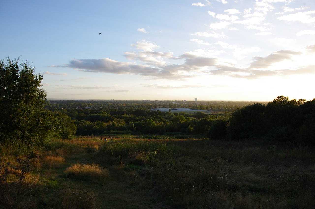
(19) Horsenden Hill
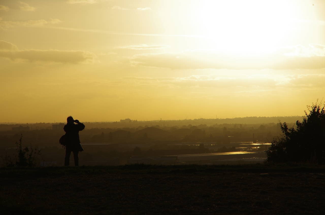
(20) Sunset on Horsenden Hill
The Capital Ring follows the towpath for about a kilometre, the last third of that by Perivale Wood Local Nature Reserve (picture 17), before passing under the single arch of the Ballot Box Bridge that carries Horsenden Lane North over the canal. A number of narrowboats were moored on the far side of the bridge (picture 18).
Just after passing under the bridge the Capital Ring leaves the towpath, circling around to the right to cross over a footbridge next to the road bridge. Less than 50 metres further the route bears left onto an earth path and begins to climb up through scrubland and meadows to the top of Horsenden Hill, site of ancient Stone Age and Iron Age settlements and the highest point in the borough of Ealing at 85 metres above sea level. From a viewpoint near the summit there were good views south and west across London (picture 19) and I paused to watch a plane approaching Heathrow before continuing on to another viewpoint where there were views towards the impending sunset (picture 20).
(21) Horsenden Wood
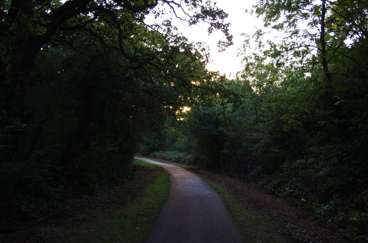
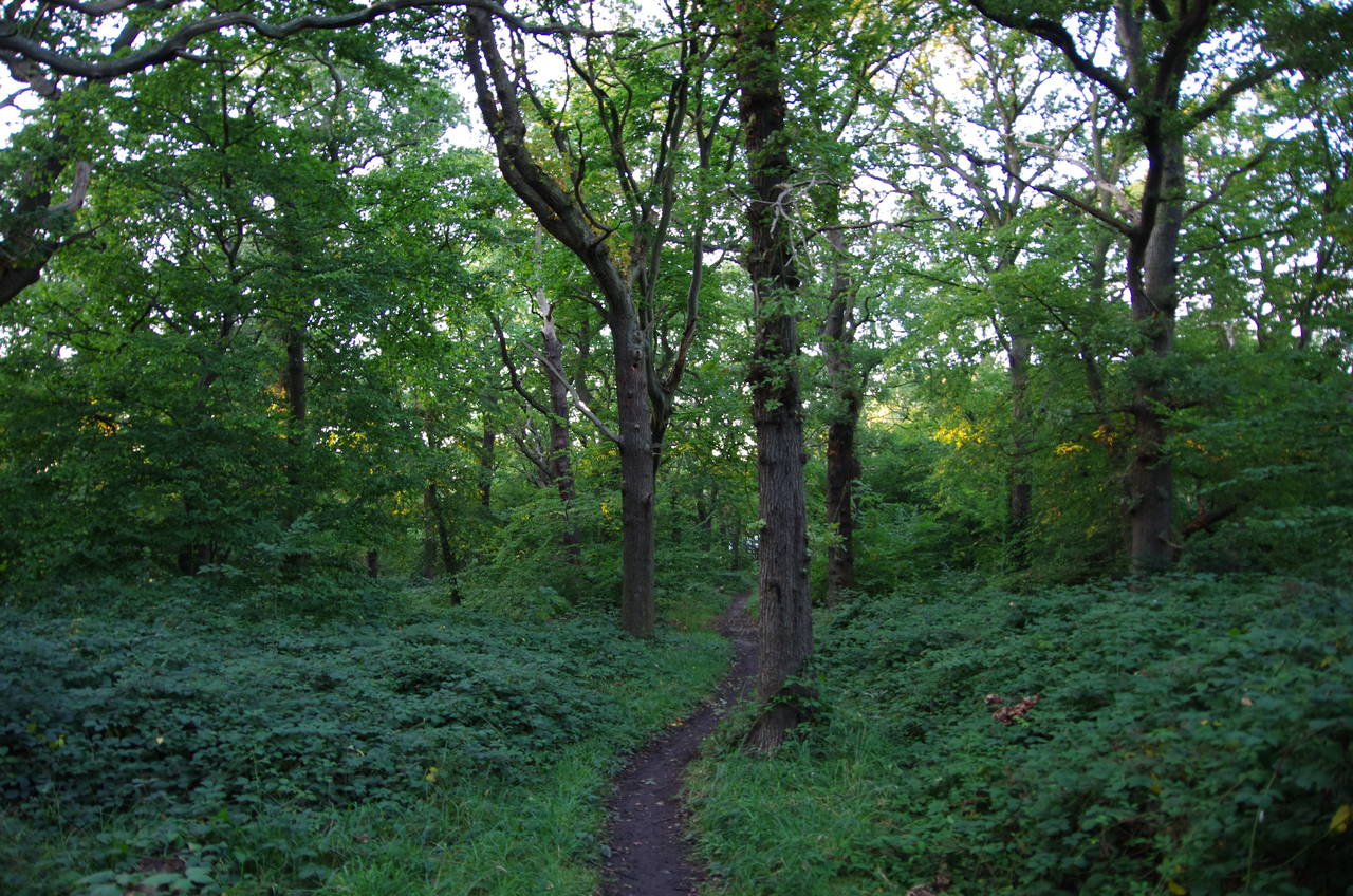
(22) Ridding Wood
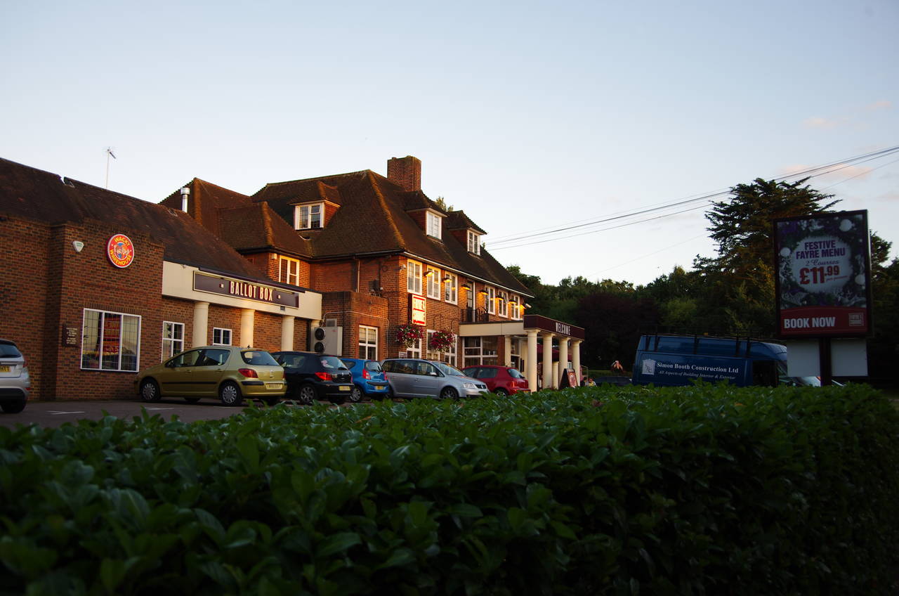
(23) The Ballot Box, Sudbury
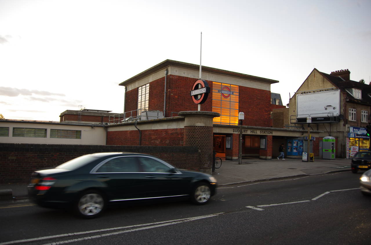
(24) Sudbury Hill Station
From the summit, the path descends through Horsenden Wood (picture 21) which covers much of the north side of the hill. Reaching the end of Whitten Drive at the foot of the hill, the path turns left, taking a tarmac footpath for 400 metres across the foot of the hill through Ridding Wood (picture 22) to rejoin Horsenden Lane North next to the Ballot Box pub (picture 23).
Turning right, the Capital Ring follows the road opposite a line of shops and then ahead into Melville Avenue and up to a T-junction with the A4090 Whitten Avenue East. A short distance to the left the route crosses over the road, backtracking a few metres along the other side before turning into Ridding Lane. At the bottom of the lane a signpost points left along a footpath beside the Uxbridge branch of the Piccadilly Line, leading to a second encounter with the A4127 Greenford Road. A few metres to the right the path crosses over the railway line into the borough of Harrow. Next to the bridge stands the ticket hall of the Sudbury Hill tube station (picture 24), where I left the Capital Ring for the day, having covered another 13.3 kilometres of the official route.