THE THAMES PATH
Stage 10: Hampton Court to Hammersmith
Friday, June 17, 2011

(1) The gates of Hampton Court Palace
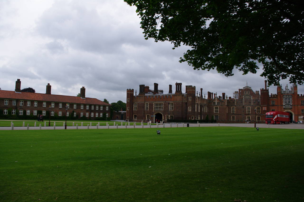
(2) Hampton Court Palace
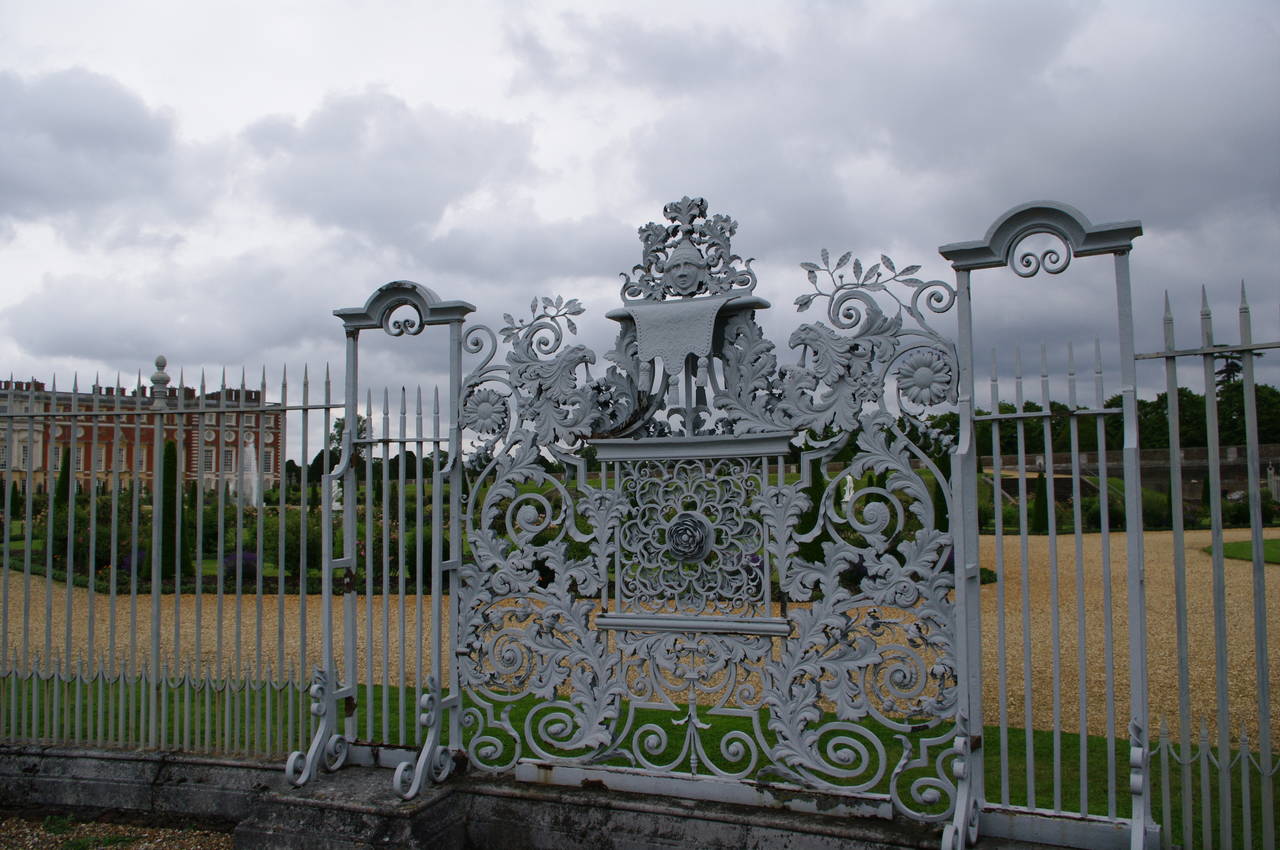
(3) Wrought iron fence, Hampton Court Palace
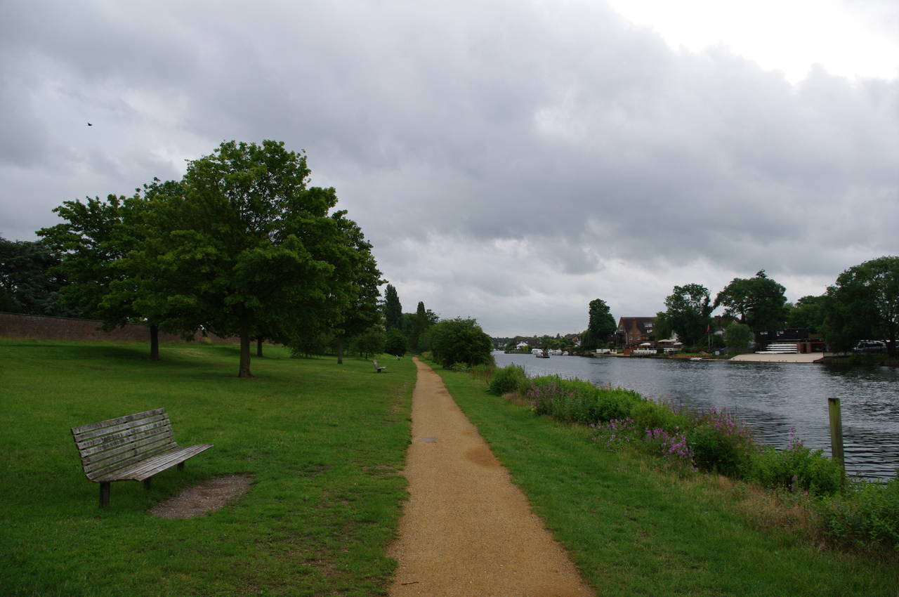
(4) Hampton Court Park
It was a gloomy morning as I set off purposefully from Hampton Court Station and across Hampton Court Bridge. At the north end of the bridge, the Thames Path turns right onto the towpath, known as the Barge Walk here, but before joining the towpath, I walked a few metres further along the road to see the statues on top of the gates of Hampton Court Palace (picture 1).
The broad sealed path by the edge of the river runs just outside the grounds of the palace, giving good views through the wrought-iron fence to the long row of apartments and the palace itself (picture 2). Further on, the path passes close by the corner of the palace and then by a series of intricately detailed fence panels that enclose the palace's privy garden (picture 3).
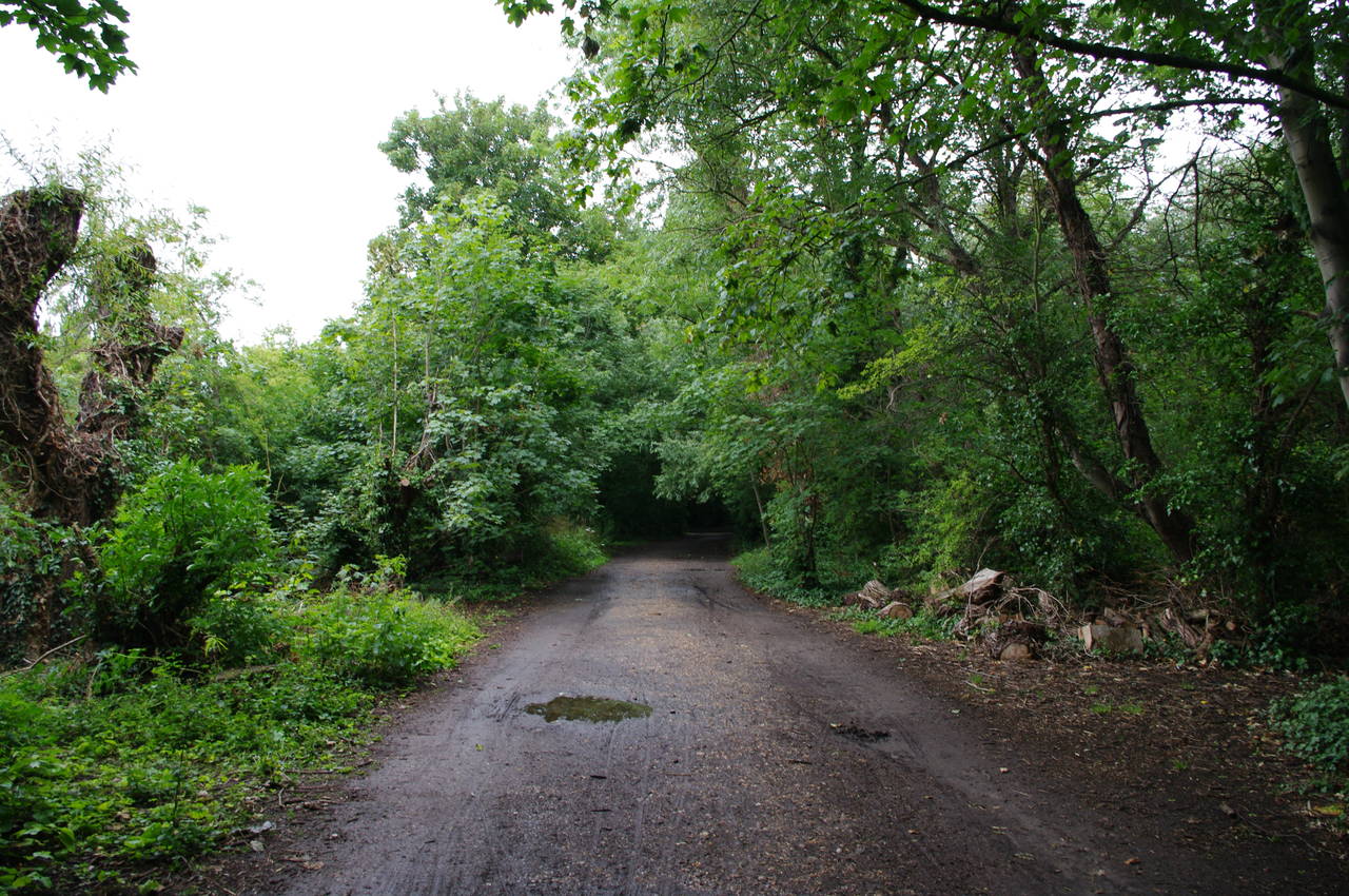
Once past the far corner of the palace grounds, the path becomes narrower and unsealed as it heads out into the pleasant parkland of Hampton Court Park (picture 4).
(5) Chimney, Hampton Court Park
(6) Campers, Hampton Court Park
(7) View across to Kingston
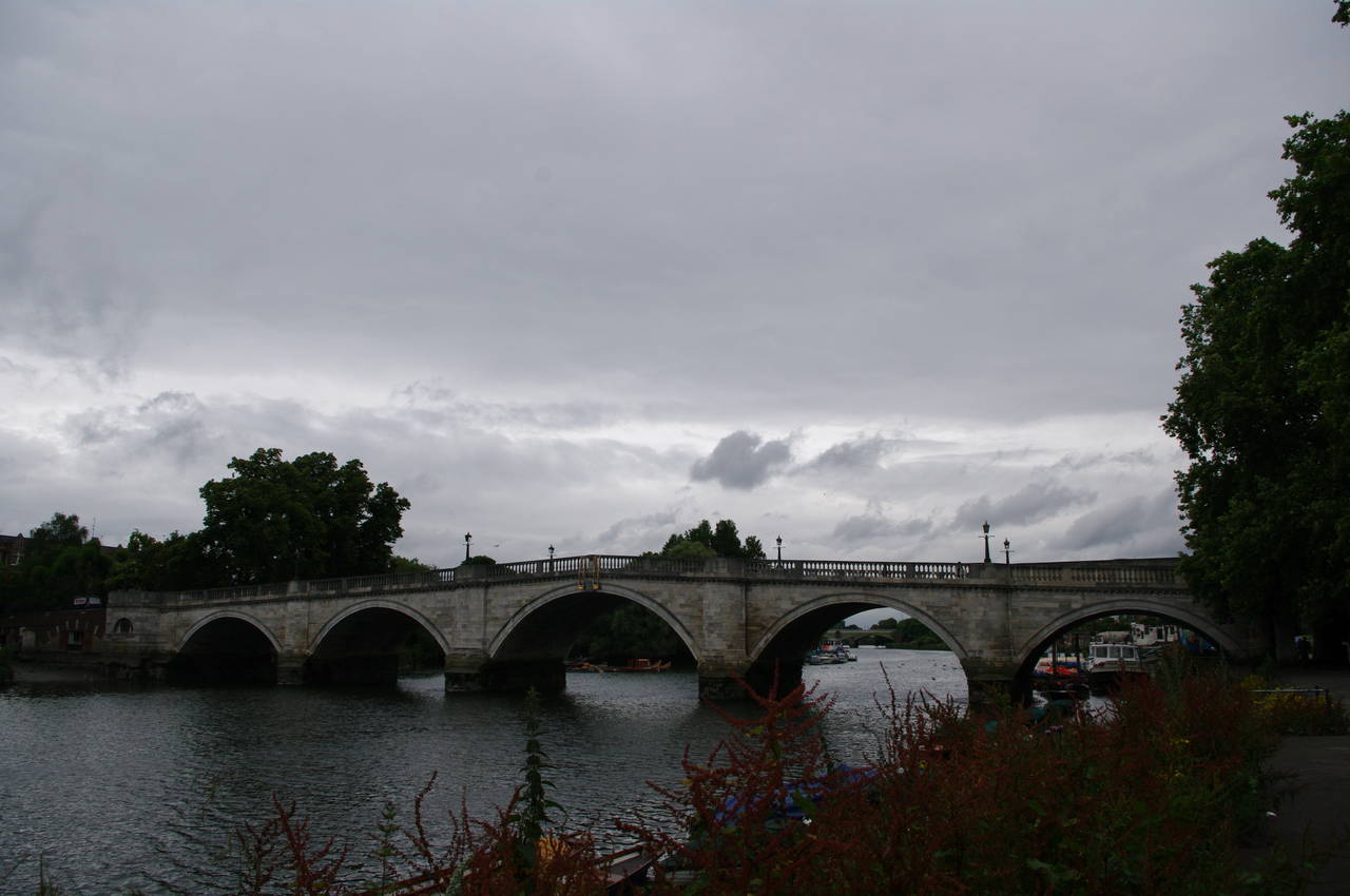
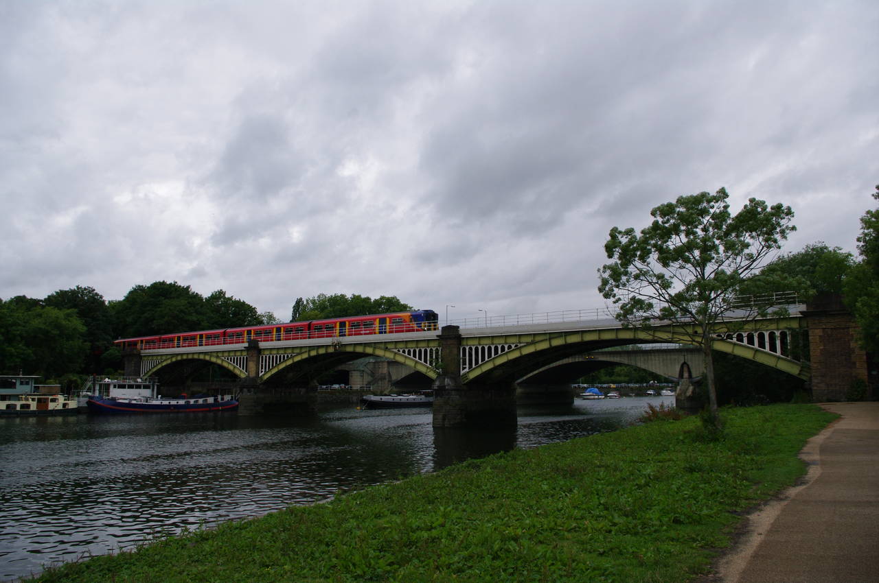
(8) Approaching Kingston Bridge
Over the next four and a half kilometres, the path follows the course of the river as it gradually curves to the left around Hampton Court Park, changing direction from south-easterly to northerly. Along the way I passed a strange looking brick chimney next to the path (picture 5), which reminded me of the railway tunnel exhaust chimneys I passed on Shakespeare Cliff while walking between Dover and Folkestone the previous summer, though as far as I know there aren't any railways under the park so I'm unsure what this chimney is for.
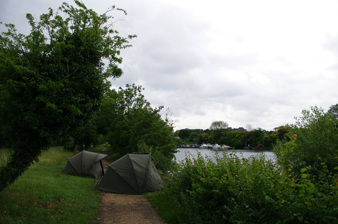
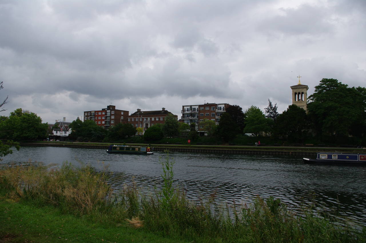
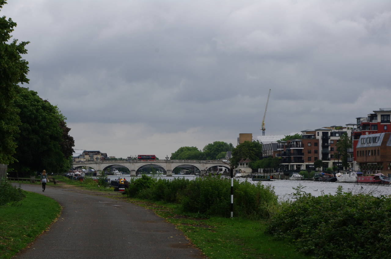
Along the path, there were quite a number of campers who had pitched tents near, or in a few cases directly on, the towpath (picture 6). Civilization was never far away however, as for much of this section of the walk, the buildings of Kingston filled the opposite bank of the river (picture 7). After a good hour's walking, Kingston Bridge came into sight ahead on a fairly long straight stretch of river (picture 8).
(9) Kingston Bridge
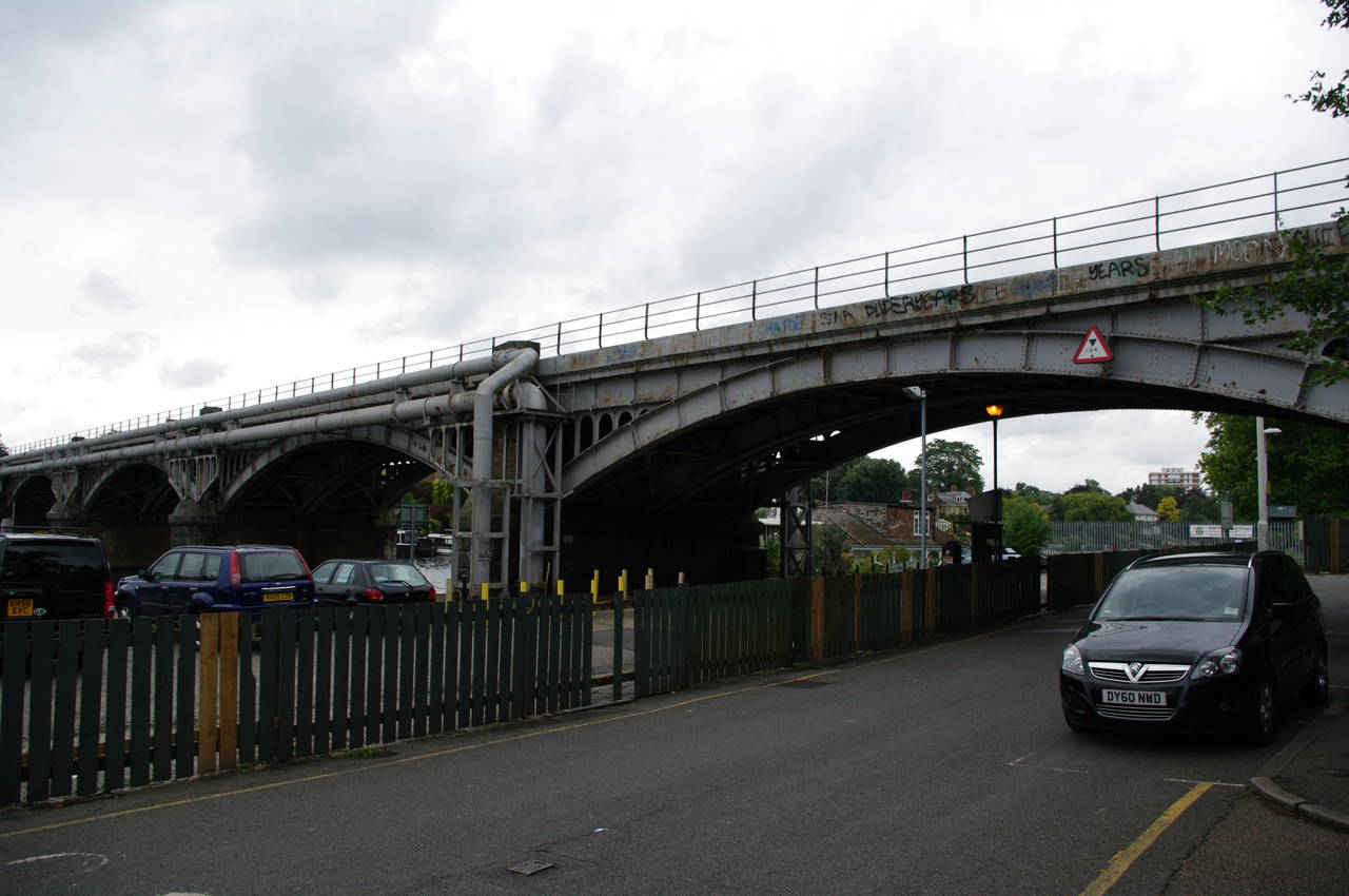
(10) Kingston Railway Bridge
(11) Canbury Gardens, Kingston
(12) Approaching Teddington Weir
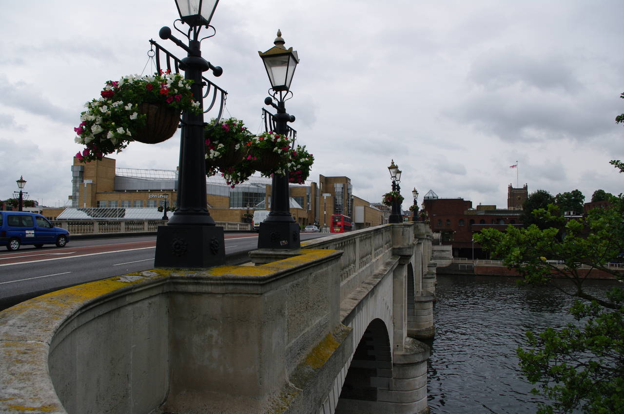
Just before the bridge the path heads a little away from the river to join a road up to the bridge. The Thames Path crosses the bridge on the upstream footpath, where the lampposts were hung with overflowing flower baskets (picture 9), before taking a flight of steps down to the right and joining a footpath which leads under the bridge and continues downstream.
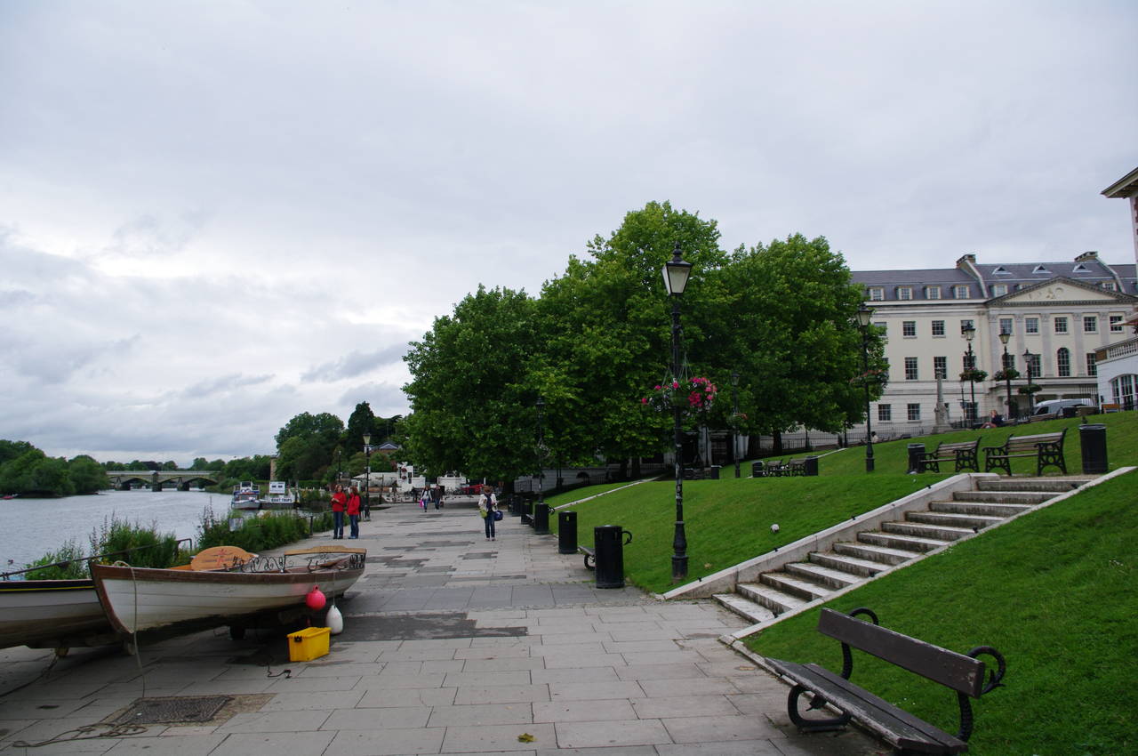
The path joins a road past Turk's Pier and under the Kingston Railway Bridge (picture 10), before the road turns away from the river and the Thames Path continues ahead on a riverside footpath through Canbury Gardens (picture 11). The path passes the Boaters Inn pub and a large boathouse around a hundred metres before the gardens end and the route has to cross over Lower Ham Road to follow the footpath on the other side of the road along a stretch of river where to towpath no longer exists.
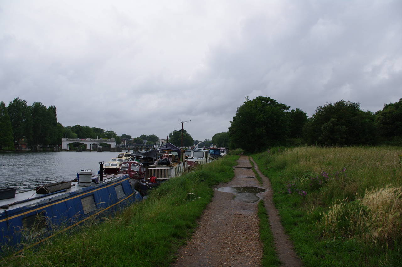
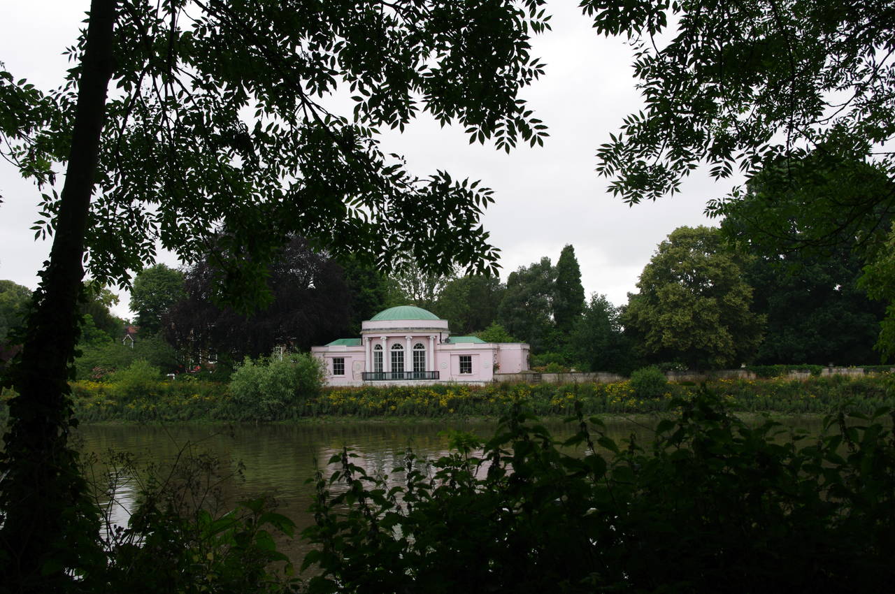
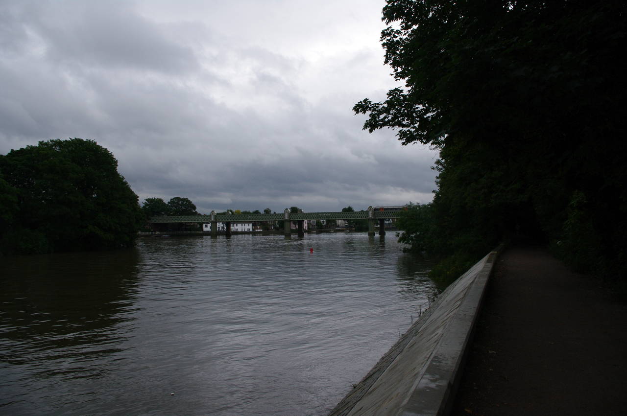
After around four hundred metres, the towpath begins again and runs alongside parkland where boats were moored two and three deep as the river approaches Teddington Weir (picture 12), where around 70,000 litres of water flows over the weir every second.
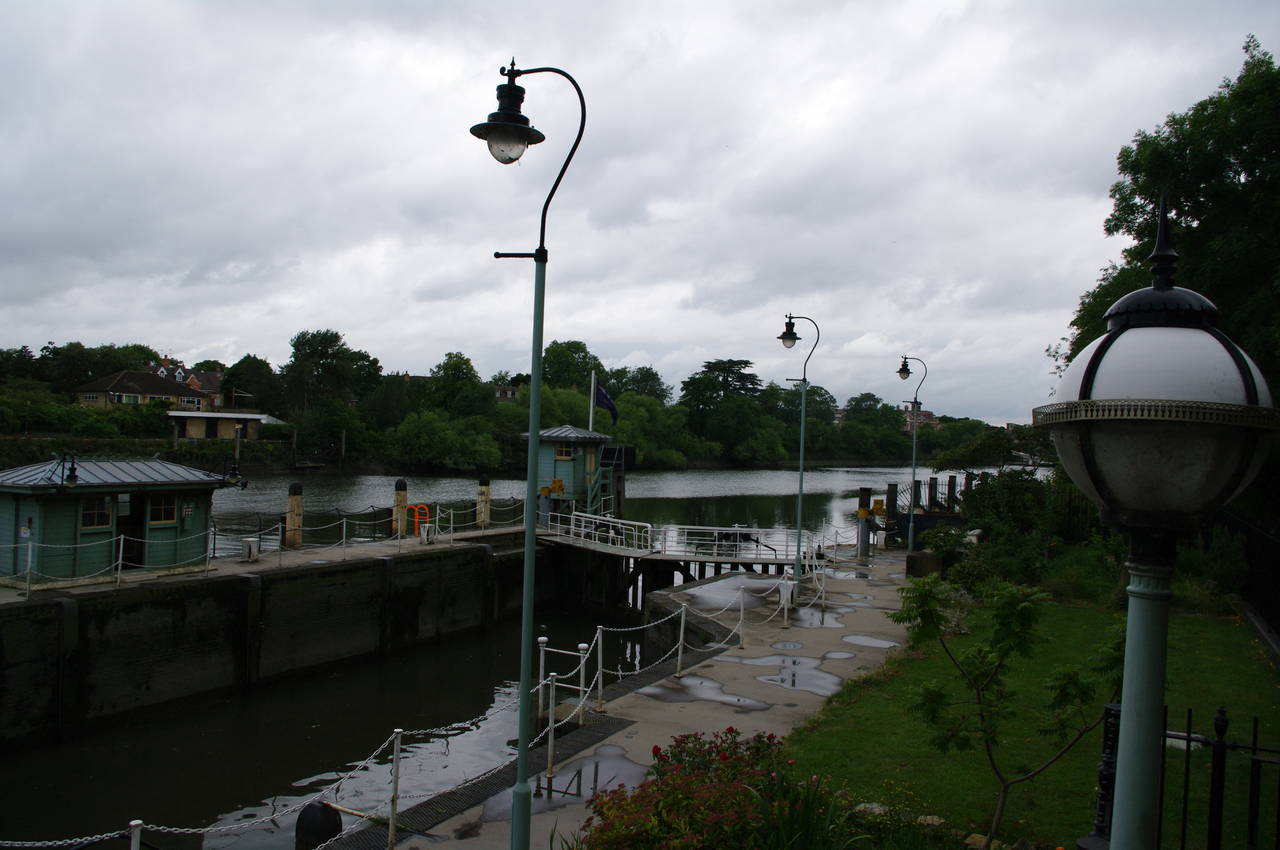
(13) Teddington Lock
(14) Ham Lands
(15) Thames Conservancy Obelisk
(16) Approaching Richmond
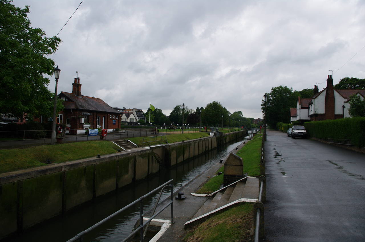
Teddington Lock (picture 13) actually has three locks: a "skiff lock" for very small boats, a regular lock, and closest to the towpath, a 198-metre long barge lock, which has an extra set of lock gates halfway along. The barge lock is by far the largest lock on the Thames.
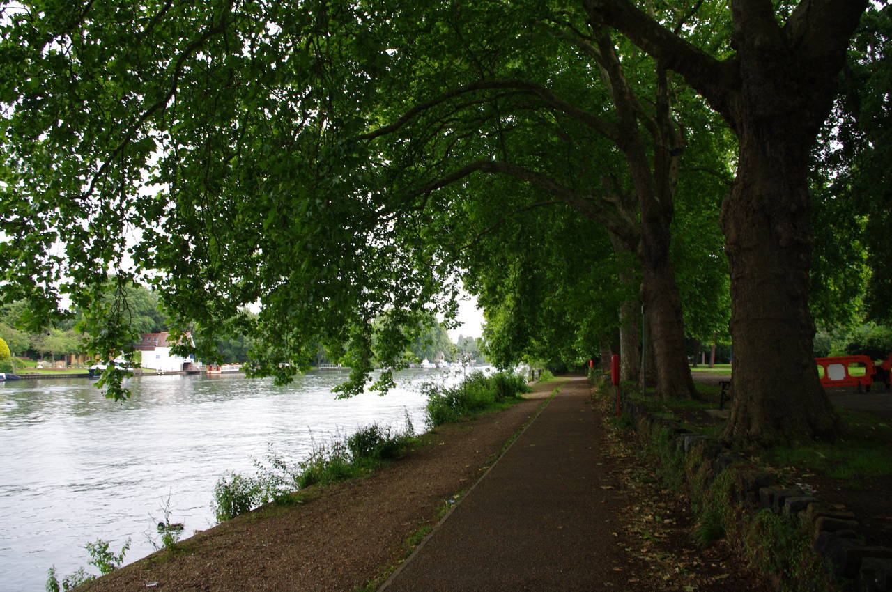
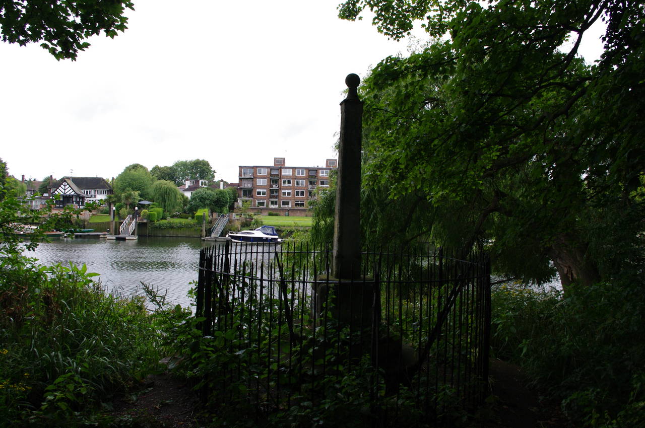
Below Teddington Lock, a broad gravel path heads through the dense woods of Ham Lands (picture 14), soon passing an obelisk that marks the boundary established in 1909 between the jurisdictions of the Thames Conservancy (now part of the Environment Agency) and the Port of London Authority (picture 15). Just beyond this, the path crosses a bridge over the entrance of a large marina before continuing through the thick woodland with only occasional views across the river to the houses of Strawberry Hill.
Around a long right-hand bend in the river, a gap in the woods at the site of a carpark gives a good view downstream towards Richmond Hill (picture 16).
(17) Petersham Meadow and Richmond Hill
(18) Squirrel, Buccleuch Gardens
(19) Richmond Bridge
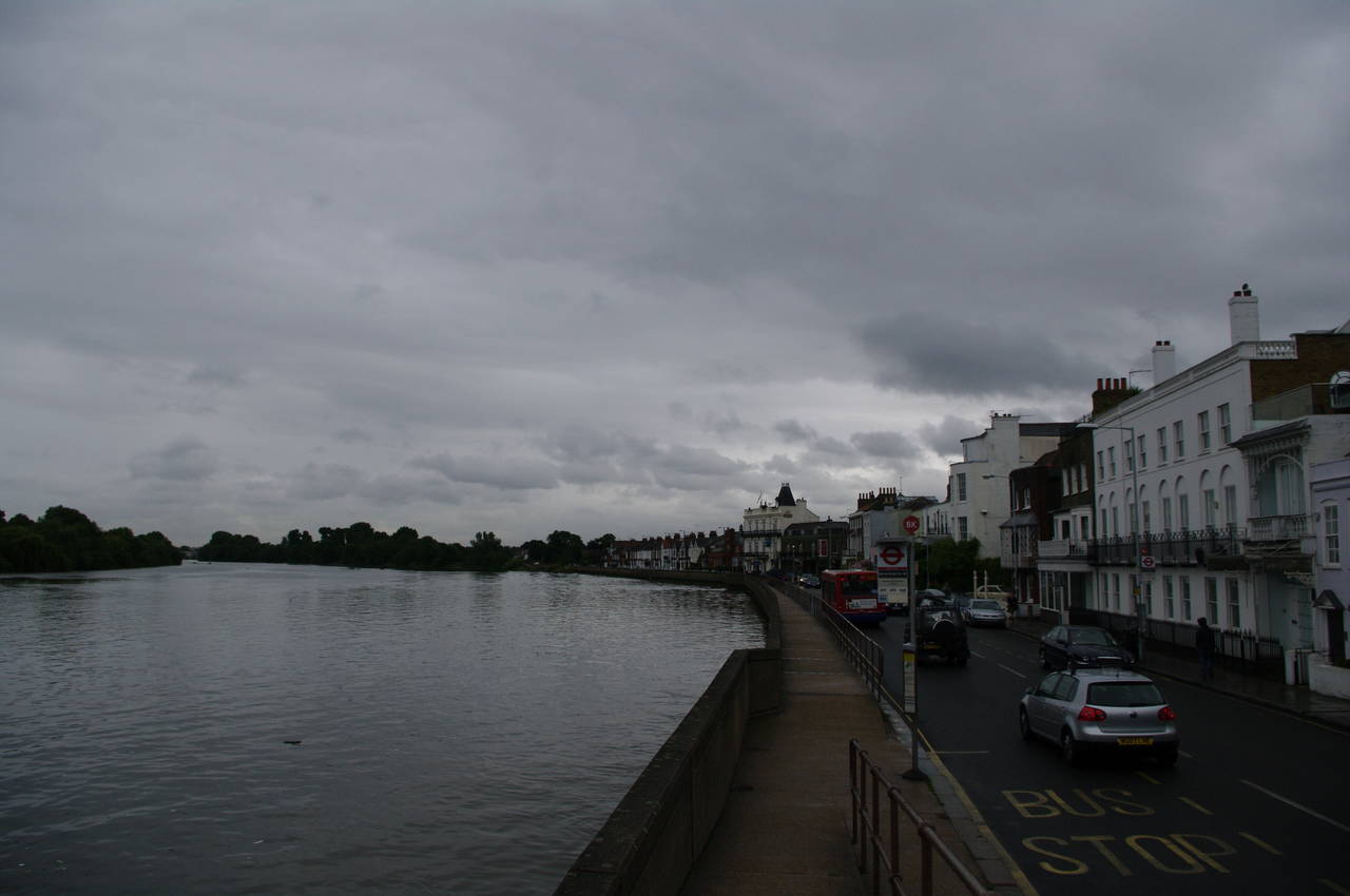
(20) Richmond waterfront
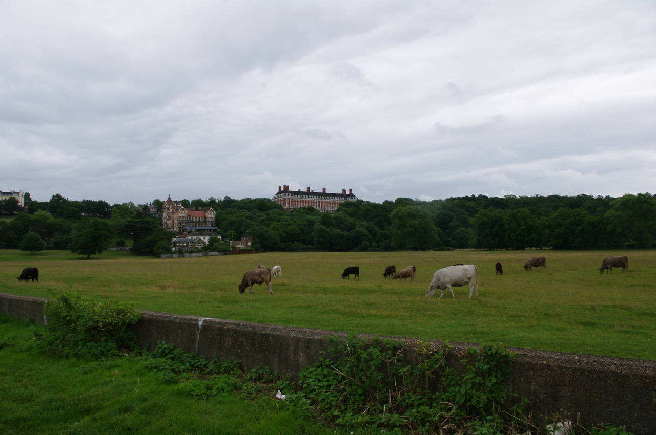
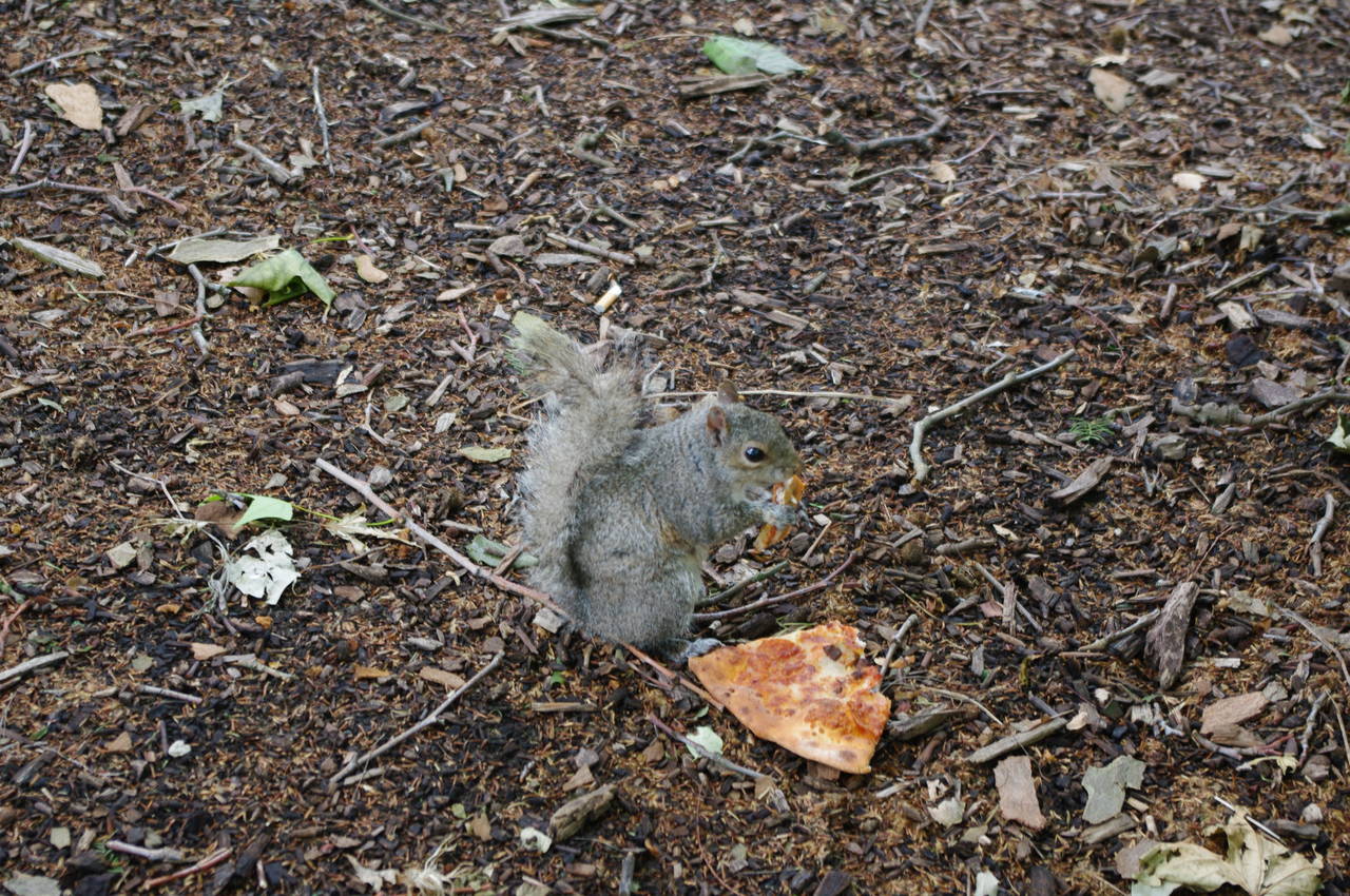
A few minutes walk further, the path passes Petersham Meadows, a traditional cattle-grazed Thames flood meadow at the foot of Richmond Hill (picture 17). At the far end of the meadow the path briefly heads away from the river into Buccleuch Gardens, where I saw a squirrel helping itself to a discarded slice of pizza next to the path (picture 18).
Leaving the gardens, the path returns to the riverside and follows the towpath under Richmond Bridge (picture 19), which was opened in 1777 and is the oldest surviving bridge over the Thames in London.
Just beyond the bridge the promenade passes a pleasant grassy hillside below a couple of large old buildings (picture 20). Stopping here briefly for a snack, I noticed that there were jets passing overhead every couple of minutes as they descended towards Heathrow, just a few kilometres to the north.
(21) Site of the Palace of Shene
(22) Richmond Railway Bridge
(23) Kew Meridian, Old Deer Park
(24) Richmond Lock
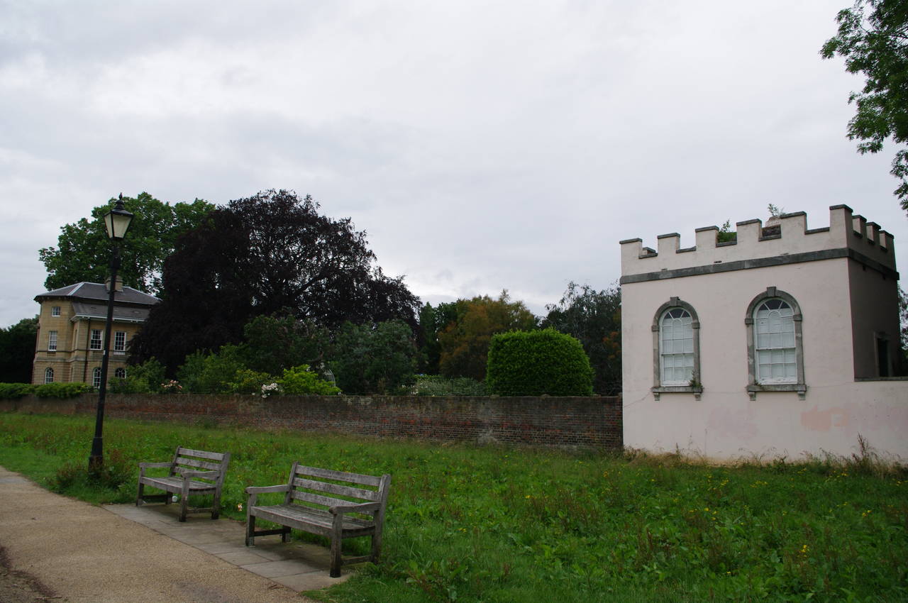
Continuing along the waterfront, the route passes the White Cross pub, a line of garages and then a couple of interesting old buildings on a part of the riverfront that was once the site of the royal palace of Shene (picture 21). A few steps further, the path passes under the Richmond Railway Bridge (picture 22) and the Twickenham Road Bridge in quick succession.
Beyond the bridges the path begins to pass by Old Deer Park, which is now home to the Kew Observatory, the Royal Mid-Surrey Golf Club, and a recreation ground. After a short distance the path passes a marker showing the line of the meridian that passes through the observatory (picture 23) and then the path runs by the edge of Richmond Lock (picture 24). The lock, which has a fall of three metres at low tide, was built in 1894 to ensure that navigation up to Teddington Lock would always be possible. The lock is the lowest on the Thames and is only used when the tide is low - for two hours either side of high tide, the gates of the weir are raised, making the stretch of river up to Teddington Lock partially tidal.
(25) Old Isleworth
(26) Syon Park
(27) View downstream from Kew Gardens
(28) Kew Palace
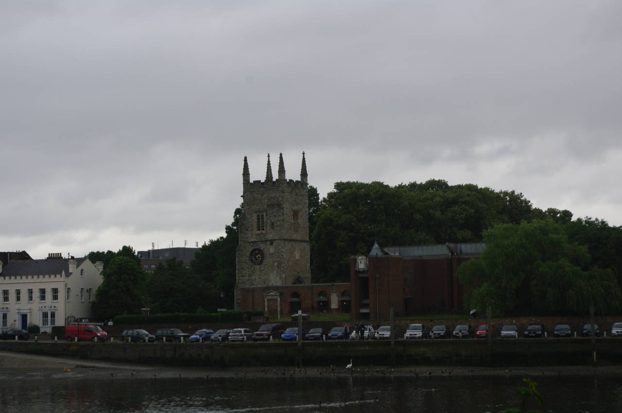
Below the lock, the path gradually curves around to the right, changing direction from north-westerly to north-easterly. This section of path is mostly tree-lined and runs between the river and a wide drainage ditch. Just beyond the end of a large island called Isleworth Ait, the view opens up to the medieval church tower of Old isleworth across the river (picture 25). Around the next bend in the river, a gap in the trees gave a good view across to a domed white building that is part of the Syon Park estate (picture 26).
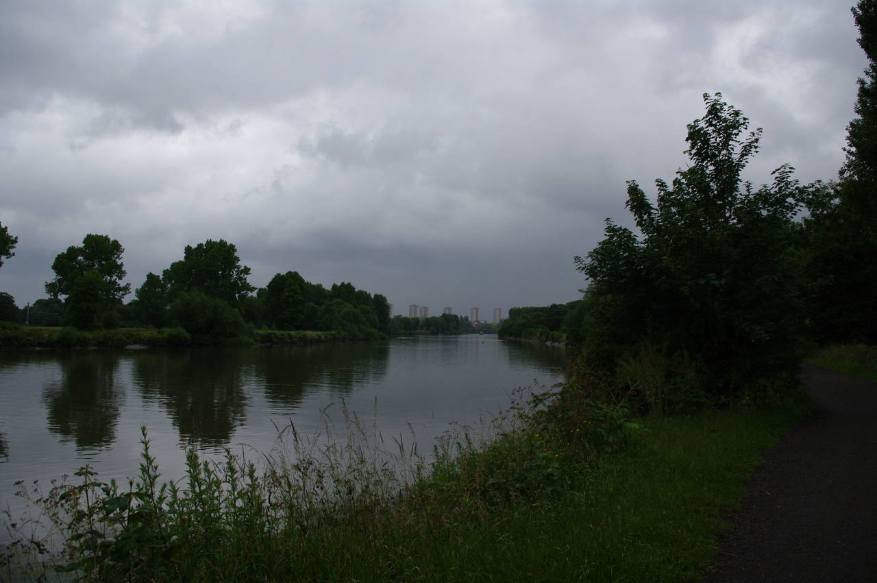
Further on, the path went by a second marker for the Kew Meridian before passing along the edge of Kew Gardens. For a while both sides of the river are wooded and this would have looked like a quite deserted stretch of river, were it not for the half-dozen tower blocks on the horizon ahead (picture 27).
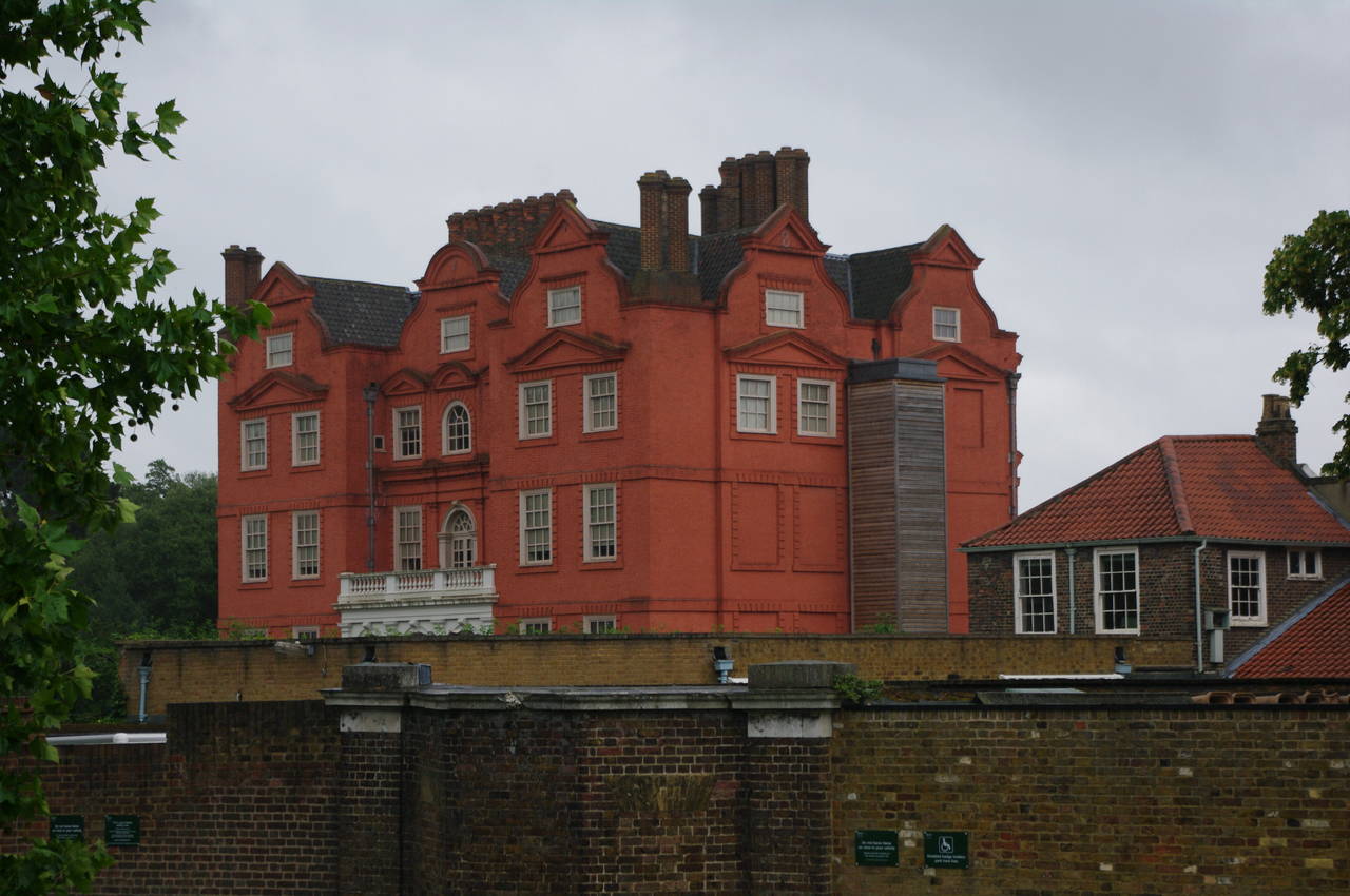
The path eventually reaches the carpark of Kew Gardens and then passes by the walled grounds of Kew Palace (picture 28). Here the wind began to pick up and before long it was raining.
(29) Kew Bridge
(30) Kew Railway Bridge
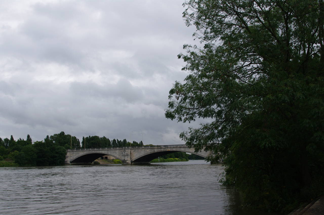
(31) Chiswick Bridge
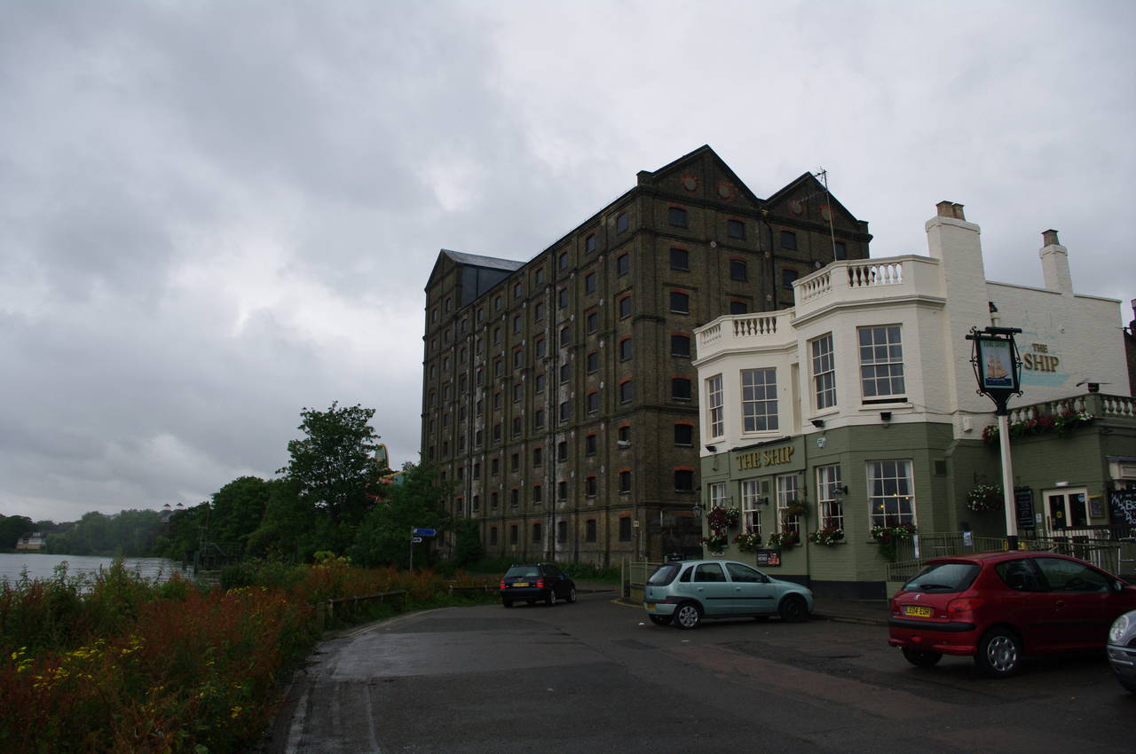
(32) The Ship and the old Mortlake Brewery
The path soon leads under Kew Bridge (picture 29) and past Kew Pier, then runs through trees that mostly screen the view of nearby tennis courts and houses to pass under the Kew Railway Bridge (picture 30). The tree-lined path then passes a long string of apartment buildings, then a boathouse and a small park before reaching Chiswick Bridge (picture 31).
Not far beyond Chiswick Bridge, I reached The Ship Inn, which stands in the sizeable shadow of the disused Mortlake Brewery (picture 32). It being lunchtime, I decided to stop at the pub for some refreshment.
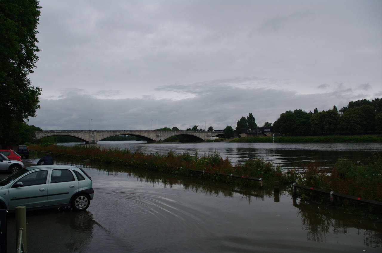
(33) Flooded carpark in front of The Ship Inn

(34) Barnes Railway Bridge
(35) The Terrace, Barnes
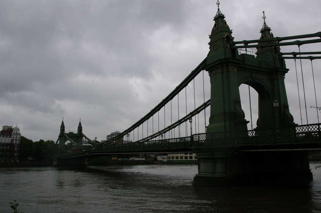
(36) Hammersmith Bridge
After about 45 minutes I emerged from the pub to find that the incoming tide had caused the river to flood the road and carpark in front of the pub (picture 33), as well as the next section of path past the brewery. This is apparently a regular occurence here.
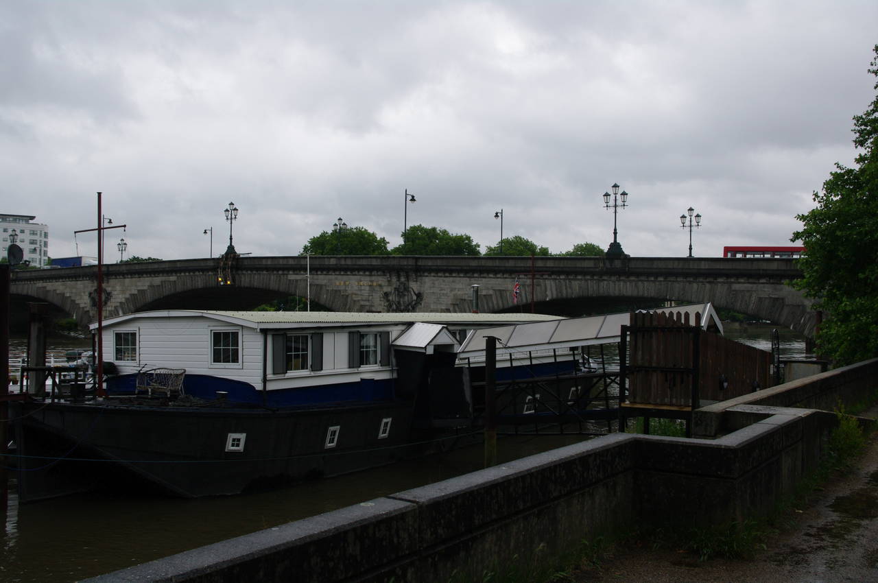
Rather than wait for the tide to recede, I headed up the lane beside the pub and then along Mortlake High Street for a couple of blocks to a small park called Jubilee Gardens, where I was able to return to the riverbank. Before long, the path joins a road called The Terrace (picture 35), which runs under Barnes Railway Bridge (picture 34) and along the waterfront up to the foot of Barnes High Street.
Beyond the intersection with the High Street, the road becomes Lonsdale Road and after a few hundred metres more the Thames Path bears left away from the road to follow an enclosed path through trees between the river and a disused reservoir, then past a school and playing fields to reach Hammersmith Bridge (picture 36).
Due to the persistent rain since Kew and the increasingly cold wind, I decided to finish my walk at this point, though it was only mid afternoon and I had been hoping to get as far as Wandsworth or Battersea Park. My GPS reported that I had covered another 22.5km of the Thames Path today and I had made fairly good time in spite of the weather, so I didn't feel overly disappointed about finishing early.
From the southern end of Hammersmith Bridge it was less than ten minutes walk across the bridge and up to the large shopping mall that houses the Hammersmith tube station. The bridge has some quite intricate decorations, which I wouldn't have gotten to see up close if I had continued the walk, but more about that in the description of the next walk.