THE THAMES PATH
Stage 7: Reading to Marlow
Monday, June 13, 2011
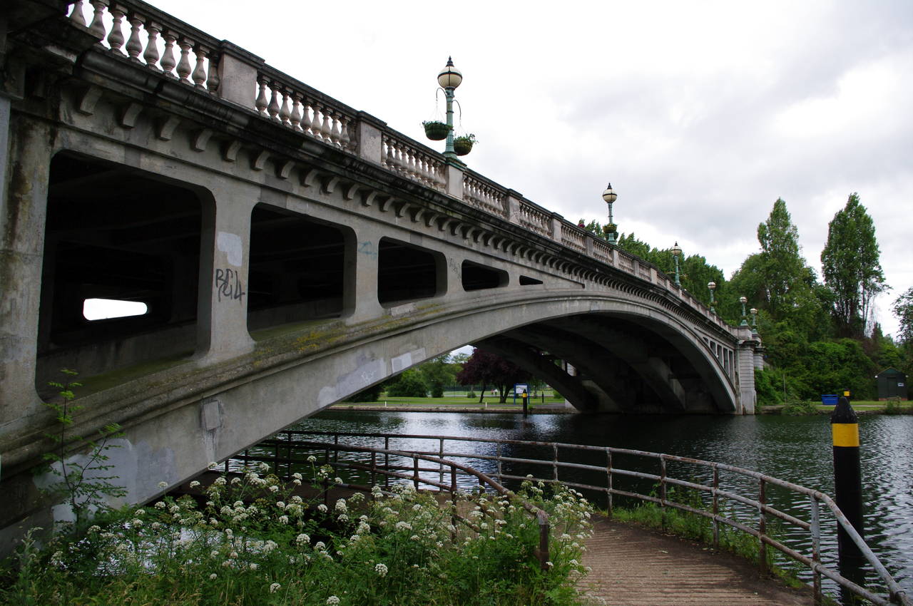
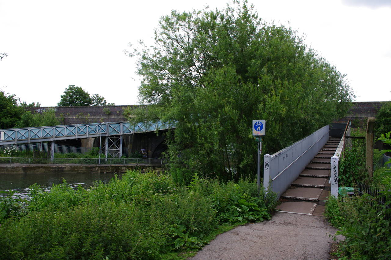
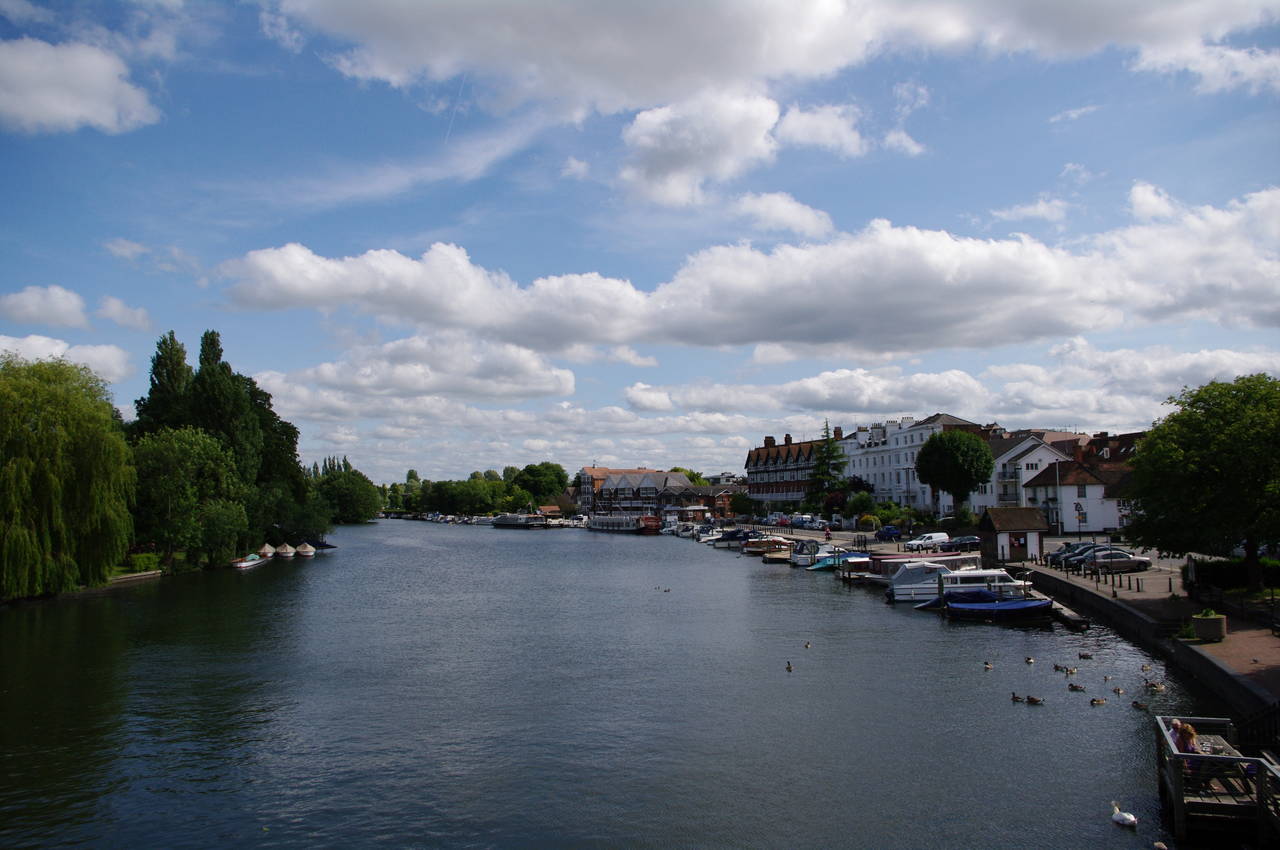
(1) Reading Bridge
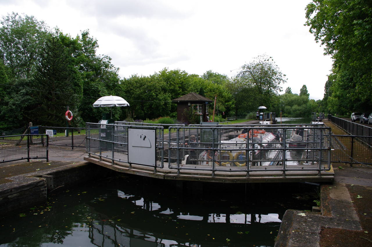
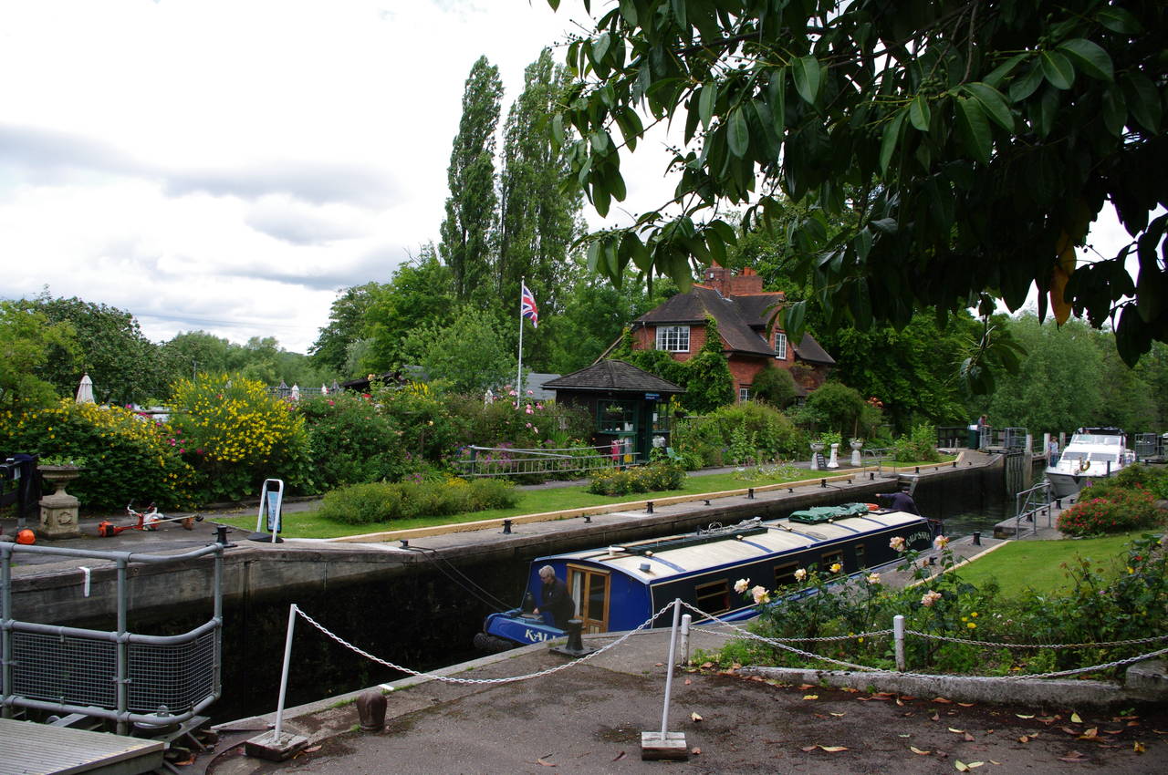
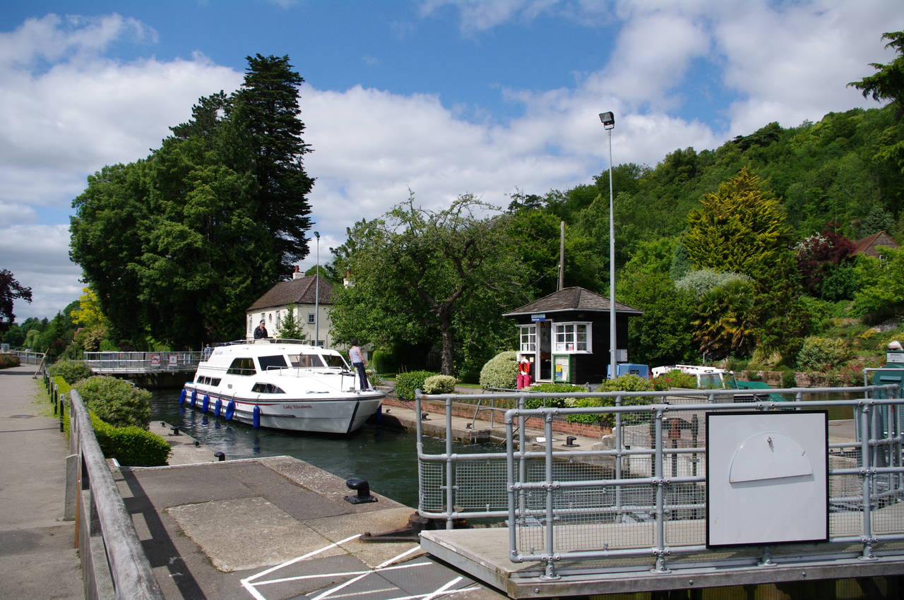
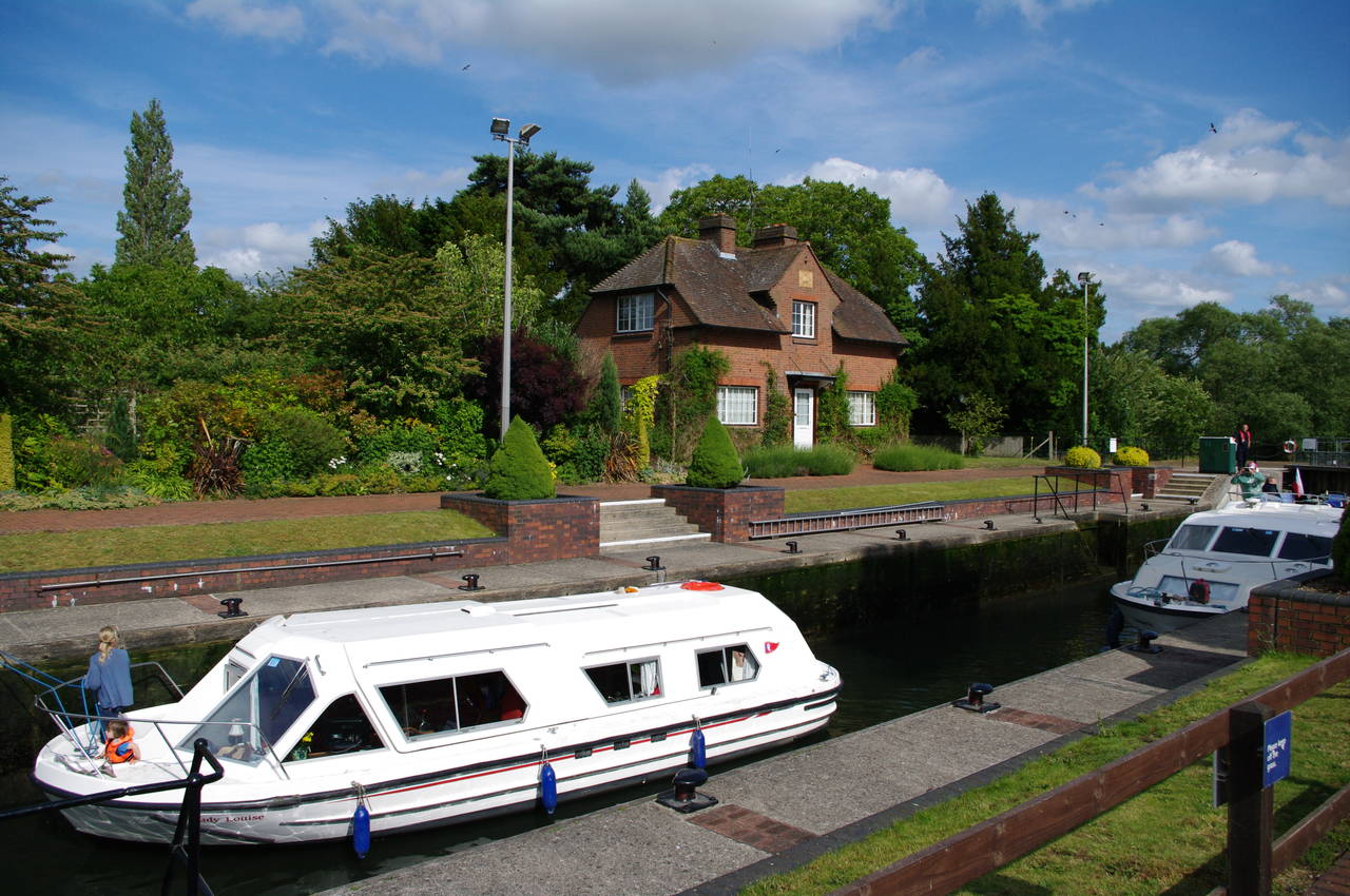
(2) Caversham Lock
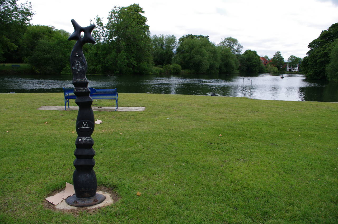
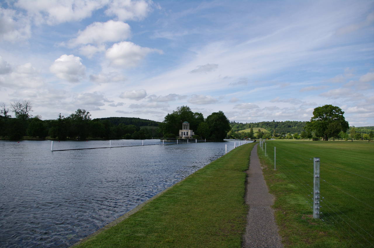
(3) River Thames by King's Meadow, Reading
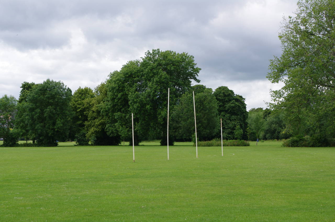
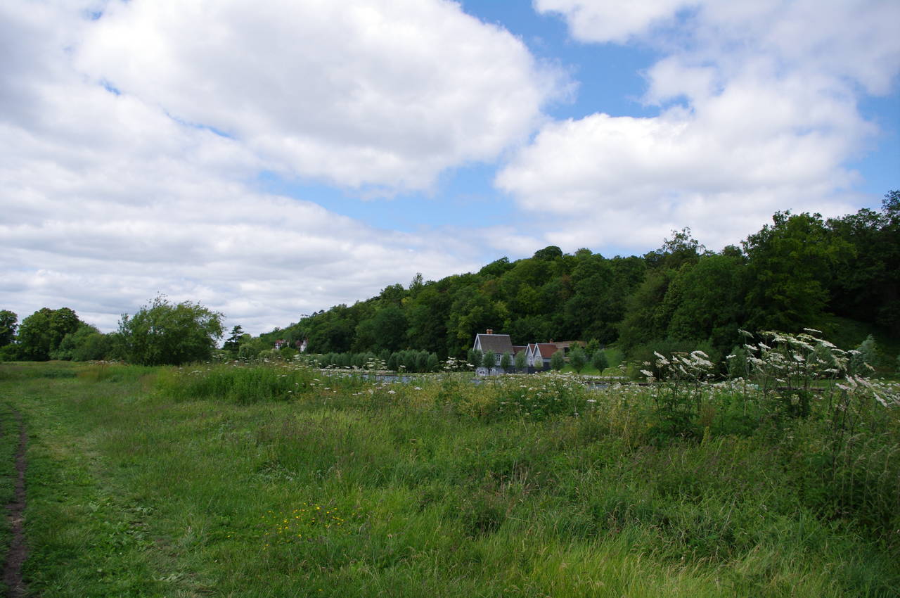
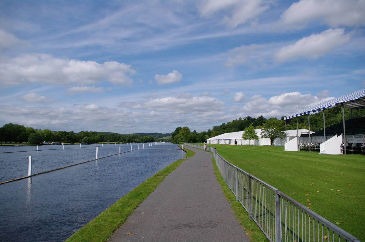
(4) Playing field in King's Meadow
After completing the previous stage of the Thames Path, I had spent two days trying to explore the city of Oxford in cold and wet weather that would have been more typical for January than for June. On the third morning, the weather was looking a little more promising, so I pulled on my hiking boots and headed back to Reading.
Rejoining the Thames Path by the south end of Reading Bridge (picture 1) in the shadow of a large riverside tower block, I started walking downstream on the broad footpath. It took only a couple of minutes to reach Caversham Lock (picture 2), where the lower lock gates had just opened to allow two narrowboats, a large cruiser and a rowboat to resume their journeys downstream.
Beyond the lock the path continues beside the pleasant parkland and playing fields of King's Meadow. This part of the path is shared with the National Cycle Network and one of the distinctive NCN route markers stands beside the path (picture 3). To my surprise, the last of the playing fields had goalposts for Australian Rules Football (picture 4), something I hadn't expected to see in soccer-mad England.
(5) Horseshoe Bridge
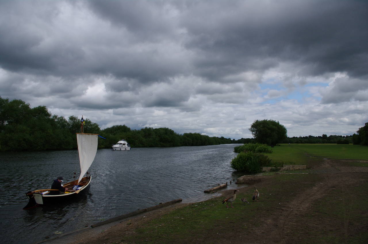
(6) Sailor on the Thames near Reading
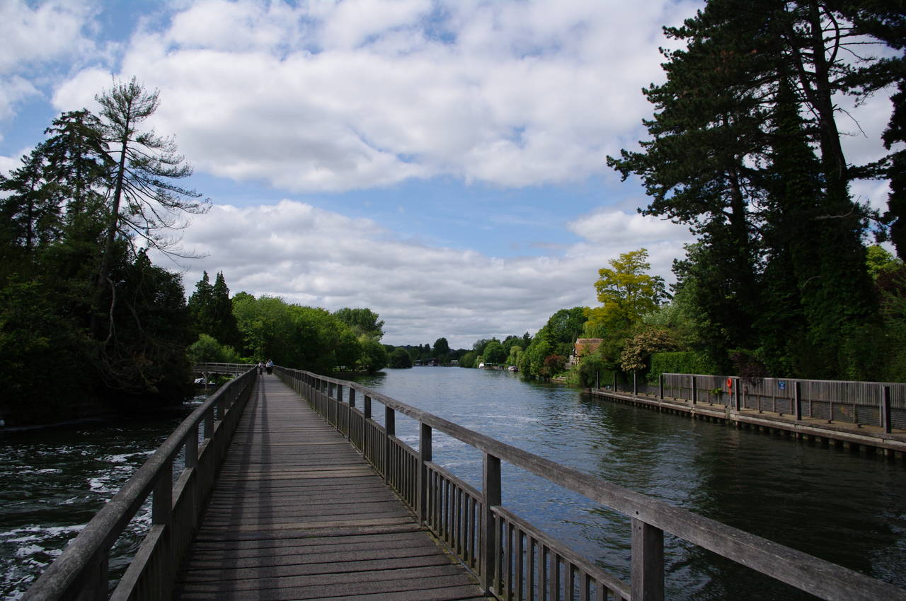
(7) River Thames above Sonning Lock
(8) Sonning Lock
Beyond the playing fields the path is mostly shaded by a strip of woodland, which hides a large supermarket from view. The path soon curves back towards the railway line, beneath which the River Kennet emerges and flows into the Thames, while the Thames Path crosses the confluence via the Horseshoe Bridge (picture 5).
Mercifully the path then heads away from the railway line, following the river beside a wide strip of short grass with regular benches by the water and quite a number of people out walking their dogs. Here, the rowboat that I had seen earlier at Caversham Lock approached the riverbank and the occupant put up a sail (picture 6).
Some distance further on, the path enters woods downhill from the Reading Blue Coat School (picture 7), passing the school's boathouse before reaching Sonning Lock (picture 8), which was lined with colourful flowerbeds. Both above and below the lock there were groups of students from the nearby school walking along the path wearing their dark blue coats.
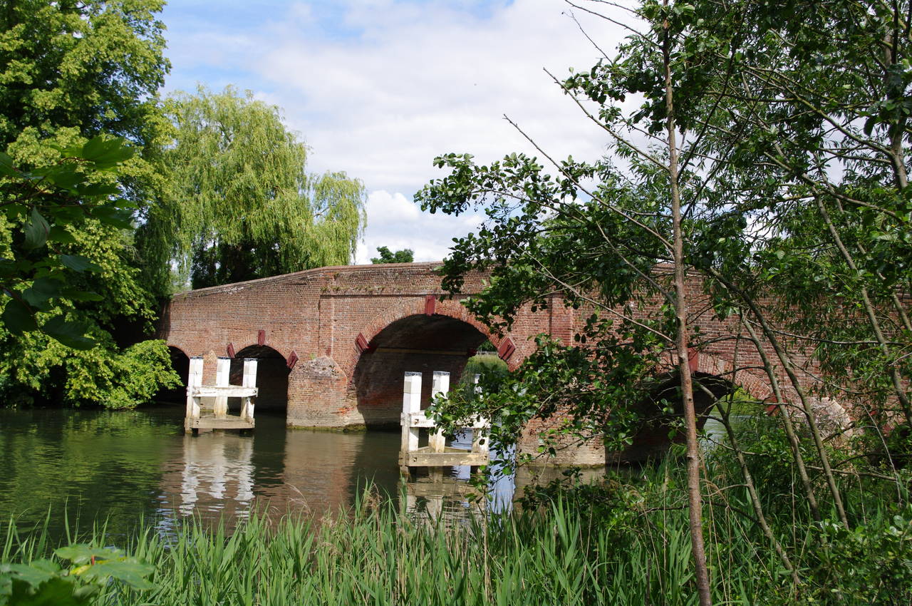
(9) Sonning Bridge

(10) Cottages at the end of Sonning Bridge

(11) Footbridge over Sonning weir stream
(12) Rower downstream from Sonning Bridge
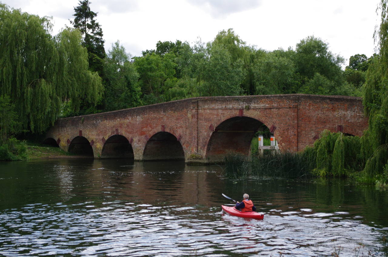
The riverside path soon reaches Sonning Bridge (picture 9), built of brick in 1775. The route crosses the narrow bridge onto a large island that separates the lock and weir streams. Just before an attractive cottage (picture 10), the route turns right and crosses a footbridge over the weir stream (picture 11) to reach the Oxfordshire bank of the Thames.
Just beyond the footbridge, I was asked for directions by a lady who was walking upstream on the Thames Path while her husband was rowing a kayak upstream and was wondering which channel to follow up to Sonning Lock. Having pointed them in the right direction, the husband headed off under Sonning Bridge (picture 12) and I shortly continued my walk downstream.
It sometimes surprises me how often people ask me for directions when I'm out walking in England -- on average probably a couple of times a day. This doesn't happen nearly as often at home in Australia. I suppose I must give the illusion of knowing where I'm going.
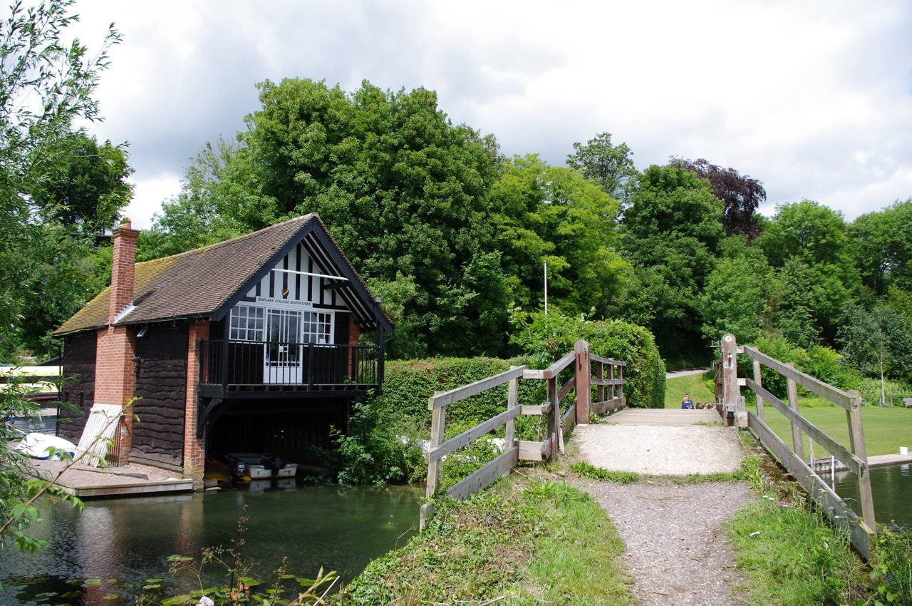
(13) Shiplake College boathouse
(14) Approaching Shiplake Lock

(15) Lashbrook Farm, Lower Shiplake
(16) Bolney Ferry
For the next three kilometres the mostly tree-lined riverside path follows the twists and turns of the river past large meadows until a footbridge carries the path past an attractive boathouse belonging to Shiplake College (picture 13) and onto a riverside lawn where a dozen or so boys from the college were preparing some boats.
The route crosses the lawn and heads into some trees by the river's edge, sticking to the river bank for almost a kilometre to reach Shiplake Lock (picture 14), where the towpath switches to the other side of the river. The Thames Path doesn't cross the footbridge to the lock island, but instead turns left and follows a stone wall away from the river to turn right onto Mill Lane. After 20 metres, the route turns left and follows a fenced path through some trees and then beside a wheat field, through a metal kissing gate and diagonally across another wheat field to reach a lane at Lashbrook Farm (picture 15).
A signpost points along the lane to the left, where the route reaches a junction and turns right to follow Mill Road past houses and into the middle of the town of Lower Shiplake. At an intersection with the Baskerville pub on the right-hand side, the route turns right and follows Station Road for a short distance to a level crossing near Shiplake Station.
A few metres past the level crossing, the Thames Path turns left off the road to follow a narrow enclosed footpath beside fences and hedges. After a couple of minutes, the path bears right through an old kissing gate and another narrow footpath between houses leads out to Bolney Road.
The route follows the road to the left, passing some impressive houses that separate the road from the Thames. At an intersection, the Thames Path is joined for a while by the Chiltern Way long-distance path as it heads up to the end of the road and takes a fenced path to the left of a private driveway. This path heads through some trees and then into an open field and back to the riverbank near the site of the old Bolney Ferry where the towpath returns to this side of the river (picture 16).

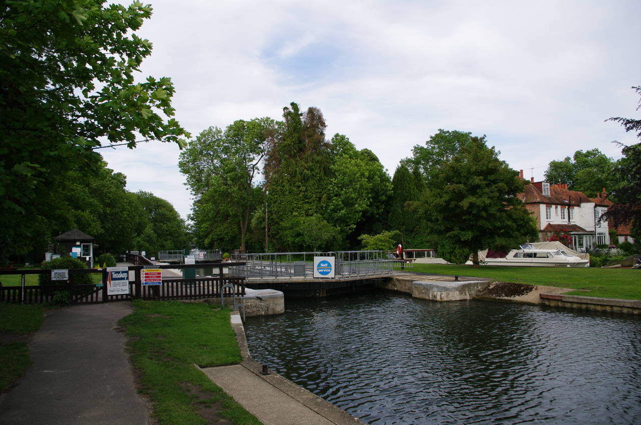
(17) Causeway leading to Marsh Lock
(18) Marsh Lock
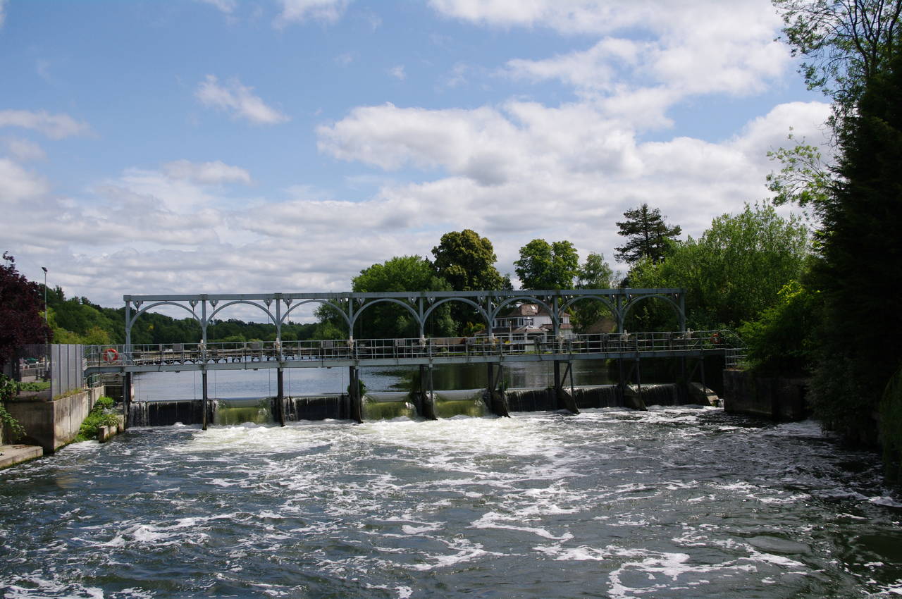
(19) Marsh Weir
(20) Causeway leaving Marsh Lock
At the end of the field, the Thames Path follows a long wooden causeway out into the middle of the river, with good views of the houses on the wooded hillside of the Berkshire bank of the river (picture 17). The causeway leads to Marsh Lock (picture 18), where the route passes along the lock edge with water pouring over the weir to the left (picture 19), before another long causeway takes the Thames Path back to the same bank from which it departed (picture 20).
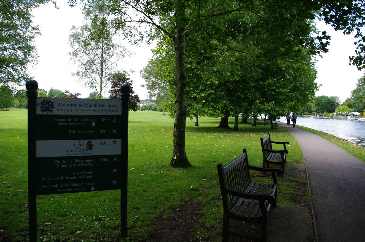
(21) Marsh Meadows, Henley-on-Thames

(22) Boats moored by Marsh Meadows
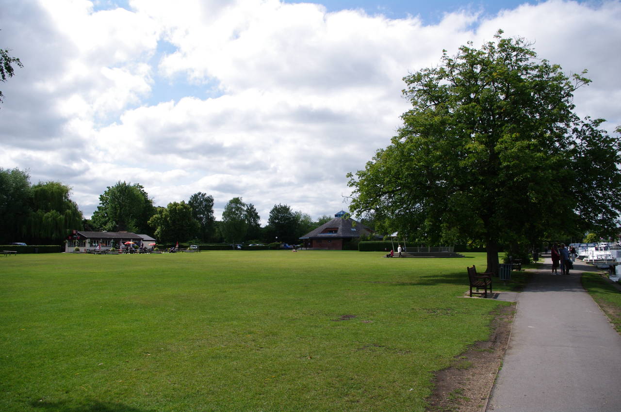
(23) Mill Meadows, Henley-on-Thames
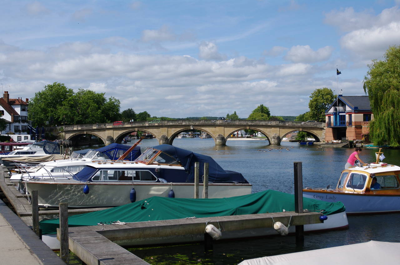
(24) Henley Bridge
Back on the riverbank and now in the town of Henley-on-Thames, the path passes the parkland of Marsh Meadows (picture 21). About 600 metres further on, Marsh Meadows is separated from the busier Mill Meadows by the River and Rowing Museum. Nearing the museum, there were many boats moored by the riverbank (picture 22) and several groups of people milling around at the water's edge.
Across the grass of Mill Meadows there was a café (picture 23), where I stopped for lunch before continuing downstream along Henley's waterfront, passing many more moored boats before reaching Henley Bridge (picture 24).
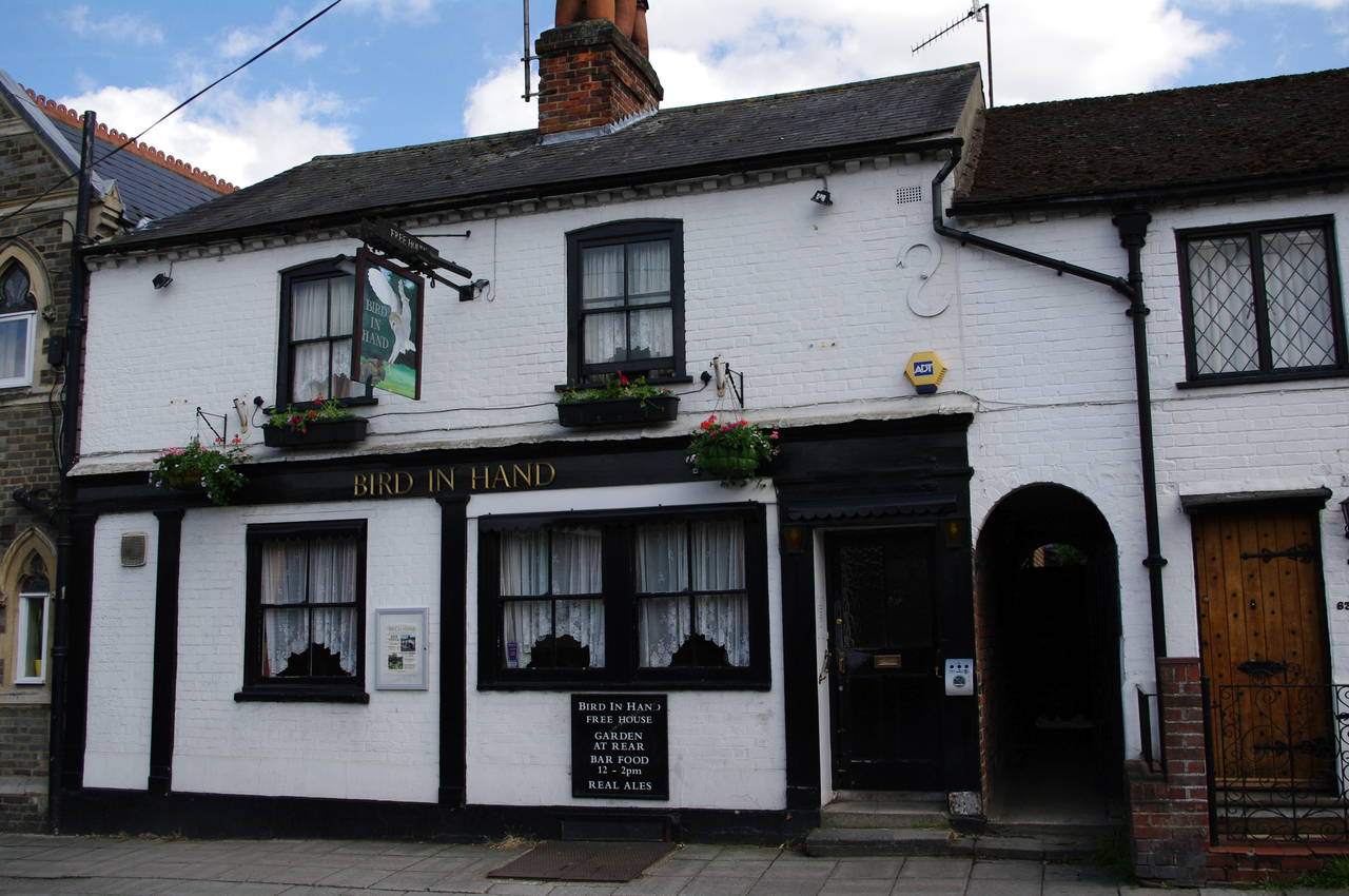
(25) The Bird In Hand, Henley-on-Thames
(26) View upstream from Henley Bridge
(27) Henley rowing course
(28) Temple Island
Approaching the bridge, the riverside path is blocked by the Angel pub and the Thames Path goes around the pub and up onto the bridge. Before crossing the bridge, I left the path and headed several blocks away from the river to find the Bird in Hand Free House on Greys Road (picture 25), which has been named CAMRA's South Oxfordshire Pub of the Year for three of the last five years.
Returning to Henley Bridge, I crossed over, leaving Oxfordshire for the final time on this walk. From the bridge there were good views back upstream along Henley's waterfront (picture 26) and downstream along Henley's famous rowing course, where many marquees and grandstands were being erected in preparation for the following month's Regatta.
Descending from the bridge back to the riverside footpath, in Berkshire once again, the Thames Path follows alongside the regatta course (picture 27) for just over two kilometres -- a rare straight section of the river. Beyond the grandstands, the path passes several buildings belonging to various rowing clubs before passing several neatly mown fields. The rowing course ends beside Temple Island (picture 28), beyond which the river begins to curve away to the right.
(29) Hambledon Lock
(30) The Flower Pot Hotel, Aston
(31) River Thames, near Culham Court
(32) Medmenham Abbey
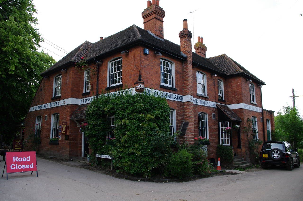
Little more than a kilometre beyond Temple Island, the path reaches Hambledon Lock (picture 29), the course of the river having turned almost 180 degrees. At the end of the second field beyond the lock, the path reaches the location of the former Aston Ferry, where once again the towpath changes to the opposite bank of the river. This causes the Thames Path to leave the river along Aston Ferry Lane, passing the Flower Pot pub (picture 30) and continuing a short distance ahead on Aston Lane before turning left along a farm road.
The road climbs uphill for a short distance and where the road turns right the Thames Path continues ahead into a grassy field where the path divides. The official route of the Thames Path follows the right-hand path, though it doesn't really matter, as the two paths join up again in a few hundred metres.
The path gives views across the Thames (picture 31) before the river swings away again and the path follows the line of a metal fence below the red-brick building of Culham Court. Reaching a kissing gate, the path follows a wire fence towards some farm buildings, joining a farm track for around a hundred metres before a wooden fingerpost points across a meadow and back to the riverbank.
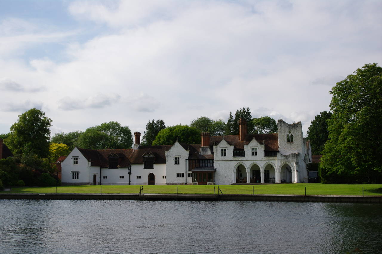
The Thames Path then follows the riverbank beside pastures where several small groups of cows were grazing. After about a kilometre, the interesting structure of Medmenham Abbey can be seen across the river (picture 32), the far bank now marking the border of Buckinghamshire. The unusual building results from an 18th century house being built around the remains of the earlier abbey.
(33) Hurley Weir
(34) Hurley Lock
(35) Temple Footbridge
(36) Temple Lock
In front of the Abbey, the towpath returns back to the Berkshire bank and the Thames Path follows it past a long row of chalets, a huge caravan park and a large but deserted riverside camping ground. Towards the end of the camping ground, the wide Hurley Weir stretched across the far side of the river, while a large group of ducks were swimming near the riverbank (picture 33).
A little further on, the path crosses a wooden footbridge onto the large lock island and then follows a footpath along the lock cut to pass by Hurley Lock (picture 34). At the far end of the lock island, another footbridge carries the path back to the Berkshire bank.
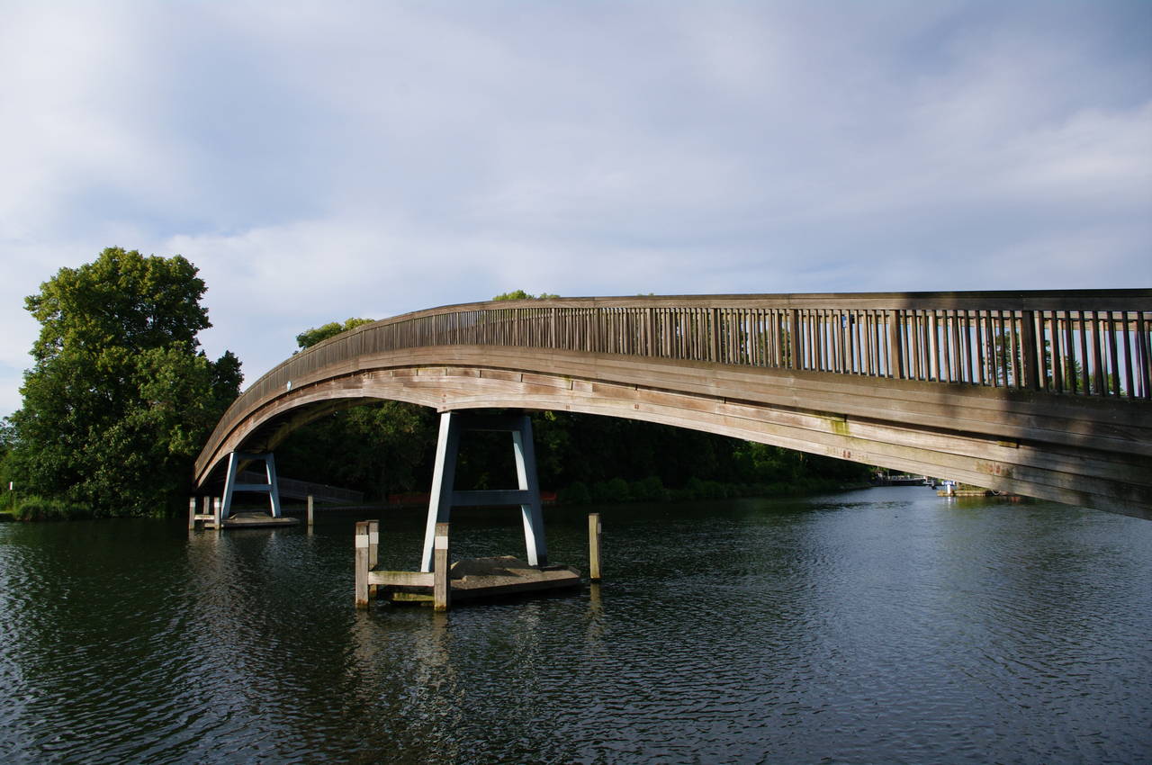
The path continues by the tree-lined river's edge with many boats moored in front of another large caravan park on the opposite bank. Fairly soon, the path reaches the graceful wooden arch of the Temple Footbridge, Britain's longest hardwood bridge, at 80 metres with a central span of 46 metres. The bridge was built in 1989 to take the Thames Path across to the Buckinghamshire bank where the towpath used to cross the river via a ferry.
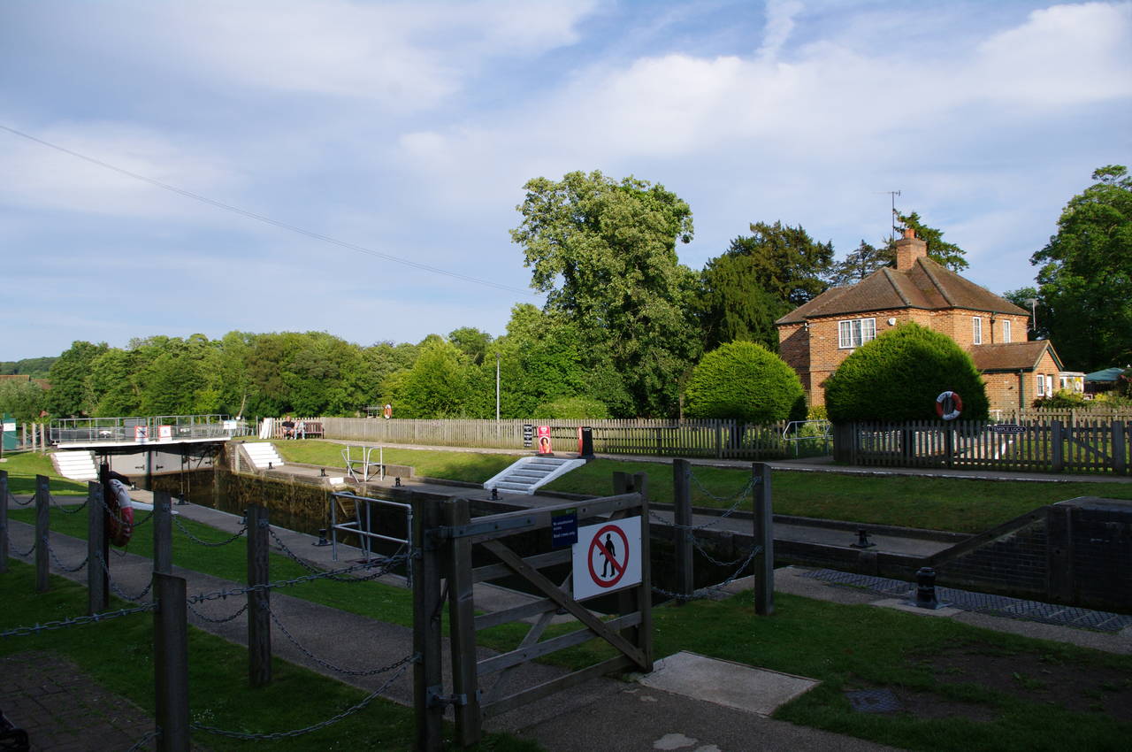
A short distance downstream after crossing the footbridge, the path passes by Temple Lock (picture 36).
(37) Bisham Church
(38) Approaching Marlow
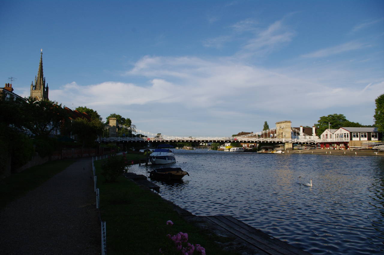
(39) Marlow Bridge
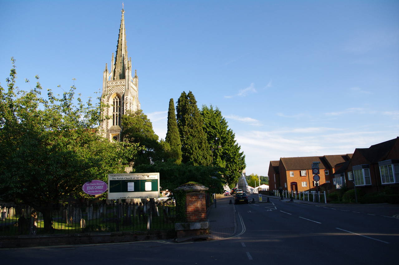
(40) Parish Church of All Saints, Marlow
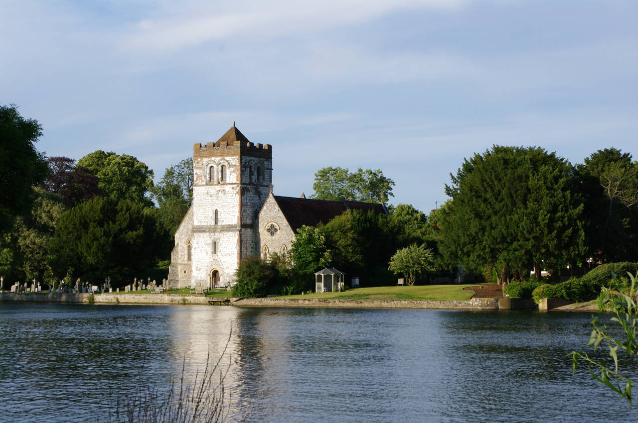
The path now runs beside a series of fields, some of them grazed by sheep. After a kilometre, the village of Bisham comes into view on the opposite bank with its church standing close to the river (picture 37).
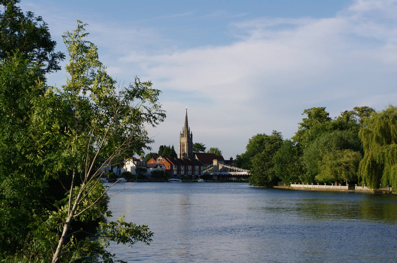
Ahead, the tall church steeple of the town of Marlow gradually comes into view, still a kilometre away (picture 38). The path follows the riverbank up to Marlow Bridge (picture 39), a magnificent steel suspension bridge opened in 1832. The Thames Path turns left beside the bridge and heads up to the road, which it crosses to the corner of the churchyard of the Parish Church of All Saints (picture 40).
At this point I left the Thames Path for the day, having completed another 28.6km of the trail. From here I walked a short distance up the High Street and turned right to follow Station Road as far as Station Approach where I found the rather well-hidden railway platform and a waiting train.
The train service here is a little odd -- the train from Marlow only runs one station down the line to Bourne End, where I had to change to another train that runs down the rest of the branch-line to join the main-line at Maidenhead Station. In hindsight, it would perhaps have been wiser to continue on the Thames Path for the extra four kilometres to Bourne End, as this would have made the journey to my lodgings and the return journey the following morning a little bit simpler.
Despite that, this had been another good day's walking along the Thames Path and, after a couple of freezing cold rainy days walking around Oxford, I was quite pleased to get a nice sunny afternoon for this walk.