ST SWITHUN'S WAY
Stage 1: Winchester to New Alresford
Wednesday, May 2, 2012
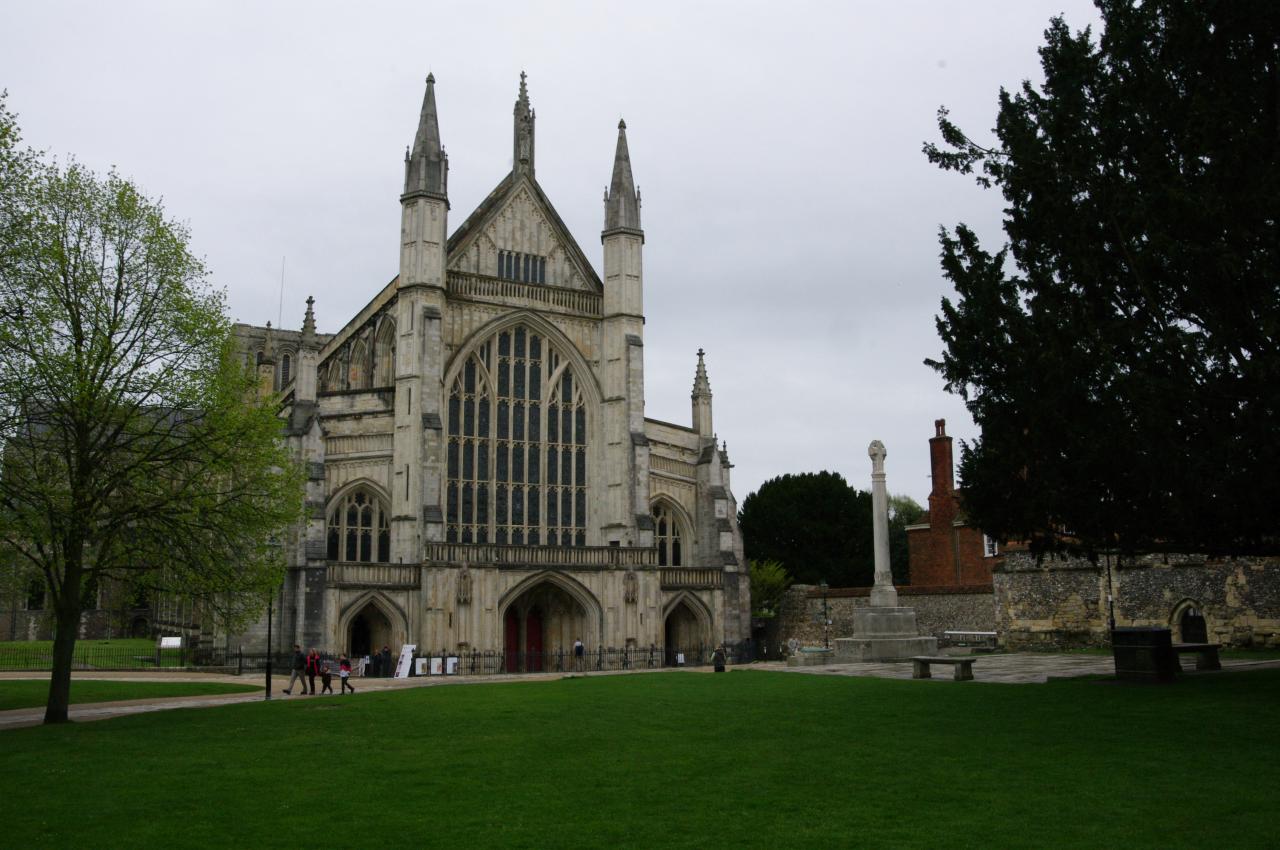
(1) Winchester Cathedral
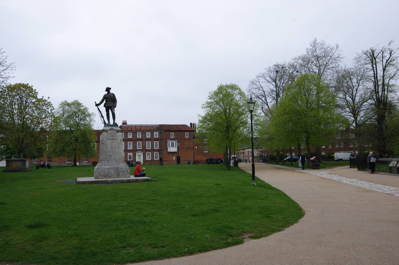
(2) Cathedral Close
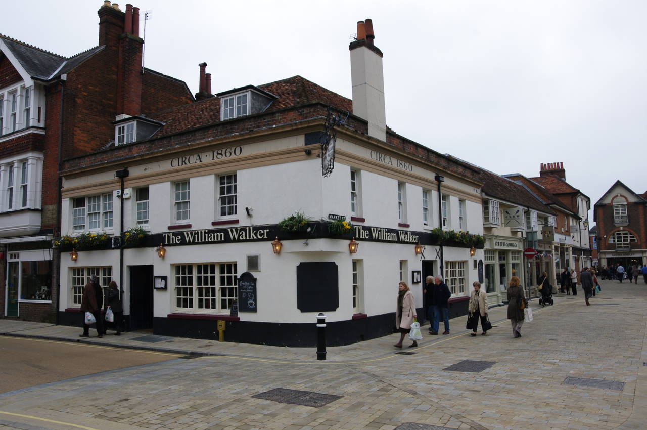
(3) The William Walker Pub
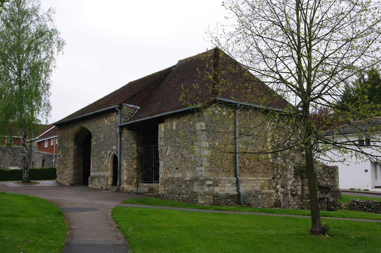
(4) Hyde Gate
I began my walk along St Swithun's Way on a rather gloomy and rainy afternoon. With only a few days left before I was due to move on from Winchester and the weather forecast predicting that similar weather was likely to prevail for the next week, I decided to don my waterproof gear and make the best of this relatively short first stage of the walk.
St Swithun's Way begins where the South Downs Way ends: in front of the impressive 12th-century Winchester Cathedral (picture 1). From the paved square in front of the cathedral, the route follows a footpath north across the grassy Cathedral Close, passing by a war memorial (picture 2) before leaving the Close and following Market Street past the William Walker pub (picture 3), which has stood on this spot since 1860 but was later renamed after a pioneering early-20th-century diver who spent five years reinforcing the cathedral's waterlogged foundations.
Reaching the end of Market Street, the route turns left along Winchester's pedestrianised High Street, which is filled with market stalls on most days. After one block, a right-turn leads into Parchment Street, where shops soon give way to residential buildings. At the end of the street, the route briefly goes to the right along North Walls before crossing the road and heading into a large carpark. On the other side of carpark, the route turns left, joining Gordon Road and then continuing ahead into Hyde Abbey Road.
The first street on the right is also called Hyde Abbey Road, and St Swithun's Way follows it to the far end, crossing a footbridge over a narrow stream to reach the end of Arlington Place. Here the route turns left and then very soon right to follow a footpath between buildings to the end of King Alfred Terrace where a footbridge leads into a small park.
Following the footpath through the park, one soon passes by the 15th-century Hyde Gate (picture 4), a flint building that is one of the few remaining parts of Hyde Abbey, which once occupied much of the land in this part of Winchester.
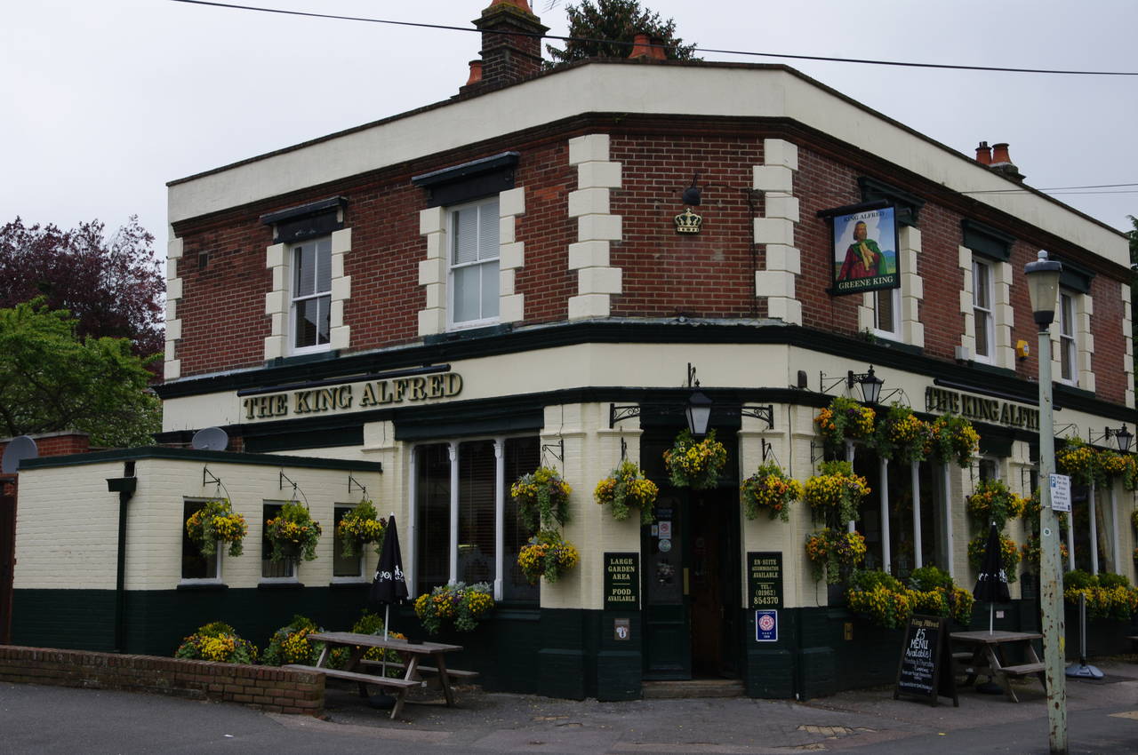
(5) King Alfred Pub
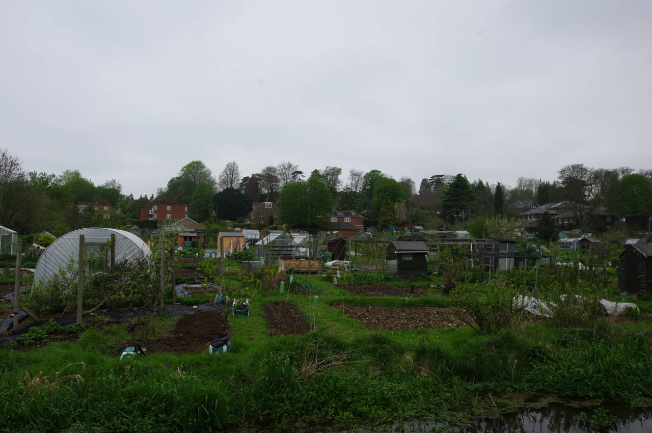
(6) Allotments
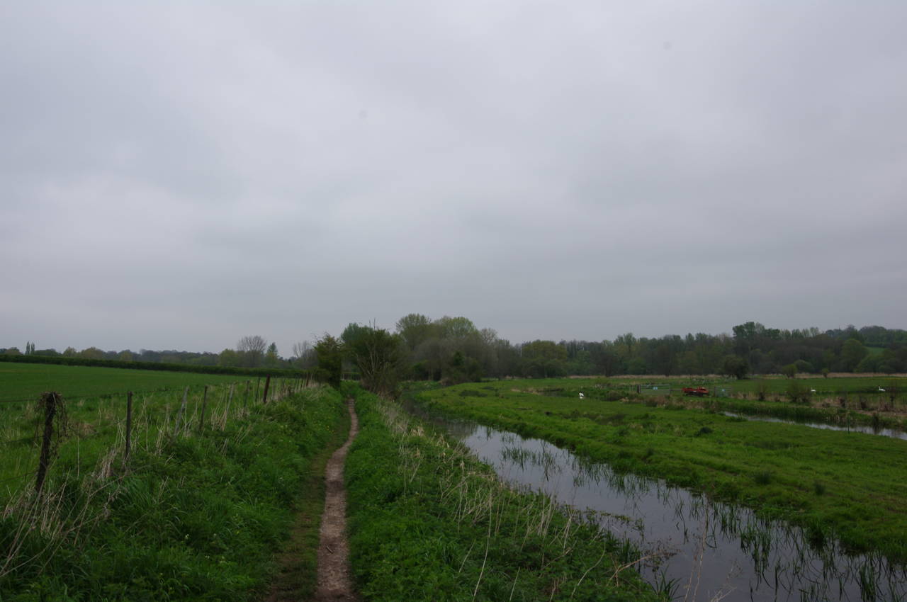
(7) Open fields north of Winchester
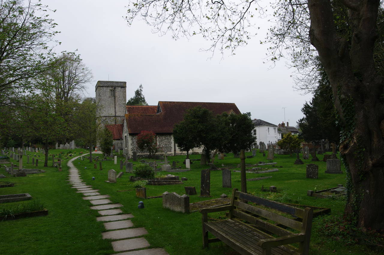
(8) Parish Church of St Mary, Kings Worthy
Leaving the park, the Way continues ahead along Saxon Road, where it soon passes the King Alfred Pub (picture 5), which happened to be where I was staying for the week. The pub was built in the 1890's and was recently refurbished. With about half a dozen guest rooms upstairs, it's a very comfortable place to stay and is in a nice quiet neighbourhood, comfortable walking distance from the city centre, but far enough away that the patrons are mostly locals rather than the hordes of tourists who fill the pubs on the High Street.
After passing the pub the route continues along Saxon Road to the next street on the right, Nuns Road, following it for about ten metres to cross a side-stream of the River Itchen before turning left onto a footpath along the right bank of the stream. A large block of allotments soon appears on the far side of the stream (picture 6).
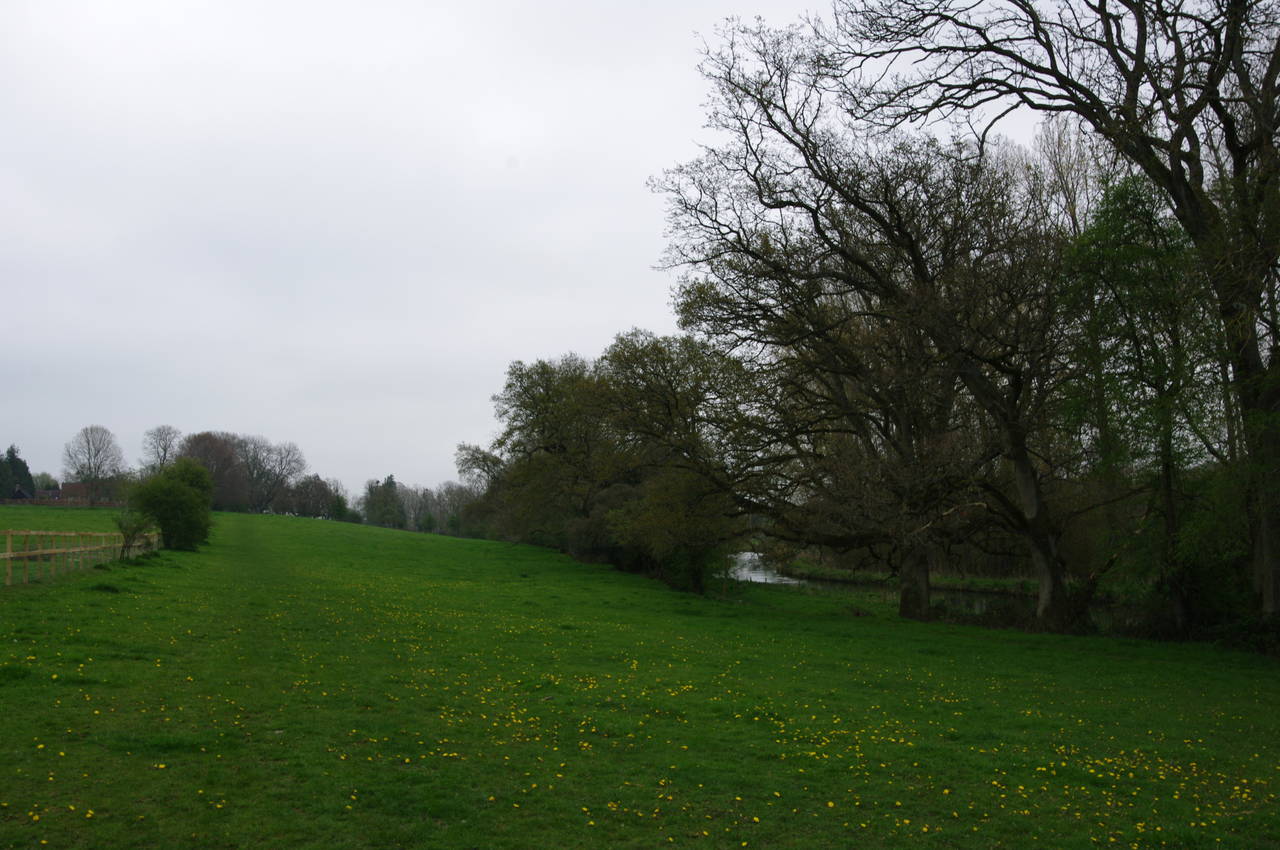
The route continues ahead beside the tree-lined stream, eventually changing to the left bank as it strikes out across more open fields and leaves Winchester behind (picture 7). Eventually, the path goes through tunnels under the two halves of the A34 Winchester Bypass road to emerge into a small office park in the village of King's Worthy. The Way then continues straight ahead between office buildings and past some houses to enter the churchyard of St Mary's (picture 8).
(9) Path to Easton Lane
(10) Thatched houses, Martyr Worthy
(11) Church of St Swithun, Martyr Worthy
(12) Pasture near Martyr Worthy
The route heads around the left side of the church before bearing right into St Mary's Close. At the end of the short street, a path between two garages leads to a crossing of the A33 road. Once safely over the busy road, the Way heads into the trees along a well-worn path that runs roughly parallel to the River Itchen for a few hundred metres before bearing left and uphill across a small field to reach the B3047 road just east of the village of Abbots Worthy.
The route only follows the road to the right for about thirty metres, to pass by the front fence of a riverside house, before following the edge of the next field back down to the rejoin the riverbank as it passes under the very noisy M3 motorway. Just a few metres beyond the motorway, the path parts company with the riverbank once again, heading left then soon right to follow the straight line of a fence between fields with the twisting course of the river a short distance away to the right.
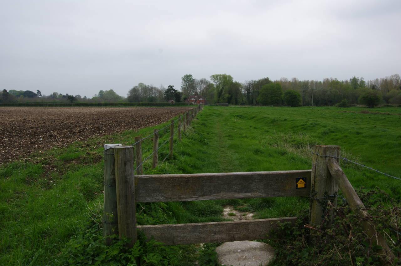
Halfway along the fence, the path switches from the left of the fence to the right via a slightly unusual stile (picture 9), continuing ahead towards a solitary house that stands by a minor road called Easton Lane. Crossing the lane, the route heads between the house and the River Itchen for a hundred metres more before turning left to join Church Lane in the village of Martyr Worthy.
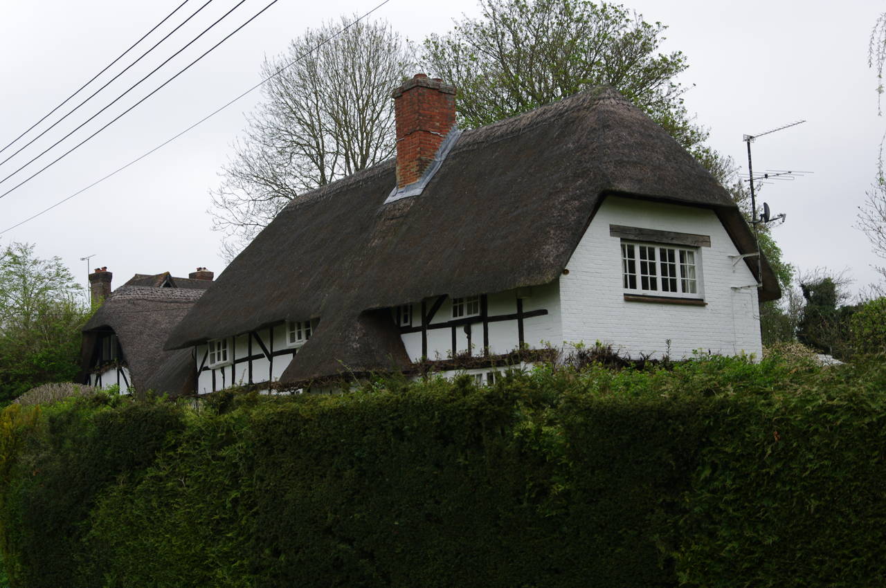
St Swithun's Way follows the lane past a couple of attractive thatched houses on the left (picture 10) to the Church of St Swithun (picture 11), which stands a little way further up on the left. Drawing level with the church, the route turns right along a short driveway, heading through a metal gate and out across a large pasture with views across the River Itchen (picture 12).
(13) River Itchen near Itchen Abbas
(14) The Trout Inn, Itchen Abbas
(15) Church of St John the Baptist, Itchen Abbas
(16) Church of St John the Baptist, Itchen Abbas
Reaching a gate on the far side of the pasture, the path continues ahead across two smaller fields before following a path beside a wooden fence to reach Chillard Lane on the edge of the town of Itchen Abbas. A few metres along the lane to the left, a fingerpost points along a narrow alleyway between fences, leading down to the wooded bank of the River Itchen. The Way now follows the course of a post and rail fence across a grassy field full of little yellow spring wildflowers (picture 13), gradually bearing away from the riverbank to meet a gravel driveway. Rather than following the driveway, the route continues ahead along several more field edges to eventually reach a minor lane.
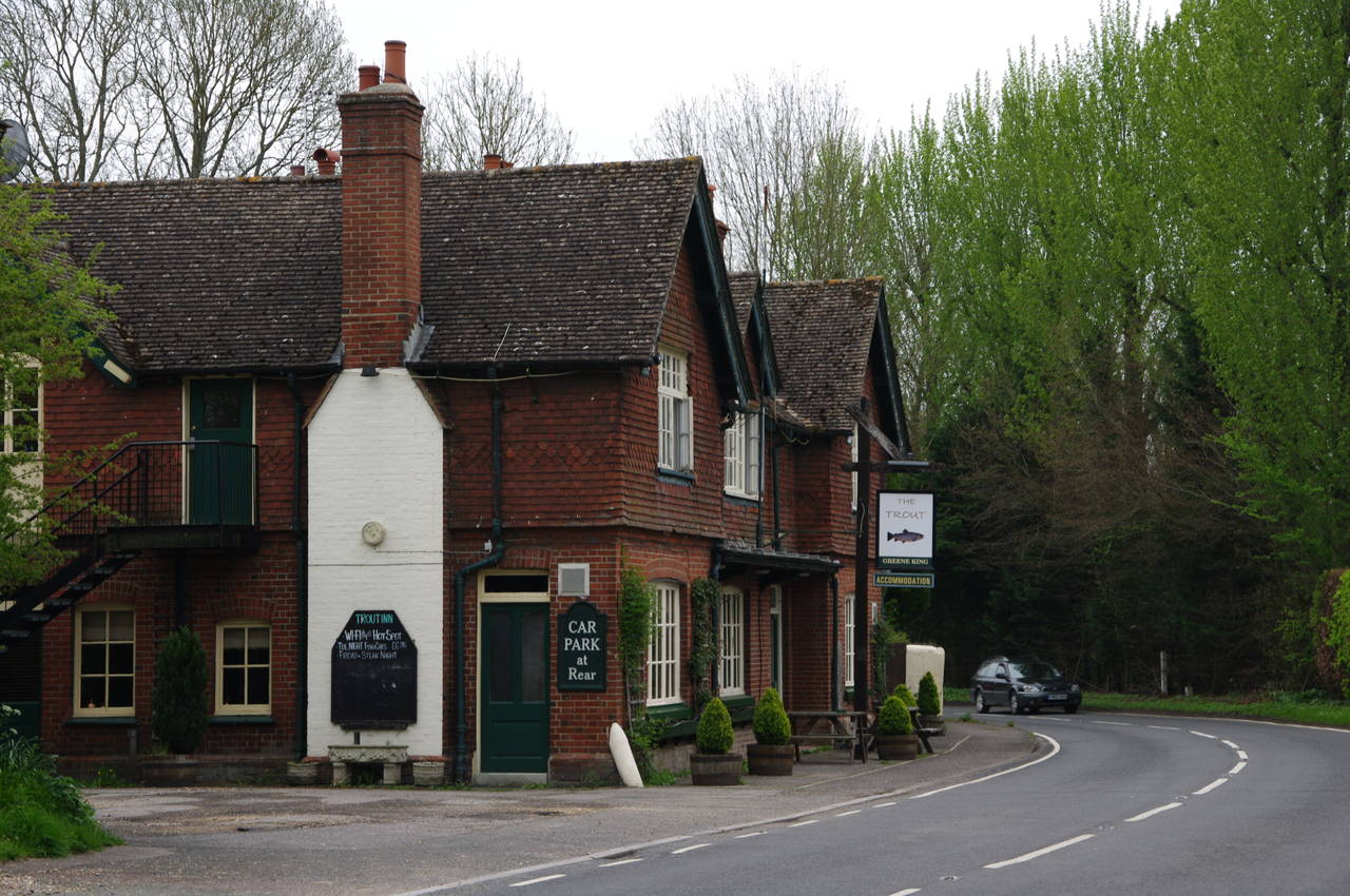
Before following the signposted route down the lane to the right, I took a short detour to the left where the Trout Inn (picture 14) stands on a bend in the B3047 road.
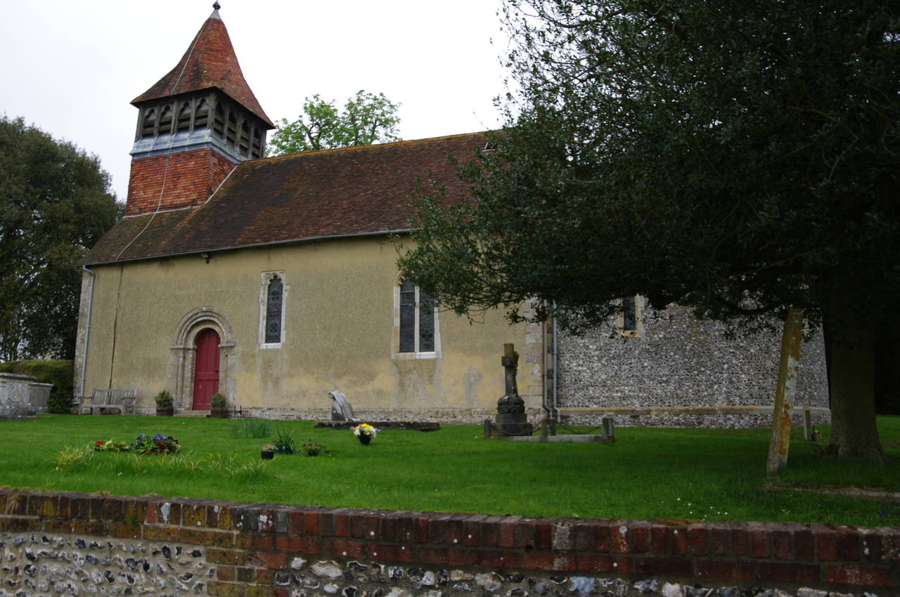
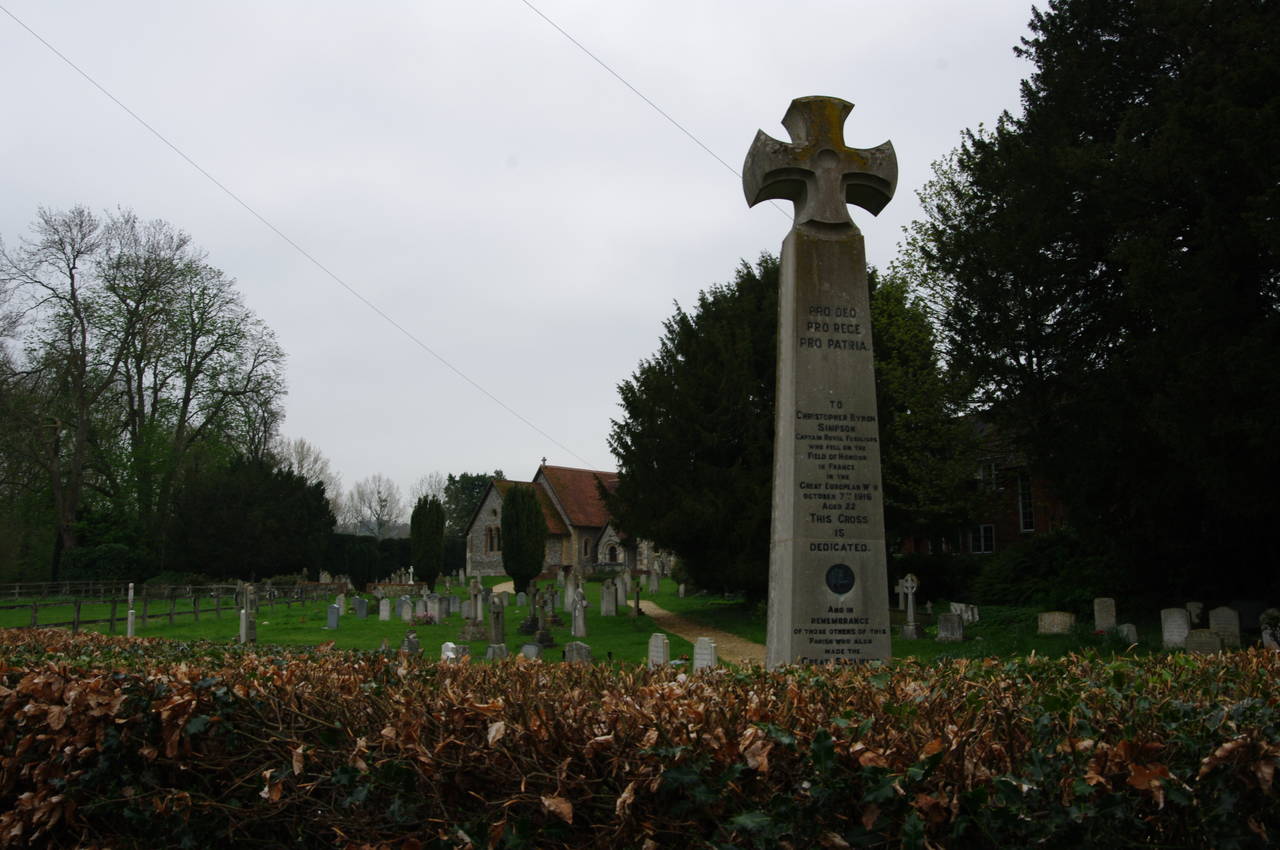
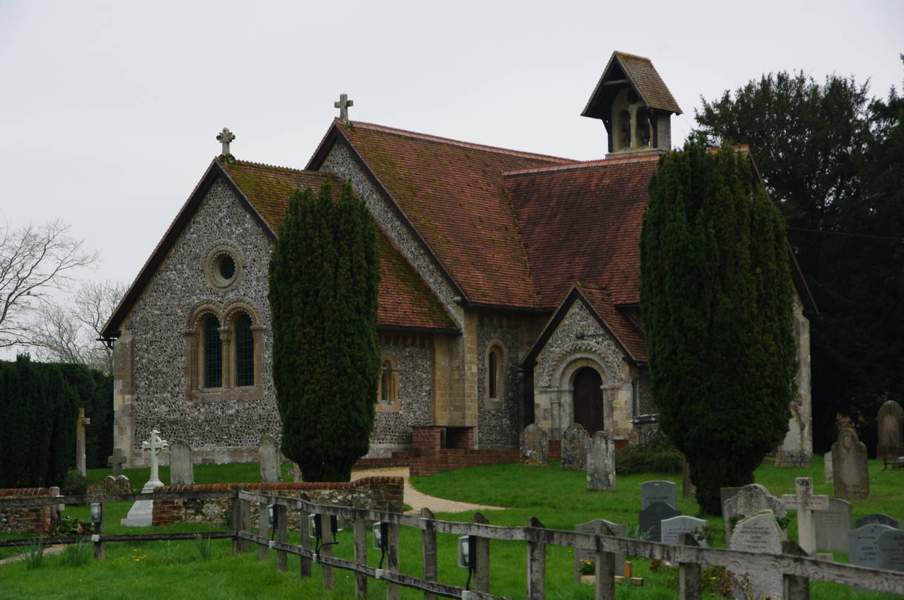
Rejoining St Swithun's Way, I soon passed by the Church of St John the Baptist, which stands well back from the road (picture 15). After a quick detour into the churchyard for a closer look (picture 16), I continued down the narrow lane, which crosses a couple of bridges over channels of the River Itchen. The second bridge crosses an old millstream, now apparently disused.
(17) Gates of Avington Park
(18) Gates of Avington Park
(19) Yevington Farm
(20) Lovington Lane approaches Ovington
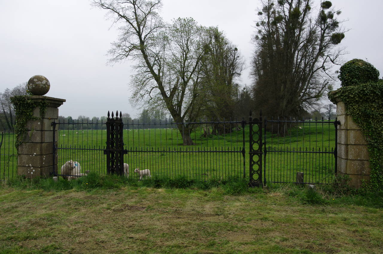
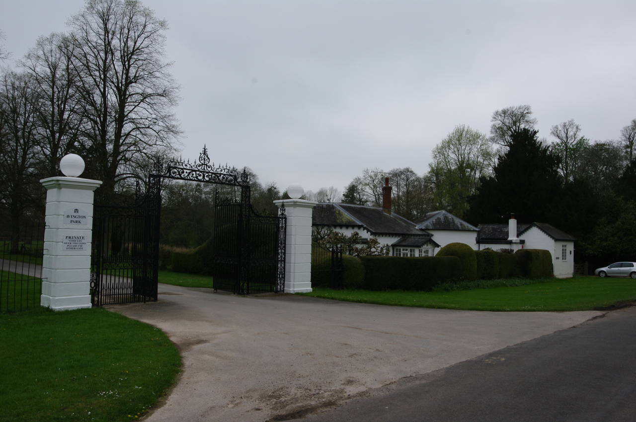
A little further down the lane, I passed two sets of grand gates belonging to the Avington Park Estate. While of obviously similar design, the gates on the left were looking rather unloved (picture 17), in stark contrast to those on the right (picture 18).
At the bottom of the lane, the route turns left along another lane for about fity metres then turns right to follow the driveway of the Avington Park Golf Club up to a car park, where the route turns left on a broad stony track separated from the golf course by a dense line of trees and bushes.
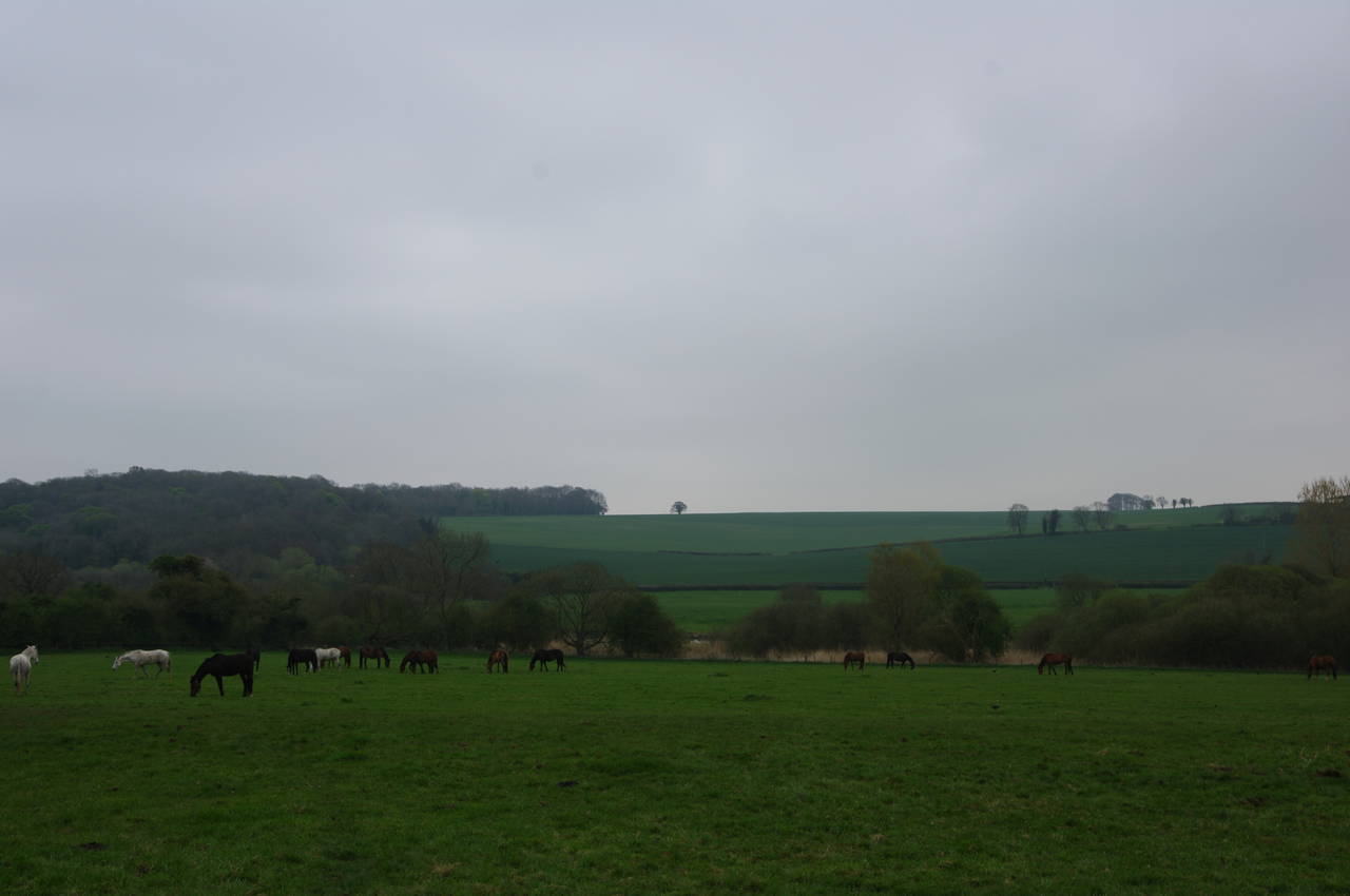
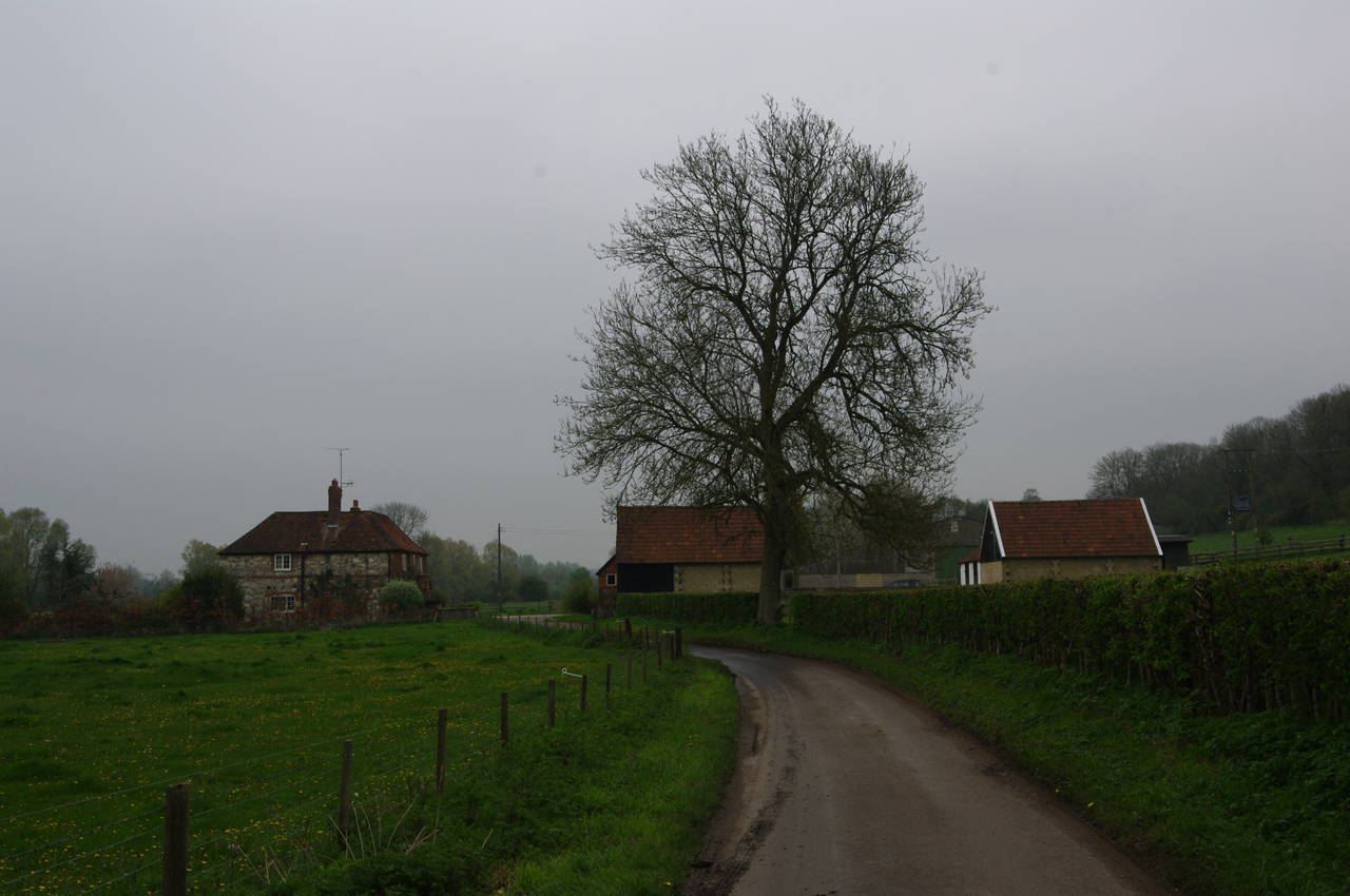
When that path ends, the route continues straight ahead on a grassy uphill path beside a wire fence. This path soon curves to the right to head through the middle of a small stand of trees, then turns left along a field edge and over a stile to make a short but steep descent to join Lovington Lane near Yevington Farm (picture 19). Heading between the farmhouse and farm buildings, the route keeps to the quiet lane as it winds its way over undulating grassy hills for around two kilometres to reach the village of Ovington (picture 20). In better weather there would have been some fine views over the valley of the River Itchen from these hills, but today the views were mostly shrouded in mist.
(21) Ovington
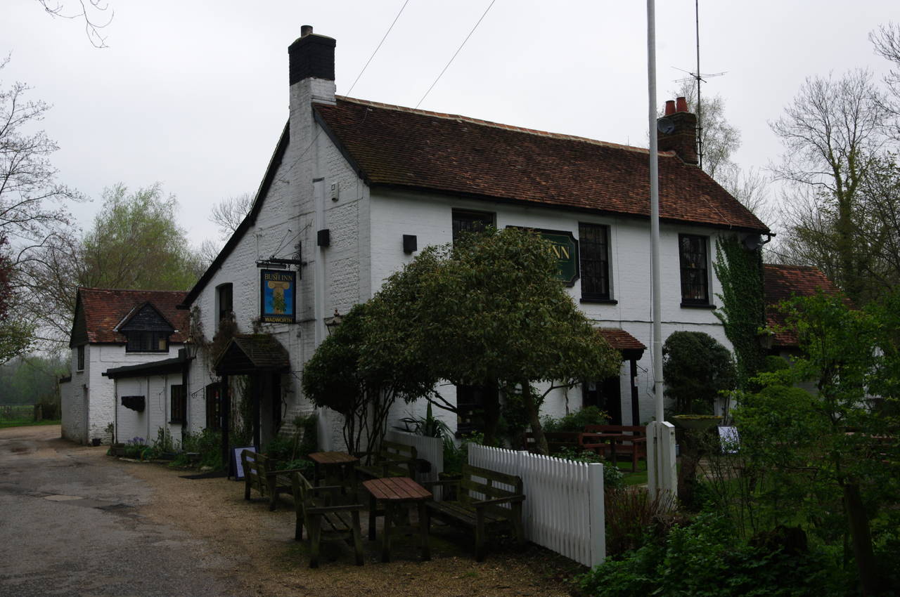
(22) The Bush Inn, Ovington
(23) Watercress bed on the edge of New Alresford
(24) The Cricketers, New Alresford
Reaching a T-junction in front of an attractive brick and stone cottage in the middle of the small village of Ovington (picture 21), the route turns left for a short distance downhill to another T-junction. The Bush Inn (picture 22) stands just to the left, but St Swithun's Way heads to the right, following East Lane through woods beside a side-stream with main channel of the River Itchen sometimes visible further off to the left.
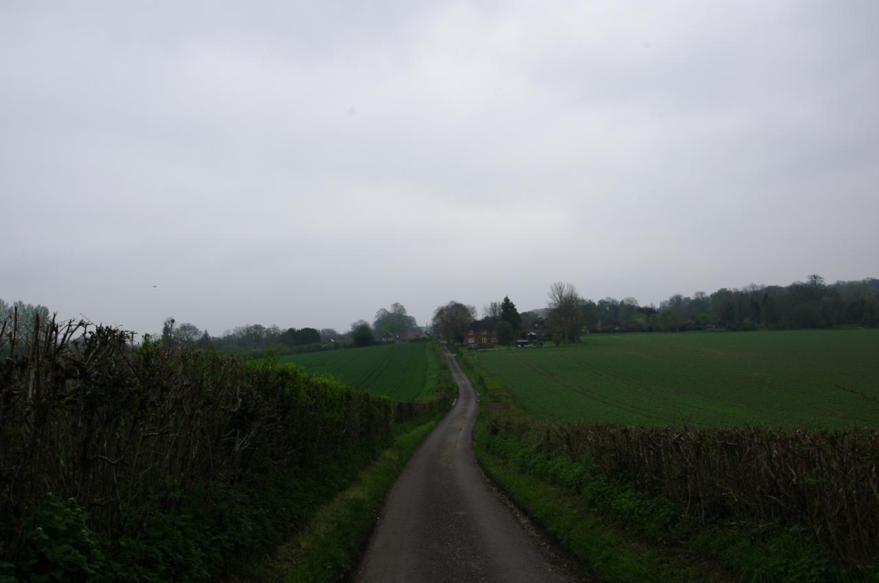
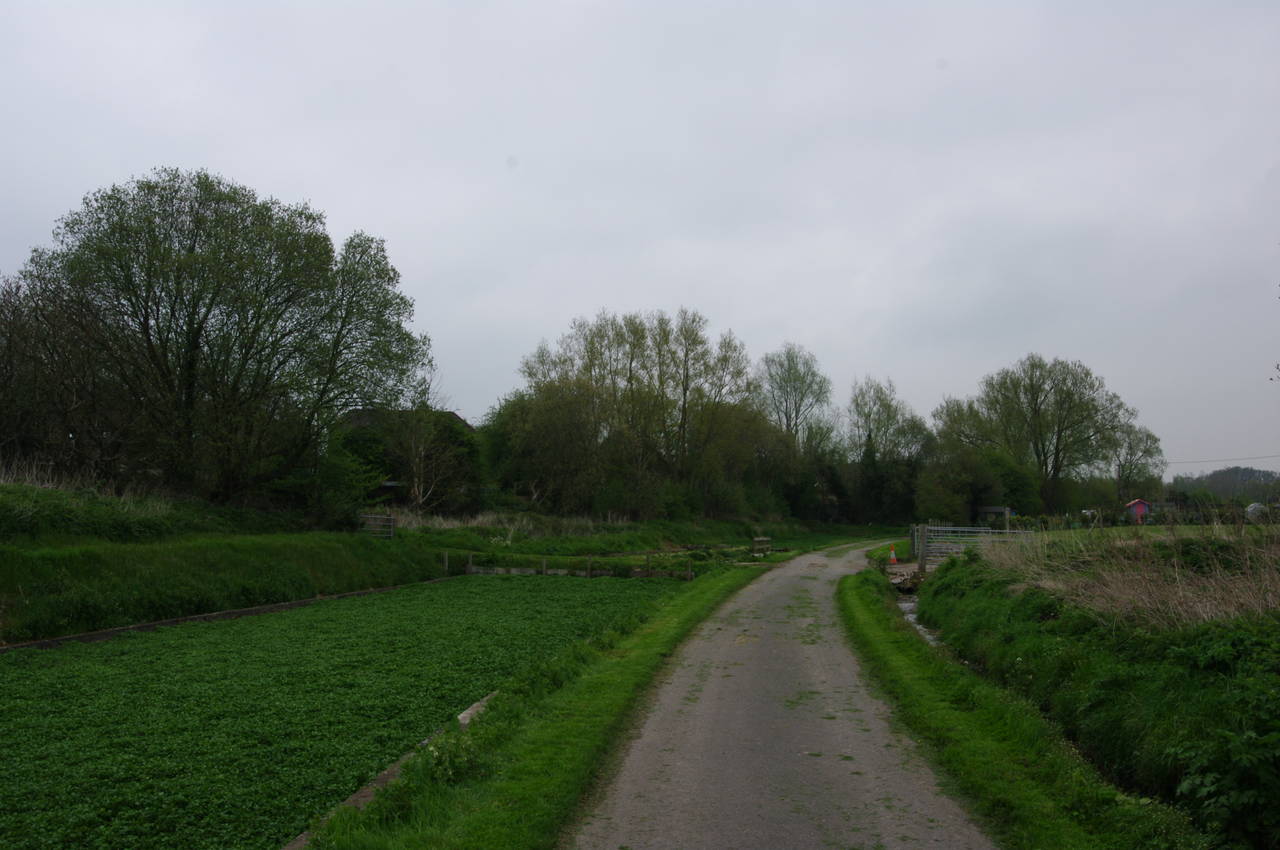
After around a kilometre, East Lane reaches the B3047 Alresford Road near a roundabout where the B3047 meets the A31. Beside the roundabout, a fingerpost points up a narrow, muddy path that runs through a tunnel of bushes for about 150 metres before crossing a lane and following another lane straight ahead. Beyond a little plank footbridge beside a ford where the lane was covered by about six inches of water, I continued ahead, now at the outskirts of the large town of New Alresford (pronounced "all's-ford" for reasons that I have yet to discover).
Before reaching the first houses of the town, the lane runs through an area used for growing watercress, one of the traditional crops in this part of Hampshire (picture 23). Growing watercress needs a lot of water, and there was a constant sound of running water as I followed the lane past several dozen watercress beds, each separated from its neighbours by small irrigation channels.
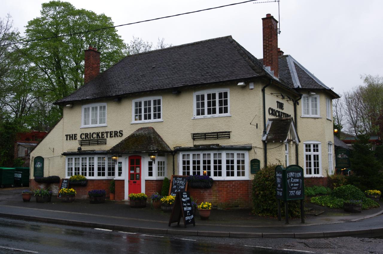
Reaching houses, the route bears right and follows Spring Gardens along the southern edge of New Alresford for a couple of blocks to cross the B3046 in front of the Cricketers pub (picture 24), the end point of this stage of the walk, with 14.1 kilometres completed.
There is a convenient bus stop a few steps along the B3046, with regular services back to Winchester, but before departing, I called into the pub for a pint and a light meal. The Cricketers was recently taken over by a very young couple, who are probably the youngest landlords I've come across, and they're doing a superb job. As well as a good selection of tasty meals and excellent service, the pub also offers a good selection of real ales, including Banks Bitter, Bowmans Wallops, and my favourite English beer, Timothy Taylor's Landlord. Over the next few days I was able to return to the Cricketers several more times, and it has become one of my favourite English pubs.