ST MICHAEL'S WAY
Lelant to Marazion
Sunday, May 31, 2015
My first UK walk for 2015 was St Michael's Way, a fairly easy 16.9km path that cuts across the Penwith Peninsula on the south-western tip of Cornwall. The Way connects the sandy beaches of St Ives Bay on the north coast with the famous island of St Michael's Mount in Mounts Bay on the south coast. The route is thought to have been used by Welsh and Irish pilgrims to avoid the dangerous seas around Land's End on their journey to the Cathedral of St James in Santiago de Compostela in Spain.
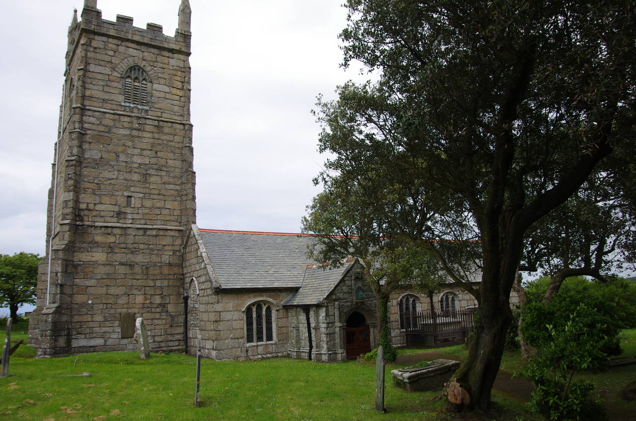
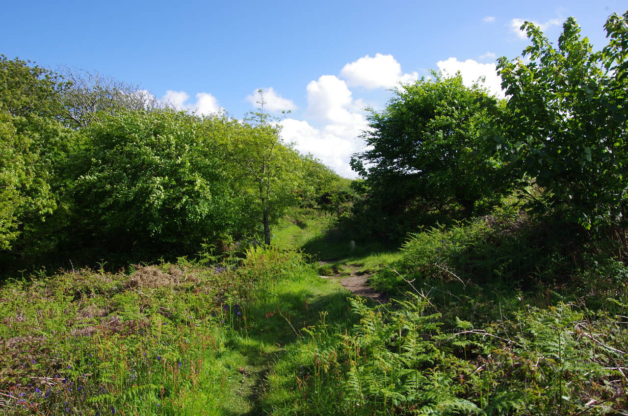
(1) Parish Church of St. Uny, Lelant
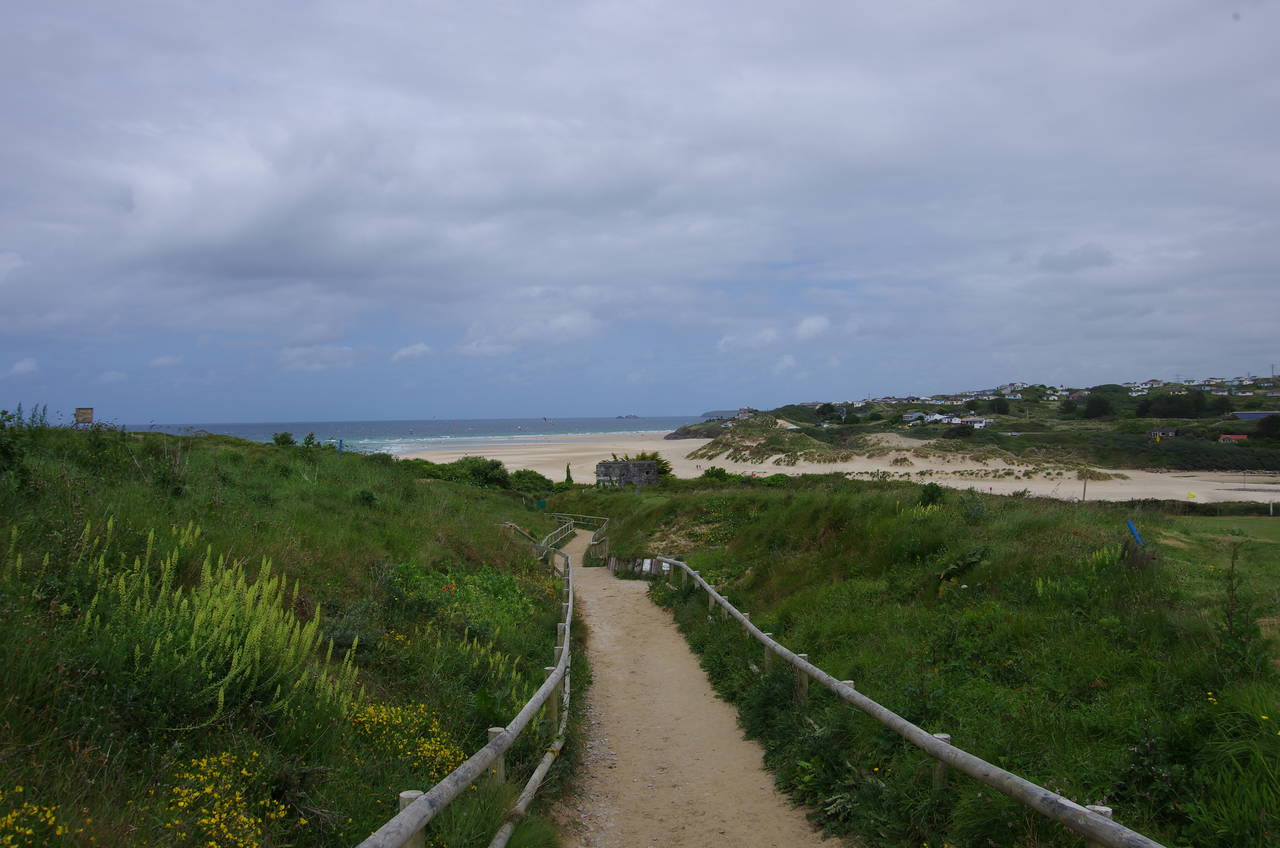
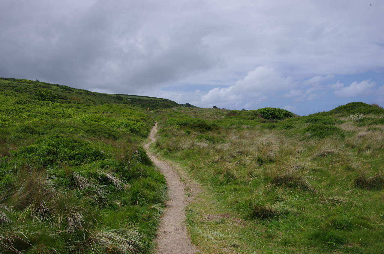
(2) Path across West Cornwall Golf Course
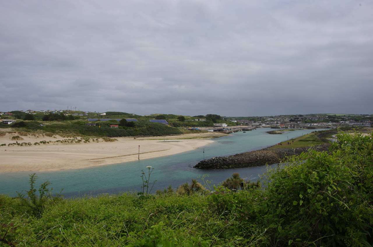
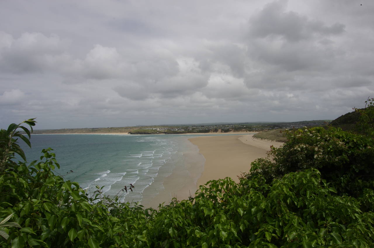
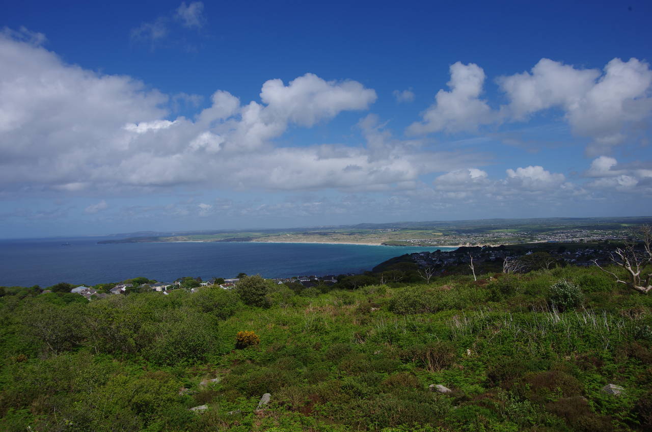
(3) Hayle Estuary
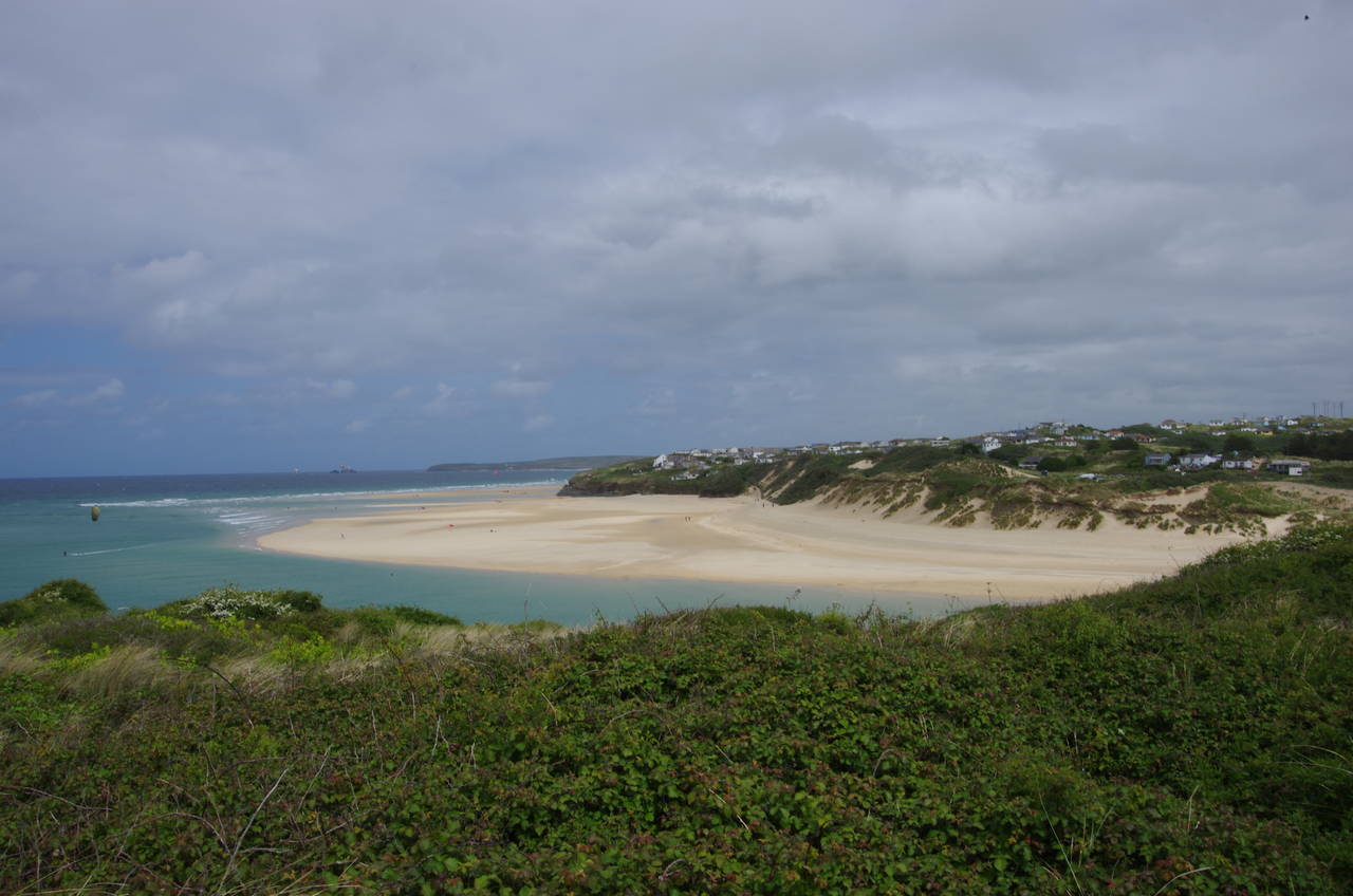
(4) Hayle Towans
St Michael's Way begins at the Church of St Uny, which stands on a low hill on the western side of the estuary of the River Hayle, separated from St Ives Bay by a large complex of sand dunes that contains the West Cornwall Golf Club.
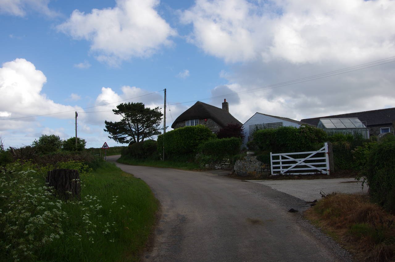
Due to some morning rain, it was about midday before the weather was looking good enough to head out for a walk. I took a mainline train one stop from Penzance to St Erth then changed to the St Ives Bay branch line, going one more stop to Lelant Saltings Station, which overlooks marshes on the edge of the wide and shallow Hayle Estuary. It was then just over a kilometre's walk to the start of the path, following a quiet street called The Saltings, which follows the railway line along the edge of the estuary, passing the tiny Lelant Station, where the train rarely stops. At a fork in the road, the right-hand branch leads up to the corner of Church Lane, where a wooden signpost marks the official start of St Michael's Way.
The first few kilometres of St Michael's Way is shared with the South West Coast Path, meaning that I would be following that stretch of path back the other way in a few days time.
The signpost points along a path that passes to the left of the Church of St Uny (picture 1) then downhill across the golf course towards the coast (picture 2). The path soon passes by an old World War II pillbox then under the railway line, turning left to follow a sandy path through the dunes parallel to the tracks. From the top of the first dune there are good views south along the estuary to the town of Hayle (picture 3) and north along the coast on the far side of the estuary past Hayle Towans ('towans' is Cornish for 'sand dunes') and on to the distant Godrevy Point and Godrevy Island, with it's lighthouse (picture 4).
(5) Lelant Towans
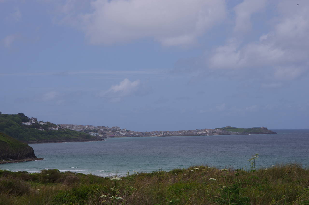
(6) View towards St Ives
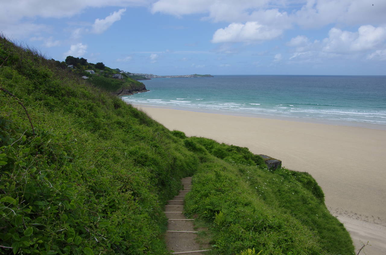
(7) West end of Porth Kidney Sands
(8) Carrack Gladden
For the next two kilometres the path winds it's way westwards through the gorse-covered dunes of Lelant Towans (picture 5) above the wide sandy beach of Porth Kidney Sands. For the first half of this stretch, the path is a hundred metres or so back from the edge of the dunes, so the beach is not visible. To compensate, there are good views across the bay to the town of St Ives each time the path goes over the top of a dune (picture 6).
As the path approaches the western end of Porth Kidney Sands it runs along low clifftops above the beach (picture 7) for a while before heading into a small wood on the sloping headland of Carrick Gladden (picture 8), which separates Porth Kidney Sands from the next sandy beach around the corner in Carbis Bay.
(9) View back along Porth Kidney Sands
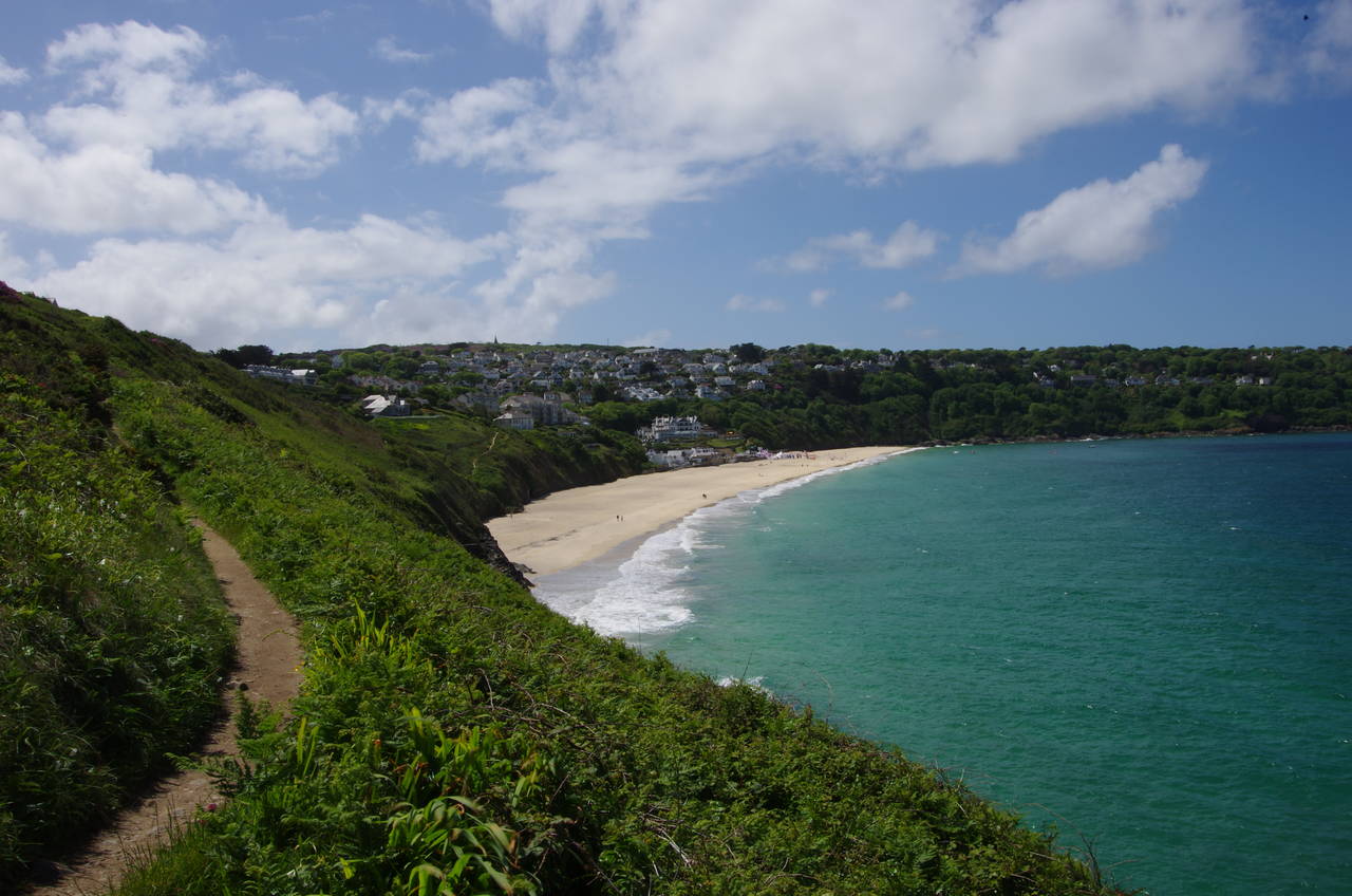
(10) Carbis Bay
(11) The Cornish Arms, Carbis Bay
(12) Knill's Monument
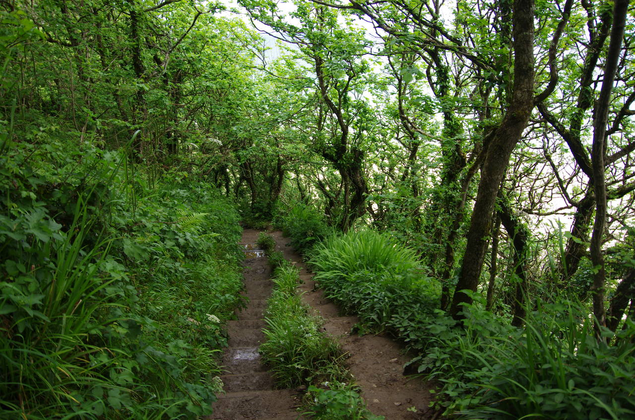
The eastern side of the headland is almost a rainforest, with dense and leafy vegetation crowding the path, which was quite muddy in places. As the path winds its way around several hillside houses there are a few gaps in the foliage that give good views back along Porth Kidney Sands (picture 9) before the path rounds the headland and follows a clifftop path through knee-high gorse above the beach at Carbis Bay (picture 10).
About half way around the bay, the path makes a sudden left hand turn to climb a steep flight of steps up to Beach Road, then turns right to follow the road back down to a carpark in front of the Carbis Bay Hotel, which stands above the busiest part of the beach. St Michael's Way crosses the hotel's lawn and joins an enclosed footpath that climbs up through woods to cross a footbridge over the railway line. After running parallel with the railway line for a short distance, the path reaches a wooden signpost where St Michael's Way turns sharply left, parting company with the Coast Path, which continues straight ahead.
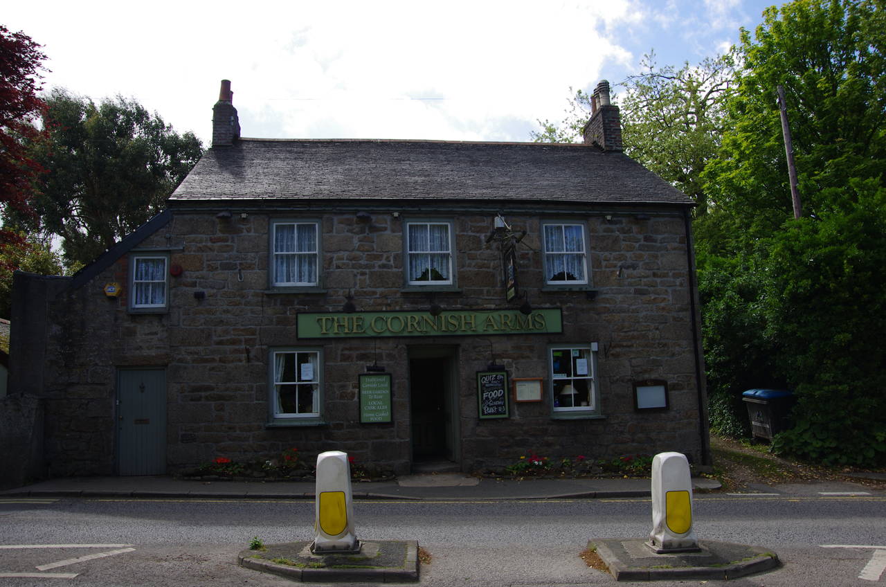
St Michael's Way now follows a concrete path uphill to the end of Wheal Margery Road, which continues ahead to the A3074 St Ives Road. The route turns right along the main road, crossing it via a refuge in front of the Cornish Arms pub after about 100 metres (picture 11). Just to the right of the pub the route turns left into Higher Tregenna Road and almost immediately bears left again into Steeple Lane.
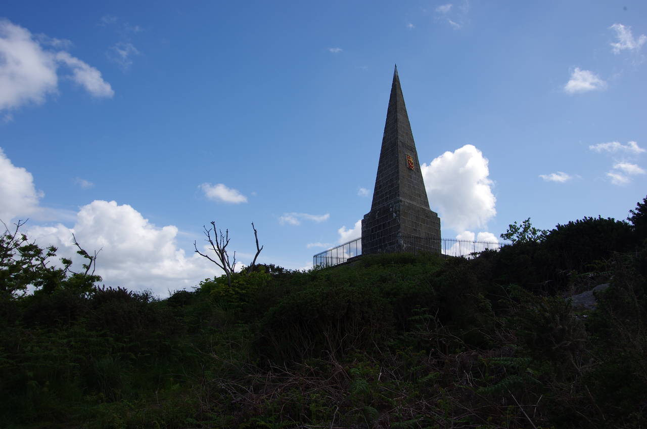
The lane is followed on a long steady climb, with the countryside gradually taking over from suburbia on the way up to Steeple Woods. Eventually a signpost on the left points off the road on a narrow trail up through gorse to the summit of Worvas Hill, which is topped by Knill's Monument (picture 12). The 15-metre high steeple was built in the late 18th-century by John Knill, mayor of St Ives, who intended to be buried in a vault beneath it, though he ended up being buried in Holborn in Central London. Every five years, on July 25, a large celebration is held with a procession heading up from the town to the monument.
(13) View over St. Ives Bay
(14) View inland from Knill's Monument
(15) Steep climb past large stones
(16) View back from Trencrom Hill
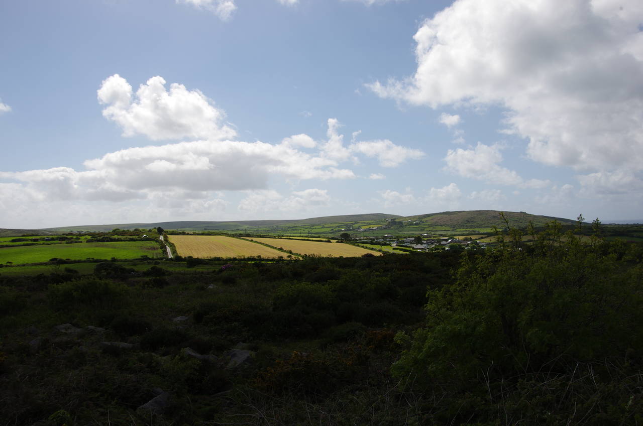
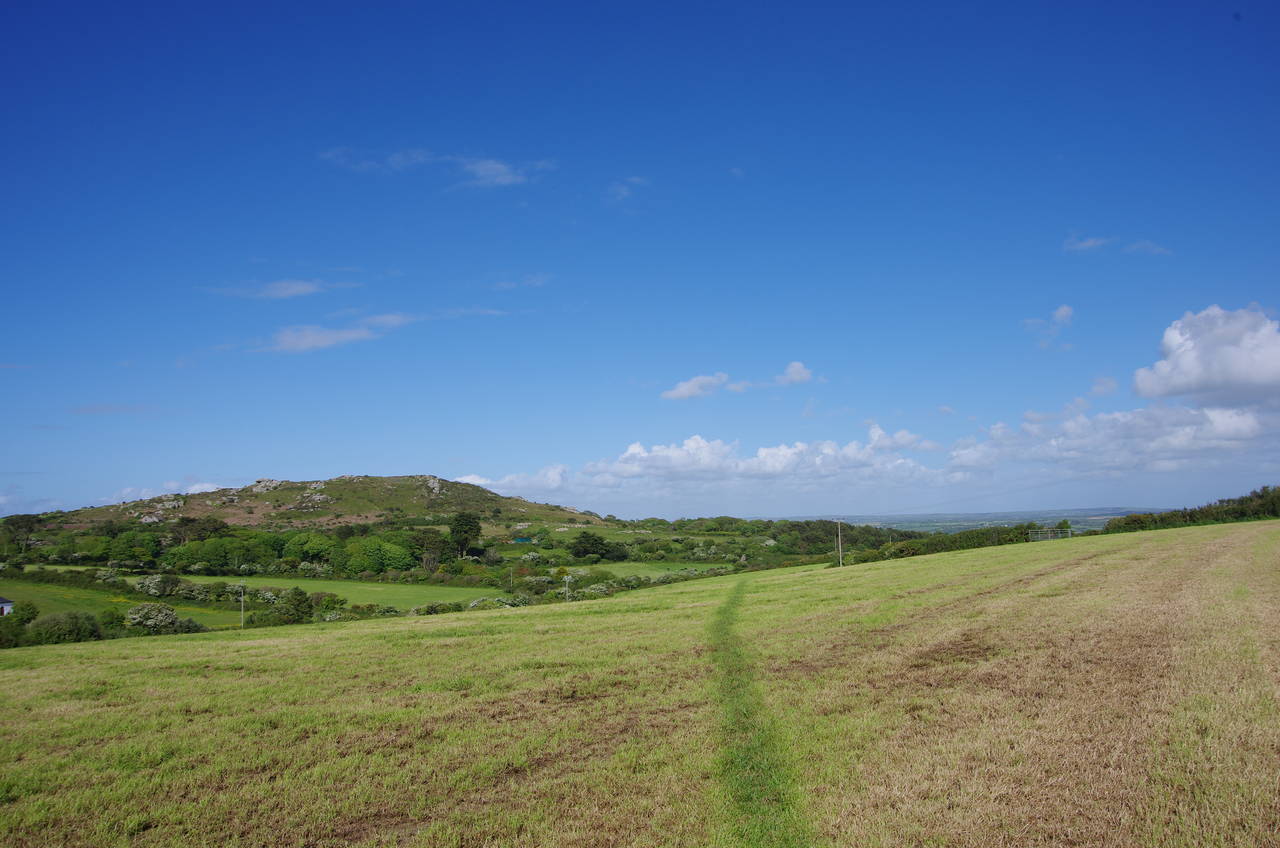
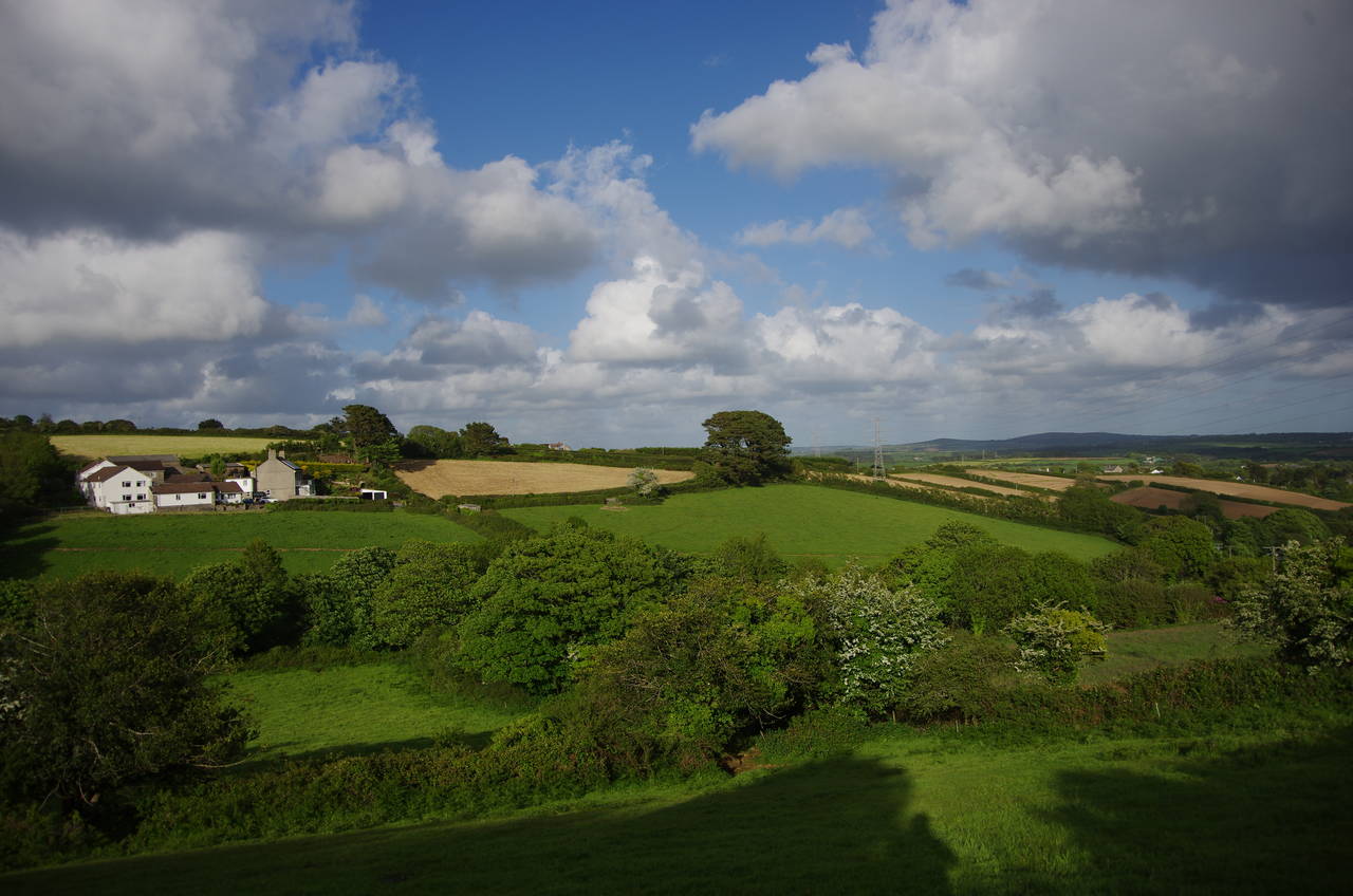
From the top of the hill, at 170 metres above sea level, there are far-reaching views back over St Ives Bay (picture 13) and ahead to the hills in the middle of Penwith (picture 14). There was a very cold wind blowing across the exposed hilltop however, so I did not choose to linger for very long.
A level path leads about 50 metres northwest of the steeple, where St Michael's Way turns left down a narrow and rocky path to meet tarmac once more at a bend in Laity Lane. The hedge-lined lane is followed to the left, heading through quiet farmland for a little over a kilometre until, about 100 metres after the lane makes a ninety-degree left turn, a signpost on the right points onto a short enclosed footpath which leads to a more open path between post and rail fences through a seemingly abandoned part of a caravan park.
At the end of this, the route crosses a stile into a field, aiming for another stile just to the left of a metal barn. A driveway is followed past the barn out to Trencrom Lane, where a signpost and stile diagonally opposite lead into a large field. The left-hand edge of the field is followed to find a stile that was fairly well-hidden in the hedge, beyond which a broad strip of grass is followed to the right between the hedge and a wire fence.
After the fence bends left then right, the route leaves the grassy path and crosses a stile to follow a sunken path inside a narrow strip of woods. This leads to an overgrown path around the left side of a cottage and onto the cottage's driveway. As there was a car parked across the end of the path, and no signposts, I imagine that it would be very difficult for anyone walking the other way to find the correct route around the cottage.
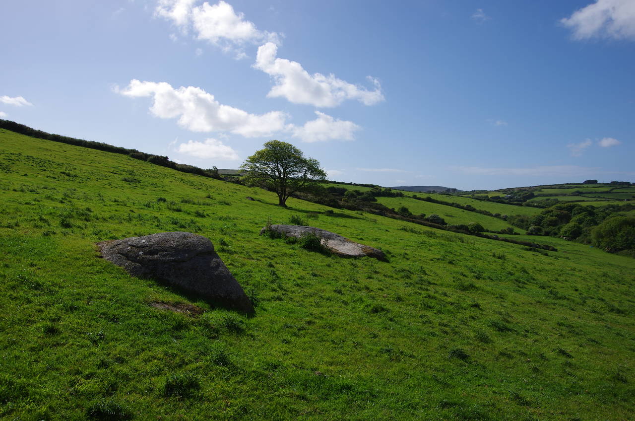
The unsealed driveway is followed downhill to a road, where the Way crosses diagonally left to another driveway, where a large stone bears the words 'Bowlrock Chapel'. Some rough stone steps at the top of the driveway climb up to a stile and an enclosed path alongside a fence to a second stile at the foot of a large sloping field. The Way climbs towards the top left corner of the field, passing several large granite stones in the middle of the field (picture 15). From the stone stile beside the road at the top of the field there are good views back over the surrounding farmland and a final glimpse of St Ives Bay (picture 16).
(17) Trencrom Hill

(18) Cornish cross
(19) View back to Trencrom Hill
(20) First view towards St. Michael's Mount
Across the road is a second stile, leading into National Trust land on Trencrom Hill (picture 17). St Michael's Way skirts around the hill some distance below the summit to reach a National Trust carpark, turning right along the road then shortly forking left down a lane.
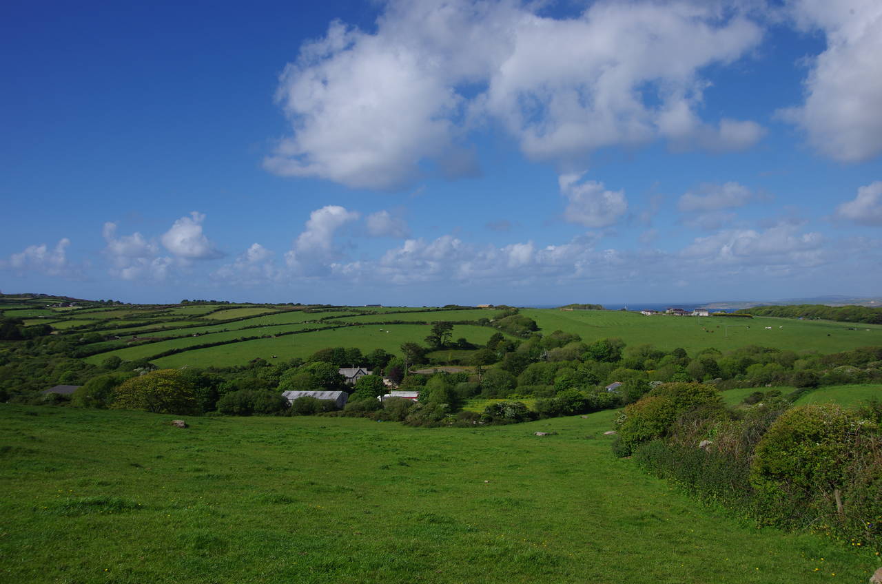
About 100 metres down the lane the route turns right along a gravel drive and when that bears left the Way keeps ahead alongside a tiny stream, passing a Celtic cross and a standing stone (picture 18). The path soon crosses a stile and follows the creek through a small wood before a second stile takes the path onto the bottom edge of a large sloping field. The path heads for a gate in the far hedge about halfway up the slope, then continues diagonally up the field beyond, from which there is a good view back to Trencrom Hill (picture 19).
At the top of the field the path heads through another gate and crosses a series of smaller fields, passing a little to the left of the large Trembethow Dairy. The signposted route here seemed to differ from the route on the Ordnance Survey map, which appears to go through the middle of the diary.
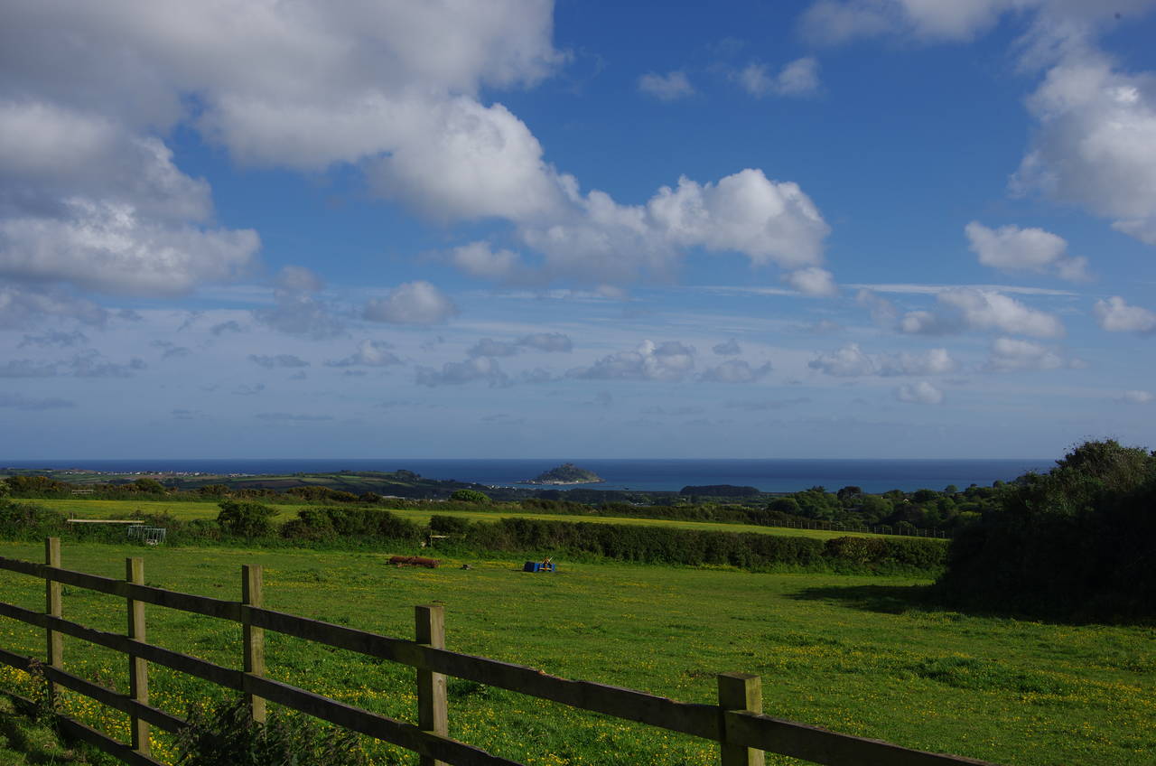
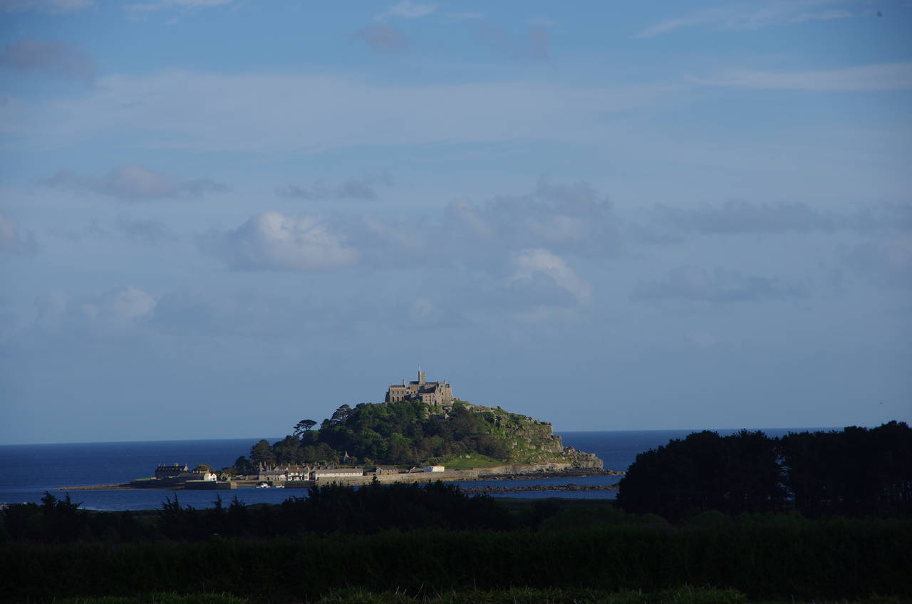
Across several more fields, the path reaches a double stile beside a farm track, bearing slightly right to head for the corner of the next field. From here St Michael's Way has its first view of Mounts Bay and St Michael's Mount (picture 20).
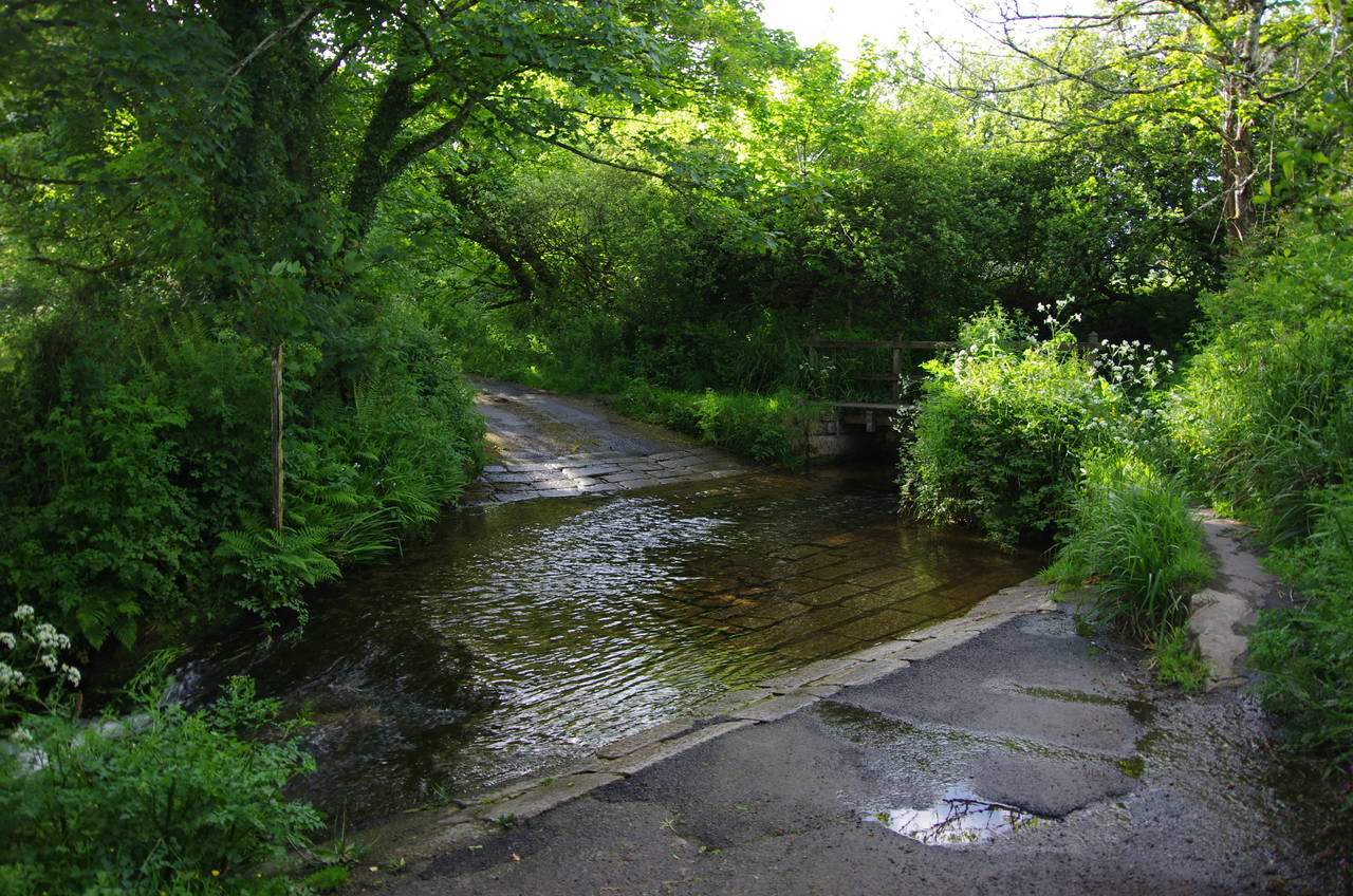
(21) Crossing ford
(22) Boskennal Farm
(23) Nanceddan Farm
(24) St Paul's Church, Ludgvan
The left edge of the next field is followed downhill before an enclosed path leads to a quiet road, where the path turns right, following the road a short distance down to ford the Red River (picture 21). The Way crosses the ford by a little footbridge to the right, continuing along the road to a junction where a sharp left turn leads back uphill past Boskennal Farm (picture 22).
Just past the farm, the road bends left but the Way keeps ahead over a stile and down the right-hand edge of a field to a stone stile into another field. The route wasn't at all obvious in the second field, but runs virtually due south down the hill to find a stile about two-thirds of the way along the lower edge of the field. The stile isn't visible from the top of the field, but an electricity pylon across the valley is a good guide for the right direction.
An obvious path goes through the wood in the bottom of the valley, emerging into a long narrow field and climbing towards the pylon seen earlier from the other side of the valley. To the left of the path was a nice view of the cluster of buildings at Nanceddan Farm (picture 23).
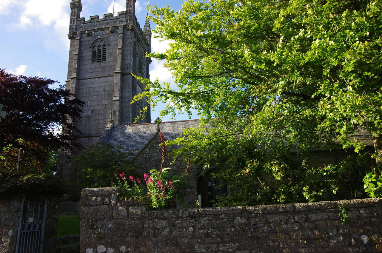
Over a granite stile and along the right-hand edge of the next field, the path reaches a road, turning left along it for about 100 metres until a signpost on the right points over another granite stile and along an enclosed path. This path soon crosses the bottom of a field before climbing up through woods and alongside St Paul's churchyard to join the main street of the small village of Ludgvan in front of the church (picture 24).
(25) St. Michael's Mount
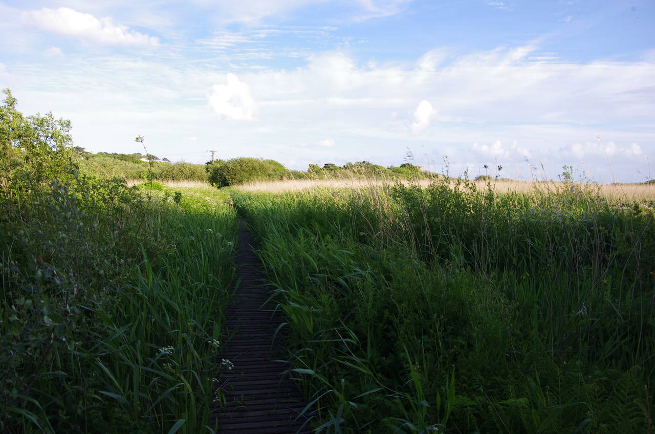
(26) Boardwalk across marshes
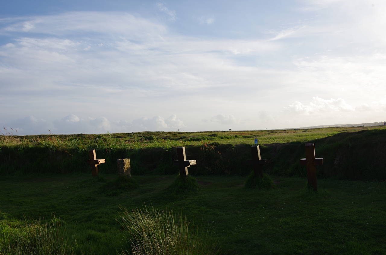
(27) Crosses on the marshes
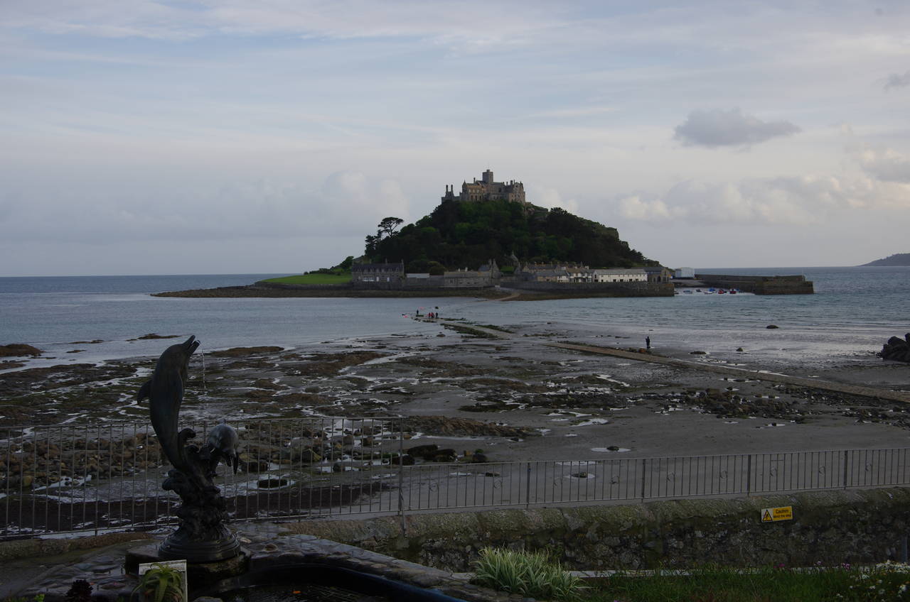
(28) St. Michael's Mount
It's just about all downhill from here, with the Way following the road past the church and the White Hart pub before turning right along a driveway and then crossing a coffin stile (basically a granite cattle grid) beside a high stone wall to get into a field where the view of St Michael's Mount was regained (picture 25).
The path follows the right-hand edge of the field downhill, crossing Long Lane and continuing ahead down the left-hand edge of a long field to reach another road on the edge of a small industrial estate. Heading to the right, the road soon joins the busy A30, which is crossed via a pedestrian refuge just to the right of the junction. A nearby stile takes the path along the left-hand edge of three more fields to cross the almost as busy A394. A stile diagonally left across the road takes the path along a fence and then onto a boardwalk across an area of marsh (picture 26) to reach a crossing of the main London to Penzance railway line.
Having safely crossed the tracks, I followed the obvious path across a much larger area of marshes, where I passed by a mysterious group of crosses (picture 27). Reaching the main coast road, I turned left and followed the road into the village of Marazion, where St Michael's Way ends in The Square, overlooking St Michael's Mount from beside the Godolphin Arms pub (picture 28).
After a quick pint in the pub, I headed off towards Penzance and the setting sun on the five kilometre stretch of the Coast Path that is sandwiched between the railway line and the beach. St Michael's Way had been a very pleasant warm up for my return to the South West Coast Path.