SOUTH WEST COAST PATH NATIONAL TRAIL
Stage 41: Newquay to Constantine Bay
Wednesday, June 10, 2015
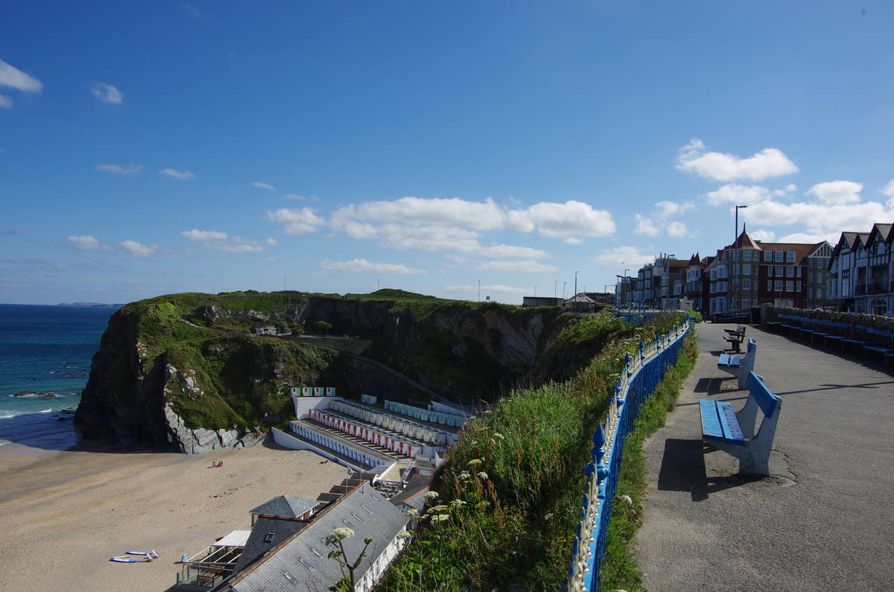
(1) Tolcarne Beach
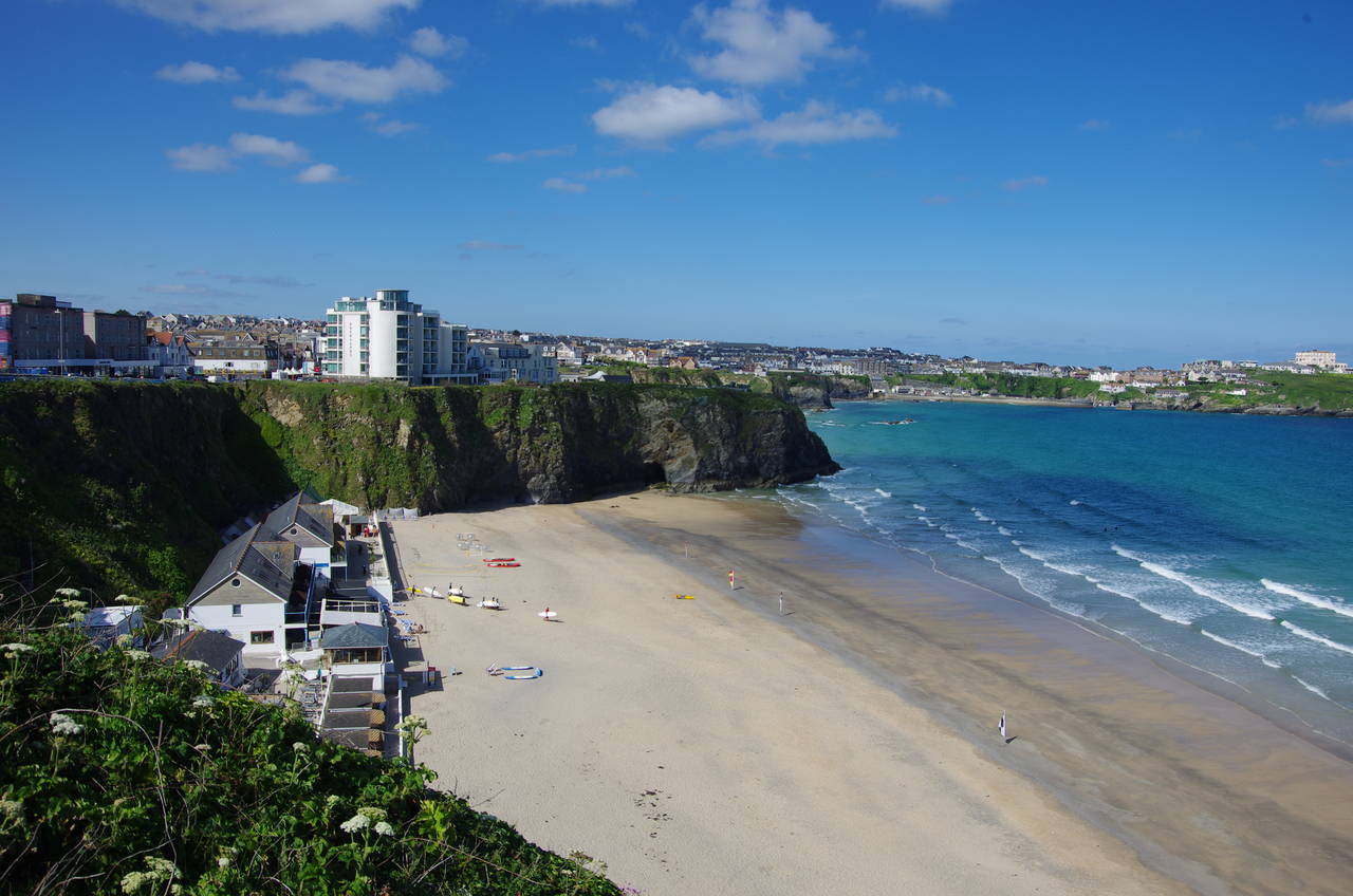
(2) Tolcarne Beach
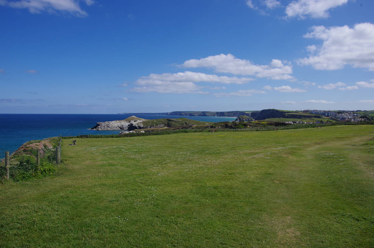
(3) The Barrowfields
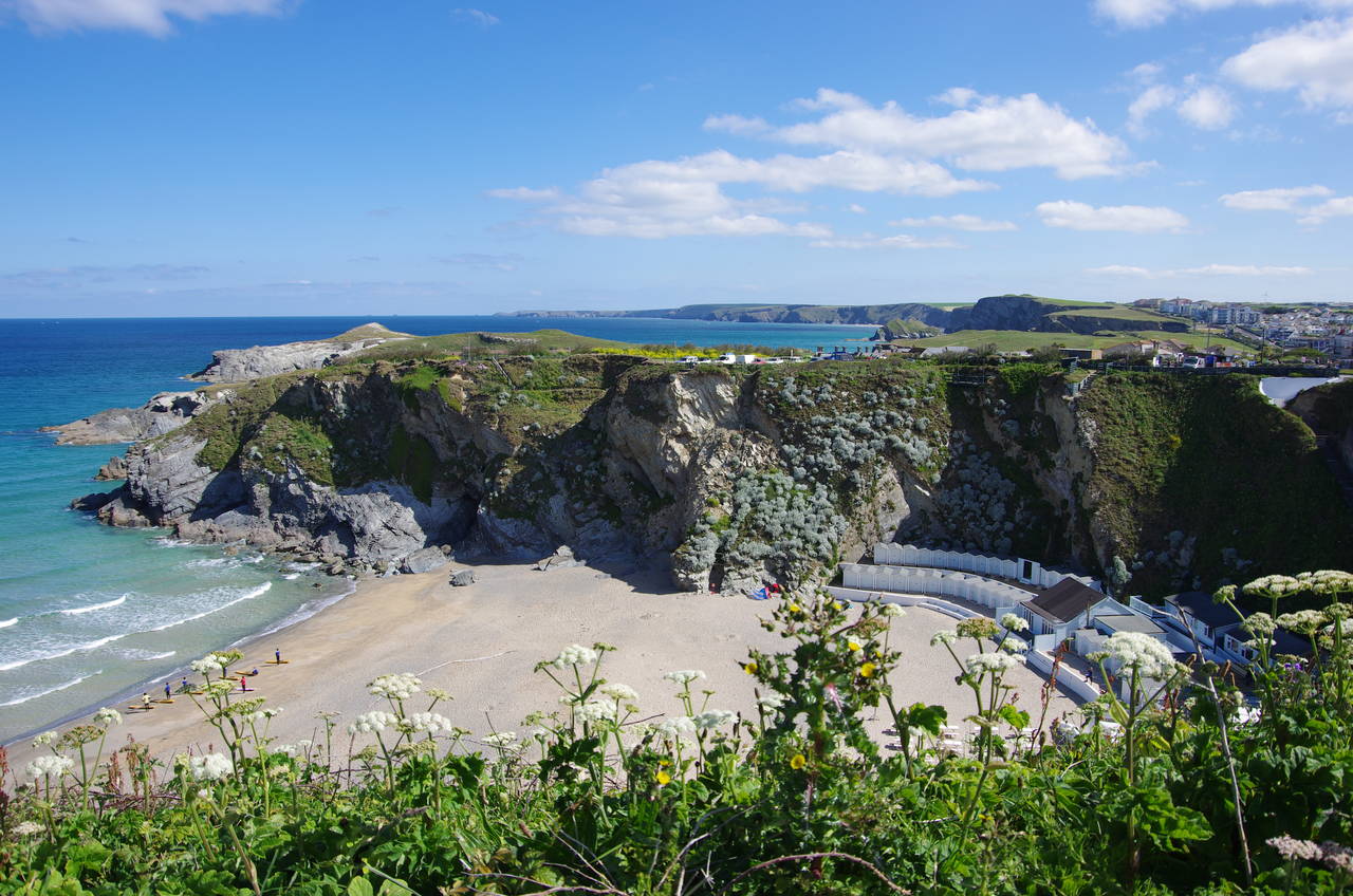
(4) Lusty Glaze Beach
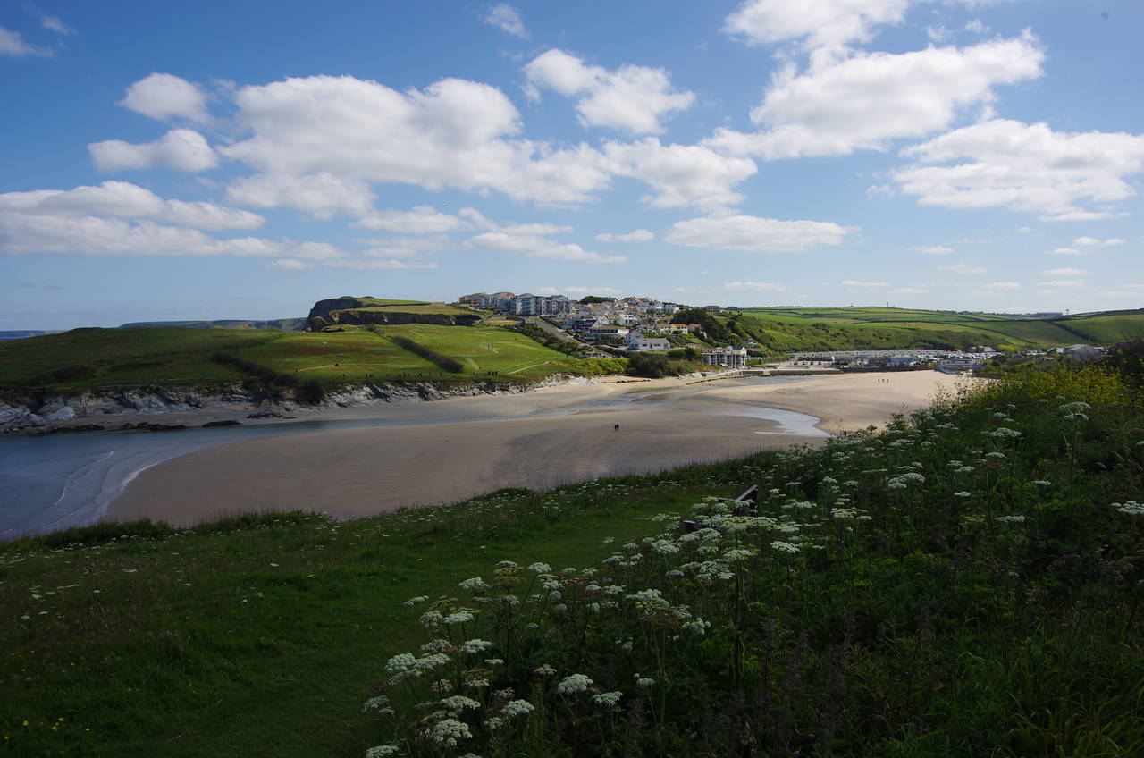
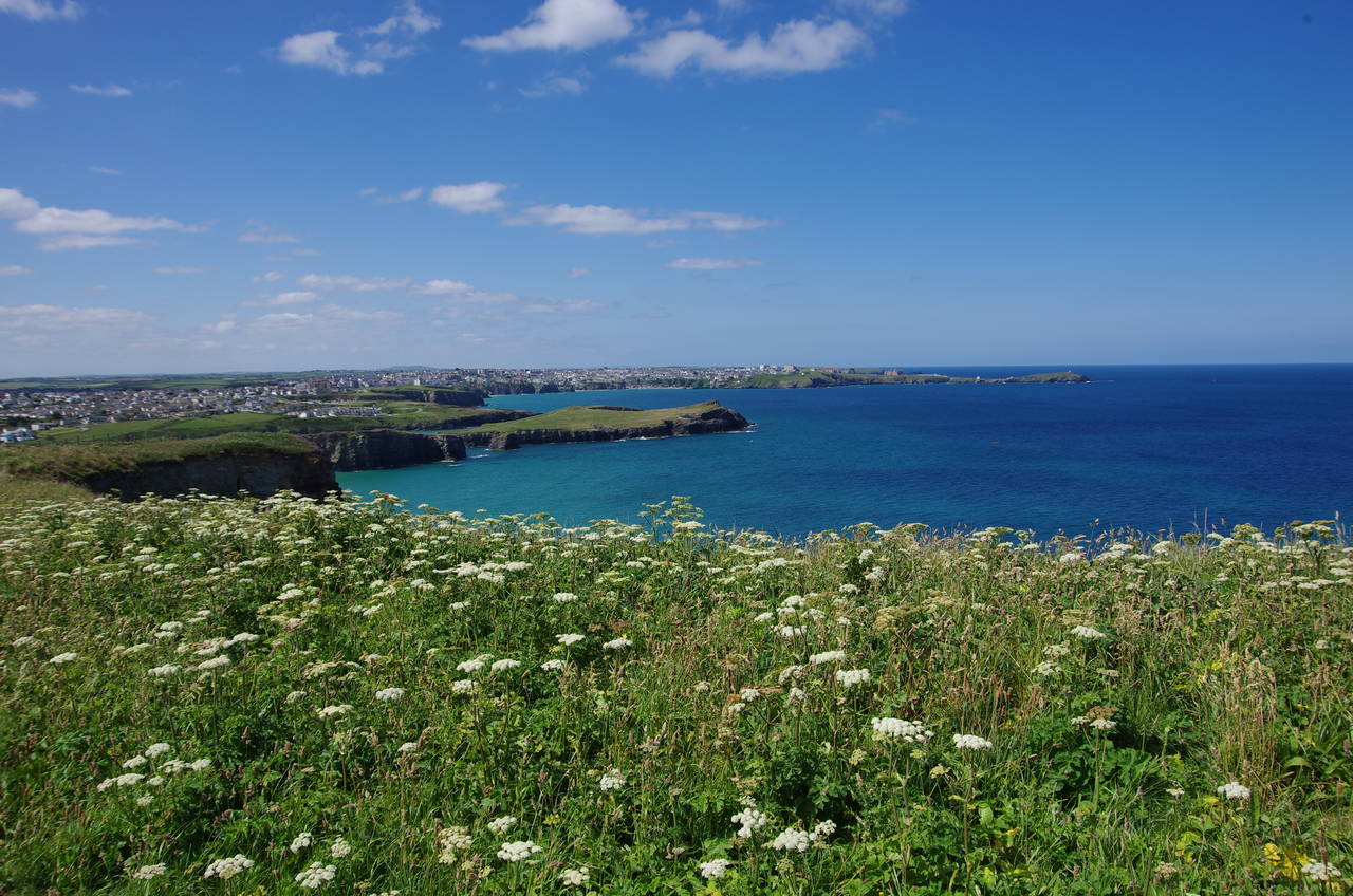
Another bright sunny morning greeted me when I returned to the promenade above Tolcarne Beach the next morning to rejoin the South West Coast Path (picture 1). The Coast Path follows the pavement north-eastwards, with one last view back across the beach (picture 2) as the path jinks left then right past some buildings before heading off across the large grassy expanse of the Barrowfields parallel to the A3058 road.
The Barrowfields (picture 3) are so named because they contained seventeen Bronze-Age burial mounds from around 1500BC until 1819, when a local farmer destroyed most of them to reuse the stone. Today, only a couple of the barrows are recognisable.
After passing by an area enclosed by a low white metal fence, the Coast Path gradually diverges from the road, angling across the grass to join the somewhat quieter Lusty Glaze Road above the privately-owned Lusty Glaze Beach (picture 4).
(5) Porth Beach
(6) Porth Beach
(7) Trevelgue Head
(8) Porth Island
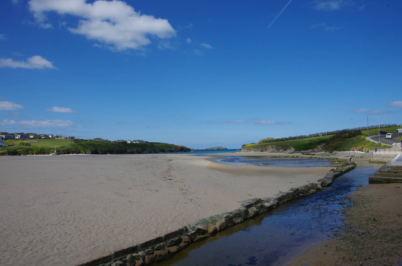
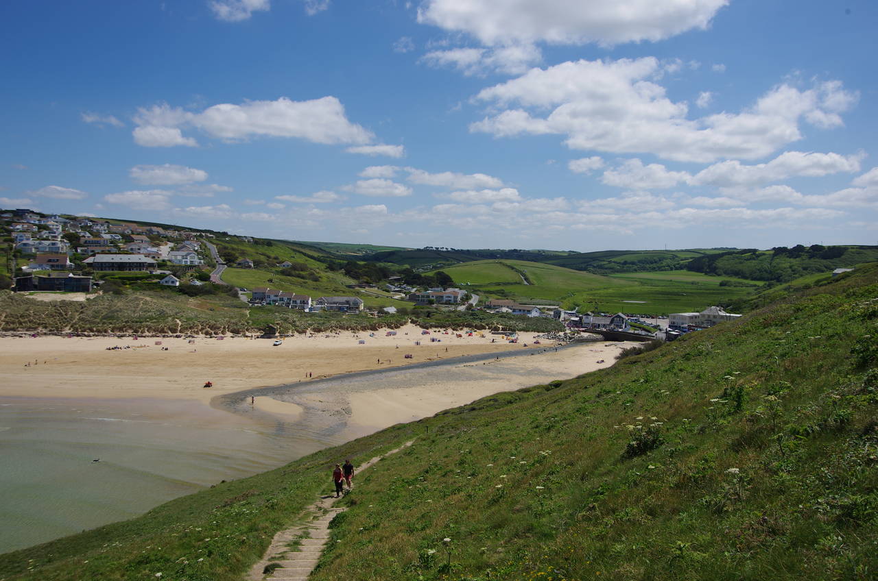
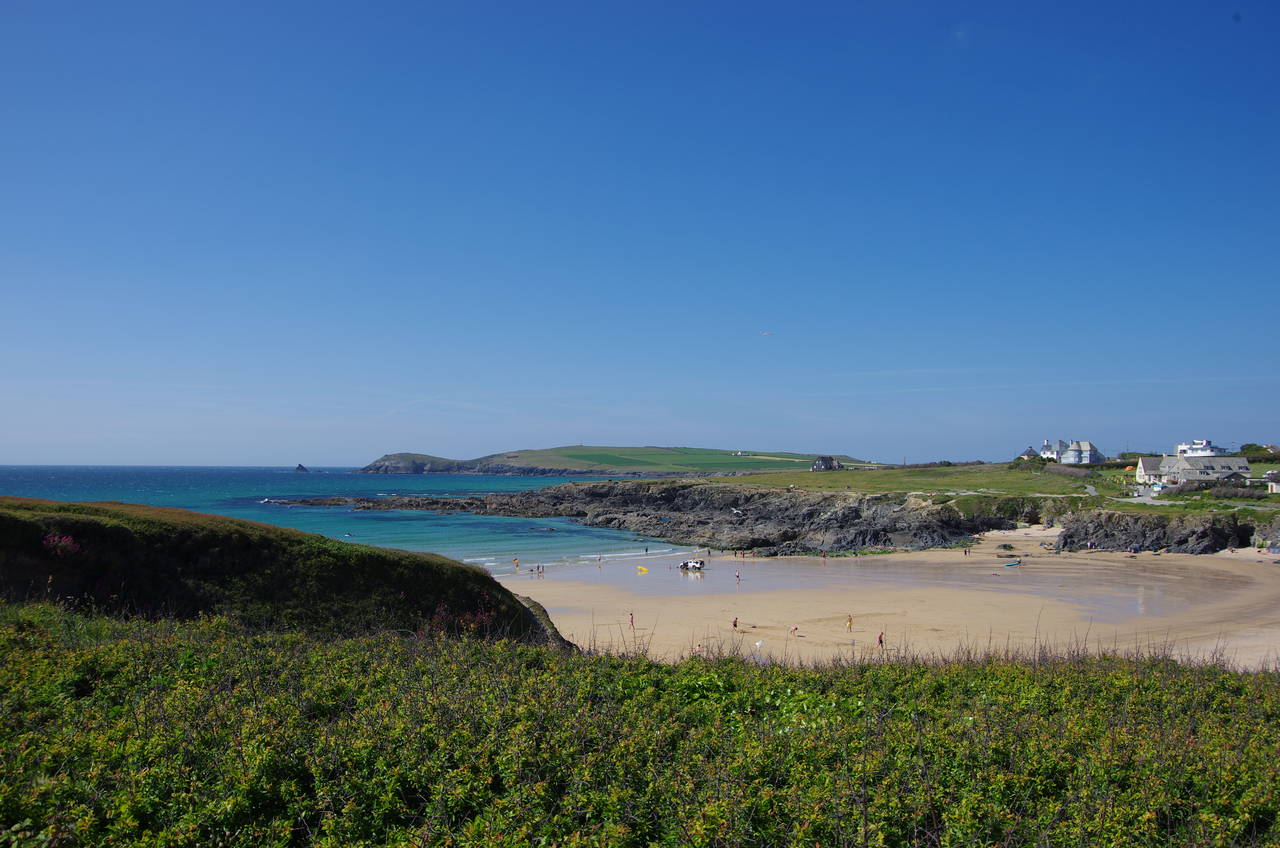
The Coast Path follows the road past the beach and then through a residential area as the road cuts across the next headland to reach a grassy area overlooking the long, narrow and shallow inlet of Porth Beach (picture 5). Having left the road, the route follows a well-worn path along the edge of the low cliffs, descending to meet Porth Beach Road at the edge of the sand.
This encounter with the beach is short however, as the road curves away to pass under a bridge carrying the B3276 Alexandra Road, then the Coast Path turns sharp left up a flight of steps to the join that road. The road is followed to the right, overlooking the tightly packed beachside houses for a while before eventually curving left opposite the large Porth Beach Holiday Park. Once again the road has a brief flirtation with the beach and there is a good view back along the narrow inlet towards the sea (picture 6).
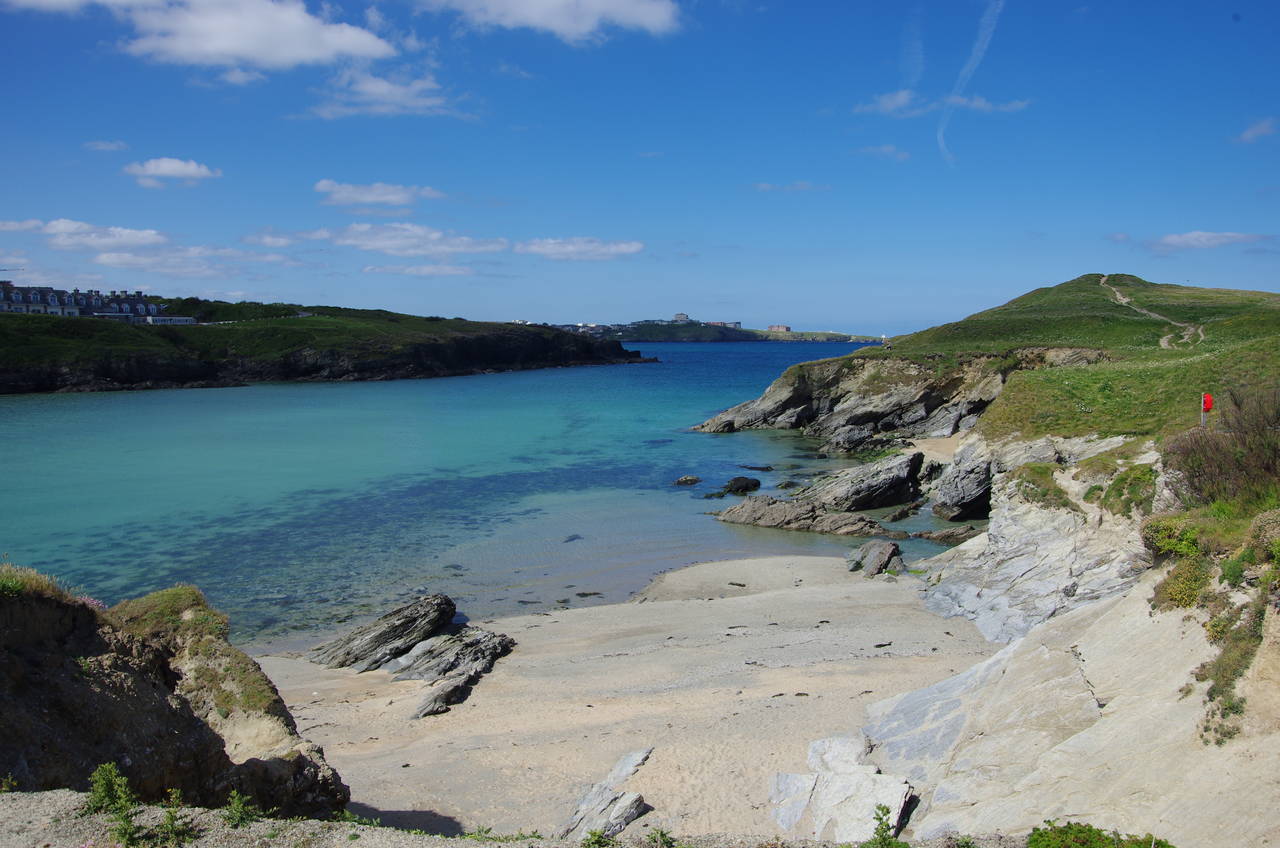
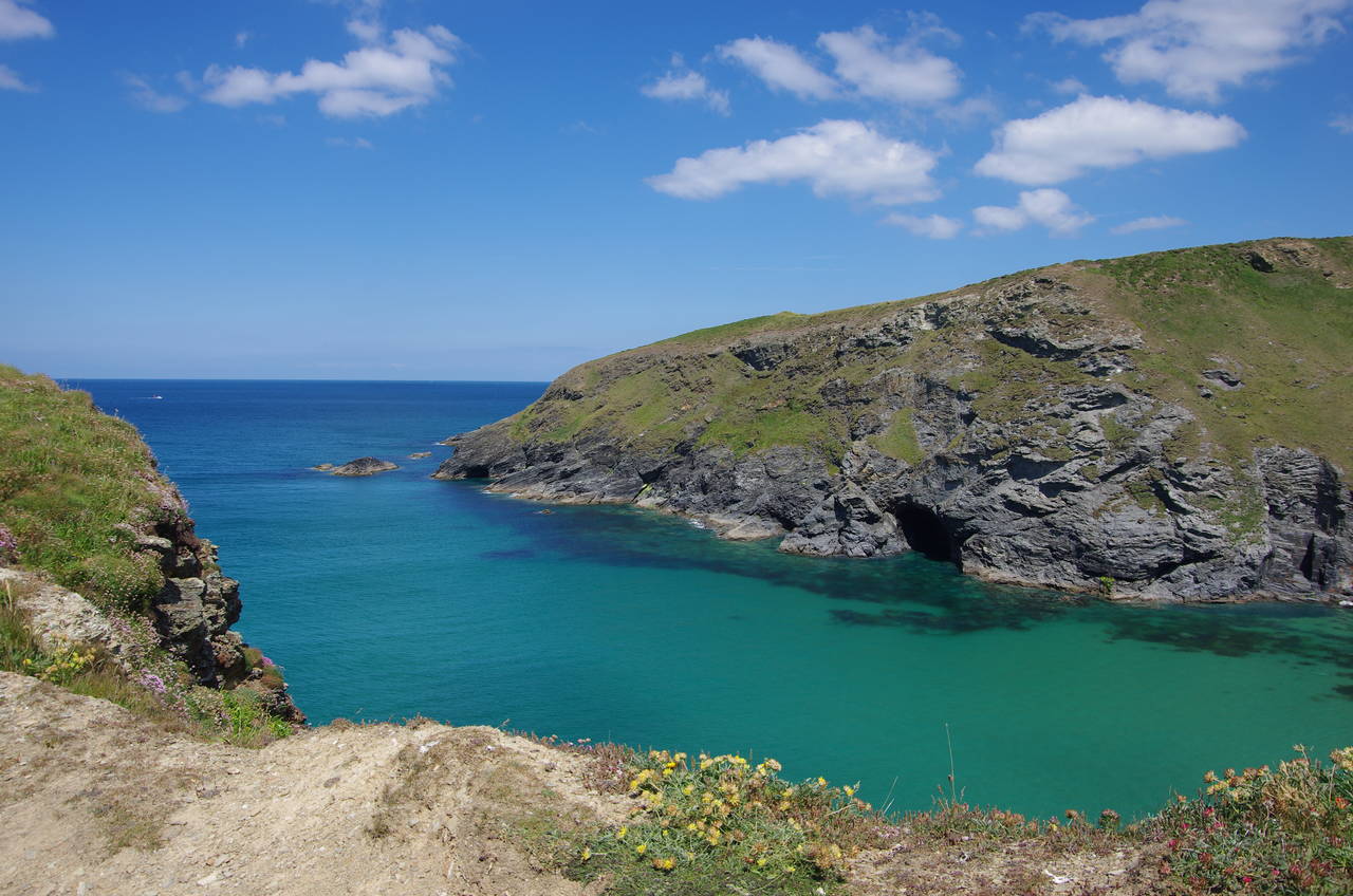
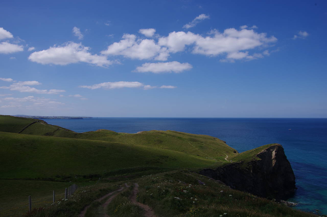
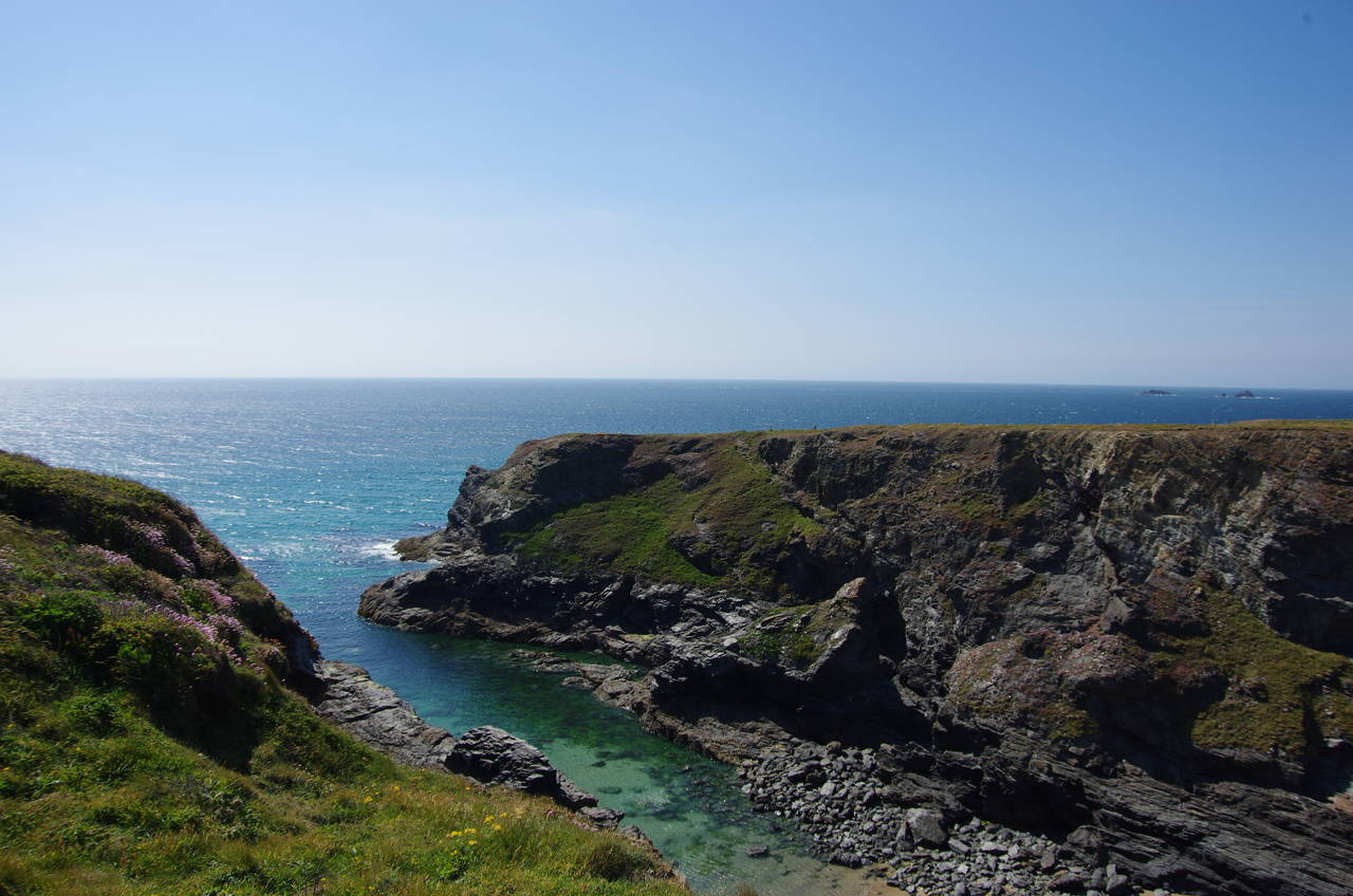
The road soon bends right to cut across the headland of Trevelgue Head, but the Coast Path follows a longer course skirting the edge of the headland (picture 7) as far as a narrow channel that cuts the headland into two about halfway along and makes the other half into an island. The official route of the Coast Path doesn't go onto Porth Island, but there is a footbridge across the gap, so I made a brief diversion to explore it (picture 8).
The island is an important archaeological site, with a pair of Bronze-Age burial mounds dating back between 3,500 and 4,000 years and remains of one of Cornwall's largest Iron-Age settlements, established between 2,100 and 2,400 years ago. Other items found on Trevelgue Head include fragments of stone tools thought to be as much as 8,000 years old, bronze and iron working remains, and Roman coins. This all suggests that the headland has been of strategic importance for a very long time.

(9) Whipsiderry Cove
(10) View back from Whipsiderry
(11) Watergate Bay
(12) Strasse Cliff
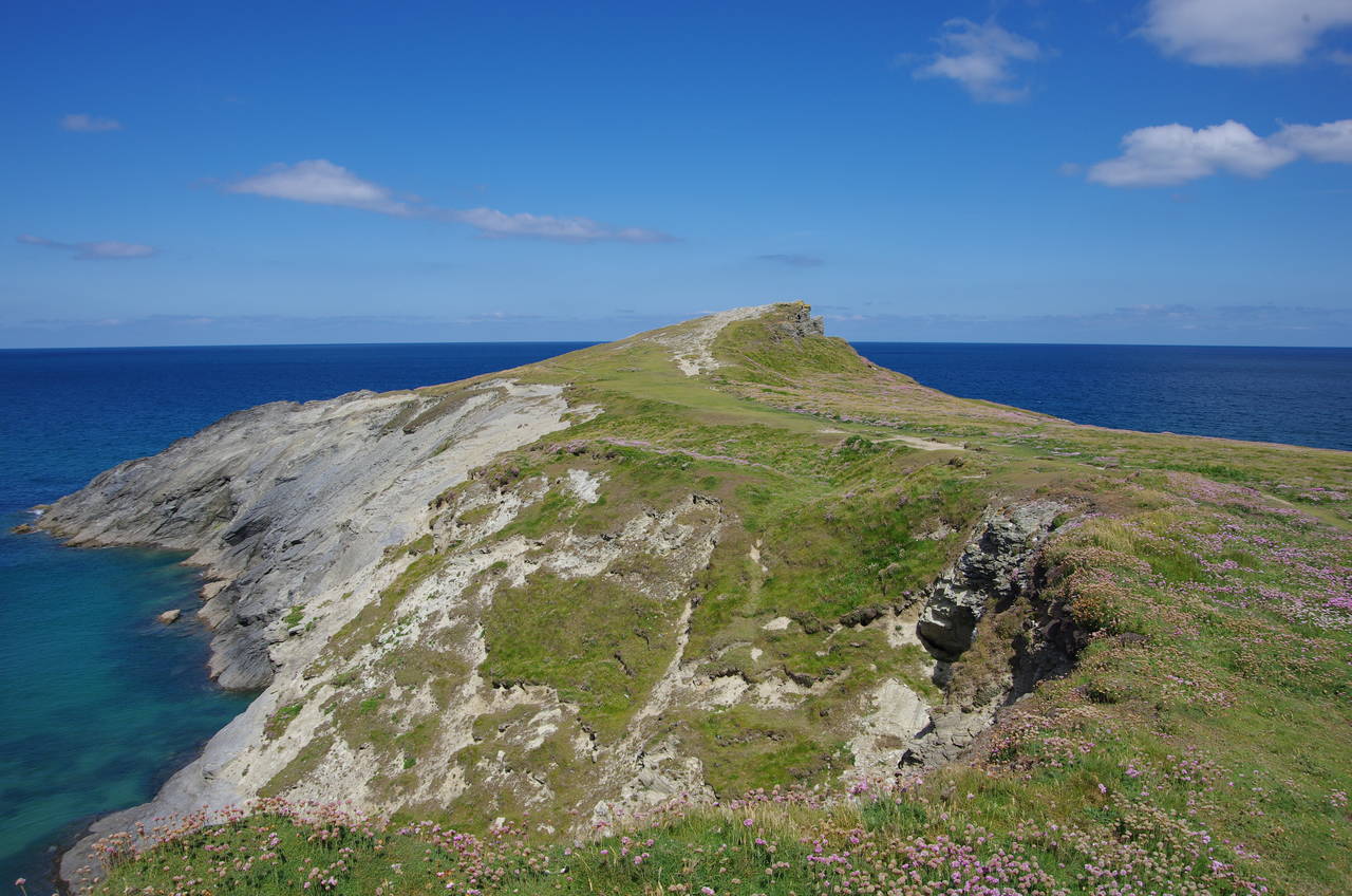
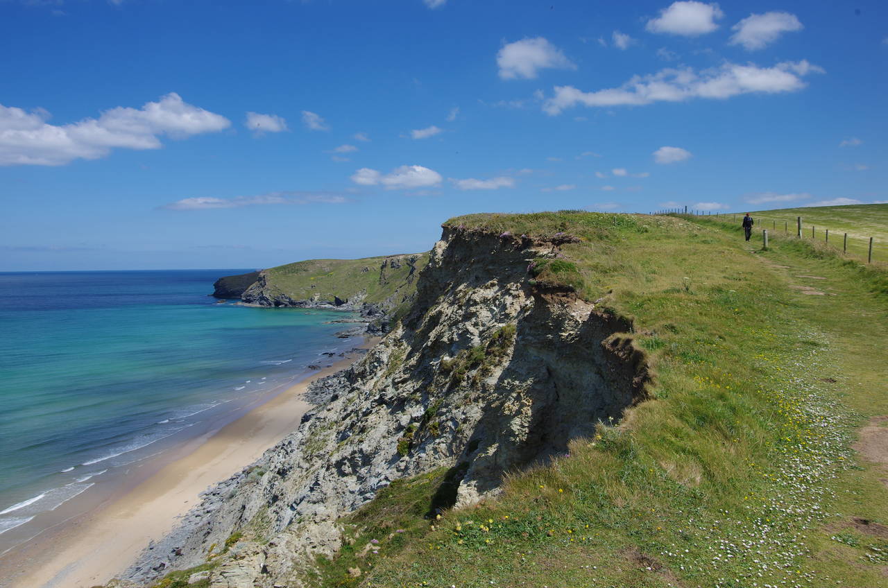
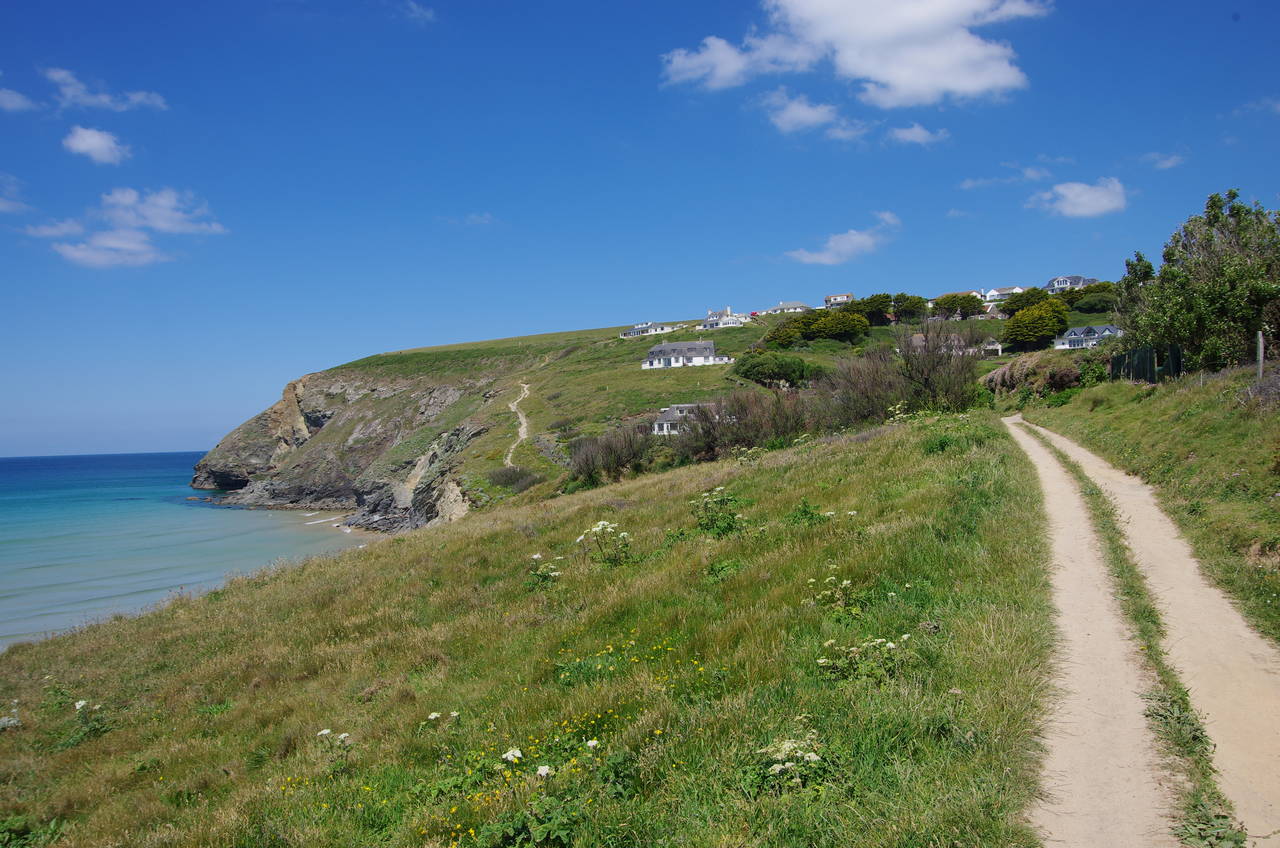
Back on the official route, I headed along the north edge of Trevelgue Head, which was covered in knee-high wildflowers, and around Whipsiderry Cove, where a rocky islet is marooned in the middle of the beach (picture 9). Halfway around the cove the path comes up beside the B3276 once again, not far from where the route previously left the road. The path continues to follow the ragged edge of the crumbling cliffs, never very far from the road, with the village of Whipsiderry across the road for a little while and then farmer's fields.
A few minutes walk beyond the end of the village the path reaches a small promontory where the path skirts around a couple of round barrows. From here there are far-reaching views back over Porth Island, Newquay and beyond (picture 10).
The next stretch of the path sticks to the clifftop above Fruitful Cove to reach Creepinghole Point, presumably a reference to the constantly eroding cliffs. The point overlooks Watergate Bay, where a densely-packed village of holiday apartments and fancy restaurants occupies a gap in the cliffs (picture 11). The path descends to meet the main road behind a large carpark, then climbs halfway up Trevarrian Hill to find a narrow flight of concrete steps between buildings leading to a path that climbs up out of the village onto Strasse Cliff (picture 12).
(13) Beacon Cove
(14) View back over Griffin's Point
(15) Mawgan Porth
(16) Trenance Point
The Coast Path now runs along a relatively straight stretch of clifftops beside fields for about 1,500 metres to climb over the little Stem Point and then around the larger Griffin's Point to reach the rugged Beacon Cove (picture 13). Behind the cove, the path climbs up over The Beacon, from which there is a good view back across the rolling landscape of Griffin's Point (picture 14).
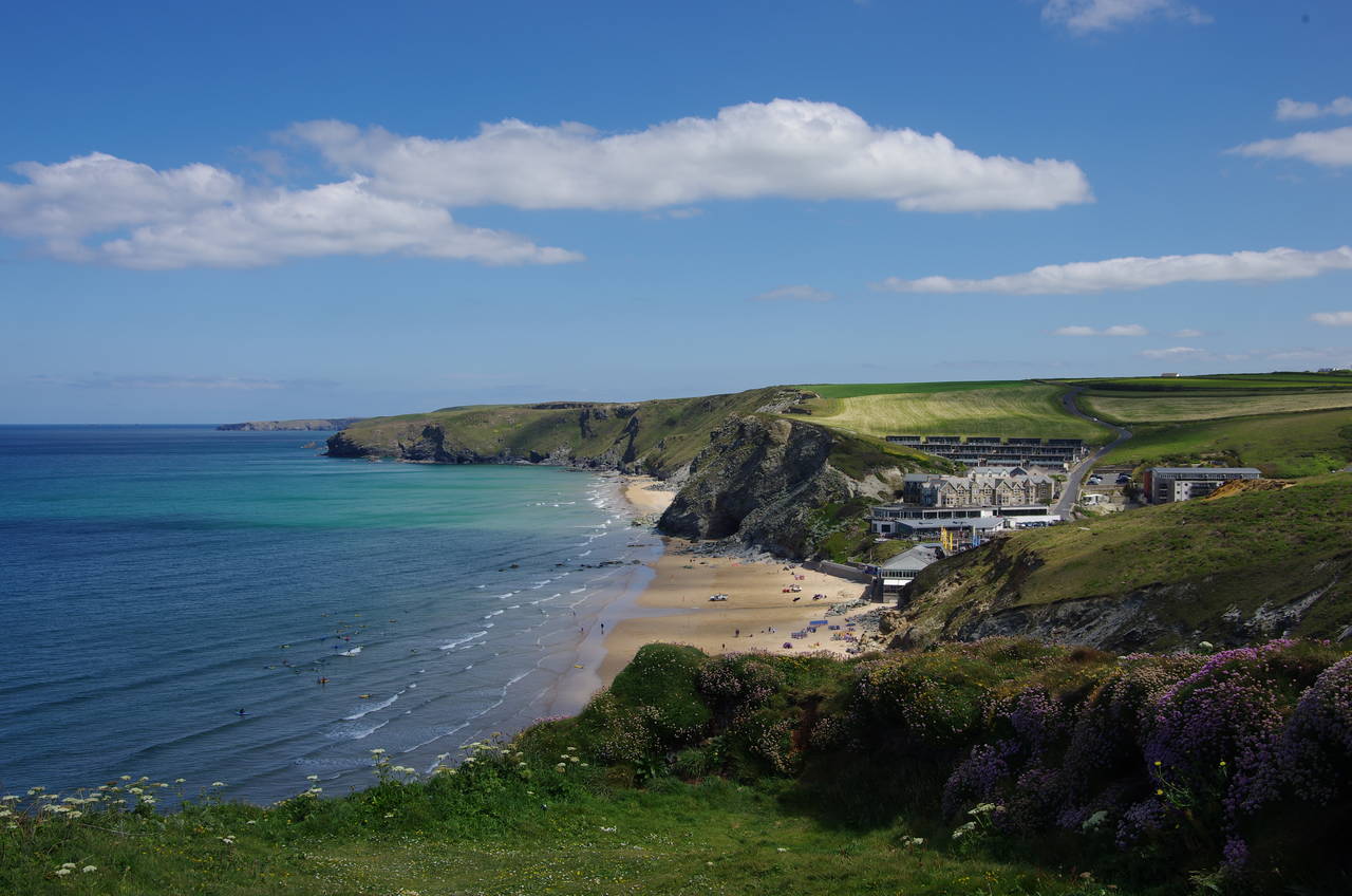
Ahead, the path rounds the even larger headland of Berryl's Point to the popular sandy beach of Mawgan Porth and the village of the same name (picture 15). Descending to the back of the beach, the path briefly joins the B3276 to cross a stone bridge over the narrow River Menalhyl then immediately heads off across the sand along back of the beach to find a path back up onto the clifftops. This path gradually gains height as it climbs up onto Trenance Point (picture 16).
(17) View ahead from Carnewas Point
(18) Bedruthan Steps
(19) Bedruthan Steps
(20) Porth Mear
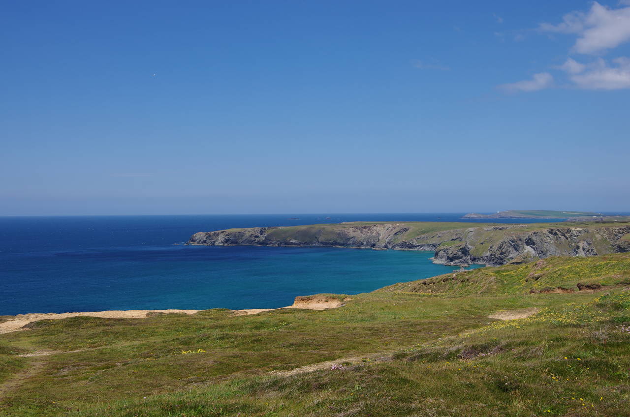
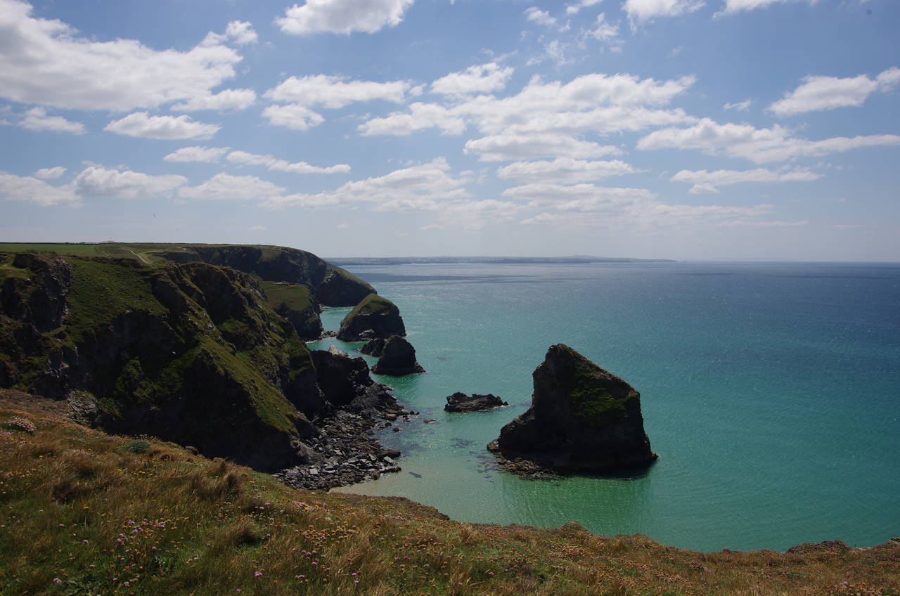
After rounding Trenance Point the Coast Path heads onto the smaller Trerathick Point and then into the National Trust's Carnewas property. From the point of the same name, there is a good view across the large bay to the finger of land of Park Head reaching out into the Atlantic, with the lighthouse on Trevose Head beyond in the far distance (picture 17).
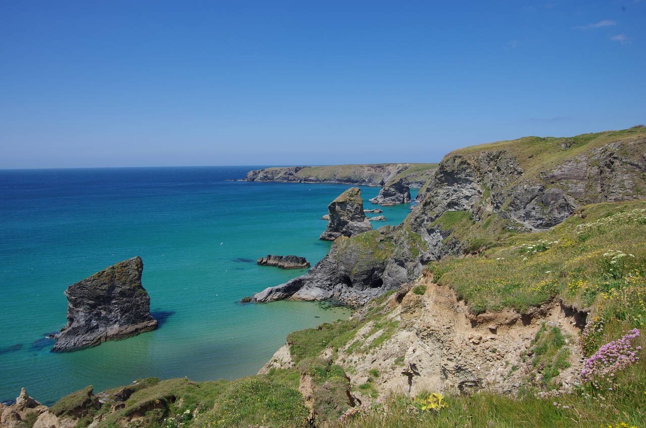
A little further on, after cutting across the little Pendarves Point, the route joins a cobbled path, built to stop the erosion caused by hordes of tourists visiting the Bedruthan Steps, a series of slate stacks standing just off the cliffs (picture 18). Local legend has it that the steps were made to enable a giant to walk across the bay.
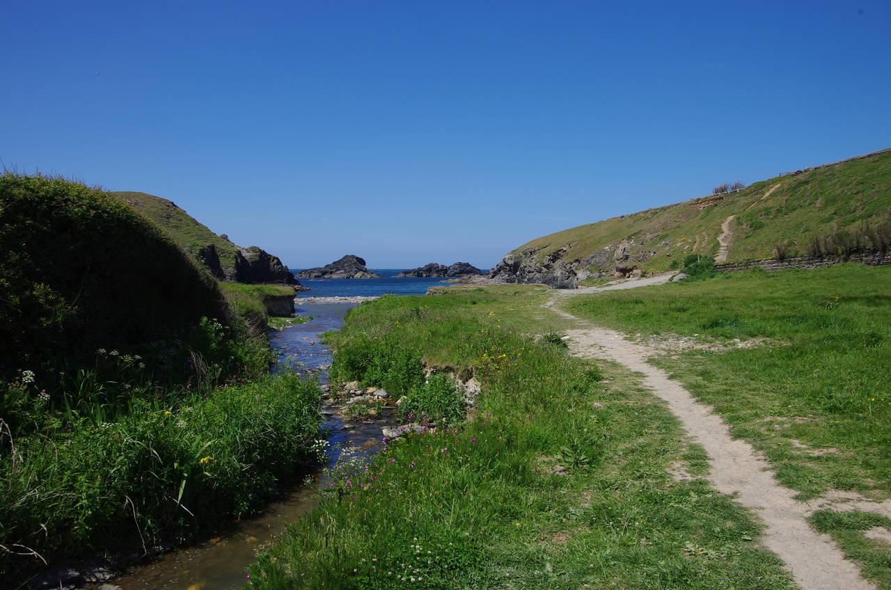
Perhaps the best view of the steps from the Coast Path can be enjoyed just before the path reaches Park Head (picture 19). The route shortcuts across Park Head, to regain the clifftop above a small cove, turning right and cutting across two more ragged points to come up on a point overlooking the lonely and rocky inlet of Porth Mear. The path descends into the combe, crossing a footbridge over a stream and then following a well-worn path that climbs steeply up to the next point (picture 20).
(21) Porthcothan
(22) Fox Cove
(23) Treyarnon Bay
(24) Constantine Bay
Leaving Porth Mear behind, the path hugs the grassy top of the jagged cliffs for a kilometre to Porthcothan, another sandy inlet cutting deep into the coastline (picture 21). The route follows the clifftop past houses lining the southern edge of the inlet to meet the B3276 in the dunes behind the beach. The road is followed for a little more than 100 metres to cross a narrow bridge over a stream, then the path turns left off the road on a footpath towards the beach, soon forking right to begin the gentle climb above the northern edge of the inlet.
The path turns away from Porthcothan above a slate stack called Will's Rock, the first of several standing off the rocky cliffs on the next kilometre to little Fox Cove (picture 22). Three more similar coves follow in quick succession, the narrow fingers of land between them showing the remains of the ramparts of an Iron-Age fortress, most of which has been eroded away by the wild Atlantic over the last 2,500 years.
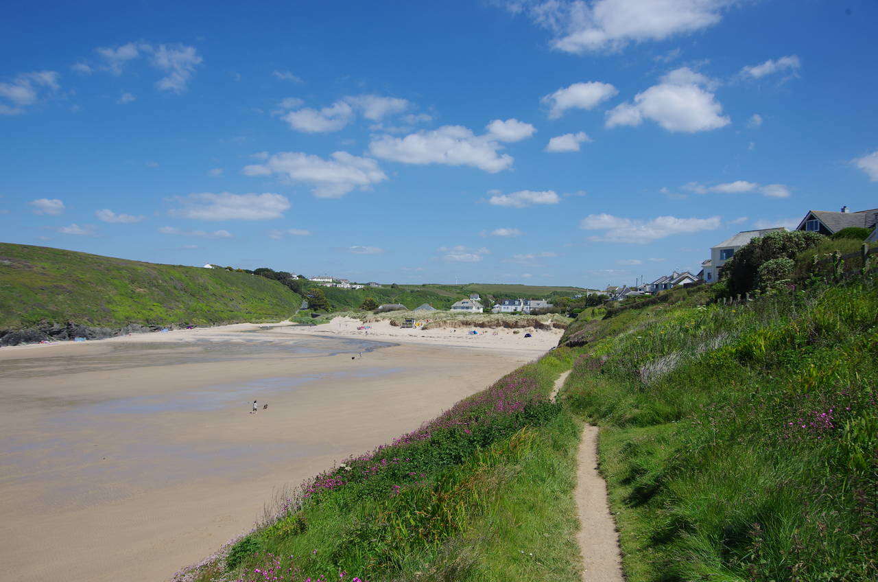
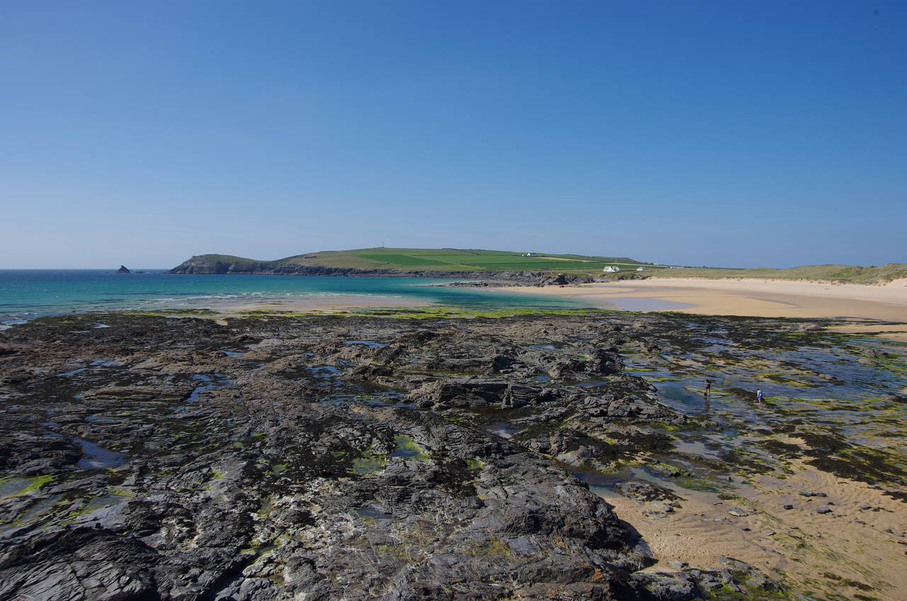
Beyond the last little cove, the path turns into the larger inlet of Treyarnon Bay (picture 23), gradually descending past houses to the back of the beach, where the path crosses the sand and a shallow stream before joining a path past a carpark and youth hostel and around the low Treyarnon Point. A large expanse of wave-cut rocks, full of little pools on the falling tide, stretches all the way around the point from Treyarnon Bay to neighbouring Constantine Bay (picture 24).
Where the rocks begin to give way to sand, a ramp heads down on to the beach, but that would have to wait for tomorrow. I left the Coast Path here, having walked 22.7 kilometres from Newquay, and followed a lane inland for 800 metres to a crossroads in the centre of the fairly large Constantine Bay village, finding the bus stop opposite the village store.
My timing wasn't so good and I was left with a wait of about 90 minutes for the last bus of the day, leaving just before six o'clock. After buying an ice-cream from the store, I wandered back down to the beach to while away the time exploring the rock pools in the afternoon sun.