SOUTH WEST COAST PATH NATIONAL TRAIL
Stage 34: Porthcurno to Land's End
Sunday, June 9, 2014
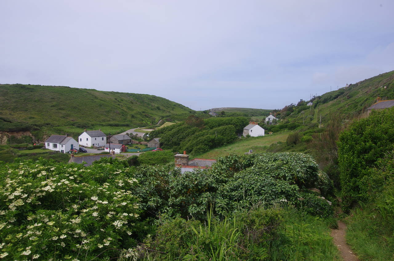
(1) Porthcurno
(2) Pedn-Men-An-Mere
(3) Porth Chapel
(4) Carn Scathe
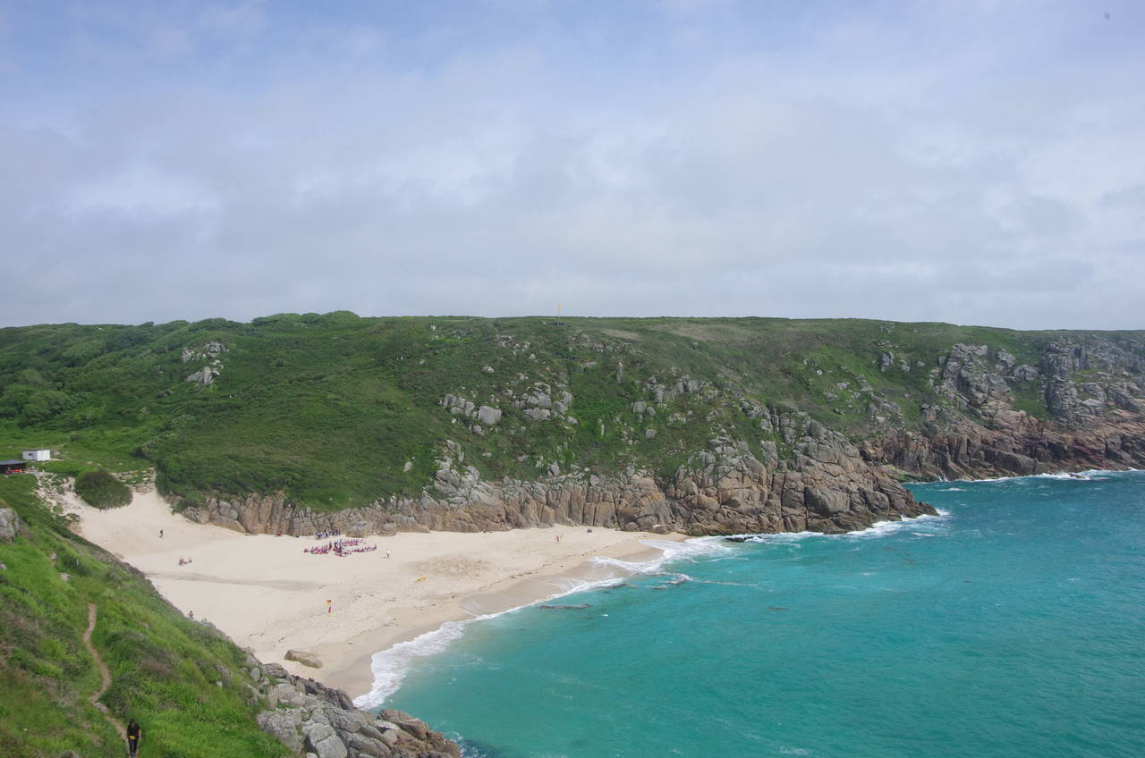
It was almost midday when I rejoined the Coast Path in the dunes behind the rather busy beach at Porthcurno. The route is signposted along a narrow path that climbs above the western end of the beach (picture 1), becoming a rather strenuous climb up rough steps to the top of Minack Point.
Minack Point is home to the famous Minack Theatre, an outdoor amphitheatre hewn into the south-facing side of the point, but unfortunately not visible from the Coast Path, except for a distant view a few kilometres before the end of the previous stage of the walk. The Minack is normally open for visitors to look around the theatre and gardens (for a fee), but was closing for an afternoon performance just as I arrived, so I'll have to try to visit again when I come back to Porthcurno to visit the Telegraph Museum.
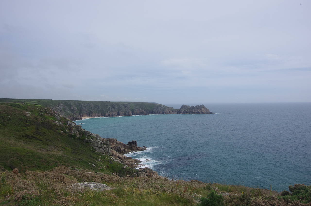
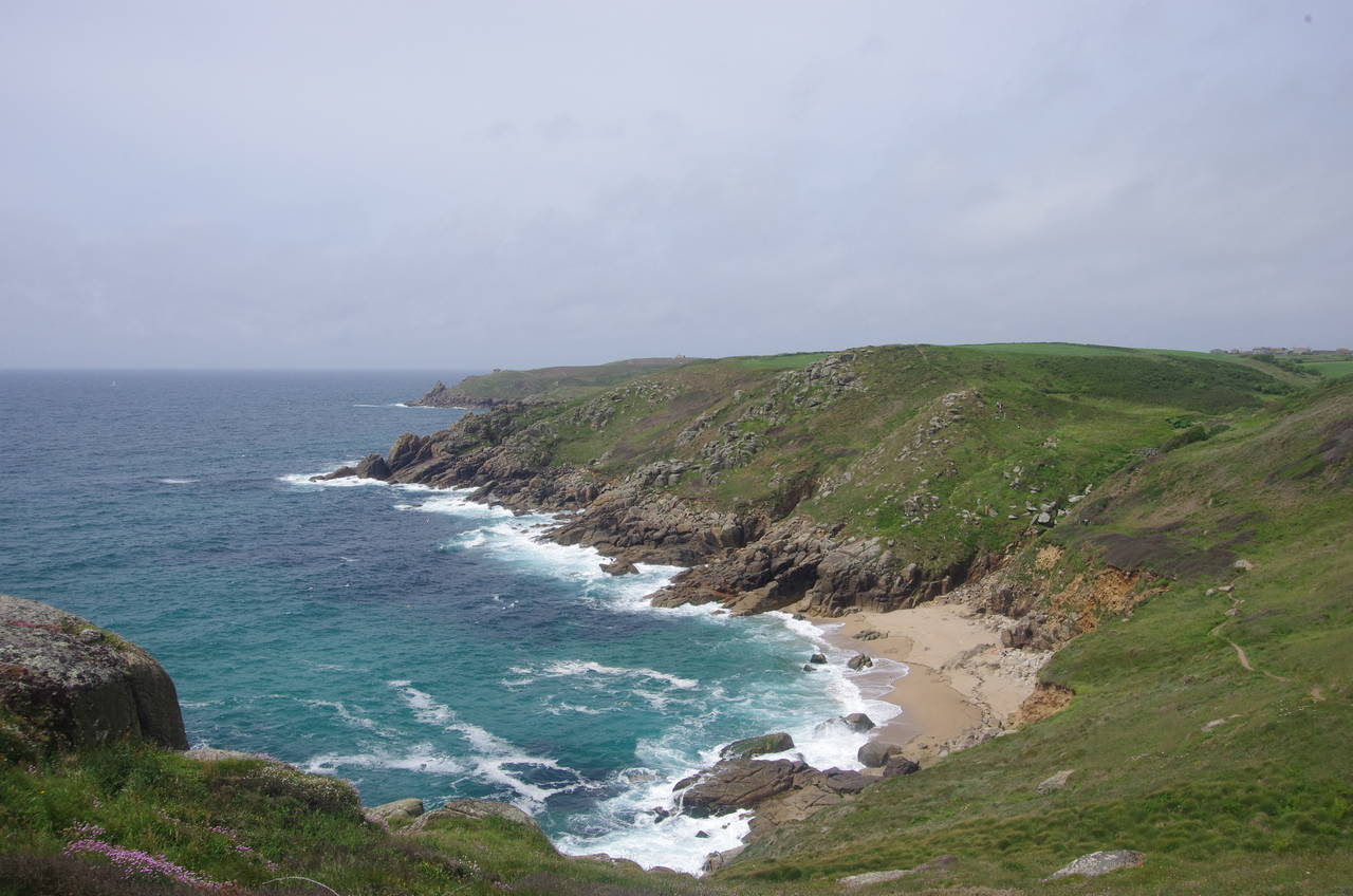
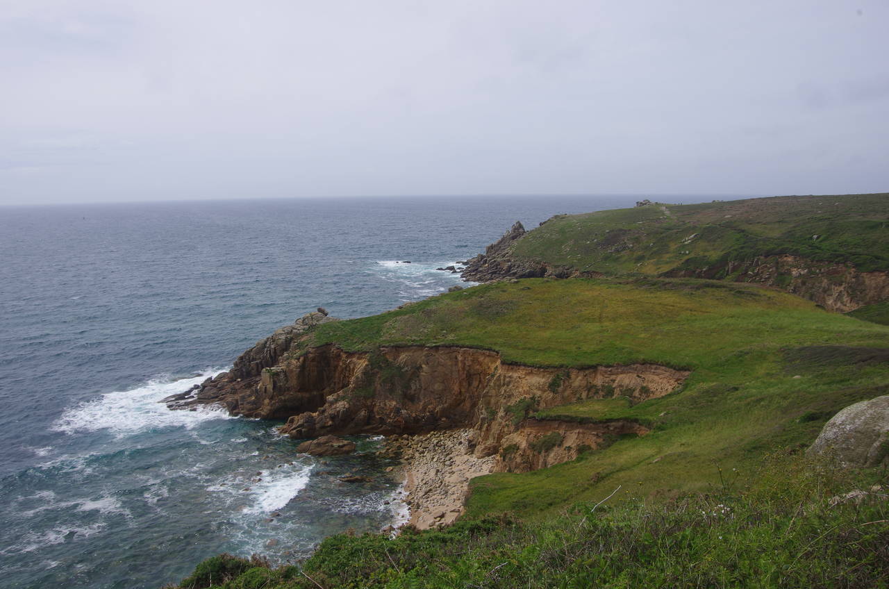
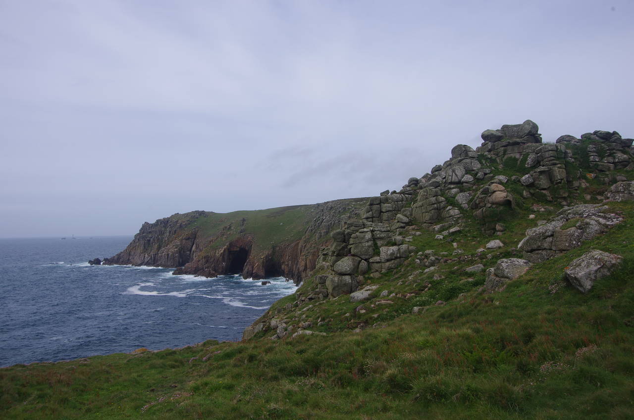
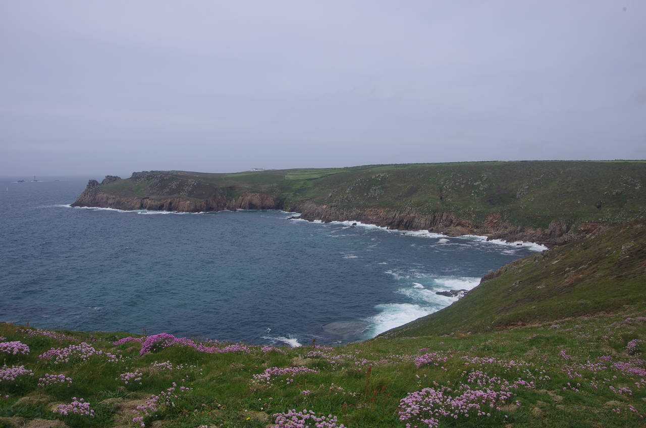
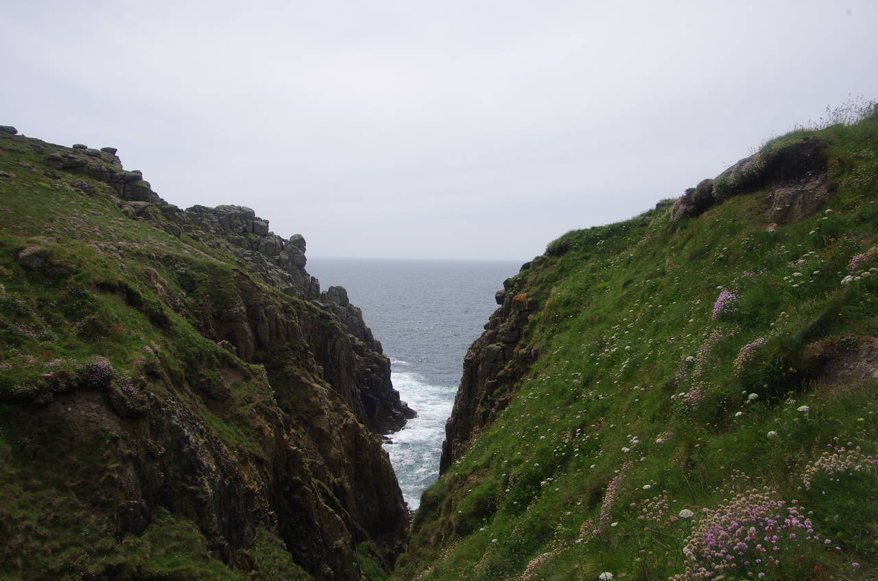
A fingerpost on the far side of the Minack's carpark directs the Coast Path out onto the clifftops towards the point of Pedn-Men-An-Mere, from which there is one last view back across the bay to Horrace (picture 2) before the path rounds the point and descends into the combe behind the deserted beach of Porth Chapel (picture 3). A testing little climb out of the combe to Carn Barges is followed by an easier walk along the clifftops towards the little headland of Carn Scathe (picture 4), which shelters the tiny village of Porthgwarra.
(5) Porthgwarra
(6) Porthgwarra
(7) Hella Point
(8) Gwennap Head
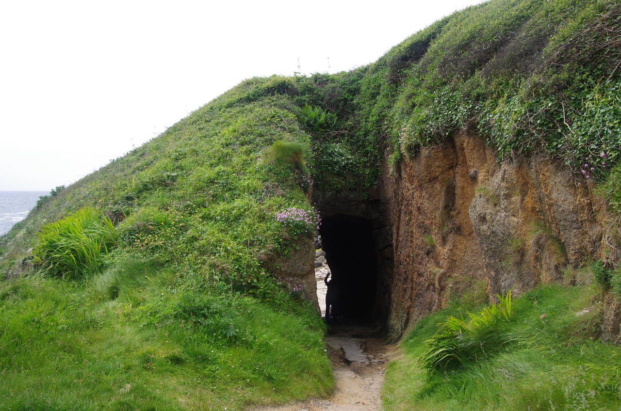
The path cuts across the back of the headland, taking a more direct route down to the village (picture 5) and descending to meet a lane that soon passes the entrance of a tunnel cut through the rock to a cobbled slipway. The Coast Path takes a slightly longer route around to the top of the slipway, but I made a quick diversion through the tunnel (picture 6) to the rocky shore, where I found a second short tunnel.
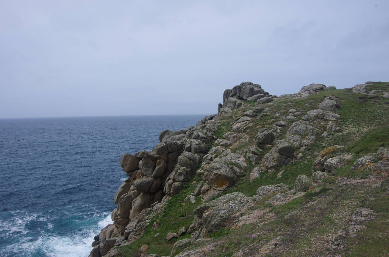
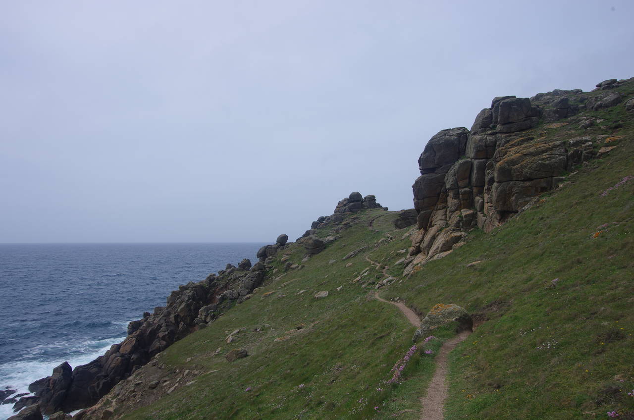
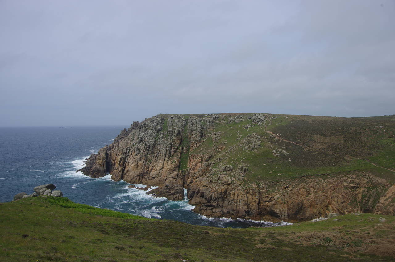
Near the top of the cobbled slipway, the Coast Path begins the climb up out of the valley and onto Hella Point, passing close by an impressive granite outcrop (picture 7) before continuing a little higher above several more as the path crosses Gwennap Head (picture 8).
(9) Tol-Pedn-Penwith
(10) Coastwatch station, Gwennap Head
(11) Porth Loe
(12) Pendover Cove
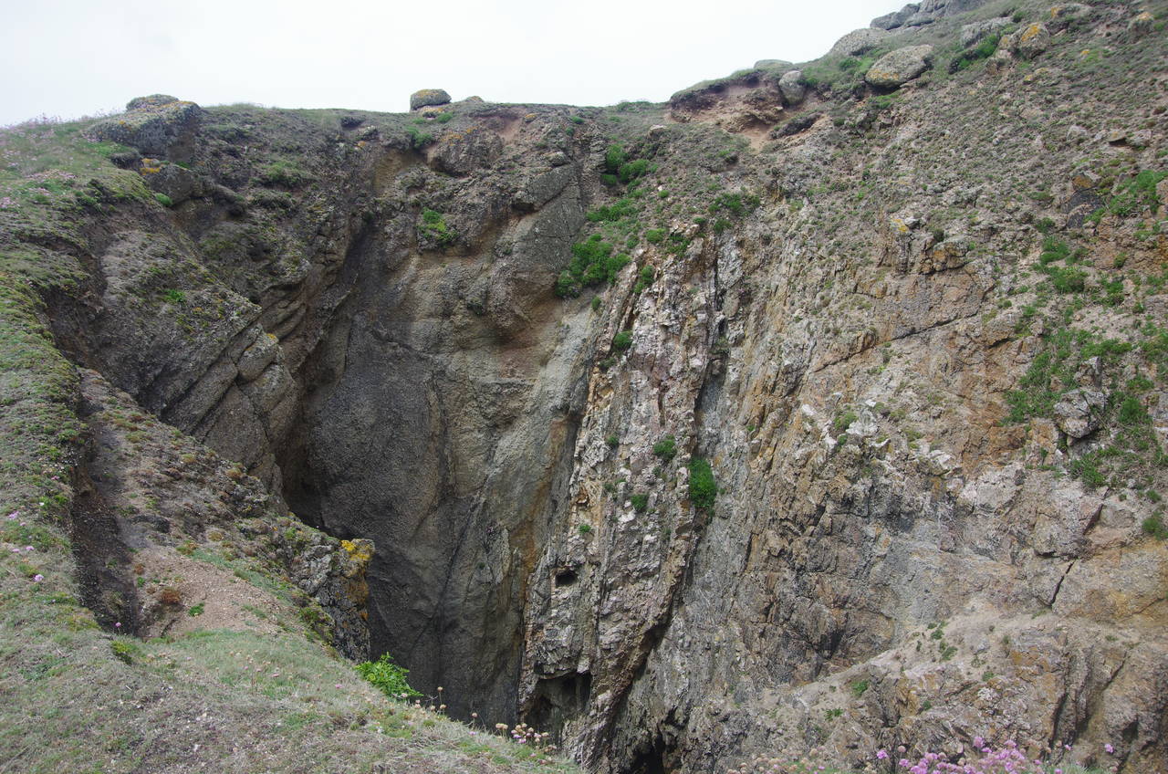
A short diversion downhill from the path is Tol-Pedn-Penwith (picture 9), a deep hole left by a partially collapsed sea cave, with a narrow land bridge remaining on the seaward side.
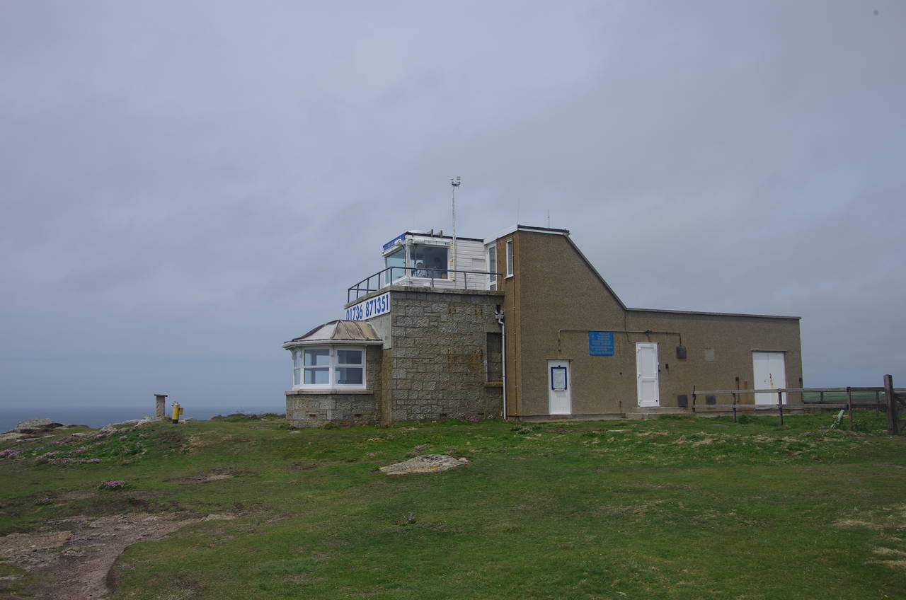
Back on the top of Gwennap Head, the path reaches a National Coastwatch Institute lookout station (picture 10) and here the path swings northwards, having reached the most south-westerly headland in Britain.
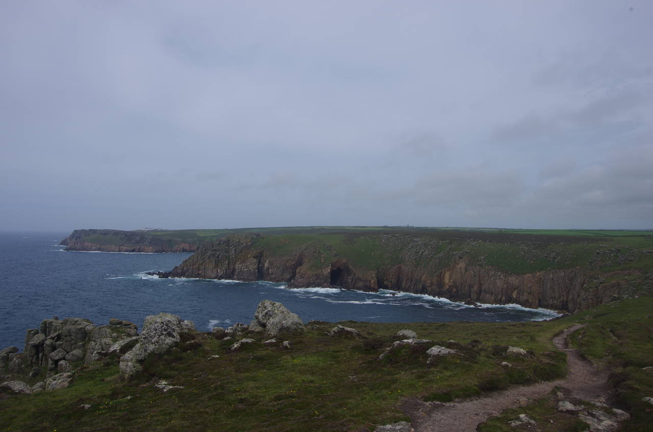
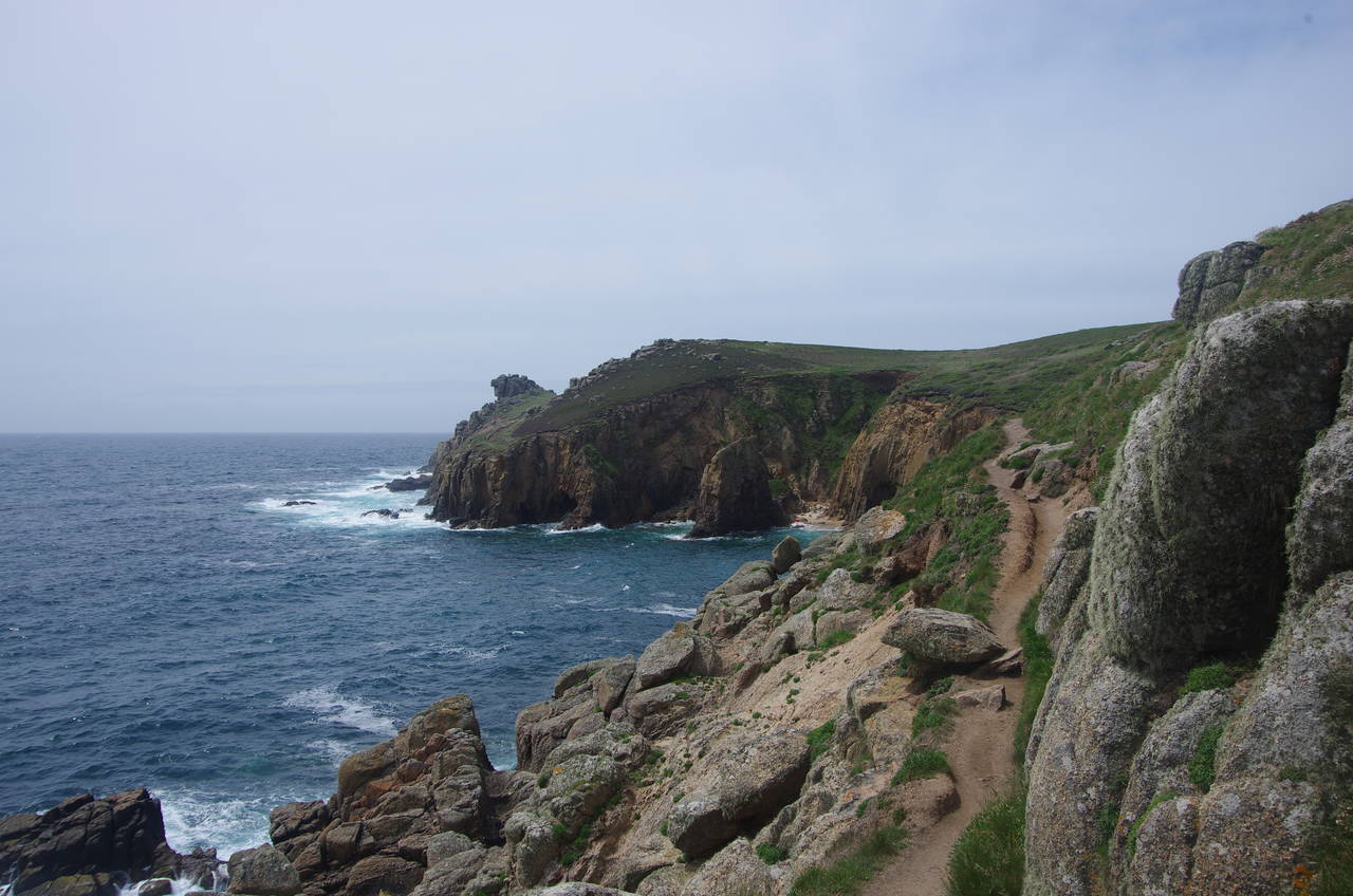
Ahead is the lonely little inlet of Porth Loe (picture 11) where the path dips down to cross the combe before climbing back up over the boulder-strewn Roskestal West Cliff. Shortly after passing through a gate in a long stone field boundary, the path reaches Carn Barra, overlooking the rugged Pendover Cove (picture 12).
(13) Pendover Cove
(14) Nanjizal Bay
(15) Nanjizal Bay
(16) Zawn Reeth
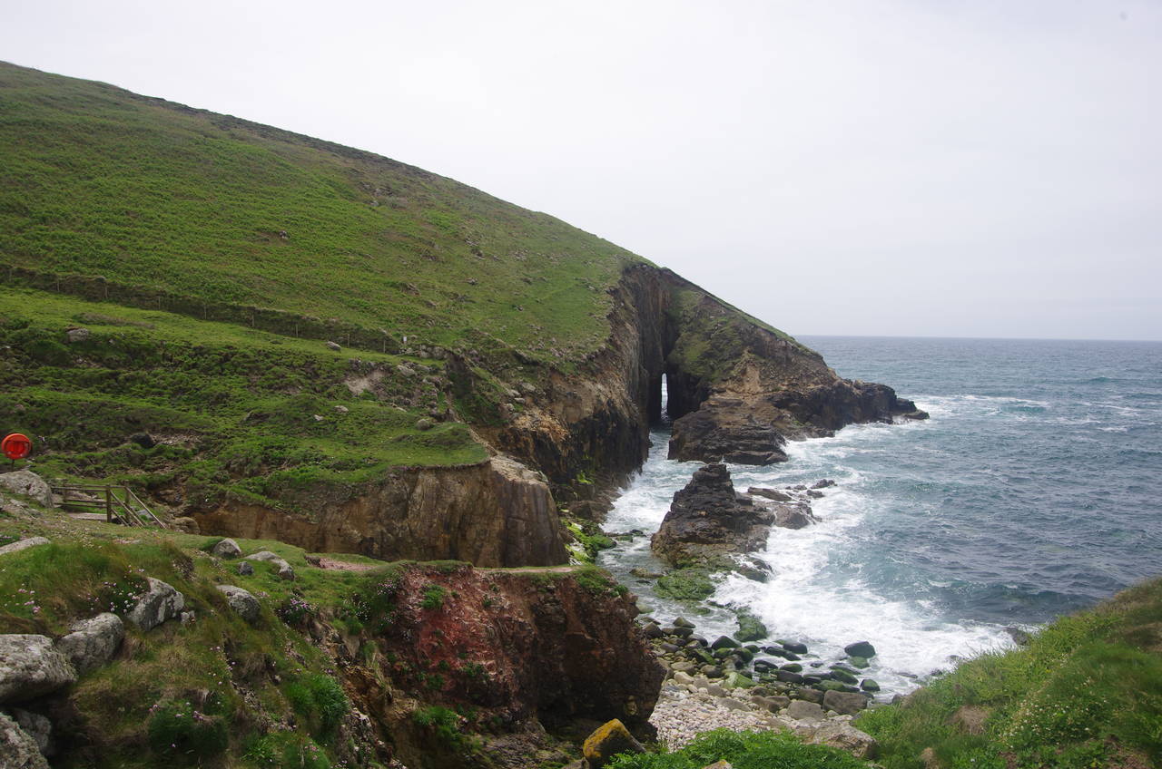
The path circles around the top of the cove, with good views across to the openings of a couple of sea caves (picture 13) before the path climbs past another cracked granite outcrop and heads across the boulder-strewn heathland of Higher Bosistow Cliff to reach Nanjizal Bay (picture 14).
Once again the path dips down to cross a tiny stream in the combe by a footbridge just below the scant stone ruins of an old mill. It's worth looking back from the bridge for a view through a narrow sea cave that has been bored through the cliff opposite by countless waves (picture 15).
From the end of the bridge the path climbs around a recently collapsed section of the cliff before setting off along the hillside above Lower Bosistow Cliff, negotiating a short section on a narrow ledge just before the little cove of Zawn Reeth (picture 16).
(17) The Lion's Den
(18) Zawn Wells, Enys Dodnan and the Armed Knight
(19) Greeb Farm and Land's End Visitor Centre
(20) Land's End Visitor Centre
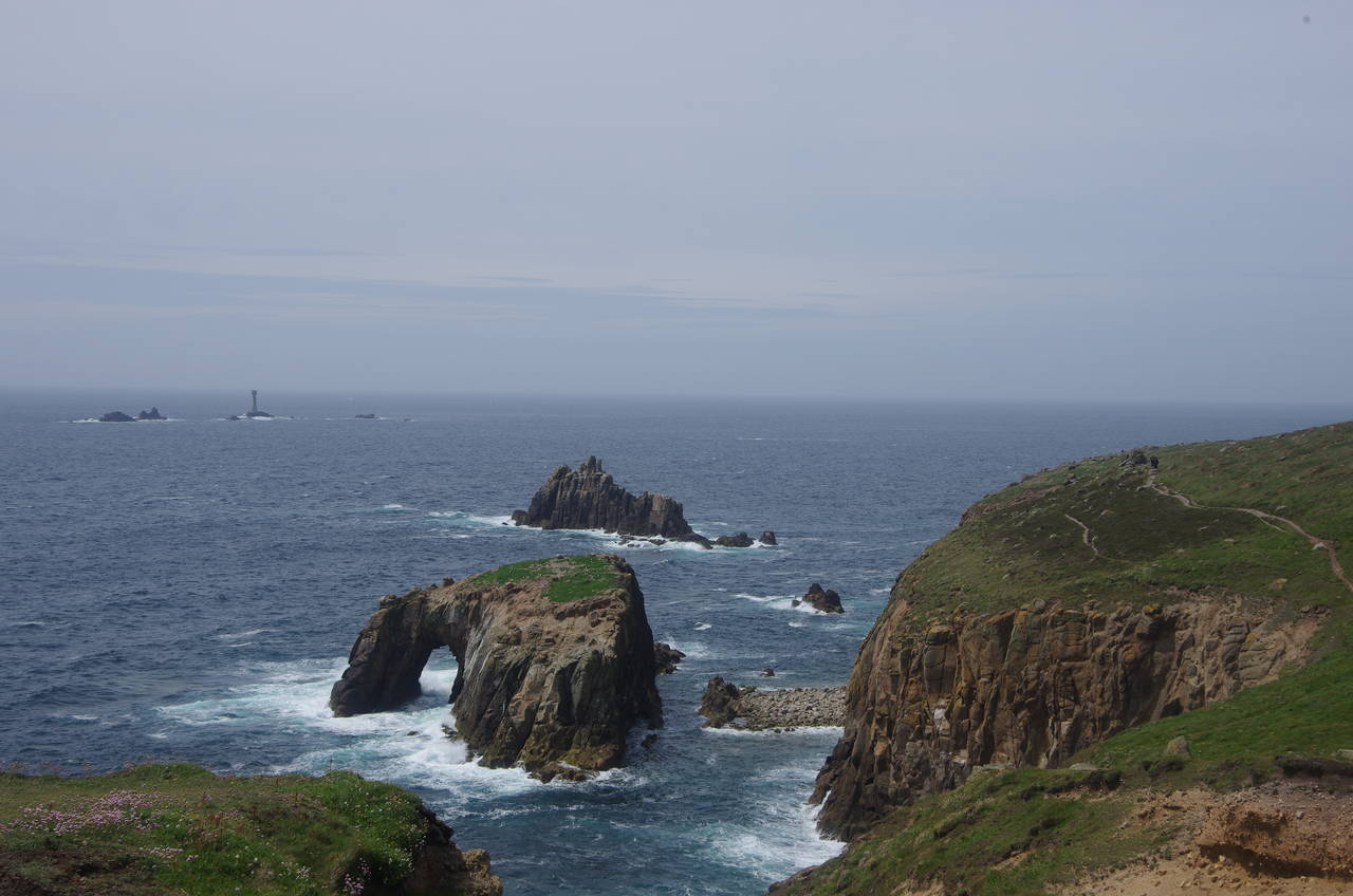
After climbing around the little inlet, the path continues to ascend as it circles around the headland of Trevilley Cliff before dipping down a little to cross the top of the narrow cleft of the Lion's Den (picture 17). After cutting across the next headland, the path looks out over the little cove of Zawn Wells with the two little offshore islets of Enys Dodnan and the Armed Knight (picture 18).
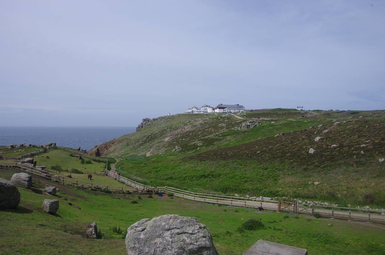
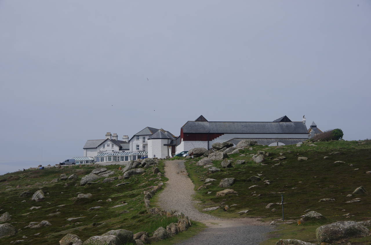
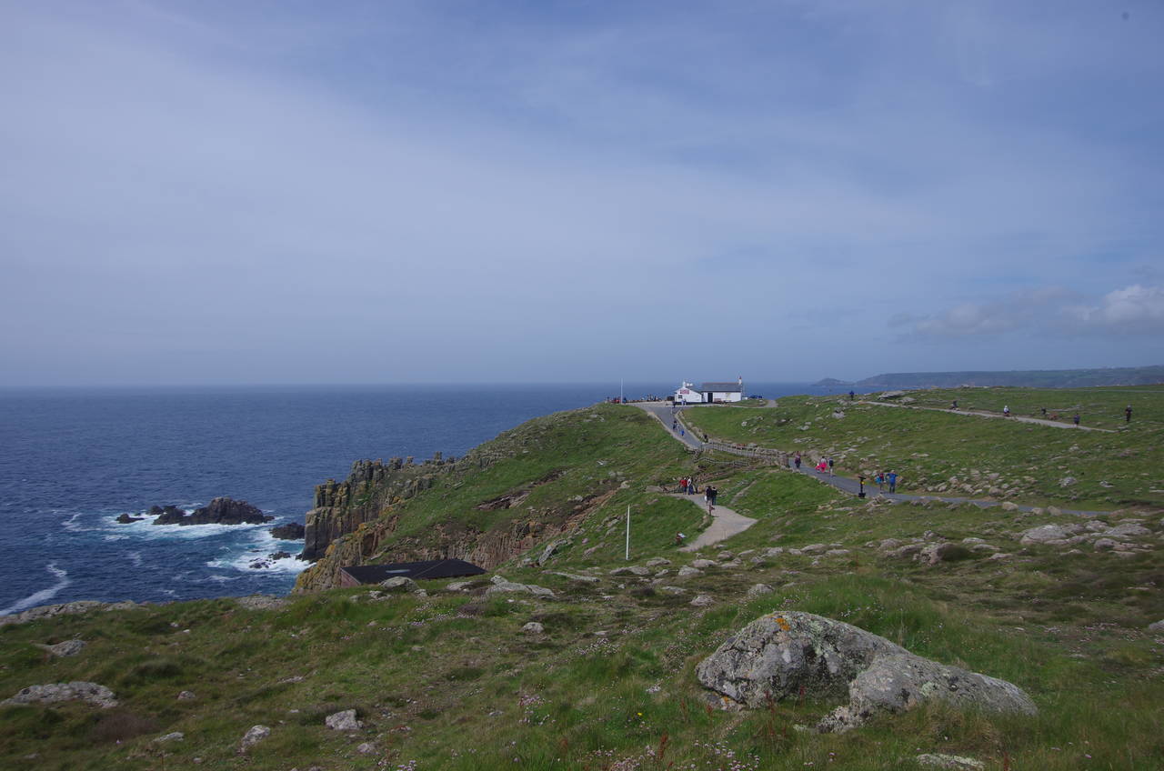
Having climbed over the ridge of the next headland, the Coast Path passes through the small Greeb Farm (picture 19) and joins a track across the next valley, heading just to the left of the sprawling Land's End Visitor Centre (picture 20), a slightly faded tourist attraction that seems to detract from the natural beauty of the location.
(21) Longships Lighthouse
(22) Dr Syntax's Head
(23) The First and Last Refreshment House
(24) View towards Cape Cornwall
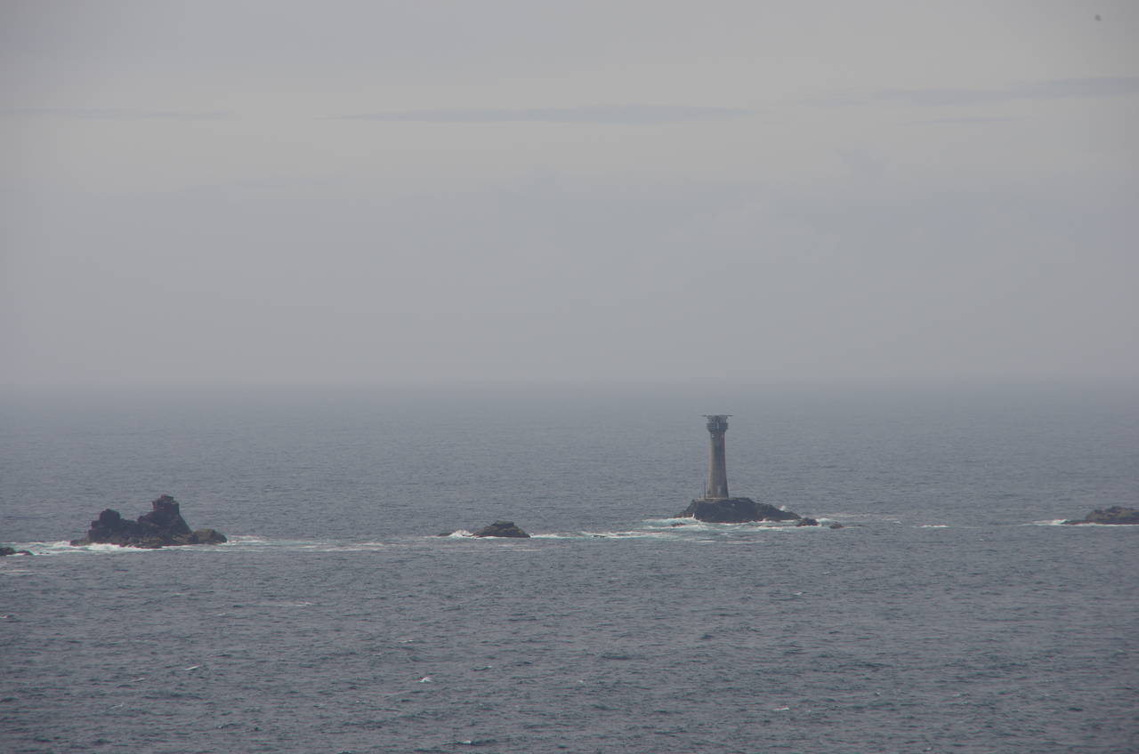
Looking westwards from the cliffs near the famous Land's End signpost on Dr Johnson's Head, one can see the granite tower of the Longships Lighthouse standing on a rocky reef a couple of kilometres offshore (picture 21). The 34 metre high lighthouse is the second tower to stand on the reef, built in 1873 to replace a smaller tower of 1795 that proved to be ineffective in guiding ships safely past Land's End due to the light being regularly obscured by spray and large waves. Prior to its automation in 1988, the tower was manned by keepers who spent weeks at a time confined to the tower. When the light was automated, a helipad was built on the top of the lantern and in 2005 the light was converted to solar power.
It turns out that, contrary to popular belief, the Land's End sign is not at the westernmost point in mainland Britain, and not quite even at the westernmost point in mainland England. The real most westerly point in mainland Britain is 740 kilometres away on the little hill of Corrachadh Mor at the tip of the Ardnamurchan Peninsula in the Scottish Highlands, while the most westerly point in mainland England is about 200 metres north of Land's End and just a few metres further west at the tip of Dr Syntax's Head (picture 22).
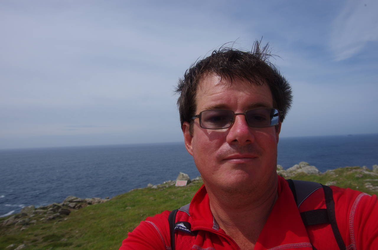
I duly followed the well-trodden path onto Dr Syntax's Head to a viewpoint in front of the First and Last Refreshment House, where I took my turn to be the most westerly person in mainland England and took a self-portrait to mark the occasion (picture 23). This also marked my having walked the entire south coast of England since setting out from Gravesend on the River Thames downstream from London a few days before the end of 2010. I was not immediately able to celebrate my achievement with a well-deserved pint of ale however, as the First and Last turns out to be a pub with no beer, on account of being established by the late-Victorian temperance movement.
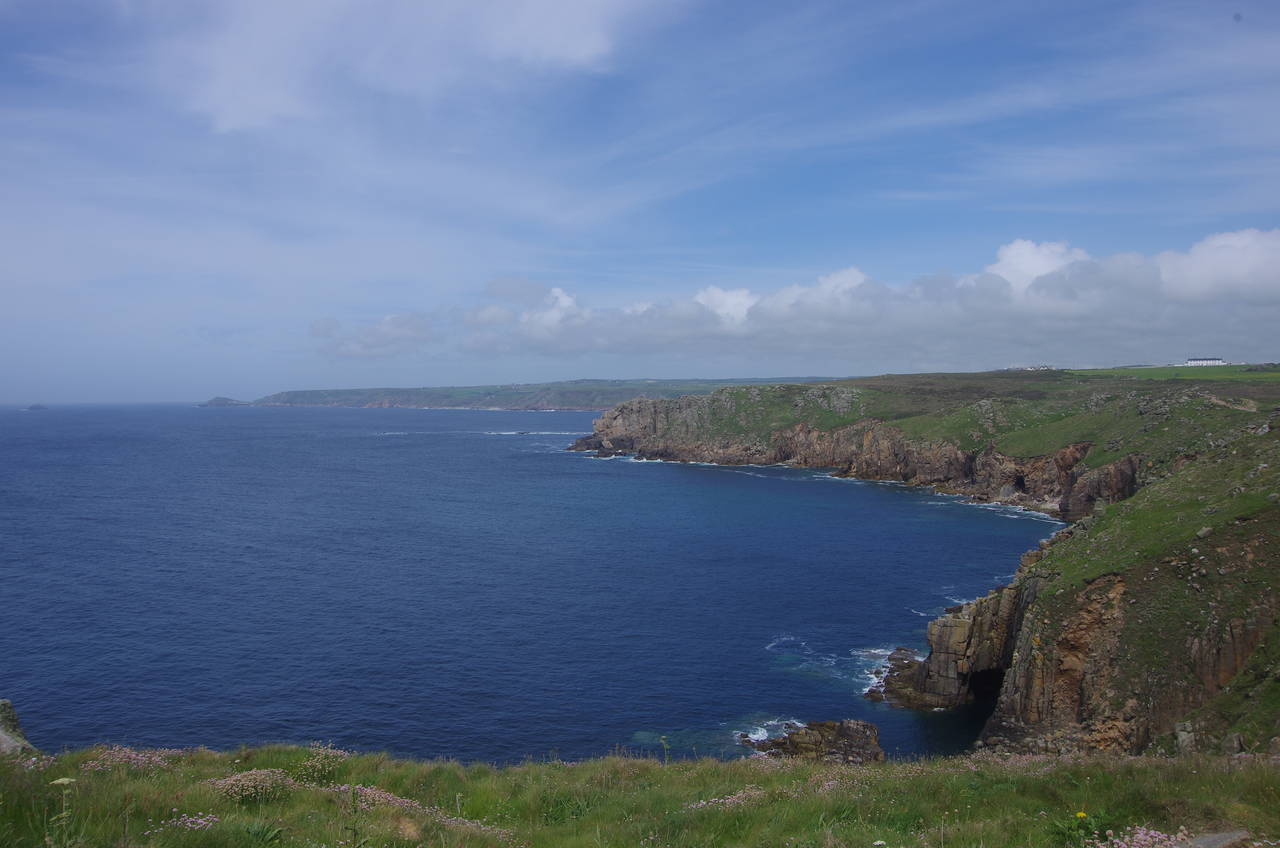
This seemed like a good place to leave the path for the day, and indeed for the summer. At 8.8 kilometres it had been a short stage, but one that is full of spectacular, rugged and windswept scenery. Looking northwards, I could see along the coast as far as the dome-shaped promontory of Cape Cornwall about 8 kilometres away (picture 24), looking tantalizingly close for something that I would have to wait almost another year to visit.