SOUTH WEST COAST PATH NATIONAL TRAIL
Stage 22: Downderry to Looe
Thursday, May 22, 2014
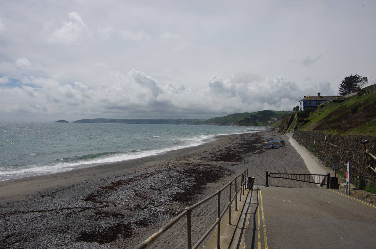
(1) Downderry Beach
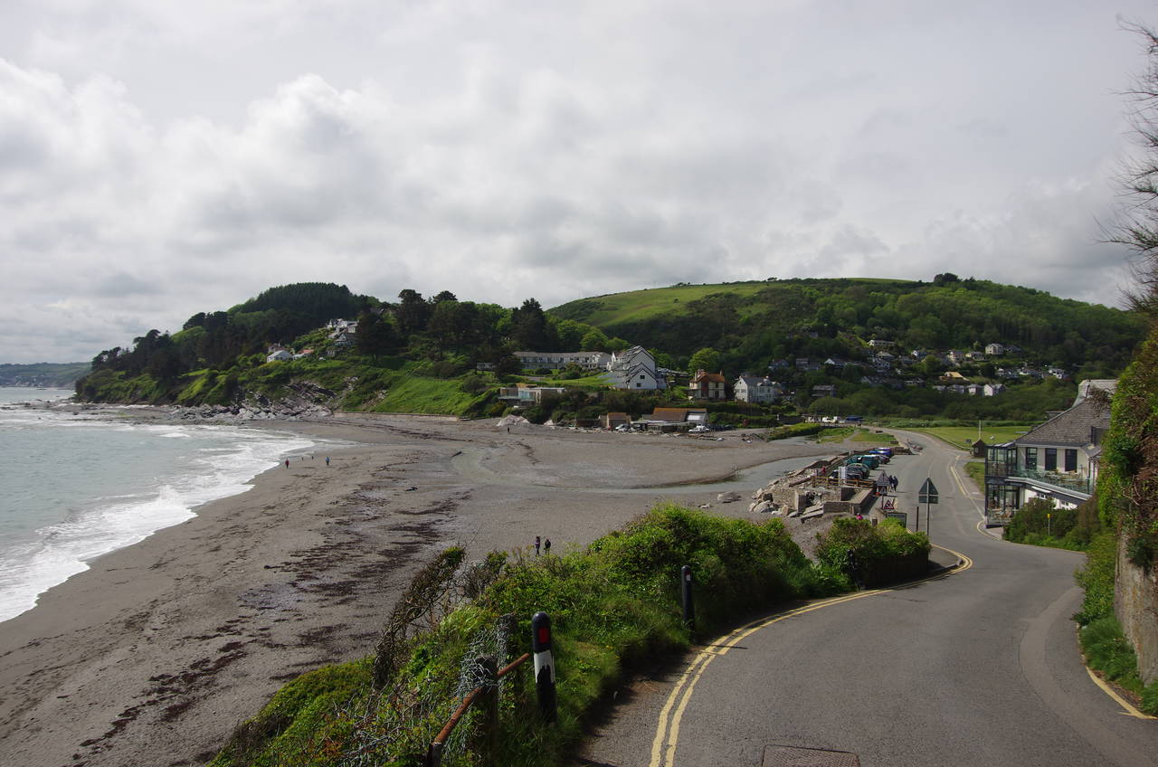
(2) Seaton
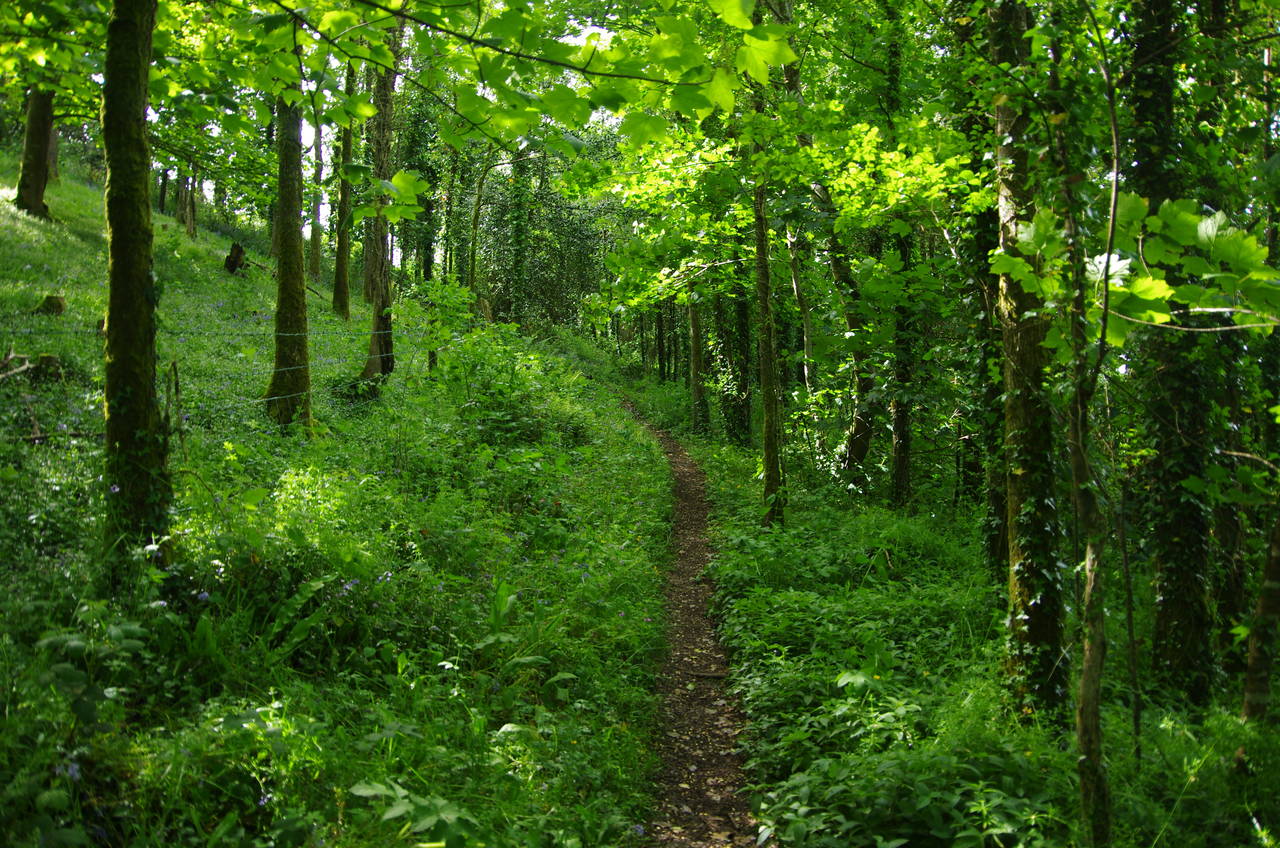
(3) Woods above Keveral Beach
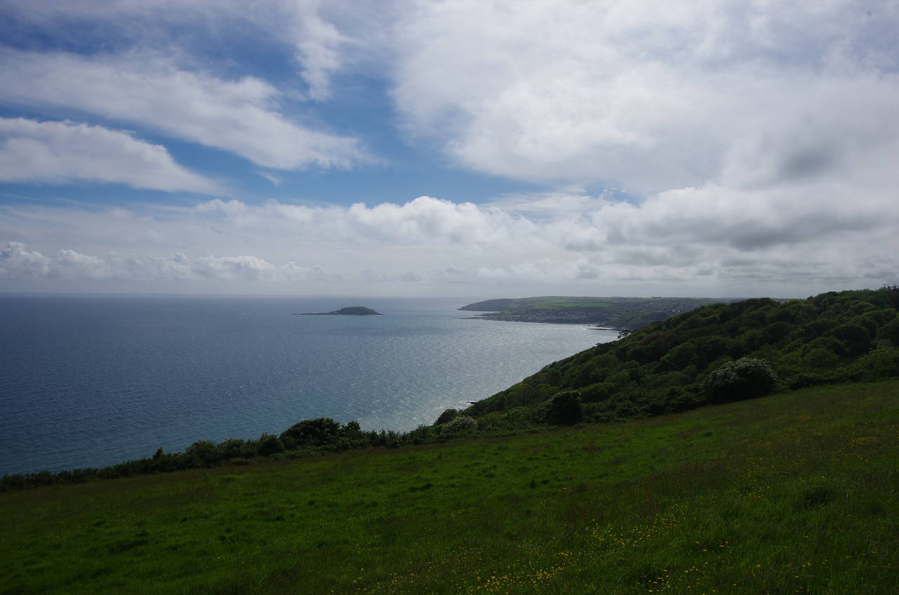
(4) Struddicks
This was one of those days where things didn't quite go to plan, but everything worked out in the end. After heavy rain kept me indoors for most of the morning, I had to wait an extra couple of hours in the town of Liskeard after missing the first bus to Downderry, which stopped on the opposite side of the road from the signed bus stop outside the railway station. Liskeard's compact town centre, about ten minutes walk from the station, proved to be an interesting place to while away the time, with several points of historical interest.
When I finally did make it onto the next bus, the journey out to Downderry was delayed by major roadworks which had the narrow road completely blocked for about half an hour. Stepping off the bus at the stop by Downderry Church just before three in the afternoon, I decided to lower my ambitions for the day's distance and have a leisurely stroll to Looe rather than trying to complete the 28 kilometres to Fowey in the six and a half hours left before nightfall, which would have allowed me very little time to explore my surroundings or take photos.
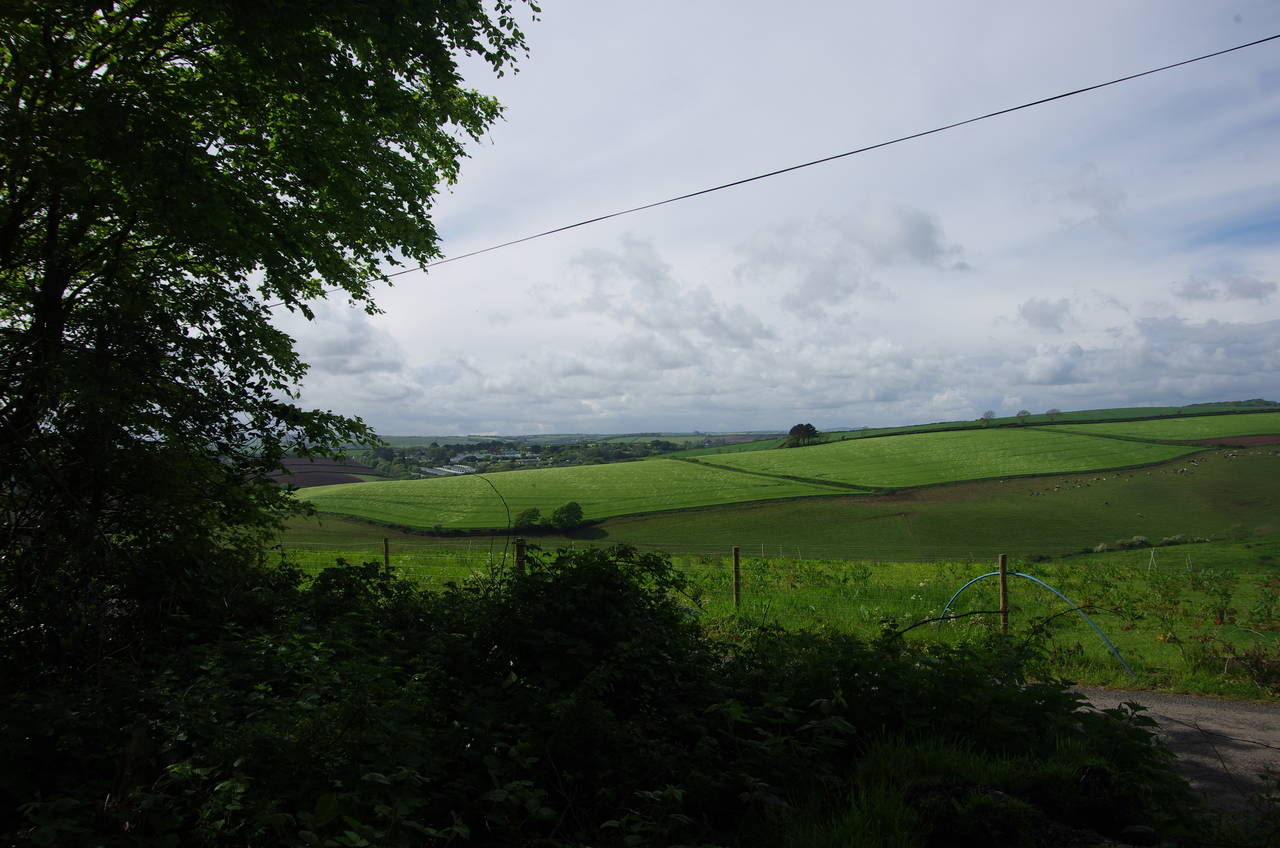
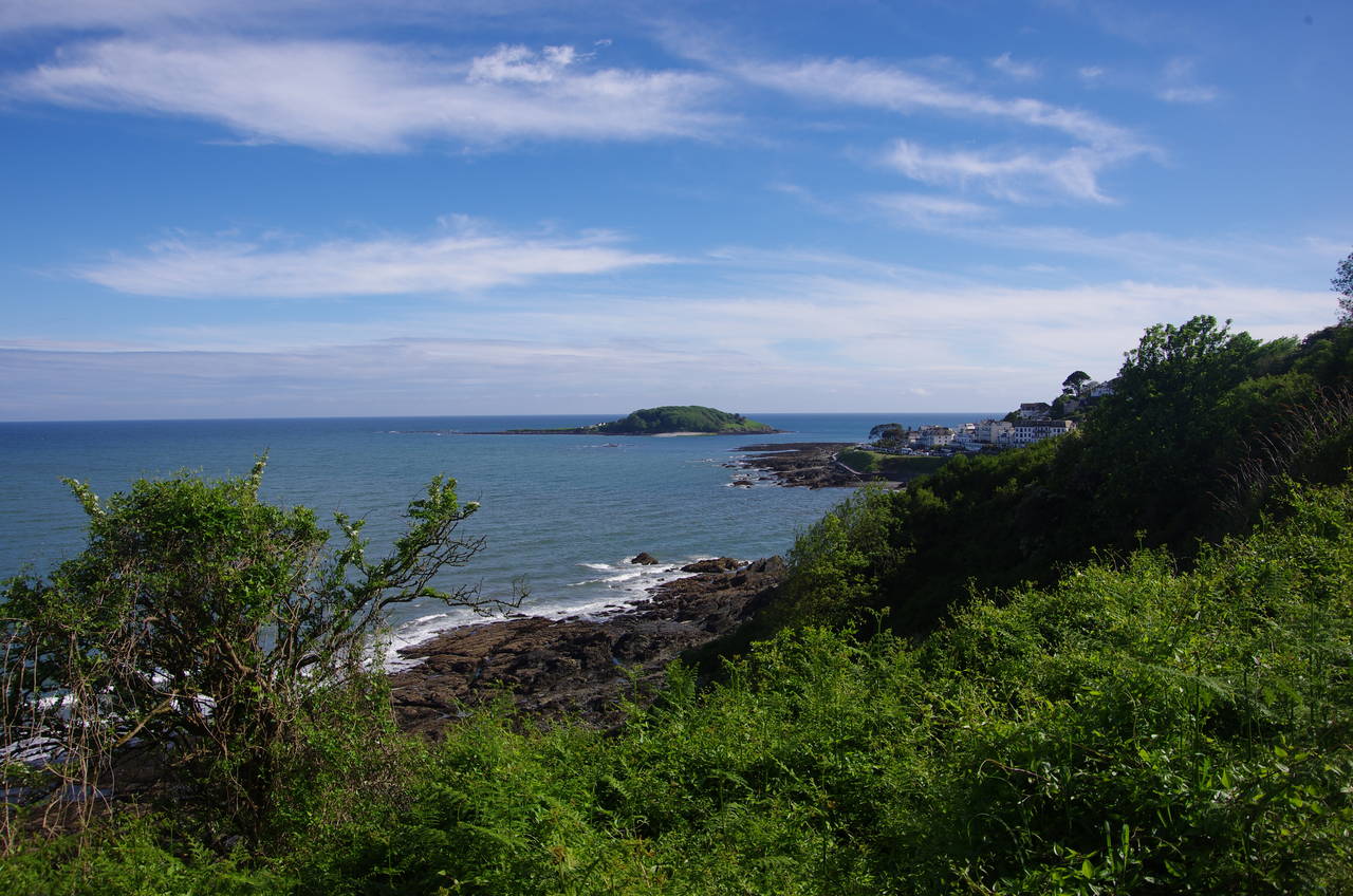
With no time pressure, I went for a wander down the hill to Downderry's pebble beach, where the afternoon's walk was laid out before me (picture 1). Looe Island, on the left of the picture would be a constant landmark throughout the walk.
Returning to the church on Main Road, I set off on the route of the Coast Path, which follows Main Road westwards through Downderry. After a couple of blocks I passed by a building marked as a polling place for the local council elections that were being held throughout England and Wales that day. The polling place seemed strangely devoid of voters however.
A little further on, Main Road becomes Brenton Road, which continues ahead through the remainder of the town; a rather long stretch of walking on the narrow but busy road with no pavement for most of the way. About one and a half kilometres from my starting point, the road descends to Seaton Beach (picture 2), heading around behind the beach to cross a bridge over the small River Seaton, which snakes across the beach to the sea.
Immediately after crossing the bridge, the Coast Path turns left off the main road to climb a narrow lane called Looe Hill, a turn that is quite easy to miss. The lane climbs above the beach for a little while before bearing away from the clifftops. A short distance beyond the last houses of Seaton, a flight of steps with wooden railings climbs to the left of the lane, taking the Coast Path through a small pine forest (picture 3) before emerging on open ground in the National Trust's Struddicks property.
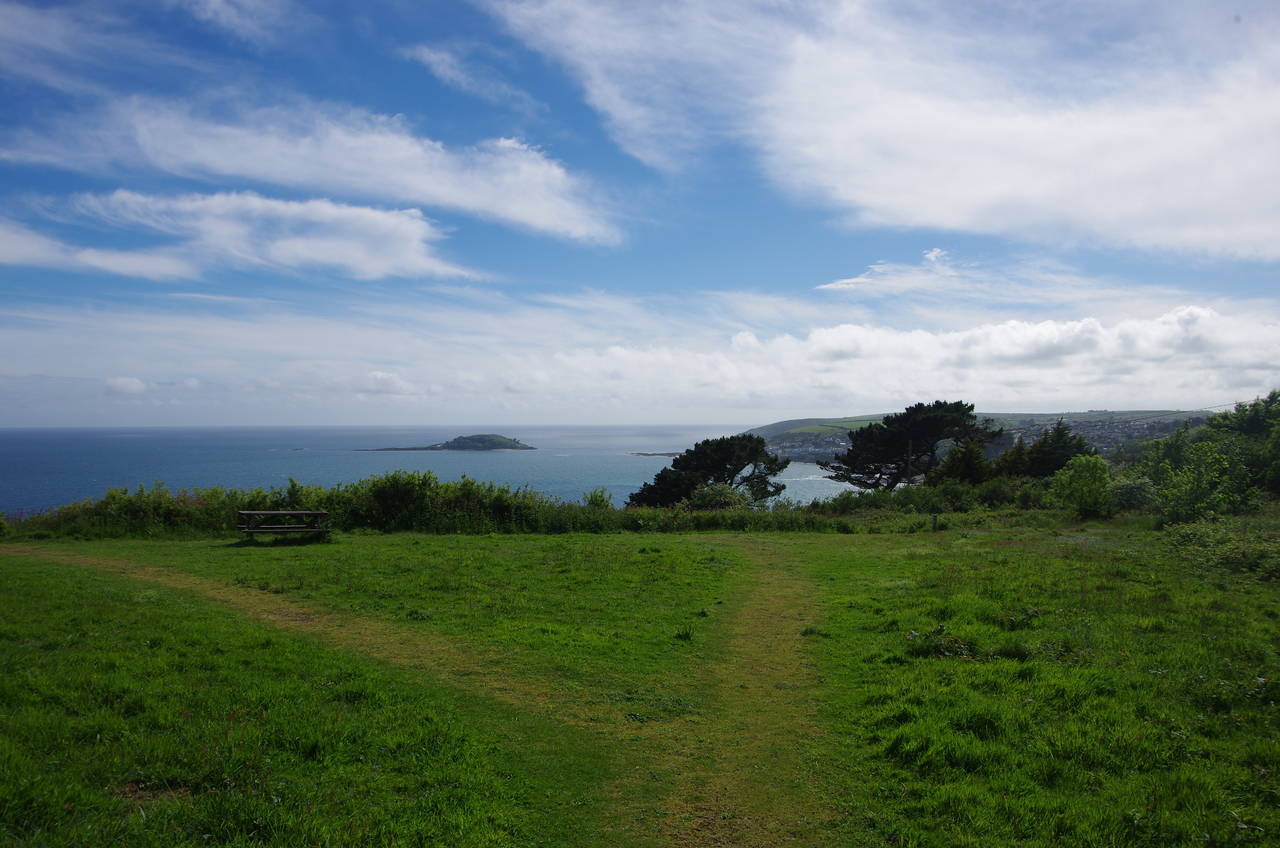
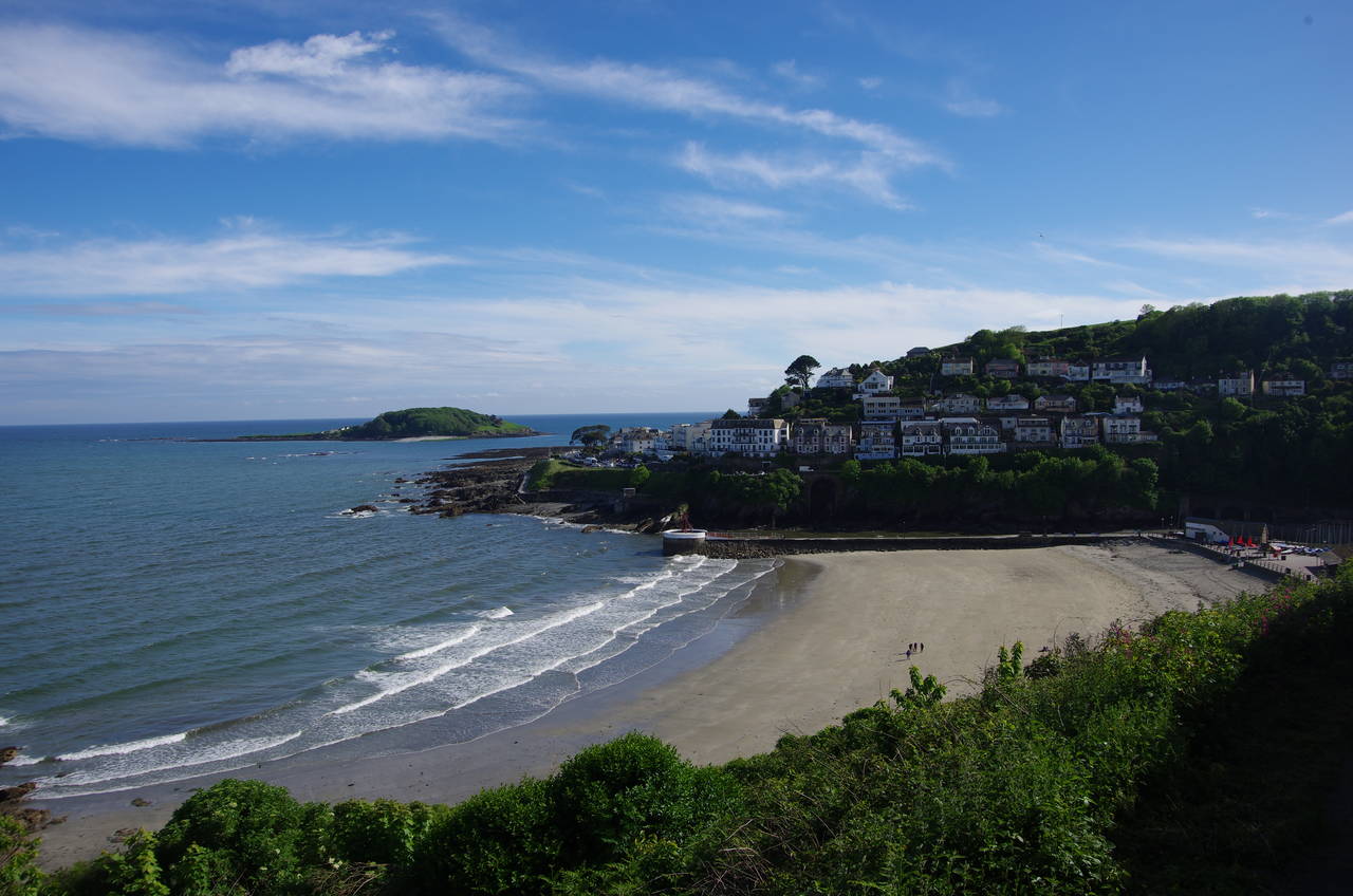
The path now snakes its way along the hillside, high above Keveral Beach. Part of this path was recently diverted to a freshly cut route higher up the hillside due to erosion of the cliffs, and further on is a more significant diversion, also caused by erosion. Before leaving Struddicks, the path gives one last spectacular view along the coast towards Looe Island (picture 4) before heading inland across fields to rejoin Looe Hill, which is now a quiet sunken lane.
(5) Path beside The Monkey Sanctuary
(6) Bodigga Cliff
(7) Millendreath
(8) Millendreath Beach
The lane soon passes a trig pillar on the bank to the right, marking the highest point of the hill and of Cornwall's south coast at 155 metres above sea level. The lane then begins a long gradual downhill run, soon passing by the entrance of The Monkey Sanctuary. The next stretch of the lane is bordered on the left by a strip of woods and before long the path leaves the lane to run parallel with it in the woods, with occasional gaps in the trees giving views inland across rolling farmland (picture 5).
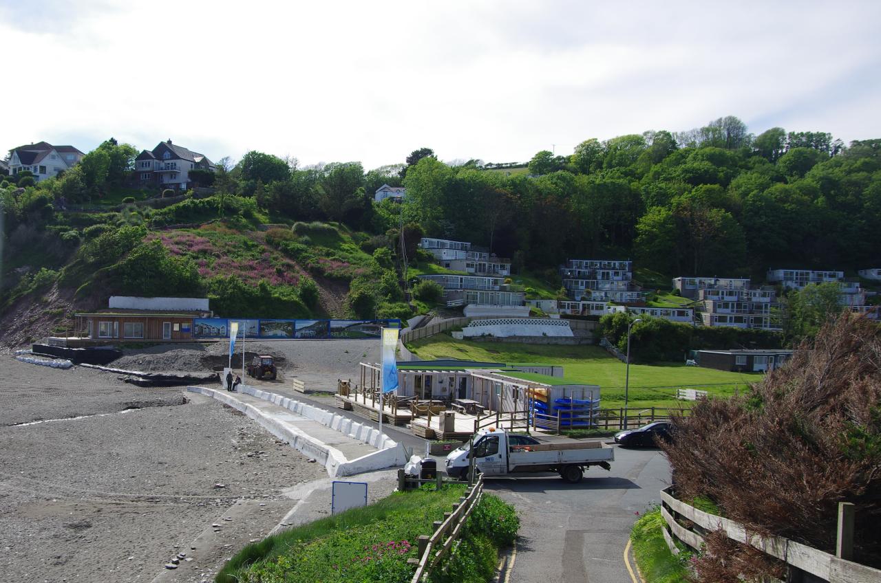
A pair of gates on either side of a driveway take the path into a small picnic area on the National Trust's Bodigga Cliff (picture 6). A brief return to the lane leads to the Bay View Farm Campsite, from which the Coast Path descends on a narrow trail through scrub and then woods to reach May Lane at Millendreath, a holiday village occupying a sheltered valley above a small cove (picture 7).
The quiet village seemed to have seen better days, but after descending the lane and crossing the valley behind the deserted little beach (picture 8), I passed a row of hoardings with signs indicating that some redevelopment was planned. The path climbs out of the western side of the valley via several flights of steps to reach a clifftop street among houses. The street is followed to its end before an enclosed path between fences cuts through to Plaidy Lane, which heads downhill to a small beach before climbing quite steeply.
(9) View towards Looe Island
(10) Looe Beach
(11) Top of East Cliff, East Looe
(12) Ye Olde Salutation Inne, East Looe
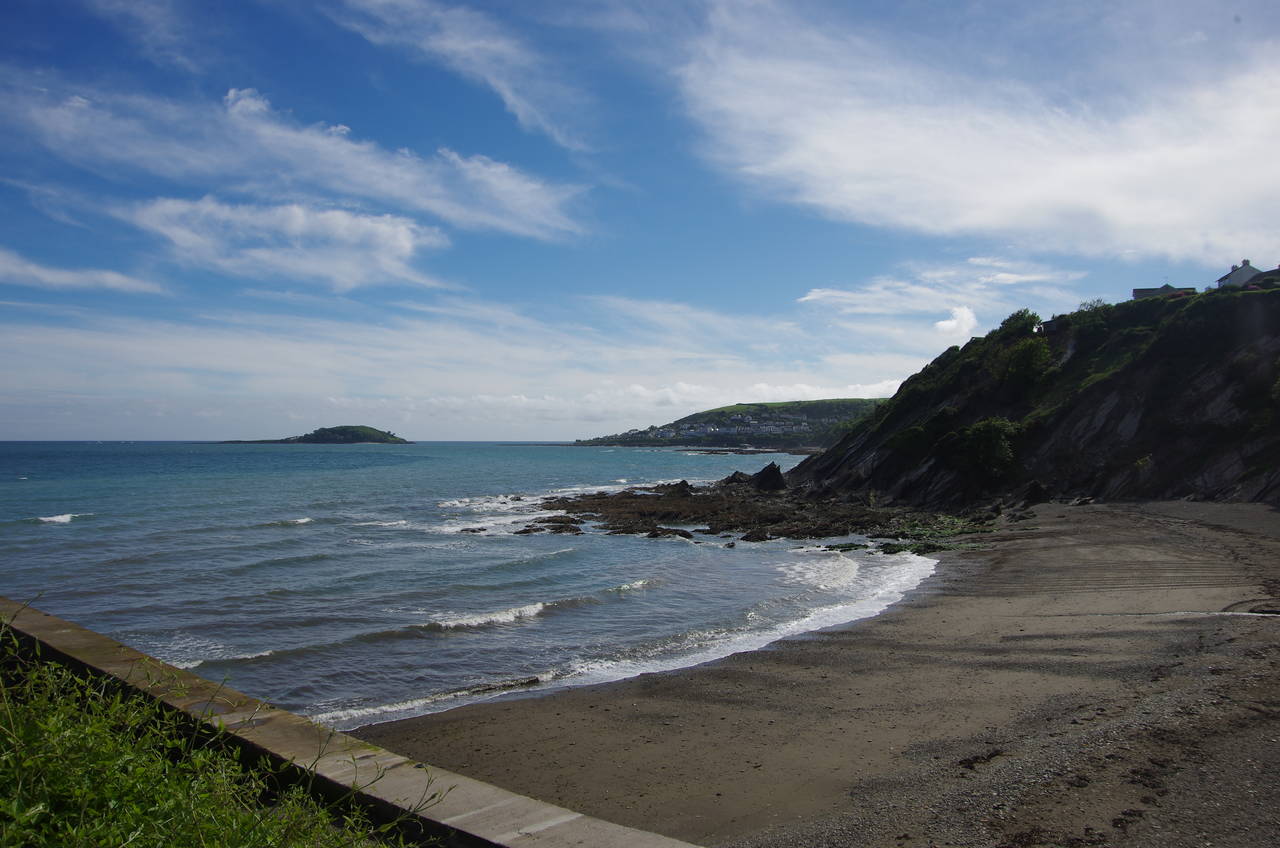
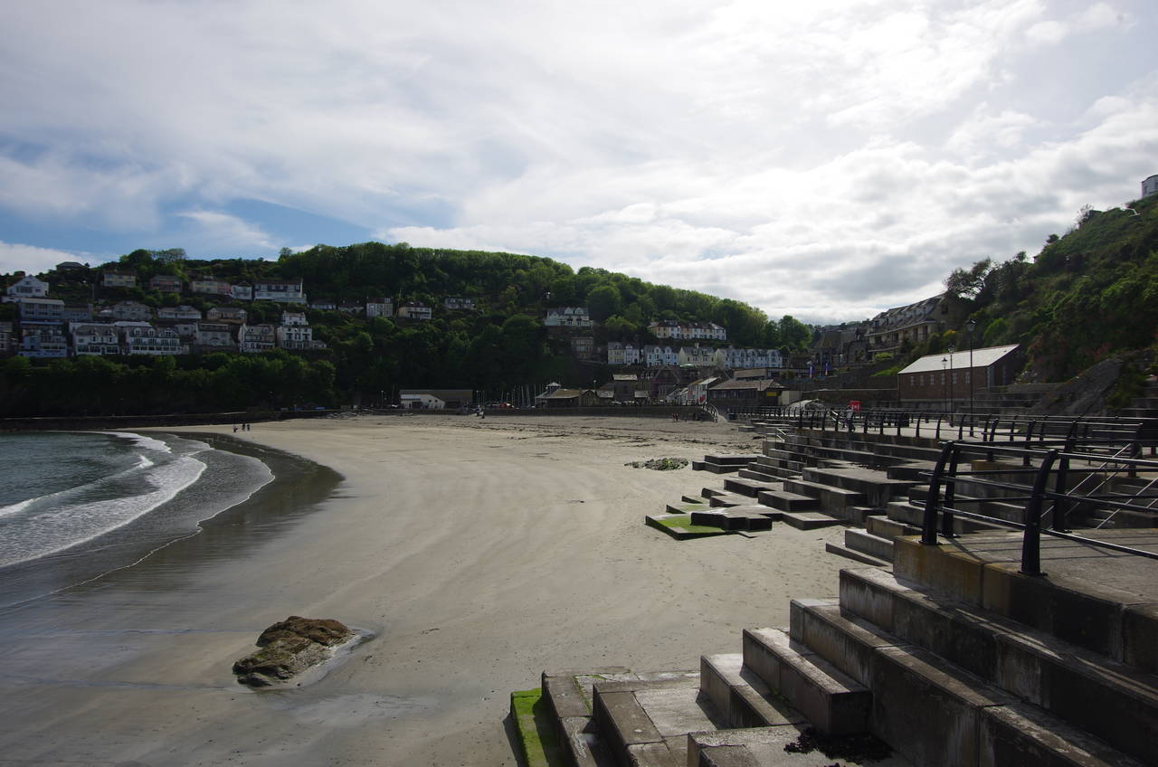
A left turn at the top of the climb takes the path past a large clifftop house and then onto a narrow path with views across to Looe Island, now much closer (picture 9). The path continues along the clifftops separating Millendreath from East Looe, soon coming around high above Looe Beach (picture 10), which is separated from the East Looe River by the stone-built Banjo Pier.
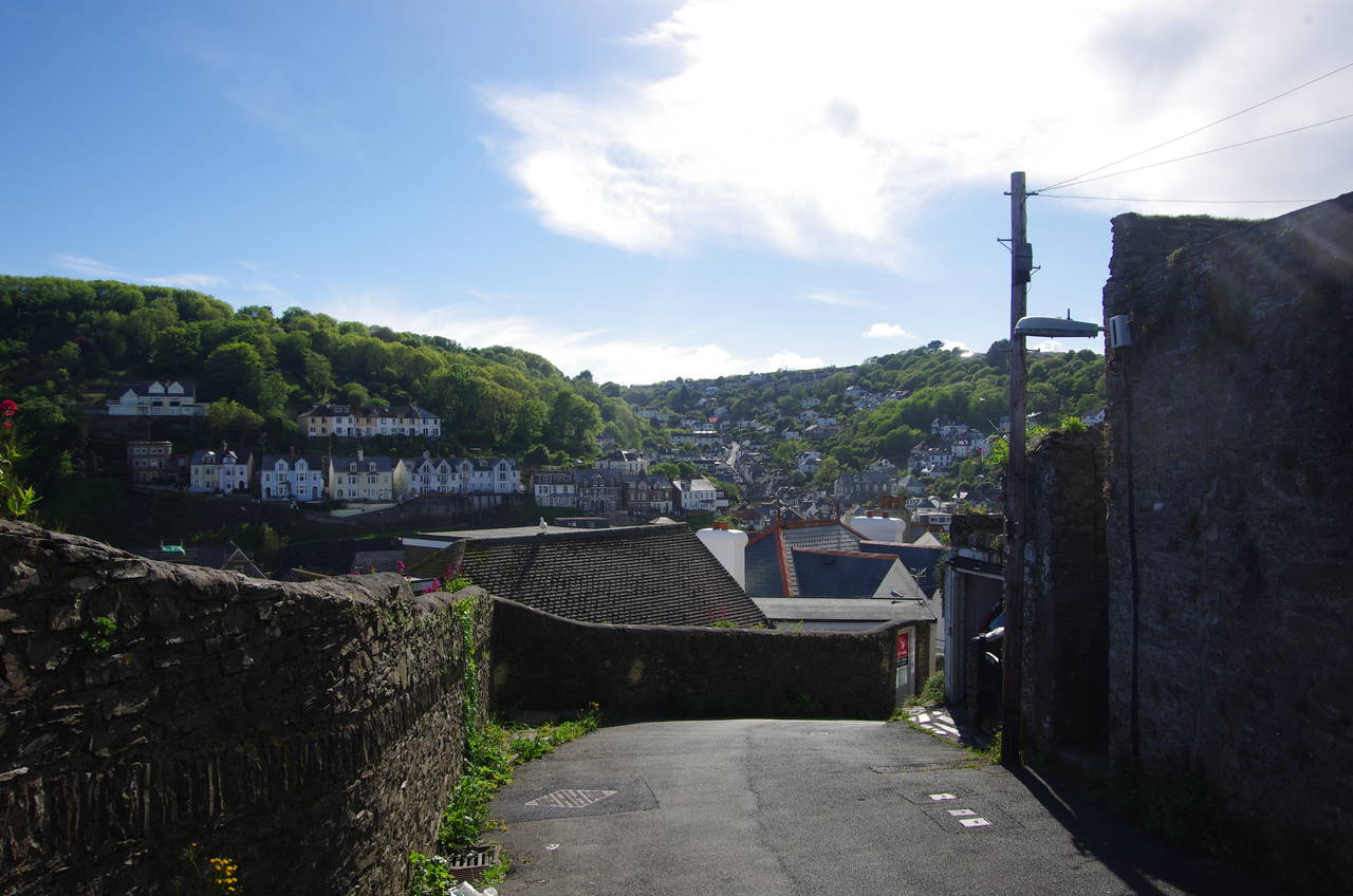
At a viewpoint behind the beach, the Coast Path joins a narrow lane called East Cliff, descending steeply into the town of East Looe. From the top of the lane one can see the many houses clinging to the steep sides of the Looe Valley in the twin towns of East and West Looe (picture 11).
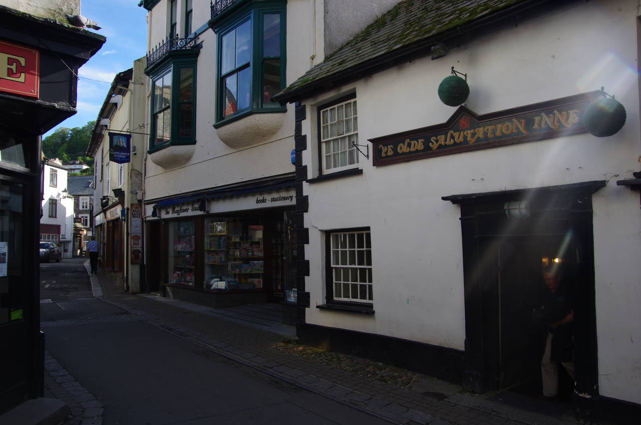
At the first intersection, the route turns sharp left into Tower Hill, a short lane leading to a right turn onto Higher Market Street, which in turn meets Fore Street in front of Ye Olde Salutation Inne (picture 12).
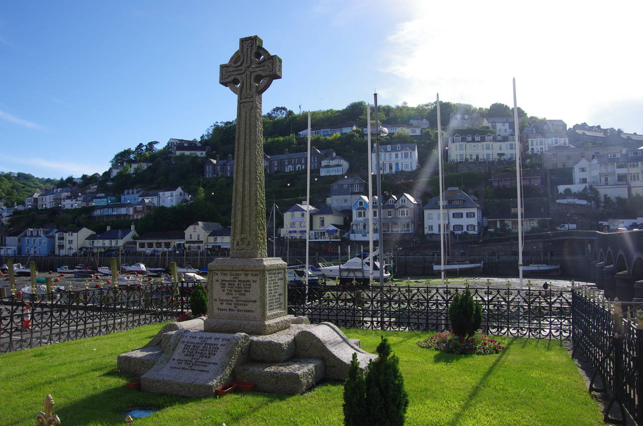
(13) War Memorial, East Looe
(14) East Looe River
(15) Looe Beach
(16) Looe Valley
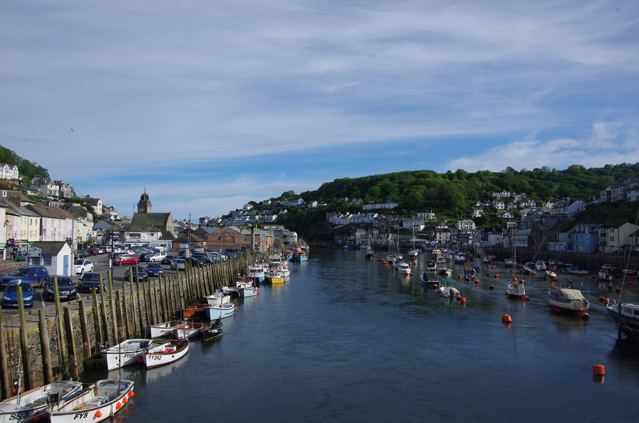
Fore Street is followed northwards through the town's main shopping area and past a large carpark to reach the town's War Memorial (picture 13), standing by the eastern end of Looe Bridge, which spans the river from East to West Looe. The bridge offers a good view downstream over the busy quays on both sides of the river (picture 14), home to a thriving fleet of small fishing boats. The bridge was a fitting place to leave the Coast Path for the day after an easy 8.4 kilometre walk from Downderry.
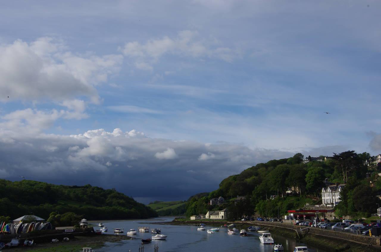
A couple of minutes walk upstream on the eastern side of the river is Looe Station, the terminus of the scenic Looe Valley branch line which runs beside the river up to Liskeard. With a couple of hours until the last train I had time to explore the town, picking up a generous serving of fish and chips in Fore Street before wandering along the quayside to the beach, where I found a pleasant spot to enjoy my dinner (picture 15). After taking a meandering walk back up through the town's narrow back streets, I climbed back up onto the bridge to admire the view inland along the Looe Valley (picture 16).
The pleasant train ride up the valley from Looe to Liskeard on the small two car diesel train is a bit of a throwback to a bygone era. The intermediate stops are all request stops at quiet village halts and before commencing the final ascent out of the valley up to Liskeard Station, the train has to reverse direction, with the driver swapping ends and the conductor jumping off the train to manually operate the signals and points.
Despite my earlier difficulties getting to the start of the walk, this had turned out to be a very nice afternoon out on the Cornish coast.