SOMERSET COAST PATH
Stage 8: Clevedon to Bristol
Sunday, August 7, 2016
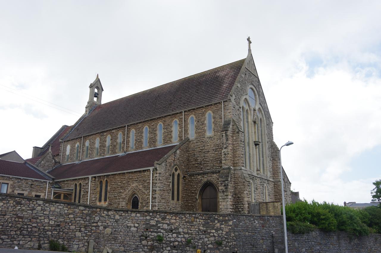
(1) Church of the Immaculate Conception, Clevedon
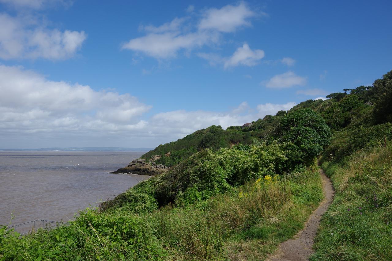
(2) Walton Cliff
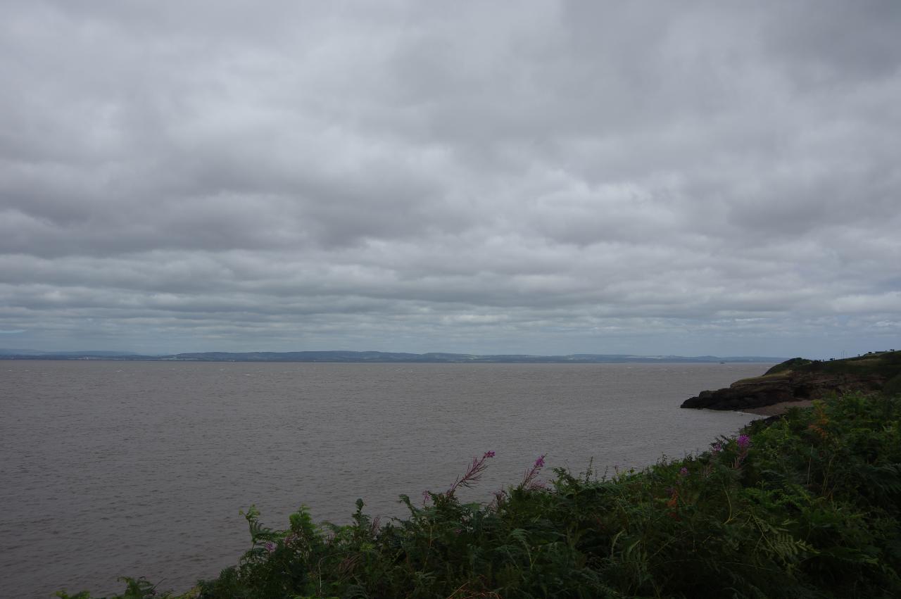
(3) Charlcombe Bay
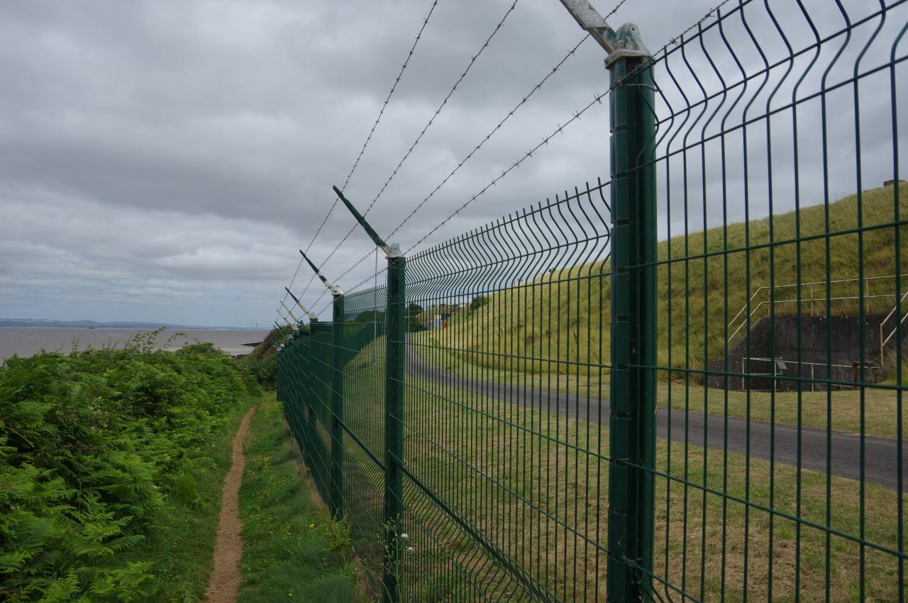
(4) Depot at Redcliffe Bay
I rejoined the Coast Path at Clevedon early on an overcast Sunday morning to begin the long day's walk to Bristol. From the pier, the route follows Marine Parade northwards past a row of houses that back onto the low, rocky cliffs. Opposite the Church of the Immaculate Conception (picture 1), the Coast Path turns left on a tarmac path, joining the route of the Gordano Round, a 43km circular route that includes the next ten kilometres of the coast.
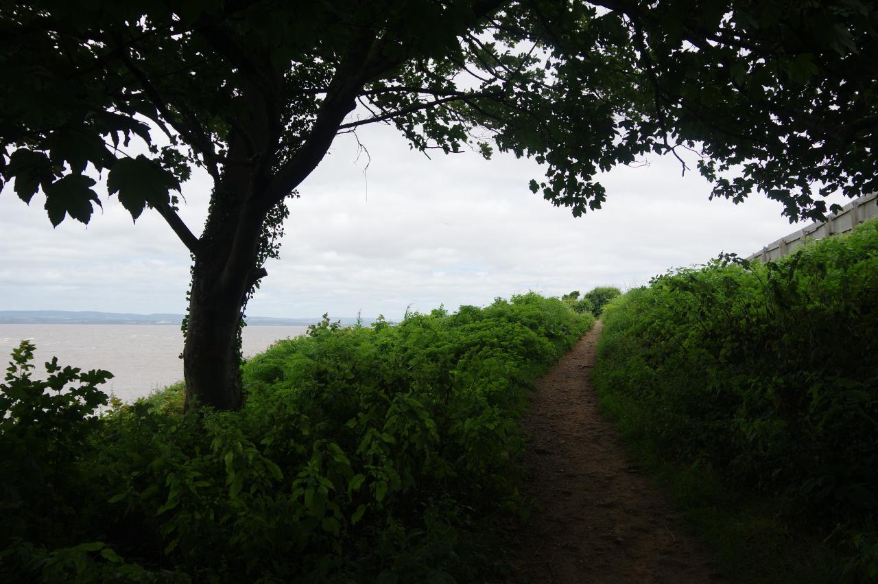
The path heads downhill below a high stone retaining wall, soon emerging onto the green hillside of Walton Cliff (picture 2). Despite there being only a narrow strip of greenery below the houses of Clevedon, this part of the path feels quite peaceful as it circles above the small beach at Ladye Bay and rounds Ladye Point. There are good views across the Bristol Channel to the Welsh coast, now about ten kilometres away.
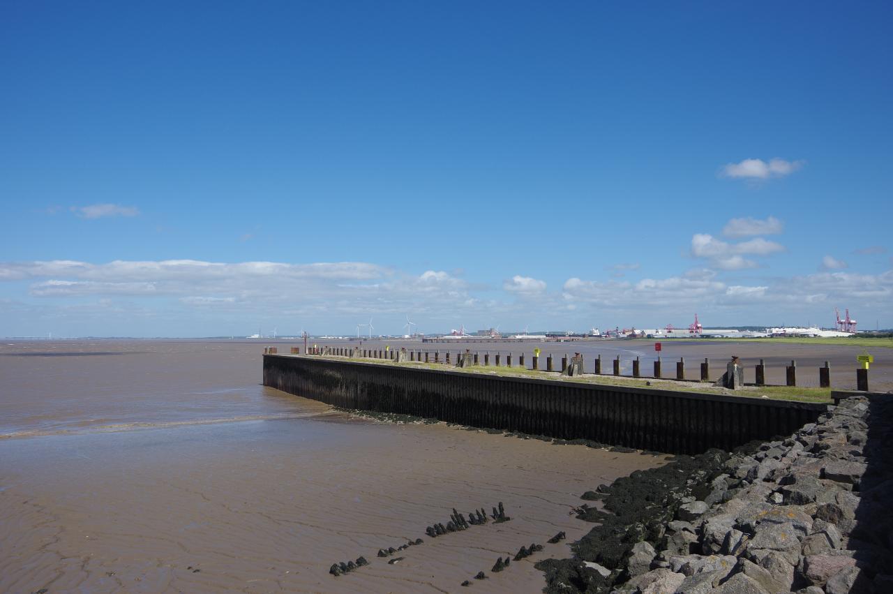
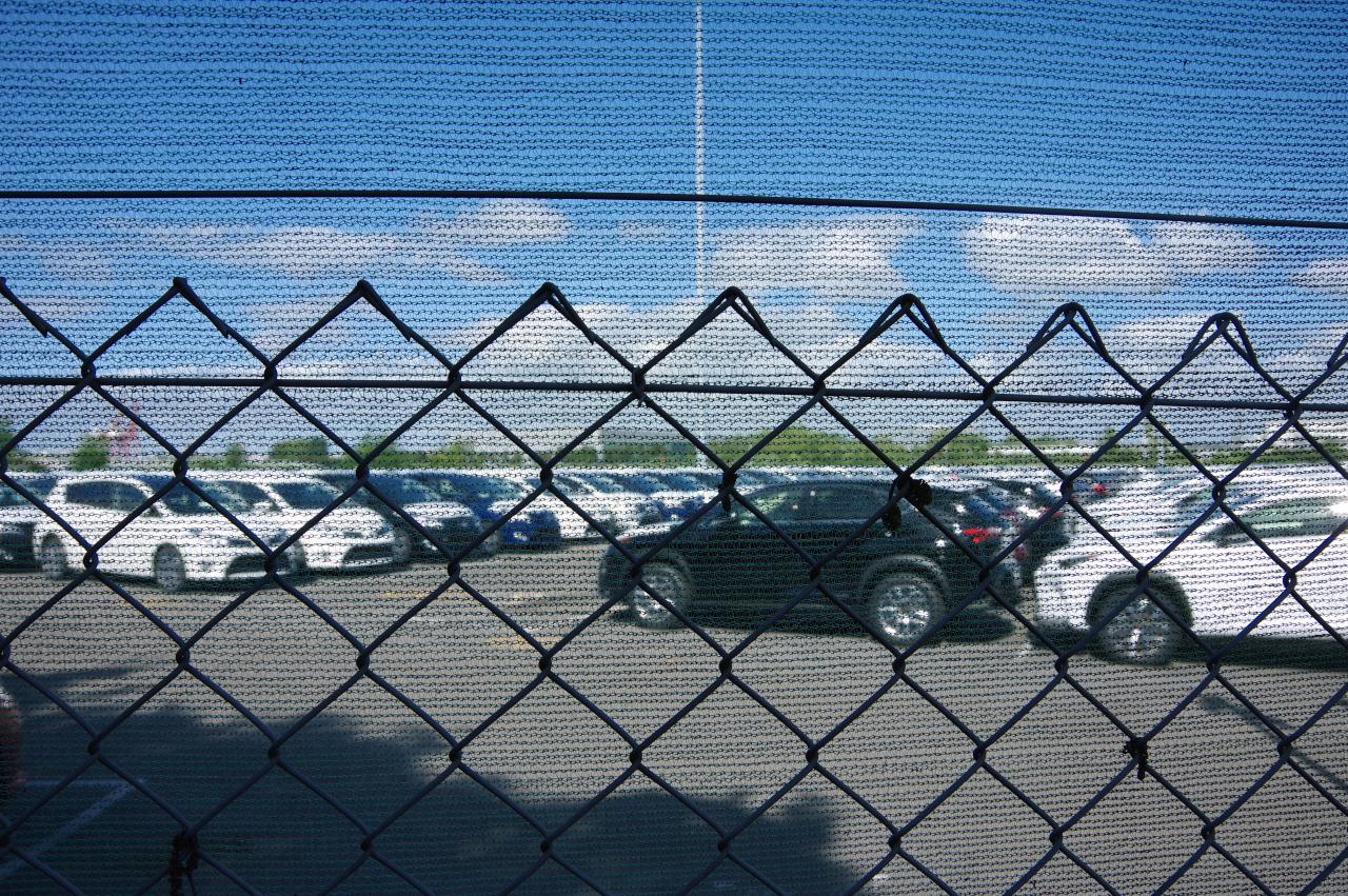
The path continues to wind its way along the hillside of Culver Cliff, passing two more tiny beaches at Walton Bay and Charlcombe Bay (picture 3). Just beyond the second bay, the path comes up beside a high wire fence surrounding a group of more than a dozen flat-topped mounds (picture 4), mysteriously labelled "depot" on the Ordnance Survey map.
(5) NT Redcliff Bay
(6) Black Nore Lighthouse
(7) Woodhill Bay
(8) Marine Lake, Portishead
Beyond the depot, the path runs below about a dozen houses at the large settlement of Redcliffe Bay to reach Hillside Road. Less than a hundred metres along the road, the path leaves the tarmac to enter the next narrow strip of green hillside (picture 5), where a National Trust sign drops the 'e' to read "Redcliff Bay".
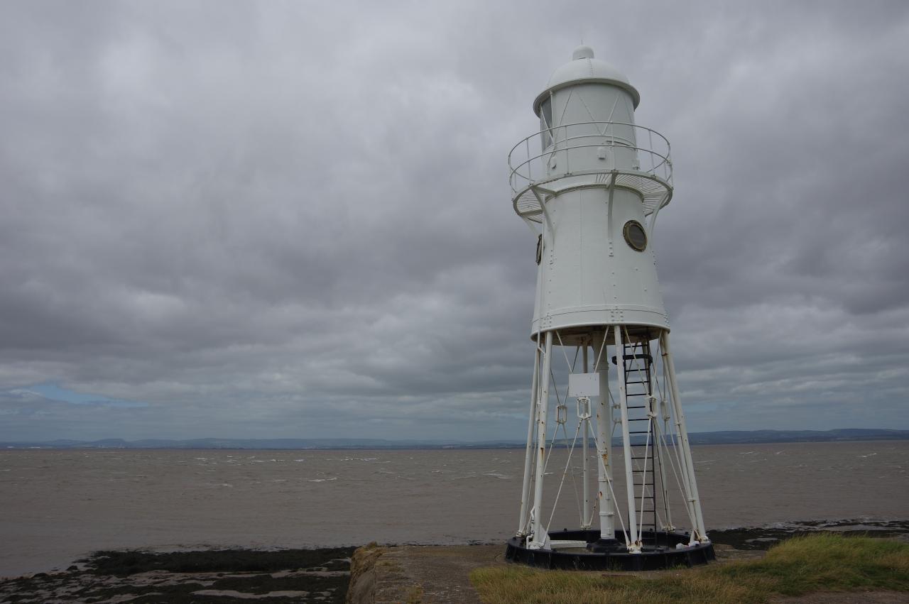
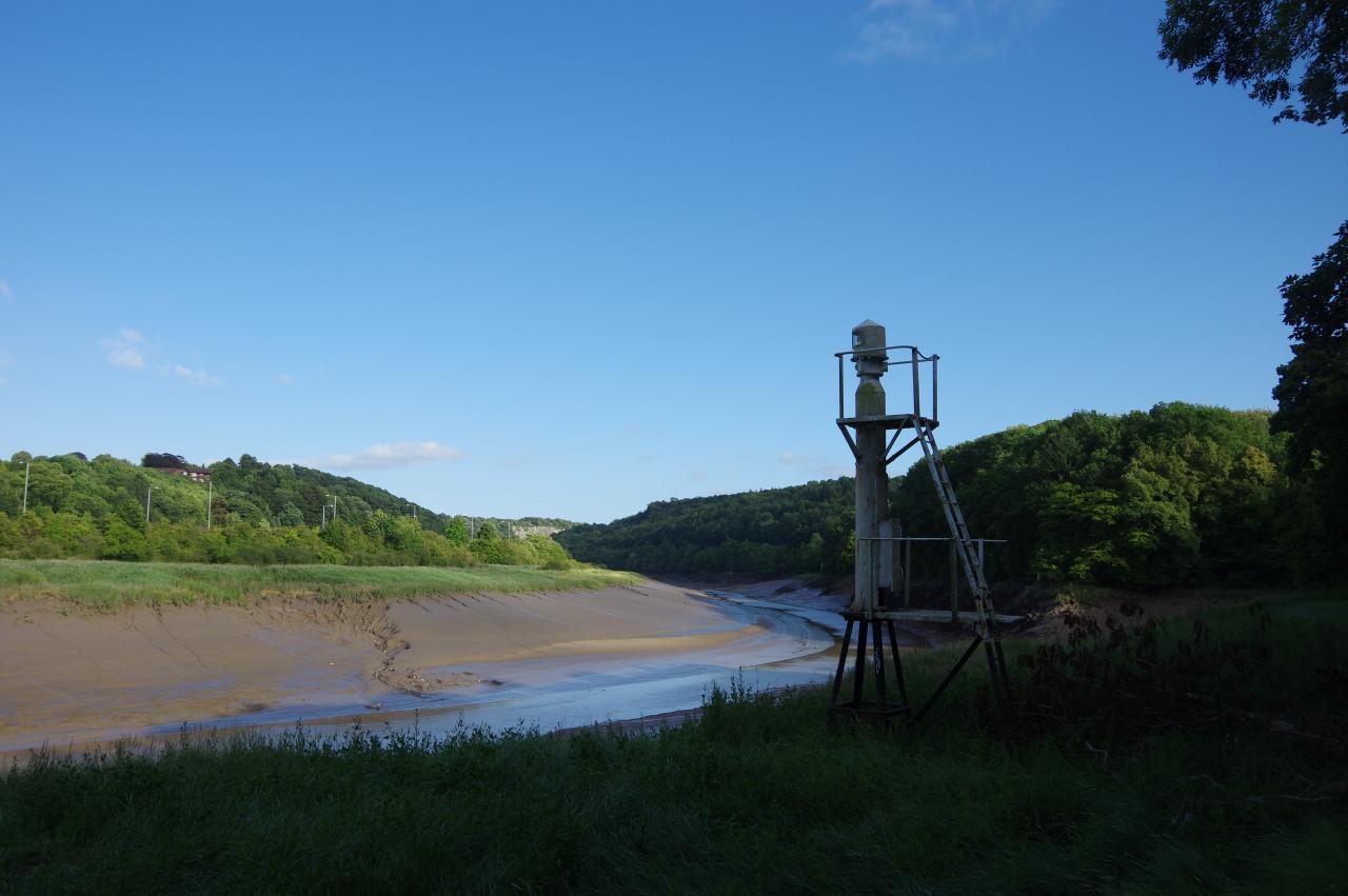
The path along the hillside runs through a mixture of woods and windswept scrub for about a kilometre to reach a rocky little point occupied by the 11-metre high cast-iron Black Nore Lighthouse (picture 6). The lighthouse was built in 1894 to guide ships along the coast to Bristol, but was deemed to be redundant in 2010 and the light was decommissioned. A local trust is now responsible for preserving the lighthouse, which is a listed building.
Now in the large town of Portishead, the Coast Path continues to wind it's way along the low cliffs, soon passing the stony little Sugarloaf Beach. All along this stretch of the path there are good views over the Severn Estuary to the two distant Severn Bridges, which I would reach in a couple of days time.
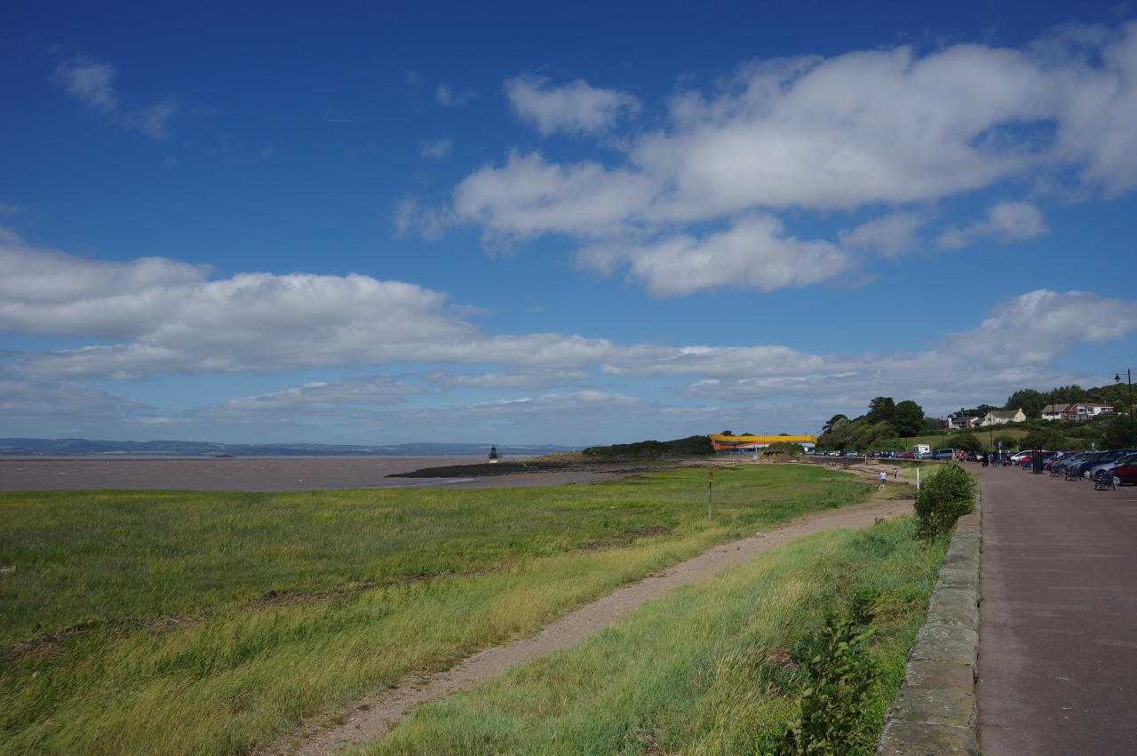
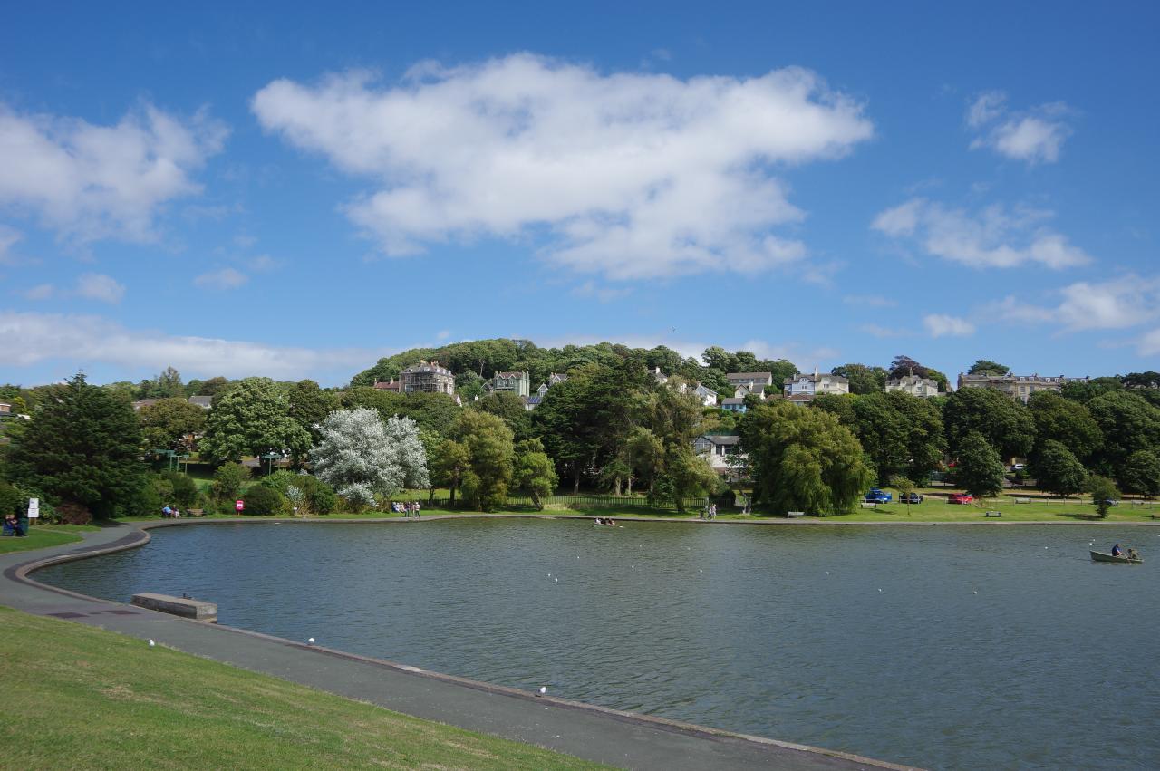
After passing by a coastal golf course and crossing a large field, the clifftop path is blocked by houses, forcing the Coast Path to make a short detour inland to join Beach Road West, where the route parts company with the Gordano Round. The road soon returns to the coast beside the marshy expanse of Woodhill Bay (picture 7), which is backed by Portishead's large Marine Lake (picture 8).
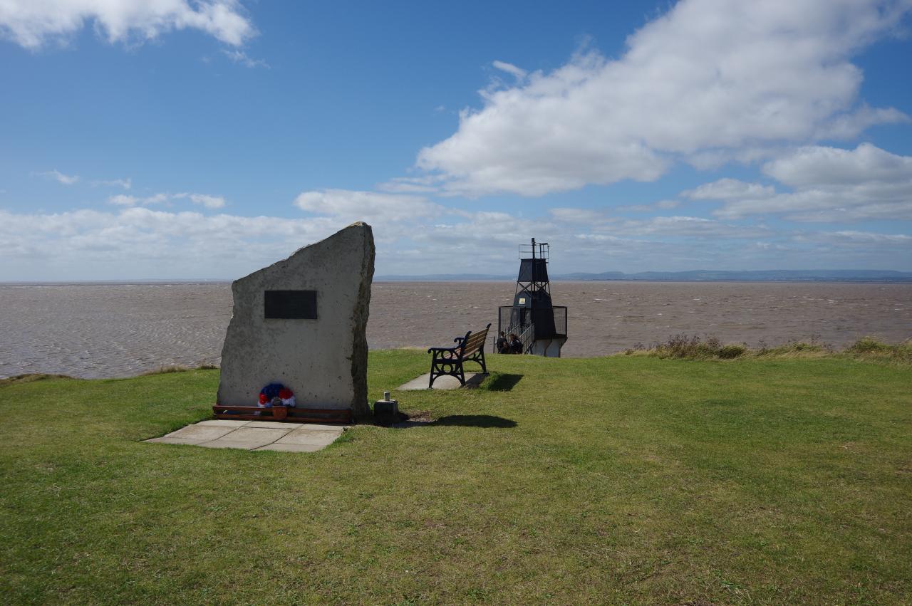
(9) Seafarers' Memorial Stone, Battery Point
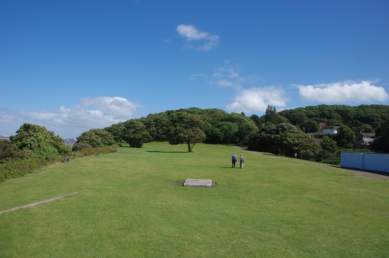
(10) Battery Point and East Wood
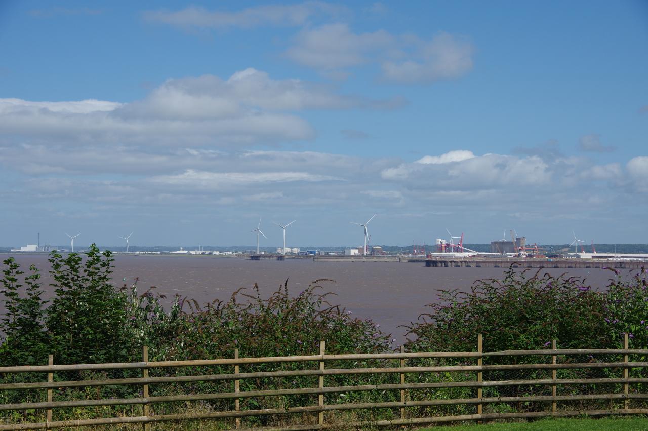
(11) View towards Portbury Docks
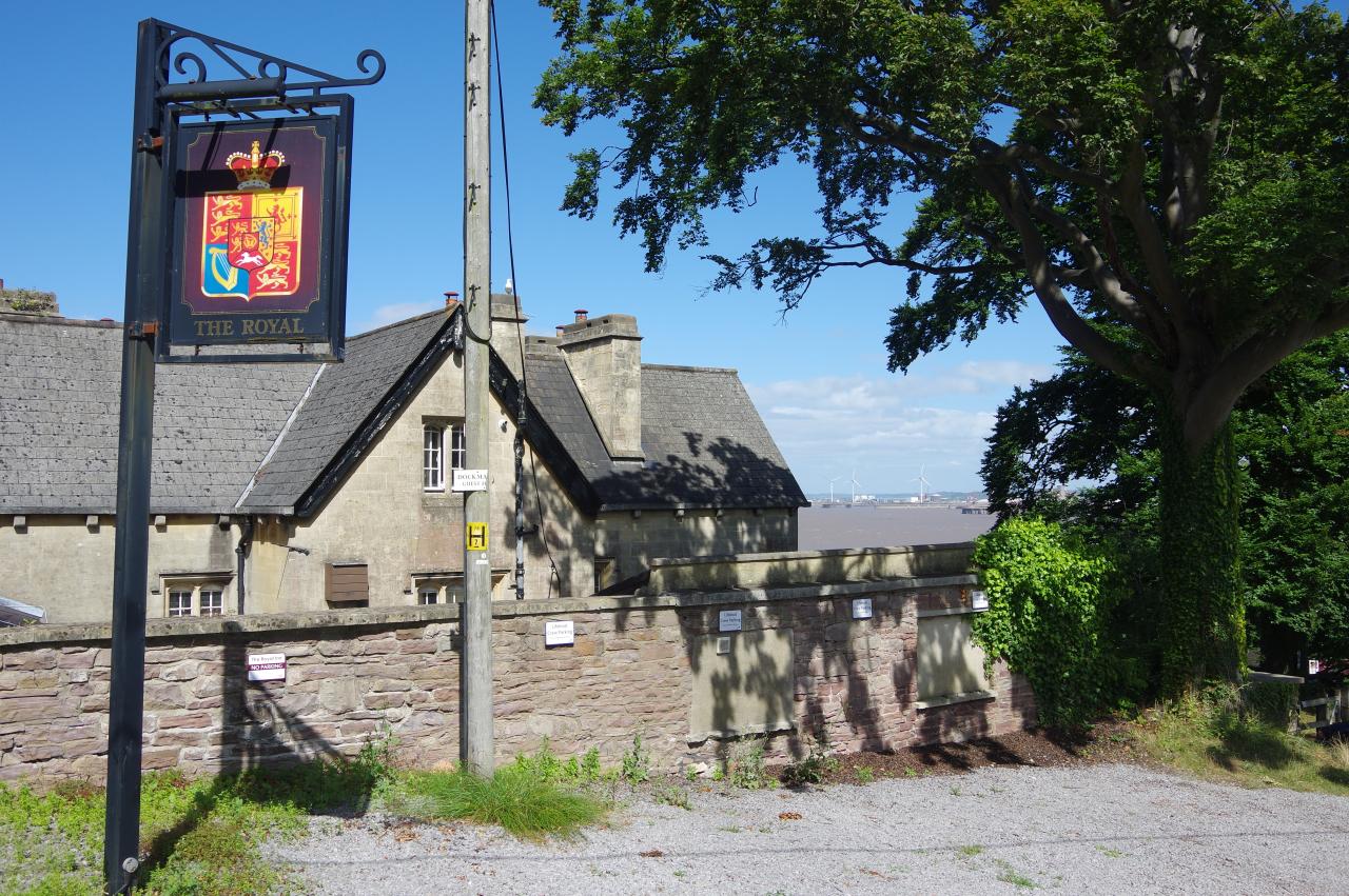
(12) Royal Hotel, Portishead
At the end of the Esplanade, a path curves around to the left of Portishead's Lido and climbs onto the grassy slope of Battery Point, where the Seafarers' Memorial Stone stands in front of the small Battery Point Light (picture 10), the latter dating from 1931. With the clouds having cleared away, this was a good spot to stop and enjoy the views across to South Wales while I ate my lunch.
The Coast Path turns away from the lighthouse, climbing higher on Battery Point (picture 10) and heading through the shady East Wood (picture 10). After passing a viewpoint with good views over Portbury Docks (picture 11), the path joins Woodlands Road, which is followed around two sides of the Royal Hotel pub (picture 12).
(13) Portishead Pier
(14) Portishead Marina
(15) Portbury Wharf
(16) Sheepway
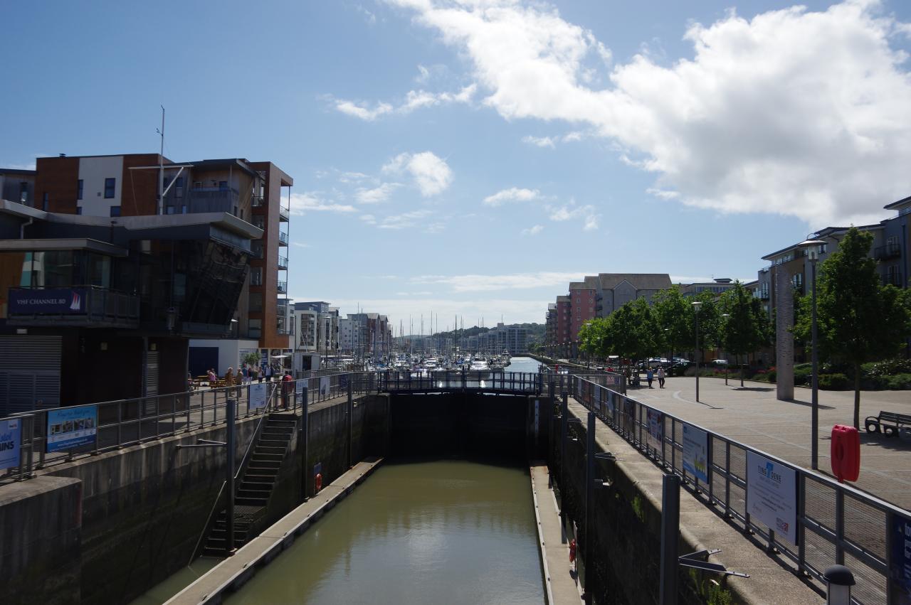
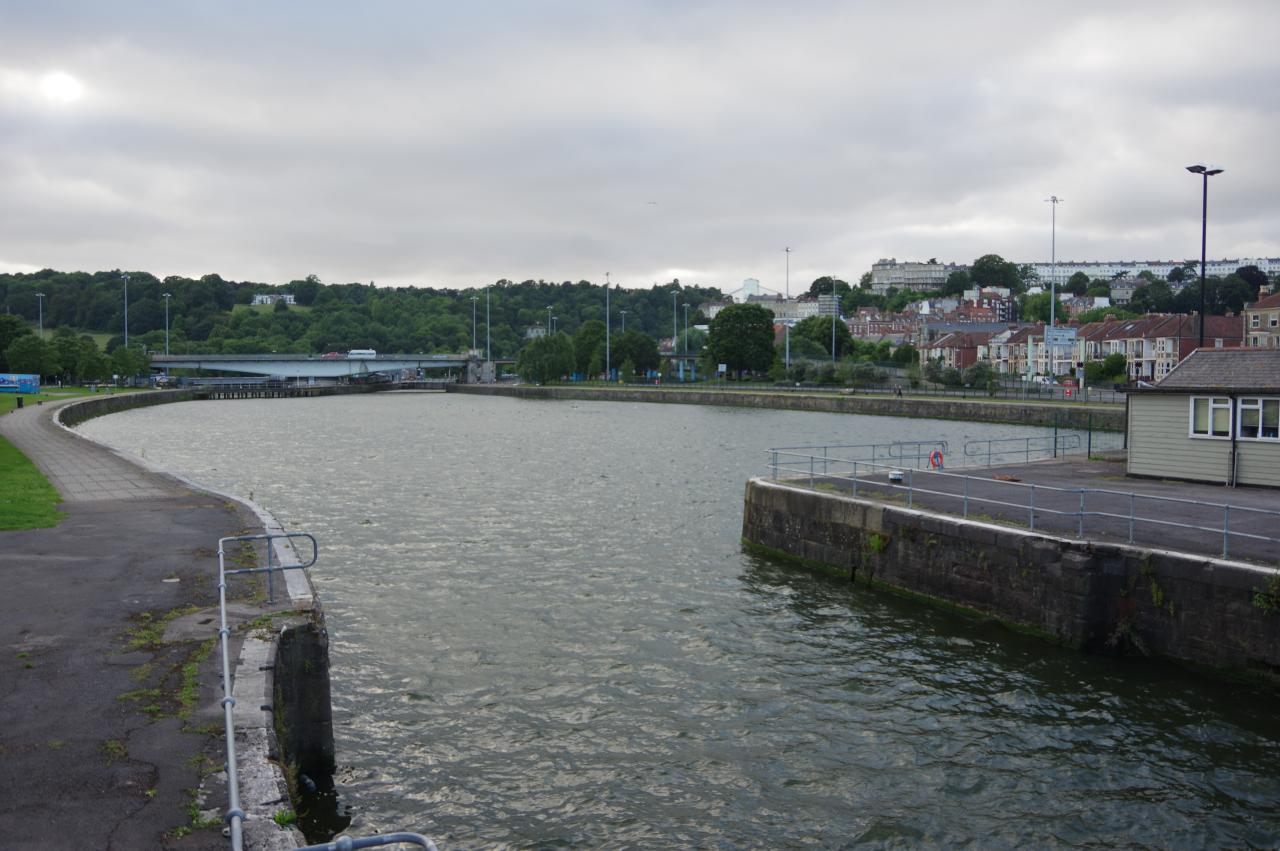
By the entrance to the pub's carpark, the Coast Path descends a long flight of steps to a paved area in front of the Portishead RNLI Lifeboat Station and the disused Portishead Pier (picture 13). A sharp right turn by the pier takes the Coast Path along the quayside to the lock at the entrance of Portishead Marina (picture 14).
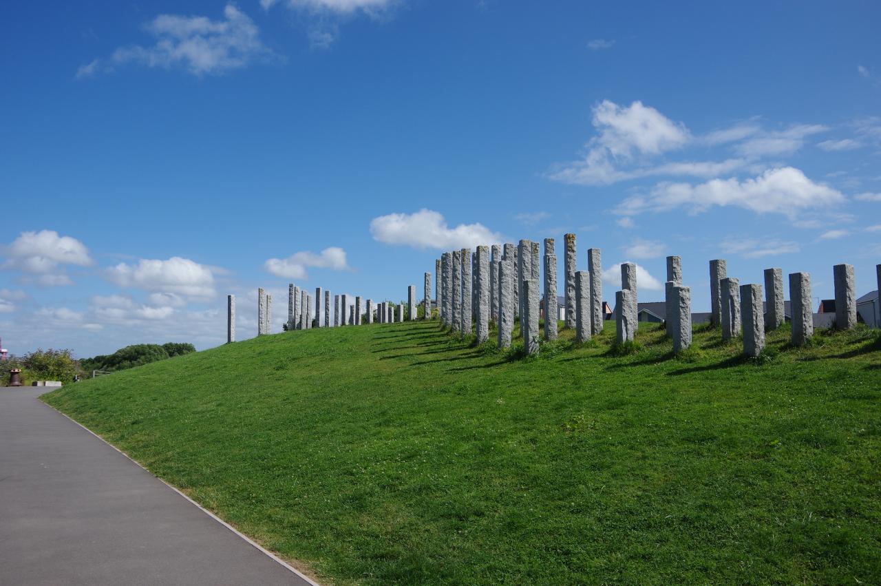
The route crosses the lock gates to an area that was once part of Portbury Wharf, but is now occupied by blocks of trendy waterside apartments. The quayside is followed past the apartments to join a tarmac cycle path, beside which a grassy bank is covered by around a hundred upright stone pillars (picture 15), the purpose of which eluded me.
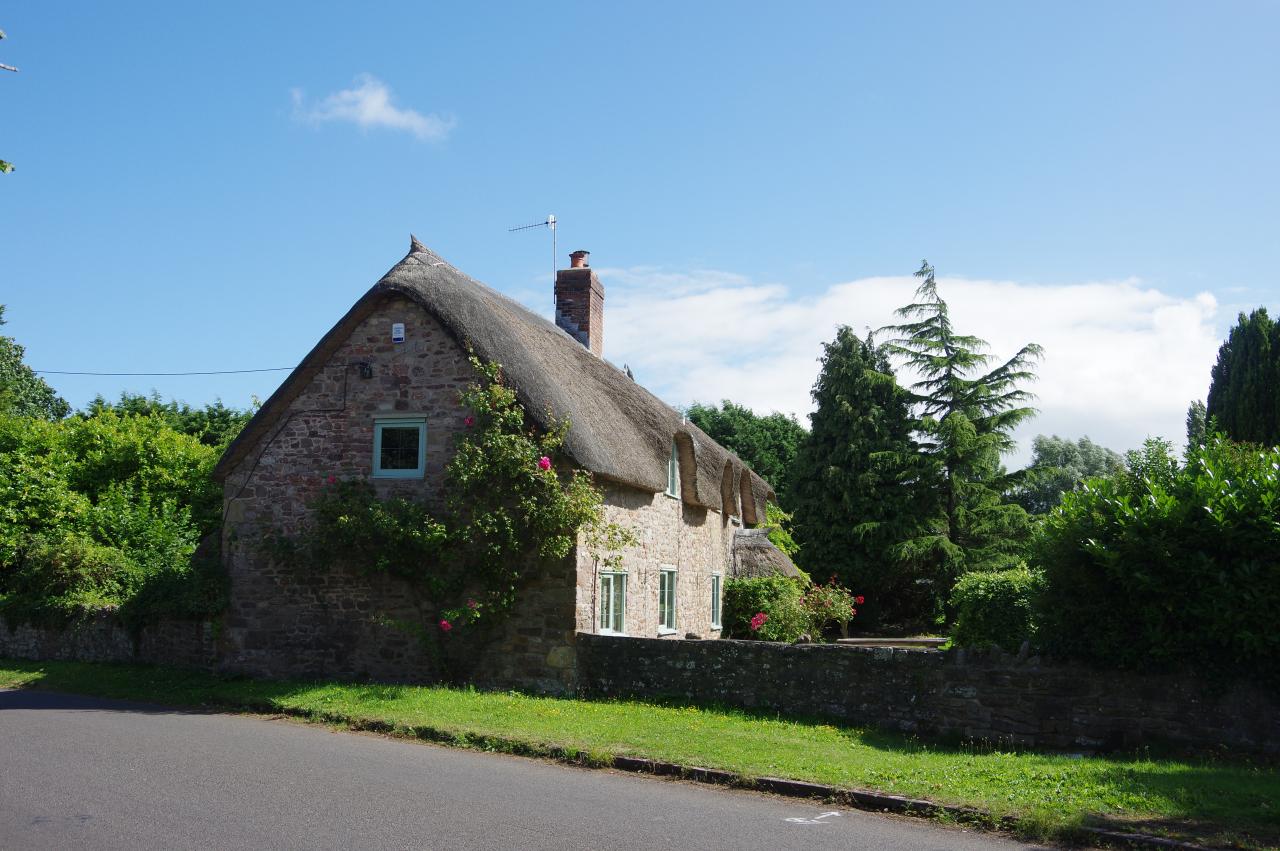
The bicycle path is followed past more housing and then an electrical substation before it bends right to enter the Portbury Wharf Nature Reserve. The main path through the reserve soon joins the quiet Wharf Lane, at the end of which the Coast Path turns left on another quiet lane called Sheepway. After about 500 metres, the lane passes an attractive thatched stone house on the right (picture 16).
(17) Portbury Docks
(18) Under the M5

(19) Pill Foreshore
(20) Pill Harbour
Another hundred metres further along the lane the Coast Path turns left onto a bicycle path that heads through trees to the perimeter of the Toyota Import Centre (picture 17), a vast expanse of tarmac next to the Royal Portbury Docks where newly imported cars are held before being distributed around the UK.
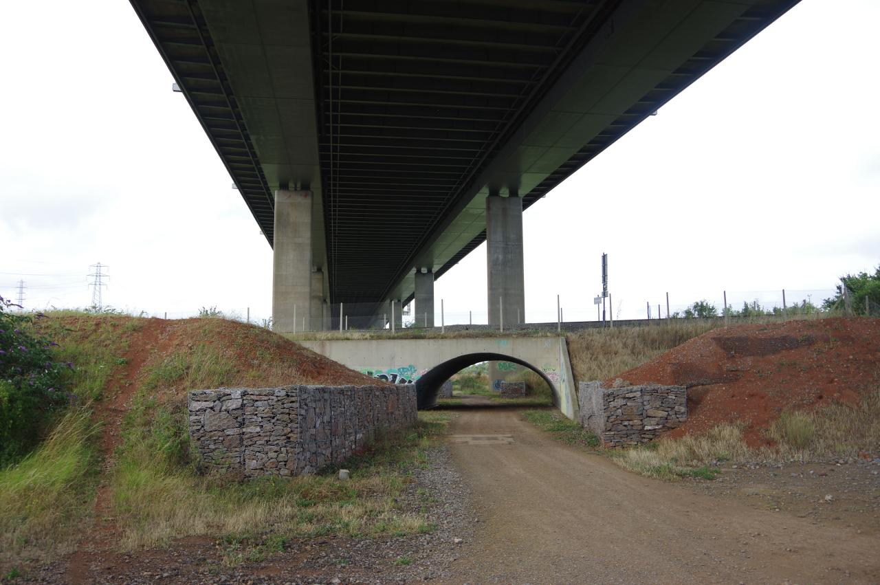
The bicycle path skirts the western and southern sides of this massive parking lot, eventually crossing a minor road to continue ahead between a drainage channel called the Drove Rhyne and another large parking area full of brand new SUV's. After crossing two more minor roads and passing yet another enormous parking lot, the path eventually finds itself in the shadow of the M5 bridge, which carries the motorway across the River Avon. Under the motorway, the Coast Path passes under the railway line that links the Royal Portbury Docks to Bristol (picture 18) and about 100 metres later the path turns right to start crossing the grassy expanse of the Pill Foreshore (picture 19).
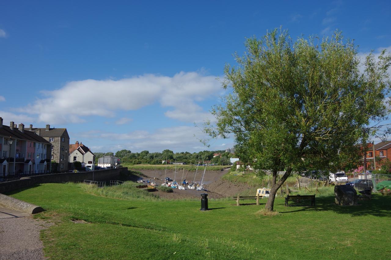
I found it a little difficult to follow the correct route across this large area of riverside marshland, as the slightly raised bank was virtually hidden under the long grass. Fortunately the path was marked on my GPS and after about fifteen minutes I reached Marine Parade on the banks of the River Avon in the large village of Pill, following the pavement beside Marine Parade to Pill's tiny harbour, which was devoid of water due to the falling tide (picture 20).

(21) Watchhouse Hill
(22) Ham Green Lake
(23) River Avon
(24) Viaduct in Leigh Woods
Beside the harbour is an information board marking the start of the 39km River Avon Trail, which follows the navigable part of the Avon from Pill to Bath. The Coast Path shares this route as far as the centre of Bristol, and the remainder of the River Avon Trail is shared with the first stage of the Kennet and Avon Canal Path, which I walked a fortnight later.
At the back of the harbour, the Coast Path crosses a grassy area in front of a railway viaduct to find a sealed path that snakes it's way uphill into the Watchhouse Hill Open Space (picture 21). On top of the hill, the path passes a playing field then skirts around a grassy, conical mound before continuing along an avenue of trees to meet a road by the entrance of the Eden Office Park.
The route continues ahead briefly on Hart Close then bears left on Chapel Pill Lane, which descends beside the long, narrow Ham Green Lake (picture 22). The lane bends around the end of the lake to find a gate at the start of an enclosed path just below a small pasture. The path soon bends around to the left to pass the little inlet of Chapel Pill and return to the banks of the Avon.
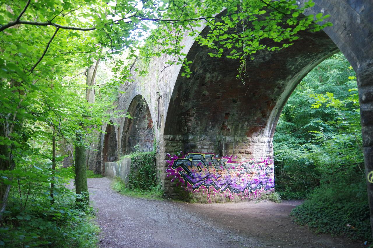
The path now sticks close to the bank of the river -- almost empty at low-tide -- around a long right-hand bend. When the river finally begins to bend the other way (picture 23), the riverside path enters the large Leigh Woods National Nature Reserve, though the tranquility is rather disturbed by the busy A4, which runs along the opposite bank for the rest of the way to Bristol. The railway line to Portbury is now close to the riverbank and in several places the railway embankment and viaducts can be seen beside the path (picture 24).
(25) Avon Gorge
(26) Clifton Suspension Bridge
(27) Cumberland Basin

(28) Baltic Wharf
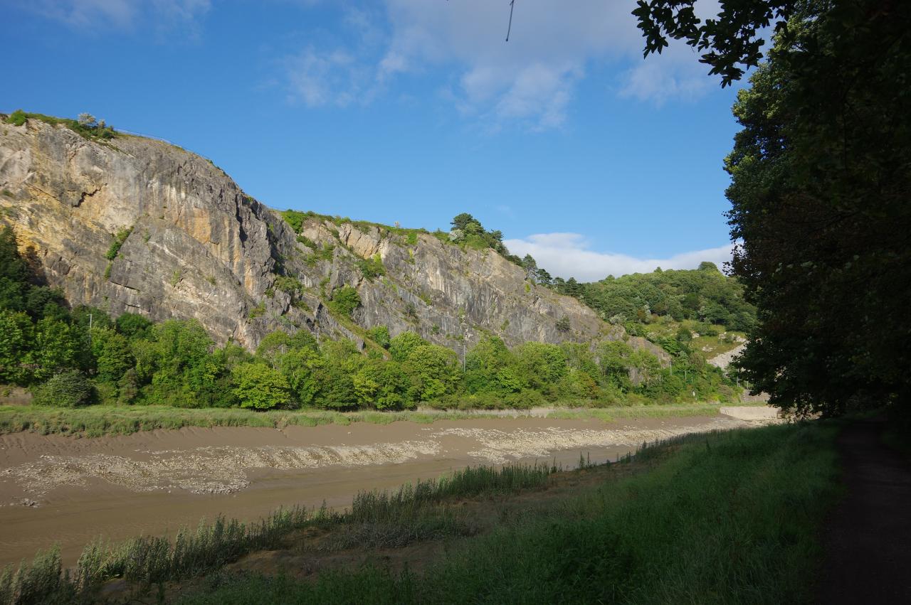
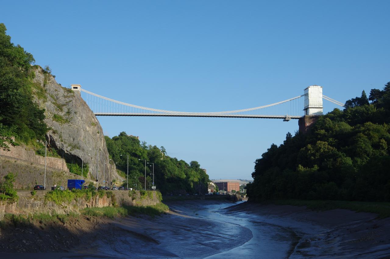
A little further ahead, the river bends right again to pass through the high-sided Avon Gorge (picture 25) and gradually the magnificent Clifton Suspension Bridge comes into view, spanning the far end of the gorge, seventy-five metres above the River Avon (picture 26). The bridge was designed by the great Victorian engineer Isambard Kingdom Brunel to link the Bristol suburb of Clifton with Leigh Woods. Construction began in 1831 but was halted by the Bristol Riots later that year and was subsequently beset by financial problems which delayed completion of the project until 1864.
The path continues along the riverbank to the end of Leigh Woods. Across the river are the lock gates of Bristol's Floating Harbour, built between 1804 and 1810 to ensure a constantly navigable depth of water in the centre of Bristol. As I was passing at low-tide, the height of the walls and lock gates emphasised the large tidal range here. The Bristol Channel and it's tributaries, such as the River Avon, have the second largest tidal range in the world, with high and low tides differing by as much as 12 metres.
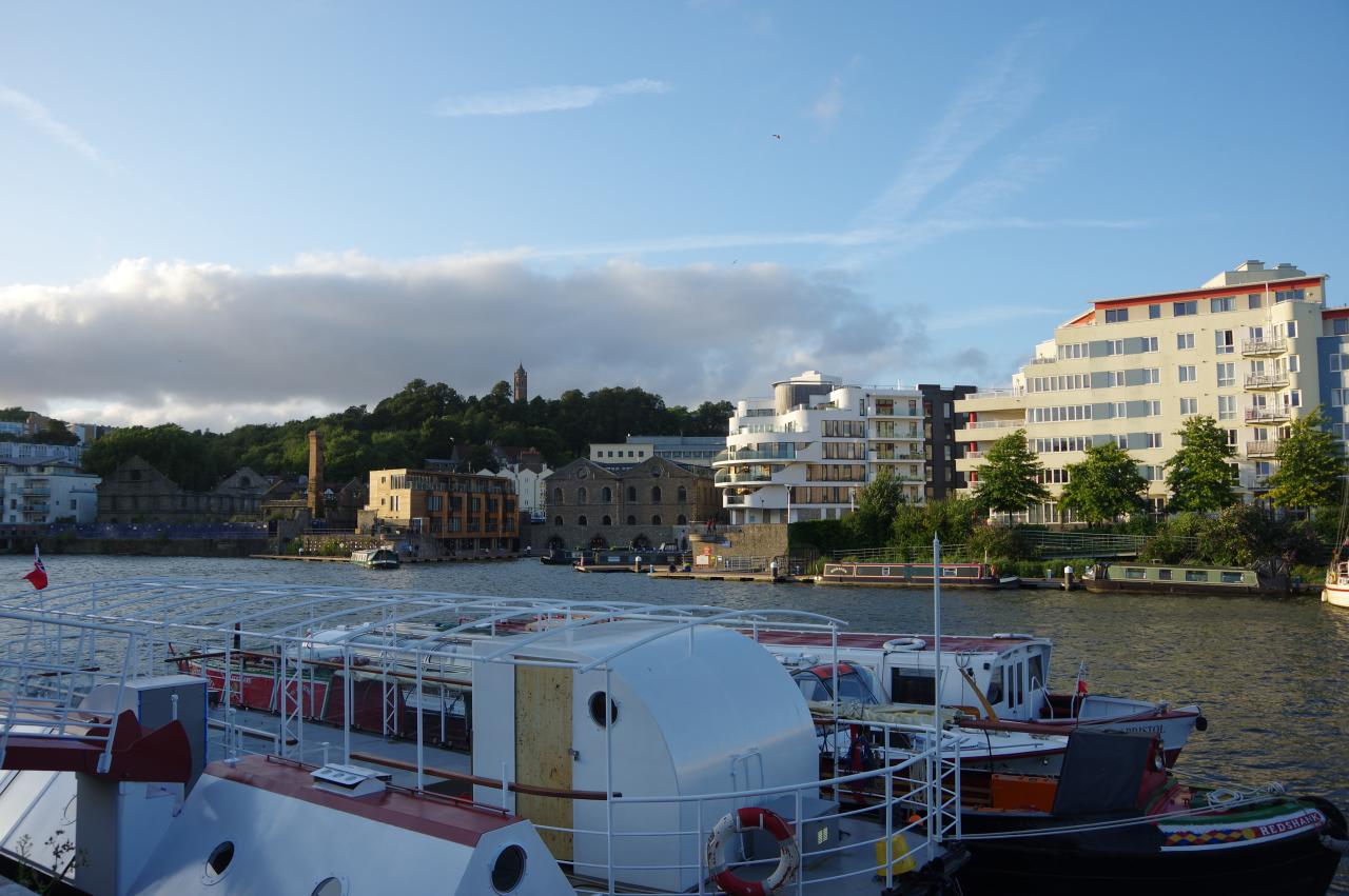
The Coast Path follows the Avon a little further, heading under the A3029 Brunel Way to reach a small park. At the far end of the park the Coast Path takes the Ashton Avenue Swing Bridge across the river to Spike Island, which separates the river from the Floating Harbour. Unfortunately at the time of my visit the swing bridge was closed for refurbishment, so I had to take a diversion up onto Brunel Way and across the river to the edge of the Cumberland Basin (picture 27), the first part of the Floating Harbour. From there, I followed the edge of the Floating Harbour through the Underfall Yard to Baltic Wharf (picture 28), where I rejoined the regular route of the Coast Path.
(29) View towards Brandon Hill
(30) Bristol Harbour Railway
(31) M Shed
(32) Pero's Bridge
The Coast Path follows the old wharf past modern housing that has replaced the old wharf buildings. Beyond these the path leaves the edge of the Floating Harbour to skirt around the Baltic Wharf Marina and behind the drydock occupied by Brunel's famous SS Great Britain, returning to the harbourside at Wapping Wharf. From here there are good views across the water to Brandon Hill (picture 29), one of Bristol's best green spaces, which is topped by the Cabot Tower, a superb viewpoint that I visited a couple of days before this walk.
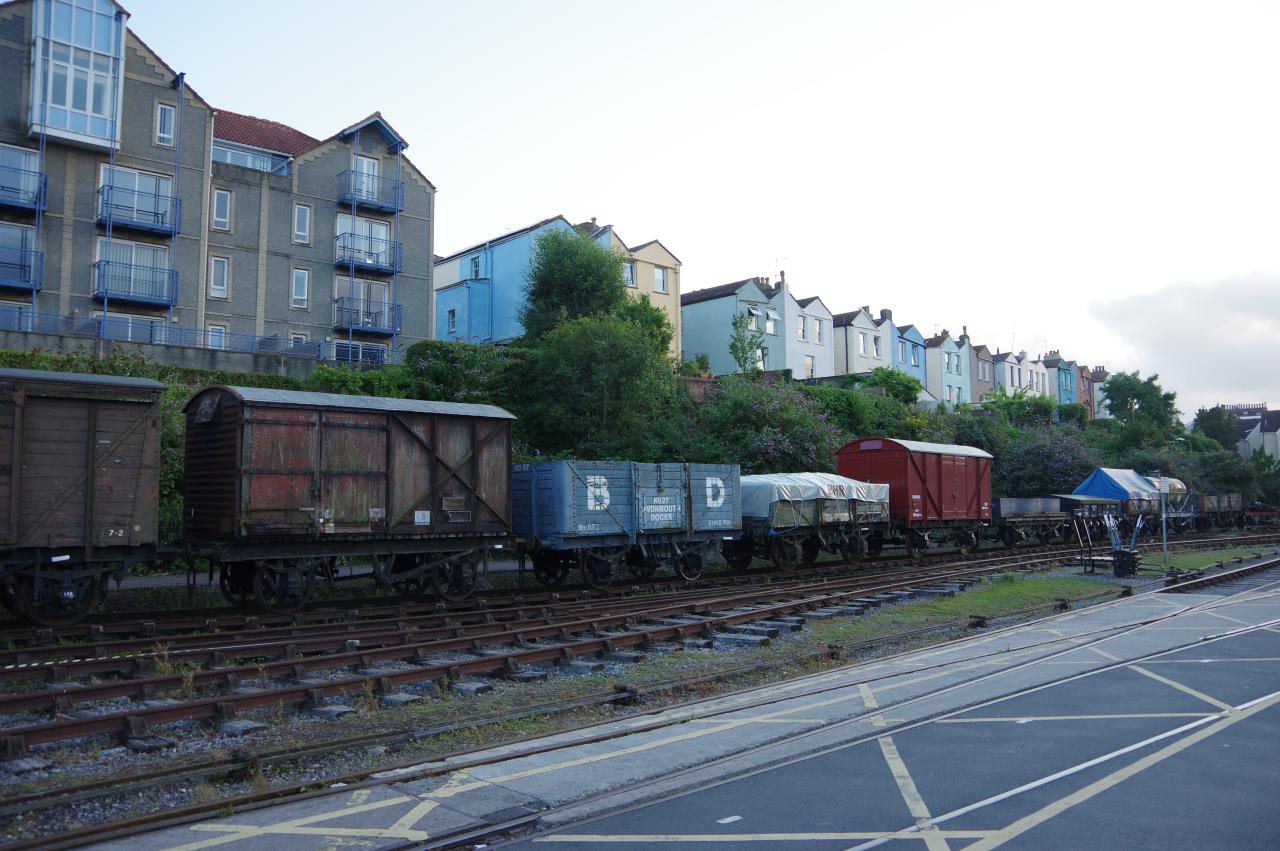
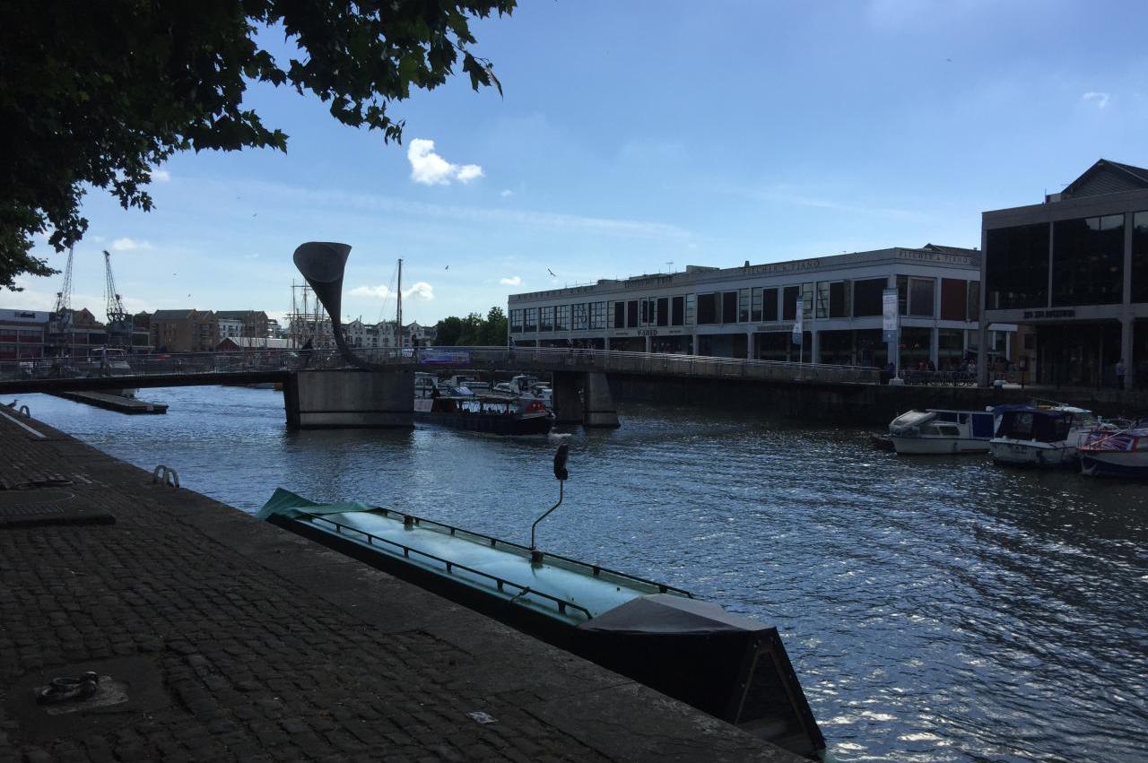
Along the length of Wapping Wharf are the tracks of part of the Bristol Harbour Railway (picture 30). Opened in 1872, the railway initially connected the Floating Harbour to the mainline at Bristol Temple Meads Station. The section along Wapping Wharf was added in 1876 and a further extension to join the Portishead Railway was added in 1904. It was for this extension that the Ashton Avenue Swing Bridge was built. The link to Temple Meads closed in 1964 and the link to Portishead closed in 1987, leaving the Bristol Harbour Railway marooned from the rest of the railway network.
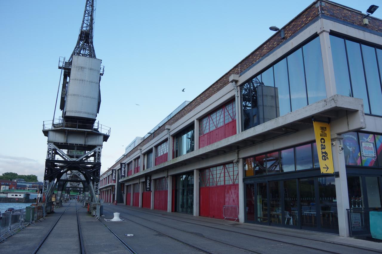
The Coast Path continues along the wharf, passing the M Shed Museum of Bristol (picture 31) then turning left on a rickety bridge to cross to the north side of the Floating Harbour. Turning left off the bridge the route follows the quayside, soon turning right onto Narrow Quay, which runs alongside a long dead-end branch of the Floating Harbour. This inlet is crossed by Pero's Bridge (picture 32), which marks the end of the Coast Path and the beginning of the Severn Way Bristol Link. I left the Coast Path here, having covered exactly thirty kilometres for the day.