SOLENT WAY
Stage 1: Emsworth to Old Portsmouth
Tuesday, May 08, 2012
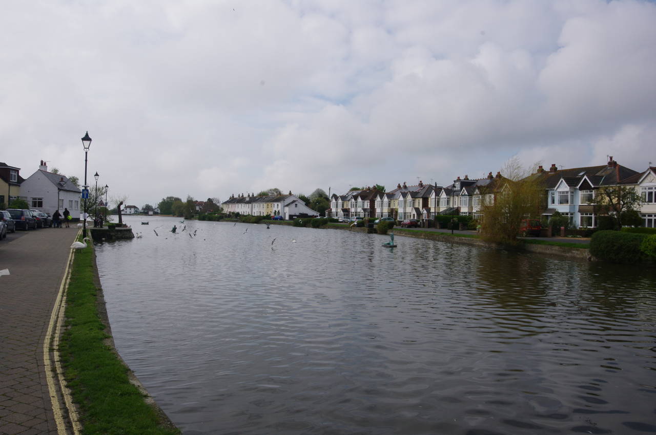
(1) Emsworth Mill Pond
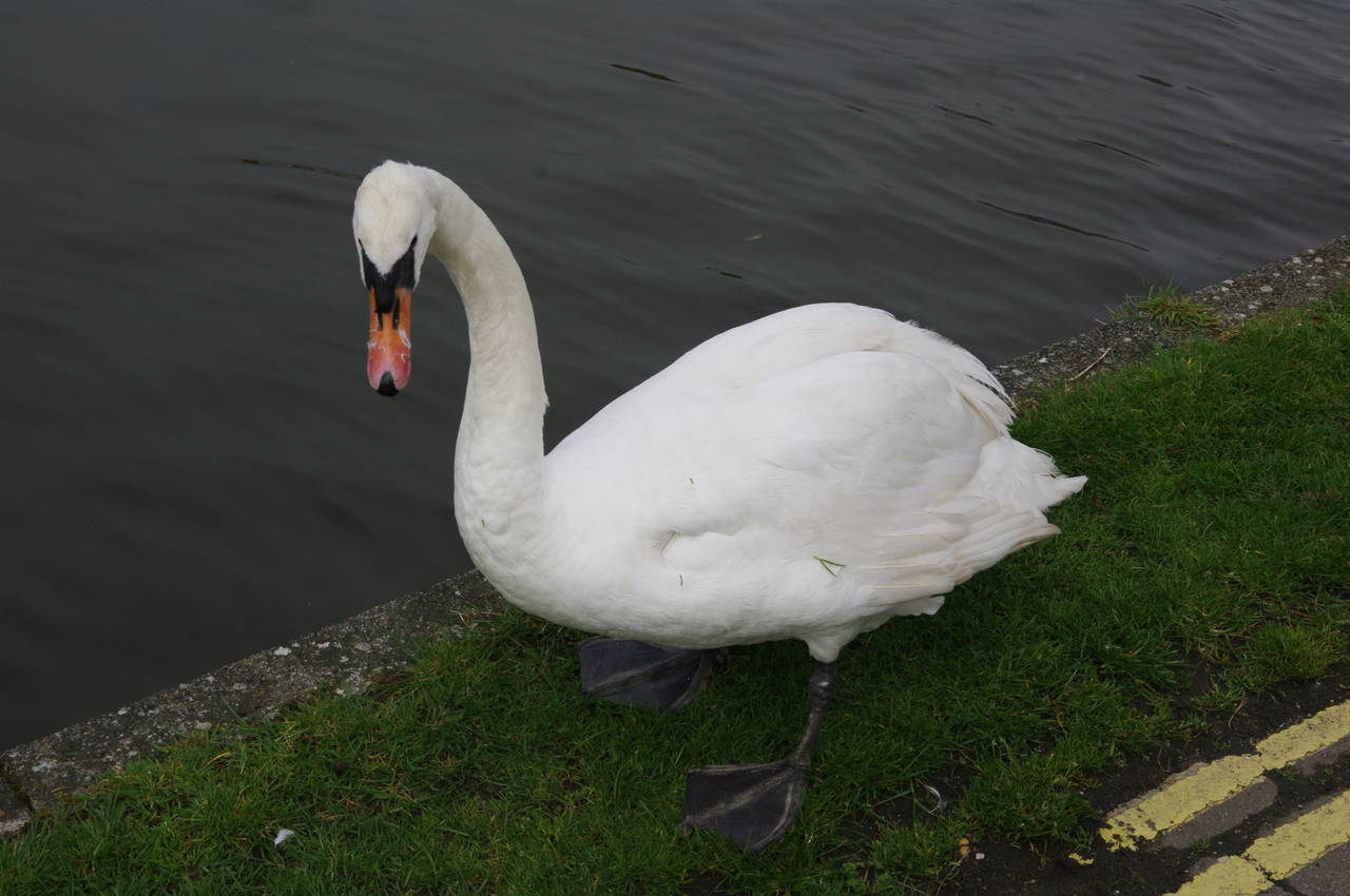
(2) Swan by Emsworth Mill Pond
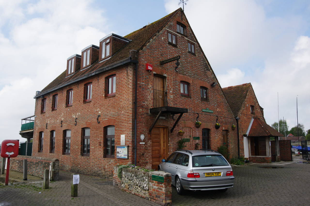
(3) Emsworth Town Mill
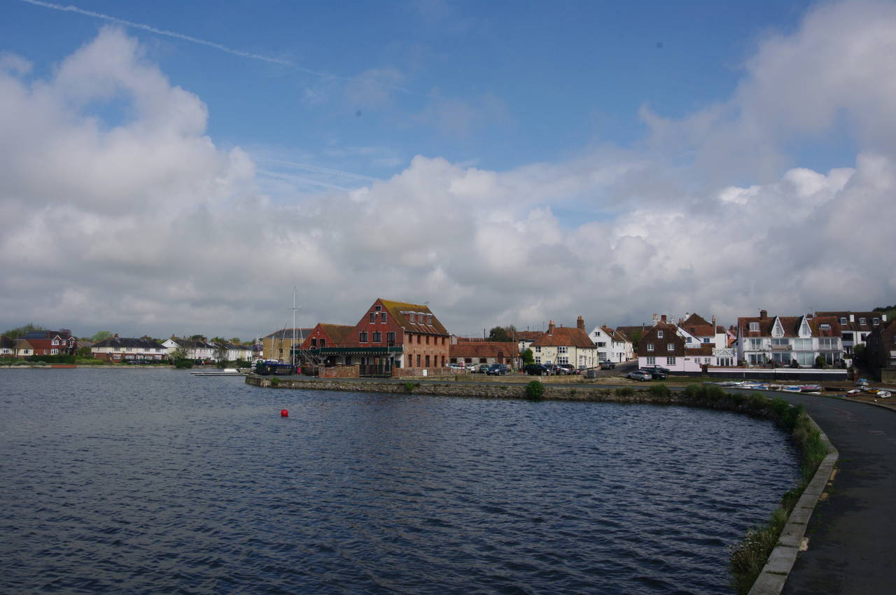
(4) Emsworth Mill Pond
From my accommodation in Winchester, it took me just under an hour to reach Emsworth Station by train, then a further ten minutes to walk south through the town to the long Emsworth Mill Pond (picture 1).
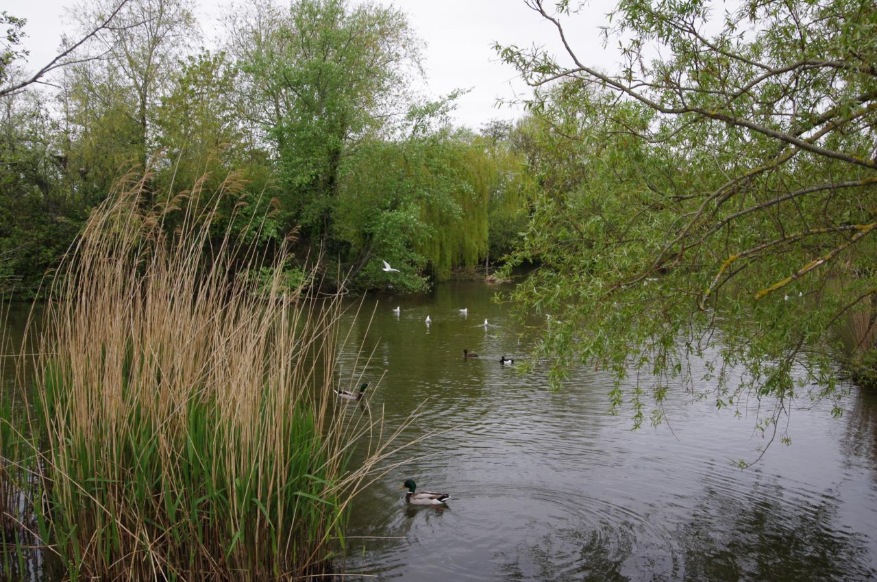
Walking along the eastern edge of the mill pond I passed several groups of Mute Swans. These seemed quite tame and not at all alarmed by camera-wielding humans (picture 2), unlike those I had encountered on the Thames Path, which only approached the riverbank to hiss loudly before swimming off again.
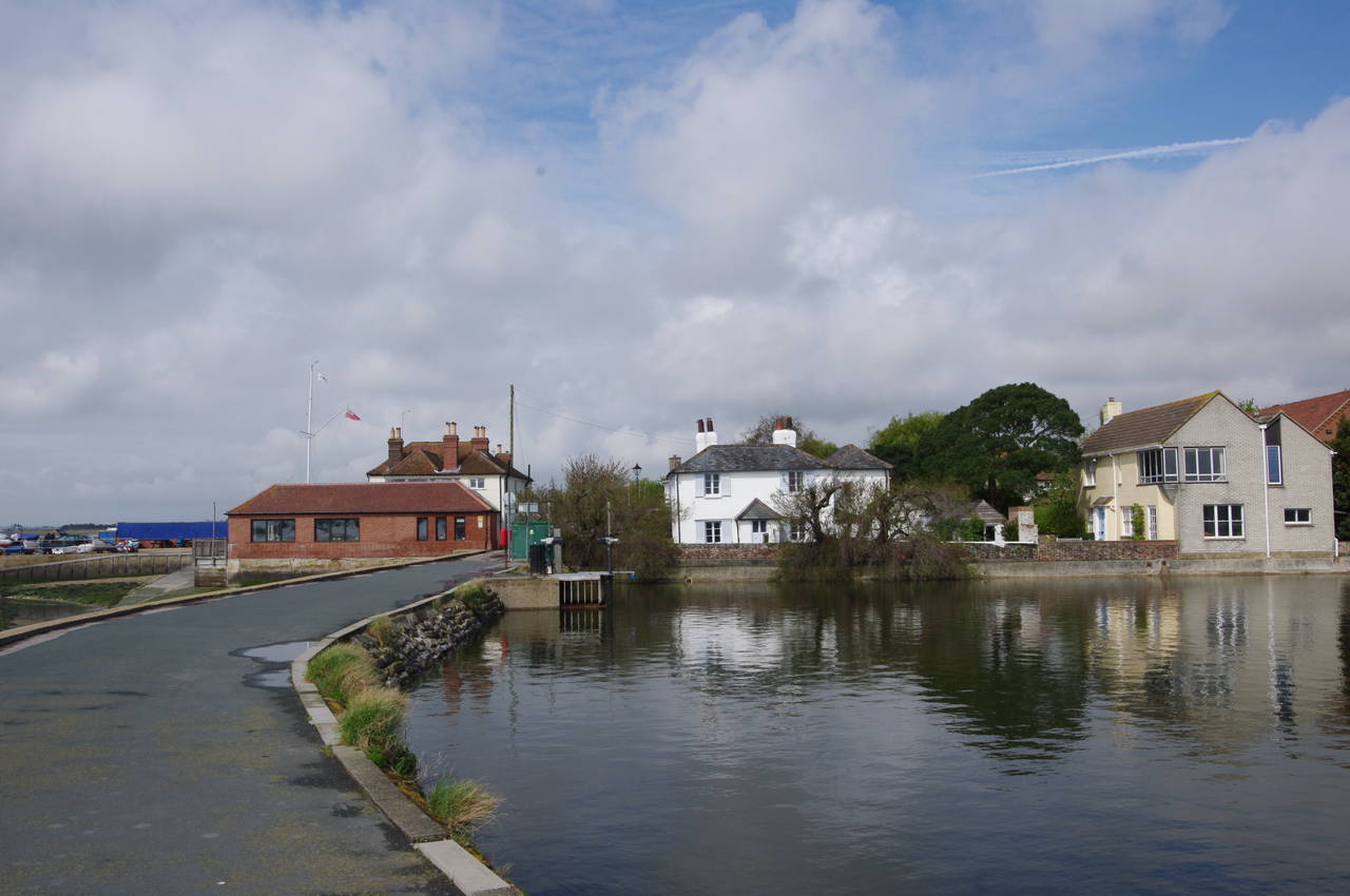
The ten-acre mill pond was enclosed in 1760 and drove the flour mill at the southern end of the pond until the 1930's, with the mill pond having passed into public ownership in 1925. The Town Mill (picture 3) is now the home of the Emsworth Slipper Sailing Club, and is also the official starting point of the Solent Way.
While taking some photos before setting off on the walk, I was apporached by an elderly gentleman who lives nearby. As well as sharing a keen interest in photography, it turned out that he was also quite familiar with my home city of Brisbane. We had a good chat for almost half an hour, during which the sun had started to break through the thick cloud cover.
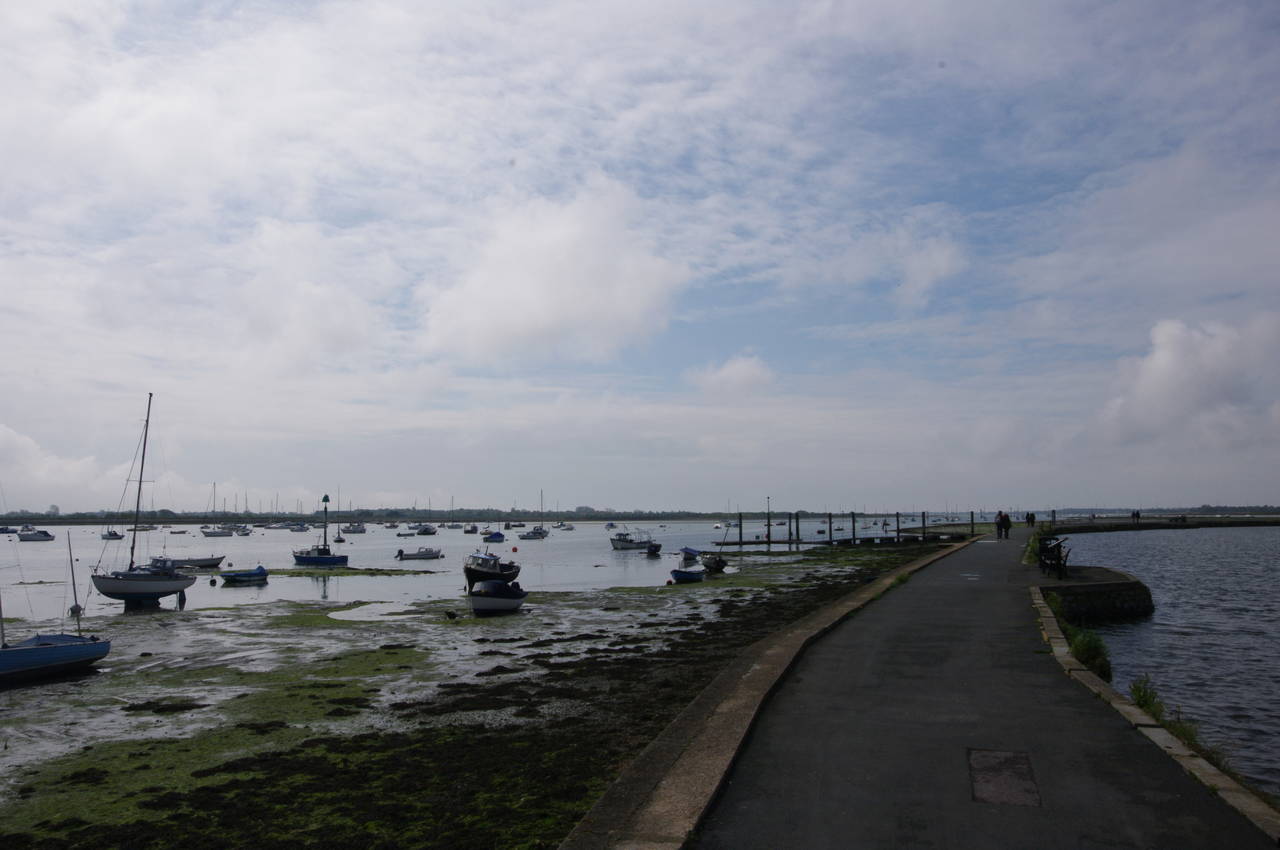
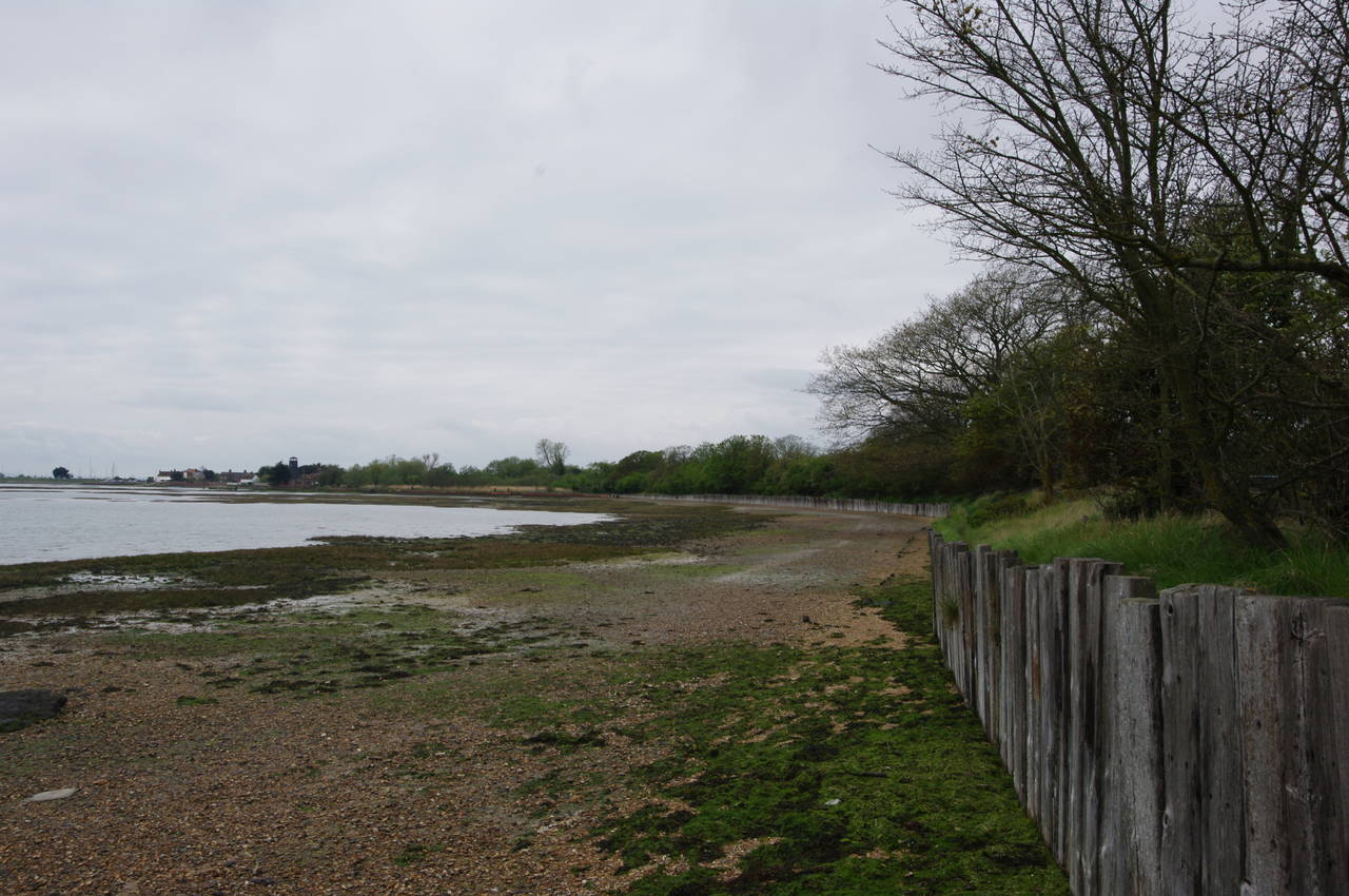
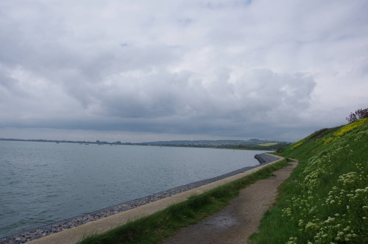
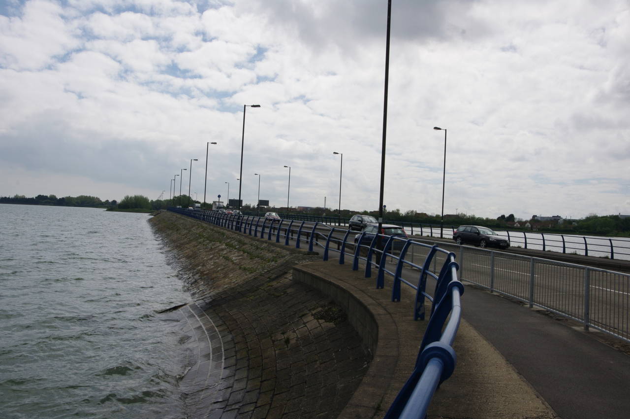
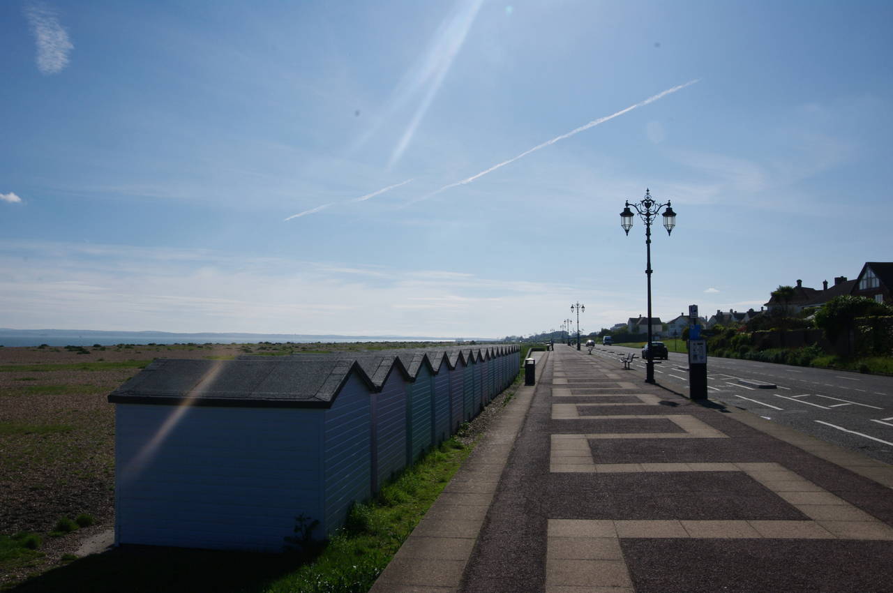
It was a few minutes before ten when I finally set off along the promenade that runs along the top of the wall separating the mill pond from the tidal waters of Chichester Harbour (picture 4, looking back towards the former mill).
(5) Chichester Harbour
(6) Emsworth Mill Pond
(7) Chichester Harbour
(8) Church of St Thomas à Becket, Warblington
Emsworth is sheltered from the English Channel by two islands: Thorney Island just to the east and the larger Hayling Island to the southwest. The latter is shaped rather like an upside-down letter T, around six kilometres long and six kilometres wide along the southern edge, but only about two kilometres wide at the northern end. The water between the two islands is Chichester Harbour, while the water to west of Hayling Island is Langstone Harbour, which the Solent Way would soon be visiting.
With the tide out, the view across Chichester Harbour from the promenade was of many small boats resting on their keels in the soft mud, with the coastline of Thorney Island stretching southwards in the background (picture 5).
Curving around the end of the mill pond, the promenade passes between a cottage and some buildings owned by the Emsworth Sailing Club (picture 6), and then along the sea wall in front of a boatyard that was crammed with small dingies and tiny sailing boats.
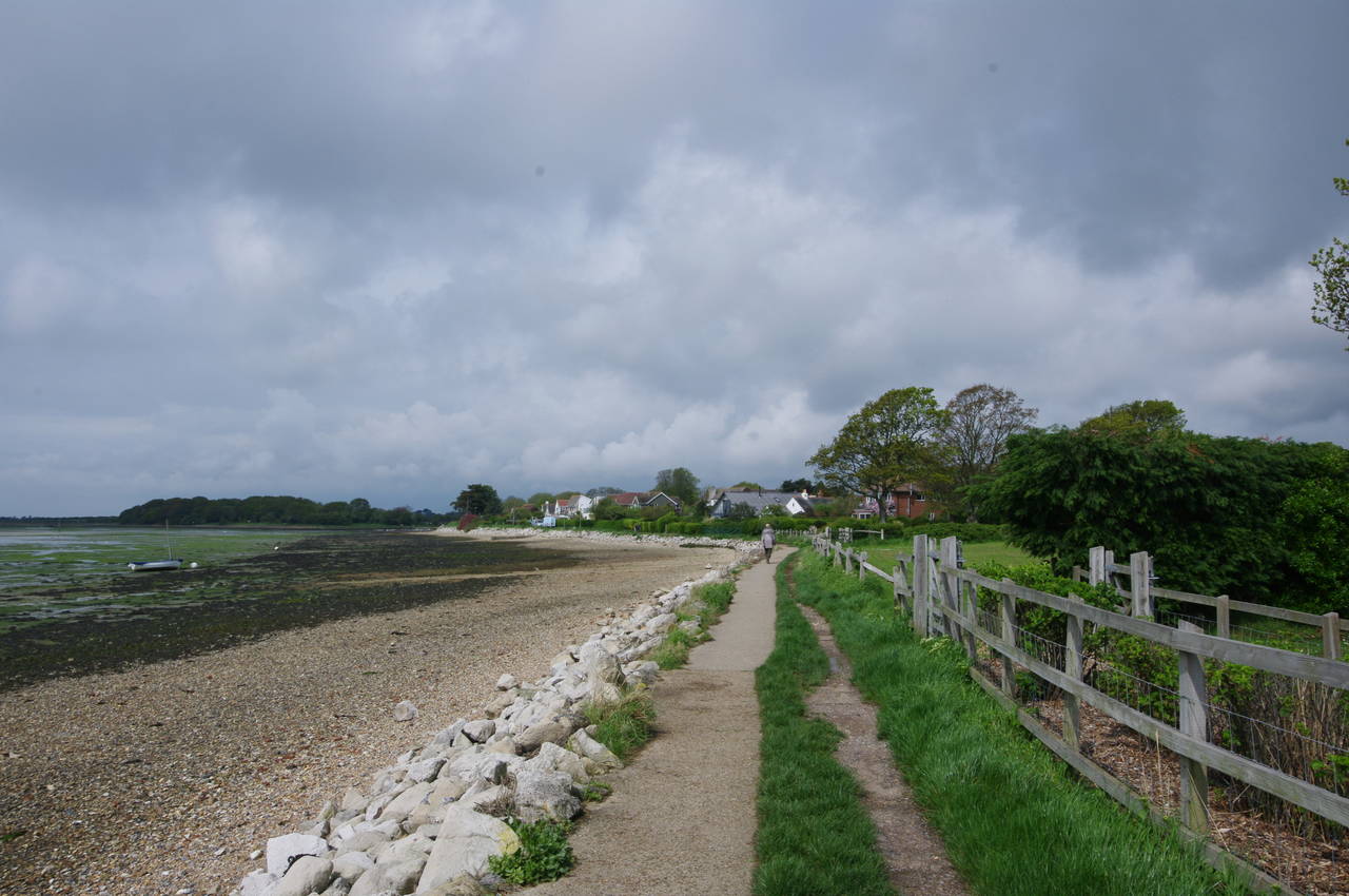
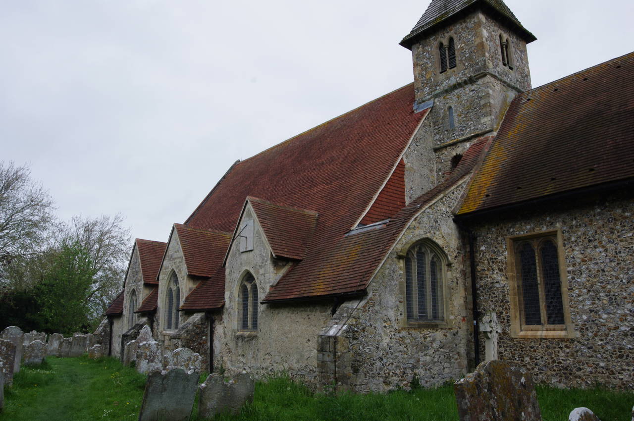
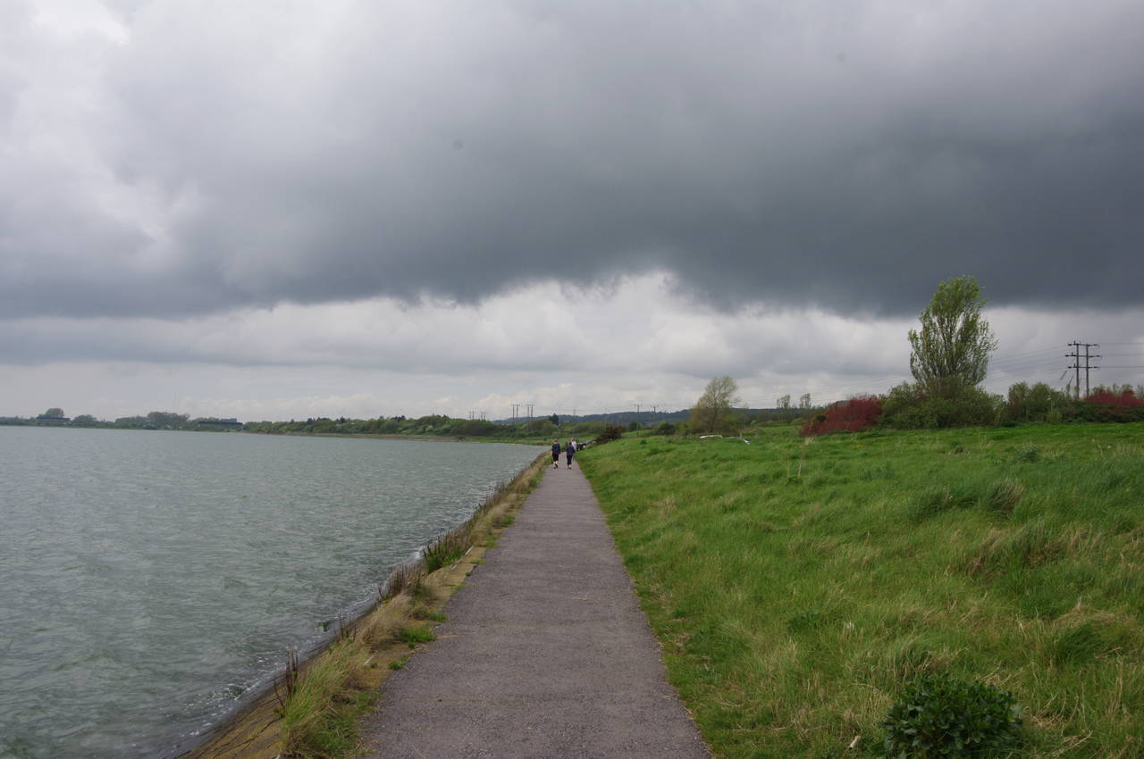
The concrete path along the sea wall soon becomes a narrow bitumen footpath above the shingle foreshore (picture 7), passing modest waterside homes, before deviating away from the harbour's edge after around eight hundred metres. Leaving the last houses of Emsworth behind, the Solent Way passes between a patch of woodland known as Nore Barn Wood and a field, then crosses another field to reach a large cemetery surrounding the Parish Church of St Thomas à Becket in the hamlet of Warblington (picture 8).
(9) Path beside Chichester Harbour
(10) Langstone Mill Pond
(11) The Royal Oak and Langstone Tide Mill
(12) Swans by South Moor
The Solent Way passes to the left of the church, then follows a well-signposted path through another section of the cemetery then diagonally across a field to rejoin the harbourside path. Hayling Island was now much closer and I could see cars going across the bridge that connects the island's northern tip to the mainland and marks the boundary between Chichester Harbour and Langstone Harbour.
The Way now runs along the shingle beach below a long retaining wall made from upright wooden planks (picture 9). I suspect that this part of the path might sometimes be underwater at high tide.
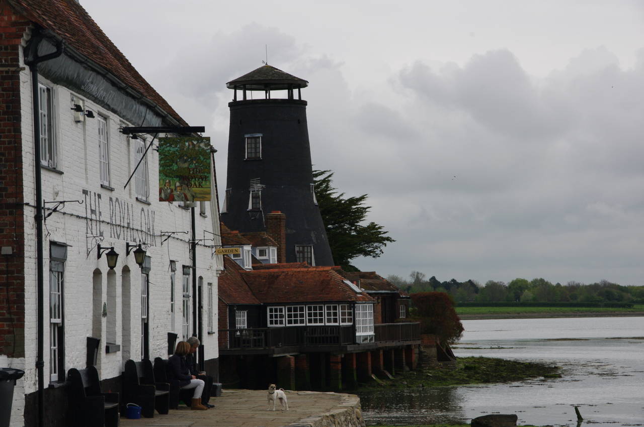
Before long, the path passes the Langstone Mill Pond (picture 10), which is much smaller than the one at Emsworth, but still home to several species of bird. The route now passes behind the Langstone Tide Mill and then in front of the 18th-century Royal Oak pub to reach the end of Langstone High Street, from which I took picture 11, looking back to the mill.
The route heads up to an intersection at the far end of the High Street, bearing right to cross the A3023 Langstone Road at a refuge and then a little further right to find a footpath that leaves the road next to a phone booth. Beside this path, I passed a fingerpost for the Wayfarers' Walk, which shares the route of the Solent Way for the first six kilometres before heading north to Inkpen Beacon, a further 106 kilometres from the point where the paths diverge.
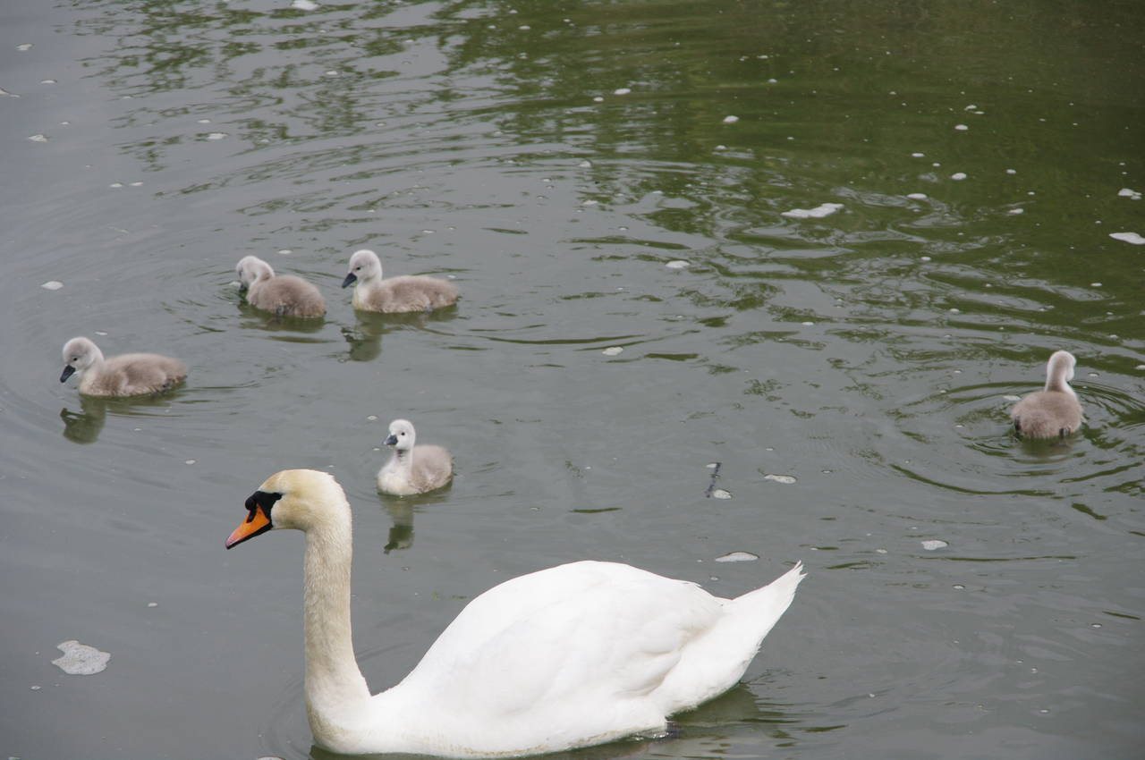
In less than a hundred metres, the path joins Mill Lane, following it ahead to its end at a little bridge across a creek, where I saw a swan swimming with her family of young cygnets (picture 12).
(13) Path beside South Moor
(14) Broadmarsh Country Park
(15) Bicycle path beside the A27
(16) Farlington Marshes
The path crosses over the creek and turns left to follow it along the edge of the marshland of South Moor and back to the edge of Langstone Harbour. On the bank of the creek, I found a man in his 20's standing by a camera on a tripod. He explained that he was testing an idea that he could make a very high-resolution time-lapse video of the changing tide in the creek by taking one frame every 15 seconds, which would compress the full eleven-hour tidal cycle into a little under two minutes. On this occasion, he was only aiming to capture an hour or so, in order to confirm that he could manage to convert a series of still pictures into a high-definition video and that his camera's battery was also up to the task. He confessed that even after less than an hour he was getting quite bored, with the camera clicking away to itself on an automatic timer, and was rather glad to talk to someone else who was interested in photography.
After another lengthy and interesting chat, I resumed my walk on the stroke of noon. With less than five kilometres covered so far, I was going to have to increase my pace if I was going to make it to Portsmouth by the end of the day.
The path now follows the sea wall along the edge of South Moor, passing a little hill that was covered in long grass and colourful wildflowers (picture 13) before turning right to follow a creek along the perimeter of a large sewage works and up to Harts Farm Way. This is the point where the Wayfarers' Walk leaves the Solent Way, and also where I had completed my walk along the Staunton Way a week earlier.
The Solent Way turns left along the road, crossing the creek and heading through an industrial estate. Just beyond a bridge over a second branch of the creek, the route crosses the road and takes a path that loops back to the bank of the creek and then under the bridge to follow the creek back to Langstone Harbour, just a few metres away from where I had left it, but having walked a little over a kilometre to get there.
After going around the end of a slipway, the path follows the sea wall along the edge of Broadmarsh Coastal Park (picture 14). By now I had noticed that there were some dark clouds up ahead, but fortunately it didn't rain.
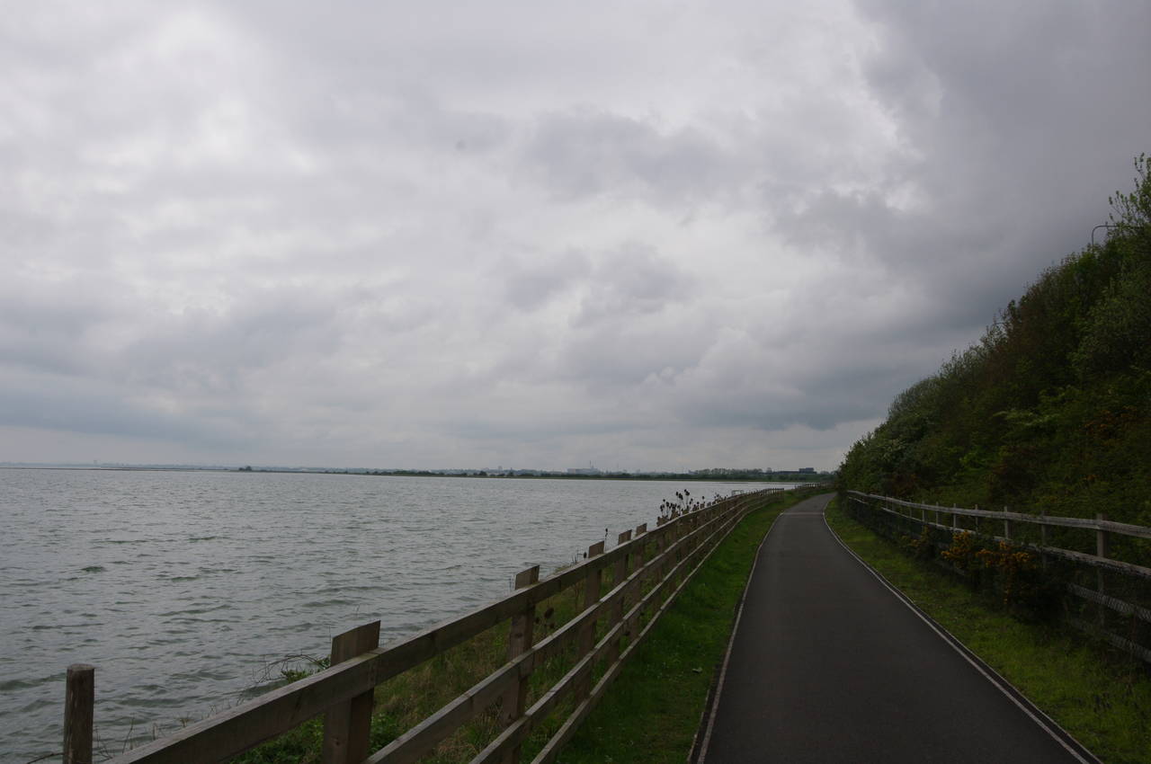
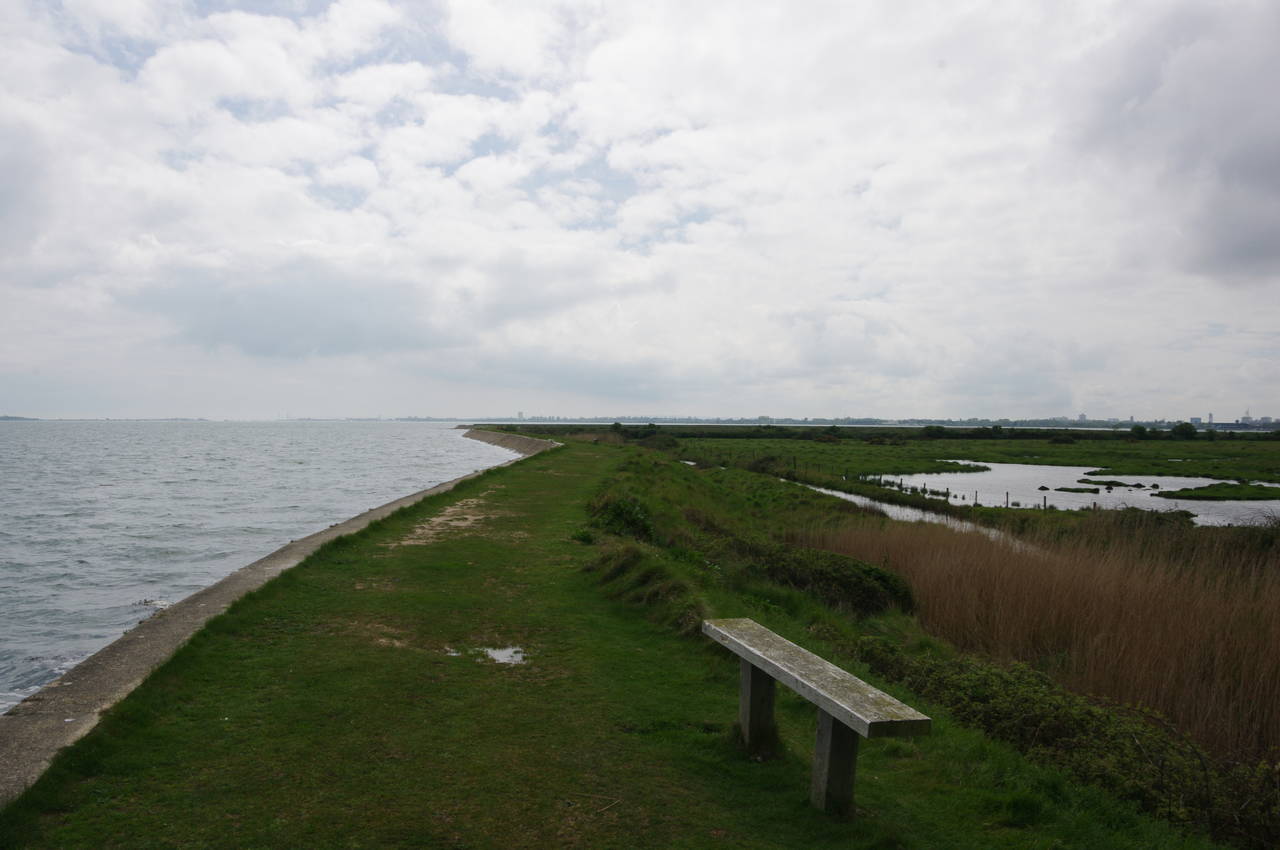
About 700 metres from the creek mouth, the Way joins a bicycle path, following it along a narrow strip of land between the harbour and the noisy A27 road (picture 15) for another 700 metres before bearing left on a path that leads to the sea wall on the edge of the Farlington Marshes Nature Reserve. For almost three kilometres, the path follows the sea wall around three sides of the marshes (picture 16) before returning to the side of the A27.
The Farlington Marshes are grazed by livestock and provide an important habitat for migrating birds, particularly in the winter. The walk around the marshes was very peaceful, accompanied by the sounds of the incoming tide lapping against the sea wall and a few sea birds searching for their lunch in the waterways that criss-cross the marshes.
(17) Bridge over Ports Creek

(18) Langstone Harbour
(19) Milton Common
(20) Milton Lock
From the northwest corner of the marshes, the path beside the A27 takes about 500 metres to reach a carpark, beyond which the Solent Way joins the A2030 Eastern Road to cross the bridge over Ports Creek to Portsea Island (picture 17). Once over the bridge, the route leaves the road and follows a narrow, but well-worn path along the grassy western bank of the harbour, where there were more spring wildflowers growing in the long grass (picture 18).
The path leaves the shore briefly to skirt around the perimeter of a gravel works before returning to the shore and passing the Tudor Sailing Club. The path continues south along the shore, at times running close to Eastern Road until the road eventually bears away from the shore, leaving the Solent Way to continue along the shore past the green expanse of Milton Common (picture 19). The common is an area of open grassland, popular with local walkers, with three small lakes next to the Solent Way.
Reaching some houses, the path continues beside the harbour for a short distance to Milton Lock. From the footbridge over the lock there were good views out across Langstone Harbour (picture 20) towards the narrow harbour entrance between the tips of Portsea Island and Hayling Island.
(21) Bransbury Park, Eastney
(22) The Esplanade, Eastney
(23) South Parade Pier, Southsea
(24) Spitsand Fort
Rather than crossing over the lock, the Solent Way instead runs beside it, soon joining Locksway Road and following it for 600 metres to turn left into Ironbridge Lane. At the far end of the lane, the route continues ahead on a footpath across the middle of Bransbury Park (picture 21), which separates the suburbs of Milton and Eastney. Leaving the park, the route turns left to head east along Henderson Road, which gradually curves around 180 degrees to become The Esplanade when it reaches a wide shingle beach (picture 22), taking the Solent Way to the shore of the Solent for the first time.
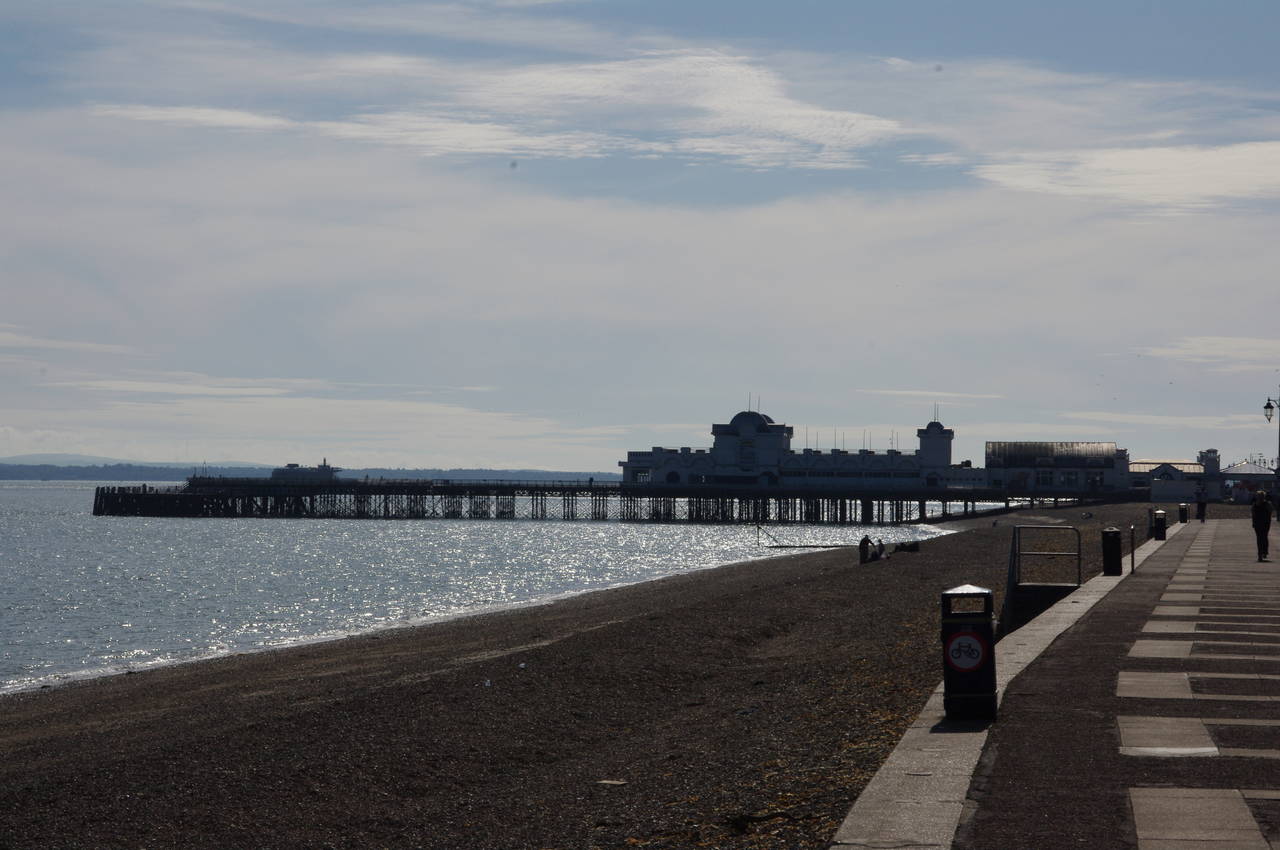
The Solent Way follows the shore closely for the rest of the day's walk. Two kilometres along The Esplanade, having passed from Eastney into Southsea, the route reaches the landmark of South Parade Pier (picture 23).
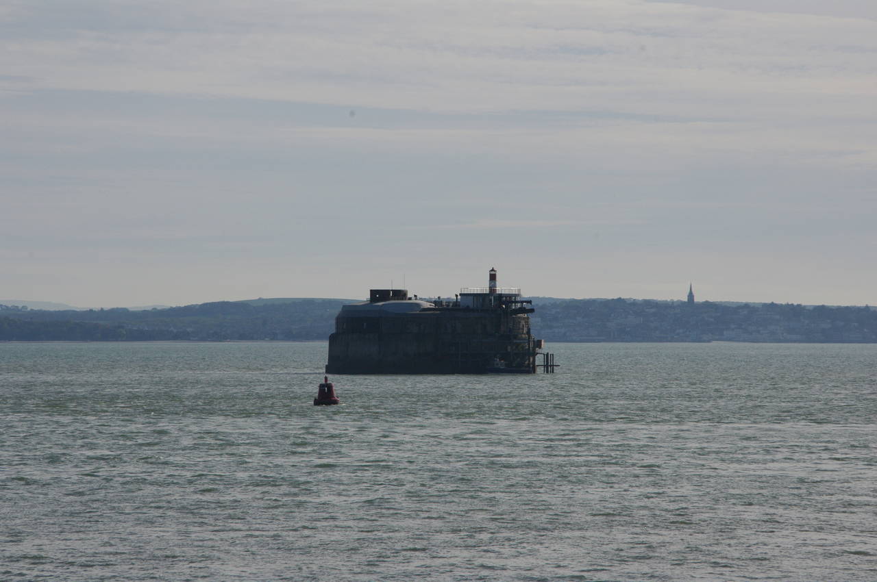
Out in the middle of the Solent, almost two kilometres beyond the end of the pier, one can see the squat, round shape of Spitsand Fort (picture 24), which measures about 50 metres across, with the town of Ryde on the Isle of Wight in the background (you can see the spire of one of Ryde's churches to the right of the picture). This was one of four forts built in the 1860's and 1870's to defend shipping passing along the Solent to Portsmouth Harbour. No longer needed for the defense of the port, the fort is now in private ownership and has been turned into an eight-room hotel and luxury spa.
(25) Southsea Castle
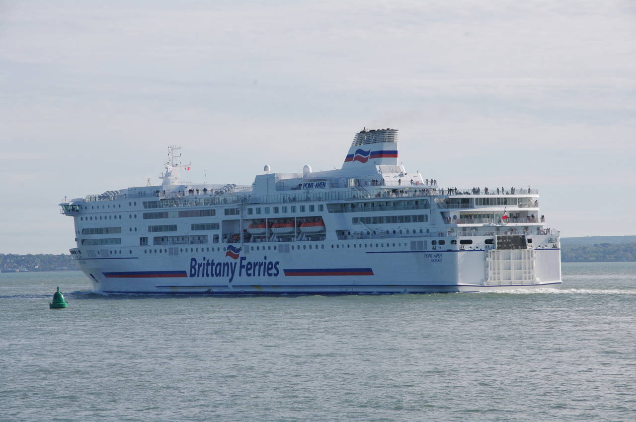
(26) M.V. Pont-Aven
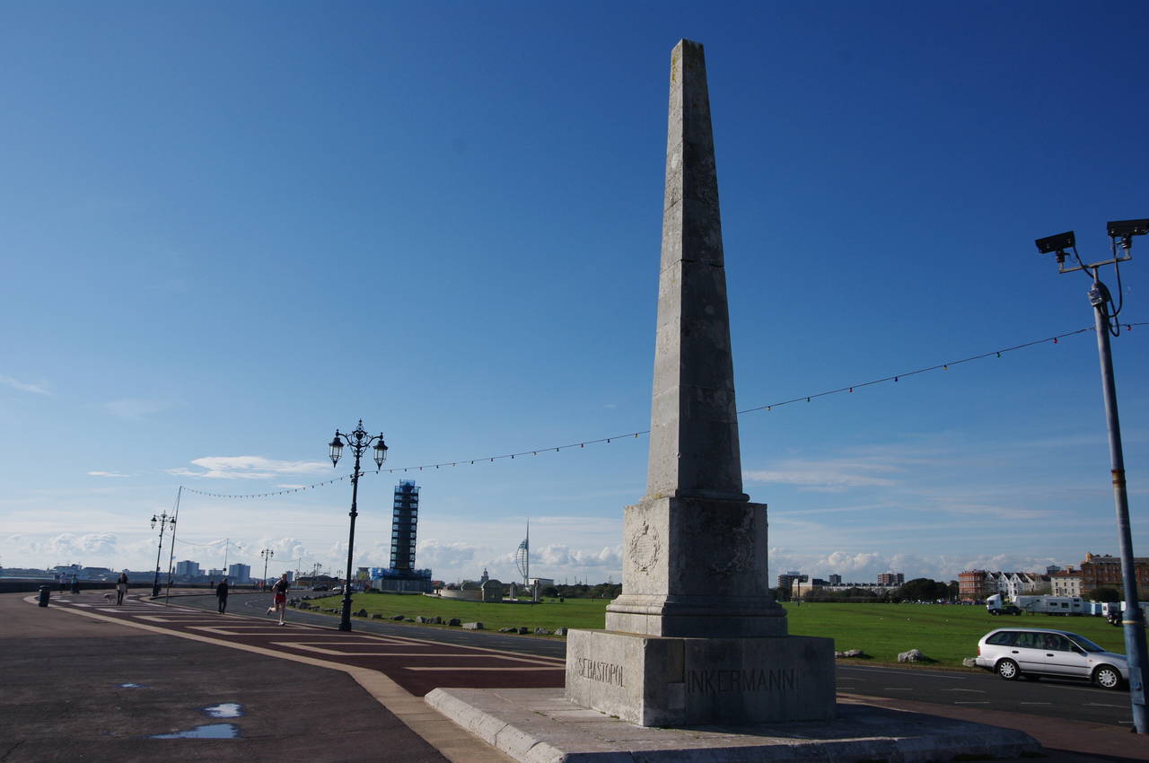
(27) Crimean War Memorial, Southsea Common
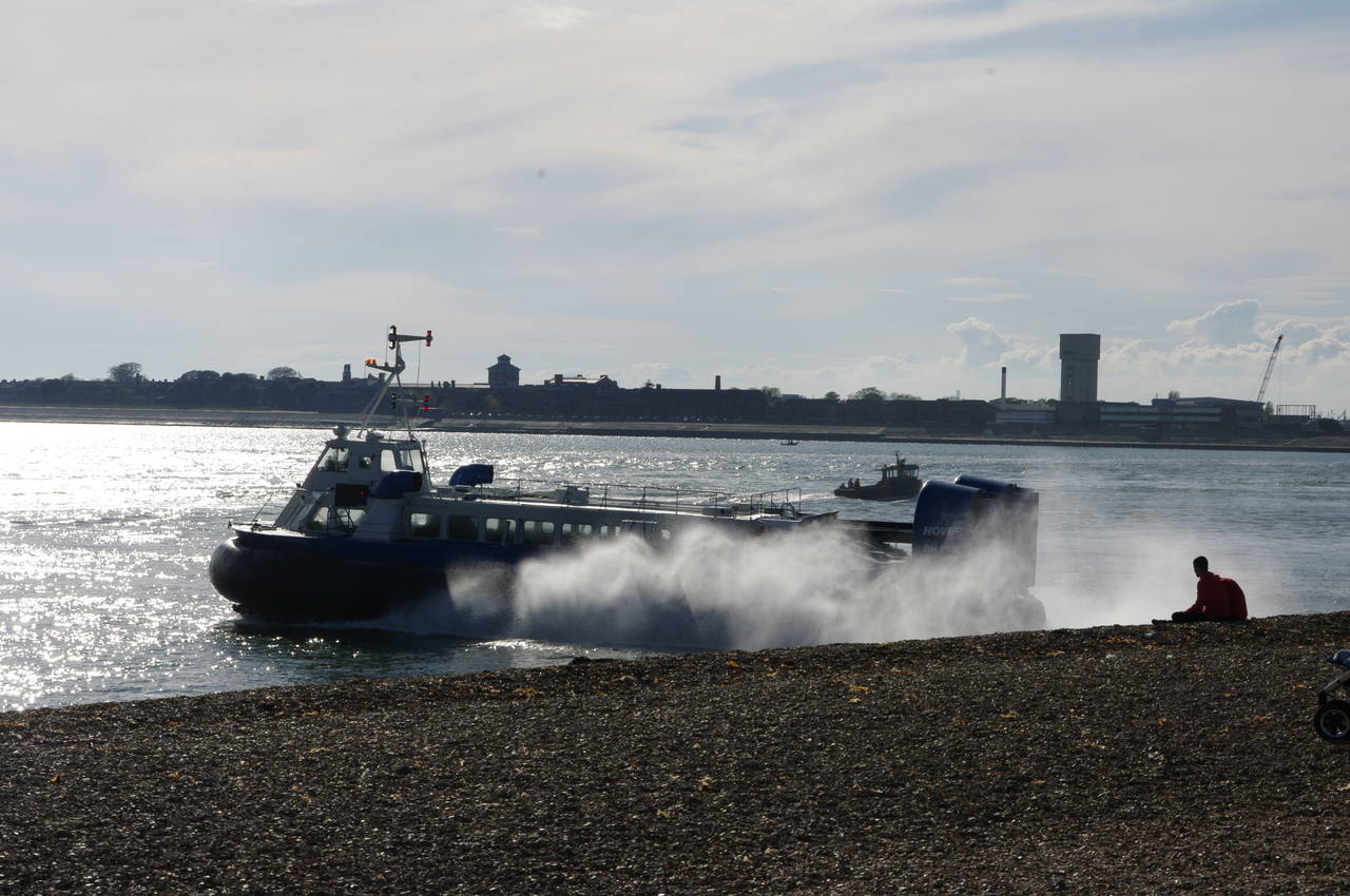
(28) Hovercraft launching from Southsea Common
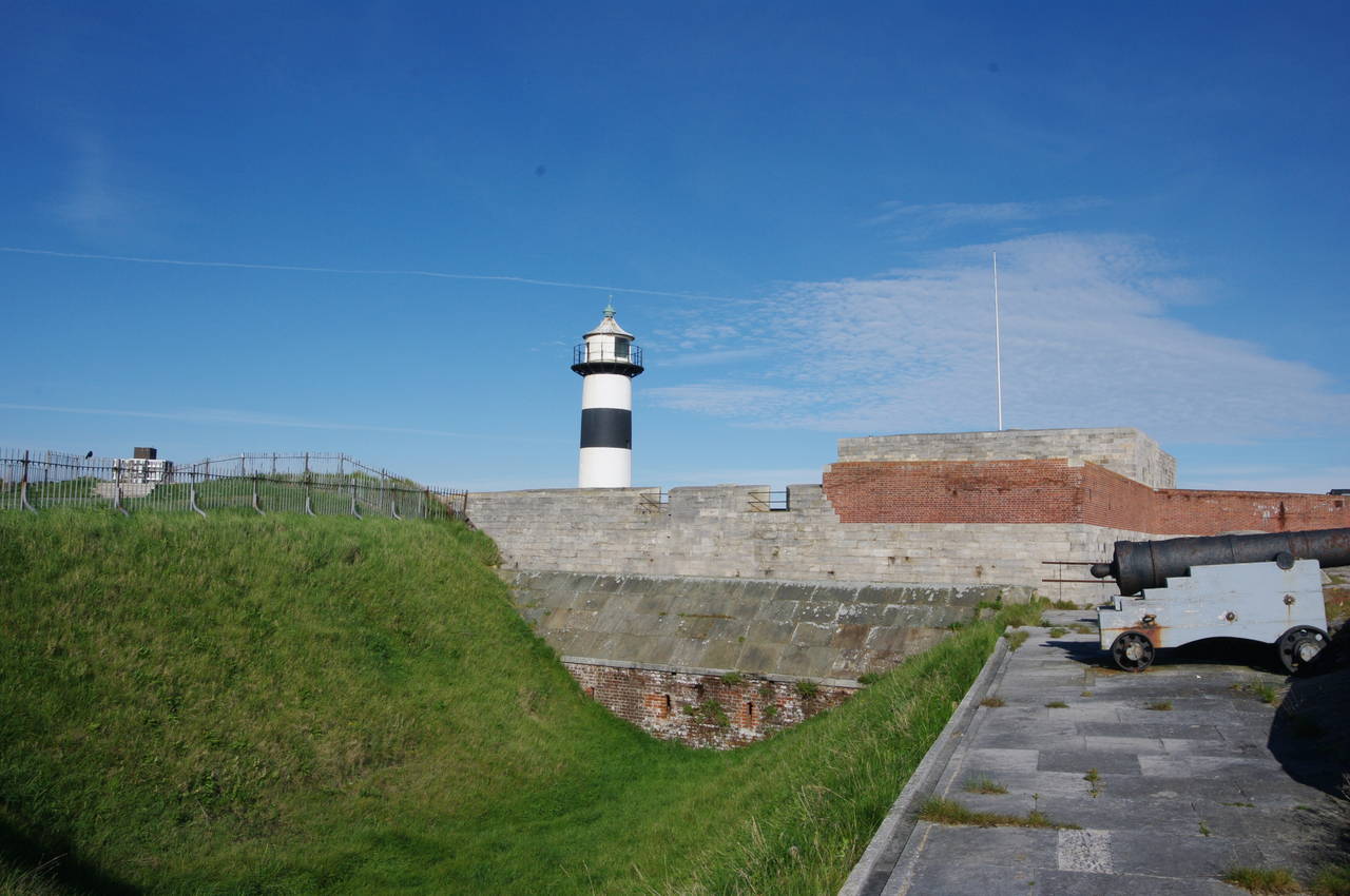
The Way continues along the shore for another 800 metres to round Southsea Castle (picture 25), where the coast turns northwestward for the final stretch to the mouth of Portsmouth Harbour. The Castle was built in 1544 on the orders of Henry VIII; one of a long string of defensive structures he had built along the south coast of England to counter possible invasions from mainland Europe. In the end, the castle never saw action against foreign invaders, but instead was occupied by Royalists and then captured by the Parliamentarian Army in 1642, during the English Civil War. The candy-striped lighthouse on the western side of the castle is a much later addition, dating from 1828.
As I passed the castle, I saw a large ferry heading out of the harbour and into the Solent (picture 26). The 41,700 ton M.V. Pont-Aven is the flagship of Briittany Ferries and makes frequent crossings of the English Channel between various ports in the United Kingdom, Ireland, France and Spain.
A short distance behind the Castle is the superb D-Day Museum, telling the story of the Allied liberation of Normandy on the 6th of June 1944, which marked the beginning of the end of World War II in Europe. I visited the museum a couple of days after this walk while exploring Portsmouth and Southsea, finding it to be a fascinating and moving exposition of one of the most significant events of the twentieth century.
Southsea Castle and the D-Day Museum stand at the eastern end of Southsea Common, a kilometre-long stretch of grassy parkland parallel to the shore where the City of Portsmouth has erected a number of memorials to past naval and military achievements. The first of these is a large obelisk commemorating the various battles of the Crimean War (picture 27). Further on, the much taller column of the Portsmouth Naval Memorial was clad in scaffolding for repairs, so I wasn't able to get a good look at it. In the far distance in the middle of the picture is Portsmouth's iconic 170-metre tall Spinnaker Tower, which stands close to the destination of the day's walk.
Near the far end of the common, Britain's last remaining commercial hovercraft service launches from the shingle beach for the twelve-minute journey across the Solent to Ryde on the Isle of Wight (picture 28).
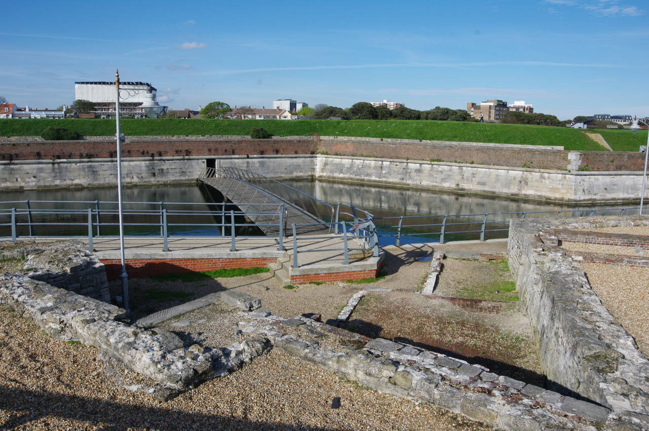
(29) Spur Redoubt
(30) Long Curtain Battery
(31) Royal Garrison Church
(32) The Square Tower
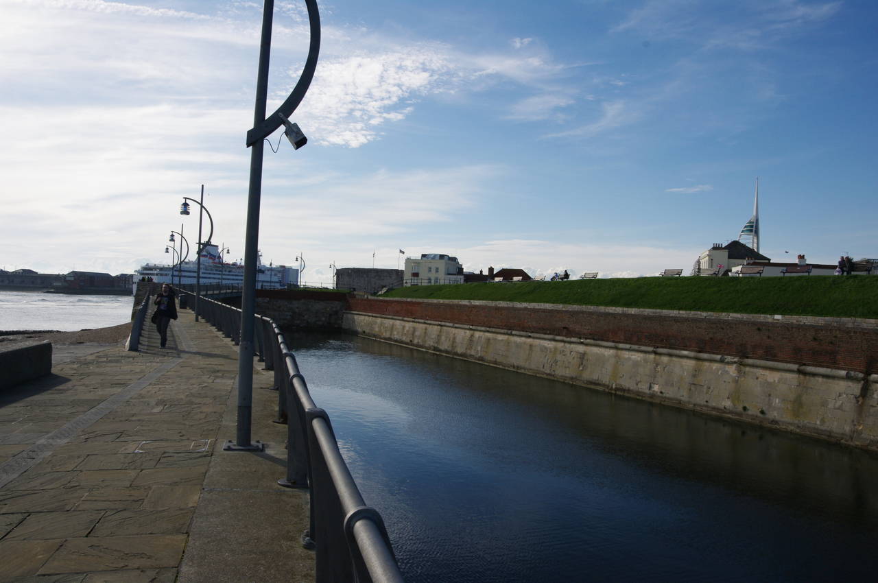
Just beyond the hoverport, the Solent Way heads through the amusement arcades and rides of the Clarence Pier complex then crosses a wooden footbridge that passes over the remains of the Spur Redoubt, a triangular fortification built in 1680 (picture 29). The path then continues along the outer wall of the moated Kings Bastion and Long Curtain Battery (picture 30). All of these fortifications were built to protect the narrow entrance to Portsmouth Harbour.
The harbour itself seemed to be quite busy and in the few minutes it took me to walk along the wall I saw the ferry Bretagne (sister ship of the Pont-Aven that I saw earlier) squeeze through the harbour mouth, quickly followed by two smaller Isle of Wight ferries and a small container ship.
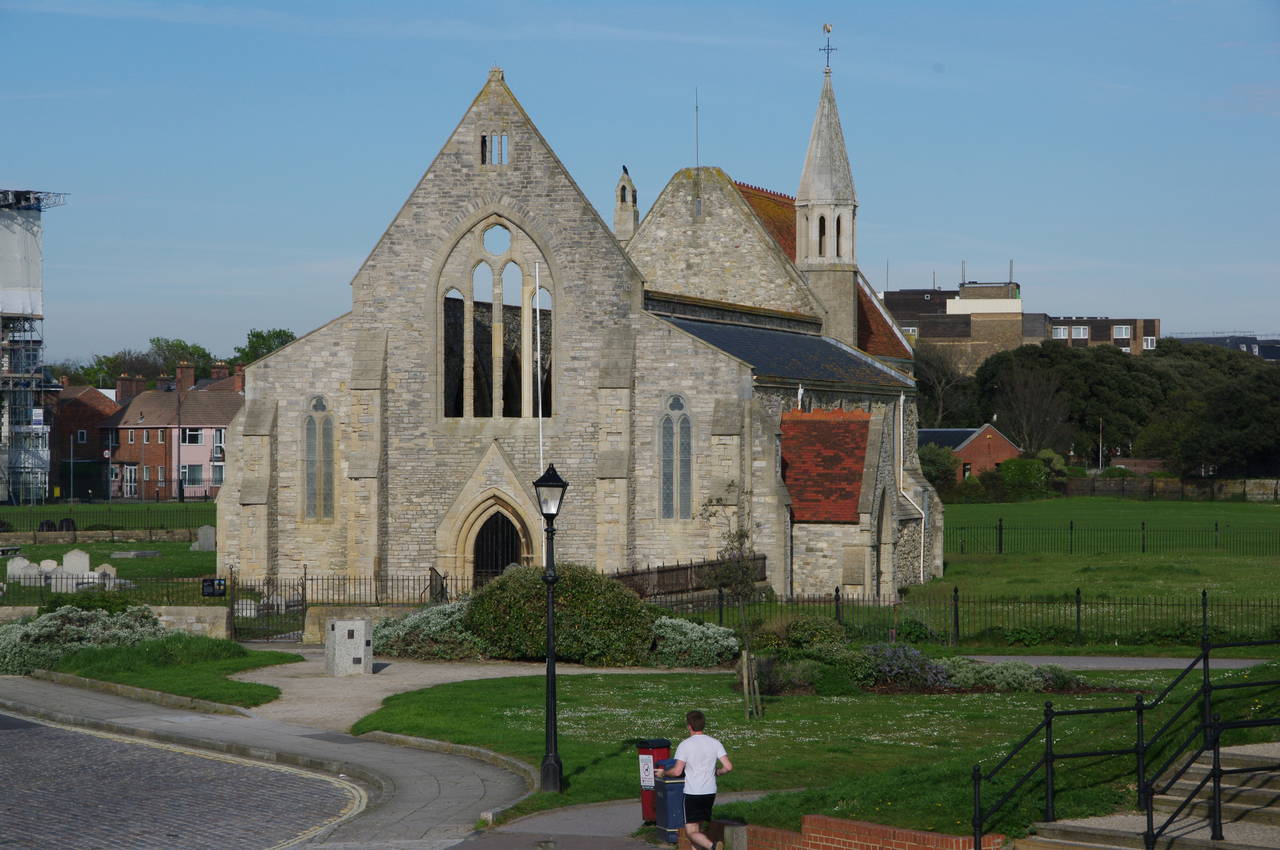
Across the moat stands the shell of the Royal Garrison Church (picture 31), built in 1212. The roof and the interior of the church were destroyed by German bombs on the 10th of January 1942. Due to its importance as a naval base, Portsmouth came under particularly heavy attack during World War II and many of its historic buildings did not survive.
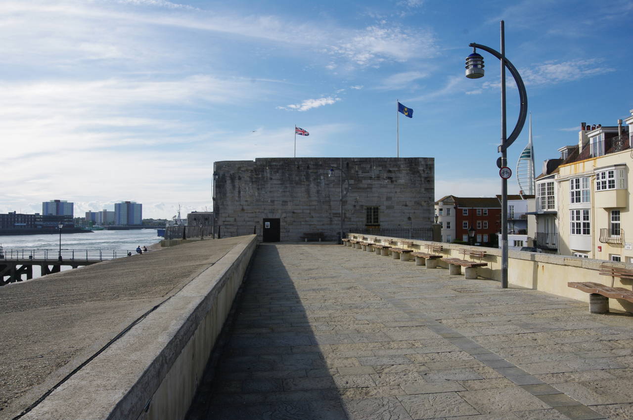
The next section of the sea wall, beyond the end of the moat, is known as the Saluting Platform and leads to the Square Tower (picture 32). The tower, built in 1494, stands by the narrowest part of the entrance to Portsmouth Harbour, which is barely 200 metres wide at this point.
(33) Portsmouth Harbour Station

(34) HMS Warrior 1860
(35) HMS Victory, Portsmouth Historic Dockyard
(36) On board HMS Victory
On the other side of the Square Tower, the Solent Way leaves the waterfront and goes down some steps, crossing Broad Street and heading along White Hart Road. In two hundred metres, White Hart Road becomes Gunwharf Road and passes the high brick wall of the Wightlink Ferry Terminal, where a long queue of cars were lined up waiting to get on the next vehicle ferry to Fishbourne on the Isle of Wight.
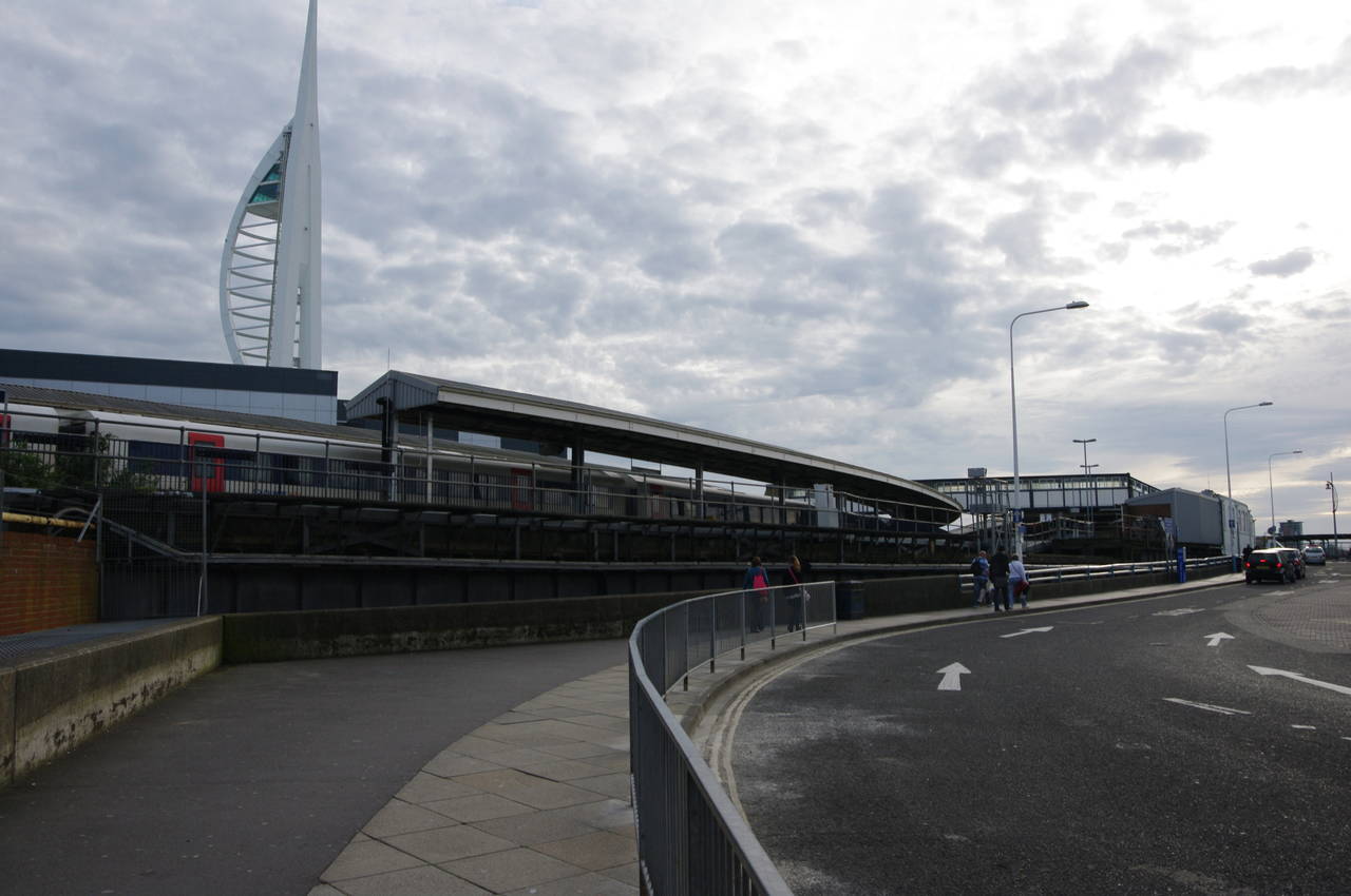
Gunwharf Road soon bends to the right before reaching an intersection where the Way turns left onto the B2154 Ordnance Row. This road is followed under railway lines and then to the left to follow them around to the front of Portsmouth Harbour Station (picture 33) and the end of this 26.4 kilometre stage of the walk in the shadow of the Spinnaker Tower.
From the station forecourt, there are good views of HMS Warrior 1860 (picture 34), which is permanently moored at the Portsmouth Historic Dockyard. The Warrior was the world's first armour-plated warship, powered by both steam and sail.
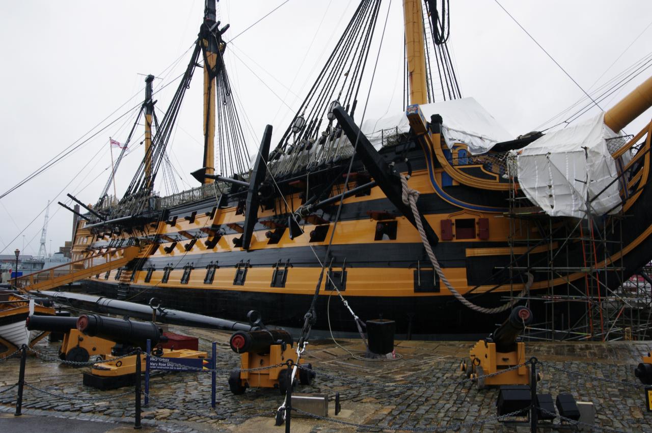
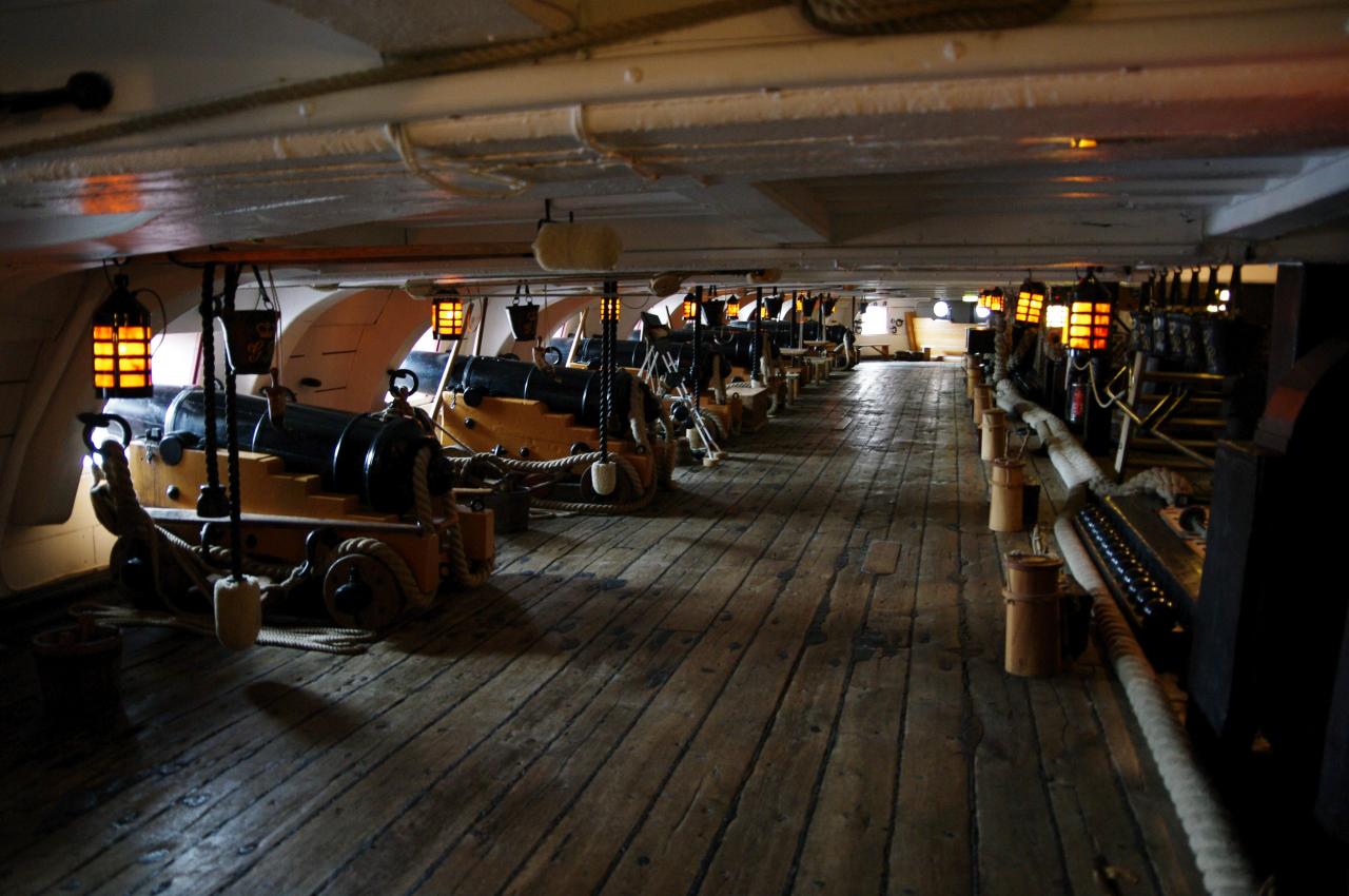
The Historic Dockyard is also home to HMS Victory (picture 35), launched in 1765 and the flagship of Lord Nelson's fleet at the Battle of Trafalgar in 1805. After completing the remainder of the Solent Way, I returned to Portsmouth and spent a day at the Historic Dockyard, where one can explore on board both of these magnificent and fascinating ships (picture 36) as well as seeing the remains of Henry VIII's flagship, the Mary Rose, which sank in the Solent in 1545 and was raised from the seabed 1982. The ticket also includes a cruise around the harbour to look at some of Britain's modern warships.