ISLES OF SCILLY WALKS
Stage 4: Tresco
Wednesday, September 19, 2018
(1) New Grimsby Quay
(2) New Grimsby
(3) Castle Down
(4) New Grimsby Sound
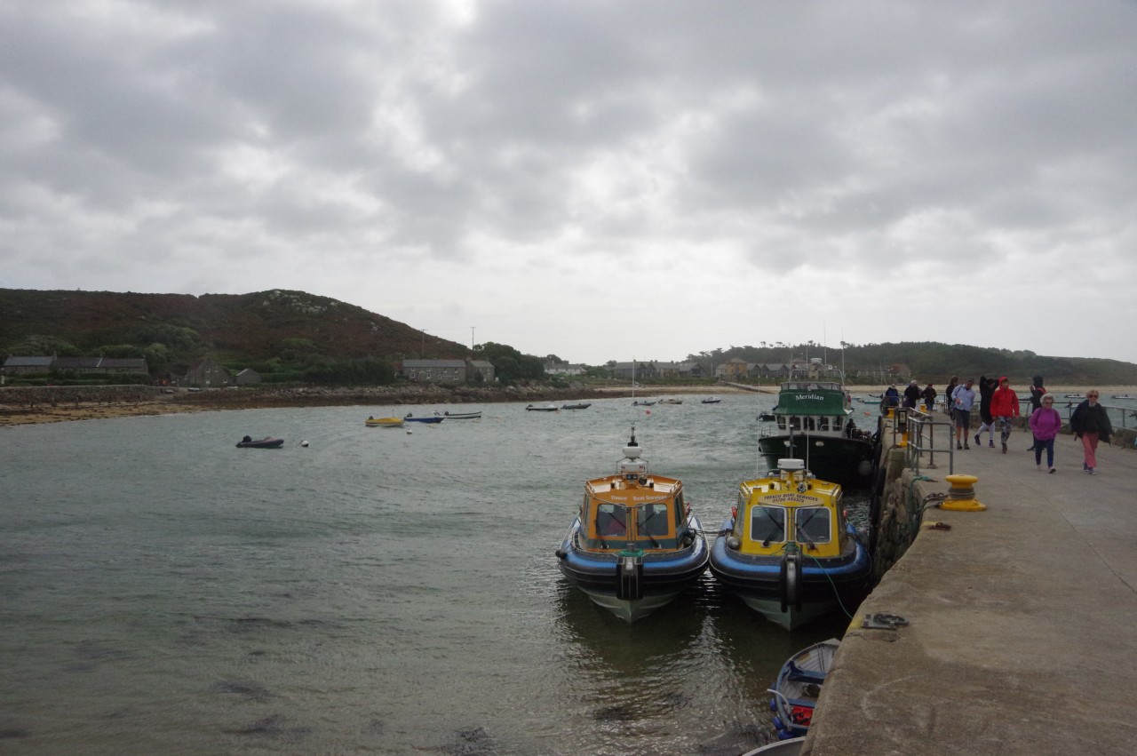
It was overcast and rather cold when I boarded the Meridian for the short trip from Hugh Town over to New Grimsby Quay on Tresco (picture 1). The boat journey was very similar to the previous morning, as New Grimsby Quay is opposite Bryher's Church Quay, though the sea was rougher and most of the passengers got a little wet.
Tresco is the most populous of the off-islands, with around 175 permanent residents, though that is less than half of the population of the island in the mid-1800s. Similar to Bryher, the northern third of Tresco is a boulder-strewn moorland. The residents live in the relatively sheltered middle third of the island, while the lower third is mainly heather-covered sand dunes.
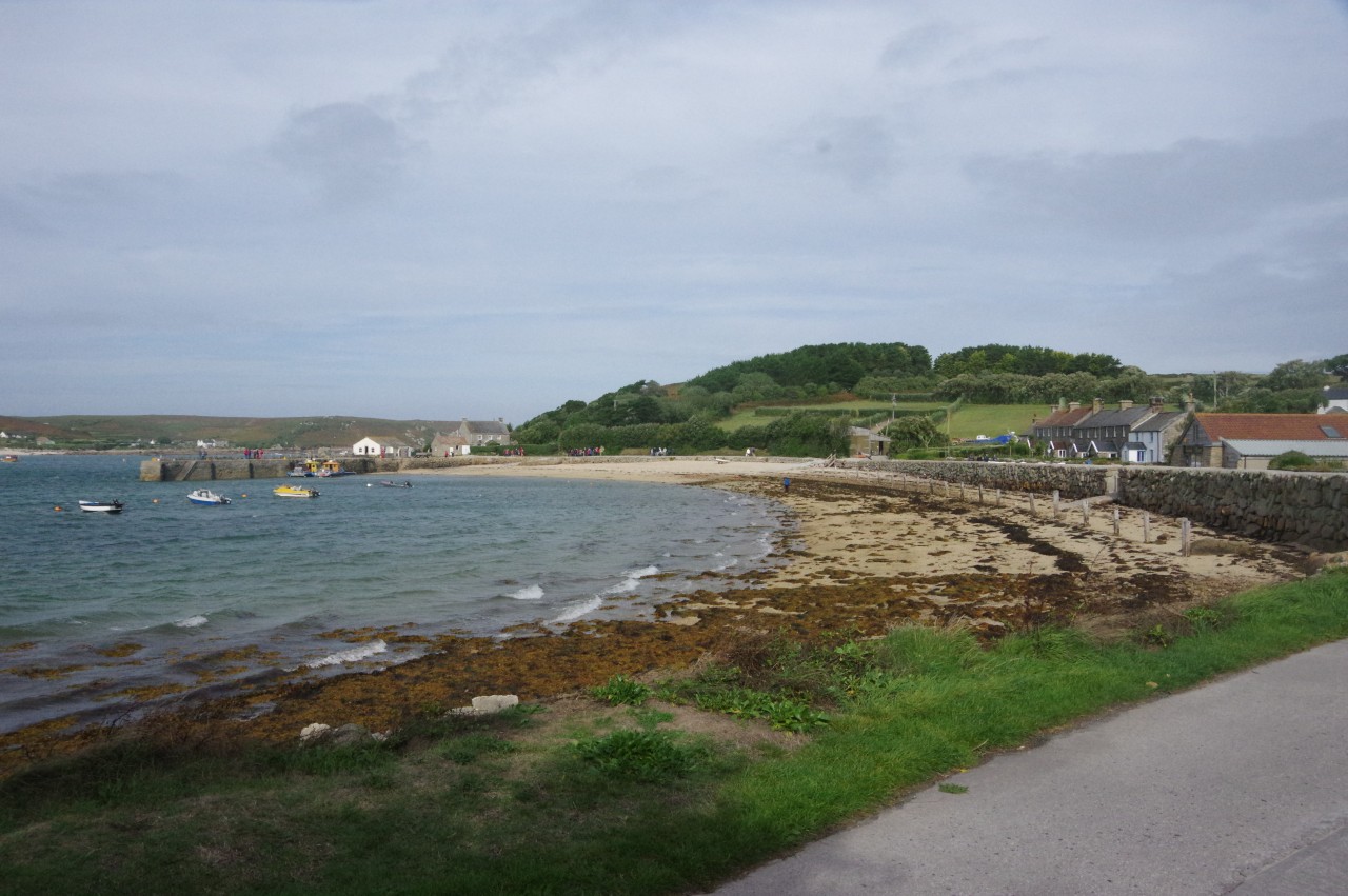
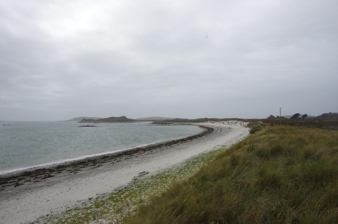
Before heading off on my walk around the island, I first walked down the road to collect some supplies from the Tresco Stores and then walked back around the beach to return to the quay (picture 2).
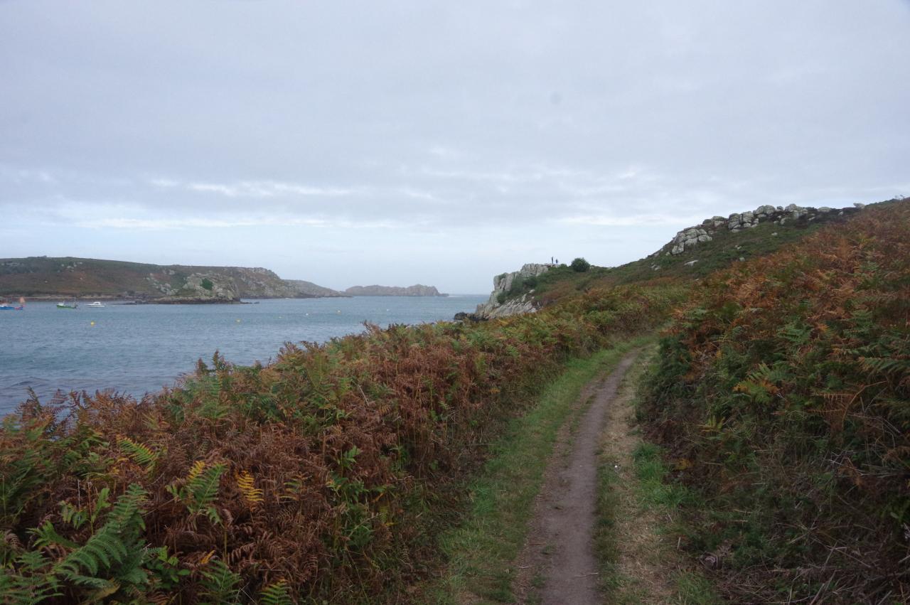
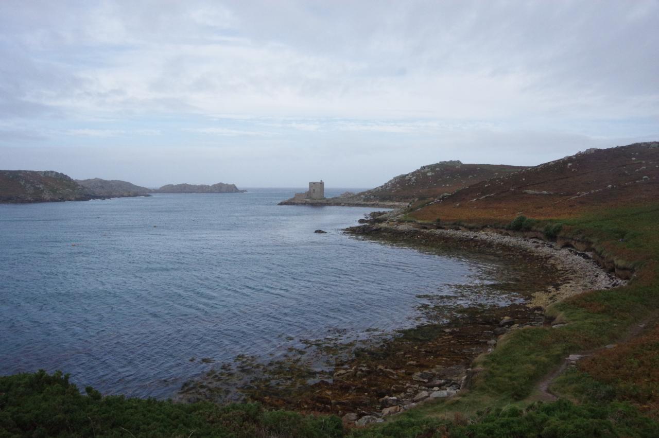
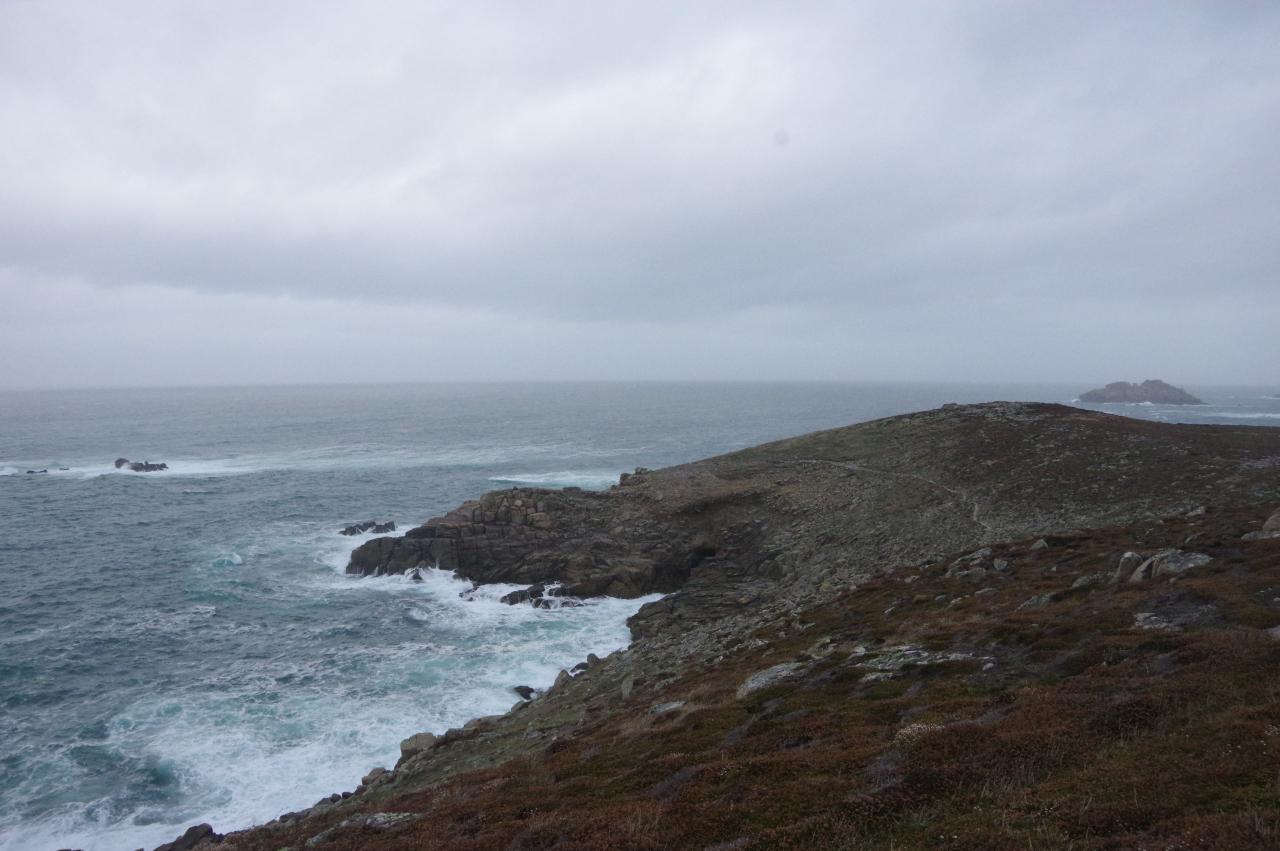
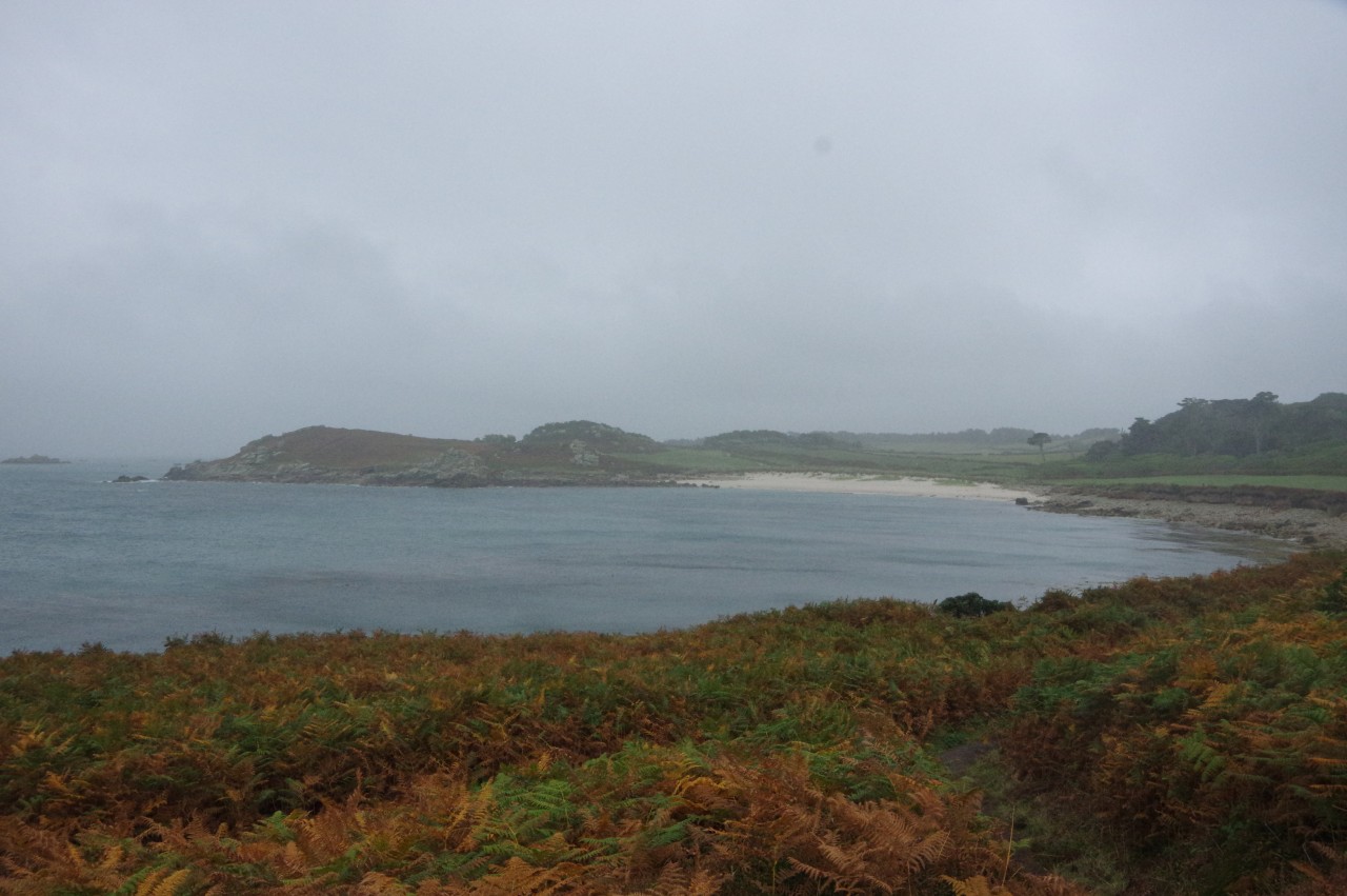
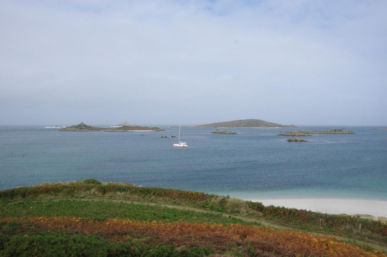
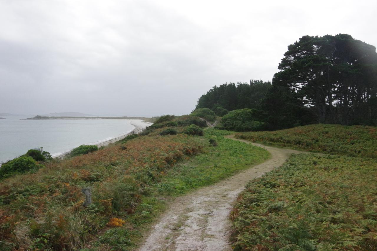
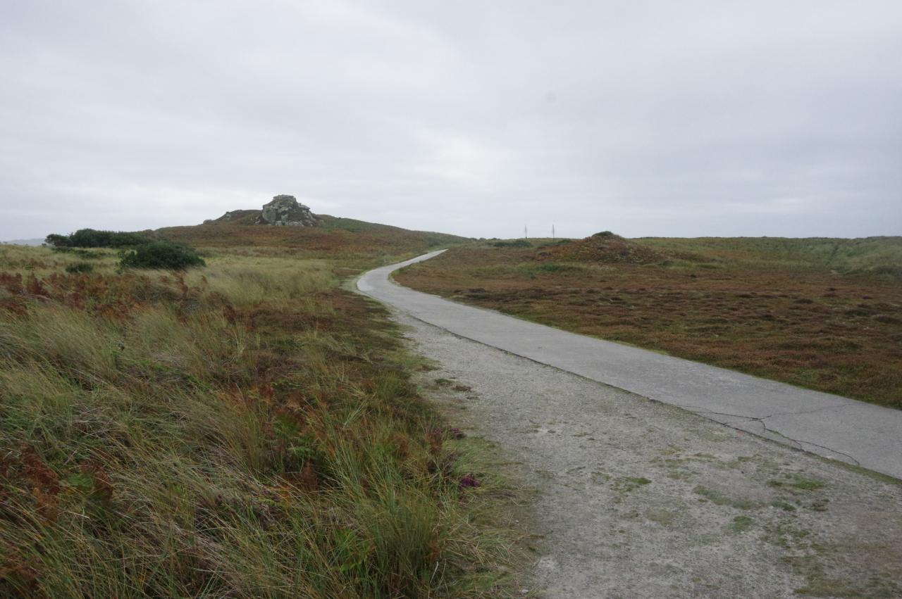
At the top of the quay, a path heads to the right of the public conveniences to run along the edge of the bracken-covered Castle Down beside New Grimsby Sound (picture 3). When the path climbs up a low ridge to the granite tor of Braiden Rock, there is a good view back over the harbour towards The Garrison, St Agnes and Samson (picture 4). Beside the path here is a plaque describing the activities of a group of British fishing boats that were based in New Grimsby Sound in the middle of the Second World War. Maps of German defences on the French coast were smuggled across the Channel by those boats and provided vital information for D-Day.
(5) New Grimsby Sound
(6) Cromwell's Castle
(7) View towards Shipman Head
(8) Castle Down and Gun Hill
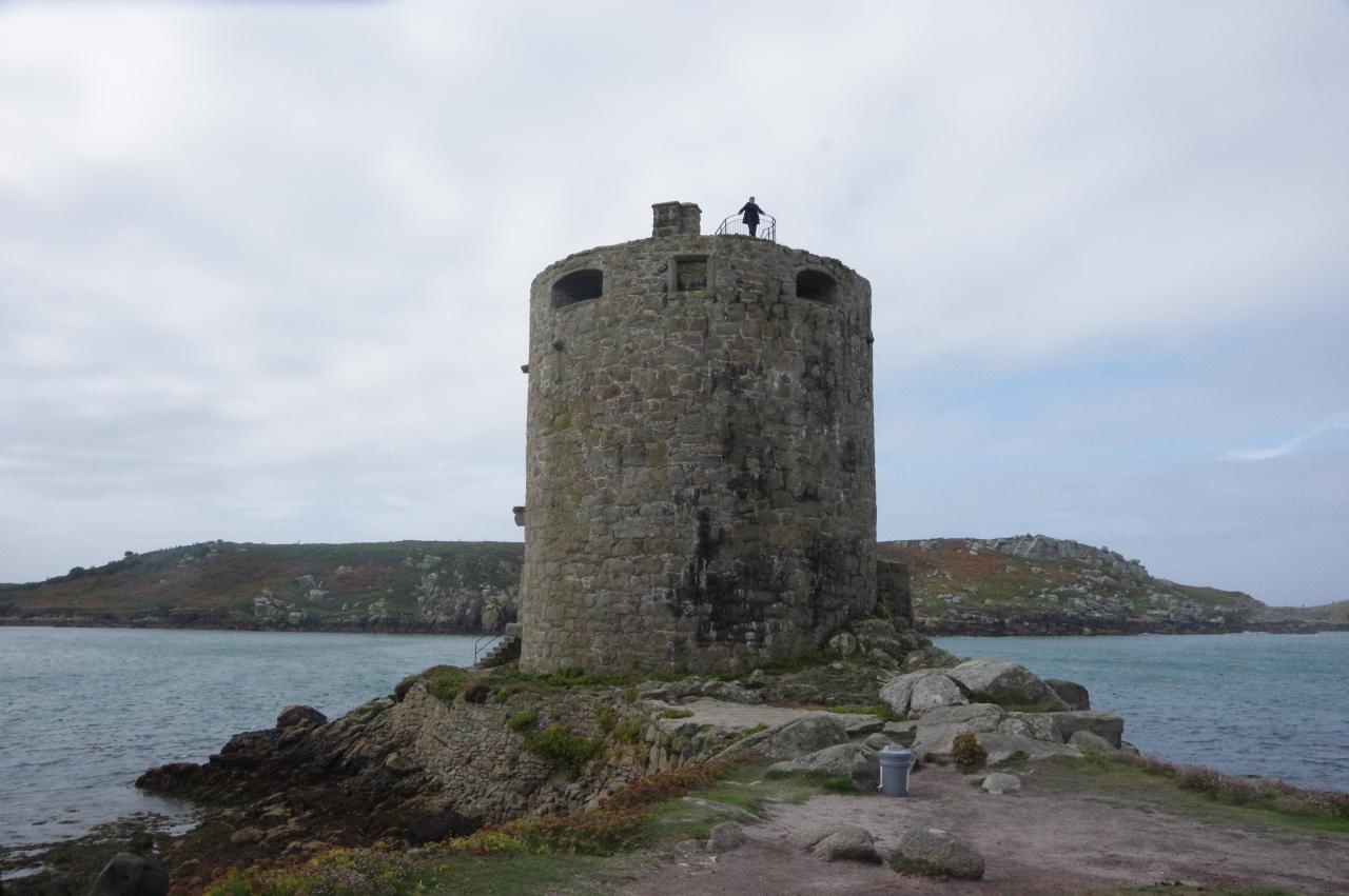
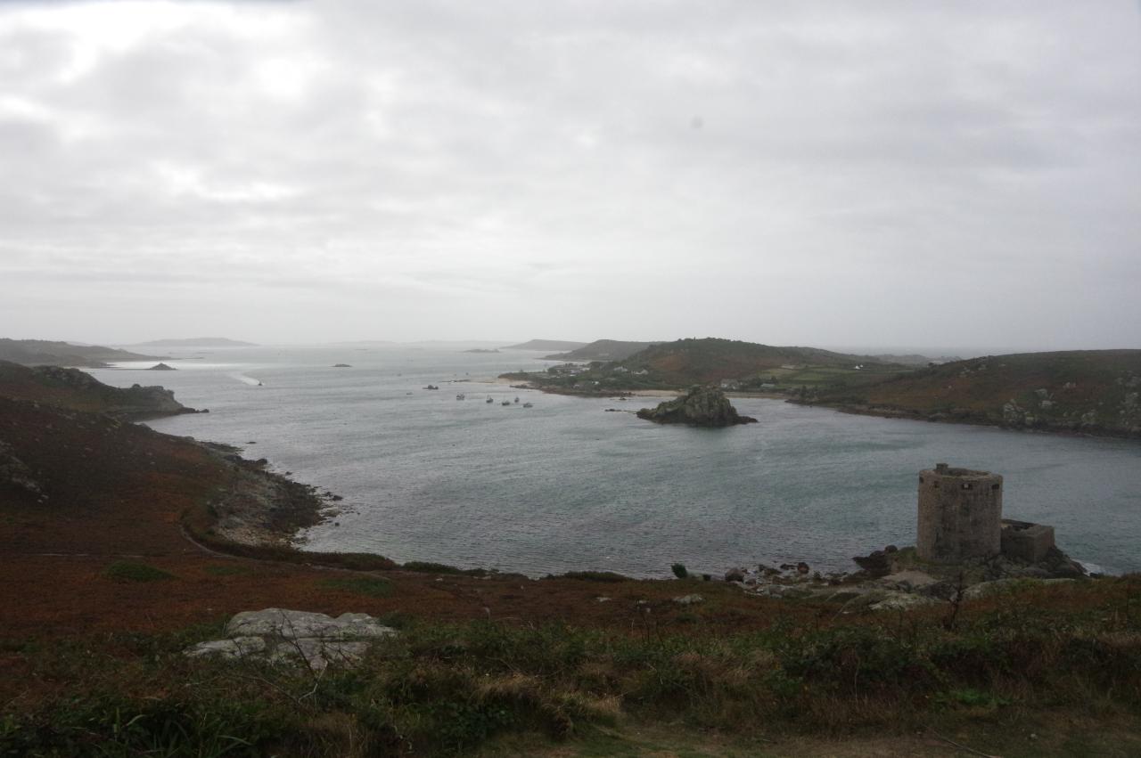
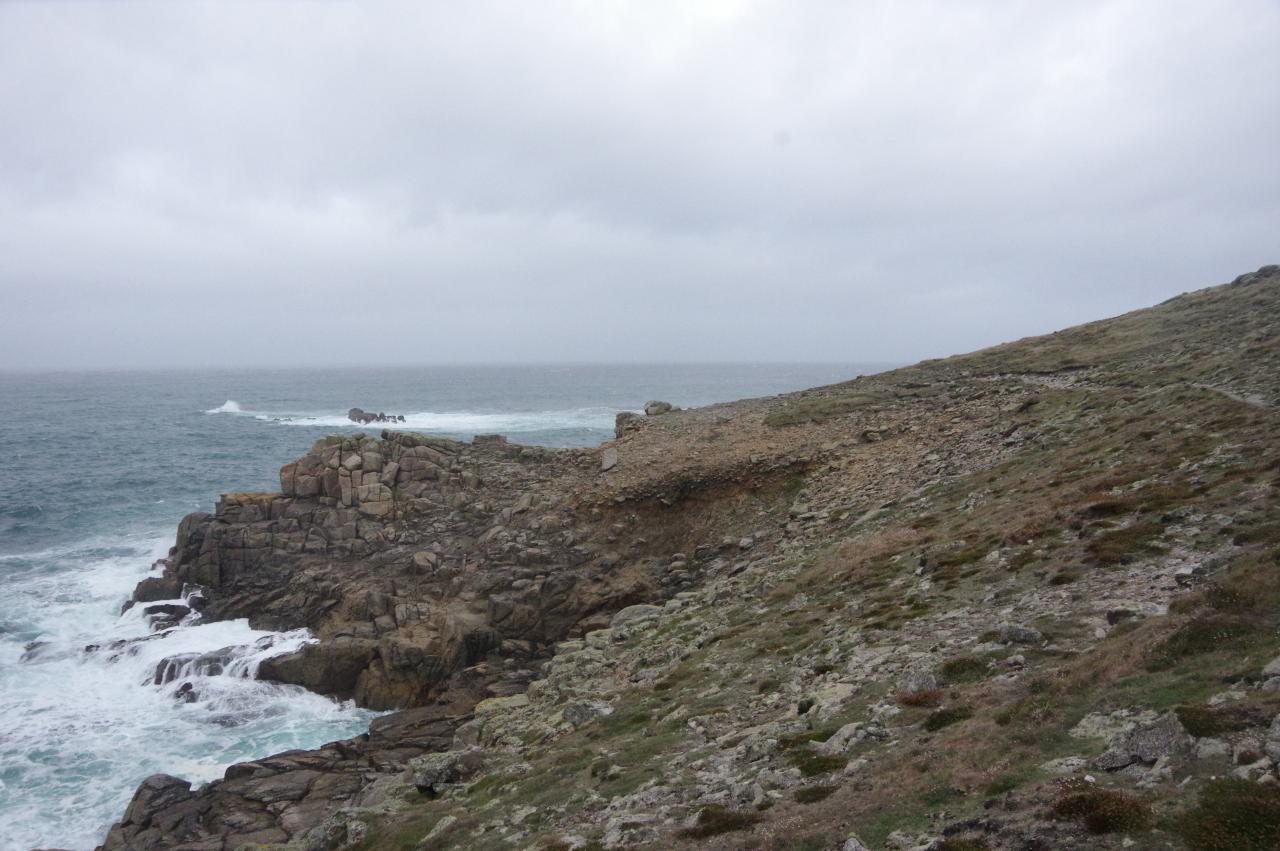
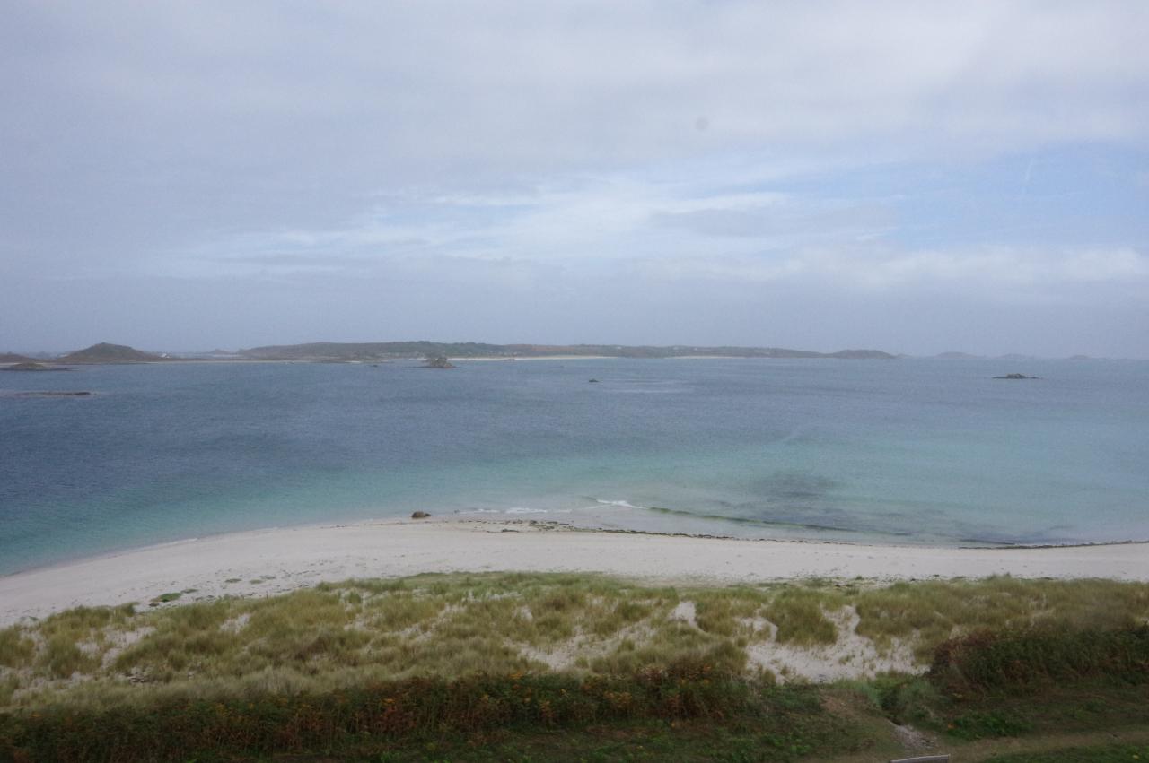
As the path dips down again, the view ahead along the New Grimsby Sound is dominated by the round tower of Cromwell's Castle standing on a low point on the far side of Castle Porth (picture 5). The path follows the shoreline up to the castle (picture 6), which is open to the public and worth exploring.
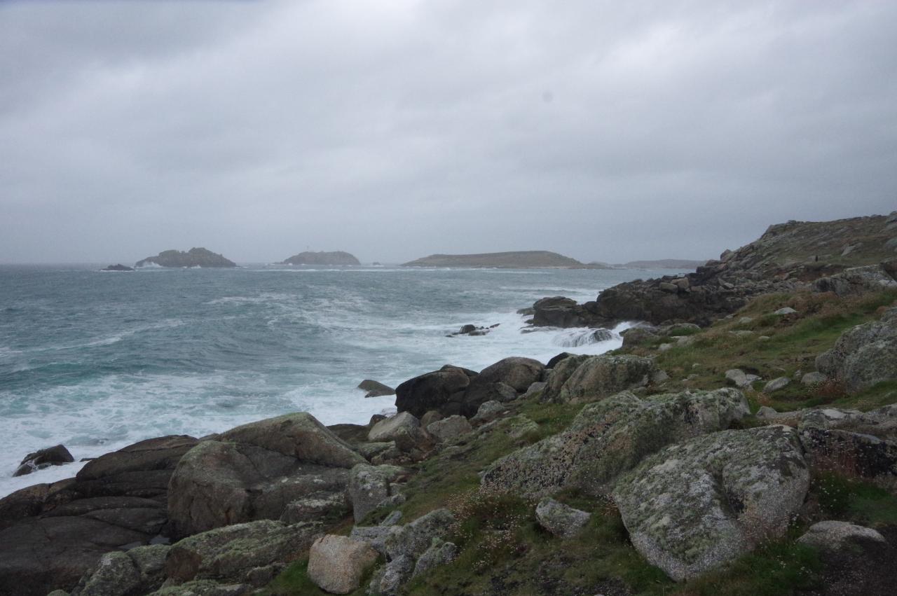
The tower was built by the Parliamentarians in 1651-2 after they captured the Isles of Scilly from the Royalists late in the English Civil Wars. The gun platform on top of the castle has clear views all the way along New Grimsby Sound, including to Shipman Head on Bryher (picture 7) and the bouldery slope of Castle Down (picture 8), where the coastal path goes next.
(9) King Charles' Castle
(10) King Charles' Castle
(11) New Grimsby Sound
(12) View to Shipman Head from Gimble Point
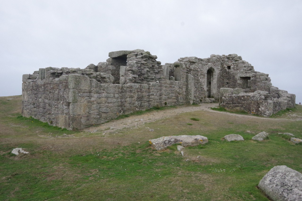
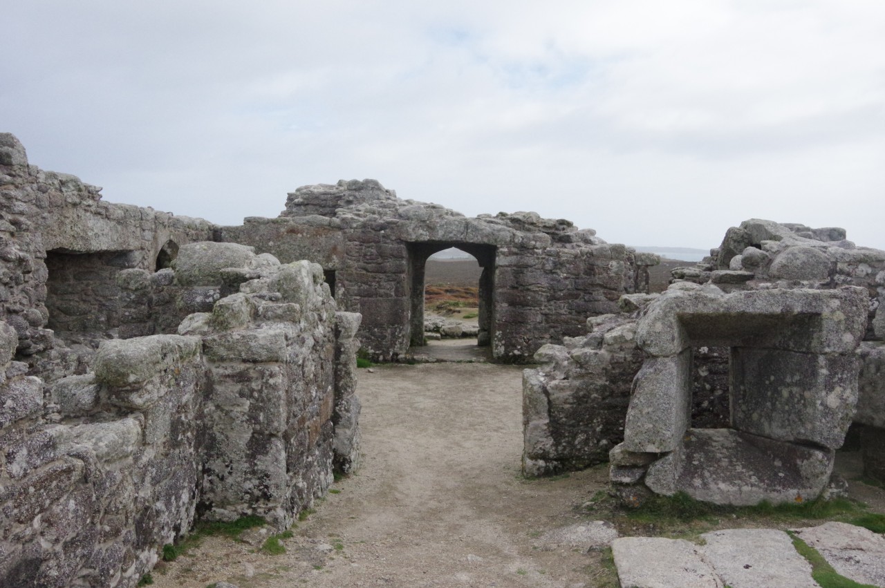
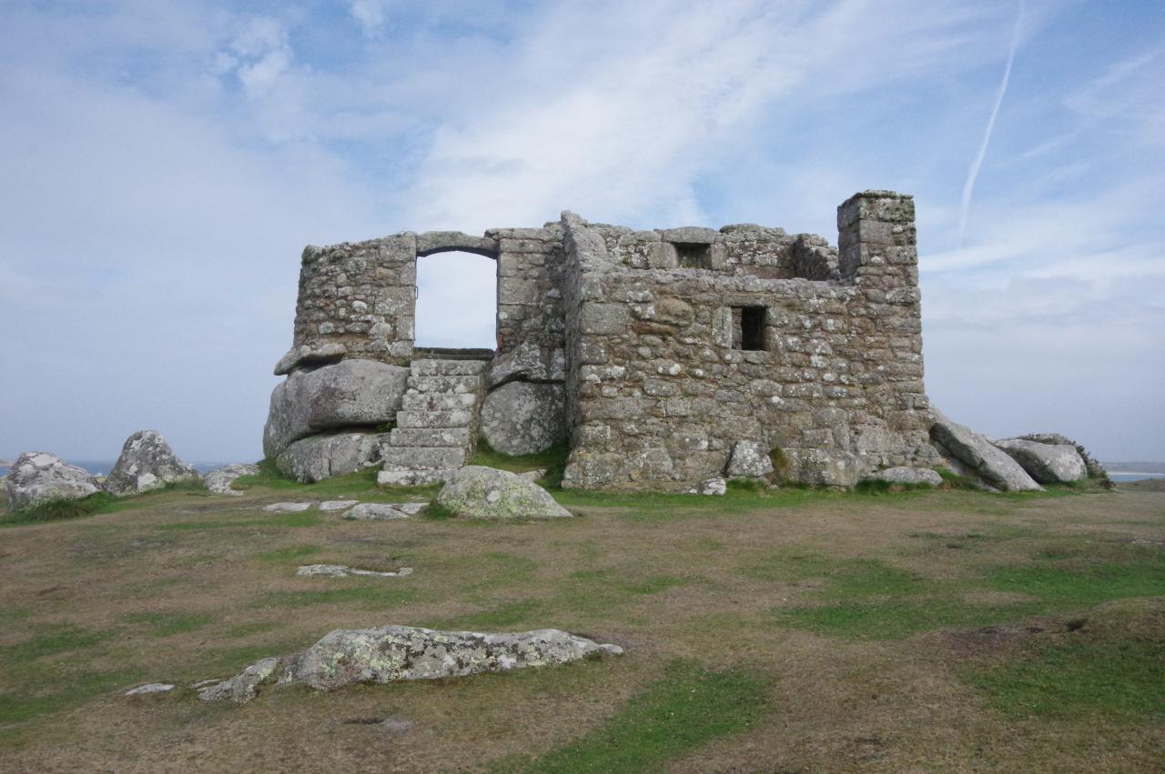
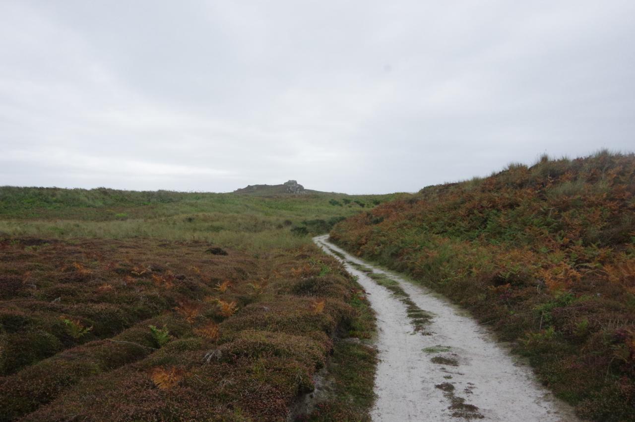
A rough path leads up the slope to the top of Castle Down and the ruins of King Charles' Castle (picture 9). As I climbed up the hillside and lost the shelter provided by the bulk of Bryher across the Sound, the wind blowing in from the west proved to be very strong and very cold, encouraging me to go inside the ruins for a while (picture 10).
King Charles' Castle is about a century older than its neighbour, having been built in the early 1550s on the 43-metre high peak with an excellent view of the Sound (picture 11). This site was not entirely suitable, however, as the castle's guns couldn't be aimed downwards at targets in the harbour directly below. When the islands fell to the Parliamentarians, the retreating Royalists destroyed part of the castle and later some of the stone was taken down the hill to build Cromwell's Castle.
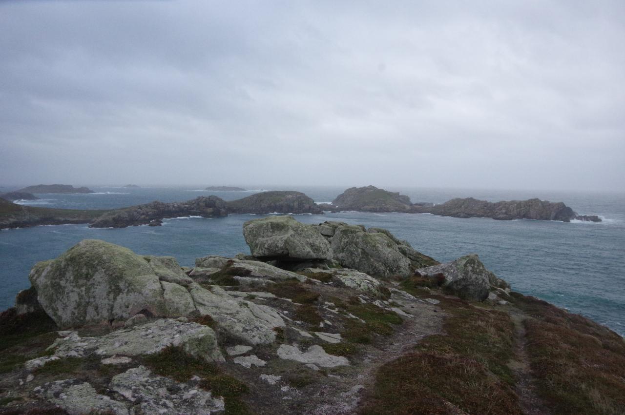
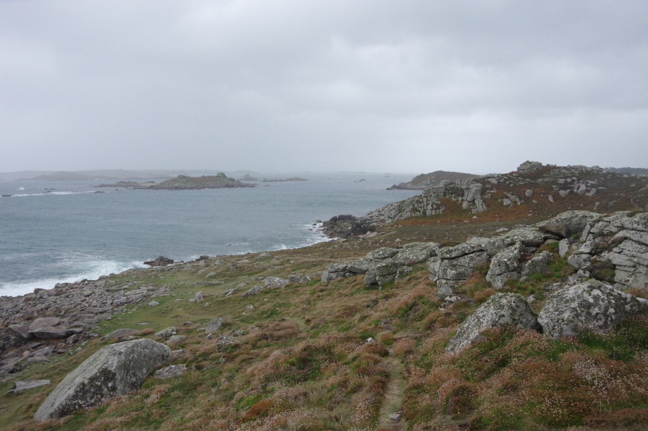
The coastal path continues along the ridge to Gimble Point, Tresco's closest point to Shipman Head (picture 12). Walking into the stiff wind was a bit of an effort here and the wind chill was making the 'transitions' coating on my glasses turn almost black and I found it easier to walk without them.
(13) Gun Hill
(14) Kettle Point
(15) Men-a-vaur, Round Island and St Helen's
(16) Tregarthen Hill
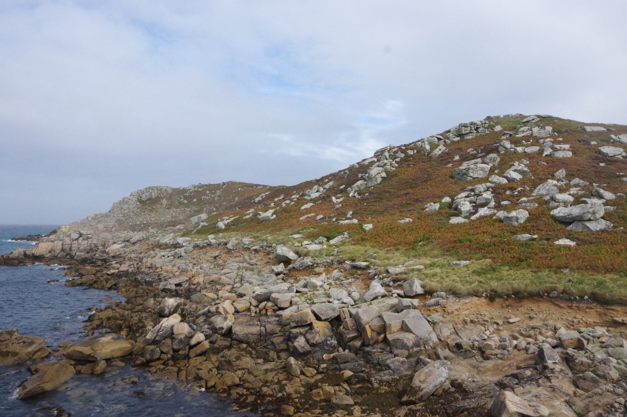
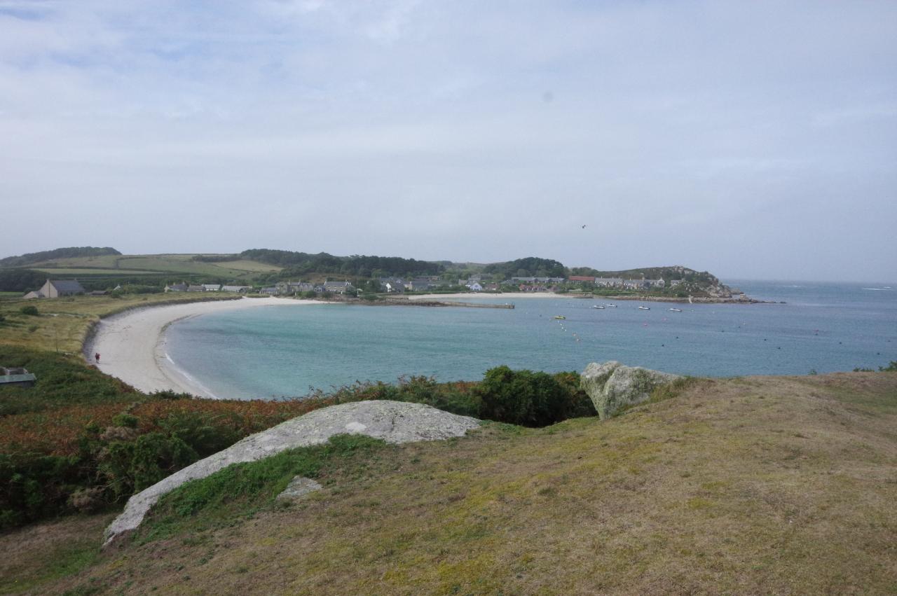
The path continues over the shoulder of Gun Hill (picture 13) to Kettle Point (picture 14), turning along the north end of the island where the three uninhabited islands of Men-a-vaur, Round Island and St Helen's come into view (picture 15). After dipping down to the shore, the path passes the site of an old tin mine before climbing again to round the north-east corner of the island above Piper's Hole, a sea-cave that extends fifty metres into the hill. Due to the hostile weather, I didn't attempt the scramble down the rocks for a look inside the cave.
Now on the flank of Tregarthen Hill, another little island, Northwethel, is visible in front of St Martin's, though it had started to rain and the latter soon disappeared from view (picture 16).
(17) Gimble Porth
(18) Gimble Porth
(19) Merchant's Point

(20) Raven's Porth
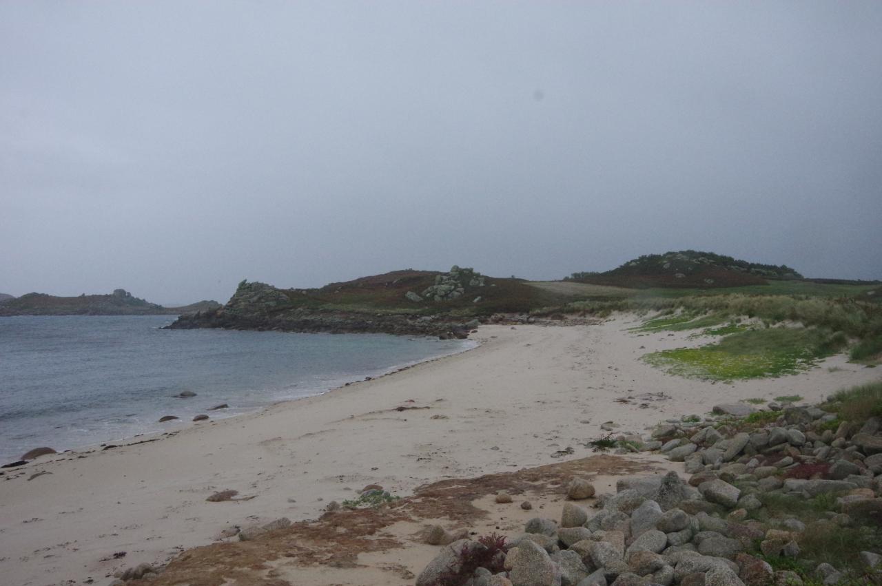
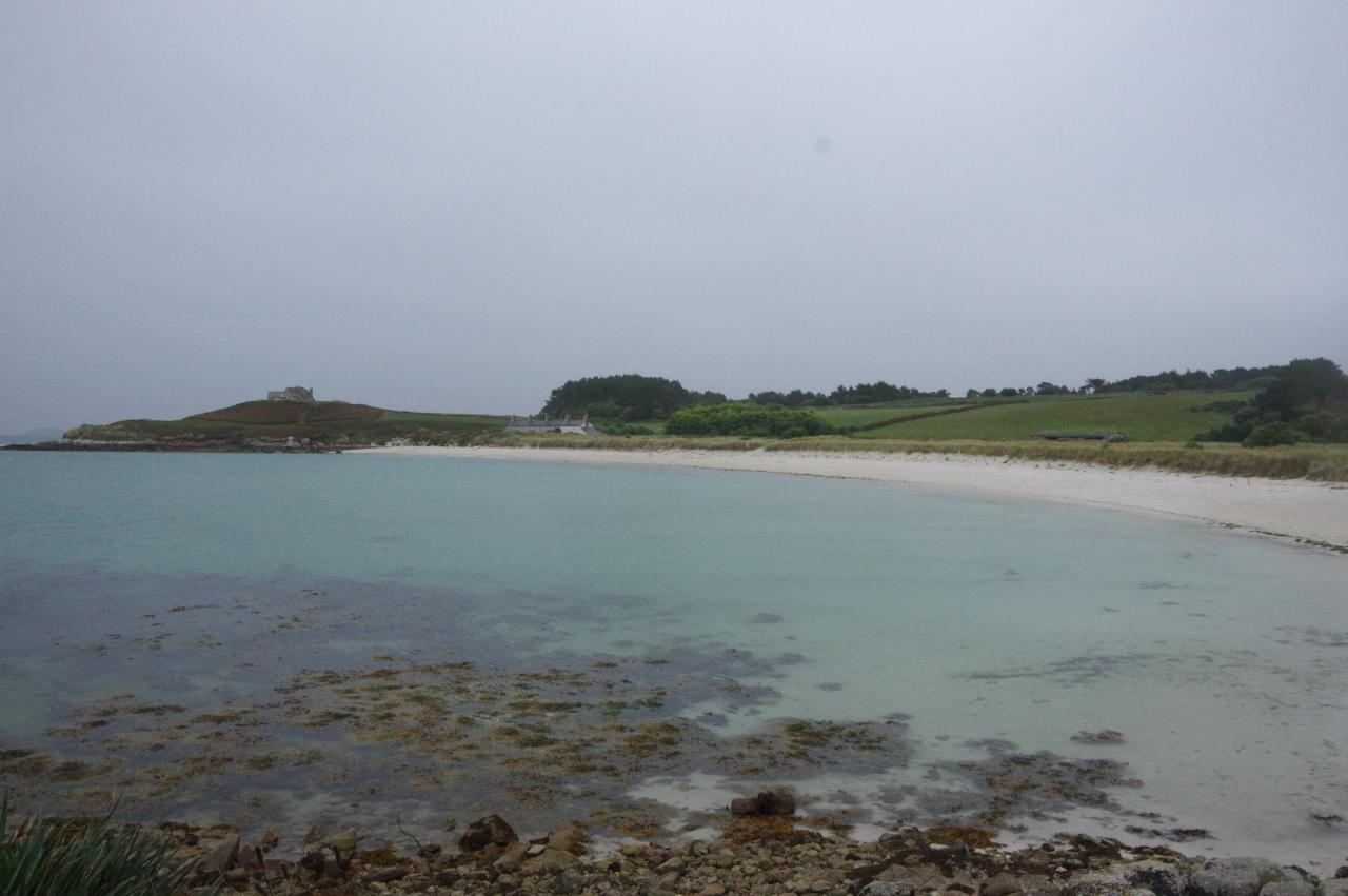
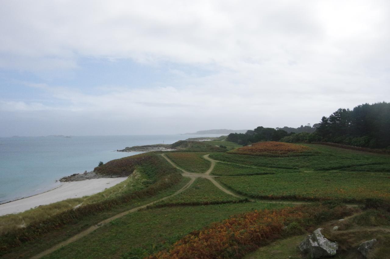
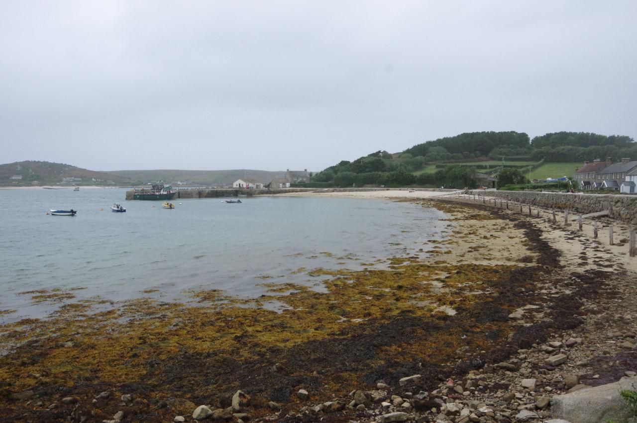
Ahead, the path passes an old tin-mining pit before bearing inland to climb over a low ridge and descend through bracken to the edge of Gimble Porth (picture 17). The path skirts around the bay to the small beach on the far side (picture 18), from which a track cuts across Merchant's Point (picture 19). The track reaches the settlement of Old Grimsby, going ahead at a crossroads to reach the edge of the sandy Raven's Porth (picture 20).
(21) Old Grimsby Quay
(22) Green Porth
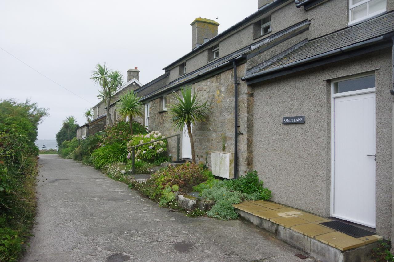
(23) Sandy Lane
(24) Old Blockhouse
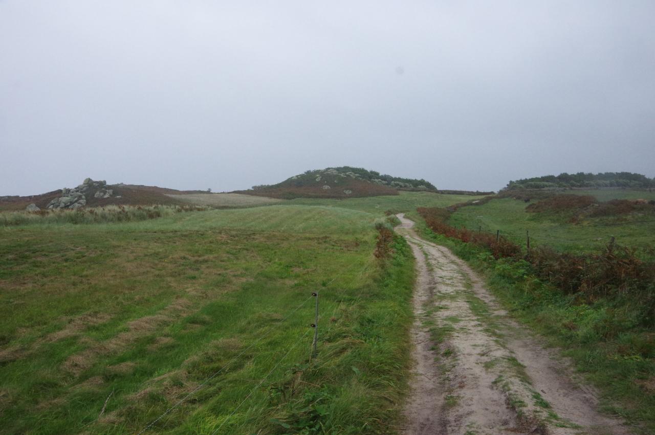
A concrete path runs past beachside houses to Old Grimsby Quay (picture 21), which separates Raven's Porth from Green Porth (picture 22). From the quay, the coastal route turns up Sandy Lane to pass a row of cottages (picture 23) then turns left along another lane. Around 250 metres along the lane a track on the left leads past Blockhouse Cottages to a fork and the left branch soon leads to another fork. The coastal path goes left here to skirt around Blockhouse Point, but first I went straight ahead to climb up to the Old Blockhouse on top of Tommy's Hill (picture 24).
The Blockhouse was built against the tor on the crown of the hill around 1550 to defend Old Grimsby, which was Tresco's main harbour at the time. In 1651, late in the English Civil Wars, the Blockhouse saw action when the Isles of Scilly, which had been loyal to the Crown, were captured by the Parliamentarians.
(25) View back to Old Grimsby
(26) Northwethal and St Helen's
(27) Tean and St Martin's
(28) Cradle Point and Rushy Point
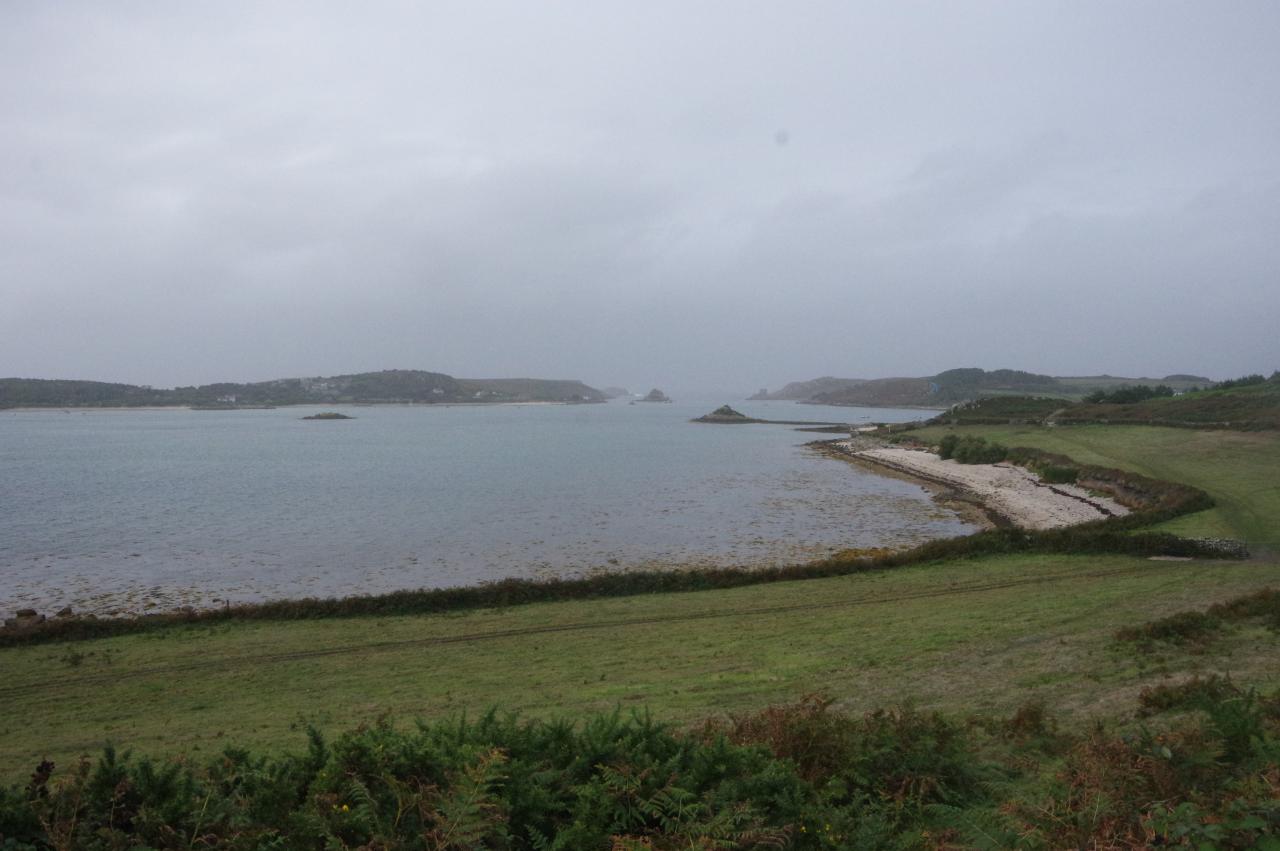
Fortunately, both the rain and the biting wind had subsided and I was able to pause on the gun platform on top of the Blockhouse to eat my sandwiches and admire the view. To the north-west, one can look over Old Grimsby (picture 25), to the north are the bird sanctuaries of Northwethal and St Helen's, with the Round Island Lighthouse peaking over the top (picture 26), and to the north-east are Tean and the long white sand beaches on the south side of St Martin's (picture 27). All of those islands were populated from the Bronze-Age, and still have the remains of burial chambers, hut circles and early-Christian chapels, but all except St Martin's were abandoned in medieval times due to rising sea levels.
After descending from the Blockhouse to skirt around the foot of Tommy's Hill, the coastal path follows the leftmost of several available paths over the heathery slopes of Cradle Point and on past a sandy beach to Rushy Point (picture 28).
(29) Lizard Point
(30) Pentle Bay
(31) Bathinghouse Porth
(32) Abbey Pool
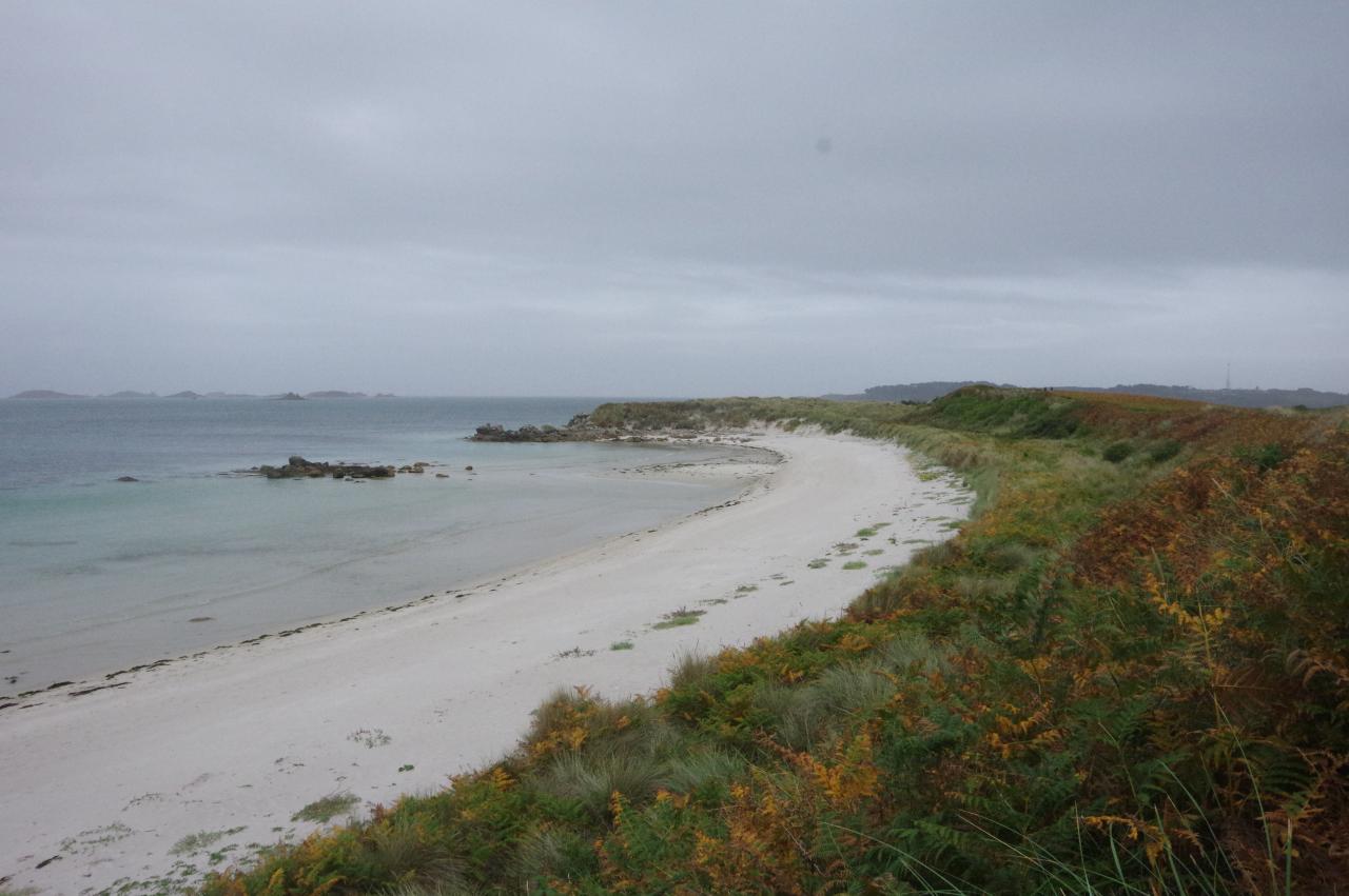
Another lovely beach is passed on the way to Lizard Point and the Eastern Isles can be seen off to the left (picture 29). The well-worn trail through the bracken is very soft and sandy in places where the grass has worn away as the south end of Tresco is primarily made up of sand dunes.
The path cuts across Lizard Point to circle the much larger beach of Pentle Bay (picture 30). At the far end of the bay, the path joins a broader track that passes a shed and a large woodpile, cutting across the next point, a finger of land called Skirt Island (despite being attached to Tresco) at the south-east corner of the island.
The next bay, Bathinghouse Porth (picture 31), faces the north coast of St Mary's, while inland across the dunes is the Abbey Pool and the buildings of Tresco Abbey (picture 32).
(33) Appletree Banks
(34) Carn Near
(35) Carn Near Quay
(36) Appletree Bay
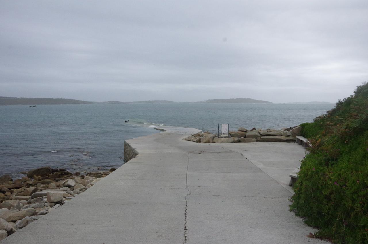
The track loses sight of the beach as it dips down behind a dune and crosses Appletree Banks (picture 33), a curious name as there are no trees on the dunes. Eventually the track bears left at a fork and soon bears left a second time to follow a narrow concrete lane past the tor of Carn Near (picture 34) and down to Carn Near Quay (picture 35). The quay, at Tresco's south-western tip, is the island's low-tide landing point.
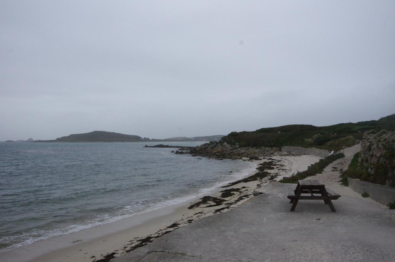
The only way to go from here is back up the lane. Halfway back to where I had joined it, a sandy path on the left sets off across Rushy Bank, eventually meeting a concrete track that heads left a short distance down to Appletree Bay (picture 36).
(37) New Grimsby Sound
(38) Great Pool
(39) New Grimsby
(40) New Grimsby Harbour
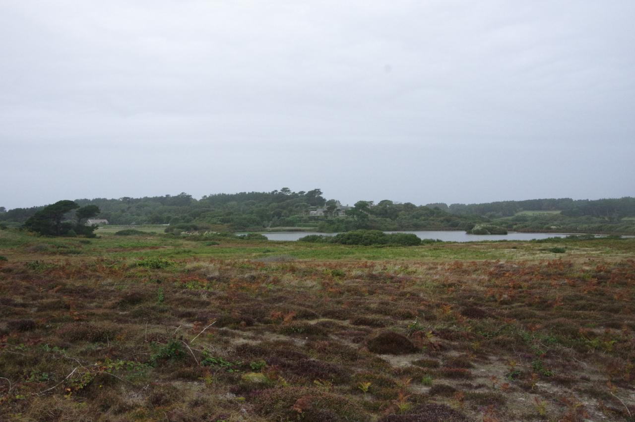
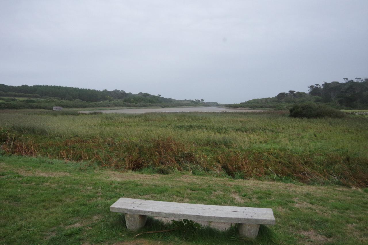
Ignoring a gap in the tall stone wall behind the beach, the coastal route follows a sandy path atop a low sea-wall and past a wooden shed to join Appletree Road. The narrow ribbon of crumbling concrete snakes along the hillside above fields with a good view along New Grimsby Sound (picture 37) before turning right around the end of a wood and merging into Abbey Road. Just along the road is a handy bench overlooking the Great Pool (picture 38), the largest body of fresh water in the islands, stretching most of the way across Tresco.
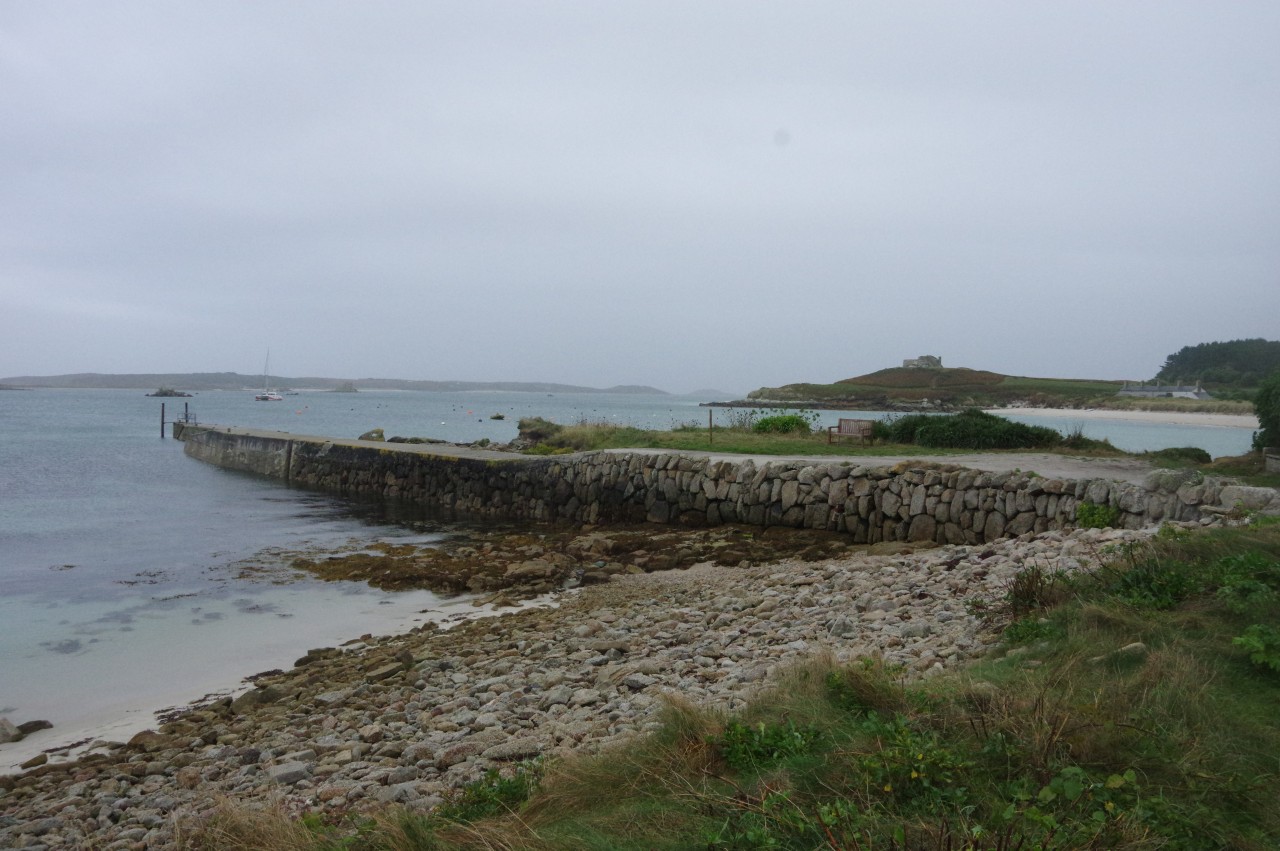
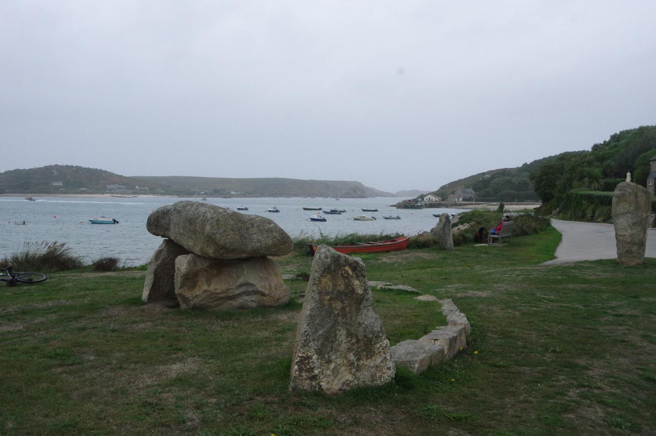
The road leads through the attractive houses of New Grimsby, returning to the coast at a stone monument by the harbour (picture 39) and then following the road around the harbour to the quay (picture 40) and the end of an 11.4 kilometre walk around Tresco.
(41) St Nicholas' Church
(42) The New Inn
(43) Smith Square
(44) Tresco Abbey
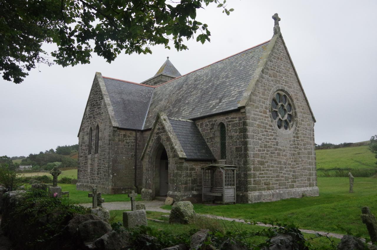
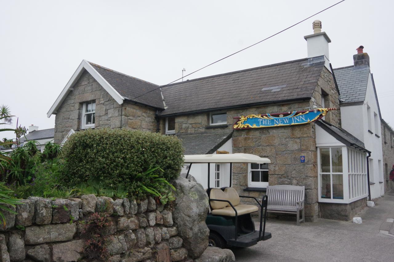
I had a couple of hours before the return boat, so I headed off along the lane linking New Grimsby to Old Grimsby. Three-quarters of the way to Old Grimsby, the Church of St Nicholas stands on the edge of a pasture (picture 41). A plaque inside shows that the church was started in 1877 and completed in 1879. Its seating capacity of 250 people is now more than the island's entire population.
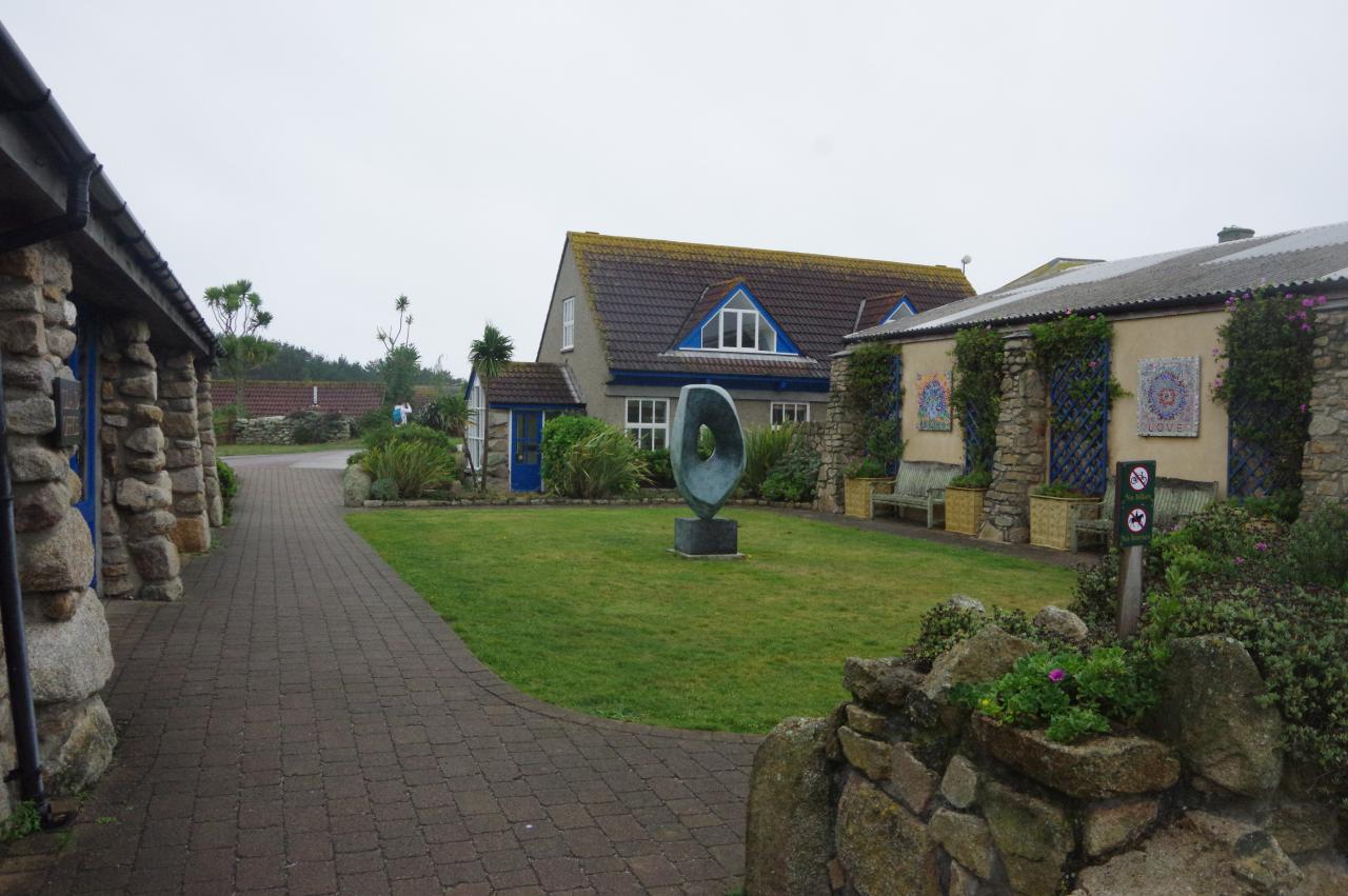
After having a good look around the church, with its impressive stained-glass rose window, I backtracked to the New Grimsby's pub, the New Inn (picture 42). Disappointingly, the pub was closed so I backtracked further to the Tresco Stores. The pleasant little square outside (picture 43) is named after Augustus Smith, who acquired the lease of the Isles in 1834 and proceeded to make a number of changes, including introducing the first compulsory schooling regime in England, establishing the local tourist industry, and planting thousands of trees on the formerly treeless Tresco.
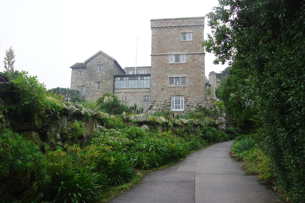
I still had just enough time to walk a brisk circuit of the Great Pool before heading for the quay. Halfway around it is the imposing Tresco Abbey (picture 44), now a private house of Augustus Smith's descendants, who are still the proprietors of the island.
(45) Tresco Abbey Gardens
(46) Tresco Abbey Gardens
(47) Tresco Abbey Gardens
(48) Valhalla
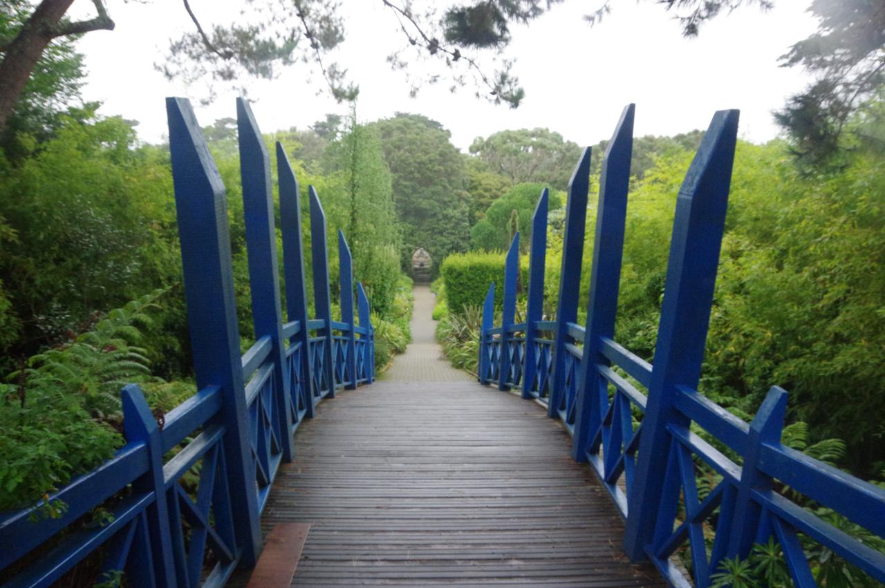
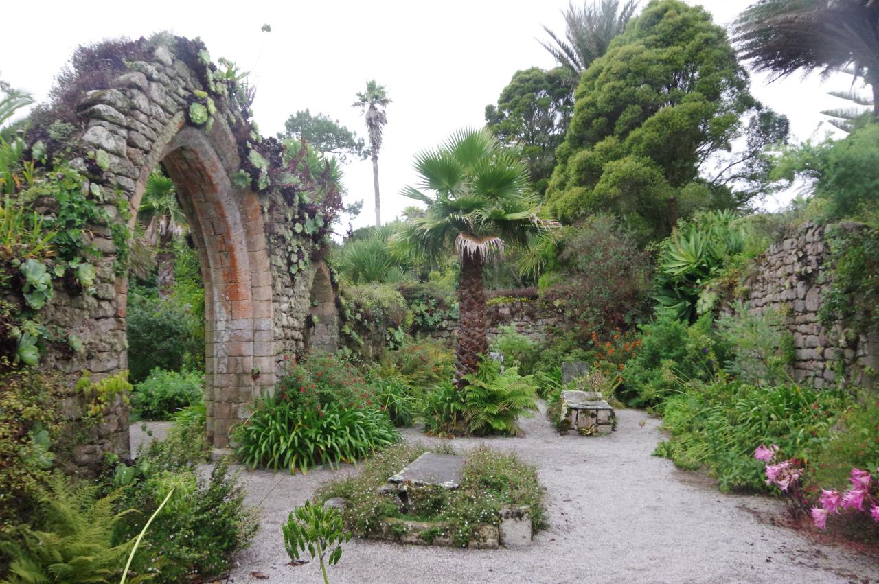
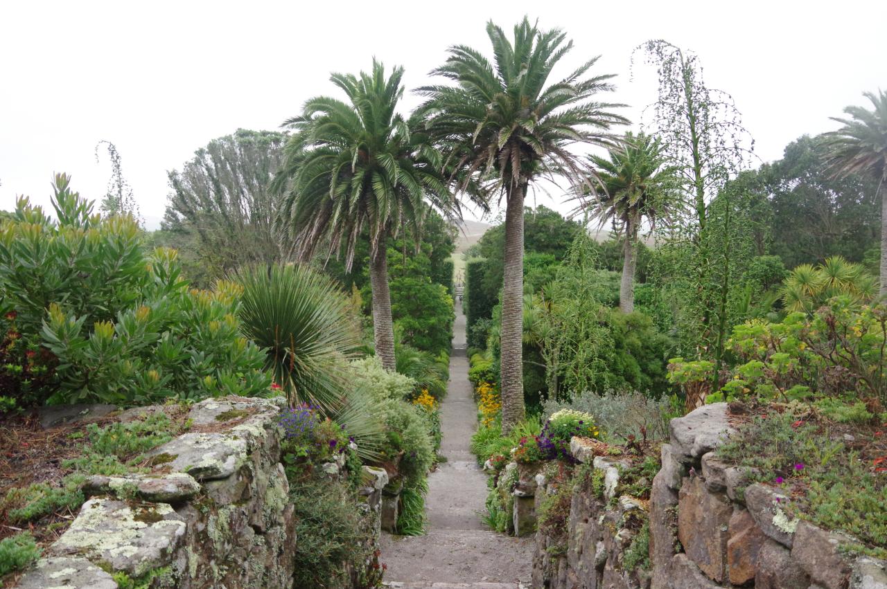
The day after this walk I returned to Tresco in similarly poor weather to spend a few hours exploring the Tresco Abbey Gardens (picture 45), which lie among the woods on the south side of the Great Pool. The world-famous subtropical gardens were created in the ruins of the 12th-century Priory of St Nicholas, which was abandoned in the 14th century after repeated raids from pirates. Parts of the runs are still visible (pictures 46 and 47).
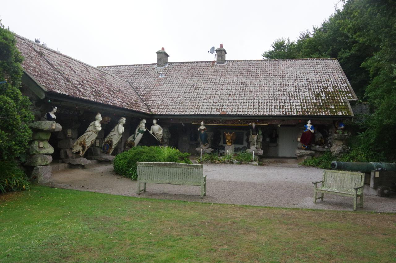
One of the interesting features of the gardens is a pavilion called Valhalla, where there is a display of figureheads salvaged from more than twenty local shipwrecks (picture 48).