TENNYSON TRAIL: Alum Bay to Carisbrooke
Saturday, May 26, 2012
(1) Needles Headland
(2) Alum Bay
(3) Hurst Castle
(4) The Needles Old Battery
The Tennyson Trail is named after the poet Alfred Lord Tennyson, who lived on the Isle of Wight for many years in the 19th century and knew the local countryside very well, once famously declaring the air to be "worth sixpence a pint".
The first few kilometres of the trail are shared with the Coast Path, which I walked a few days earlier, though I did so in the opposite direction and in somewhat hazy conditions that had curtailed some of the spectacular views that would be on offer on this fine and sunny Saturday.
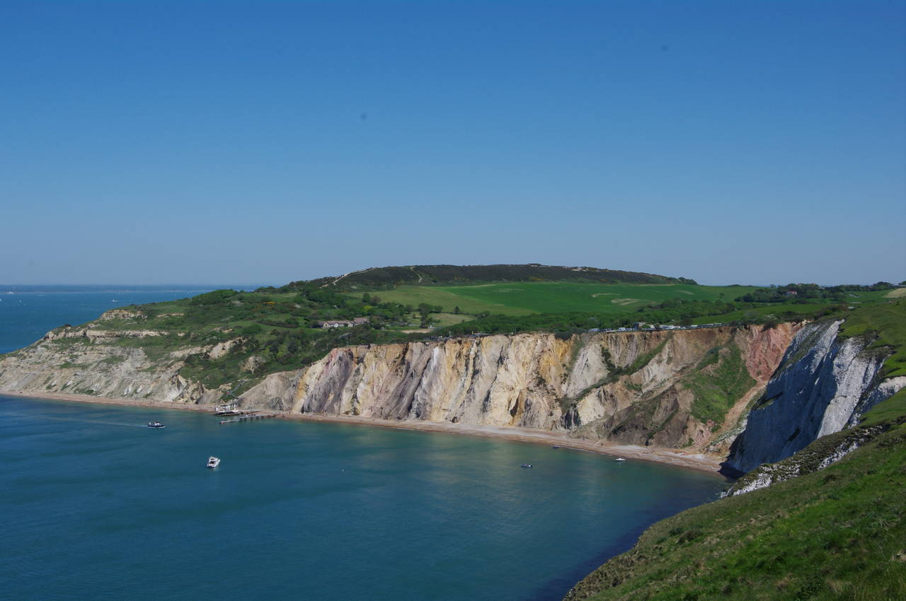
The walk starts at Alum Bay, near the western end of the Isle of Wight. Above the bay's famous coloured cliffs, the Needles Pleasure Park offers food, drink and a variety of family entertainment, as it has done since Tennyson's time.
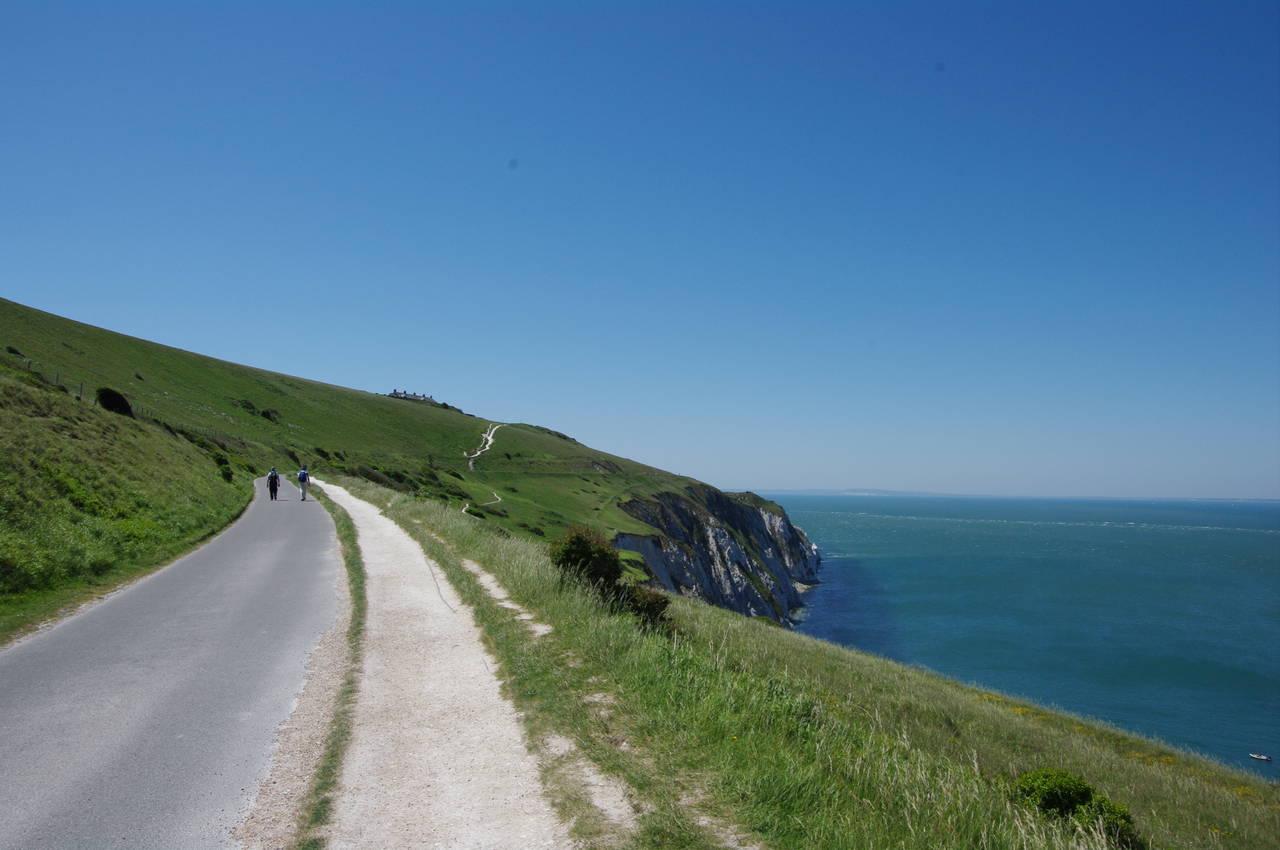
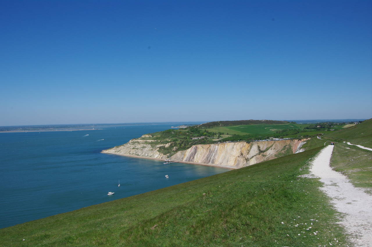
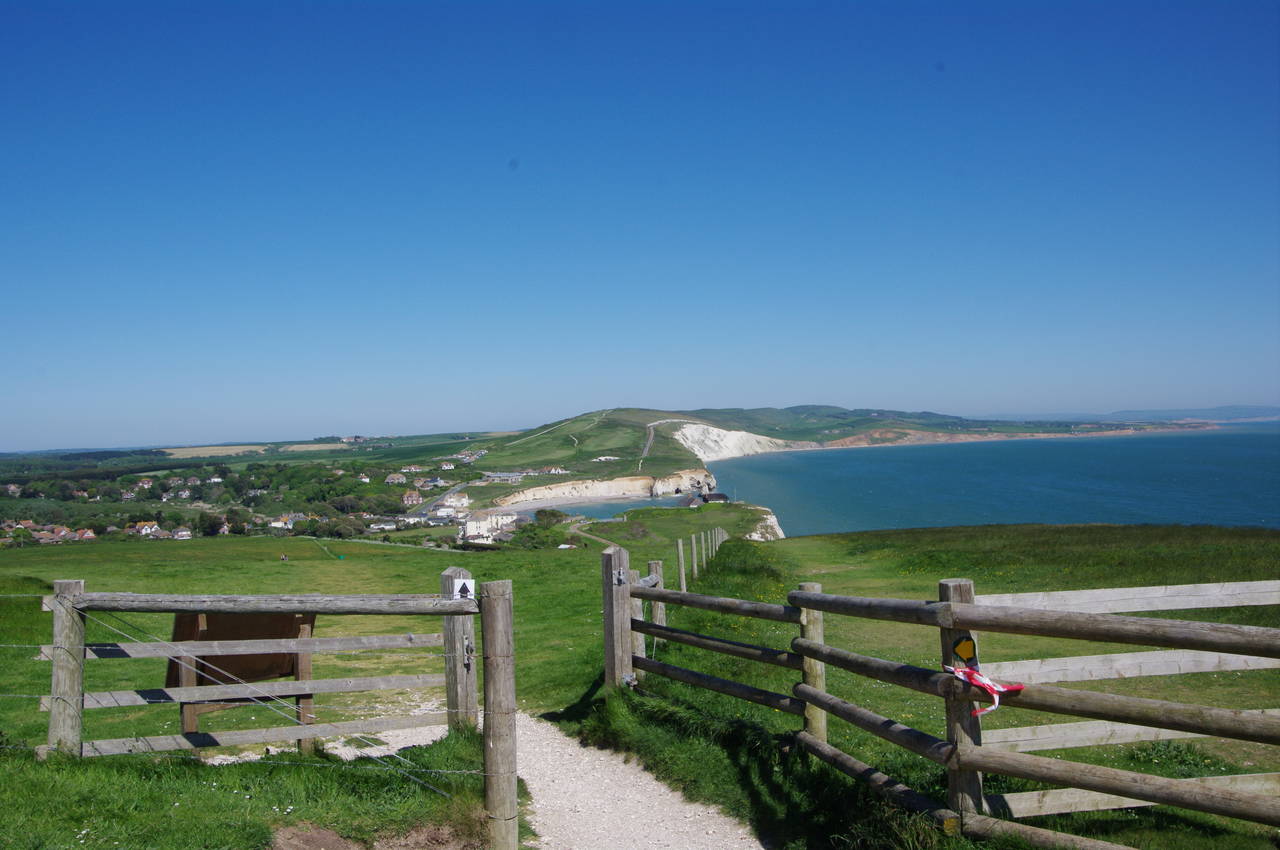
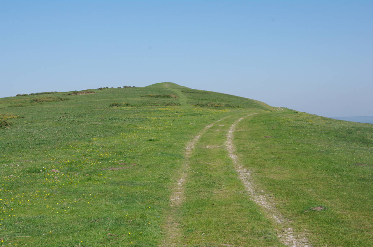
From the main car park behind Alum Bay, the Tennyson Trail heads south for a short distance, passing a garden with an impressive collection of gnomes before turning right to follow a chalky path beside the road as it climbs uphill towards the western tip of the island (picture 1). As the path climbs higher, the view back over Alum Bay gets better and better (picture 2).
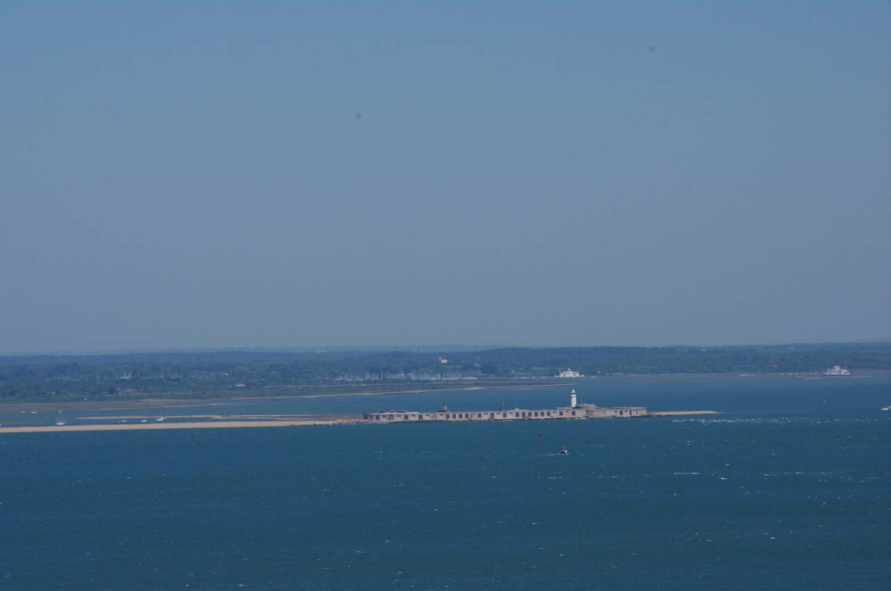
Courtesy of the fine sunny weather, I could also see well beyond Alum Bay and across the waters of the Solent, which separates the Isle of Wight from the English mainland. The long shingle curve of Hurst Spit stretches out into the Solent from the mainland town of Milford-on-Sea, ending with Hurst Castle and Hurst Lighthouse (picture 3). Beyond these, the forest of masts of Lymington Marina could also be clearly seen.
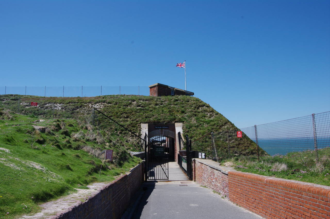
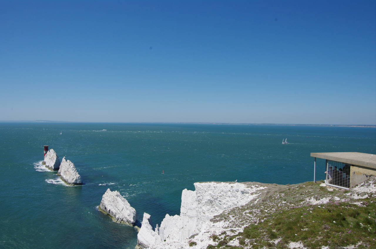
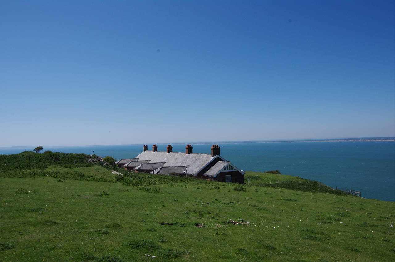
After about 600 metres, the path bears left from the road, angling up the hill to a gate just below and beyond a row of old Coastguard cottages. At this point the trail turns sharply left to climb back past the cottages to the top of the chalk ridge of West High Down, but before making that climb I continued ahead to visit the Needles Old Battery, which occupies the cliff-top at the very tip of the island (picture 4).
(5) The Needles
(6) Searchlight Emplacement above The Needles
(7) The Needles
(8) The Needles from above the New Battery
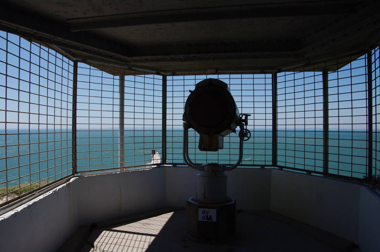
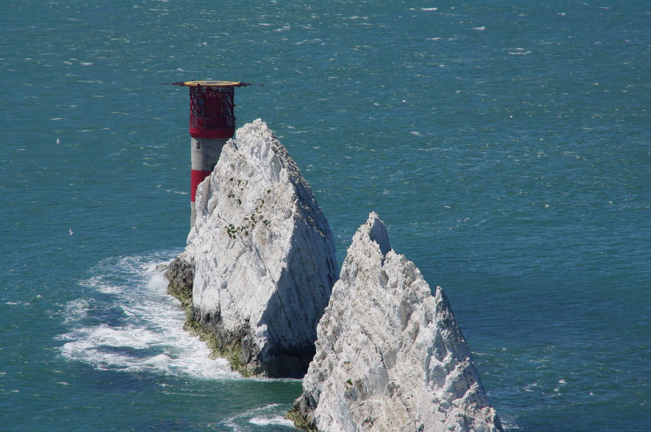
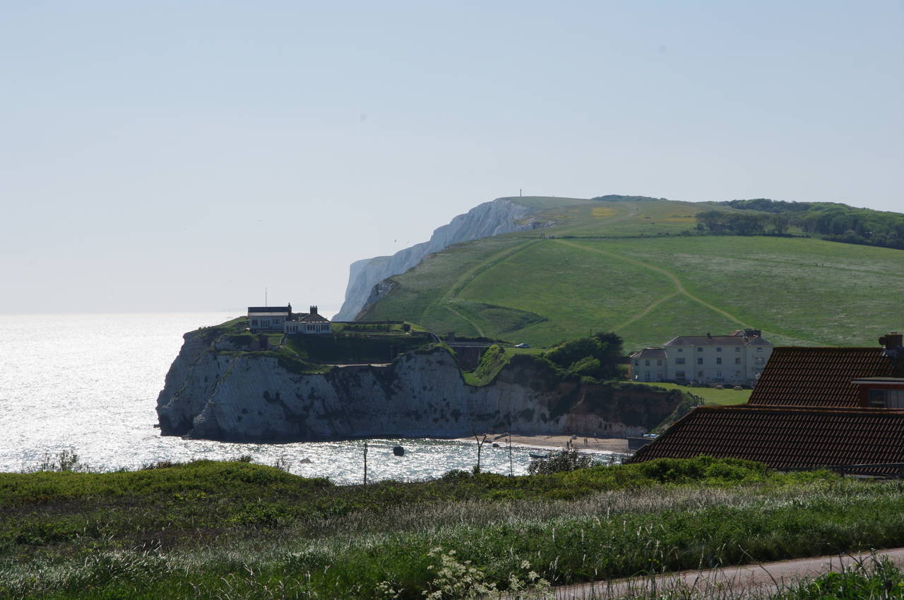
The Old Battery was built in the early-1860's as part of the defences of the western entrance to the Solent and was in active use until after World War II. The displays at the Old Battery provides an interesting insight into the operation of a Victorian-era military fortress, but its main attraction is undoubtedly its fine views over The Needles, a row of four chalk stacks that stand just off the tip of the island, and the Needles Lighthouse, which stands just beyond the last needle (picture 5). Those not suffering from claustrophobia can get closer still by following a narrow 65-metre underground tunnel from the Old Battery's parade ground to a searchlight emplacement built on the cliff edge in 1899 (picture 6). From there, the views of the lighthouse and the farther two needles are nothing short of spectacular (picture 7).
Several information boards dotted about the Old Battery describe some of the many ships that have been wrecked on The Needles over the years, including a number that came to grief here after the current lighthouse was built in 1859.
The lighthouse replaced an earlier one that was sited on top of the ridge and prone to being obscured by fog. The newer lighthouse was operated by three-man crews until 1994, when the light was automated. The helipad on top of the lighthouse was added in 1987, before which it must have been rather tricky to get people on and off the lighthouse in bad weather.
Higher up on the headland is the Needles New Battery, built in 1895 after concerns were raised about the detrimental effect of repeated firing of the Old Battery's guns on the stability of the soft chalk cliffs. Like the Old Battery, the New Battery saw service in both World Wars and was also one of the principal sites of British rocketry and satellite research from 1956 to 1971, although the rockets were not actually launched from here. Various engines were tested here and then shipped off to Woomera in a remote corner of South Australia for launch.
After the research wound down, both Batteries came into the ownership of the National Trust in 1975 and were restored and opened to the public in 1982. Displays in the underground chambers of the New Battery describe the pioneering research that took place here and include a life-size model of Prospero, the only British satellite to be launched by a British rocket. Although Prospero is no longer used, it is still orbiting the Earth and recent experiments by local amateur radio enthusiasts suggest that it is still transmitting its heartbeat signal, after more than 40 years in space.
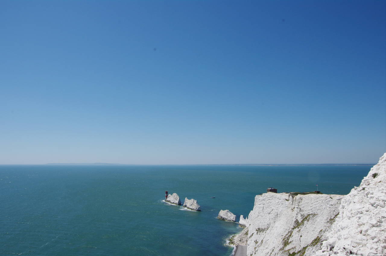
A viewpoint above Scratchell's Bay, just to the south of the New Battery, gives more good views of The Needles (picture 8) and a panoramic view across Poole Bay to the mainland, where the coastal towns of Christchurch, Bournemouth and Poole can all be seen on the horizon to the northwest, along with the outline of the chalk hills of the Isle of Purbeck (actually part of the mainland) to the west.
(9) Coastguard cottages on West High Down
(10) Alum Bay
(11) View east from West High Down
(12) Freshwater and the Solent
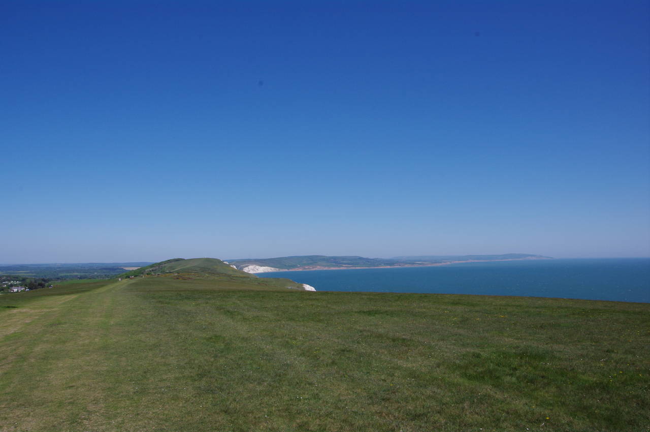
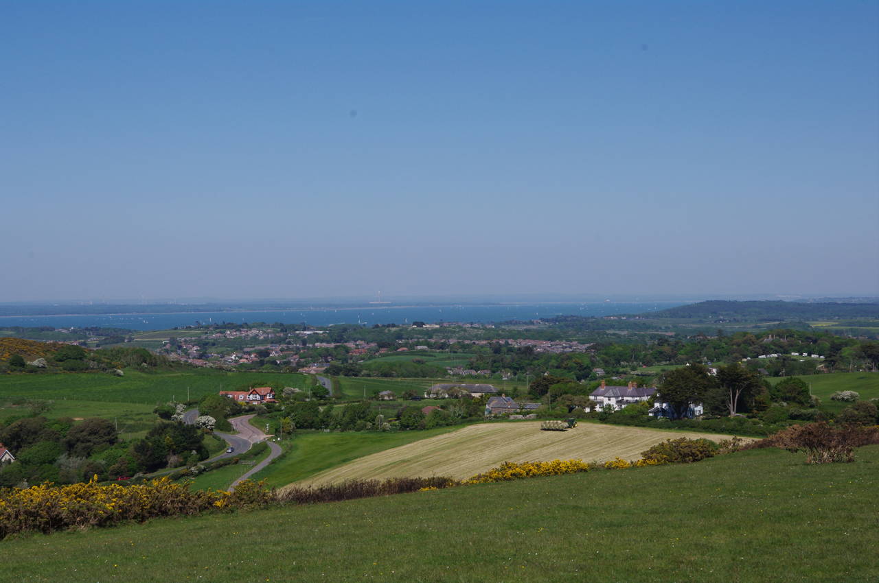
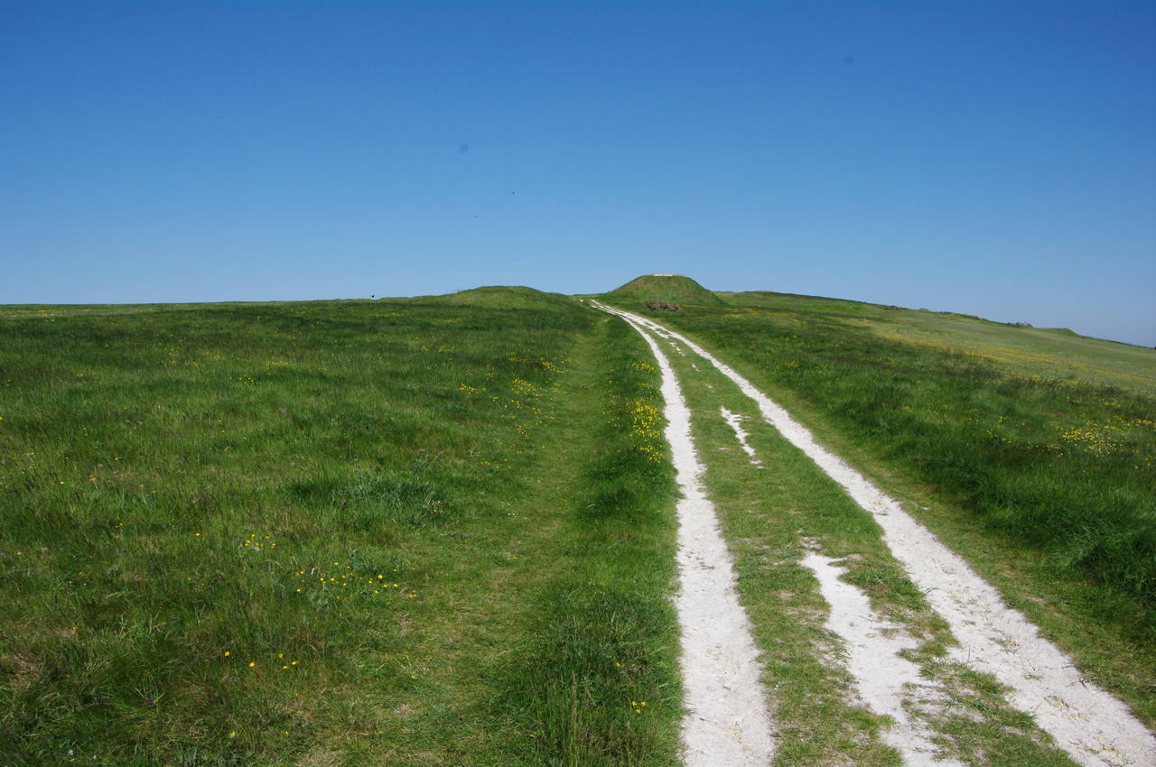
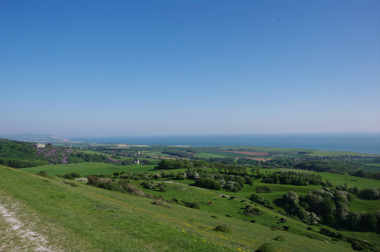
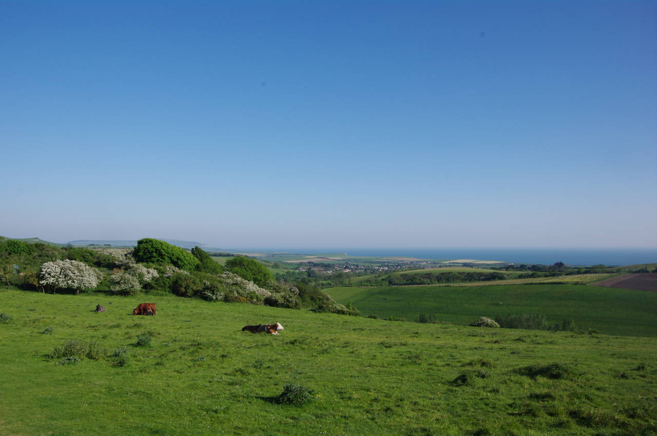
After a couple of hours spent wandering around the Old and New Batteries, I returned to the Tennyson Trail, climbing past the Coastguard cottages (picture 9) to the top of West High Down, with more great views over Alum Bay and the Solent (picture 10). For the next couple of kilometres the Tennyson Trail runs east along the fairly level and open grassland of the ridge of West High Down, with uninterrupted views all the way along the island's southwest coast (picture 11) to its southernmost tip at St Catherine's Point, more than twenty kilometres away, and over most of the western half of the island (picture 12).
(13) Approaching Tennyson Down
(14) Replica of Nodes Beacon
(15) Tennyson Monument
(16) Toposcope on Tennyson Down
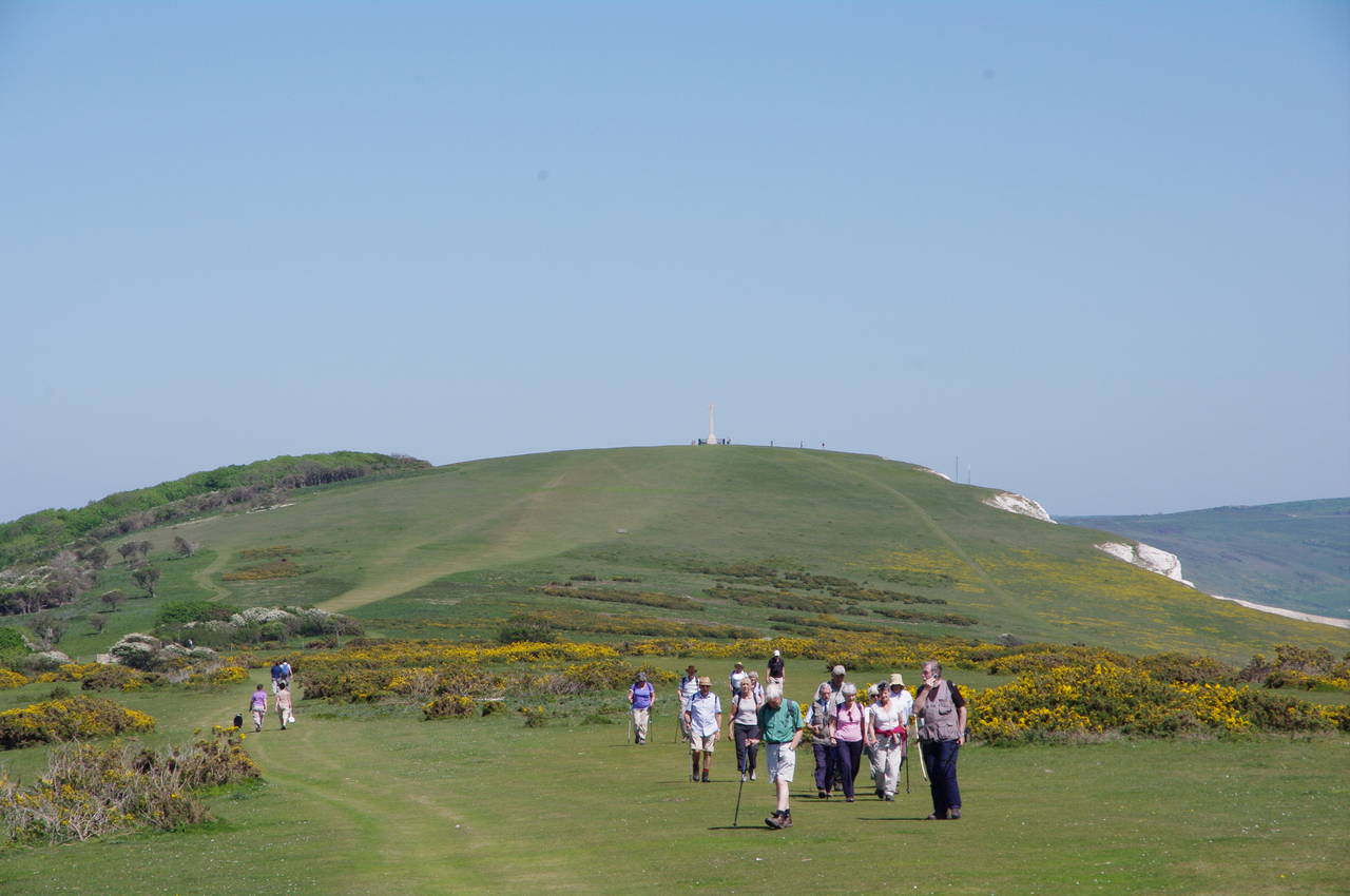
Up ahead, the celtic stone cross of the Tennyson Monument stands atop Tennyson Down, though still the better part of half an hour's walk away. On this stretch of the path there were several large groups of walkers enjoying the bright Saturday sunshine (picture 13).
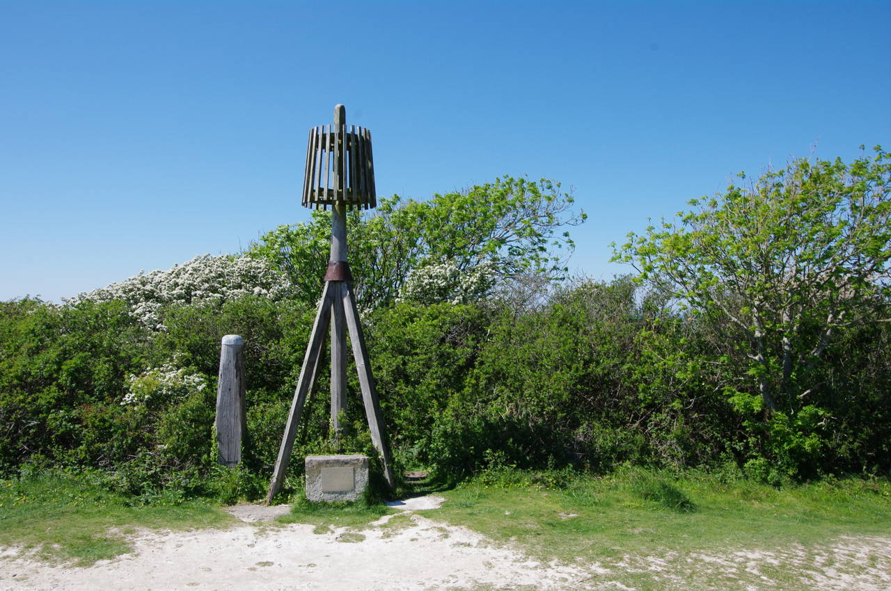
Between West High Down and Tennyson Down the path dips slightly to cross an area of gorse and scrub, where the trail passes by a half-size replica of the Nodes Beacon, a navigation aid that was replaced by the Tennyson Monument in 1897 (picture 14), though the replica dates from 1977.
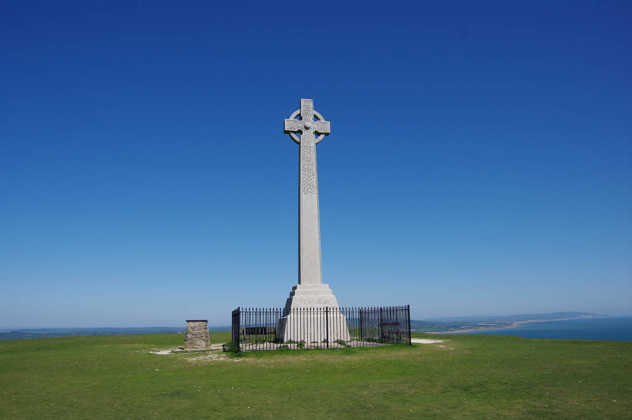
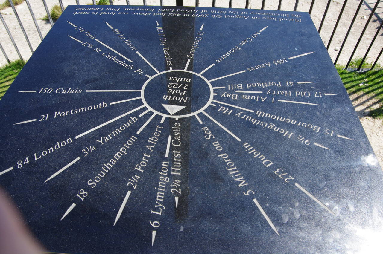
The trail then heads up to the monument (picture 15), standing on the highest point of the down, at 147 metres above sea level. Next to the monument, a toposcope shows distances to various points of interest, both near and far (picture 16).
(17) Descending to Freshwater Bay
(18) Freshwater Bay, Fort Redoubt & Tennyson Down
(19) Afton Down
(20) Compton Down
From the summit of Tennyson Down, the Tennyson Trail makes a long descent down the grassy eastern slope, heading for the village of Freshwater Bay (picture 17). On the edge of the village the trail meets an unnamed lane behind the Fort Redoubt, a 19th century defensive structure that looms over the western side of the Bay. The trail follows the lane to the left to reach Gate Lane, where the trail turns right to pass by the beachside Albion Hotel and Freshwater Bay's small promenade.
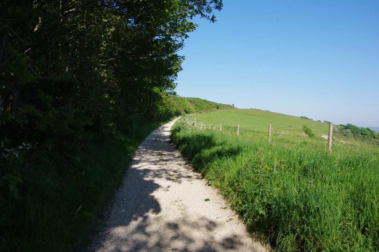
Here the Tennyson Trail parts company with the Coast Path, continuing straight ahead on the verge to the left of the A3055 Military Road as it climbs out of the village. After about 300 metres, having crossed Southdown Road, the trail bears away from the Military Road on Byway F33, from which there are good views back across Freshwater Bay to the Fort Redoubt and Tennyson Down (picture 18).
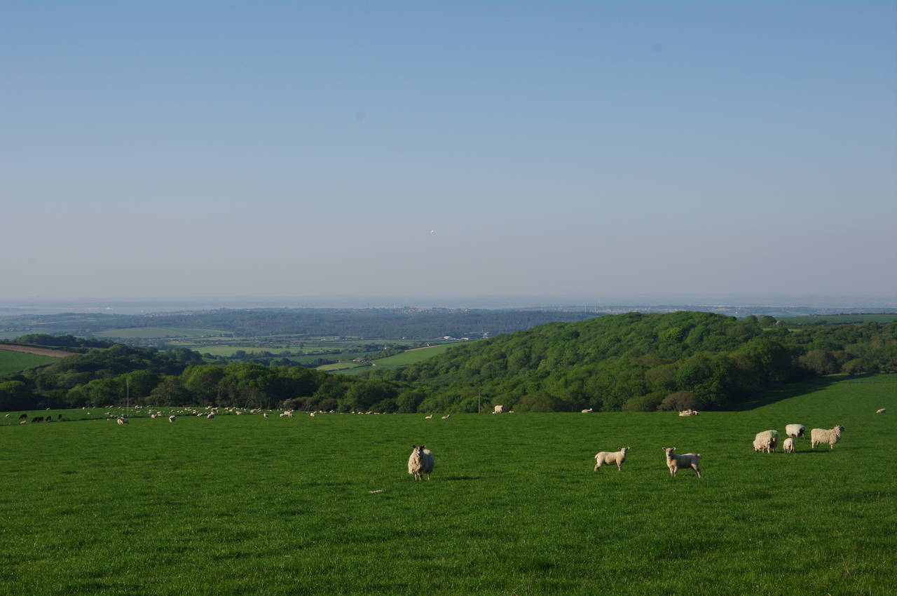
Ahead, the trail climbs steadily on a very obvious path along the chalk ridge that forms the spine of the island, running along the middle of the Freshwater Bay Golf Club on Afton Down (picture 19). Through a gate at the end of the golf course, the terrain on either side of the path becomes more varied, with a patchwork of grassland, gorse and scrub covering the top of Compton Down (picture 20). This area is home to some rare birds and butterflies and is kept in this state by grazing cattle here and by controlled burning of the taller patches of gorse every eight years to prevent it from completely taking over from the grassland.
(21) Brook Down
(22) View towards Brook Bay
(23) View from Brook Down to Mottistone Down
(24) Gorse-covered barrows on Mottistone Down
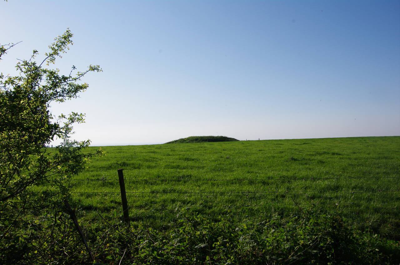
After crossing Compton Down the path dips slightly before climbing Brook Down, where a number of Bronze Age burial mounds are dotted about to the left of the path, including one that is particularly prominent on the skyline ahead (picture 21). To date, archaeologists have identified more than 200 of these barrows on the Isle of Wight, most of them located on the chalk downs.
To the right of the path, the land falls away steeply, giving good views over the rich, flat farmland that lies between the chalk downs and the rapidly-eroding cliffs above Brook Bay on the island's south-western coast (picture 22).
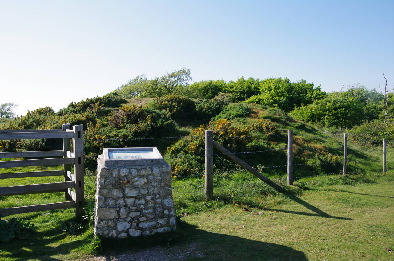
Once over the crest of Brook Down, the Tennyson Trail descends into the next valley, where it crosses the B3399 road before climbing up the open grassland of Pay Down to the gorse-covered Mottistone Down (picture 23). Atop the latter, an information board sands beside several gorse-covered barrows (picture 24).
(25) View towards Brighstone
(26) Climbing Brighstone Down
(27) Turning into Brighstone Forest
(28) Brighstone Forest
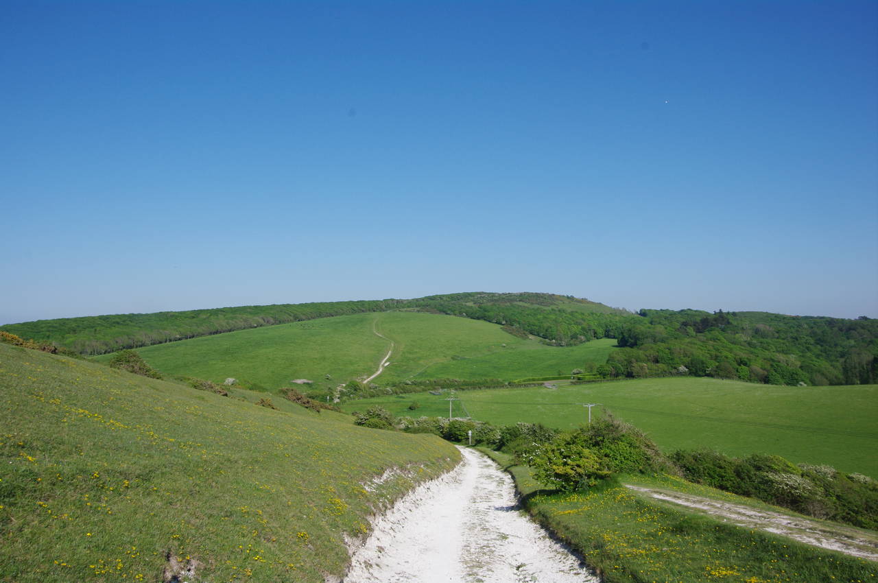
The path follows the ridge of Mottistone Down eastwards, with the plantation trees of Brighstone Forest a short distance to the left and the town of Brighstone set amongst the farmland a few kilometres down to the right (picture 25).
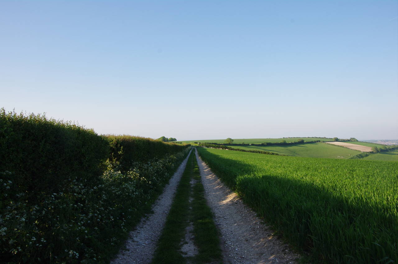
Eventually the path begins to descend gently to a National Trust carpark just off Lynch Lane. The trail follows Lynch Lane to the right for about 30 metres before turning left on Bridleway BS10 to begin the climb up Brighstone Down along the edge of Brighstone Forest (picture 26).
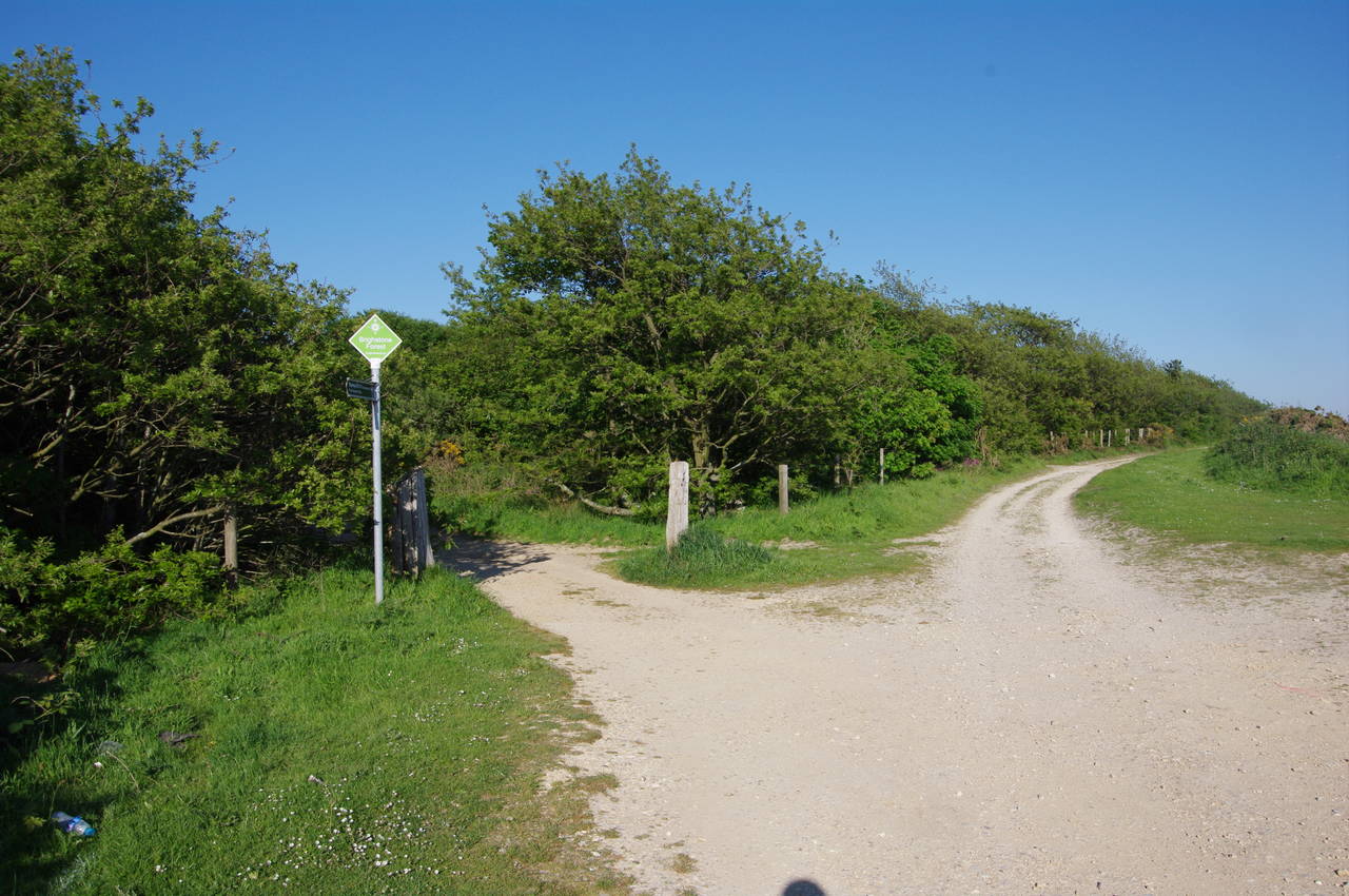
After about a kilometre of fairly gentle climbing, the Tennyson Trail reaches a path junction. Here the trail turns left into the forest on a broad track that served as the main highway to Carisbrooke for centuries before the advent of modern roads. The trail had generally been heading eastwards since leaving The Needles, but from here on it switches to a more north-easterly direction for the remainder of the walk.
Another of the official walking paths, The Worsley Trail, begins at this junction, continuing along the ridge on the southern edge of Brighstone Forest on the first part of its journey eastwards to Shanklin. It would turn out to be almost a year before I had an opportunity to walk the Worsley Trail.
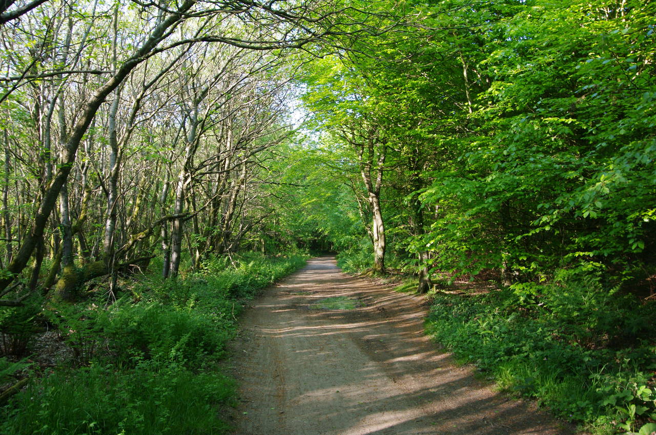
As the broad track heads into the forest, the scrub soon gives way to a mix of beech and sycamore trees (picture 28). Brighstone Forest is one of several areas of woodland on the Isle of Wight that are managed by the Forestry Commission, which harvests as much as 8,000 tons of timber on the island each year. Within the forest there were a couple of clearings to the left of the path where it appeared that harvesting had taken place fairly recently.
(29) Barrow on Bowcombe Down
(30) Bowcombe Valley
(31) Bowcombe Down
(32) View towards Carisbrooke Castle
After a little more than a kilometre of pleasant walking through the woods with just birdsong for company, the path reaches the far edge of Brighstone Forest, now on Bowcombe Down. The Tennyson Trail continues to follow the well-defined track with the forest on the right and another Bronze Age barrow visible a few hundred metres across the fields to the left of the path (picture 29). Heading almost due east to pass between the corner of the forest and the end of a row of hawthorns, the path then gradually swings back to a north-easterly course on an undulating field track (signposted as Byway N136a) with some good views east across the sheep-grazed slopes of Bowcombe Down and into the fertile farmland of the Bowcombe Valley below (picture 30).
The track soon reaches a path junction just outside the corner of Monkton Copse, where the Tennyson Trail bears slightly left on the middle of three tracks, still on Byway N136a. This track runs along the chalk ridge between fields for another 1200 metres (picture 31), before turning right on Byway N128, still following the ancient highway to Carisbrooke.
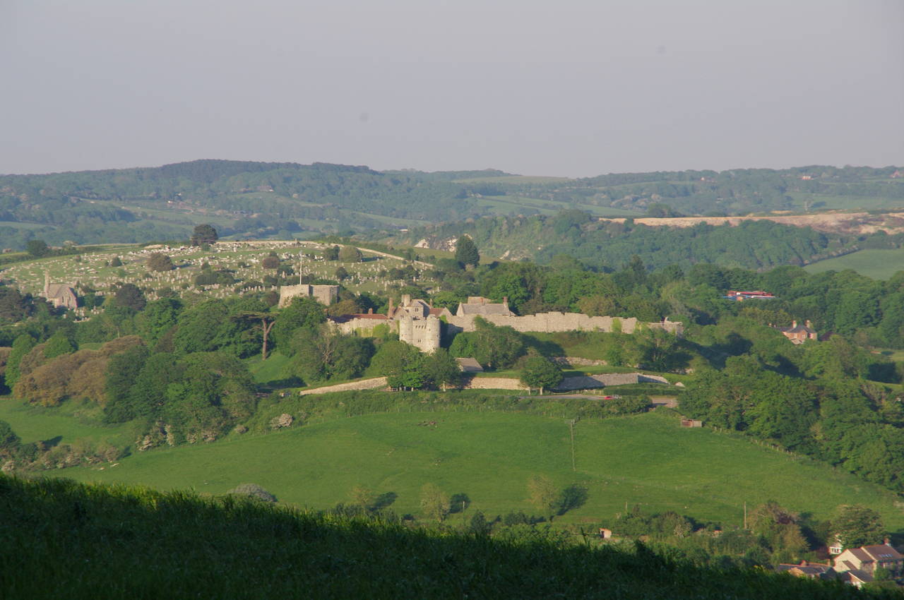
After another 700 metres walking between open fields, the path passes through a gate, narrowing and becoming Byway N123, which is lined with tall scrub for most of the next kilometre, temporarily hiding the town of Carisbrooke from view. When the path finally emerges onto open ground again, Carisbrooke is quite close and there are good views of the high stone walls and massive earthen ramparts of the 12th-century Carisbrooke Castle (picture 32, zoomed in), which occupies a strategic position on a chalk hill overlooking the town.
(33) Chapel at the end of the trail
(34) Gatehouse of Carisbrooke Castle
(35) Castle Keep
(36) View from Castle Keep
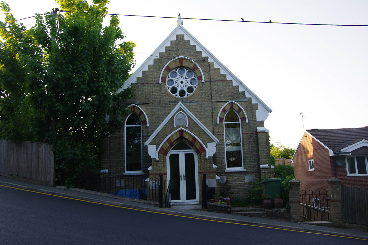
Soon the path begins to descend, broadening to become Down Lane as it nears the edge of the town. Reaching houses, Down Lane merges into Nodgham Lane and in less than 100 metres Nodgham Lane meets the main B3401 road, where the Tennyson Trail ends in front of an attractive chapel (picture 33) after 23 thoroughly enjoyable kilometres. A few minutes walk down the main road to the right one reaches Carisbrooke's High Street, and a further twenty minutes walk takes you into the heart of the adjoining town of Newport, the island's administrative centre.
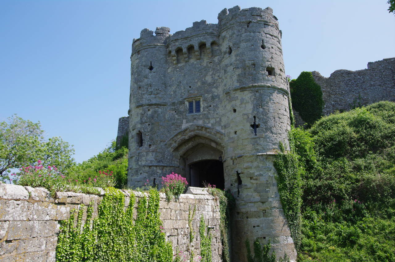
The following day I spent the morning exploring Carisbrooke Castle, which has an interesting history spanning around 900 years, including serving as a fortress, a royal prison (for King Charles I at the end of the English Civil War), a royal home, and a museum.
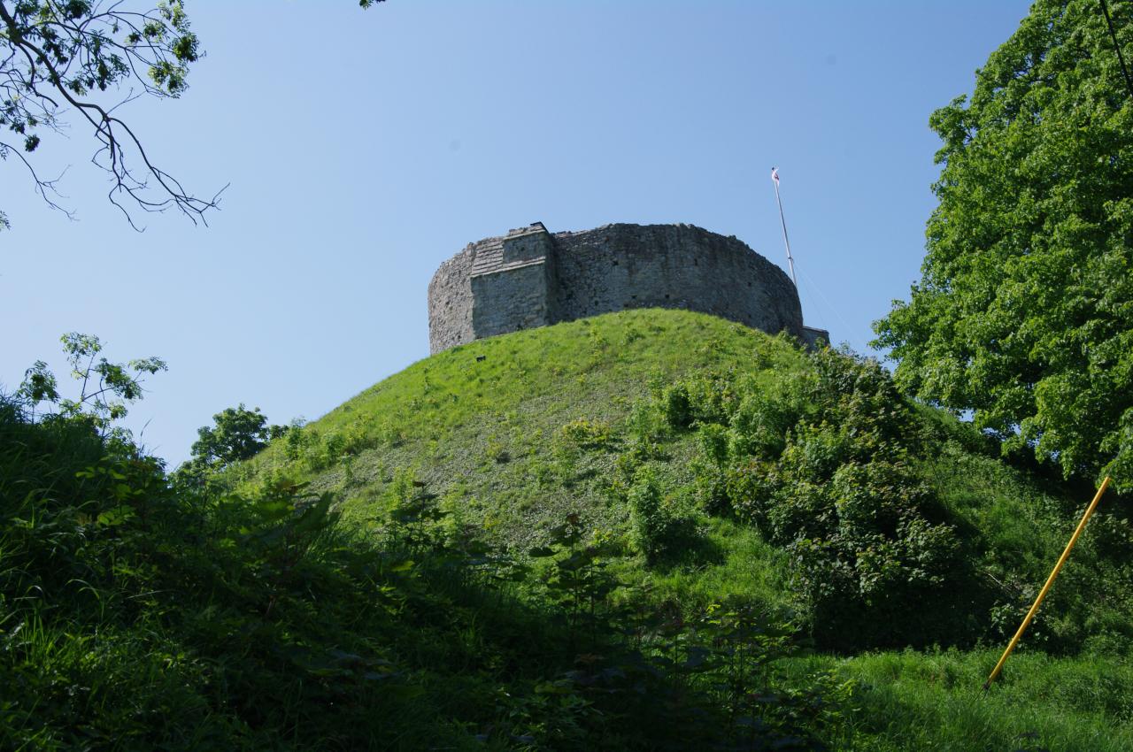
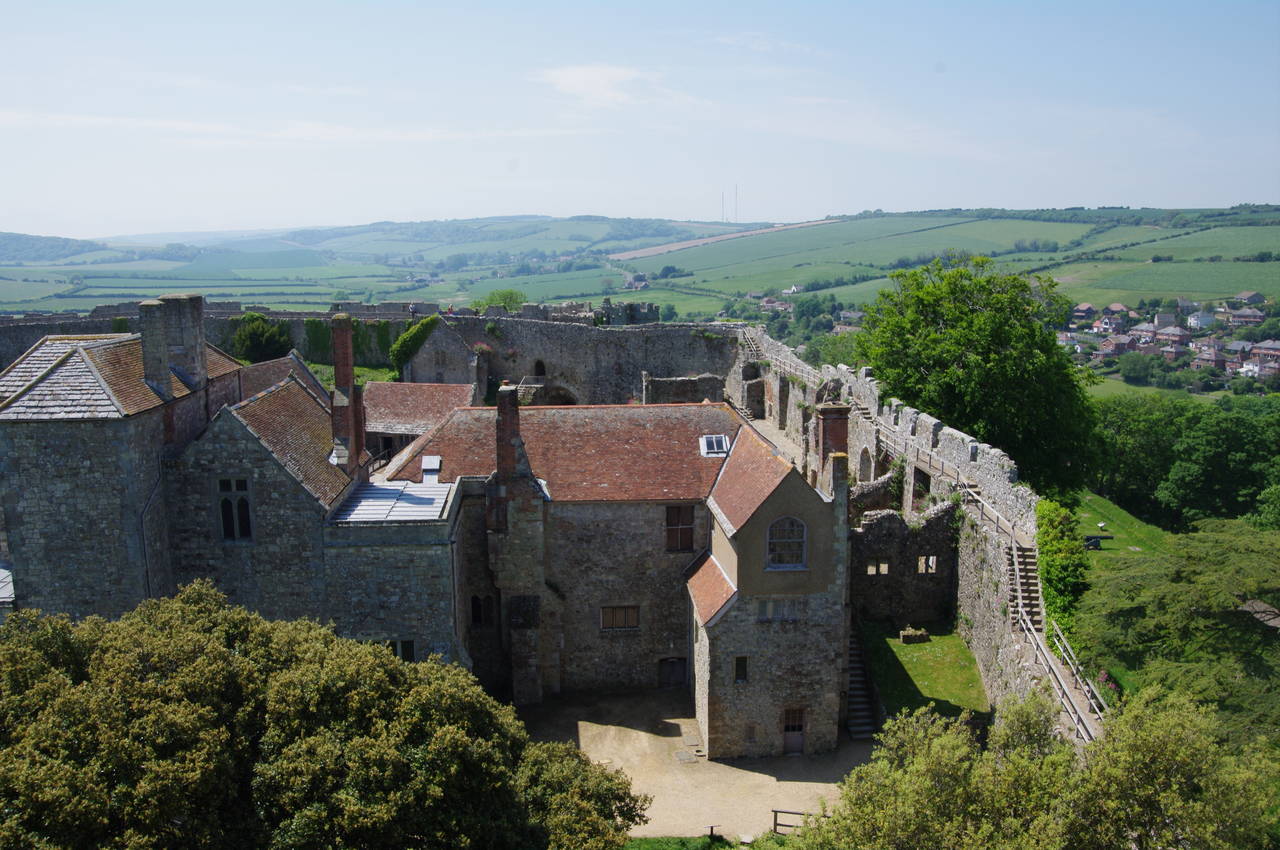
The castle is entered via its impressive gatehouse (picture 34), beyond which one can explore the variety of buildings in the grounds ranging from medieval ruins through to a home and church built in the late Victorian era. Unusually for a castle of this age, the outer curtain wall is in a good enough state of repair that one can walk along the top of almost the entire length, with superb views of Carisbrooke and the surrounding countryside. For those not prone to vertigo, a climb up a very steep flight of steps to the circular castle keep, a fortress-within-a-fortress that sits on top of a tall man-made mound in the northeast corner of the castle (picture 35), yields even better views over the grounds and beyond the walls (picture 36).