SHEPHERDS TRAIL: Carisbrooke to Shepherds Chine
Thursday, April 18, 2013
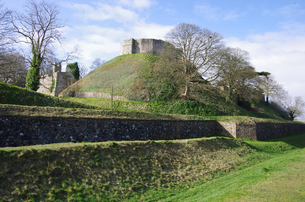
(1) Carisbrooke Castle
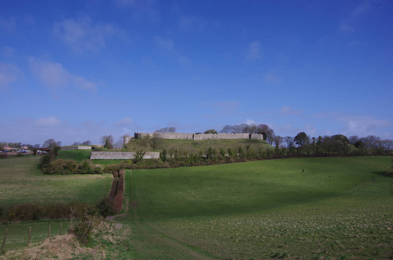
(2) Carisbrooke Castle
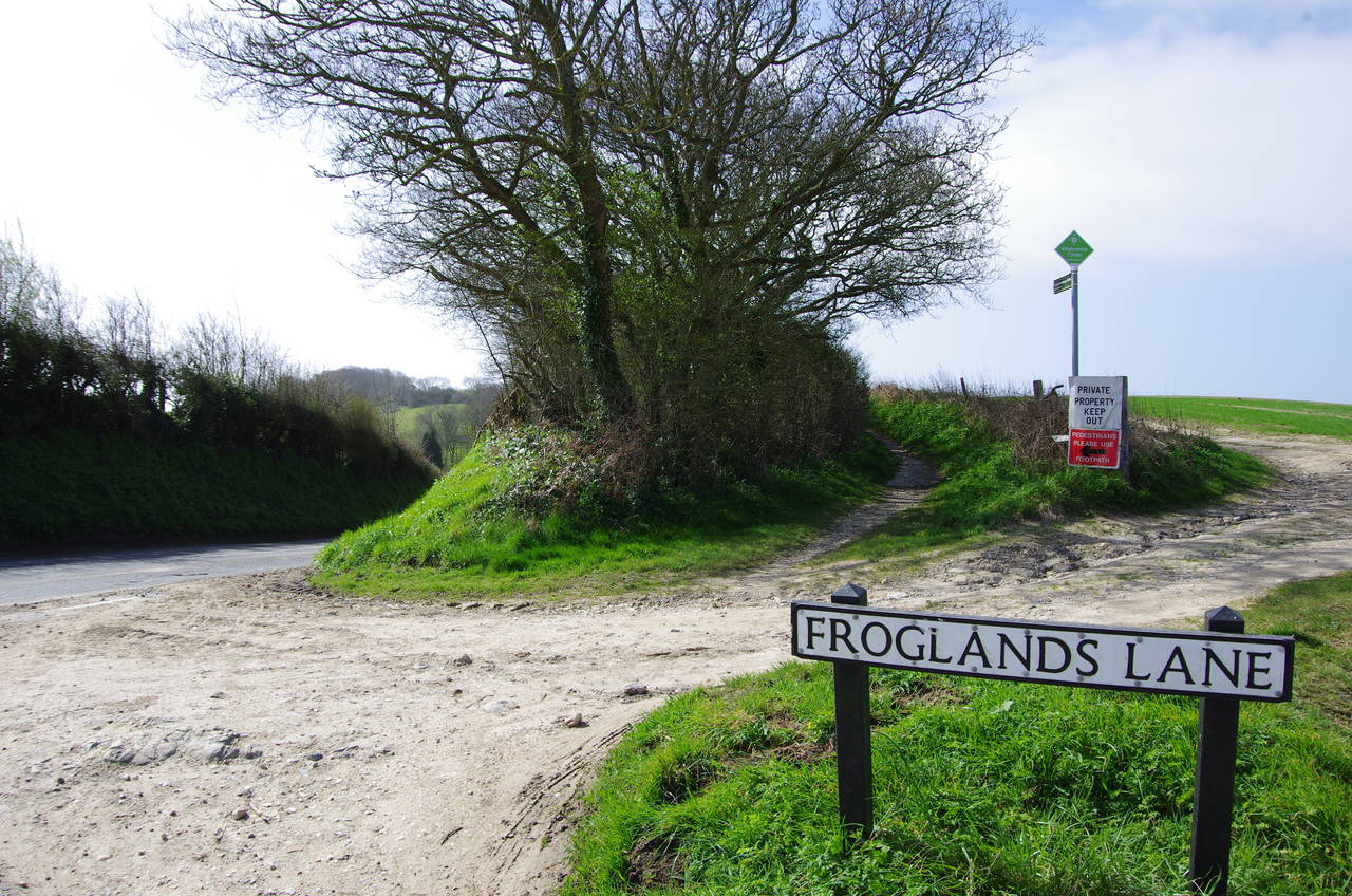
(3) Whitcombe Cross
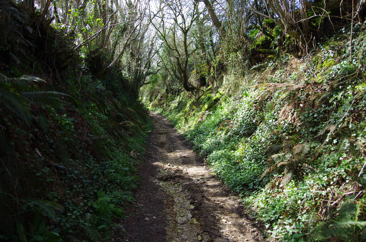
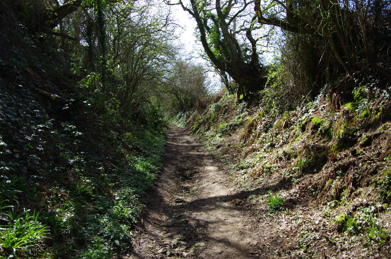
(4) Dark Lane
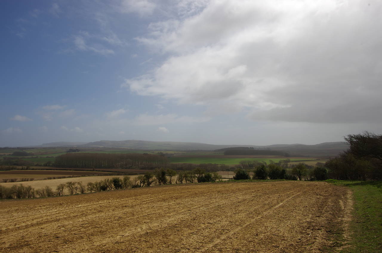
The Shepherds Trail starts near the village of Carisbrooke in the heart of the island and winds its way south then southwest through quiet countryside to meet a dramatic stretch of the southwest coast.
It took me about twenty minutes to walk over from my accommodation in Newport to the village of Carisbrooke, where the Norman castle stands on a chalk hill overlooking the village. Walking up Castle Hill, one gets a good view of the castle's massive defensive ramparts and the stone keep atop its steep-sided mound (picture 1). From the carpark at the end of Castle Hill, a worn path skirts around the outer ramparts on the next side of the castle. At the next corner of the earthworks, a narrow path heads down between hedges to cross a shallow valley and climb up to Froglands Lane, from which there are good views of the southern side of the castle (picture 2).
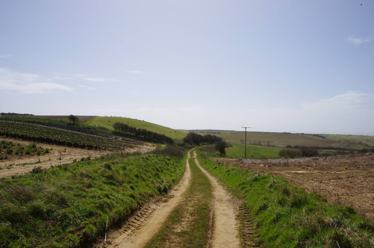
A short distance to the left the lane meets Whitcombe Road at Whitcombe Cross, the official start of the Shepherds Trail (picture 3). Rather than following the road, the trail heads along a track on the right-hand side of the trees, signposted as Bridleway N108. This is an ancient path, known as Dark Lane. The name is soon justified as the track heads into the trees and becomes a sunken path lined with ferns and tree roots (picture 4).
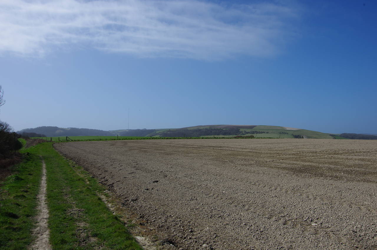
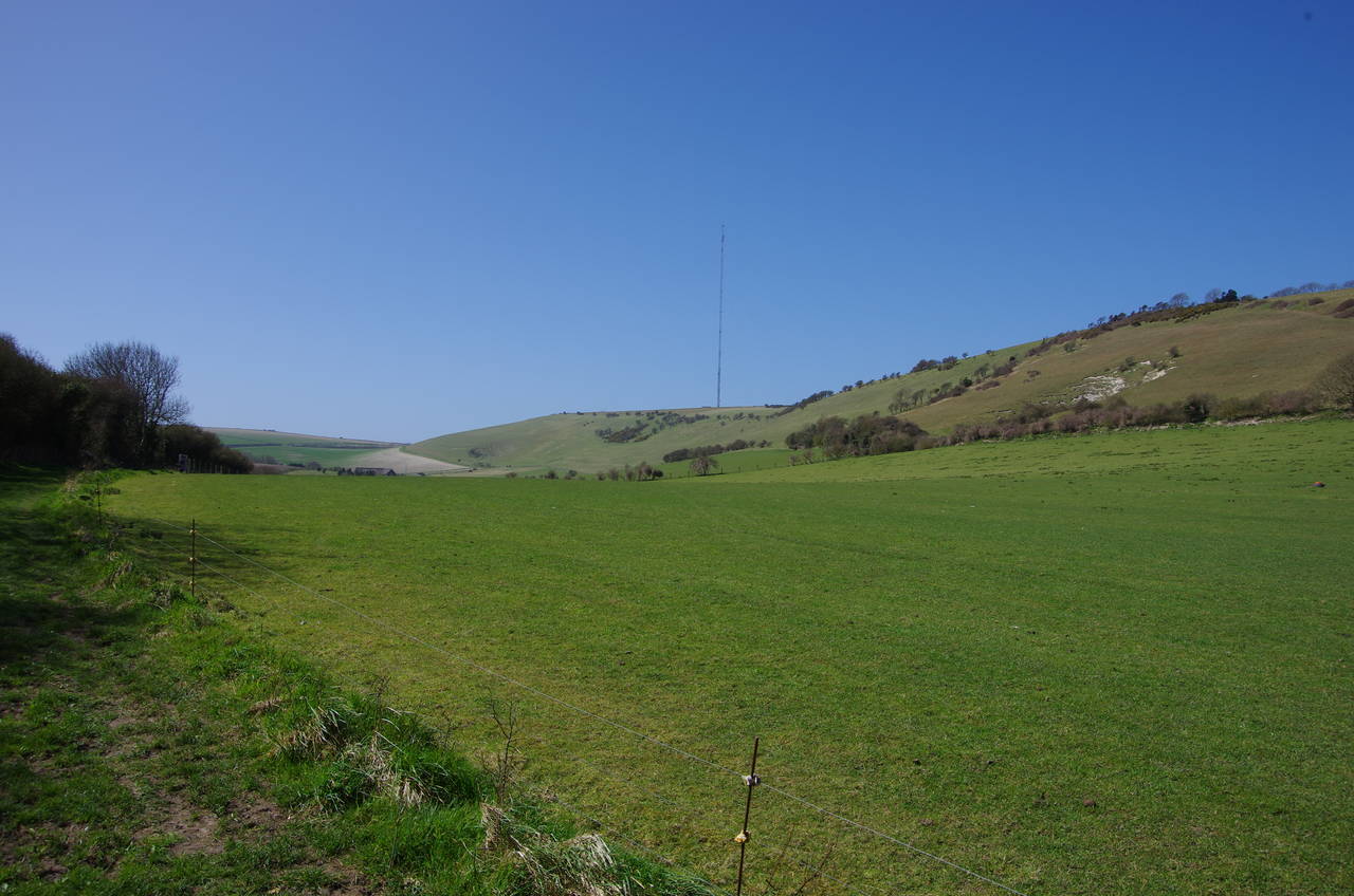
(5) View towards Chillerton Down
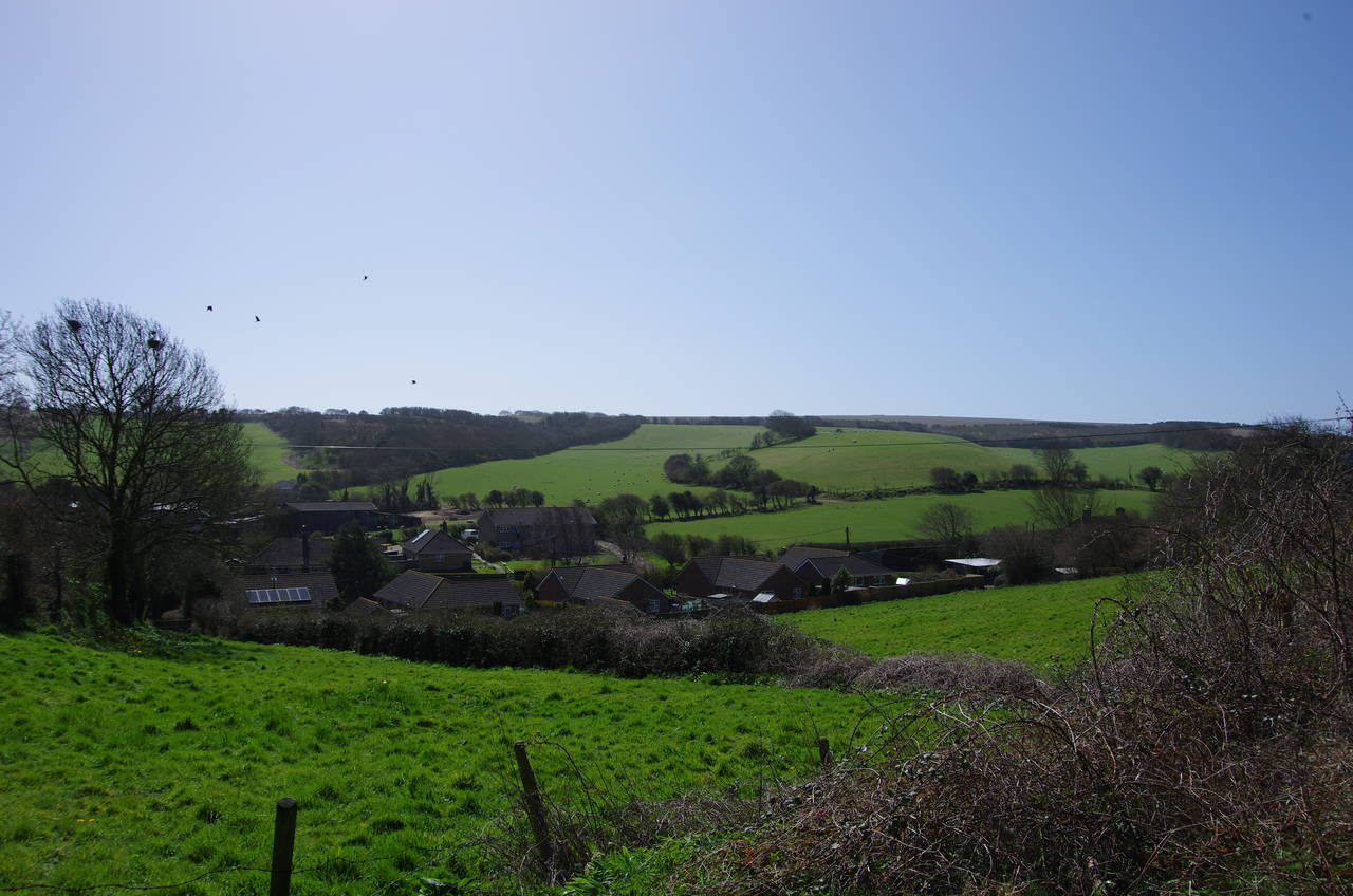
(6) Whitecroft
(7) Descending to Gatcombe
(8) Approaching Tolt Copse
The sunken track eventually emerges on a plateau of fields with the thin TV mast on Chillerton Down visible in the distance ahead (picture 5). The Shepherds Trail continues south, still on Bridleway N108 for a time, before reaching a junction of paths and continuing ahead on Bridleway G6. A short distance along this path there are good views across the valley to the left where the clock tower of the former Whitecroft Mental Hospital can be seen (picture 6). The hospital operated from 1896 until 1992, and was originally operated by the interestingly-named "Commission in Lunacy", whose members were known as "Commissioners in Lunacy".
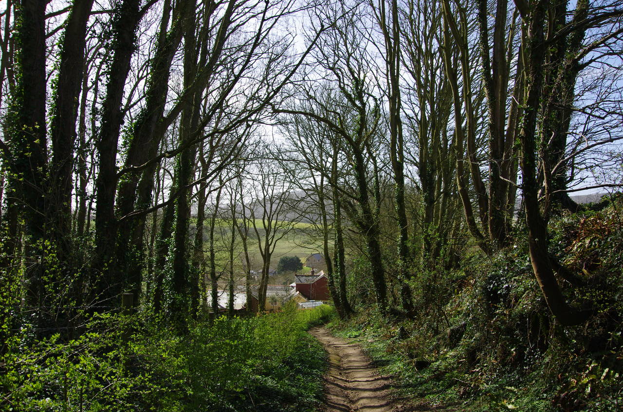
Beyond the next crossing of paths, the Shepherds Trail descends through trees (picture 7) to reach Newbarn Lane in the hamlet of Gatcombe. The route turns right along the lane for about 400 metres. When the lane turns sharp right up towards Newbarn Farm, the Shepherds Trail turns left on a chalky field-edge path towards the left-hand end of Tolt Copse (picture 8).
(9) Chillerton Down
(10) Chillerton
(11) Hollow Lane
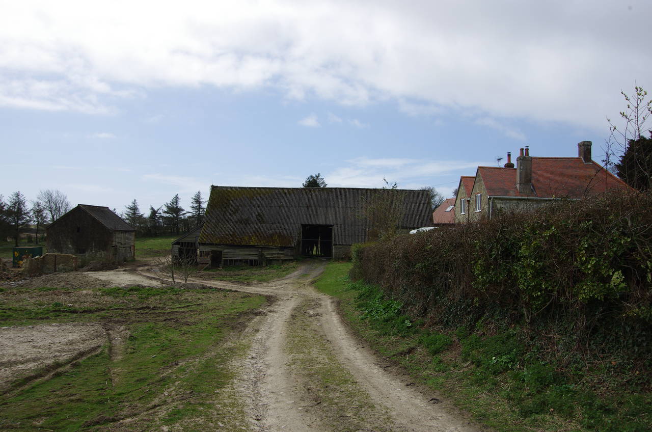
(12) Ramsdown Farm
Just after passing through the end of the copse, the route leaves the main chalky path and heads along the left-hand edge of a long narrow field, at first parallel to the copse and then slowly curving to the right below the eastern face of Chillerton Down (picture 9).
After about a kilometre, the path curves back to the left and descends to the village of Chillerton (picture 10). On meeting the main road the route crosses to the far side and follows the verge to the left for 150 metres to find a right turn into Hollow Lane, signposted as Bridleway G15a.
After passing a few houses, the lane earns its name, becoming a sunken track (picture 11) that climbs steadily inside a band of trees before emerging into the open again at the top of the climb. Here the route joins a farm track that is lined by low hedges, briefly heading left before turning right to follow a line of telegraph poles between two large fields. At the far side of the fields, the track again turns right and descends through Ramsdown Farm, passing between two of the farm buildings (picture 12) before meeting a quiet country lane.
(13) View from Bridleway G15
(14) Bridleway SW43
(15) Subsidence on the path
(16) Bucks Farm
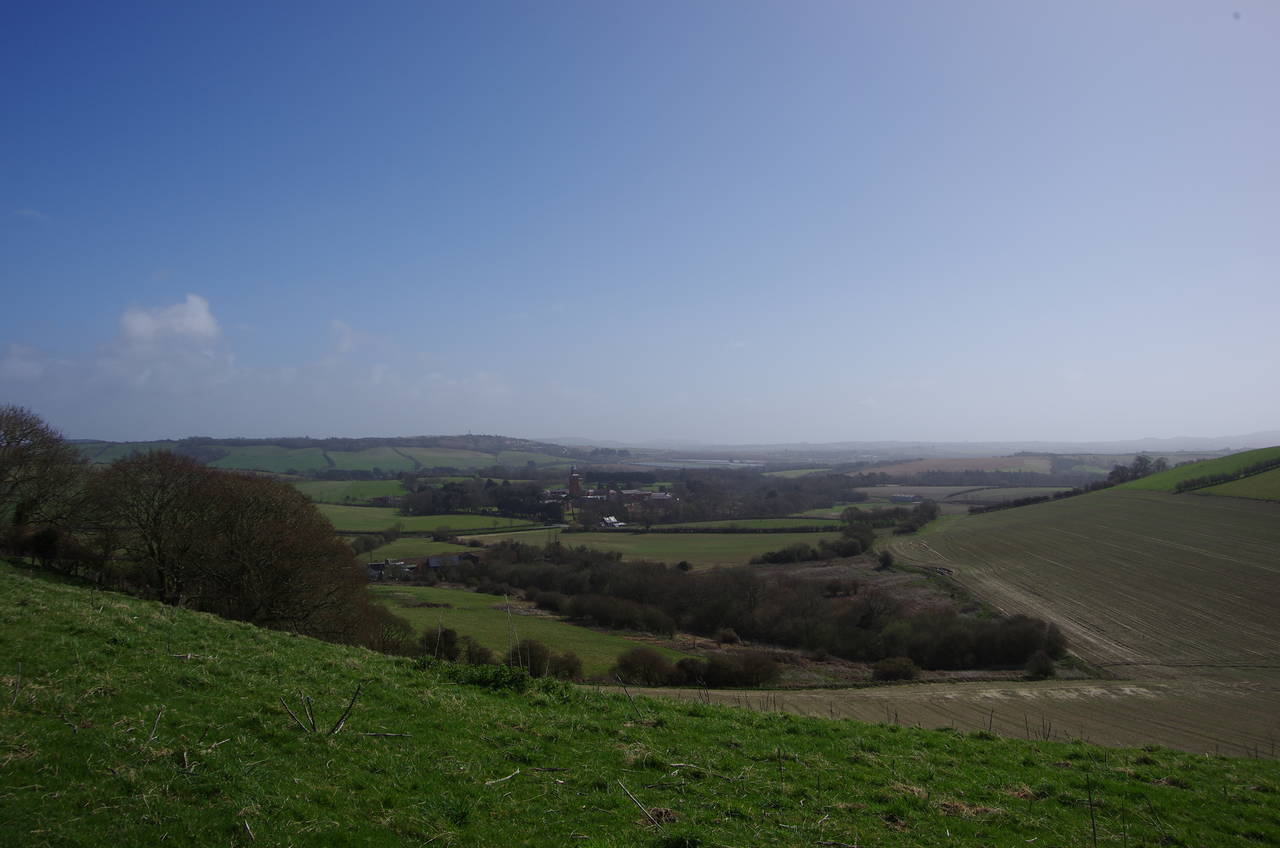
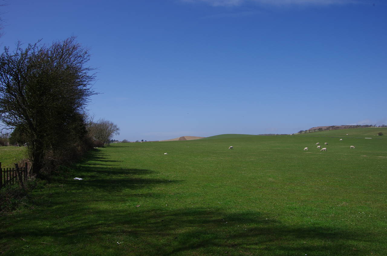
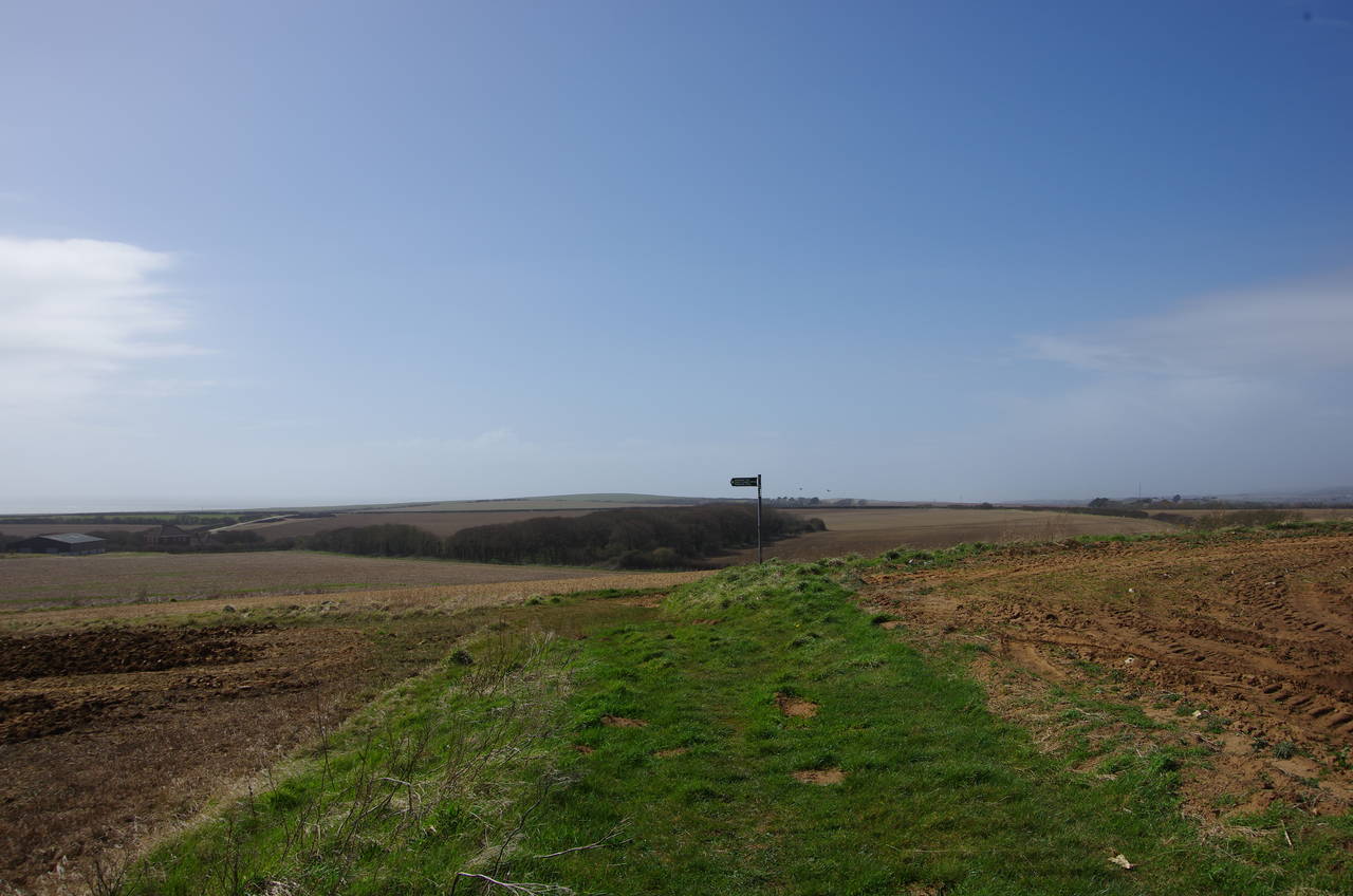
150 metres along the lane to the right, a signpost for Bridleway G15 points left along the edge of a field where there are good views ahead over farms to distant hills (picture 13). At the far end of the field the route bears left to take a grassy track down to meet a road called Berry Shute at a bend. After passing the buildings of West Billingham Farm, a signpost on the right points away from the road along Bridleway SW43, which runs westward across rolling, sheep-grazed fields for the next kilometre (picture 14).
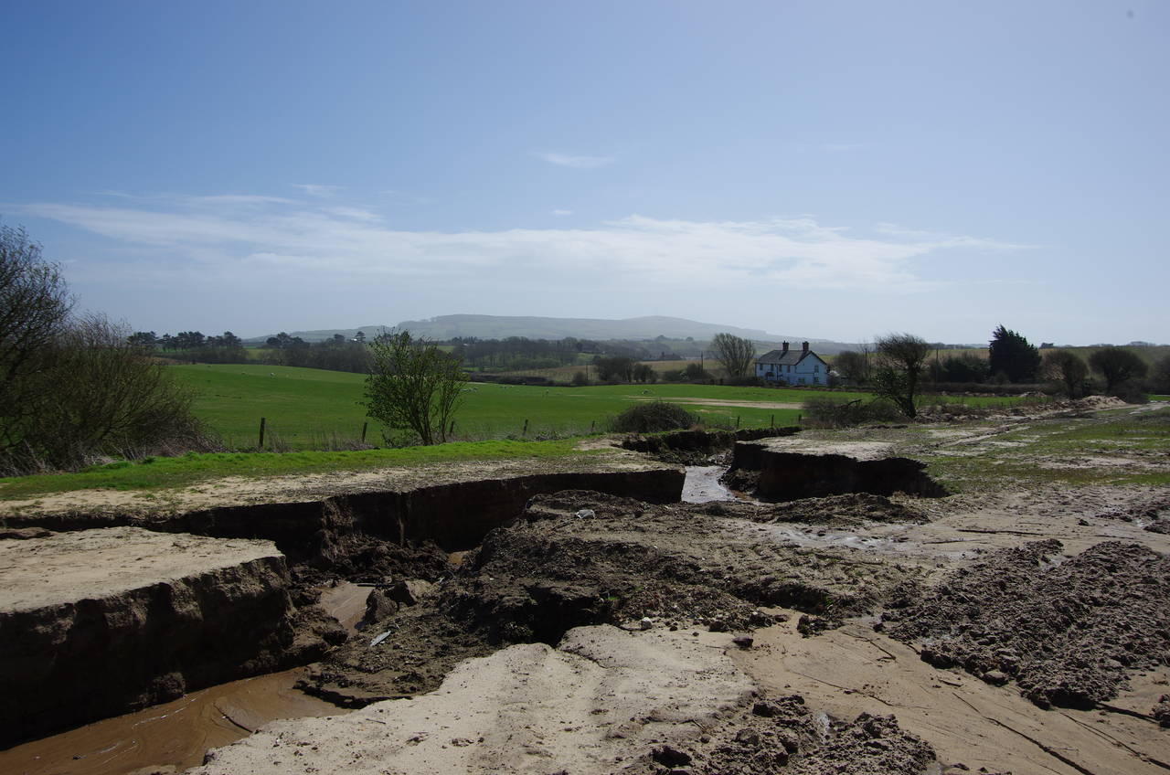
Shortly after passing by a large sheep pen, the bridleway passes through a metal gate and bears left, diagonally across a field towards the B3399 road. Here I was confronted with a large fissure running across the path (picture 15) and I had to find a spot where it was narrow enough to jump across. I presume this subsidence must have been quite recent, and at the time of writing (a year later) it still doesn't appear on Google's aerial view.
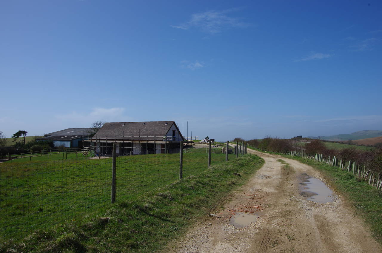
A short distance to the right along the B3399, the Shepherds Trail bears left on the drive of Bucks Farm (picture 16), signposted as Bridleway SW54.
(17) Bridleway SW54
(18) Dungewood Farm
(19) Samber Hill
(20) Path across ploughed field
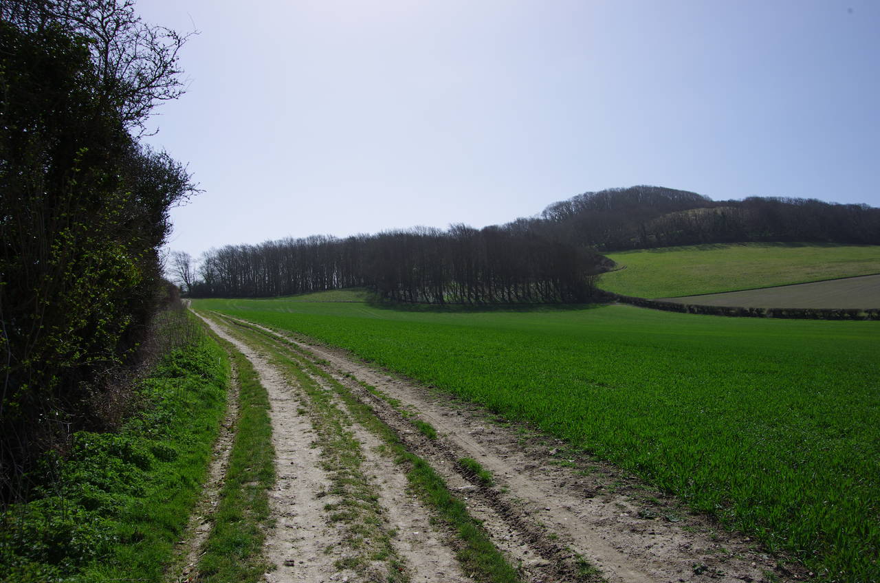
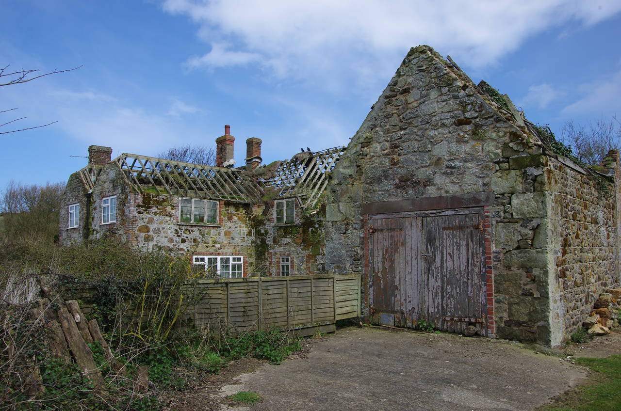
After passing by the farm buildings, the bridleway swings left, heading south between fields for the next kilometre with Gun Hill rising to the left of the track (picture 17). When the track reaches a crossing of bridleways, the Shepherds Trail turns right on Bridleway SW56, which soon turns right again on a narrow hedge-lined track to Dungewood Farm. The track skirts around the left side of the farm buildings, including a ruined farmhouse (picture 18), before becoming Dungewood Lane, which has several twists and turns over the next kilometre before it ends at a junction with Atherfield Road.
A signpost at the junction points to the right along the road, and after 200 metres another signpost points left on a grassy path that climbs between fields to the top of Samber Hill (picture 19), where the path turns left to continue between fields with the English Channel now within sight up ahead.
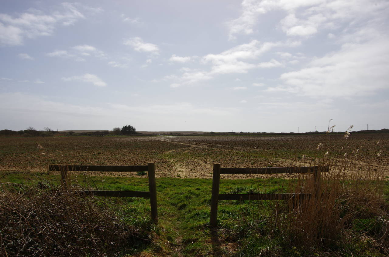
After the path bears right along a field edge, it passes through a gap in a fence and across a field where the path had been ploughed away (picture 20).
(21) Shepherds Chine
(22) Shepherds Chine
(23) Brighstone Bay
(24) Chale Bay
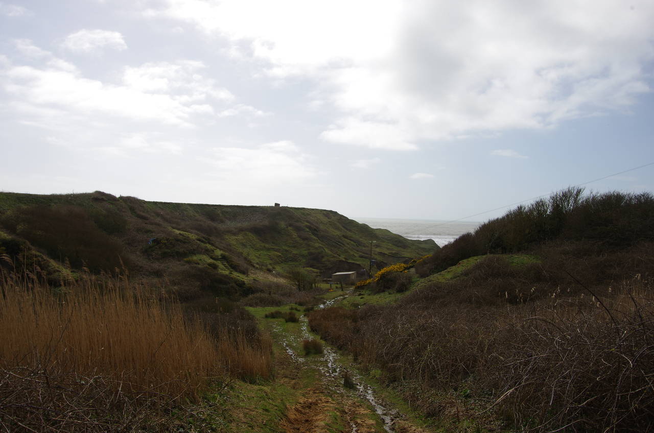
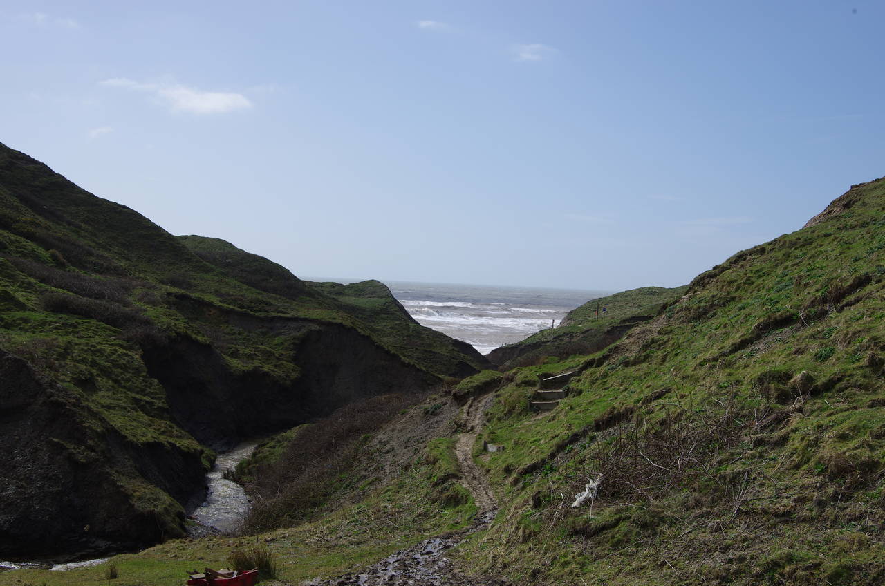
On the far side of the field, the Trail crosses over the A3055 Military Road and joins a path that descends into Shepherds Chine (picture 21). The chine is one of a number of deep clefts cut into the soft cliffs of the Isle of Wight's southern coast by small streams.
Deeper in the chine the path became quite muddy and tricky to navigate (picture 22). The last 100 metres of the path was closed due to landslips caused by the bad weather of the previous winter, so instead of following the path all the way down to the official end of the Shepherds Trail on the small beach at the mouth of the Chine, I instead climbed up to the clifftop above it as the closest accessible point to the end of the trail. My GPS showed 13.7 kilometres walked from Whitcombe Cross.
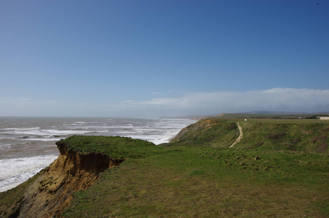
From the clifftop there were good views to the west across Brighstone Bay, where strong winds were churning up a lot of white water and sending waves crashing loudly against the cliffs (picture 23).
This part of the Isle of Wight is something of a black spot as far as public transport is concerned, so I had decided to walk eastwards along the Coastal Path (which I had walked in the other direction during the previous summer) to catch a bus in the village of Chale, about an hour's walk away.
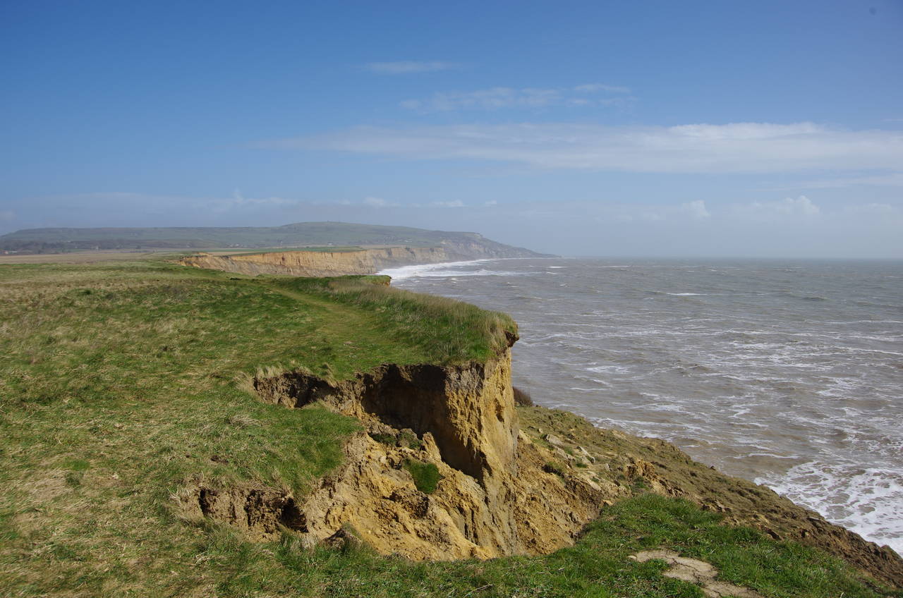
The Coastal Path rounds Atherfield Point and then follows the clifftop above Chale Bay, where the rapid erosion of the coastline was quite apparent. There were several places where I found the trampled grass path that myself and many other walkers had followed the previous summer ending abruptly where a huge bite had been taken out of the cliff (picture 24). In places, it appeared that as much as five metres of the clifftop had disappeared in less than a year.
When I reached the bus stop by the church in Chale, I had walked a total of 22.3 kilometres. It was only as I boarded the bus that it occurred to me that I hadn't seen another person since leaving the castle carpark at Carisbrooke.