ISLE OF WIGHT COAST PATH
Stage 5: East Cowes to Ryde
Friday, May 25, 2012

(1) Gatehouse of Osborne House
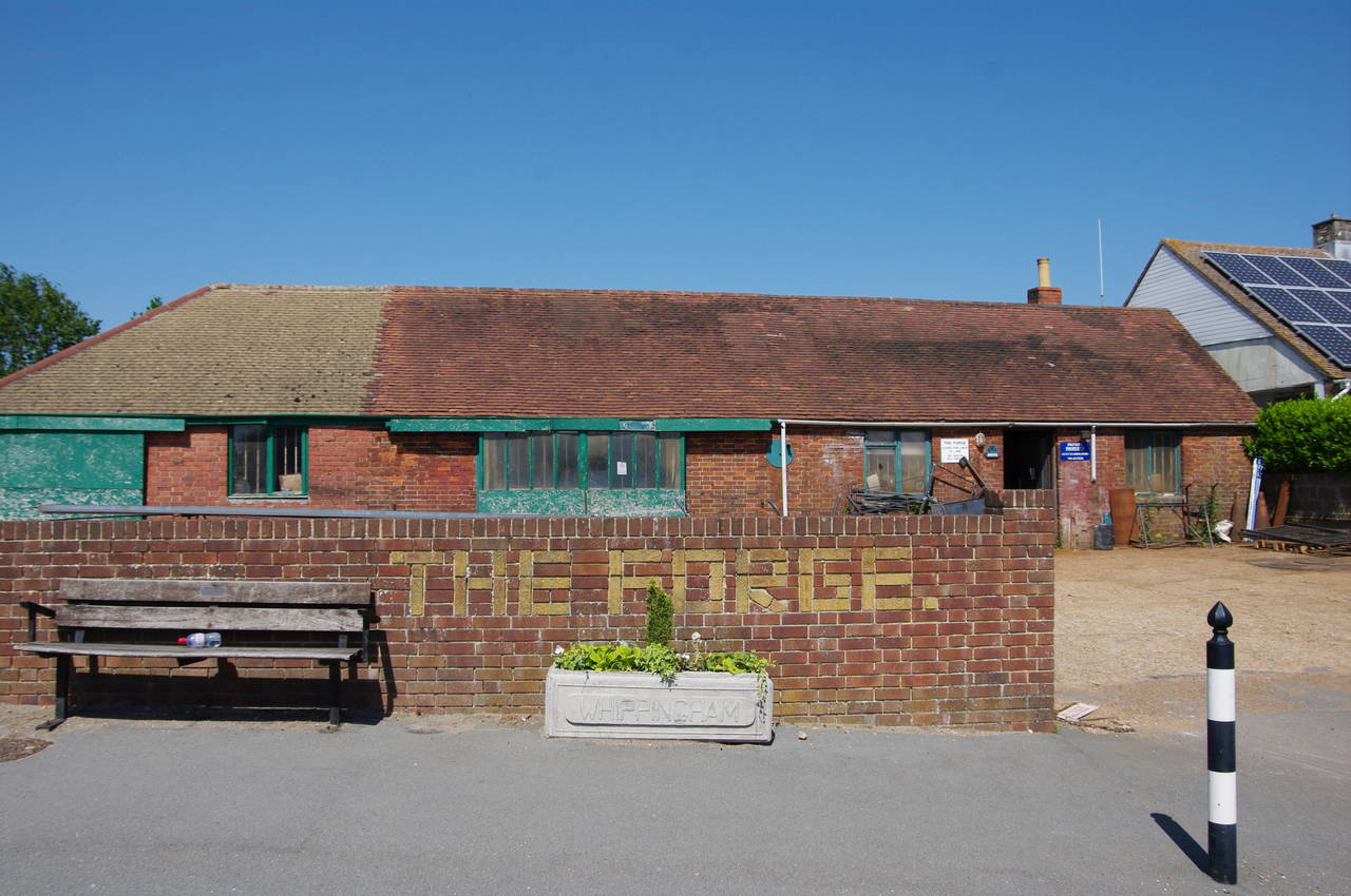
(2) The Forge, Whippingham
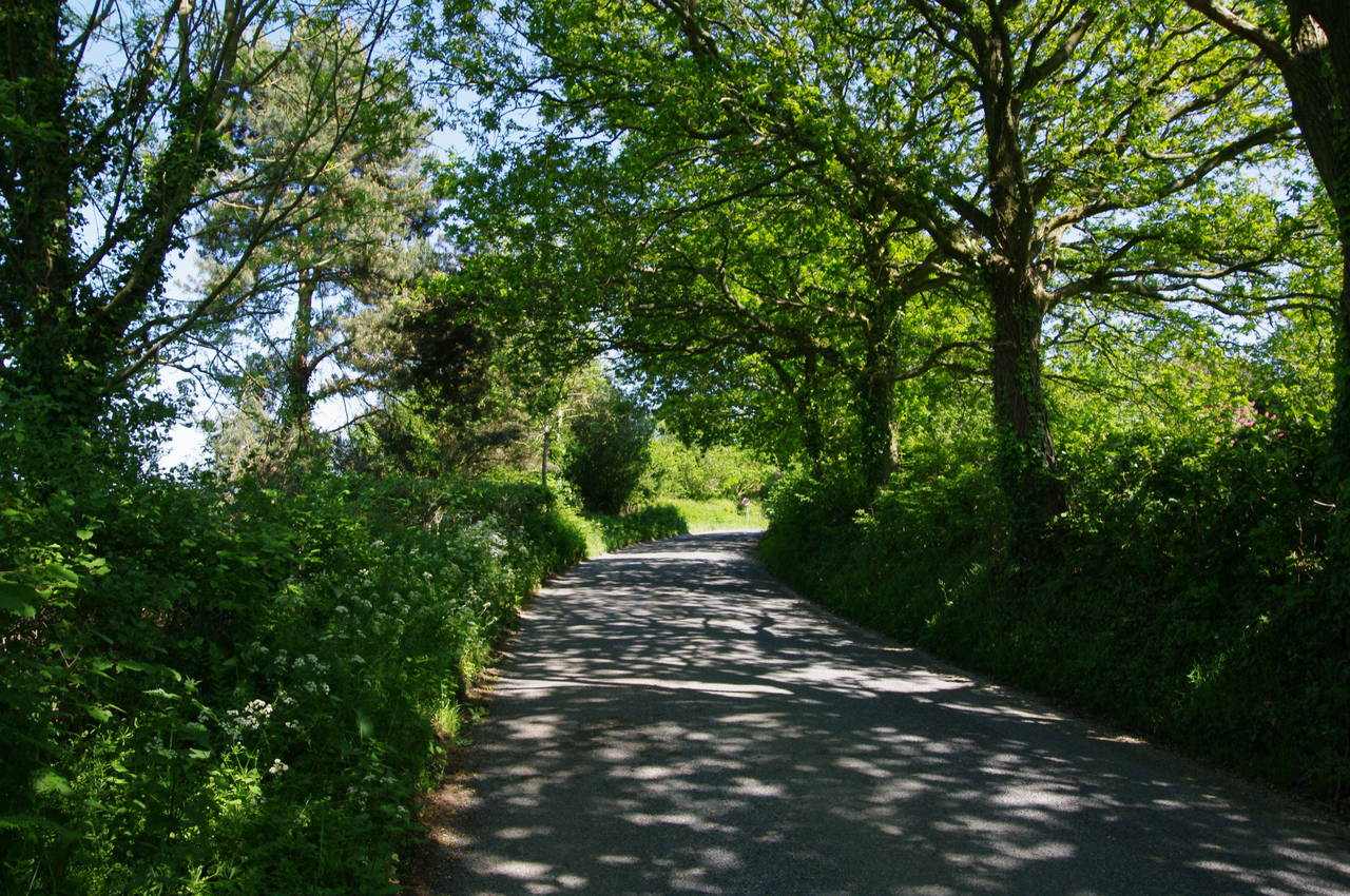
(3) Brocks Copse
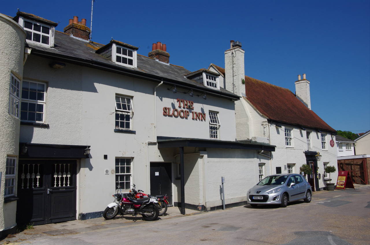
(4) The Sloop Inn, Wootten Bridge
The relatively short 11-kilometre final stage of the Isle of Wight Coast Path, from the eastern outskirts of Cowes back to the starting point in Ryde, is perhaps the least scenic, and certainly the least coastal of the walk. Most of the coast between Cowes and Ryde is privately owned and is not accessible to walkers, so this section of the Coast Path doesn't actually encounter the coast until the very end. There are still several points of interest along the walk, however.
I started the walk on the A3021 York Avenue, in front of the Prince of Wales pub and opposite the main entrance of the Osborne House estate (picture 1). The Coast Path follows the busy road, which soon changes its name to Whippingham Road, for almost two kilometres, eventually turning left into the much quieter Alverstone Road. On this corner is a building named The Forge, for which I imagine it would take quite an effort to change the name (picture 2).
Alverstone Road initially passes a row of neat houses before becoming hedge-lined and running between fields to a crossroads where the Coast Path continues straight ahead on Brocks Copse Road, which soon passes through Brocks Copse (picture 3). A few hundred metres further along the road are the first houses of the town of Wootten and at the end of the road the Coast Path turns left on Palmers Road then almost immediately right on Footways.
At the end of Footways, the route continues ahead between houses on footpath N96 soon bearing left to reach St Edmunds Walk, a quiet residential street which the path follows to the right for about 80 metres before turning off to the right on Footpath N97. After running between more houses, the path emerges on Red Road, continues ahead into the short School Lane and then turns right on New Road. About 80 metres along New Road, a Coastal Path signpost on the right points down Footpath N190, leading to the Sloop Inn (picture 4).
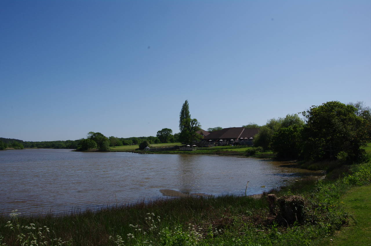
(5) The Old Mill Pond, Wootten Bridge

(6) Quarr Abbey
(7) Church of the Holy Cross, Binstead
(8) Ryde Pier
Just past the pub, the path joins the A3054 and uses the opposite pavement to cross over Wootten Creek via Wootten Bridge. To the south of the bridge, the creek has been dammed to form the picturesque Old Mill Pond (picture 5), while on the north side of the bridge the creek is used as a marina with easy access to the Solent.
Incidentally, Wootten is at the western end of the Isle of Wight Steam Railway, which runs southeast through woods, farmland and the village of Havenstreet to join the main Island Line at Smallbrook Junction, south of Ryde.
After crossing Wootten Bridge, the path continues along the A3054 for about 400 metres before crossing back over and turning left into Ashlake Copse Lane. The lane soon ends and the Coast Path continues ahead through the trees to reach Ashlake Copse Road. Before long, a signpost on the right directs the path along Footpath R1, which leads to Fishbourne Lane. Turning left along the lane, the path passes by the ferry terminal where car ferries regularly arrive from Portsmouth.
Just beyond the ferry terminal, and just before the Fishbourne Inn, the Coast Path turns right on the unsealed Quarr Lane, which soon becomes Quarr Road. This track is followed for almost two kilometres, soon passing Quarr Abbey (picture 6) and a little later the scant ruins of the original abbey. The current Benedictine abbey was founded in 1912, while the original dates from 1132, much of the stone having been taken for use in other building projects after the monasteries were dissolved in the 1530's. The original Quarr Abbey took its name from the local quarries, which provided limestone for notable buildings including Winchester Cathedral.
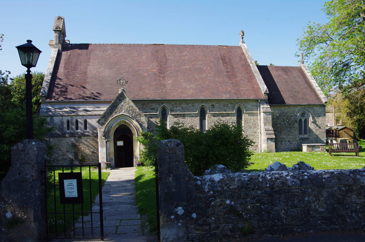
Nearing the end of Quarr Road, the Coast Path reaches the edge of the village of Binstead and at the end of the road the route turns left on Church Road. At a crossroads, the route turns left, still on Church Road and passes in front of the Church of the Holy Cross (picture 7), bearing right onto the tarmacked Ladies Walk.
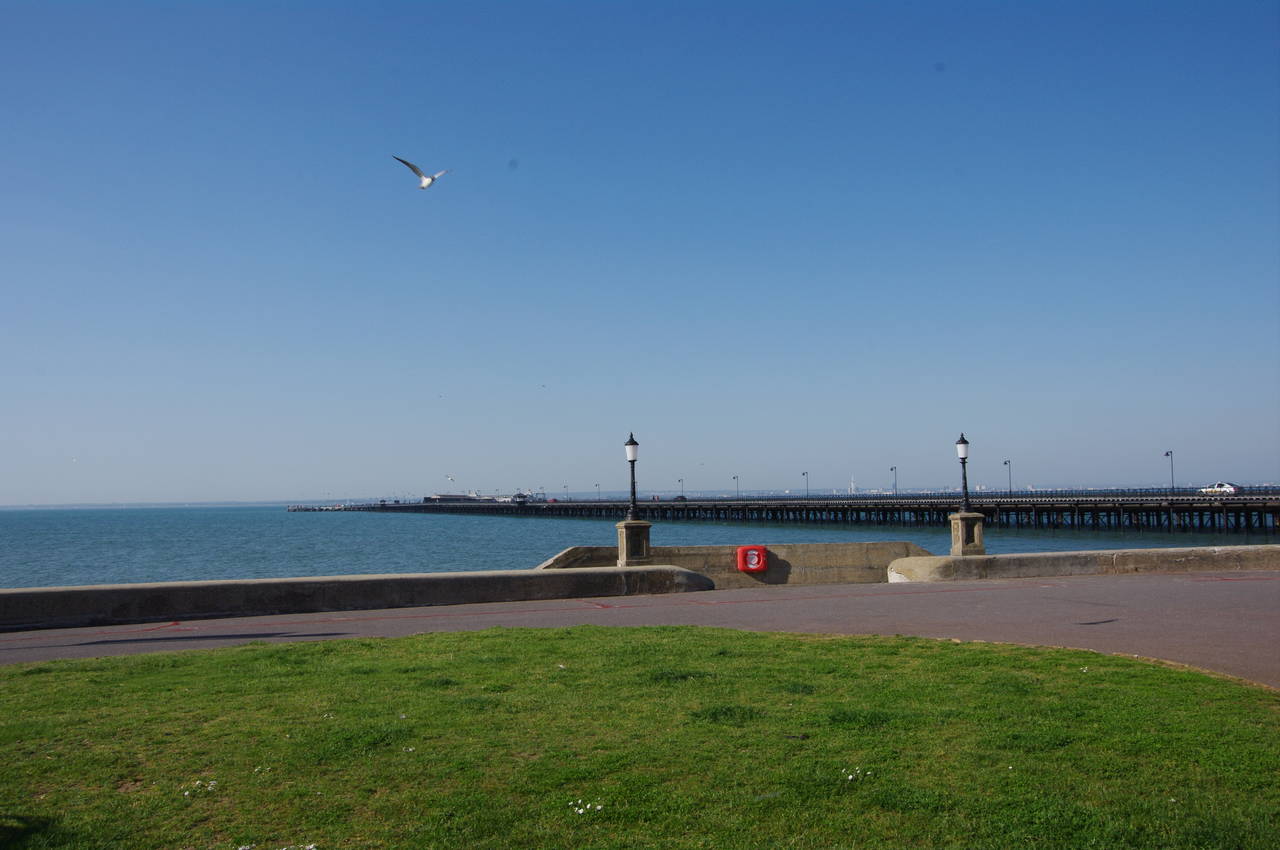
The long hedge-lined path cuts across the middle of the Ryde Golf Club, emerging next to the main A3054 road in the outskirts of Ryde after about 800 metres. Here two roads head off to the left and the Coast Path takes the second of these, Spencer Road. After another 800 metres walking through a residential area, Spencer Road ends and the Coast Path turns left onto St Thomas Street, which leads downhill to Ryde West Sands, where the promenade is followed for the last hundred metres to the landward end of Ryde Pier (picture 8) and the end of a very satisfying circuit of the England's smallest county.