CHANNEL ISLANDS WAY
Stage 10: La Corbiere to St Helier
Tuesday, August 15, 2017
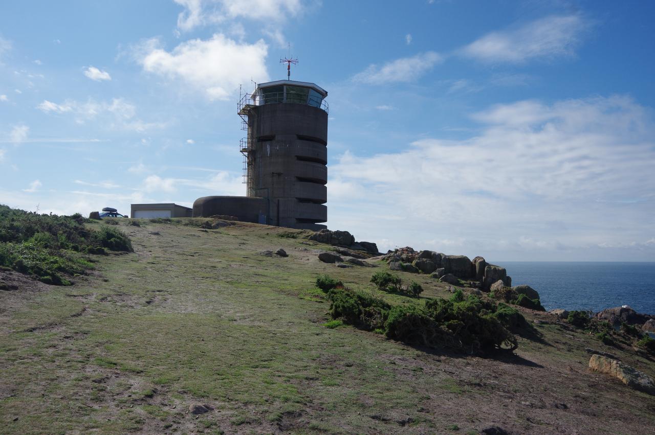
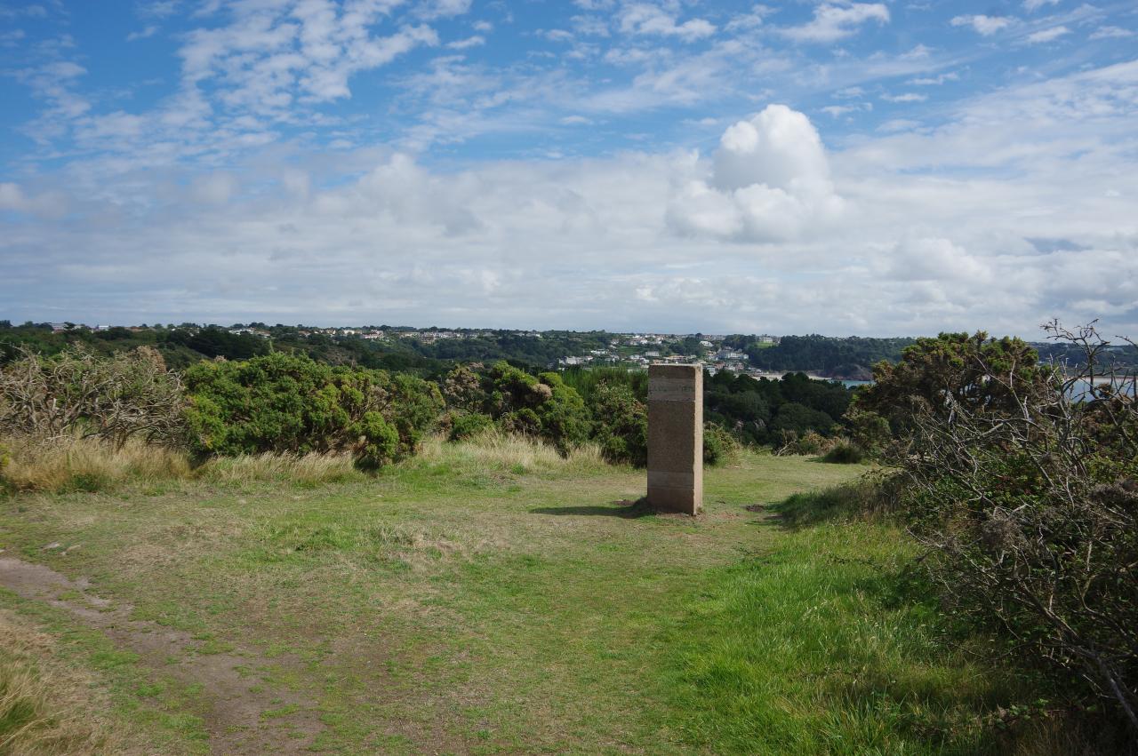
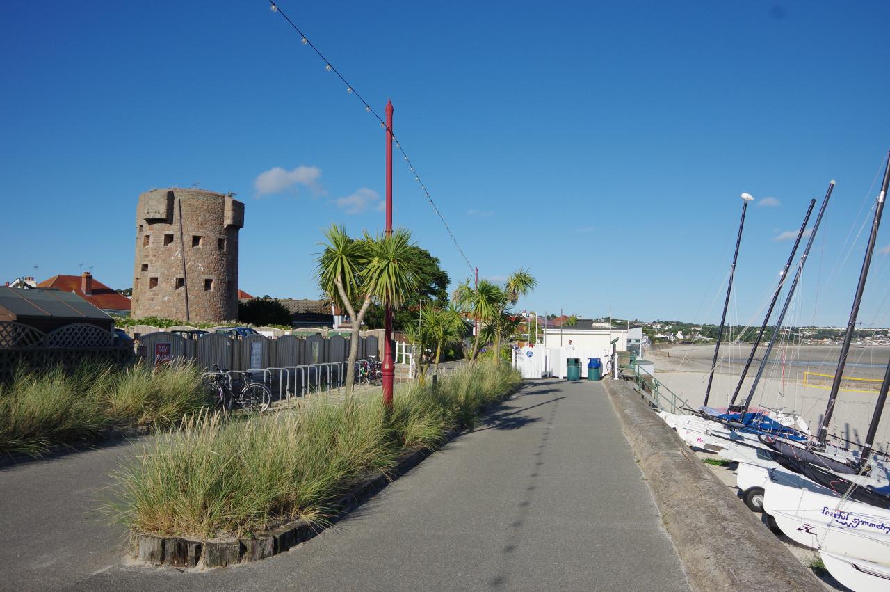
(1) La Corbiere Tower
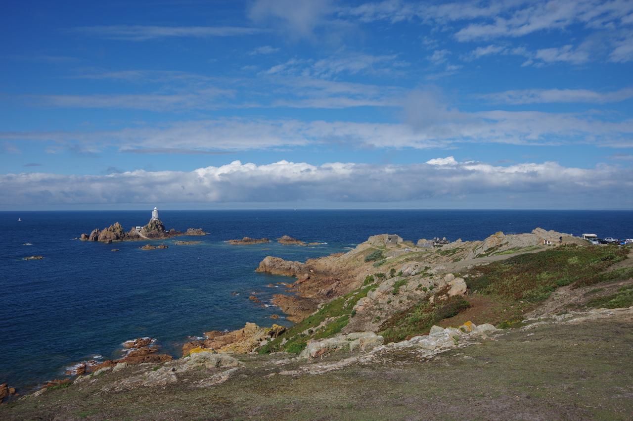
(2) La Corbiere
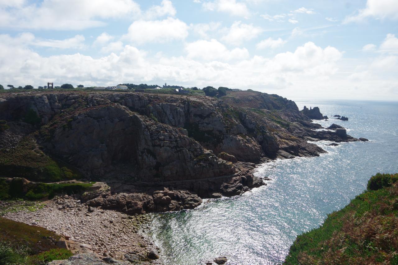
(3) La Rosiere
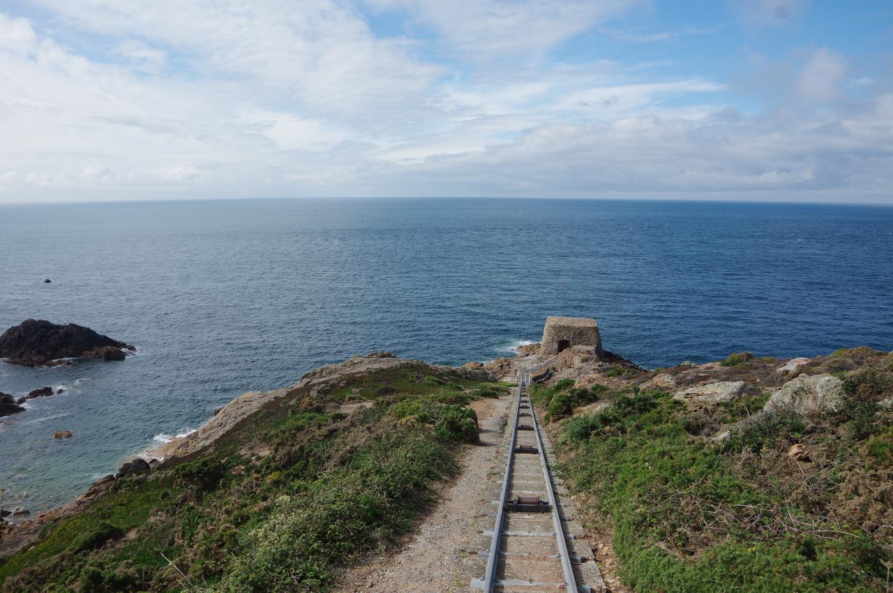
(4) Pump house
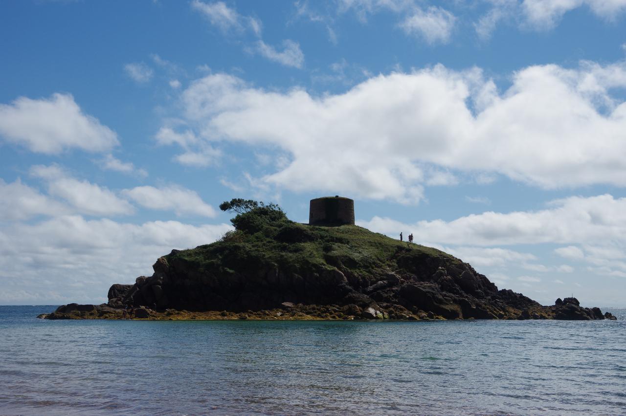
It was bright and sunny when I returned to La Corbiere to start my last day on the Channel Islands Way. I rejoined the path by the six-level German observation tower (picture 1), which was used to control nearby gun batteries. From 1976, the tower was used for Jersey's shipping radio and marine search and rescue services — hence the glass-walled gallery added to the roof. In the early 2000s those services were moved to the harbour in St Helier and the tower was acquired by the Jersey Heritage Trust, who converted it into holiday accommodation.
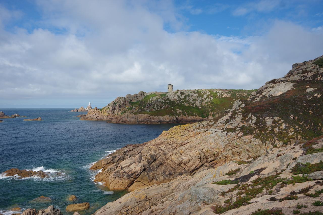
Before heading off on my walk, I paused to admire the view towards the lighthouse (picture 2). The causeway I had walked across the previous evening was now under a few metres of water.
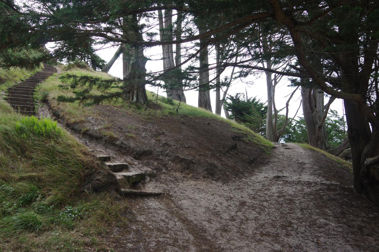
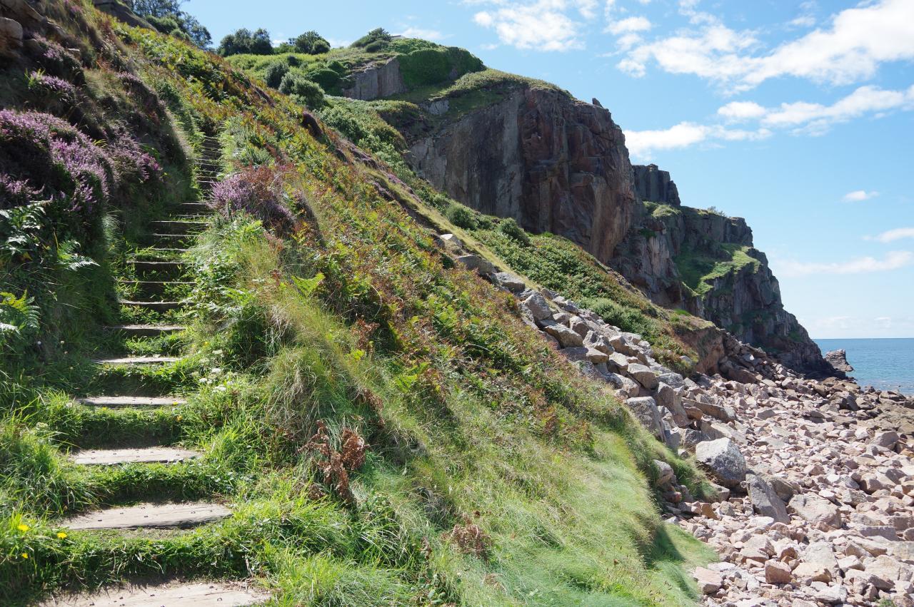
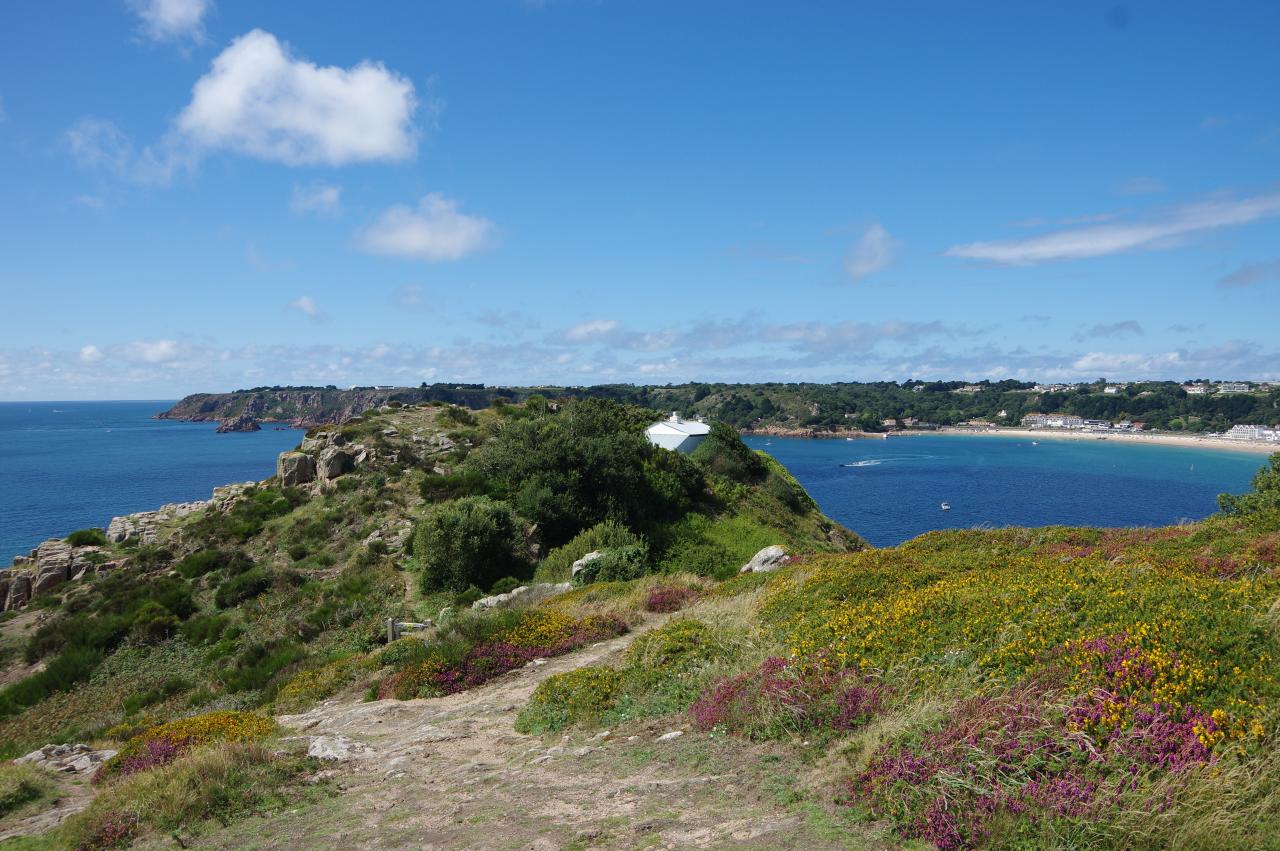
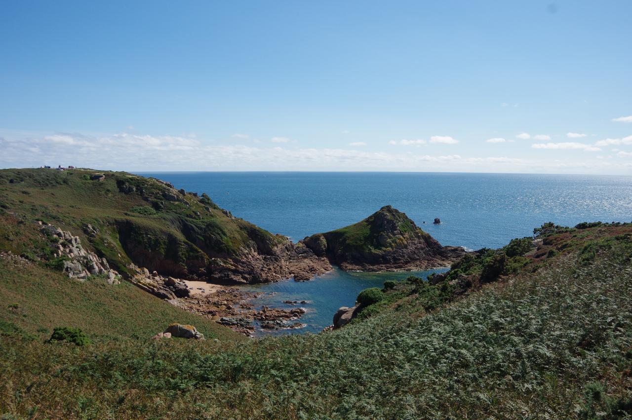
The Way starts out by crossing a carpark beside the tower and following a clear clifftop path that circles above a small cove and below The Highlands Hotel to the headland of La Rosiere (picture 3). Shortly after passing a small stone hut with grass growing on the roof, the path descends beside a chain-link fence to meet a narrow-gauge railway line running steeply down to a small, square stone building on the tip of the headland (picture 4). Sadly, I didn't get to see what kind of vehicle travels on these rails.
The building is a pump house that takes in seawater for a desalination plant located in a disused quarry on the top of the headland. The plant was built in 1999 and only operates when the island's natural water supply is insufficient. It is capable of providing up to six million litres of fresh water per day — about a quarter of Jersey's average consumption.
(5) View back to La Corbiere
(6) La Rosiere
(7) Weather radar station
(8) Ficquet Bay
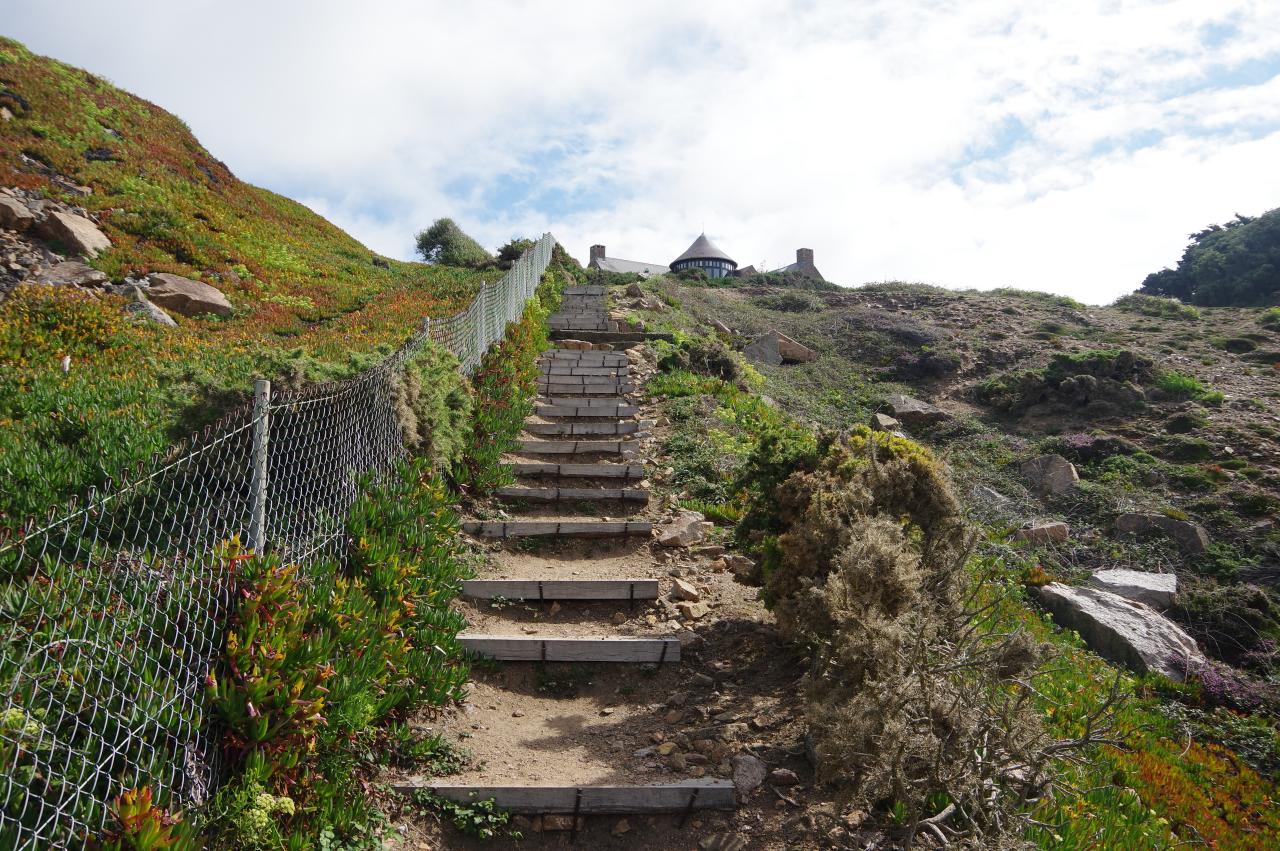
The Way follows the rails downhill until they are about to become enclosed by railings on both sides. There is a good view back to La Corbiere from close to sea-level (picture 5) as a concrete path on the left starts to climb back up to the clifftop, passing a narrow fissure carrying the pipes from the pumping station before climbing a long flight of rough steps towards a fancy house (picture 6).
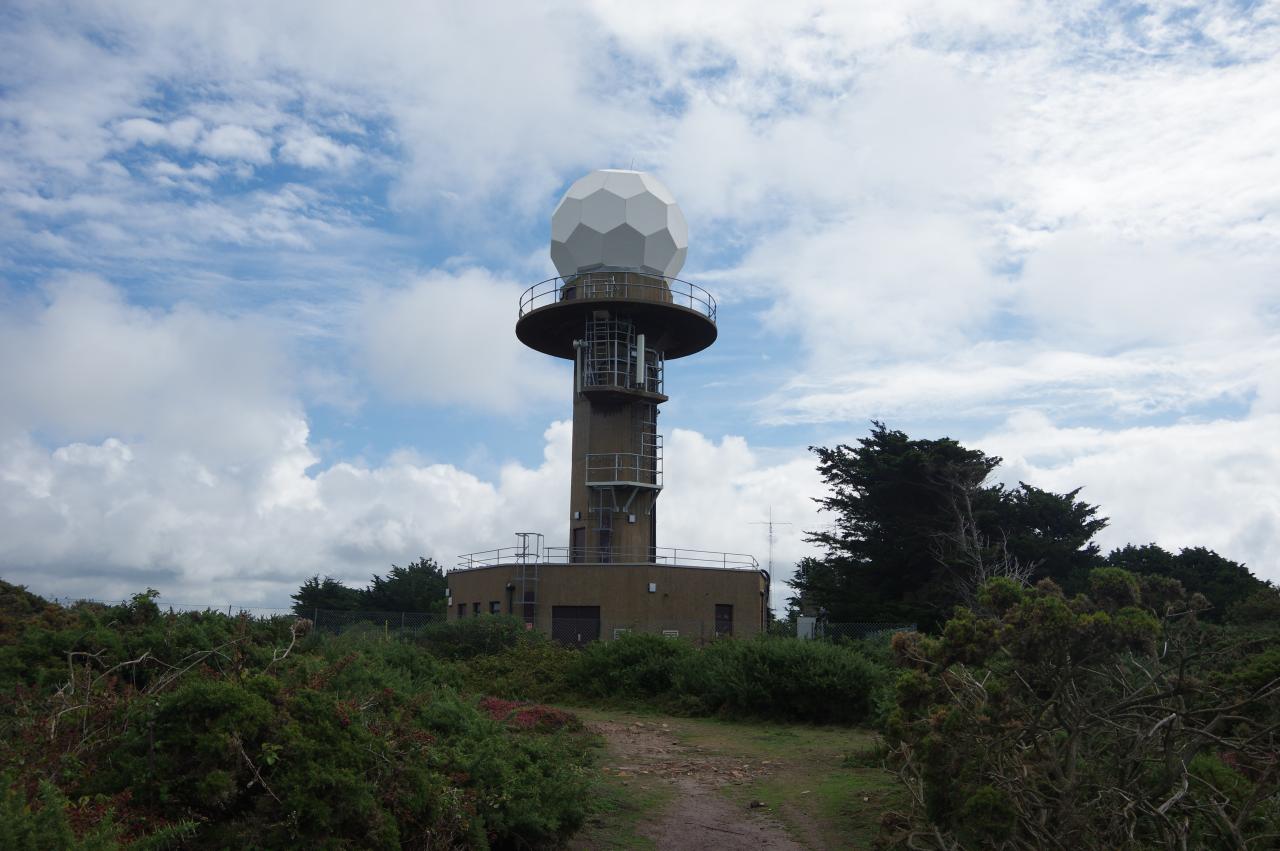
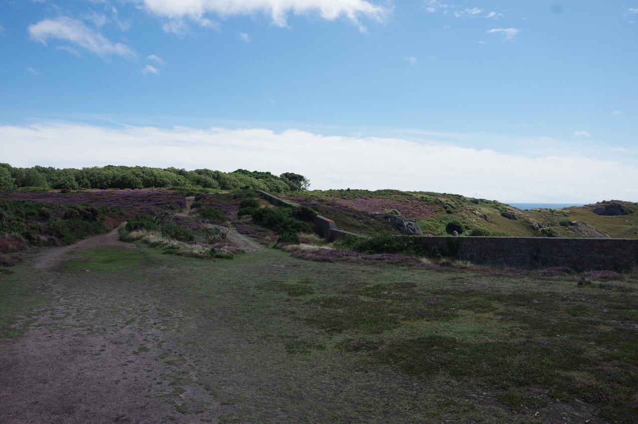
At the top of the steps the path turns right, crossing another track to climb more roughly cut steps, this time with wire fences on both sides. Having finally regained the clifftop, the path heads to the landward side of a pair of houses and then sets off through waist-high gorse towards a weather radar station that resembles a giant golf ball atop a giant golf tee (picture 7).
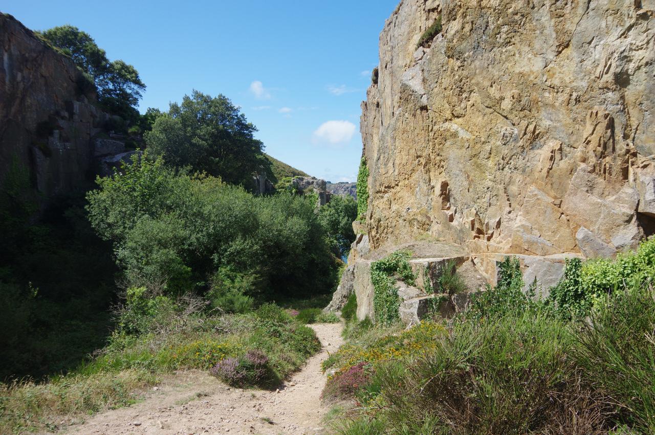
A broader track from the weather station snakes onward through the gorse to meet Le Chemin des Signaux by the tall and forbidding double fences of the La Moye Prison, from which no inmate has ever escaped. The Way turns right along the road, which soon turns left around the corner of the prison before bearing away to the right halfway along the fence. When the road ends at a gate bearing the name HM Old Signal Point, a path bears left past a short stone pillar labeled Les Ieaux des Ficquet to rejoin the clifftop overlooking the inaccessible rocky inlet of Ficquet Bay (picture 8).
(9) La Grosse Tete
(10) La Beauport
(11) Bouilly Port
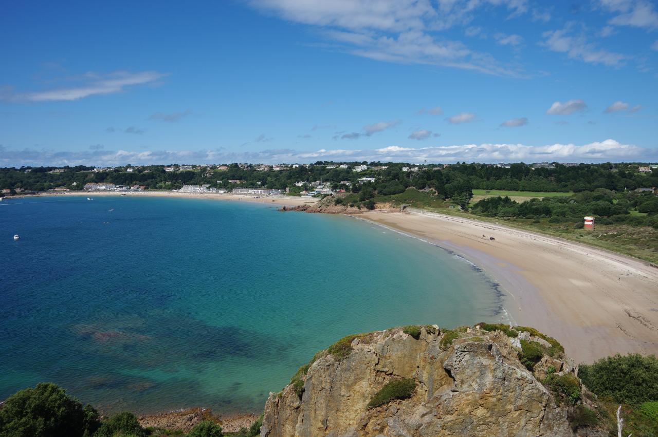
(12) St Brelade's Bay
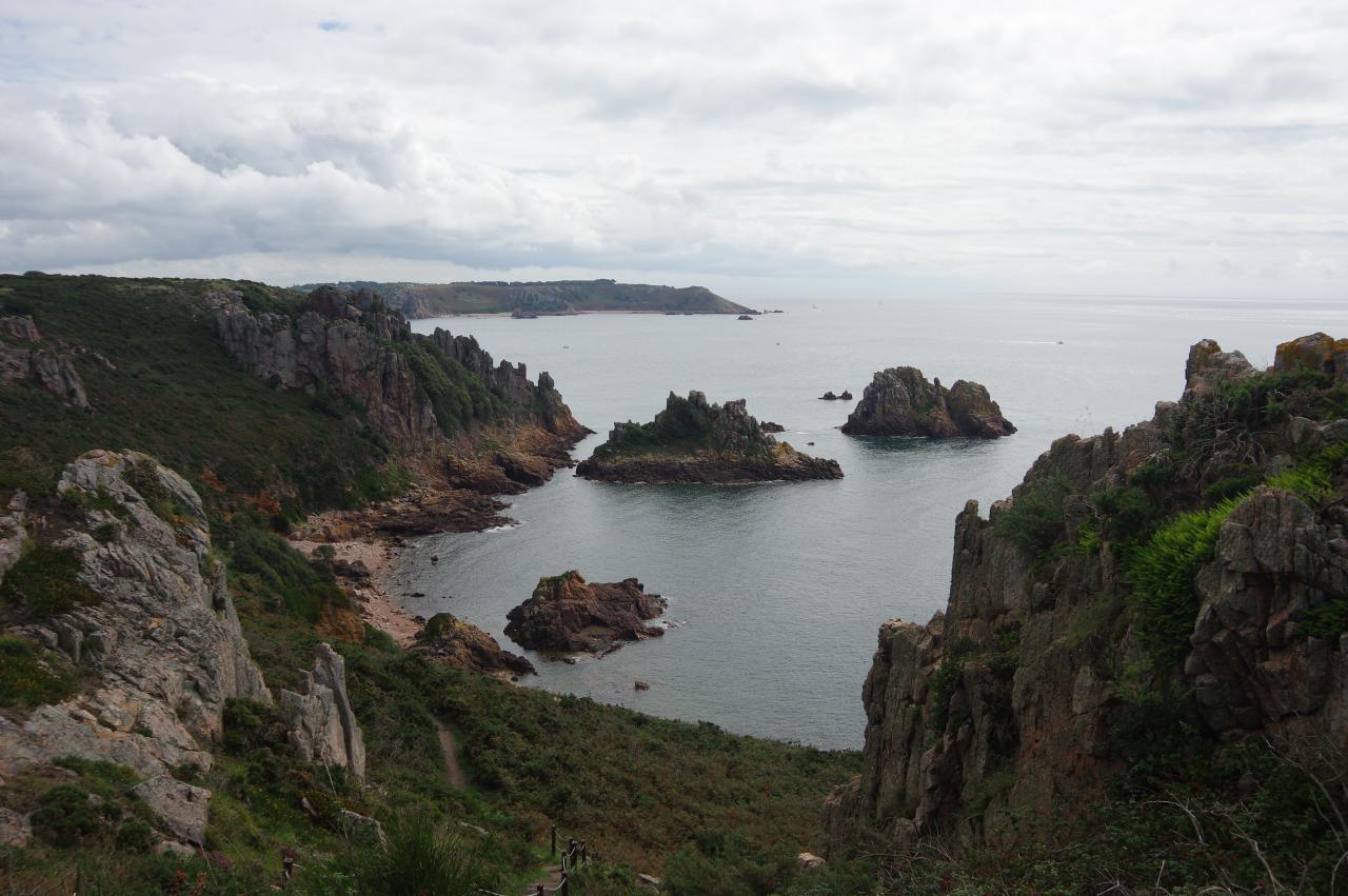
The path descends steps between tall granite outcrops to cross the steep hillside above the bay then climbs up to the next headland, which another stone pillar proclaims as La Grosse Tete (picture 9). There are good views down to the popular little beach of La Beauport (picture 10) before the path heads a little inland to the Beauport Carpark.
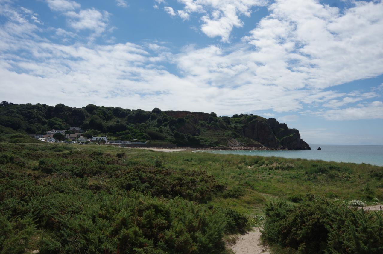
One must cross the carpark and continue inland on it's access road to find a fingerpost and footpath on the right. This footpath follows a fence for a short distance then crosses a shallow, wooded valley to emerge on more open ground. Now a well-worn groove, the path meanders along the top edge of a slope. Just before the path begins to descend into trees, there is a brief view over Bouilly Port (picture 11), which the path has already passed, while ahead the long crescent of St Brelade's Bay is visible over the treetops (picture 12).
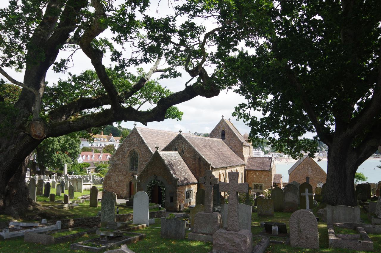
(13) St Brelade's Parish Church
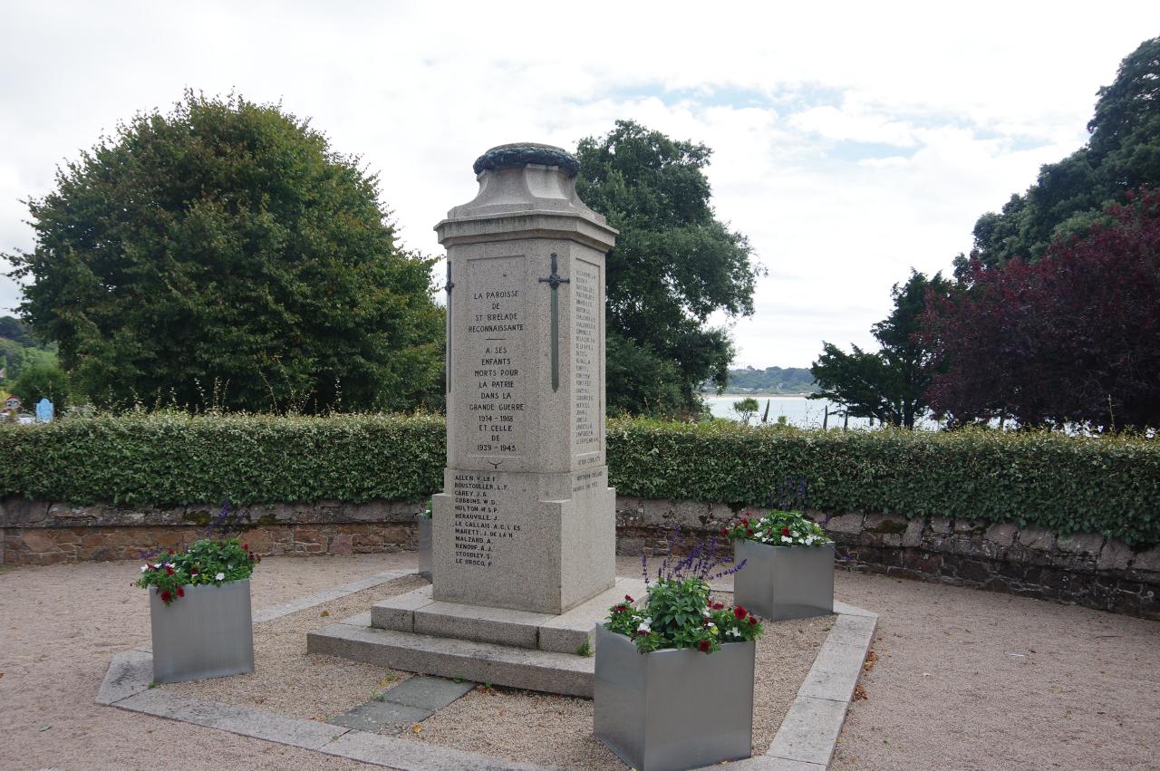
(14) St Brelade's War Memorial
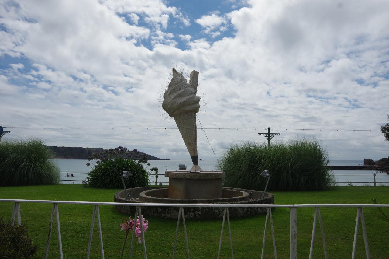
(15) Podium Art
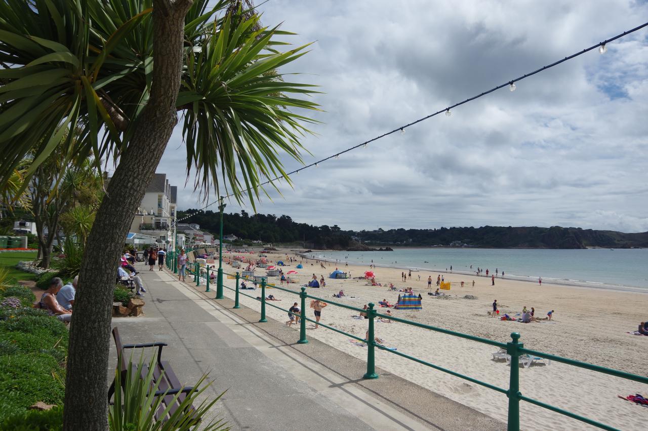
(16) St Brelade's Bay
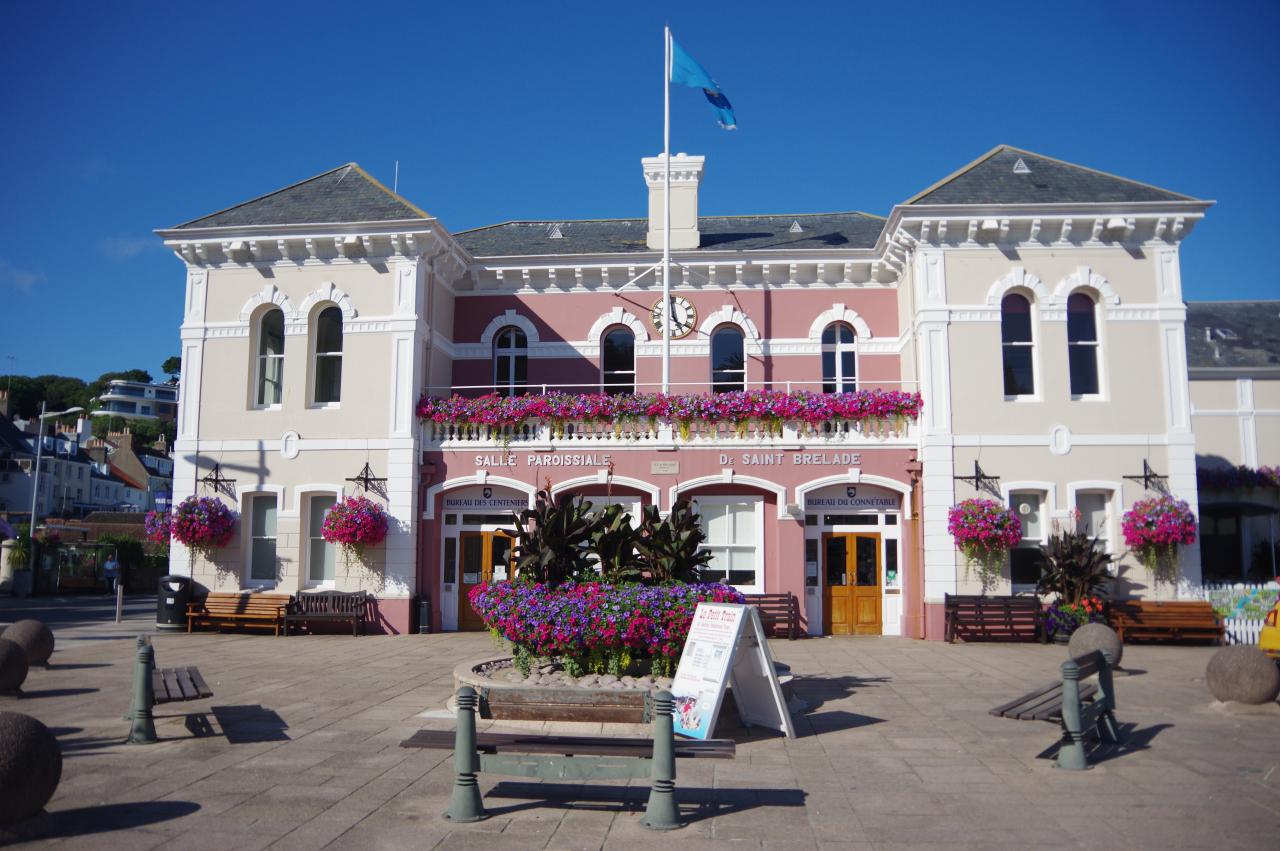
The path drops down through the trees to turn left on the Chemin des Creux. The narrow road is followed up to a junction with St Brelade's Parish Church on the right (picture 13) and the church hall ahead. The Way bears right to follow Mont es Croix between the two and along the edge of the churchyard to the next corner, where the parish's war memorial stands (picture 14).
Turning right on La Route de la Baie, one must endure a short stretch without a pavement to reach a little rectangular park opposite St Brelade's Bay Hotel, where the balconies were festooned with colourful flower-boxes. In the centre of the park is a podium, where different works by local artists are displayed each year. The winner for 2017 was titled Monument to the Departed (with a flake), by Dan Entwistle (picture 15).
The Way soon leaves the road and joins the beachside promenade (picture 16). As I strolled along here, I began to wonder if the Podium Art was really a clever marketing ploy by the local businesses as I found myself scanning each of the establishments I passed to see if they could satisfy a sudden craving for an ice-cream. I didn't even get halfway around the bay before I surrendered to temptation.
(17) Le Grouin
(18) Ouaisne Bay
(19) Ouaisne Tower
(20) Ouaisne Common
At the end of the promenade, concrete steps climb past a sealed German bunker and onto the small headland of Le Grouin. A level path leads out to a battery on the end of the headland, but the Way ignores it and instead climbs more steps over the spine of the headland (picture 17) and descends over the roof of another bunker (picture 18) to join a well-worn path next to an anti-tank wall that runs almost all the way around Ouaisne Bay.
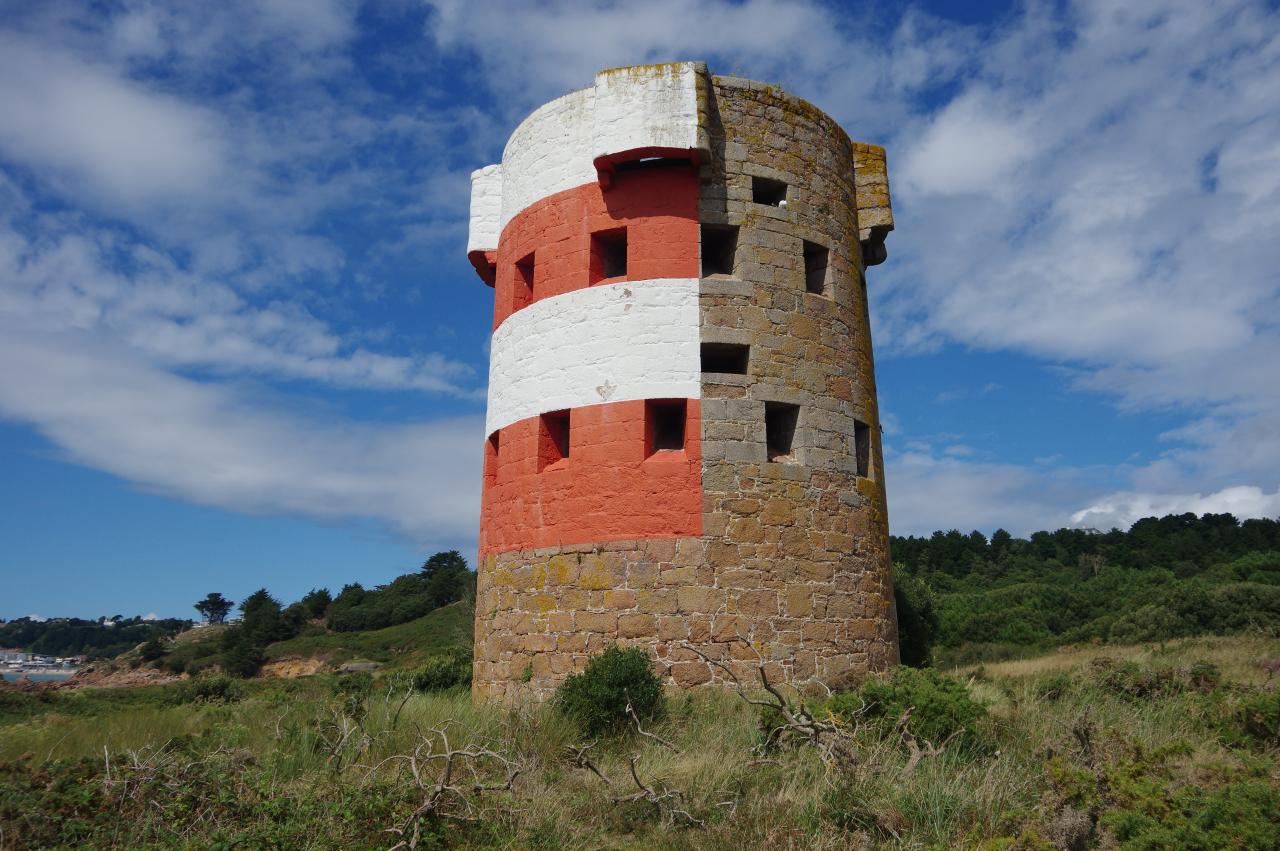
Ouaisne Bay is a huge contrast to neighbouring St Brelade's Bay; relatively undeveloped and much less visited. The path was lined with marram grass and many patches of wildflowers as I walked to the Ouaisne Tower (picture 19), halfway around the bay. The tower was built sometime in the 1780s and now, like most of the loophole towers, is painted on the seaward side to assist navigation.
Beyond the tower, the Way keeps following the path by the anti-tank wall to a carpark at the end of the beach, while the gorse-covered expanse of Ouaisne Common (picture 20) stretches away inland. Before World War II, the Common was an area of shifting sand dunes, but the anti-tank wall now prevents significant movement and the area is slowly transforming into a heath. The Common is home to several rare plants and birds, as well as the Agile Frog, which is Jersey's only native species of frog.
(21) Climbing from Ouaisne Bay
(22) Quarry
(23) St Brelade's Bay and Ouaisne Bay
(24) Portelet Common
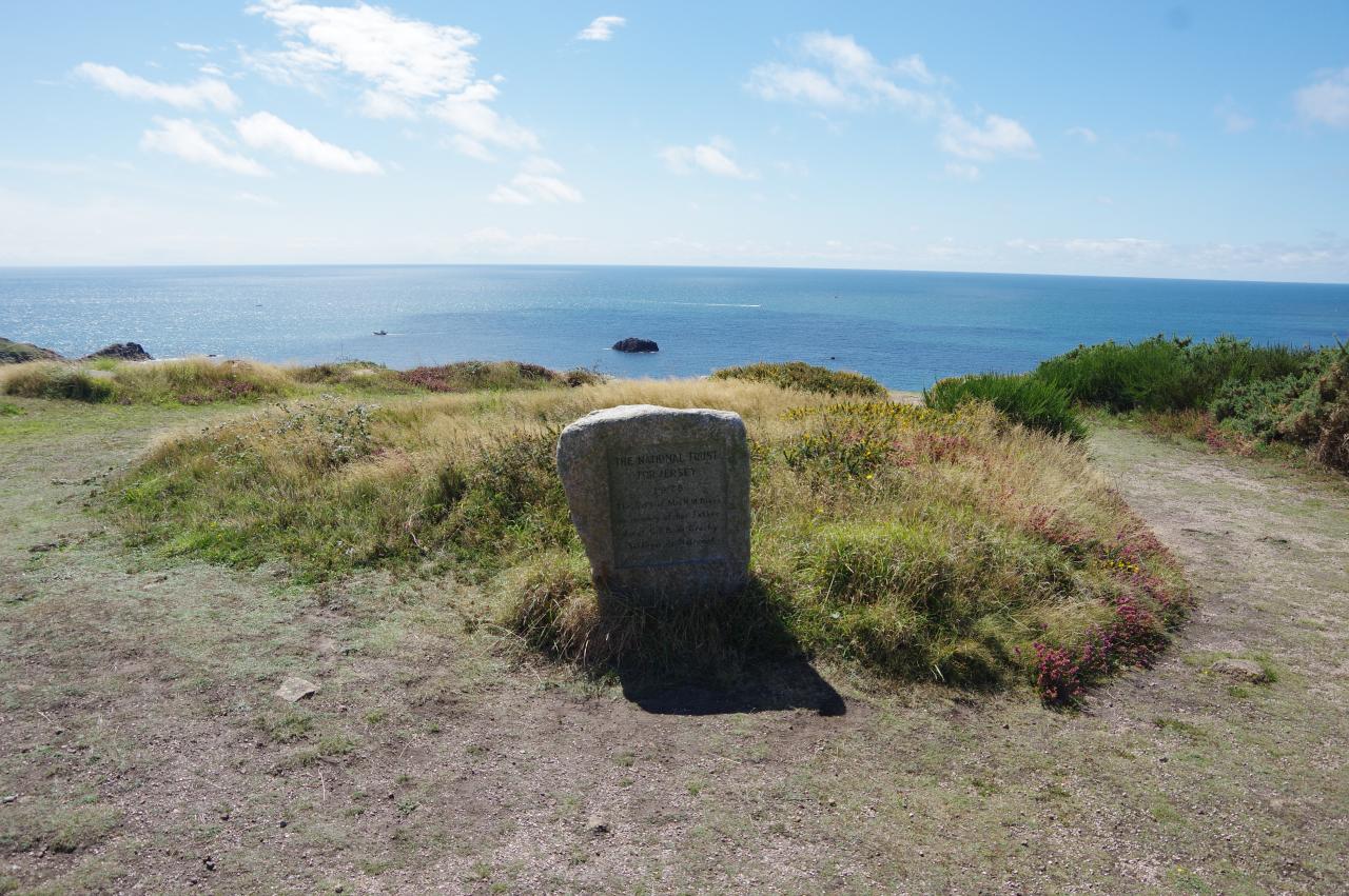
The Way goes down a slipway on the far side of the carpark, following a narrow apron along the foot of the seawall then scrambling across rocks for 50 metres to find some rough steps (picture 21) at the beginning of a long climb up to a disused quarry on the next headland. The path runs through the floor of the quarry, now partly reclaimed by vegetation (picture 22) to find some more steps up to the edge of Portelet Common. There is a fine view back across Ouaisne Bay and St Brelade's Bay (picture 23) as the path approaches an inscribed stone that commemorates the gift of the Common to the National Trust for Jersey in 1978 (picture 24).
(25) La Cotte de St Brelade
(26) Portelet Common
(27) Portelet Inn
(28) Portelet Bay
On the far side of the quarry is the hump of La Cotte de St Brelade (picture 25), an archaeological site where human and animal bones discovered in a cave revealed that this area may have been inhabited by early humans as much as 200,000 years ago.
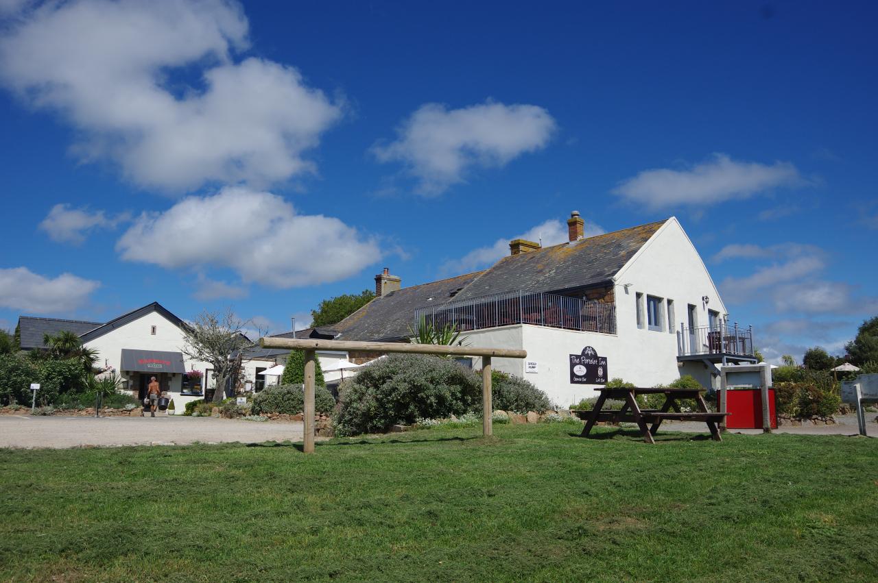
An obvious path heads out along the edge of the common, soon accompanied by a stout concrete wall (picture 26) that fences off the next headland. At a gate in a corner of the wall, the Channel Islands Way eschews the path through the gate onto the headland and instead turns left through trees and follows a chain-link fence along the edge of the common to a small carpark. A fingerpost points to the right along Le Chemin de Portelet and, after about 300 metres, another right turn takes the Way down La Rue Voisin. At the end of the lane, a left turn along Portelet Lane leads to the large Portelet Inn (picture 27), which has been in business since 1606.
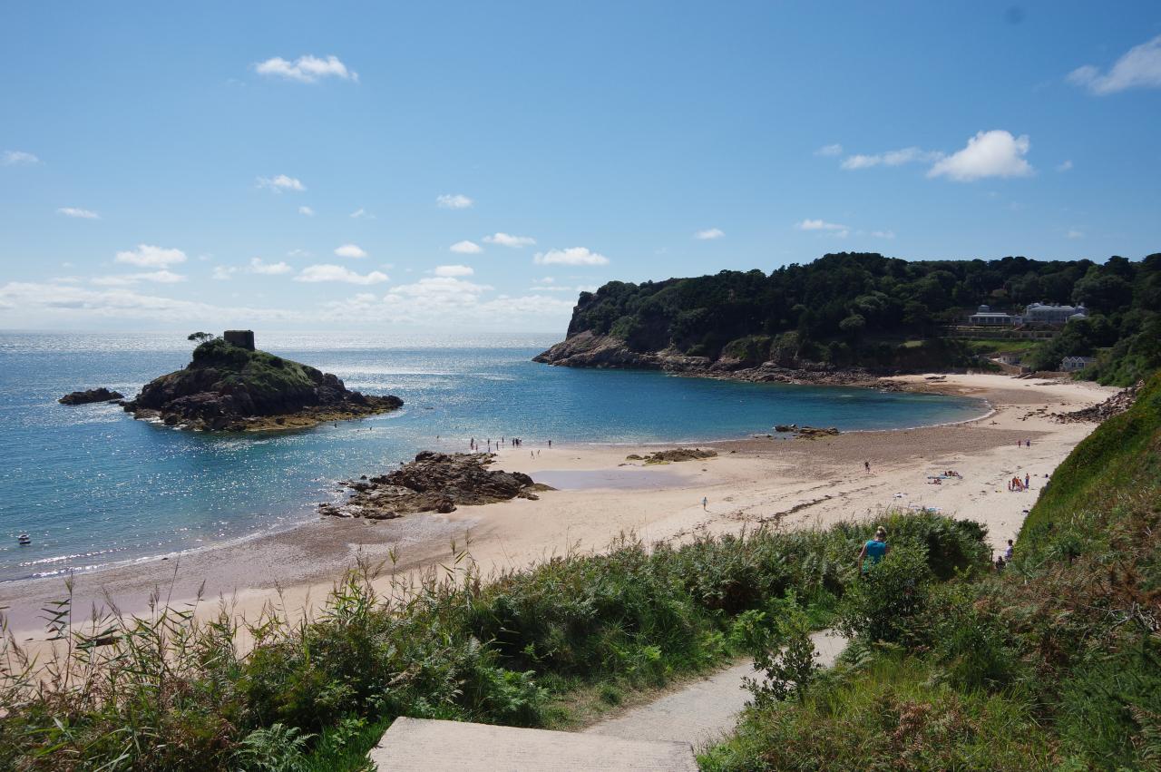
I stopped at the pub for lunch, and before I continued along the coastal path I walked down a path that starts in front of the pub and descends to the beach at Portelet Bay (picture 28).
(29) Janvrin's Tomb
(30) Noirmont Point
(31) Noirmont Point
(32) WWII Memorial, Noirmont Point
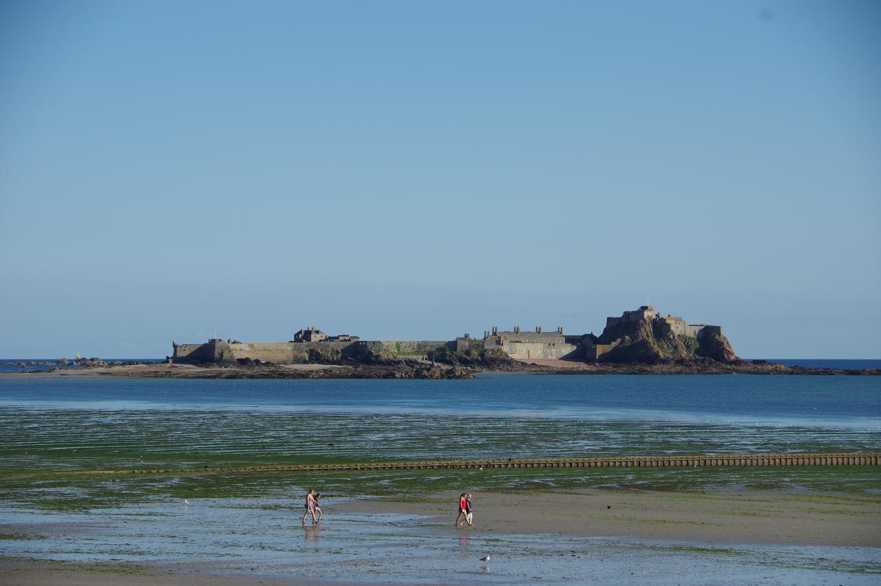
The little island in the middle of the bay, topped by the Portelet Tower, is L'Ile au Guerdain (picture 29). The island is also known as Janvrin's Tomb, but that name isn't quite accurate. Philippe Janvrin was a Jersey seafarer who died of plague in 1721 while his ship was anchored off Jersey in quarantine. The authorities wouldn't allow him to be buried on Jersey for fear of spreading the plague, so he was initially buried on the little island in the bay instead, but was later reburied in St Brelade's Churchyard. The Martello Tower was built on the island almost a century later, in 1808, during the Napoleonic Wars.
After returning to the pub, I walked a short distance further along Portelet Lane to turn into the beach carpark. A path on the other side parallels the long driveway of a lone house before skirting around the rim of a rocky cove (picture 30) and heading out onto Noirmont Point (picture 31), which was heavily fortified during the Occupation.
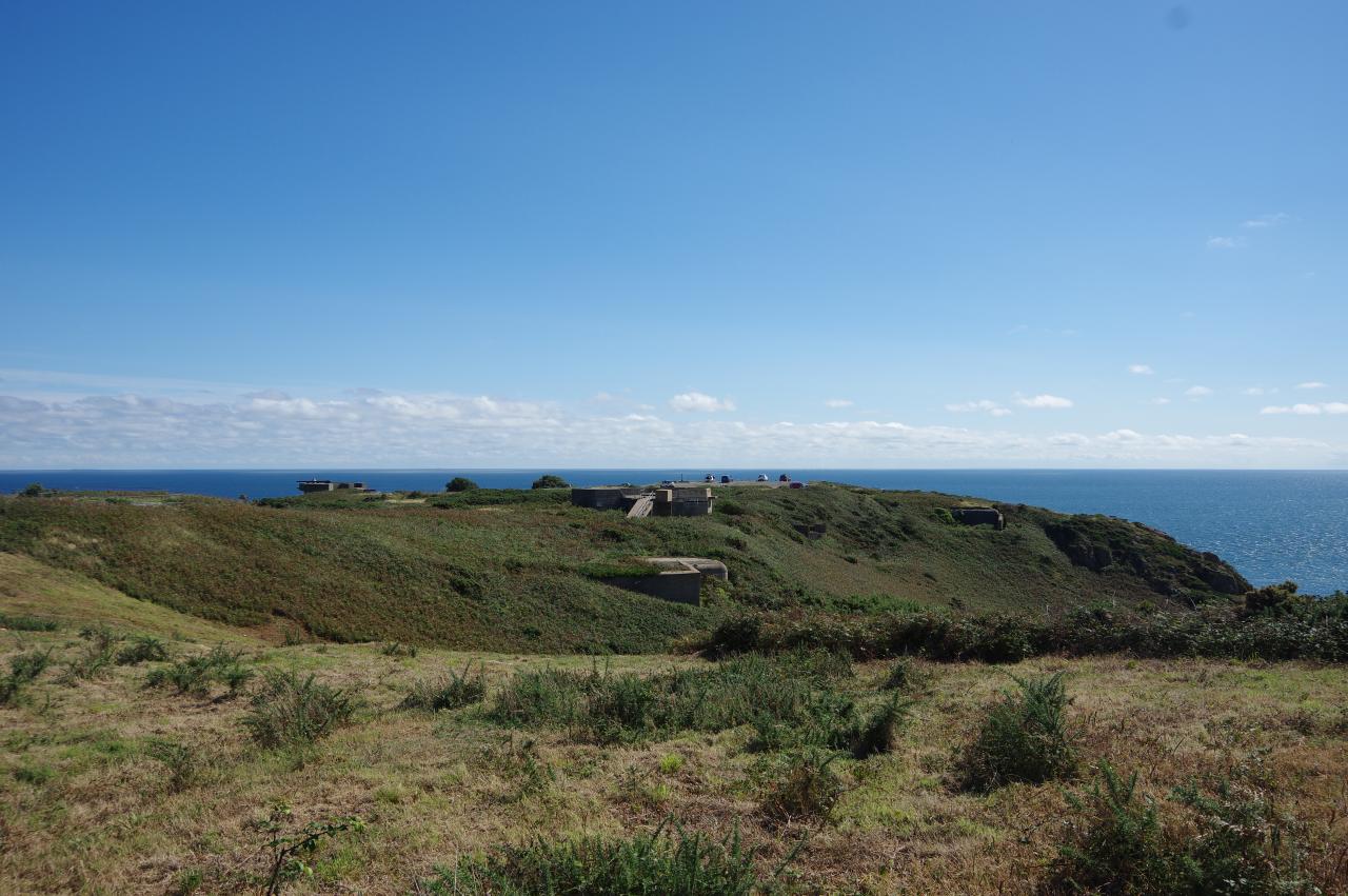
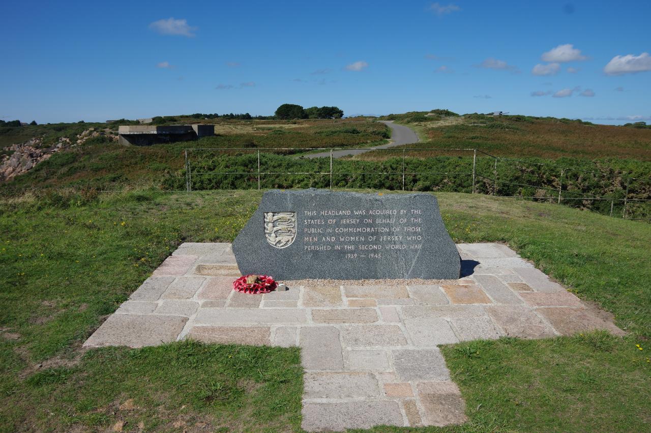
The path passes a gun emplacement before turning right along Le Chemin de Noirmont, which passes more than a dozen other wartime structures on the way to a carpark at the end of the headland, where a memorial remembers the people of Jersey who died during the war (picture 32).

(33) Noirmont Point
(34) Gun emplacement overlooking St Aubin's Bay
(35) PT Squadron 34 Memorial
(36) La Rue de Haut
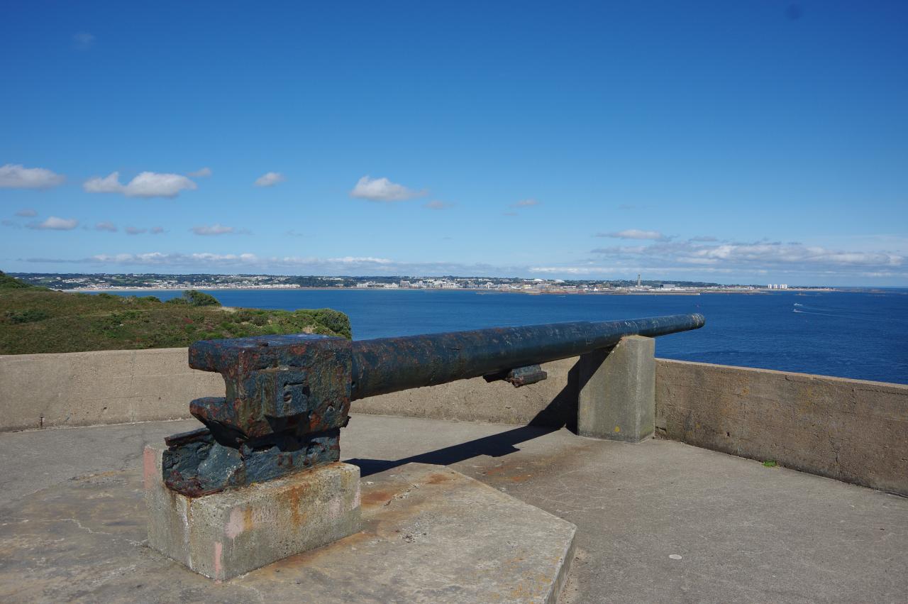
Nearby, at the tip of the headland, a German naval observation tower is built into the hillside rather than on top of the headland like the others I had seen on the islands. This allows one to walk on the roof of the tower, which overlooks a Martello tower built on rocks at the foot of the cliffs (picture 33).
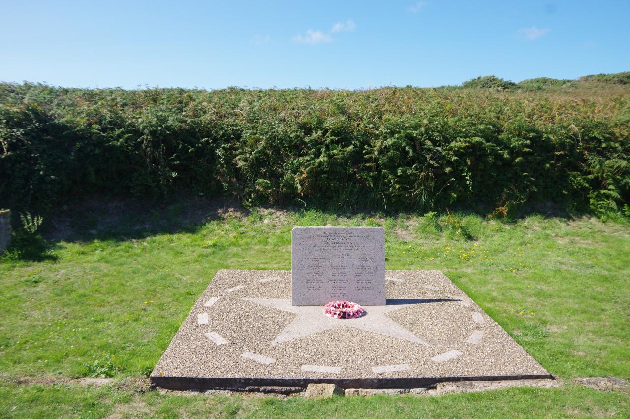
By the east end of the carpark, a gun emplacement provides a good viewpoint to look across St Aubin's Bay to St Helier, where the tall chimney of the power station is a prominent feature of the skyline (picture 34). A path leads away from the gun emplacement, soon passing the PT Squadron 34 Memorial, bearing the names of sixteen American sailors who lost their lives off Noirmont Point on 9 August 1944 (picture 35).
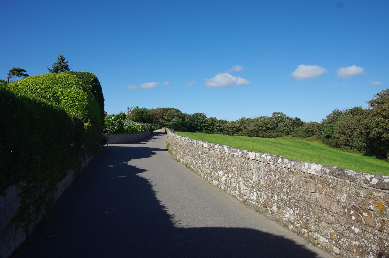
The path continues along the clifftop with magnificent views across St Aubin's Bay until the path comes up beside a chain-link fence and follows it through woods, eventually emerging on the Route de Noirmont, just to the left of a crossroads. The Way goes through the crossroads and on to the next, turning right along the narrow and stone-walled La Rue de Haut (picture 36).
(37) St Aubin Harbour
(38) St Brelade Parish Hall
(39) St Aubin's Bay
(40) St Aubin
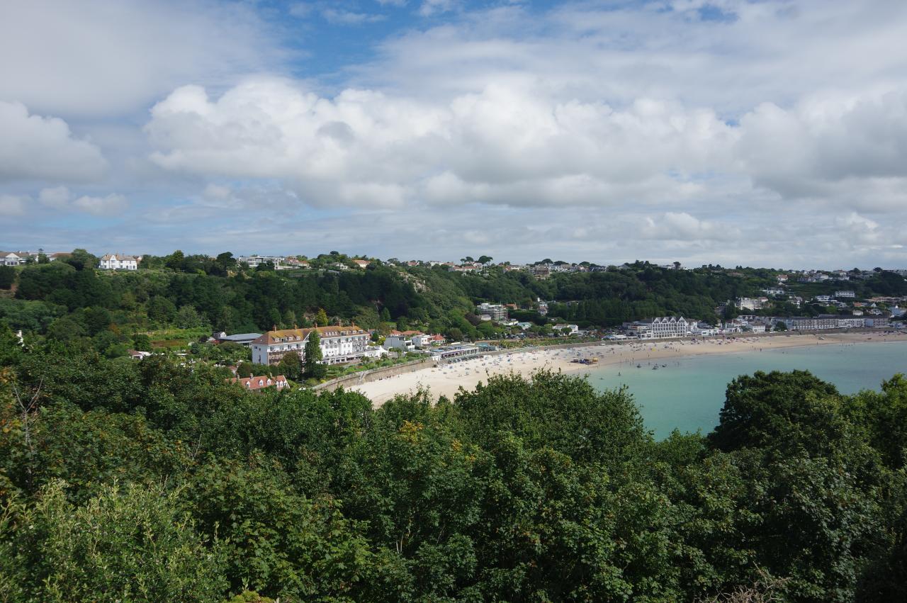
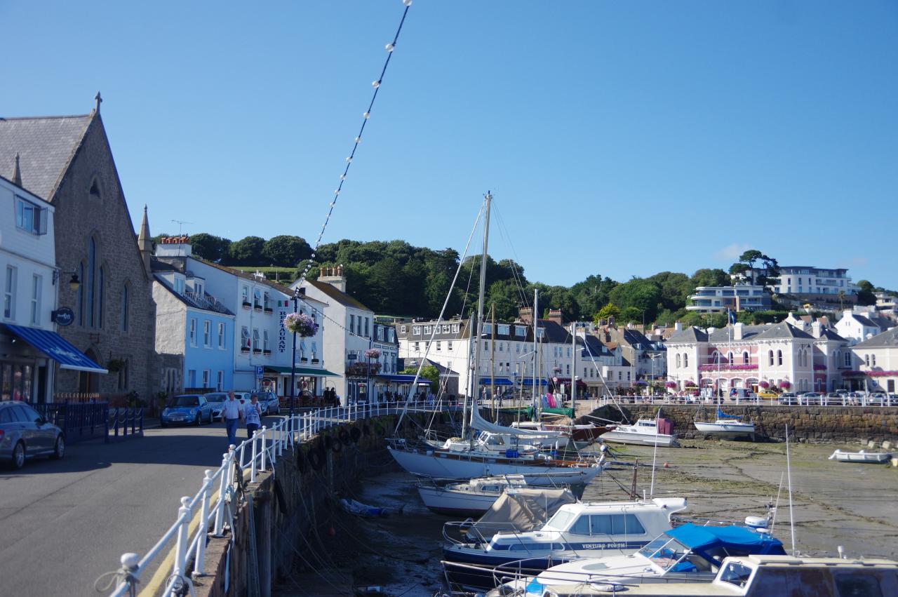
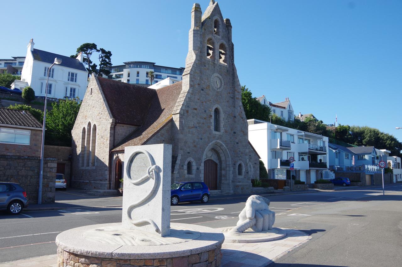
After 750 metres, La Rue de Haut becomes Mont es Tours, which twists and turns as it heads steeply downhill into the village of St Aubin. Mont es Tours in turn becomes the residential Mont de Boulevard, descending amongst houses to a corner of St Aubin Harbour.
Le Boulevard runs along the edge of the harbour, passing some grand seaside buildings, including St Aubin's Church (picture 37). Opposite the next corner of the harbour is the St Brelade Parish Hall (picture 38), originally built as a railway station. The station was the terminus when the line from St Helier arrived in October 1870, but became an intermediate station when the line was extended to La Corbiere in 1885. The line was never financially successful, with the operating company going bankrupt in 1874 and again in 1895, and the line closed for good in 1937.
The trackbed between St Aubin and La Corbiere was converted into a walking and cycling path, which I walked the day after this walk, while the trackbed in the opposite direction is now the promenade path that runs all the way around St Aubin's Bay to St Helier, about five kilometres away. The Way turns right past the front of the Parish Hall and an adjoining building before turning left across a carpark to join the beginning of the promenade next to the seawall.
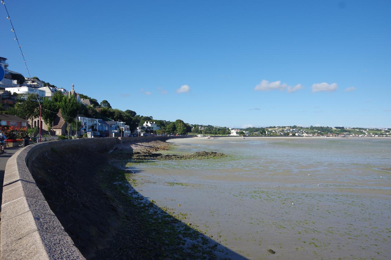
With the tide having gone out, the sandy beach was very wide (picture 39), the water's edge being as much as 400 metres from the seawall in some places. The promenade soon comes up beside the main road around the bay, and at this point there are a couple of artworks celebrating St Aubin (picture 40), though I didn't fully understand the symbolism.
(41) St Aubin's Fort
(42) Beaumont Tower
(43) Elizabeth Castle
(44) Les Jardins de la Mer
The width of the promenade varies significantly as it works its way past various obstacles. I had been forewarned that it is wise to be vigilant when walking here, as many cyclists zoom along the shared path with little regard for pedestrians. I didn't get very far along the promenade before I reached the conclusion that the warning was entirely accurate.
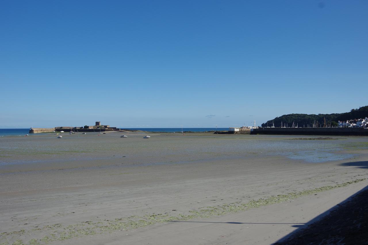
Offshore beyond St Aubin's Harbour is St Aubin's Fort (picture 41). The tower was built in 1542 to protect the harbour when it was Jersey's most important port, and the fort was built around the tower during the English Civil Wars in the 1640s.
A quarter of the way around the bay, I passed the Beaumont Tower (picture 42), also called the Third Tower, as it was the third tower one would pass if traveling west from St Helier. The Second Tower was demolished during the Occupation, while the First Tower stands a little inland from the promenade, about three quarters of the way around the bay.
The scenery is very urban as the promenade runs beside the A2 road almost the entire way around the bay. Aside from the towers and a couple of German bunkers built into the seawall, there are few points of interest until one nears St Helier, where Elizabeth Castle guards the entrance of the harbour (picture 43). Work on the castle began in the 1590's and continued on and off into the 1700s. Sir Walter Raleigh named it after Elizabeth I while he was governor of Jersey.
Eventually the path turns away from the busy road and I could finally stop looking out for overzealous cyclists as I passed Le Fregate Cafe, which resembles an upturned boat, and the small landscaped park of Les Jardins de la Mer (picture 44).
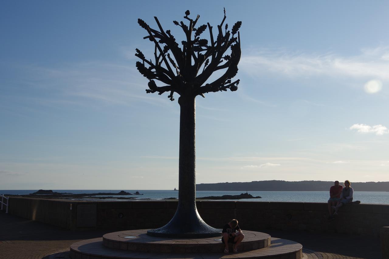
(45) Freedom Tree
(46) Elizabeth Marina
(47) Bench by St Helier Harbour
(48) Liberation Square
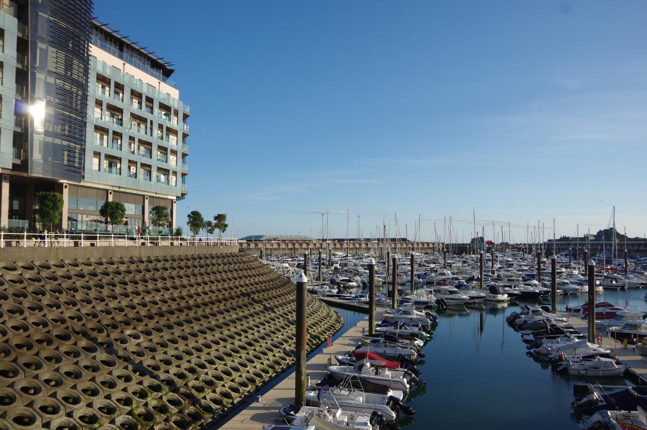
A short distance further along the seawall is a tall sculpture called The Freedom Tree (picture 45), unveiled by Queen Elizabeth II in 2005. The Way turns left here, following the edge of the Elizabeth Marina (picture 46) past waterfront hotels and offices until turning left on La Rue de Cartaret. At the end of the short street, a right turn onto Rue de L'etau leads to a roundabout where the Way goes diagonally right across La Route du Port Elizabeth and along another short street to the edge of The Marina. All the land between Le Fregate and this point was reclaimed from the sea during a controversial waterfront development project that ran from 1979 to 2011.
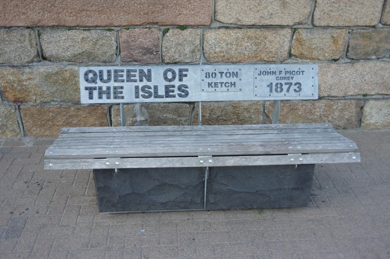
The St Helier Lifeboat Station is just to the right, but the Way goes left along the quayside opposite modern apartments to reach a right turn across the back of The Marina, alongside the A1. There are several benches along here dedicated to ships from Jersey's past (picture 47), part of the same series of benches I had seen on the first morning of my walk around Jersey.
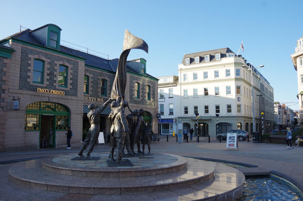
Beyond these benches, a pedestrian crossing over the A1 took me back to Liberation Square (picture 48), once the site of the St Helier terminus of the Jersey Railway, as recalled by a blue plaque on the building behind the monument. Of course, Liberation Square was also the end of my circuit around Jersey and the end of a very satisfying journey on the Channel Islands Way.