London, England
March 2009
On my way back home from a five-week work trip to Norway, I spent the first week of March 2009 exploring central London on foot. During the week I took well over 1,000 photos and you can see a selection of them below.
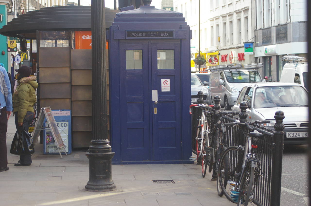
(1) Police Box outside Earls Court Tube Station
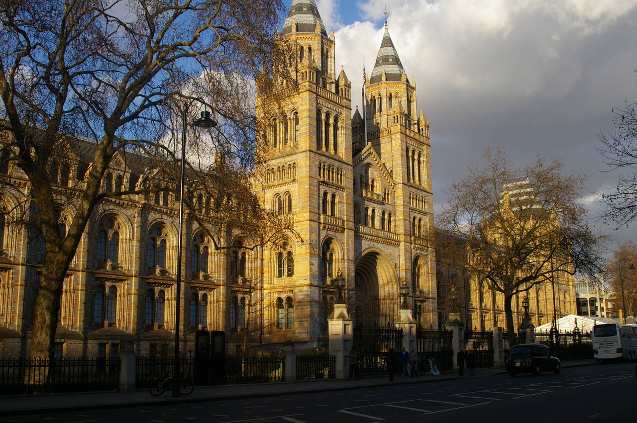
(2) Natural History Museum
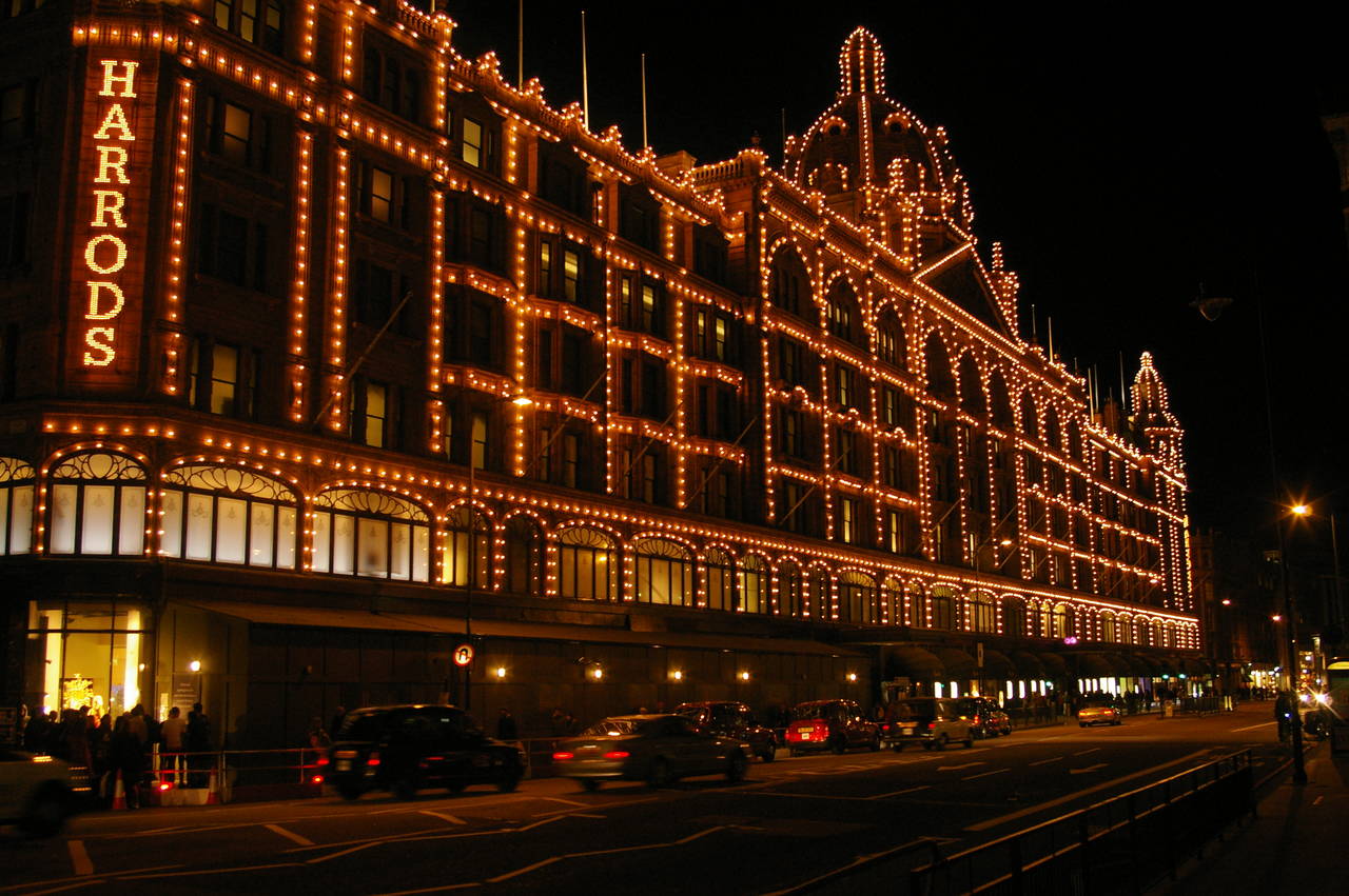
(3) Harrods
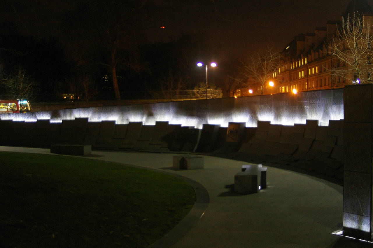
(4) Australian War Memorial, Hyde Park Corner
I chose to stay in Earls Court, where it seems almost all of the Australians in London choose to stay. Just outside the tube station, I found a Police Box (picture 1), but rather disappointingly this one wasn't bigger on the inside.
The main road east from Earls Court passes by a cluster of large museums in South Kensington. It was too late in the afternoon to go in when I walked by, but the facade of the Natural History Museum looked quite good in the setting sun (picture 2). Further along the main road, in Knightsbridge, is the famous Harrods store (picture 3).
Continuing along the road to Hyde Park Corner, you come to a round park, encircled by busy roads. In one corner of the park is the long, curved wall of the Australian War Memorial (picture 4), somewhere that every Aussie in London should visit.
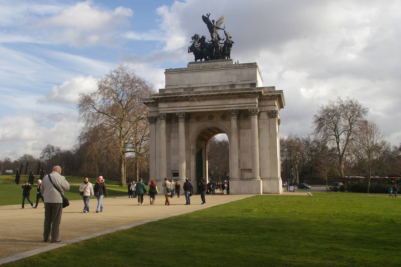
(5) Wellington Arch, Hyde Park Corner
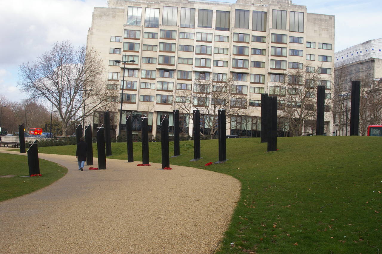
(6) New Zealand War Memorial, Hyde Park Corner
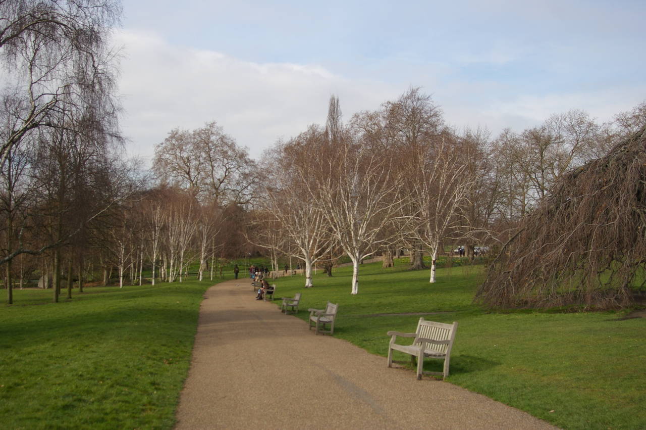
(7) Hyde Park
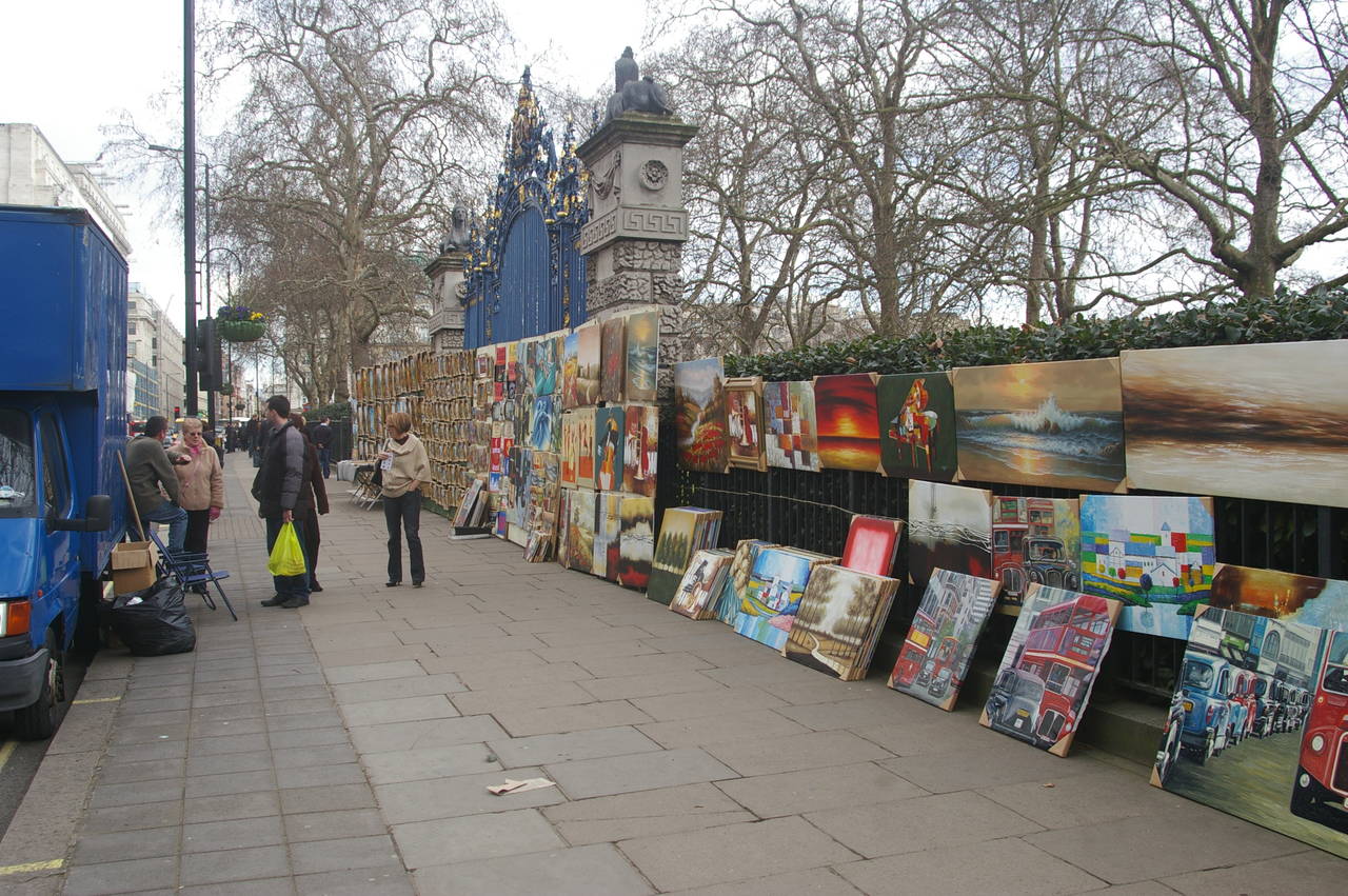
(8) Market beside Green Park
Also at Hyde Park Corner are various monuments to British soldiers, including the Wellington Arch (picture 5), named after the Duke of Wellington, whose army defeated the French at the Battle of Waterloo. Off to the left of the picture, a group of cross-shaped posts marks the New Zealand War Memorial (picture 6).
As the name suggests, Hyde Park Corner sits just off one corner (the south east corner) of Hyde Park, a large green space made up of woods, gardens, a large lake and even larger open fields. The park has many kilometres of footpaths and many places to sit and relax (picture 7). One of the strangely English things about Hyde Park is that it is closed at night and rangers drive about and herd visitors out of the park at dusk.
Southeast of Hyde Park is the large triangle of Green Park. On weekends a market stretches along most of the northern edge of the park, selling mainly paintings and t-shirts (picture 8).
Incidentally, the road along this side of Green Park is called Piccadilly, which might be familiar from the British version of the Monopoly game. On this trip to London, I think I managed to visit every location on the Monopoly board except Old Kent Road and Vine Street. The latter is a short dead-end street near the north-eastern end of Piccadilly, though I didn't discover that until later. The story I heard is that the company that created the game sent one of their secretaries to London to research famous locations to put on the game board, but that she spent the time doing other things and chose random streets for the game, thus ending up with a mixture of famous and obscure locations for the game.
(9) Piccadilly Circus
(10) The Mall and Buckingham Palace
(11) Buckingham Palace from St James's Park
(12) Horse Guards Parade
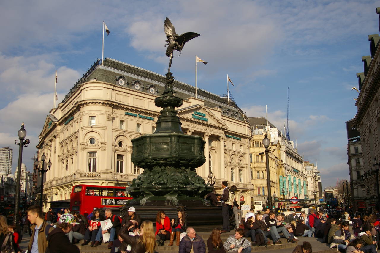
If you continue east to the end of Piccadilly, you reach the famous intersection of Piccadilly Circus, in London's West End theatre district, where the round monument topped by a statue of Eros seems to be a popular spot for people to sit and eat their lunch (picture 9).
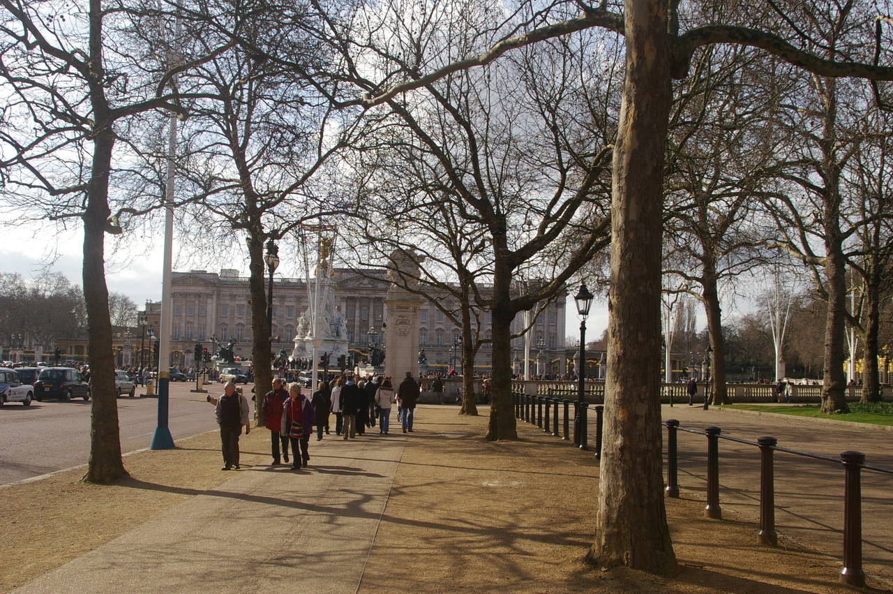
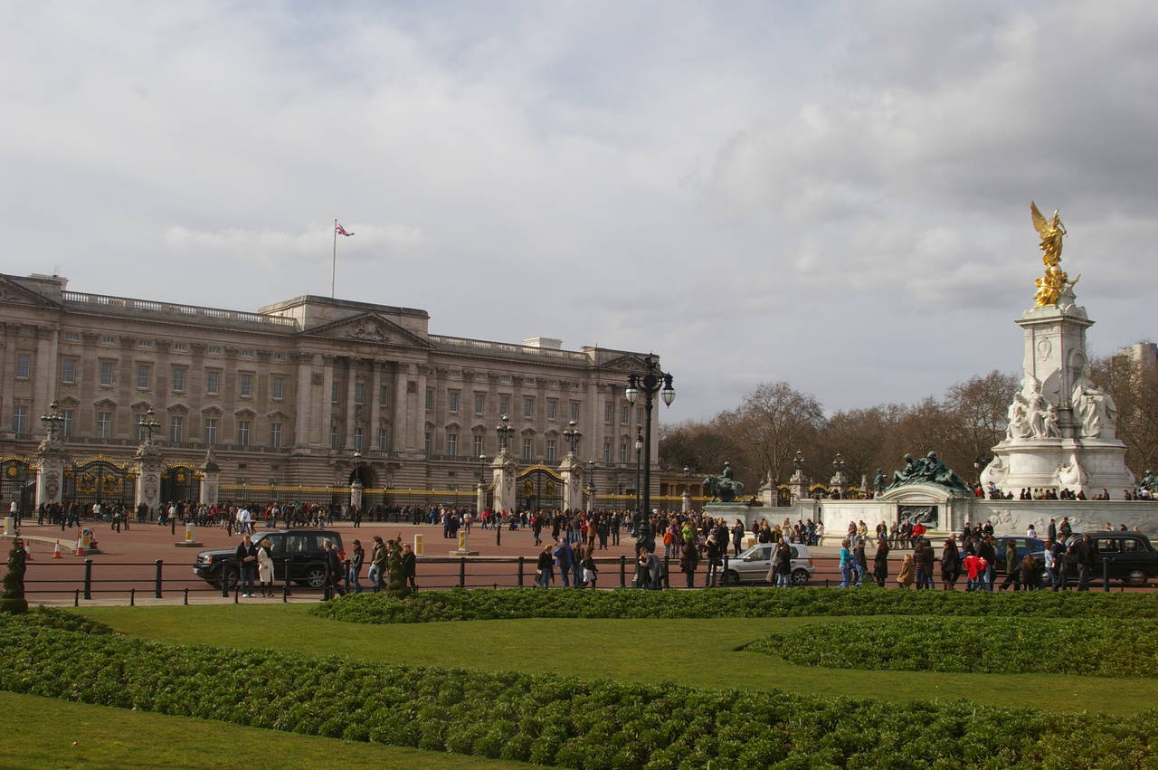
If instead you leave Picadilly and head down the western side of Green Park, you end up on a wide avenue called The Mall, in front of Buckingham Palace (picture 10), where large crowds were milling around the gates and the monument in front of the palace, even though nothing seemed to be happening. On the far side of The Mall is the pleasant St James's Park, where there are manicured gardens (picture 11) and a long lake that normally attracts a large variety of birds but which had been drained for some kind of maintenance.
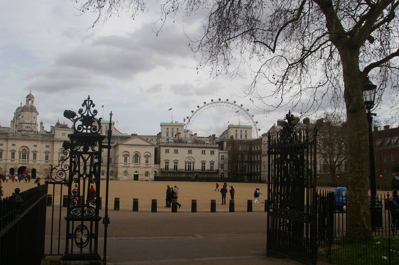
Following the path beside the lake eastwards eventually leads to a large square called Horse Guards Parade, which is surrounded on three sides by various official buildings (picture 12). The buildings on the right back onto the Prime Minister's official residence at Number 10 Downing Street, though Downing Street is now out of bounds to the public. In 2012, the square will be transformed by hundreds of tons of imported sand to become the beach volleyball arena for the London Olympic Games.
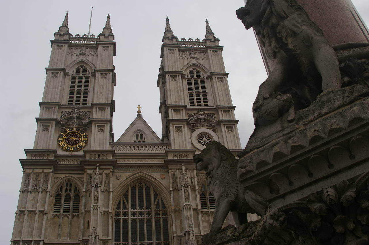
(13) Westminster Abbey
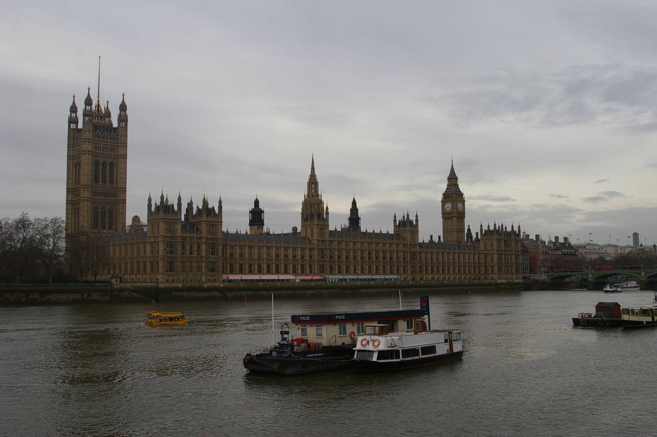
(14) The Houses of Parliament
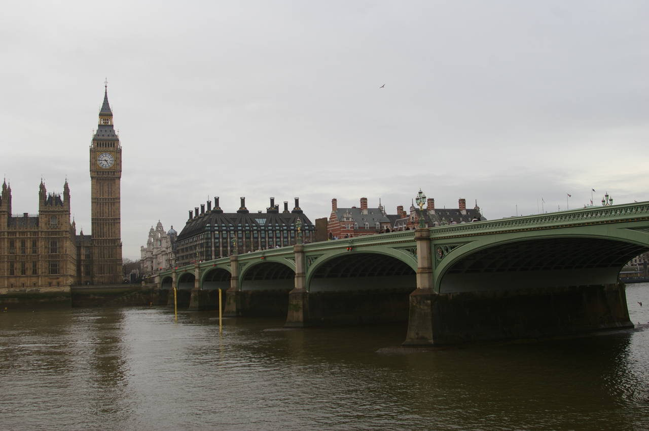
(15) Big Ben and Westminster Bridge
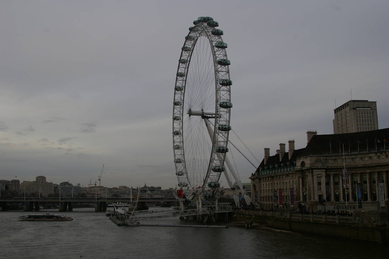
(16) The London Eye from Westminster Bridge
Turning south along the road in front of Horse Guards Parade soon leads to the front of Westminster Abbey (picture 13), parts of which were built in the 11th century.
East of the abbey, on the banks of the River Thames stand the Houses of Parliament (picture 14, taken from the opposite bank of the river). At the northern end of the building is the famous Big Ben (picture 15), although Big Ben is actually the name of the bell, not of the clock or the tower.
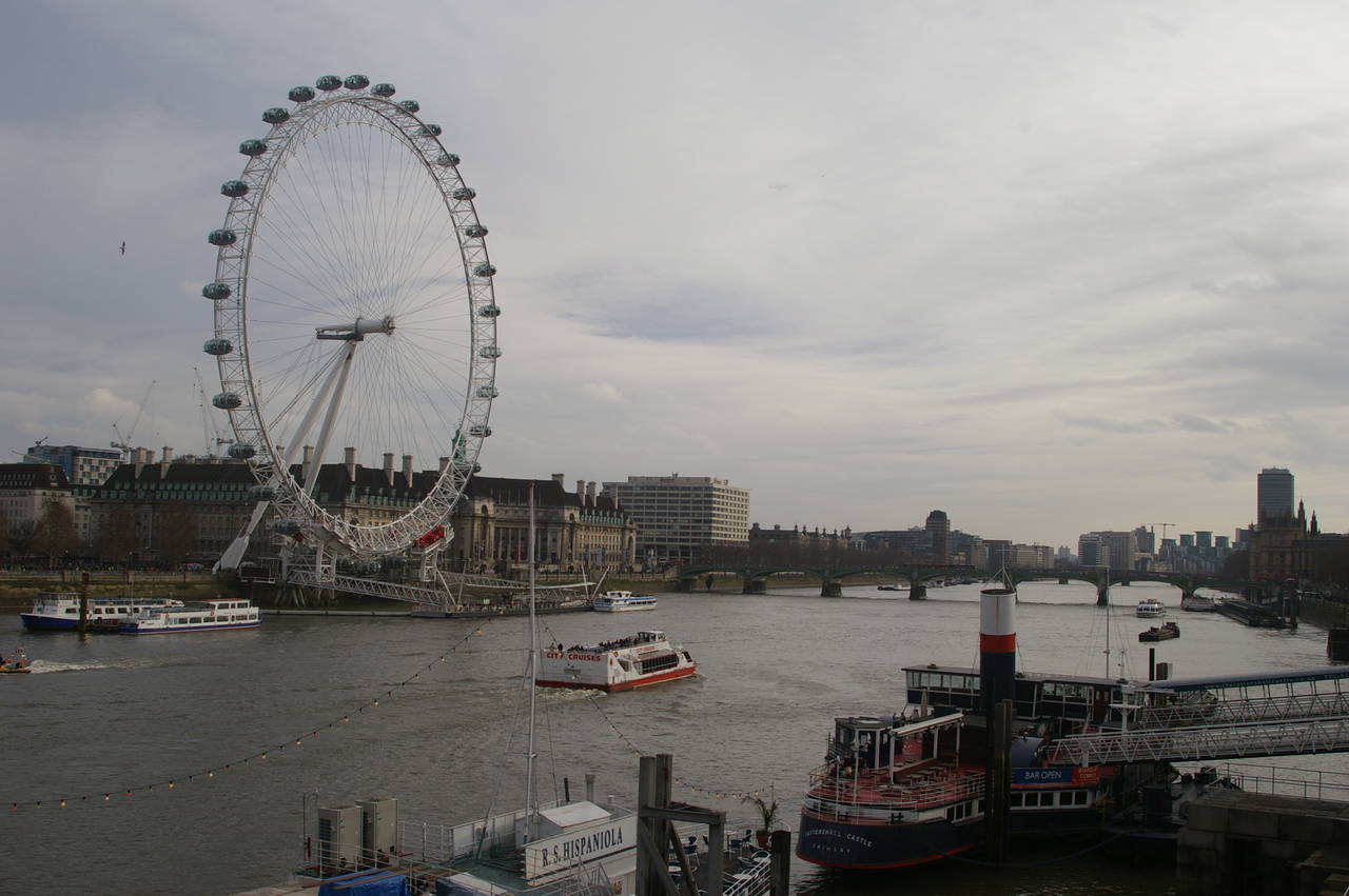
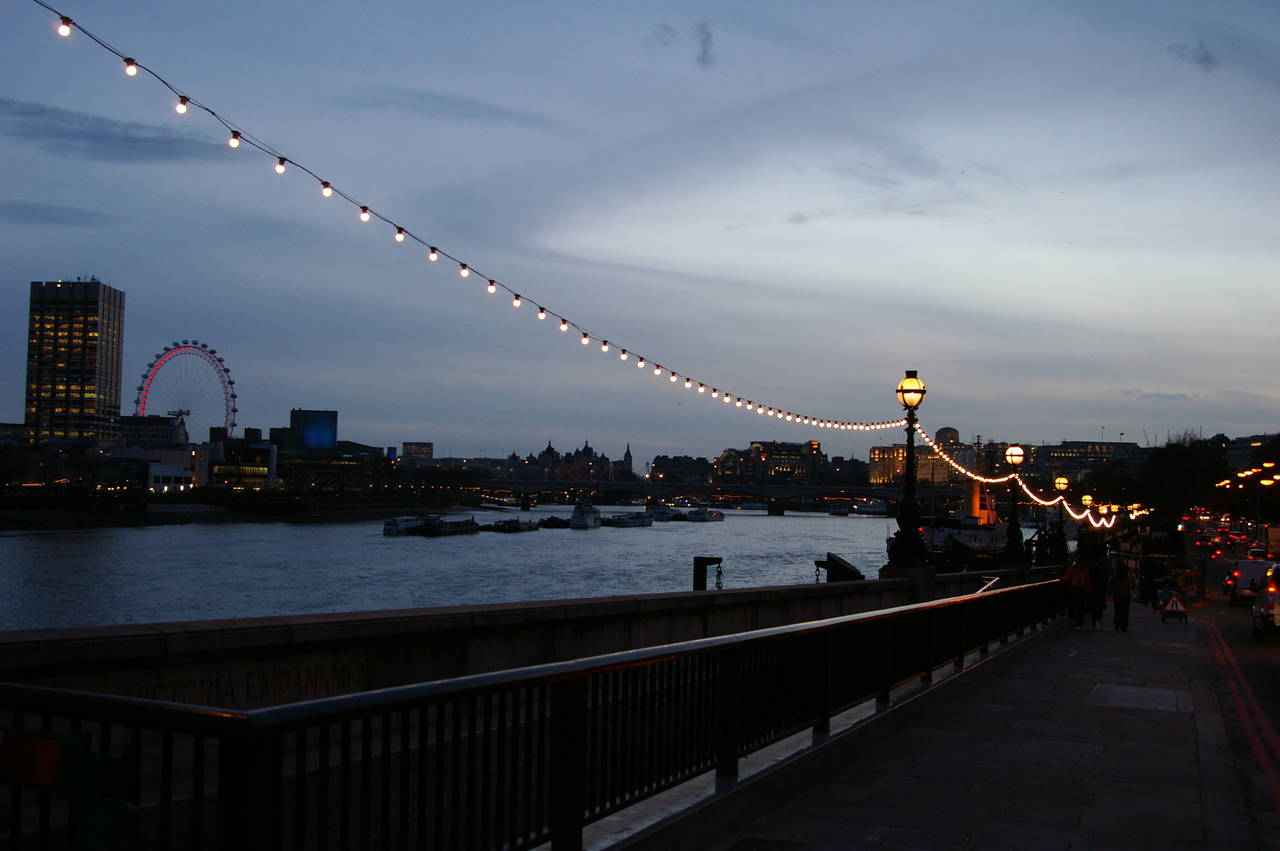
Just downstream from Westminster Bridge on the opposite bank of the Thames is the London Eye (picture 16), the world's largest observation wheel when it was built in 1999, but now overtaken by two others in Asia. Originally, the London Eye was only supposed to stand for a year, but was so popular that it was kept.
(17) The London Eye from Jubilee Bridge
(18) St Martin in the Fields, from Trafalgar Square
(19) The Harp, Covent Garden
(20) The Apple Market, Covent Garden
The next bridge downstream is the Jubilee Bridge, two footbridges attached to either side of an older railway bridge. From the upstream footbridge, there are good views back to the London Eye and along the river (picture 17).
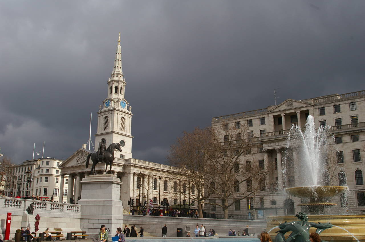
At the end of the bridge, a road leads away from the river and soon reaches Trafalgar Square. As well as housing Nelson's Column, Trafalgar Square contains a couple of large fountains that were added to make it harder for large groups of protesters to gather in the square. Also related to controlling protesters, one corner of the square has the world's smallest police station -- a round telephone booth, just large enough for one officer to shelter in while reporting to headquarters.
The square is bordered on one side by the National Gallery, while across the road to the right stands the former church of St Martin in the Fields (picture 18), though there haven't been any open fields in this part of London for around 300 years. The church is now a popular venue for small concerts.
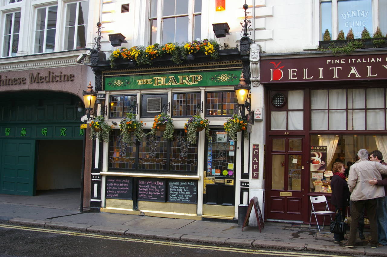
Not far to the east of Trafalgar Square is an area called Covent Garden. Until the 1980's Covent Garden was one of London's biggest food markets and is still a major shopping and entertainment area. There are many pubs scattered around this area, and my favourite is a long, narrow establishment called The Harp (picture 19), which became the first London pub to win CAMRA's Pub of the Year award in 2011. The inside of the atmospheric pub is covered in painted portraits and the small bar serves an ever-changing selection of England's finest real ales, some of which are listed on the blackboards below the stained glass front windows.
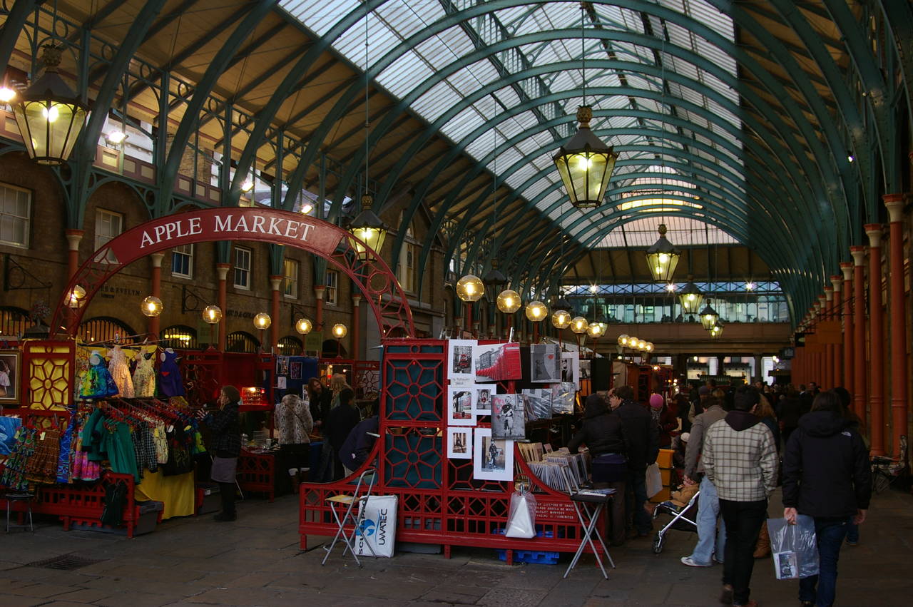
In the centre of Covent Garden, a 19th-century market hall occupies the middle of a large square. The hall houses a variety of shops and market stalls, including the Apple Market (picture 20), these days selling clothes and souvenirs rather than fruit. The square always seems to have a variety of buskers, who have to audition to gain permission play here.
On the eastern side of the square you can find the London Transport Museum, which displays a variety of old buses, trains and horse-drawn coaches t o illustrate the history of London's public transport systems.
(21) Fleet Street
(22) St Paul's Cathedral
(23) St Paul's Cathedral
(24) Millenium Bridge
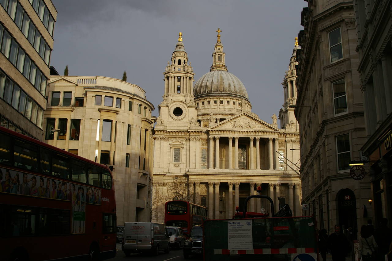
Running eastwards across the southern edge of Covent Garden, the main road is The Strand, which becomes Fleet Street as it passes from the City of Westminster into the City of London (picture 21). Fleet Street was home to the British press for centuries, but in recent times the newspapers have all moved elsewhere as computer technology has made the old printing presses obsolete.
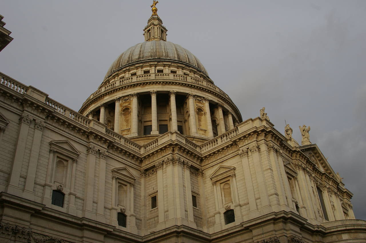
At the far end of Fleet Street, the road approaches St Paul's Cathedral (picture 22), designed by Sir Christopher Wren and completed in 1710. For well over two hundred years the cathedral was the tallest structure in London, the cross on top of the dome being 365 feet above the surrounding streets (picture 23). The previous wooden cathedral, which burned down in the Great Fire of 1666 was more than 100 feet taller again.
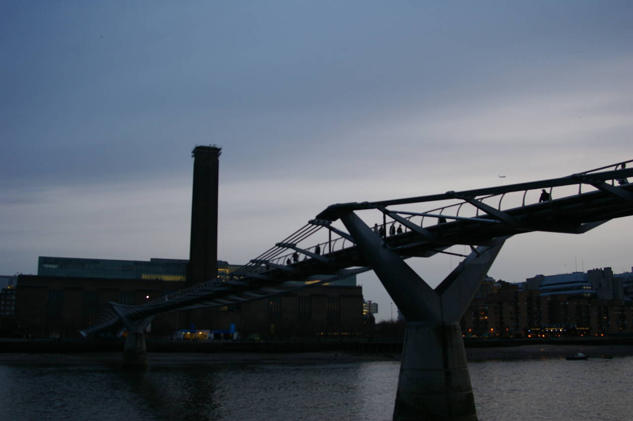
Heading a short way south from St Paul's, you reach the Millenium Bridge (picture 24), which crosses the Thames to the old Bankside Power Station, which now houses the Tate Modern art gallery. Londoners often call it the "wobbly bridge" as it was closed just a few days after opening due to alarming wobbles caused by footsteps resonating through the steel structure. After lengthy rework the bridge reopened in 2001 and is now safe.
(25) The Thames, near Blackfriars
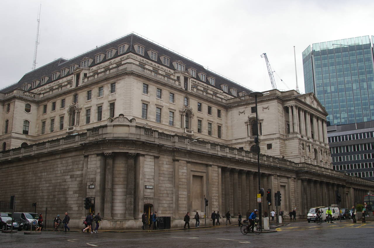
(26) The Bank of England
(27) The Gherkin
(28) Leadenhall Market
The next bridge upstream is Blackfriars Bridge, where I took a nice picture of the Thames at dusk (picture 25).
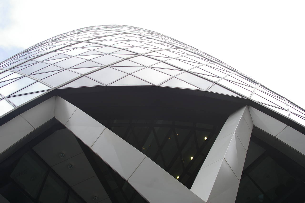
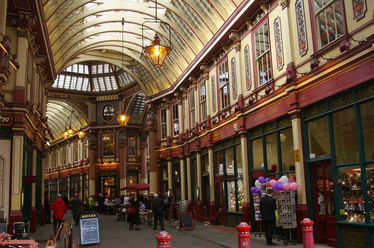
The square mile of the City of London is known as London's main financial district and is home to the fortified Bank of England (picture 26), and many insurance companies, including the one that occupies the iconic tower of the Gherkin (picture 27). Not far from the Gherkin, another interesting piece of architecture can be found at the Leadenhall Market (picture 28).
(29) The Tower of London
(30) Tower Bridge
(31) Tower Bridge
(32) View upstream from the top of Tower Bridge
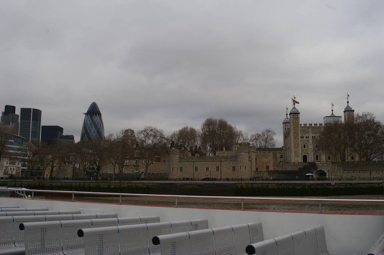
At the southeast corner of the square mile of the City of London stands the Tower of London (picture 29), which over the last thousand or so years has served as a royal palace, a fortress, a prison, a place of execution, and a vault for the crown jewels.
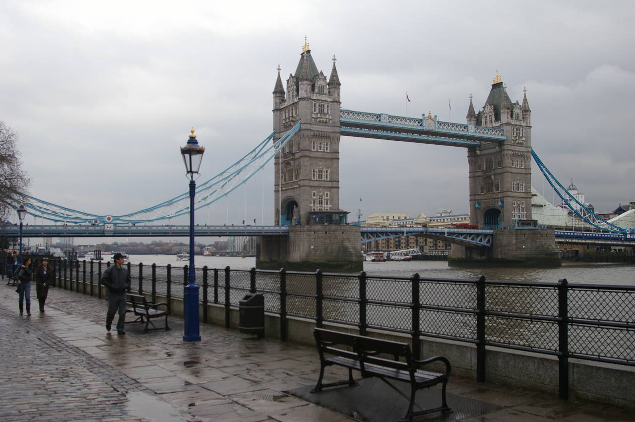
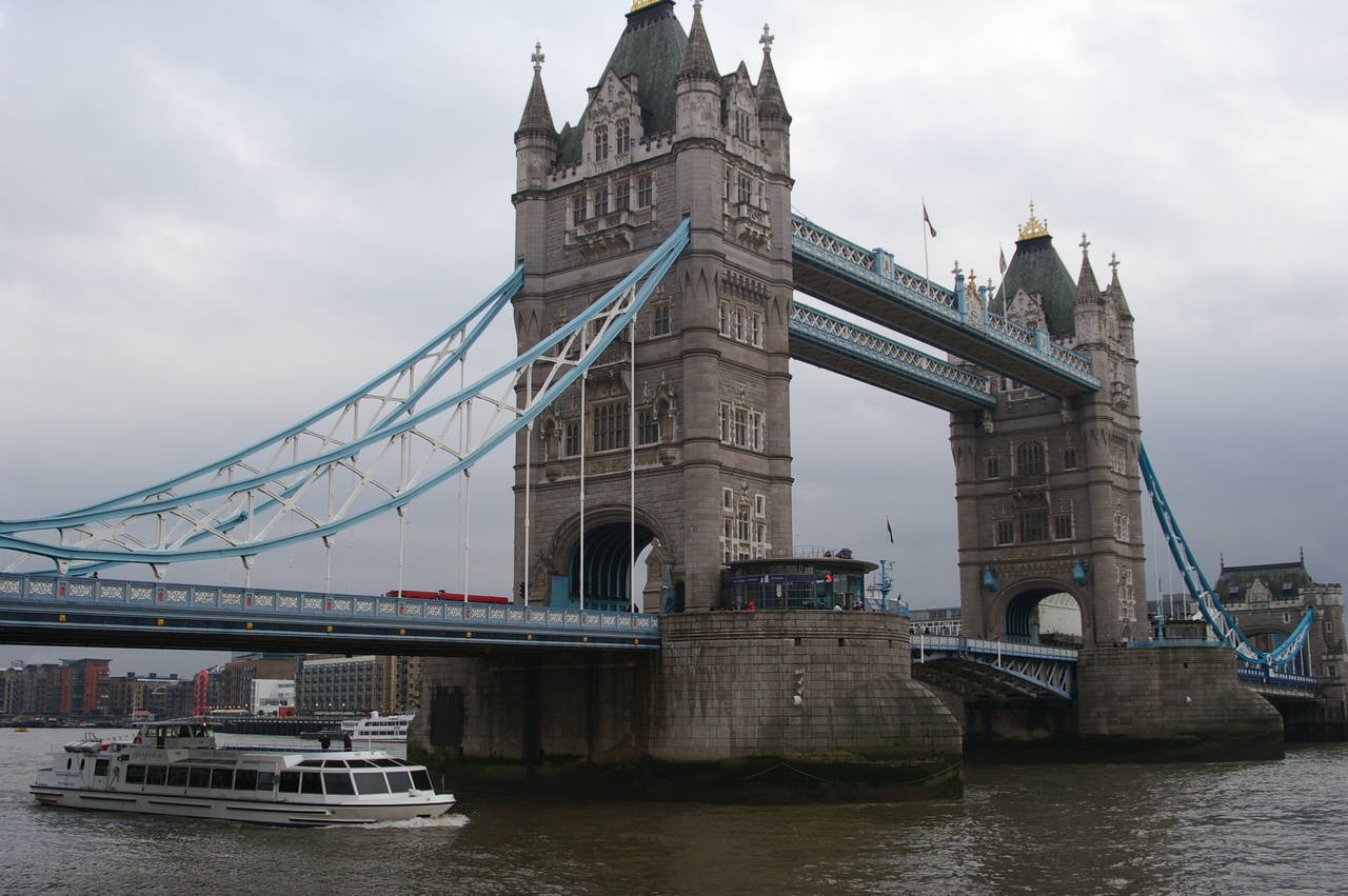
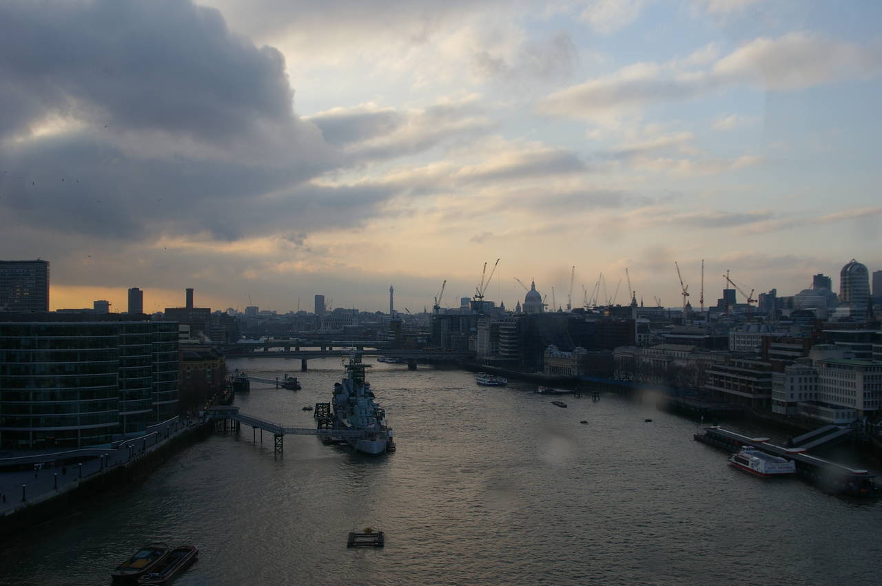
Crossing the river next to the tower is the Tower Bridge (pictures 30 and 31). The middle section of the bridge was designed to open to allow tall ships to pass underneath, and still does so occasionally. It is possible to go up into the towers and the upper walkways as part of the Tower Bridge Exhibition, and there are good views both upstream (picture 32) and downstream.
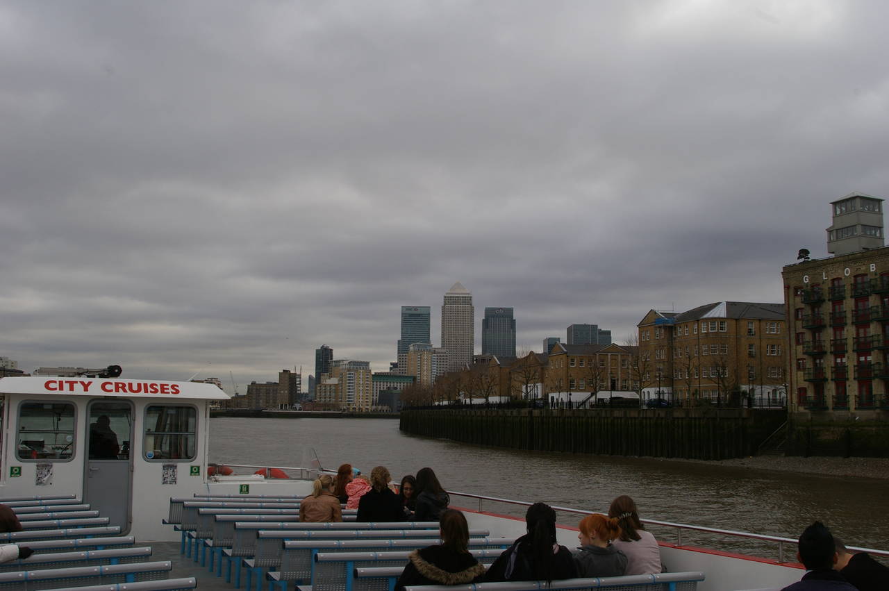
(33) Approaching Canary Wharf
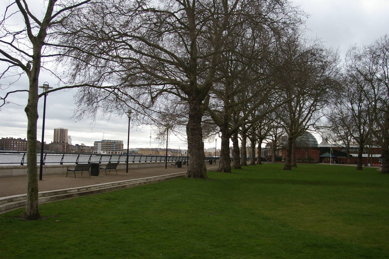
(34) Island Gardens
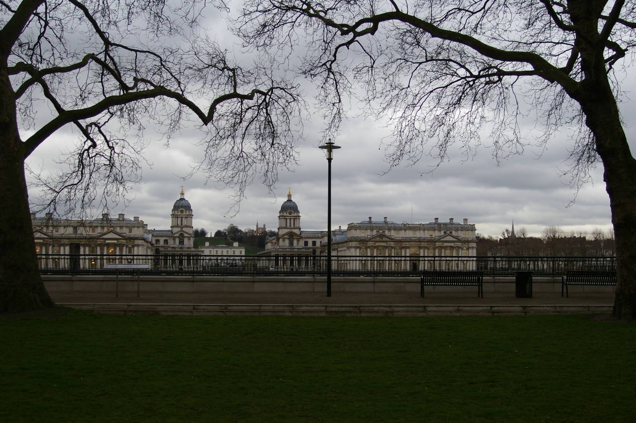
(35) The Old Royal Naval College, Greenwich
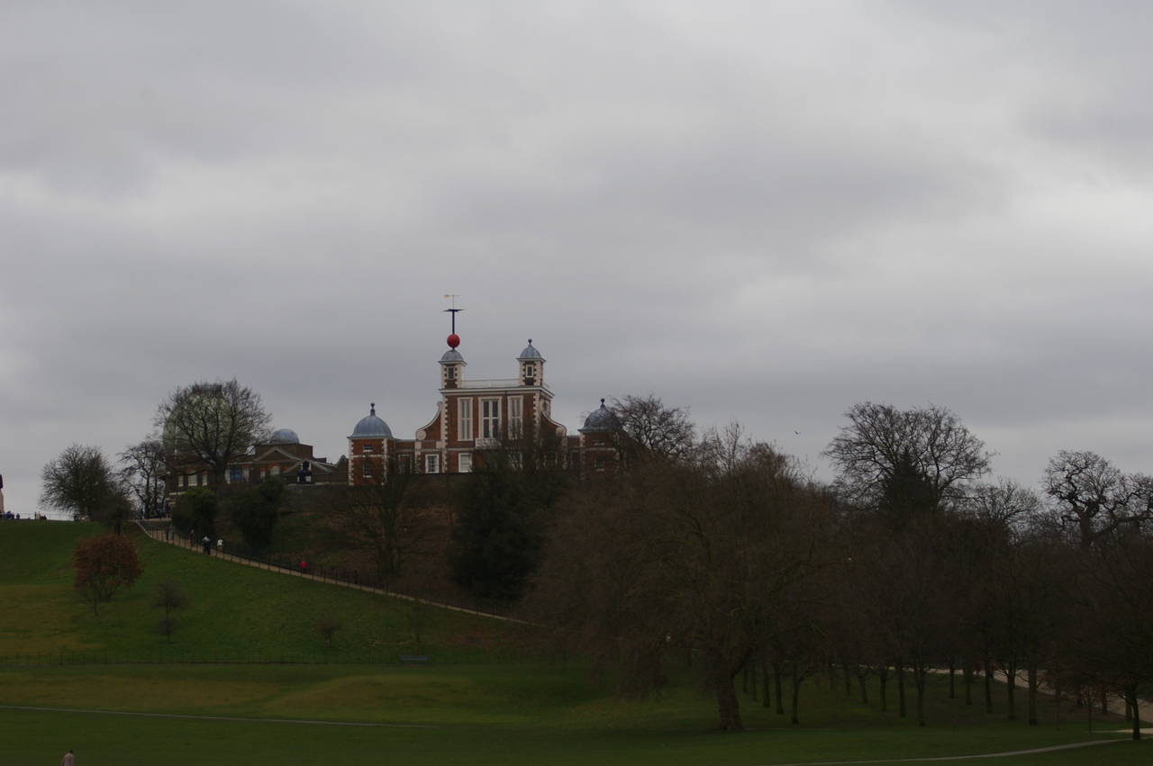
(36) The Greenwich Observatory
A short distance upstream from Tower Bridge is a pier that is the departure point for ferry services that run downstream to Greenwich. On the way to Greenwich, the ferry passes by the tall tower blocks of Canary Wharf (picture 33). Not far from the arrival point at Greenwich Pier, a foot tunnel runs under the Thames to Island Gardens (picture 34), a park built specifically for the purpose of having a pleasant place to admire the view across the river to the historic buildings of the Old Royal Naval College at Greenwich (picture 35).
The 17th-century buildings of the college are now part of the University of Greenwich and are often used for filming movies and TV shows, including some of the Harry Potter movies and Four Weddings and a Funeral. The college is also the only 17th-century building to have contained a nuclear reactor, though the reactor has since been replaced by a microbrewery.
High on the hill behind the college are the buildings of the Greenwich Royal Observatory (picture 36), through which the Greenwich Meridian, zero degrees longitude, passes. The observatory is an interesting place to visit with many historical timepieces and astronomical instruments on display, as well as a chunk of a metallic meteorite that is estimated to be more than four billion years old -- the oldest object that most people will ever touch.